Discover extraordinary places shared by our community of travelers
Kalymnos
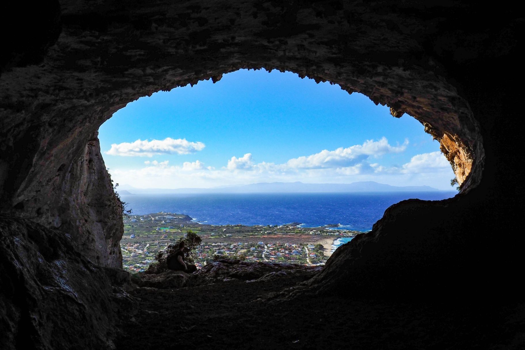
## Description The **Lerá Cave (Σπήλαιο Λερά)** is one of the lesser-known yet historically and mythologically significant caves in Greece. Nestled on the island of **Kalymnos** in the Dodecanese, the cave has been a place of worship since antiquity. Archaeological findings suggest that it was used as a sanctuary dedicated to deities such as **Zeus**, **Hera**, and possibly **Apollo**, highlighting its importance in ancient Greek religious practices. The interior of the cave is both impressive and atmospheric. Visitors are greeted by stalactites, natural chambers, and an aura that recalls the sacred rituals once held there. Some areas still contain traces of ancient votive offerings, fragments of altars, and inscriptions. Unlike more famous caves in Greece, such as those on Crete, Lerá Cave remains largely untouched by mass tourism, making it a fascinating site for travelers seeking authenticity and tranquility. A little-known fact is that the cave continued to be used in later centuries, even during Christian times, when it was adapted for chapels and local worship. This continuity of use gives the Lerá Cave a rare cultural layering that spans thousands of years. ## Location Lerá Cave is located on the island of **Kalymnos**, part of the **Dodecanese** island group in the southeastern **Aegean Sea**, **Greece**. The cave lies on the slopes of Mount Vathy, above the picturesque Vathy Valley, about 9 kilometers from Pothia, the island’s capital. To reach the cave, visitors typically begin from Vathy village and then hike up a marked path leading to the cave entrance. The hike can be moderately challenging, involving rocky paths, so proper footwear is essential. Travelers arriving on Kalymnos usually come by ferry from Kos or Rhodes, or by domestic flights to Kalymnos Island National Airport. Once on the island, local taxis or rented vehicles can bring you close to the trailhead. ## Tips * **Wear sturdy shoes:** The trail to the cave is uneven and rocky, so hiking footwear is strongly recommended. * **Bring a flashlight:** While some natural light enters, the cave interior can be dark, and a torch helps you explore safely. * **Combine with a hike:** The path to Lerá Cave offers panoramic views over the Vathy Valley and Aegean Sea—make the most of the journey, not just the destination. * **Respect the site:** Remember the cave’s sacred history; avoid touching archaeological remains or leaving litter. * **Visit in cooler hours:** Early morning or late afternoon hikes are more comfortable, especially in summer when temperatures are high. * **Consider a guide:** Local guides provide insights into the myths and history tied to the cave, enriching the visit. ## Conclusion The **Lerá Cave** is more than a natural formation—it is a place where geology, mythology, and history converge. With its ancient role as a sanctuary, its natural beauty, and its enduring aura of mystery, it stands as one of Kalymnos’s hidden treasures. For travelers seeking an off-the-beaten-path cultural experience in Greece, a visit to Lerá Cave is deeply rewarding. ## FAQ **1. What was Lerá Cave used for in antiquity?** It served as a sanctuary dedicated to gods like Zeus, Hera, and possibly Apollo, where locals made offerings and conducted rituals. **2. How difficult is the hike to the cave?** The hike is moderately challenging due to rocky terrain. It is accessible to most visitors with proper footwear and reasonable fitness. **3. Is the cave suitable for children?** Yes, but with caution. The path and cave interior can be uneven, so supervision is essential for younger children. **4. Do I need a guide to visit Lerá Cave?** Not strictly, but hiring a local guide enhances the experience by providing historical, mythological, and archaeological context. **5. Is there an entrance fee?** No, Lerá Cave is free to visit, though donations to local cultural associations are sometimes welcomed. **6. Can I combine this visit with other attractions?** Yes, the cave is near Vathy Valley, known for its orchards and harbor, and can easily be combined with a cultural or nature tour of Kalymnos. ## Links * [Dodecanese Islands Tourism](https://www.visitgreece.gr)
GemVoyage Team • World
Malmö
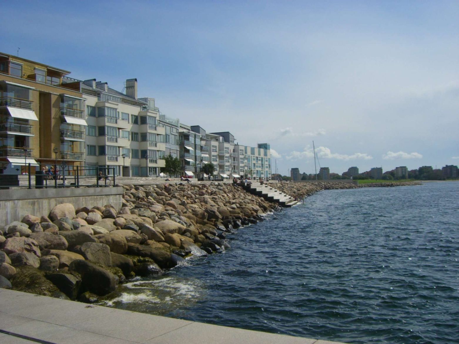
## Description Malmö’s promenades—particularly the waterfront walks in areas like **Sundspromenaden** in **Västra Hamnen**—represent a perfect mix of urban design, nature, sea, and Scandinavian minimalist style. These promenades are places to stroll, cycle, relax by the water, take in views across to Denmark, swim, or simply enjoy public space thoughtfully crafted for citizen leisure. What makes them special is how they combine modern architecture, revitalised waterfront land, and ecological awareness. Västra Hamnen itself is a former industrial/harbour area that has been transformed into a sustainable residential and recreational district. The promenade features wooden jetties, platforms for swimming, promenading paths, seating, small cultural touches, and design elements that allow people to use the space in multiple ways—sunbathing, exercising, enjoying views. ([visitsweden.fr][1]) A lesser-known fact: some portions of the promenades have public bathing decks with ladders into the sea, though the water can be quite deep. Also, lighting design (for example, in other Malmö waterfront developments) is intentionally done so that the ambiance at dusk feels safe, warm, and comfortable—even when colder. ([selux.com][2]) ## Location These promenades are located in **Malmö**, a city in **Skåne County** in southern **Sweden**, lying on the coast of the Öresund strait opposite Denmark. Västra Hamnen is the “Western Harbour” district, by the coast. The sundspromenaden waterfront walk is in/near Västra Hamnen. Other promenades like Ribersborg beach promenade are also in the broader coastal edges of Malmö. ([Travelwider][3]) To get there: if you arrive in Malmö by train (e.g. Malmö Central), you can walk, take local buses or tram to Västra Hamnen. Biking is also very good as Malmö is bike-friendly. From Copenhagen, there are trains across the Öresund Bridge; once in Malmö you use local transport or walk depending on which part of the promenade you aim for. ([Erasmusu][4]) ## Tips * **Time your visit for golden hours**: sunrise or sunset bring beautiful light over the water, especially looking toward Öresund and the Öresund Bridge. ([Wanderlog][5]) * **Bring swim gear**: In summer, many promenades have decks, ladders, or stepping points into the sea. If the weather is warm enough, swimming is possible. ([komoot][6]) * **Dress in layers**: The sea breeze can make things cooler, even in summer evenings. For morning walks or late afternoons it might be windy. * **Biking or walking**: Use the paths designed for pedestrians and cyclists. Some stretches are flat and very pleasant. A bike is a great way to cover longer stretches of promenade. * **Check local weather**: Rain or wind can make parts less pleasant; also, sea conditions vary. Be cautious if swimming. * **Explore by sections**: The waterfront promenade isn’t one single piece—various districts (Ribersborg, Västra Hamnen, etc.) offer different vibes (beach-style, urban, architecturally modern). Choose based on what you want: swimming, views, architecture, relaxation. ## Conclusion Malmö’s promenades are a standout example of how a coastal city can turn its sea edges into spaces that are both beautiful and functional. Whether for locals or visitors, they offer calm, recreation, waterfront views, and a chance to experience Malmö’s blend of urban renewal, sustainability, and Scandinavian waterfront charm. A walk here is more than just moving from A to B—it’s an experience of light, water, architecture, and local life. ## FAQ **1. Are the promenades free to access?** Yes, public promenades are free. There is no entrance fee to walk along Västra Hamnen waterfront or to use public seating areas, jetties, etc. **2. Can you swim there?** Yes—in parts. Some sections have bathing platforms, ladders, and wooden jetties. But water can be deep, and conditions (temperature, currents) vary. It’s good to check locally and stay where it’s safe. ([komoot][6]) **3. What is the best time of year to enjoy the promenade?** Late spring through early autumn (May to September) is best, when weather is warm, days are long, and outdoor amenities are most usable. Summer evenings are particularly lovely. Winters are colder and more challenging for outdoor swimming or lounging. **4. Are the promenades suitable for someone with limited mobility or stroller?** Many paths are flat and well-maintained, so promenading/strollers are possible in many places. However, wooden platforms or jetties might have steps or ladders for water access not suitable for all. It’s best to choose accessible sections near Västra Hamnen or Ribersborg. **5. What else can I see or do near the waterfront promenade?** Plenty: architectural highlights like the Turning Torso, cafés and restaurants in Västra Hamnen, parks, local beaches (Ribersborg), views of the Öresund Bridge, outdoor workouts, bike paths, evening walks. The area combines leisure, modern design, and views. **6. How long should I plan to walk to get a good sense of the place?** If you set aside 1-2 hours, you can enjoy a stretch with views, maybe stop for café or swim. For a full exploration of different sections, 3-4 hours or more allows you to experience the variety between Ribersborg, Västra Hamnen, and other promenades. ## Links * [Visit Sweden – Malmö Outdoor & Nature](https://visitsweden.com) * [Malmö City Official Site](https://malmo.se)
GemVoyage Team • World
Sintra
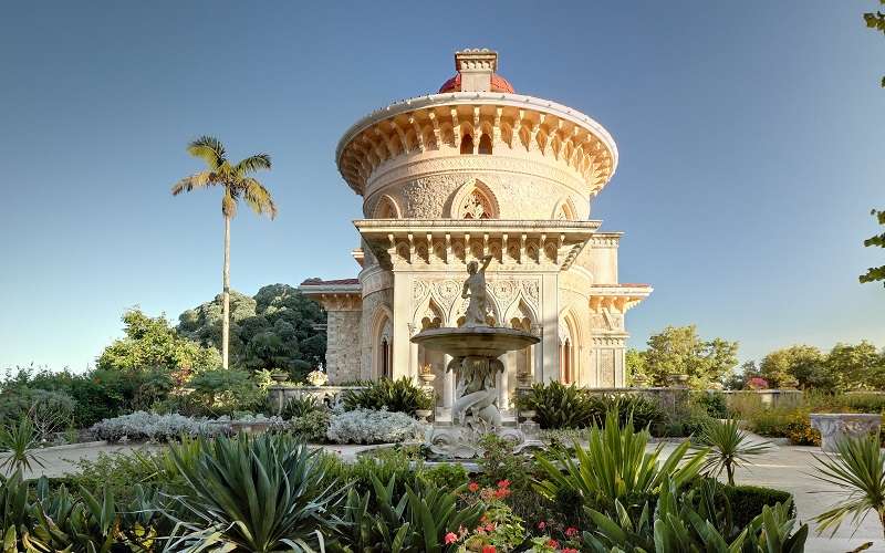
## Description Monserrate Palace in Sintra is one of Portugal’s most exquisite and underrated architectural treasures. Nestled in the lush hills of the Serra de Sintra, this 19th-century palace is a masterpiece of Romanticism, blending Gothic, Moorish, and Indian architectural styles into a harmonious and visually captivating whole. Commissioned by Sir Francis Cook, a wealthy English art collector, the palace was designed as a summer retreat and reflects his eclectic taste and fascination with exotic cultures. The palace’s interior is a feast for the eyes, with intricately carved marble columns, lace-like stonework, and domed ceilings inspired by Islamic architecture. The Music Room, with its ornate plasterwork and acoustics, is particularly striking and occasionally hosts cultural events. Surrounding the palace is a sprawling botanical garden that features species from all over the world, including a Mexican garden, a Japanese garden, and a rose garden. These gardens were carefully curated to reflect the Victorian passion for exotic landscaping and offer a tranquil escape into nature. A little-known fact: Monserrate was once the home of William Beckford, an eccentric English novelist and art collector, before it was transformed by Francis Cook. Another fascinating detail is that the palace and its gardens were used as a filming location for the NBC miniseries “Gulliver’s Travels,” starring Ted Danson. ## Location Monserrate Palace is located in **Portugal**, in the **Lisbon District**, within the **city of Sintra**. It lies approximately 3.5 kilometers west of Sintra’s historic center, in the heart of the Sintra-Cascais Natural Park. ### How to Get There - **By Train**: From Lisbon, take the train from Rossio Station to Sintra. The journey takes about 40 minutes. - **By Bus**: From Sintra station, take bus 435 (the Villa Express) which stops at Monserrate Palace, as well as other key attractions like Quinta da Regaleira. - **By Car**: Driving from Lisbon takes around 45 minutes. Parking is available near the palace. - **By Tuk-Tuk or Taxi**: Local tuk-tuks and taxis offer scenic rides from Sintra’s center to Monserrate. Its slightly off-the-beaten-path location means it’s often quieter than Sintra’s more famous palaces, making for a more relaxed visit. ## Tips - **Visit Early or Late**: To enjoy the gardens and palace with fewer crowds, aim for early morning or late afternoon. - **Wear Comfortable Shoes**: The gardens are extensive and include uneven paths, so sturdy footwear is recommended. - **Bring a Camera**: The architectural details and lush landscapes are incredibly photogenic. - **Use the Map**: The ticket includes a map of the gardens—use it to explore hidden corners like the Fern Valley and the ruins of the chapel. - **Combine with Nearby Attractions**: Monserrate pairs well with a visit to Quinta da Regaleira or a hike in the Sintra-Cascais Natural Park. - **Check for Events**: Occasionally, concerts and exhibitions are held in the Music Room—check the schedule in advance. ## Conclusion Monserrate Palace is a stunning fusion of art, architecture, and nature. With its exotic design, peaceful gardens, and rich history, it offers a unique and serene alternative to Sintra’s more crowded landmarks. ## FAQ **1. What are the opening hours of Monserrate Palace?** The park is open from 9:00 AM to 7:00 PM, and the palace from 9:30 AM to 6:00 PM. Last admission is 30 minutes before closing. **2. What is the entrance fee?** Adult tickets cost €12, youth (6–17) €10, and seniors €6.50. Children under 6 enter free. **3. Is Monserrate Palace suitable for children?** Yes, the gardens are great for families, though supervision is recommended due to uneven terrain. **4. Can I buy tickets online?** Yes, tickets can be purchased through the official Parques de Sintra website or authorized vendors. **5. Is the palace wheelchair accessible?** The palace has limited accessibility due to its historic structure. The gardens have some accessible paths. **6. How long should I plan for a visit?** Allow 1.5 to 2 hours to explore both the palace and the gardens thoroughly. ## Links - [Official Park and Palace of Monserrate Website](https://www.parquesdesintra.pt/en/parks-monuments/park-and-palace-of-monserrate/)
GemVoyage Team • World
Amazonas
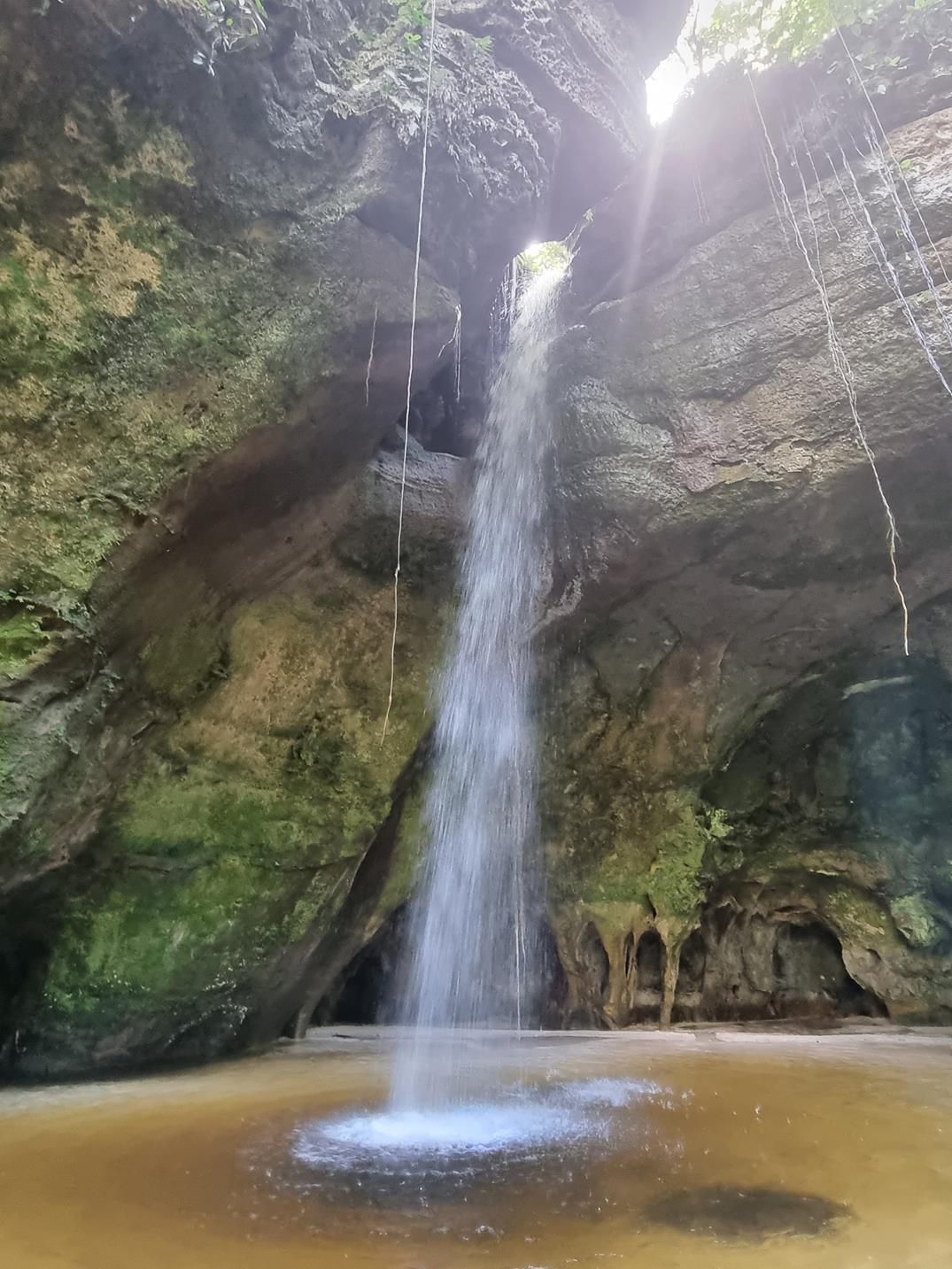
## Description Deep within the lush rainforest of the Amazon lies a pair of natural wonders: **Caverna do Maroaga (Maroaga Cave)** and **Caverna da Judeia (Judeia Cave)**. These caves are part of the Presidente Figueiredo municipality in northern Brazil, often nicknamed the “Land of Waterfalls and Caves” due to its unique geology and landscapes. The **Maroaga Cave** is famous for its dramatic sandstone formations and a stream that flows directly from within, creating a mystical atmosphere as the water emerges from the cave’s dark interior. Sunlight filtering through the forest canopy reflects on the water, giving the cave a magical glow. Its name comes from a local indigenous chief, Maroaga, who is said to have used the cave as a hideout, adding a layer of legend to its natural beauty. The nearby **Judeia Cave** is equally captivating. It features a more intimate setting, with a waterfall cascading over its entrance and forming a natural curtain of water. Walking behind the waterfall offers visitors a unique and refreshing perspective, with the sound of rushing water echoing throughout the cave. A little-known fact is that both caves are part of the same ecological reserve, which shelters a vast variety of flora and fauna. Biologists have recorded rare species of bats and amphibians in these caves, making them not only scenic wonders but also important ecological habitats. ## Location Caverna do Maroaga and Caverna da Judeia are located in **Presidente Figueiredo**, a municipality in the state of **Amazonas**, in northern **Brazil**. The region lies about 107 kilometers north of **Manaus**, the capital of Amazonas, along the BR-174 highway. The most common way to reach the caves is by car or organized tour from Manaus. The drive takes about two hours and passes through dense rainforest landscapes. Once at the entrance to the reserve, guided hikes of varying lengths lead to the caves. The trails are not particularly difficult, but they can be muddy and slippery, especially during the rainy season. For international visitors, the easiest route is to fly into Manaus and then book a day trip or multi-day tour that includes the caves as part of a broader itinerary of waterfalls and natural attractions. ## Tips * **Wear proper footwear:** Hiking boots or sturdy shoes are recommended, as the trails can be wet and uneven. * **Hire a guide:** Local guides not only ensure safety but also provide insights into the caves’ legends, geology, and biodiversity. * **Bring swimwear and a towel:** The waterfalls and streams around the caves are perfect for cooling off after a hike. * **Pack insect repellent:** The Amazon rainforest is home to mosquitoes and other insects, especially near water sources. * **Visit during the dry season:** From June to November, the trails are easier to access, although the rainy season offers stronger waterfalls and a wilder atmosphere. * **Respect the environment:** Avoid leaving litter, and do not disturb the caves’ wildlife, particularly bats and amphibians. ## Conclusion Caverna do Maroaga and Caverna da Judeia showcase the wild beauty and hidden wonders of Brazil’s Amazon rainforest. With their waterfalls, sandstone formations, and legendary history, they are must-visit sites for eco-tourists and adventurers seeking an authentic experience in the heart of nature. Together, they represent not just geological marvels but also living ecosystems that deserve protection and respect. ## FAQ **1. Do I need a guide to visit the caves?** Yes, local guides are highly recommended for safety, navigation, and to ensure the preservation of the natural environment. **2. Can I swim near the caves?** Yes, swimming is allowed in the pools and streams near the caves, but always follow local safety advice. **3. How difficult are the hikes to the caves?** The hikes are moderate in difficulty, with some slippery and uneven sections. Good footwear is essential. **4. Are the caves accessible year-round?** Yes, but the experience differs by season. The rainy season (December–May) offers stronger waterfalls, while the dry season (June–November) makes trails easier to navigate. **5. What wildlife might I see?** Bats, amphibians, tropical birds, and a wide variety of insects inhabit the area. Lucky visitors may even spot monkeys in the surrounding forest. **6. How long should I plan for a visit?** Most tours include both caves in a half-day excursion, though spending a full day allows more time to explore nearby waterfalls and trails. ## Links * [Amazons Wiki](https://en.wikipedia.org/wiki/Amazonas_(Brazilian_state))
GemVoyage Team • World
Rome
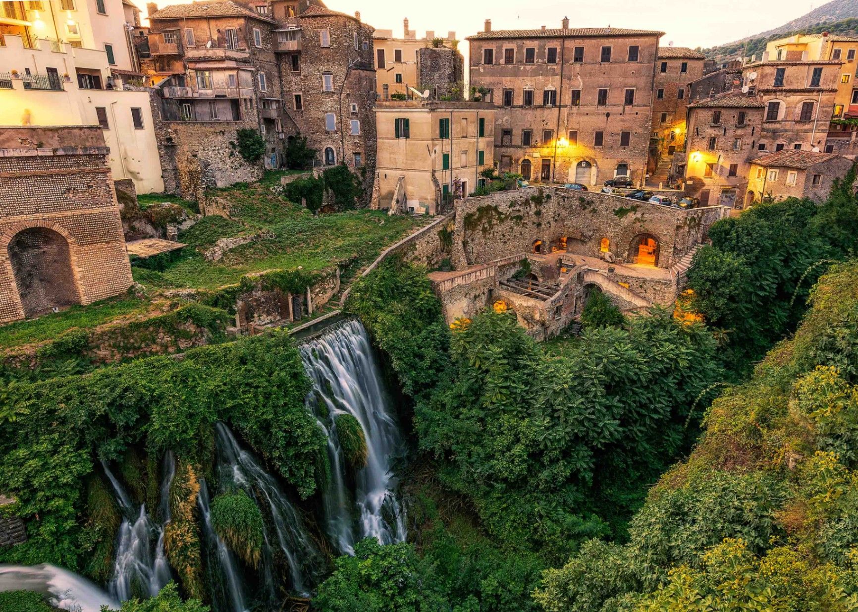
## Description Villa Gregoriana in Tivoli, just outside Rome, is one of Italy’s most captivating landscapes where history, art, and nature blend seamlessly. Unlike the lavish Renaissance villas Tivoli is famous for, such as Villa d’Este or Hadrian’s Villa, Villa Gregoriana is more of a natural park—a romantic landscape garden created in the 19th century. It was commissioned by Pope Gregory XVI in 1835 after a devastating flood of the Aniene River destroyed part of Tivoli. The project diverted the river and transformed the ravine into a park with paths, grottoes, and terraces overlooking dramatic waterfalls. The heart of the villa is the **Great Waterfall (Cascata Grande)**, a spectacular 120-meter drop of the Aniene River that roars through a deep gorge. The park is also dotted with archaeological remains, including Roman temples such as the **Temple of Vesta** and the **Temple of Sibyl**, which crown the cliffs above. Romantic poets and painters of the 19th century, from Goethe to Turner, were inspired by its sublime scenery. A lesser-known fact about Villa Gregoriana is that it fell into neglect for much of the 20th century. It was only restored and reopened to the public in 2005 thanks to the Italian heritage organization **FAI (Fondo Ambiente Italiano)**. Today, it is both a natural reserve and an open-air museum of history, geology, and art. ## Location Villa Gregoriana is located in **Tivoli**, a town in the **Metropolitan City of Rome (RM)**, in the region of **Lazio**, central **Italy**. Tivoli lies about 30 kilometers east of Rome, perched on the slopes of the Tiburtine Hills. To reach Villa Gregoriana, visitors can take a regional train from Rome’s Tiburtina station to Tivoli, which takes around one hour. From Tivoli station, it’s a short walk to the villa’s entrance. Alternatively, buses also run between Rome and Tivoli. If you’re driving, the trip takes about 45 minutes along the A24 motorway. Walking is essential once inside, as the park’s paths wind through steep terrain and natural landscapes. ## Tips * **Wear comfortable shoes:** The park has uneven terrain, stairs, and steep paths. Good walking shoes are essential. * **Allow time:** A full visit can take two to three hours if you want to enjoy both the waterfalls and the archaeological ruins. * **Best seasons to visit:** Spring and autumn offer pleasant weather and lush greenery. In summer, the waterfalls are at their most powerful but the heat can be intense. * **Photography:** Bring a camera—the views of the waterfalls and temples are spectacular from various terraces. * **Check opening hours:** Villa Gregoriana has seasonal hours and may close in winter, so it’s best to check in advance. * **Combine with other villas:** Tivoli is home to Villa d’Este and Hadrian’s Villa, both UNESCO World Heritage Sites, making it an excellent day trip from Rome. ## Conclusion Villa Gregoriana in Tivoli is a place where natural beauty meets history. With its majestic waterfalls, ancient temples, and romantic landscapes, it offers a unique contrast to the opulent villas nearby. Restored after years of neglect, it now stands as one of Italy’s most enchanting sites, ideal for travelers seeking a mix of culture, nature, and tranquility. ## FAQ **1. What is Villa Gregoriana best known for?** It is best known for its dramatic waterfalls, particularly the Great Waterfall, and for its blend of natural landscapes with ancient Roman ruins. **2. How much time do I need to visit?** Plan at least two hours to walk the trails, admire the waterfalls, and explore the archaeological sites. **3. Is Villa Gregoriana family-friendly?** Yes, but keep in mind that the terrain is steep and not suitable for strollers. Children should be supervised on paths near cliffs. **4. Are guided tours available?** Yes, guided tours are offered, and they provide fascinating insights into the park’s history, geology, and architecture. **5. Can I picnic inside the park?** Picnicking is not generally allowed inside the villa, but Tivoli offers many nearby restaurants and cafés for meals. **6. Is Villa Gregoriana accessible by wheelchair?** Due to its rugged terrain and steep paths, the site is not well-suited for wheelchair users or those with limited mobility. ## Links * [FAI – Villa Gregoriana Official Page](https://fondoambiente.it/luoghi/parco-villa-gregoriana)
GemVoyage Team • World
Laos
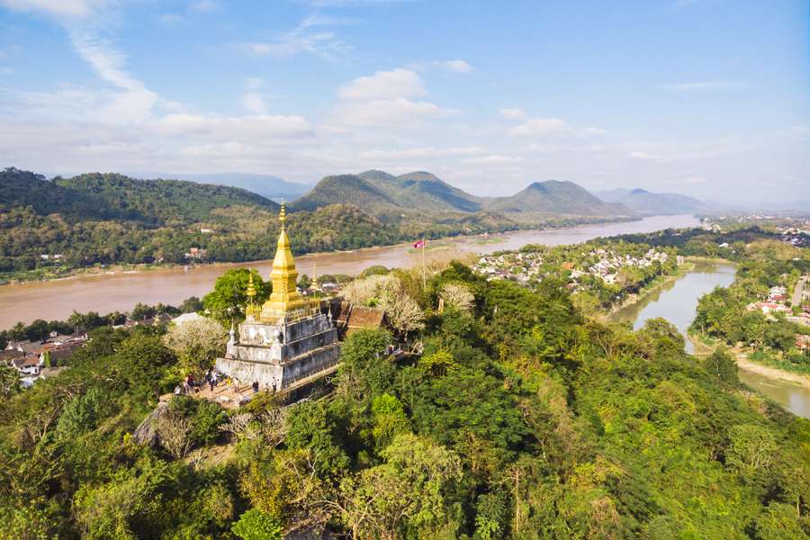
## Description Phou Si, often referred to as Mount Phou Si or Phu Si, is a sacred hill that rises 100 meters above the UNESCO World Heritage city of Luang Prabang in Laos. It’s not just a geographical landmark—it’s a spiritual and cultural centerpiece that offers panoramic views, serene temples, and a glimpse into the soul of Lao Buddhism. The name “Phou Si” translates to “Sacred Hill,” and true to its name, it’s dotted with shrines, Buddha statues, and two prominent temples: Wat Tham Phou Si halfway up, and Wat Chom Si at the summit. The climb to the top involves ascending over 300 steps, but the reward is a breathtaking 360-degree view of Luang Prabang, the Mekong and Nam Khan rivers, and the surrounding jungle-clad mountains. Along the way, saffron-robed monks stroll the leafy paths, incense drifts through the air, and small altars invite quiet reflection. A little-known fact: legend has it that a powerful Naga (a mythical serpent deity) once lived on the hill, adding a mystical layer to its spiritual significance. Another hidden treasure is a small chapel said to house a footprint of the Buddha, tucked along one of the stairways—a detail often missed by hurried visitors. ## Location Phou Si is located in **Laos**, within the **Luang Prabang Province**, in the city of **Luang Prabang**. It sits in the heart of the old town peninsula, bordered by the Mekong River on one side and the Nam Khan River on the other. ### How to Get There: - **By Foot**: Most visitors reach Phou Si by walking from nearby attractions like the Royal Palace Museum or the Night Market. The two main stairways are accessible from Sisavangvong Road and Thanon Phousi. - **By Tuk-Tuk**: If you're staying farther out, a tuk-tuk can drop you off at either entrance. - **By Bicycle**: Luang Prabang is bike-friendly, and cycling to the base of Phou Si is a scenic option. Its central location makes it an easy and essential stop on any Luang Prabang itinerary. ## Tips for Visitors To make the most of your visit to Phou Si, consider these tips: - **Go for Sunset**: The summit offers one of the best sunset views in Laos. Arrive early to secure a good spot—it's popular! - **Bring Water**: The climb can be steep and humid, especially in the afternoon. Hydration is key. - **Wear Comfortable Shoes**: The stairways are uneven in places, so sturdy footwear is recommended. - **Respect the Sacredness**: Dress modestly and be mindful of local customs. Offerings like incense and flowers are available for purchase along the way. - **Explore Both Routes**: Ascend via the Nam Khan side for scenic statues and descend via the Royal Palace side for a shorter walk. - **Entrance Fee**: Expect to pay around 20,000 Kip (~$2.50 USD), collected halfway up the hill. ## Conclusion Phou Si is more than just a viewpoint—it’s a spiritual journey, a cultural experience, and a photographer’s dream. With its sacred temples, mythical legends, and sweeping vistas, it captures the essence of Luang Prabang and offers a moment of peace above the city’s gentle bustle. ## FAQ **1. How many steps are there to reach the top of Phou Si?** There are over 300 steps, depending on the route you take—328 from the Royal Palace side and 355 from the Nam Khan side. **2. What is the best time to visit Phou Si?** Sunset is the most popular time, but early morning offers tranquility and cooler temperatures. **3. Is there an entrance fee?** Yes, the fee is approximately 20,000 Kip, payable halfway up the hill. **4. Can children climb Phou Si?** Yes, but supervision is recommended due to the steep stairways. **5. Are there restrooms or shops at the summit?** No facilities at the top, but vendors sell drinks and offerings near the base. **6. Is Phou Si wheelchair accessible?** Unfortunately, due to the stair-only access, it is not suitable for visitors with mobility issues. ## Links - [Mount Phou Si – Wikipedia](https://en.wikipedia.org/wiki/Phou_Si)
GemVoyage Team • World
Copenhagen
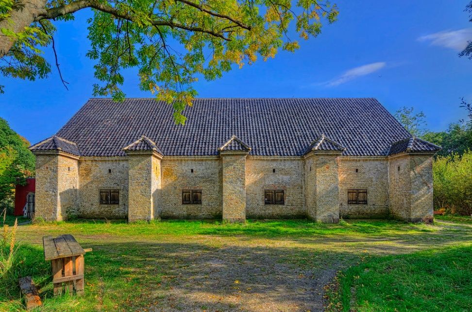
## Description **Frederiks Bastion** is one of the preserved defensive structures within Copenhagen’s historic system of coastal fortifications. Located near **Kastellet**, but distinct from it, Frederiks Bastion represents a smaller, quieter, and more understated element of Denmark’s centuries-old defensive architecture. While it lacks the scale and iconic star shape of Kastellet, its importance lies in its **strategic coastal placement**, its role in Copenhagen’s layered defense network, and its value as a surviving example of **early modern military engineering**. The bastion dates back to the era when Copenhagen’s security depended heavily on a combination of earthworks, ramparts, and coastal batteries designed to deter naval incursions. These fortifications once formed a continuous defense line protecting the harbor and the eastern approach to the city. Frederiks Bastion served primarily as a **gun emplacement**, providing a vantage point over surrounding waters and contributing to overlapping fields of fire with neighboring bastions. Unlike the more polished tourist sites in Copenhagen, Frederiks Bastion retains a **raw and authentic** military character. Much of its structure is defined by **grass-covered embankments, sturdy earthworks, and low-profile defensive shapes** that reflect 18th–19th century military design principles. Visitors who look closely can still identify the geometry of the ramparts, the angles optimized to deflect cannon fire, and the remnants of pathways used for transporting artillery and supplies. One of the most interesting aspects of Frederiks Bastion is the juxtaposition of its **military past with Copenhagen’s modern urban waterfront**. The surrounding area is now a mix of neighborhoods, harborside promenades, and cultural venues, yet the bastion remains a quiet green space that reveals how the city once prepared for siege and conflict. While many visitors overlook it on their way to more famous landmarks, those who stop here gain a deeper understanding of Copenhagen’s historical defensive logic and the engineering strategies that shaped its coastline. The atmosphere is surprisingly serene. Rather than dramatic architectural flourishes, the bastion offers a sense of **openness, subtlety, and historical layering**. It is a place where you can walk along the embankments, observe the water, and imagine the era when Copenhagen was fortified against European naval powers. The simplicity is part of its charm: no over-curated displays, no commercialized setups, just a preserved piece of functional design. Today, Frederiks Bastion is appreciated for its **heritage value**, its role in Copenhagen’s larger defensive narrative, and its suitability for contemplative waterfront walks. For urban explorers, history enthusiasts, and travelers who enjoy discovering non-touristy sites, it offers a quiet, historically charged vantage point within one of the city's most visited districts. ## Location Frederiks Bastion is located near the Copenhagen waterfront, east of the city center, not far from Kastellet and the harbor promenade. **City:** Copenhagen **Area:** Østerbro / Waterfront near Kastellet **Country:** Denmark ### How to Get There * **By metro:** * M3 or M4 to **Østerport Station**, then a short walk. * **By bus:** Several city buses stop along the harbor and near the surrounding parks. * **On foot:** Easily accessible from **Kastellet**, **Langelinie**, and the **Little Mermaid** area. * **By bicycle:** The waterfront has excellent cycling paths, making it one of the easiest ways to reach the bastion. ## Tips * **Pair it with a visit to Kastellet:** The two sites complement each other historically and geographically. * **Ideal for peaceful walks:** This is a low-traffic, quiet spot even during peak tourist season. * **Good for photography:** Particularly at sunrise or late afternoon when the light hits the embankments. * **Wear comfortable shoes:** The terrain includes grassy slopes and uneven surfaces. * **No major facilities:** Bring water or snacks if you plan to stay for a while. * **Learn the context before visiting:** Understanding its role enhances the experience, since signage onsite is minimal. ## Conclusion Frederiks Bastion is a modest but meaningful piece of Copenhagen’s military heritage. It offers insight into the city’s coastal defense strategy and provides a calm, lightly visited alternative to the larger and more structured fortifications nearby. Its earthworks, geometry, and position along the waterfront allow visitors to experience a genuine historical environment without crowds or distractions. ## FAQ **1. Is Frederiks Bastion the same as Kastellet?** No. It is a separate bastion located nearby, part of a wider defensive network. **2. Is there an entrance fee?** No. The area is freely accessible year-round. **3. How long does a visit take?** Most visitors spend **20 to 40 minutes**, often combined with a walk in the surrounding harbor area. **4. Is it family-friendly?** Yes, but keep an eye on children near steep embankments. **5. Are there views of the water?** Yes. The bastion offers clear sightlines toward the harbor and neighboring fortifications. **6. Are there signs or exhibitions?** Minimal. It’s more of a preserved outdoor site than a curated museum. ## Links * [Copenhagen Visitor Portal](https://www.visitcopenhagen.com)
GemVoyage Team • World
Paris
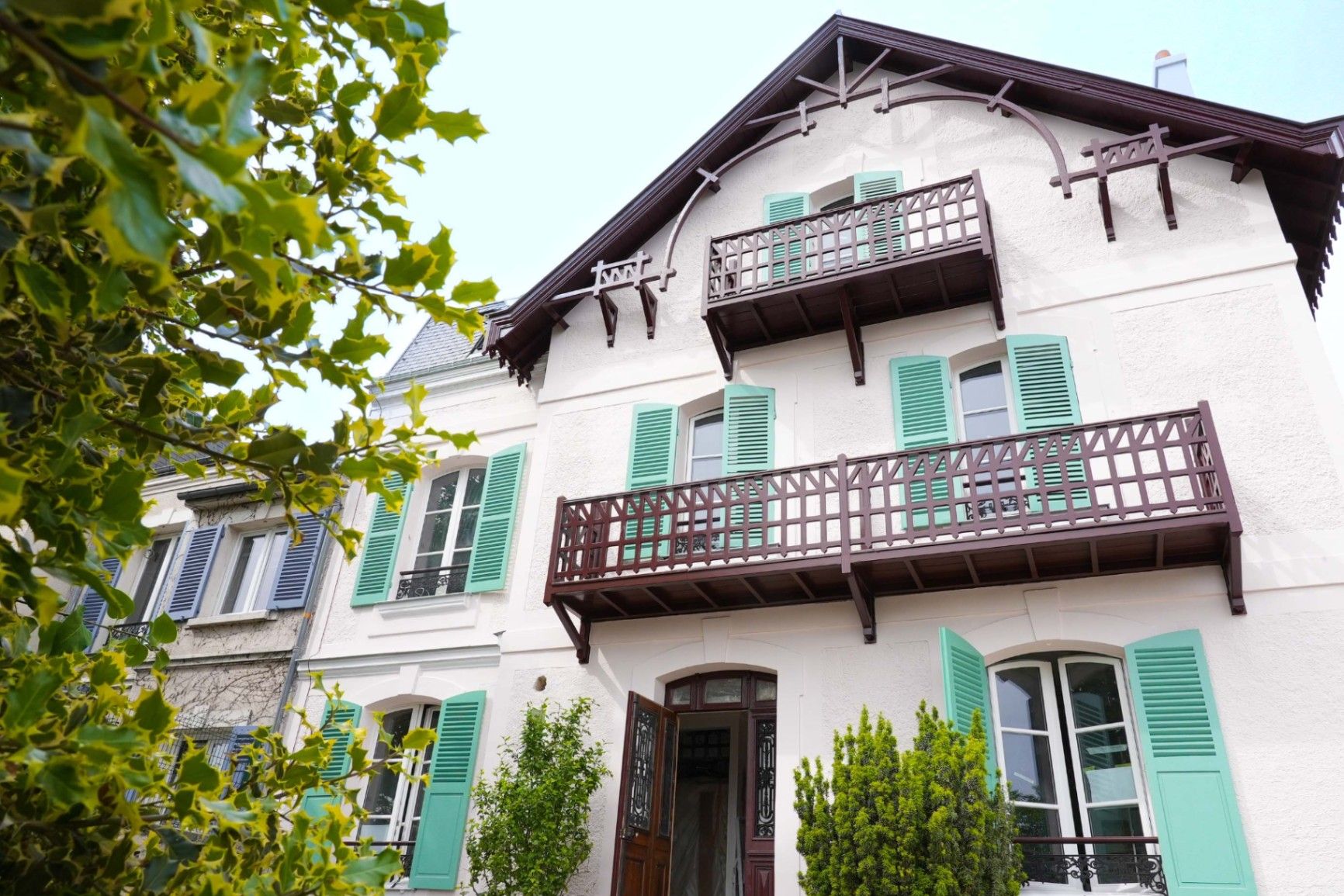
## Description **Maison Impressionniste Claude Monet Argenteuil** is a carefully reconstructed space dedicated to the years when Claude Monet lived and worked in Argenteuil, a suburb northwest of Paris. Although not the original residence, the house functions as a faithful evocation of Monet’s daily environment between 1871 and 1878, a period widely considered formative for the **Impressionist movement**. This is where Monet refined his techniques of capturing light, atmosphere, and everyday scenes, and where he produced some of his most celebrated works, including views of the Seine, gardens, and his own home life. The house is arranged to resemble the domestic context that influenced Monet’s early mastery. Rooms are curated with period furniture, reproductions of key paintings, personal objects, and interpretive displays illustrating how Monet painted outdoors, how he experimented with color, and how Argenteuil became a meeting point for artists such as Renoir, Manet, and Sisley. The staging provides an accessible narrative of Monet as a young pioneer, long before his later fame at Giverny. A little-known fact is that Argenteuil was once a **boating and leisure capital** for Parisians, and Monet frequently painted regattas and pleasure craft from the riverbanks near his home. Another lesser-known detail is that Monet’s time in Argenteuil coincided with substantial urban development, which threatened some of the very landscapes he painted. This tension between modernization and natural beauty appears subtly throughout his Argenteuil canvases. Today, the Maison Impressionniste offers a more intimate and less crowded alternative to major Impressionist institutions in Paris. It gives visitors the chance to walk through reconstructed interiors that feel personal rather than monumental and to understand the roots of what would become Monet’s global artistic influence. ## Location **City:** Argenteuil (Greater Paris area) **Region:** Île-de-France **Country:** France The house is situated in a residential part of Argenteuil, within walking distance of the Seine and the locations that inspired many of Monet’s paintings. ### How to Get There * **By train:** * From **Gare Saint-Lazare** in Paris, take a Transilien J train to **Argenteuil Station**. From there, it is a short walk or a brief bus ride. * **By bus:** * Several suburban bus lines connect Argenteuil with northern districts of Paris. * **By car:** * The area is accessible via the A15 or A86, but parking can be limited in residential streets. * **On foot from the center of Argenteuil:** * A pleasant 10–15 minute walk through town streets leads directly to the museum. ## Tips * **Visit on a weekday** to avoid periods when small tour groups pass through. * **Combine it with a Seine riverside walk**, retracing the landscapes Monet depicted in his Argenteuil period. * **Plan 45–60 minutes**, as the museum is compact but detailed. * **Photography policies may vary**, so check signage before taking photos inside. * **The museum often hosts temporary exhibits** on Impressionism and plein-air painting; check ahead for program changes. * **Bring context:** Reviewing Monet’s Argenteuil works beforehand will enrich the visit, as many are referenced in the interpretive materials. ## Conclusion Maison Impressionniste Claude Monet Argenteuil offers an intimate and historically grounded perspective on Monet’s early Impressionist years. The reconstructed spaces, the focus on daily life, and the proximity to the landscapes that shaped his artistic eye make it a meaningful stop for those seeking a deeper understanding of how Impressionism emerged and matured. ## FAQ **1. Is the house original?** No. It is a faithful reconstruction designed to evoke Monet’s home during his Argenteuil years. **2. How long did Monet live in Argenteuil?** From 1871 to 1878, a key period of his early Impressionist development. **3. Can visitors see original artworks?** The museum primarily displays reproductions and interpretive materials; original works are held in major museums in Paris and abroad. **4. Is the visit suitable for children?** Yes. The rooms are accessible, and the museum offers educational materials for younger visitors. **5. How long should I plan for the visit?** Around 1 hour, depending on reading speed and interest in the exhibits. **6. Is the museum wheelchair accessible?** Accessibility can vary; checking ahead with the museum is recommended. ## Links * [Official tourism information for Argenteuil](https://www.argenteuil.fr)
GemVoyage Team • World
Munich
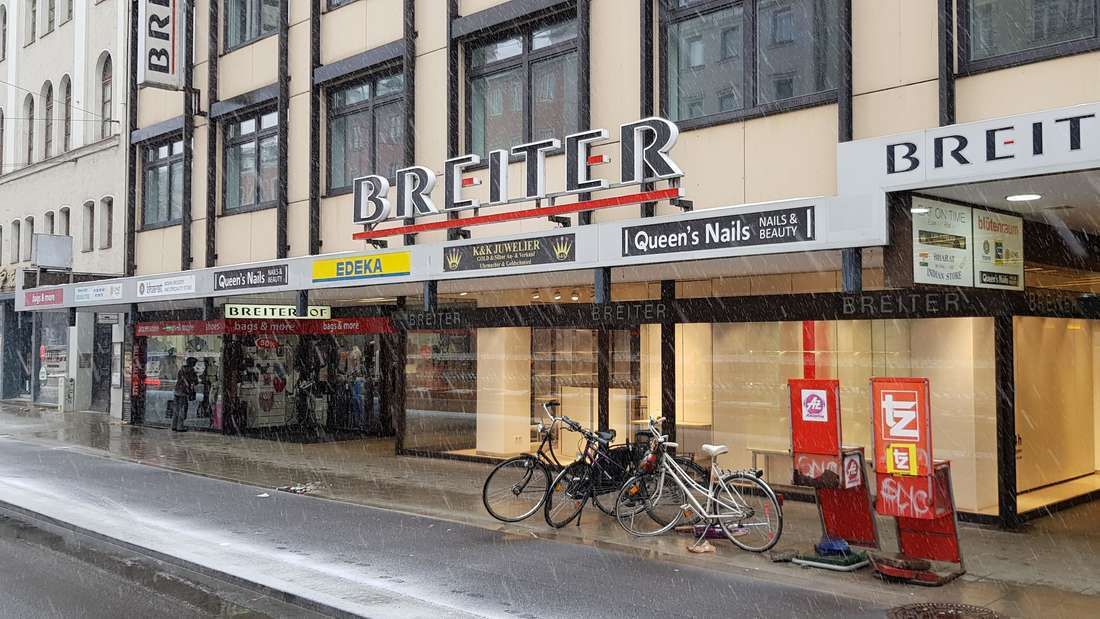
## Description **Breiterhof Passage** is a discreet but culturally significant pedestrian passageway in the heart of Munich’s old town. Unlike the city’s grand squares or monumental avenues, Breiterhof Passage represents a more **intimate layer of urban history**, where commerce, architecture, and everyday life intersect quietly rather than dramatically. The passage dates back to the **postwar reconstruction period**, when Munich rebuilt much of its historic core after World War II. Instead of restoring medieval structures wholesale, planners integrated modern functionality with traditional urban patterns. Breiterhof Passage exemplifies this approach: a short, covered walkway connecting streets while sheltering small shops, cafés, and offices. Its modest scale reflects a deliberate choice to prioritize **human movement and local commerce** over architectural spectacle. What makes Breiterhof Passage unique is its **contrast with Munich’s surrounding grandeur**. Just steps away from busy shopping streets and historic landmarks, the passage offers a slower, enclosed environment that feels almost private. A lesser-known fact is that passages like Breiterhof were designed to maintain pedestrian permeability in dense urban blocks, preserving historic movement patterns even when buildings were rebuilt. Another overlooked detail is that many businesses here are long-standing local operations rather than international chains, giving the space a distinctly Munich character. The passage is not a destination in itself, but a **transitional urban experience**. It rewards attentive visitors who appreciate the city’s smaller architectural gestures and the continuity of everyday life embedded within them. ## Location **Country:** Germany **State:** Bavaria **City:** Munich **District:** Altstadt-Lehel Breiterhof Passage is located in Munich’s historic center, close to major shopping streets and within easy walking distance of Marienplatz. ### How to Get There * **By metro or S-Bahn:** * Travel to **Marienplatz** station, then walk approximately 3–5 minutes. * **By tram:** * Several tram lines stop near the old town perimeter, followed by a short walk. * **On foot:** * Ideal when exploring Altstadt-Lehel, as the passage connects naturally to pedestrian routes. * **By bicycle:** * Bike parking is available nearby, though cycling through the passage itself is not permitted. ## Tips * **Visit during business hours:** The passage is most lively when shops and cafés are open. * **Look beyond storefronts:** Architectural details and spatial proportions are easy to miss if rushed. * **Use it as a shortcut:** It provides a calmer alternative to crowded shopping streets. * **Combine with old town exploration:** It fits naturally into a walking itinerary through central Munich. * **Respect the quiet tone:** This is a working urban space, not a tourist attraction. * **Photography is permitted:** Be mindful of people working or dining inside. ## Conclusion Breiterhof Passage is a subtle reminder that cities are shaped as much by small connective spaces as by major landmarks. Modest, functional, and quietly local, it offers insight into Munich’s postwar urban identity and everyday rhythms. ## FAQ **1. Is Breiterhof Passage a tourist attraction?** No, it is primarily a functional pedestrian passage used by locals. **2. Is there an entrance fee?** No, access is completely free. **3. How long does it take to visit?** Only a few minutes, unless stopping at a café or shop. **4. Is it historically significant?** Yes, as part of Munich’s postwar reconstruction and pedestrian network. **5. Is it suitable for children?** Yes, though there are no child-specific activities. **6. Can it be visited at night?** Access may vary depending on building hours, but daytime visits are recommended. ## Links * [Munich tourism board](https://www.munich.travel)
GemVoyage Team • World
