Discover extraordinary places shared by our community of travelers
Alexandria
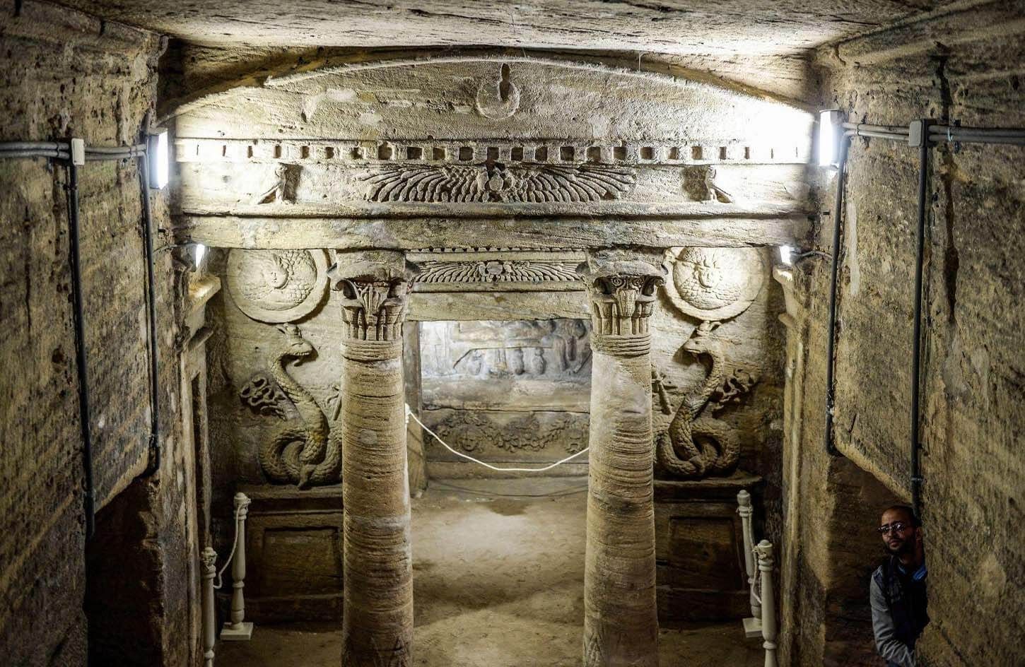
## Description The Catacombs of Kom El Shoqafa are among the most extraordinary archaeological sites in Alexandria because they condense the city’s long history of cultural blending into one underground complex. This is not a simple burial site and not a single-civilization monument. It is a layered necropolis where Egyptian, Greek, and Roman influences appear together in architecture, decoration, and ritual use. That fusion is the reason the site feels so distinctive. Visitors descend into chambers that are both funerary and ceremonial, and the result is a place that seems to express Alexandria’s identity better than almost any other attraction in the city. One of the site’s most notable features is its visual mixture of traditions. The carved motifs, sculptural forms, and architectural choices combine styles in a way that reflects the cosmopolitan nature of ancient Alexandria. A lesser-known fact is that the catacombs were discovered relatively recently in the modern period and revealed a major underground complex that had remained hidden beneath the urban fabric. Another interesting detail is that the site includes a spiral descent that gives the experience a strong sense of transition from the city above into the burial world below, making the visit feel immersive even before you reach the principal chambers. For travelers, the catacombs matter because they are not only impressive but also educational in a memorable way. They explain how Alexandria functioned as a meeting point of cultures and how religious and artistic ideas could merge rather than simply replace one another. If you are interested in ancient history, funerary art, or the Mediterranean world, this site is one of the strongest reasons to spend time in Alexandria beyond the waterfront and modern city streets. The atmosphere is part of the attraction. Underground archaeological sites always have a certain gravity, but Kom El Shoqafa also has a sense of discovery built into it. Its rooms and passageways feel like they belong to a concealed city, and that hidden quality gives the site lasting appeal. ## Location The Catacombs of Kom El Shoqafa are located in Alexandria Governorate, Egypt, in the western part of the city. The site sits within the urban area rather than far outside it, which makes it accessible as a major sightseeing stop during a day in Alexandria. Because it is embedded in the city, the exact arrival experience may involve busy streets and ordinary neighborhoods before you descend into the archaeological complex. The easiest way to reach the catacombs is usually by taxi, rideshare, or arranged local transport from central Alexandria. Public transit may be possible depending on your starting point, but taxis are often the most straightforward choice for visitors who want a predictable route. If you are planning a fuller city tour, it is sensible to combine the catacombs with other Alexandria landmarks, using them as part of a historical circuit rather than an isolated stop. As with many archaeological attractions, starting earlier in the day can improve the experience. Cooler temperatures, lighter crowds, and better energy for walking down into the complex all make a morning visit appealing. ## Tips Wear comfortable shoes. You will be walking through stairways, uneven surfaces, and underground passages, so practical footwear matters. Bring a sense of timing. The most powerful part of the visit is often the descent and the first underground chambers, so do not rush through the space. Take a guide or use a good explanation source if possible. The site becomes much richer when you understand what you are seeing and how the Roman, Greek, and Egyptian elements connect. Be mindful of heat and humidity. Even though much of the attraction is underground, the approach and exit can still be warm, especially in summer. Consider pairing the visit with other Alexandria heritage sites. The catacombs are best appreciated as part of the city’s broader ancient and Mediterranean story. ## Conclusion The Catacombs of Kom El Shoqafa are one of Alexandria’s most important cultural landmarks, combining archaeological depth, artistic fusion, and a powerful sense of place. For travelers who want history that feels tangible and layered, this site is exceptional. ## FAQ ### Why are the Catacombs of Kom El Shoqafa famous? They are famous for their blend of Egyptian, Greek, and Roman influences, which makes them a rare and visually rich example of cultural fusion in ancient funerary architecture. ### Are the catacombs underground? Yes. The experience includes a descent into underground chambers, which is a major part of the site’s atmosphere and appeal. ### How much time should I plan for the visit? Most visitors should allow around 1 to 2 hours, depending on how closely they want to explore and whether they are visiting with a guide. ### Is it suitable for all travelers? Generally yes, but visitors should be comfortable with stairs, enclosed spaces, and underground conditions. ## Links - [Catacombs of Kom El Shoqafa on Wikipedia](https://en.wikipedia.org/wiki/Catacombs_of_Kom_El_Shoqafa) - [Egyptian Ministry of Tourism and Antiquities](https://egymonuments.gov.eg/) - [Alexandria overview](https://en.wikipedia.org/wiki/Alexandria)
GemVoyage Team • World
Laos
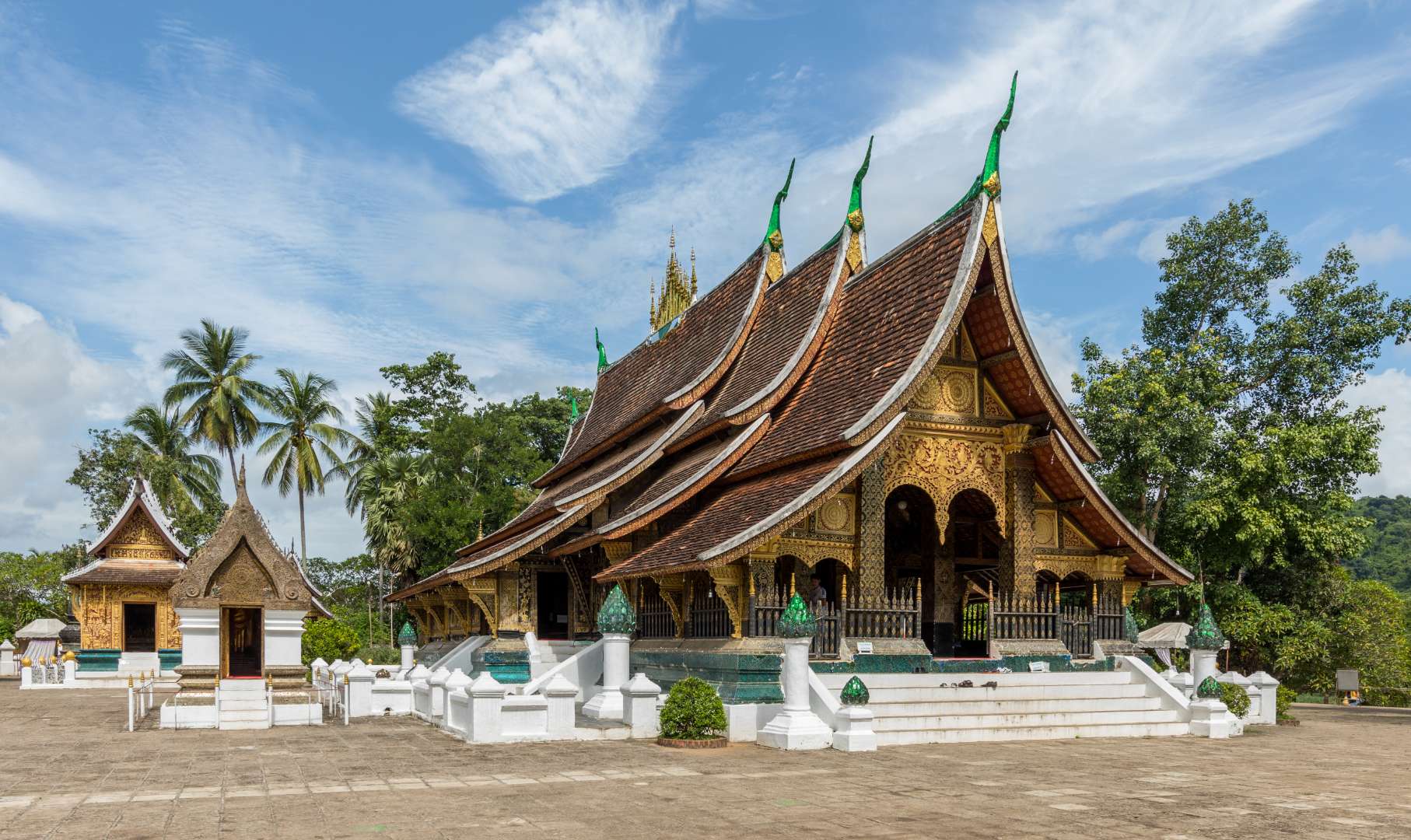
## Description Wat Xieng Thong, often referred to as the “Temple of the Golden City,” is one of the most revered and architecturally significant Buddhist temples in Laos. Located in the UNESCO World Heritage city of Luang Prabang, this 16th-century temple is a masterpiece of traditional Lao art and religious devotion. Built in 1560 by King Setthathirath, Wat Xieng Thong served as a royal temple and played a central role in religious ceremonies, coronations, and cultural festivals. The temple complex features over twenty structures, including shrines, pavilions, and monks’ quarters. Its centerpiece is the sim (main sanctuary), known for its sweeping multi-tiered roof that nearly touches the ground—a hallmark of classic Luang Prabang style. The rear façade of the sim is adorned with a stunning mosaic of the “Tree of Life,” a symbolic depiction of spiritual growth and harmony. Inside, gold stenciling on black lacquered walls illustrates scenes from Buddhist cosmology and the legendary life of King Chanthaphanith. A little-known fact: Wat Xieng Thong was spared during the sacking of Luang Prabang in 1887 by the Black Flag Haw. The invading leader, Deo Van Tri, had studied at the temple as a monk and chose to use it as his headquarters rather than destroy it. Another unique feature is the temple’s funerary carriage house, which contains an elaborate royal funeral chariot and urns used in cremation ceremonies for members of the royal family. ## Location Wat Xieng Thong is located in **Laos**, in the **Luang Prabang Province**, within the city of **Luang Prabang**. It sits at the northern tip of the peninsula formed by the Mekong and Nam Khan rivers, offering scenic views and a peaceful atmosphere. ### How to Get There - **By Foot**: If you're staying in central Luang Prabang, the temple is easily accessible by walking along the riverfront or through the old town. - **By Bicycle**: Renting a bike is a popular way to explore the city and reach Wat Xieng Thong. - **By Tuk-Tuk**: Local tuk-tuks can take you directly to the temple entrance from anywhere in town. - **By Boat**: Some river tours include a stop at the temple, offering a unique approach from the Mekong. Its location near other major attractions makes it an ideal starting point for a day of cultural exploration. ## Tips - **Visit Early or Late**: Morning and late afternoon offer softer light for photography and fewer crowds. - **Dress Modestly**: As with all religious sites in Laos, shoulders and knees should be covered. Scarves or sarongs are often available at the entrance. - **Take Your Time**: The temple complex is rich in detail. Allocate at least an hour to explore the sim, chapels, and surrounding gardens. - **Hire a Guide**: A local guide can provide deeper insights into the temple’s history, symbolism, and architecture. - **Respect the Space**: Be quiet and respectful, especially when monks are present or prayers are taking place. - **Check for Festivals**: Wat Xieng Thong hosts several annual religious events, including Pi Mai (Lao New Year), which features traditional rituals and processions. ## Conclusion Wat Xieng Thong is a cultural and spiritual gem in Luang Prabang, showcasing the elegance of Lao architecture and the depth of its Buddhist traditions. With its rich history, artistic beauty, and tranquil setting, it offers a profound and memorable experience for visitors. ## FAQ **1. What are the opening hours of Wat Xieng Thong?** The temple is open daily from 8:00 AM to 5:00 PM. **2. Is there an entrance fee?** Yes, the entrance fee is typically around 20,000 Kip per person. **3. Can non-Buddhists visit the temple?** Yes, Wat Xieng Thong is open to all visitors, regardless of religious background. **4. Is photography allowed inside the temple?** Photography is allowed in most areas, but flash and tripods are discouraged. Always be respectful. **5. Are there guided tours available?** Yes, local guides can be hired in Luang Prabang or at the temple entrance. **6. Is the temple wheelchair accessible?** Some areas may be difficult to access due to steps and uneven ground, but the main courtyard is relatively flat. ## Links - [Wat Xieng Thong – Wikipedia Overview](https://en.wikipedia.org/wiki/Wat_Xieng_Thong)
GemVoyage Team • World
Bremen
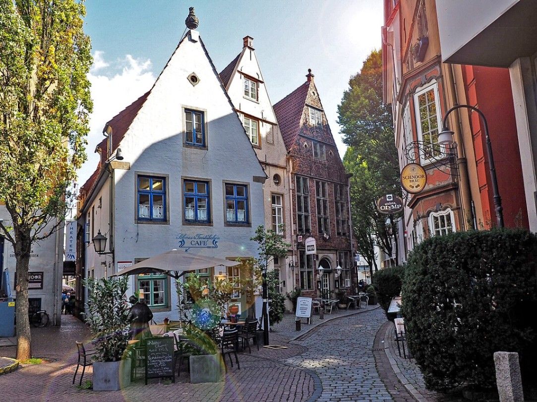
## Description The Schnoor is Bremen’s oldest quarter and one of the most picturesque areas in northern Germany. Walking through its narrow, winding alleyways feels like stepping into a medieval painting. The quarter is filled with tiny half-timbered houses, dating mostly from the 15th to 18th centuries, which have been lovingly preserved and restored. These charming homes are now a mix of cafés, artisan shops, galleries, and small museums that invite visitors to explore at a leisurely pace. What makes the Schnoor especially unique is its compact layout. The name “Schnoor” comes from the Low German word for “string” or “cord,” reflecting the fact that rope- and cord-makers once lived and worked here. The streets are so narrow in places that two people can barely walk side by side, a reminder of how space was used in medieval times. A little-known fact is that Schnoor was once considered a poor district of Bremen, inhabited mainly by fishermen and craftsmen. Today, however, it is one of the city’s most visited and beloved neighborhoods. Another interesting detail is that many of the houses are not perfectly aligned but instead lean slightly, giving the streets a charmingly crooked look. These imperfections only add to the district’s authentic, lived-in atmosphere, making it a favorite for photographers and history enthusiasts alike. ## Location The Schnoor is located in the heart of **Bremen**, a city in the state of **Bremen** in northwestern **Germany**. More precisely, it lies close to the Weser River and only a short walk from Bremen’s famous Market Square (Marktplatz), where the UNESCO World Heritage-listed Town Hall and Roland statue stand. Getting to the Schnoor is straightforward. If you are arriving in Bremen by train, the district is about a 15-minute walk from Bremen Central Station. Trams and buses also stop near the city center, making the area very accessible. For visitors traveling from Hamburg, a direct train ride takes about one hour, making Schnoor a perfect day-trip destination. Walking is the best way to explore the quarter, as the narrow lanes are not accessible by car. ## Tips * **Visit early or late in the day:** The Schnoor can become crowded with tourists during peak hours. Early mornings or evenings offer a quieter experience. * **Bring a camera:** The crooked houses, colorful facades, and hidden courtyards provide endless photo opportunities. * **Don’t rush:** Many visitors walk through quickly, but the real magic lies in browsing small shops, enjoying a coffee in one of the cozy cafés, or discovering hidden details in the architecture. * **Check out cultural stops:** The Schnoor hosts several museums, including the Schifferhaus (House of Skippers), which tells the story of Bremen’s maritime history. * **Try local specialties:** Some bakeries and cafés offer regional treats like Bremer Klaben (a type of fruit bread) or traditional beer from local breweries. ## Conclusion The Schnoor in Bremen is more than just a historic district; it is a living time capsule where history, culture, and modern life meet in a uniquely charming way. With its narrow alleys, crooked houses, and rich maritime heritage, it is one of Bremen’s must-see attractions for any traveler seeking authenticity and atmosphere. ## FAQ **1. What is the Schnoor best known for?** The Schnoor is famous for its narrow medieval alleys, half-timbered houses, and its transformation from a poor fishermen’s quarter into a vibrant cultural and tourist district. **2. Is the Schnoor suitable for children?** Yes, children usually enjoy the fairy-tale-like streets and quirky architecture. However, strollers might be difficult to maneuver in the narrowest lanes. **3. How long does it take to visit the Schnoor?** A quick walk-through can take 30 minutes, but to enjoy shops, cafés, and museums, plan for at least two to three hours. **4. Can cars enter the Schnoor?** No, the lanes are too narrow for cars. The area is best explored on foot. **5. Are guided tours available?** Yes, many guided walking tours of Bremen include the Schnoor. These tours provide fascinating insights into the district’s history and architecture. **6. Is the Schnoor open year-round?** Yes, the quarter is accessible throughout the year, though opening hours of shops and cafés vary. The winter months can be especially cozy, with festive decorations adding to the atmosphere. ## Links * [Official Tourism Page of Bremen](https://www.bremen-tourism.de) * [Visit Bremen – Schnoor District](https://www.bremen.de/tourism/schnoor)
GemVoyage Team • World
Toulouse
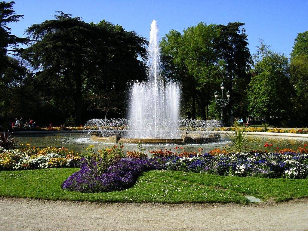
## Description The Jardin des Plantes in Toulouse is one of the city’s most beloved green spaces, offering a calm and refreshing escape from urban life. Originally created in the 18th century as a botanical garden for scientific study, it has since evolved into a public park that blends nature, history, and leisure. With its shaded paths, ponds, statues, and diverse plant life, the garden attracts families, students, and visitors looking to experience Toulouse at a gentler pace. What makes the Jardin des Plantes unique is its dual identity as both a historical botanical site and a modern recreational park. Although it no longer functions strictly as a scientific garden, many plant species and layout elements reflect its original purpose. A little-known fact is that the garden once served as a training ground for medical students studying botany and pharmacology. Another lesser-known detail is that it forms part of a larger green corridor together with the nearby Grand Rond and Jardin Royal, creating a continuous landscaped area rarely found in dense city centers. The Jardin des Plantes also features playgrounds, a carousel, and cultural installations, making it appealing to visitors of all ages while preserving a sense of historical continuity. ## Location The Jardin des Plantes is located in **France**, in the **Occitanie** region, within the city of **Toulouse**. It lies just south of the historic center, near the Muséum de Toulouse and the Canal du Midi. The garden is easily accessible by public transportation. The nearest metro station is **Palais de Justice** on Line B, which is about a 10-minute walk away. Several bus lines also serve the area. Visitors staying in central Toulouse can reach the park comfortably on foot or by bicycle, as the surrounding streets are pedestrian-friendly and well connected. ## Tips * Visit in the morning or late afternoon for a quieter and more relaxing atmosphere. * Spring and early summer are ideal for enjoying flowers and greenery at their peak. * Bring a book or picnic to fully enjoy the peaceful setting. * Families with children should check out the playground and carousel areas. * Combine your visit with the nearby Muséum de Toulouse for a full day of culture and nature. * Respect the garden rules by staying on paths and preserving plant areas. ## Conclusion The Jardin des Plantes in Toulouse offers a harmonious blend of history, nature, and everyday life. Whether you are seeking relaxation, family-friendly activities, or a scenic walk, this botanical garden remains one of the city’s most charming and accessible attractions. ## FAQ **Is the Jardin des Plantes free to enter?** Yes, entrance to the garden is free for all visitors. **How much time should I plan to spend there?** Most visitors spend between 30 minutes and two hours, depending on activities. **Is the Jardin des Plantes suitable for children?** Yes, it features playgrounds and open spaces ideal for families. **Can I picnic in the garden?** Yes, picnicking is allowed in designated areas. **Is the garden open year-round?** Yes, it is open throughout the year, though hours vary by season. ## Links * [Toulouse Tourism Official Website](https://www.toulouse-tourisme.com)
GemVoyage Team • World
Zagreb
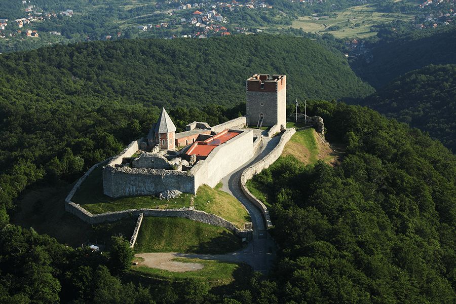
## Description Medvedgrad is a medieval fortress perched high on the southern slopes of Mount Medvednica, overlooking the city of Zagreb. Built in the 13th century following the Mongol invasion of the region, the fortress was designed as a defensive stronghold and later developed into a noble residence. Today, Medvedgrad stands as a powerful symbol of Croatian history, resilience, and national identity, offering visitors both historical insight and sweeping views of the surrounding landscape. What makes Medvedgrad unique is its dramatic setting and layered past. The fortress features preserved walls, towers, courtyards, and chapels that reveal how medieval life and defense were organized. A little-known fact is that Medvedgrad was abandoned relatively early, partly due to repeated earthquakes and difficulties accessing water on the hilltop. Another lesser-known detail is the presence of the “Altar of the Homeland,” a modern memorial within the fortress complex dedicated to Croatian independence, blending medieval heritage with contemporary national symbolism. Walking through Medvedgrad allows visitors to step back in time while also enjoying panoramic views over Zagreb and, on clear days, far beyond. ## Location Medvedgrad is located in **Croatia**, in the **City of Zagreb**, on **Mount Medvednica**, just north of the city center. The fortress sits above the neighborhood of Šestine, surrounded by forested hills and hiking trails. Visitors can reach Medvedgrad by car, taxi, or on foot via marked hiking paths from nearby neighborhoods or Medvednica Nature Park. Driving is the most convenient option, with parking available near the site, followed by a short walk. For those who enjoy outdoor activities, hiking up to Medvedgrad is a popular choice and offers scenic views along the way. ## Tips * Wear comfortable shoes, especially if you plan to hike or explore uneven stone surfaces. * Visit on a clear day to fully enjoy the panoramic views of Zagreb and the surrounding countryside. * Allow time to explore the interior exhibition spaces, which provide historical context. * Bring water and sun protection, particularly during warmer months. * Combine your visit with a walk or picnic in Medvednica Nature Park. * Check opening hours in advance, as they may vary by season. ## Conclusion Medvedgrad is a striking blend of medieval history, natural beauty, and national symbolism. Its hilltop location, well-preserved ruins, and scenic views make it one of Zagreb’s most rewarding attractions for history enthusiasts and nature lovers alike. ## FAQ **When was Medvedgrad built?** The fortress was constructed in the mid-13th century after the Mongol invasion of the region. **How long does a visit take?** Most visitors spend one to two hours exploring the fortress and enjoying the views. **Is Medvedgrad suitable for children?** Yes, though children should be supervised due to uneven terrain and high walls. **Is there an entrance fee?** Yes, a modest entrance fee is usually required to access the site. **Can I hike to Medvedgrad?** Yes, several marked hiking trails lead to the fortress from nearby areas. ## Links * [Medvedgrad Official Information](https://www.medvedgrad.hr) * [Zagreb Tourist Board](https://www.infozagreb.hr/hr)
GemVoyage Team • World
Los Angeles
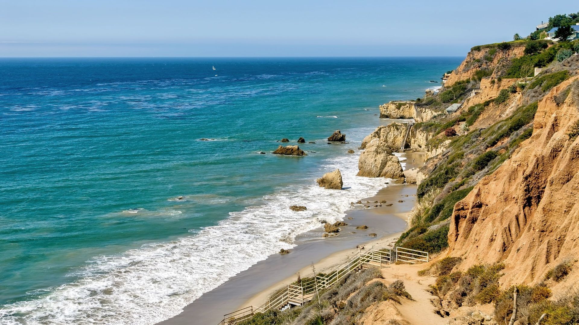
## Description El Matador State Beach is a dramatic stretch of coastline north of Malibu renowned for its sculptural sea stacks, rocky outcrops and small sand coves that create intimate scenes favored by photographers, locals and visitors seeking a more rugged California beach experience. Unlike expansive sandy beaches, El Matador’s landscape is defined by jagged rocks that rise from the surf, caves and narrow sandy pockets. Each tide reveals new textures: tide pools at low water, sea spray during higher swells, and sculpted arches that frame the Pacific during golden hour. The beach is part of the Robert H. Meyer Memorial State Beach complex and embraces a natural, relatively undeveloped character. Little-known details include a network of hidden alcoves accessible only at certain tides and a spotty but memorable chance to watch migrating whales offshore in certain seasons. The atmosphere is focused on scenic appreciation rather than typical beach amenities — visitors come to photograph, picnic, and explore rather than to find full-service concessions. ## Location El Matador State Beach is located within the Malibu coastline in Los Angeles County, California, USA, along the Pacific Coast Highway (PCH/State Route 1). It’s approximately 20–30 minutes north of central Malibu town and accessible from the PCH pull-offs. Getting there: The most common approach is by car along the Pacific Coast Highway. There is a small parking area and roadside pull-offs near Matador Beach; during busy periods parking fills quickly, and limited roadside spaces can require a short walk. From central Los Angeles, driving via Highway 1 is the most direct; rideshares are possible but may involve a short walk from parking areas. There is no direct public transit to the beach; visitors coming by transit typically need to combine buses and a walk or taxi. ## Tips - Parking & access: Arrive early in morning or late afternoon to secure parking. Expect to walk down a steep set of stairs to reach the sand; bring sturdy shoes for the descent and ascent. - Tides: Check tide charts. Low tide opens more shoreline and tide pools; high tide can restrict beach space. Be cautious near cliffs and during rising tides. - Photography: Golden hour yields spectacular silhouettes and warm light on the stacks; wide-angle and telephoto lenses are useful. Avoid walking onto slippery rocks when wet. - Amenities: There are few facilities on-site — no lifeguard on certain stretches, limited restrooms — bring water, snacks, and sun protection. - Safety: Watch for sneaker waves and changing surf conditions. Keep a safe distance from wave-swept rocks and never turn your back on the ocean. - Leave no trace: Pack out all trash and respect nesting birds or marine life in tide pools. ## Conclusion El Matador State Beach offers a compelling coastal experience that feels both cinematic and rugged: dramatic rock formations, intimate coves and exceptional sunset views. It’s a must-visit for photographers and visitors who appreciate natural, undeveloped shorelines and quiet, scenic escapes near Los Angeles. ## FAQ Q: Is there an entrance fee? A: No entrance fee, but there is limited paid parking; bring cash or card as payment methods vary. Q: Are pets allowed? A: Pets may be restricted on certain coastal state beaches; check current California State Parks rules. Q: Is the beach lifeguarded? A: Parts of the area may not be lifeguarded; swim with caution and stay aware of surf conditions. Q: Can I swim at El Matador? A: Swimming is possible but conditions can be rough; exercise caution and avoid venturing far from shore. ## Links [Wikipedia: El Matador State Beach](https://en.wikipedia.org/wiki/El_Matador_State_Beach)
GemVoyage Team • World

St. Petersburg
## Description The Narodovolets D-2 Submarine Museum in St. Petersburg is a compelling and immersive tribute to Russia’s naval history, offering visitors a rare opportunity to step inside a real Soviet-era submarine. Commissioned into the Baltic Fleet in 1931, the Narodovolets was one of the first submarines built by the Soviet Union and played a significant role during World War II. It completed four combat missions, launched twelve torpedo attacks, and successfully sank four enemy vessels—an impressive record for its time. Today, the submarine is mounted in concrete near the Shkiperskiy Canal and serves as a branch of the Central Naval Museum. Visitors can explore its authentic interiors, including the torpedo launcher compartment, engine room, crew quarters, and command center. The museum offers a hands-on experience of life aboard a submarine in the early 20th century, complete with original equipment and detailed exhibits. A little-known fact: the Narodovolets was named after the revolutionary sailors of the cruiser Aurora, symbolizing the spirit of Soviet naval resilience. Another fascinating detail is that the submarine was preserved and turned into a museum in 1993, making it one of the few surviving vessels of its kind open to the public. ## Location The Narodovolets Submarine Museum is located in **Russia**, in the **Northwestern Federal District**, within the **city of St. Petersburg**. It sits on **Vasilyevsky Island**, at **10 Shkiperskiy Protok**, near the waterfront and within walking distance of the Gulf of Finland. ### How to Get There - **By Metro**: The nearest station is Primorskaya (Line 3). From there, it’s a short walk or bus ride to the museum. - **By Bus or Trolleybus**: Bus numbers 7 and 151, and trolleybus number 10, stop near the museum. - **By Taxi**: Taxis and ride-share services like Yandex Go can take you directly to the entrance. - **By Car**: Parking is available nearby, but public transport is recommended due to limited space. Its location on Vasilyevsky Island makes it a great addition to a day of exploring St. Petersburg’s maritime and industrial heritage. ## Tips - **Wear Comfortable Clothing**: The submarine’s interior is narrow and includes steep ladders and tight corridors. Dress accordingly. - **Avoid Peak Hours**: Weekday mornings are generally quieter, offering a more relaxed experience. - **Bring a Flashlight**: While the museum is lit, some areas are dim and a small flashlight can help you see details more clearly. - **Check for Guided Tours**: Guided tours are available and provide valuable historical context and technical insights. - **Mind Accessibility**: The museum is not suitable for wheelchair users or those with limited mobility due to its confined spaces. - **Photography**: Photos are allowed, and there’s no extra fee for taking pictures—just be respectful of other visitors. ## Conclusion The Narodovolets Submarine Museum is a unique and historically rich attraction in St. Petersburg, offering a rare glimpse into Soviet naval warfare and life aboard a WWII-era submarine. With its authentic interiors and compelling exhibits, it’s a must-visit for history enthusiasts and curious travelers alike. ## FAQ **1. What are the opening hours of the Narodovolets Submarine Museum?** The museum is open daily from 10:00 AM to 6:00 PM, except on Mondays and Tuesdays. **2. What is the entrance fee?** Admission is RUB 350 for adults and RUB 200 for students. Photography is free. **3. Is the museum suitable for children?** Children are welcome, but supervision is recommended due to the submarine’s tight spaces and steep ladders. **4. Can I book a guided tour?** Yes, guided tours are available and can be arranged on-site or through the Central Naval Museum. **5. Is the museum wheelchair accessible?** No, the submarine’s design makes it inaccessible for wheelchair users or those with mobility impairments. **6. How long should I plan for a visit?** A typical visit lasts 45 minutes to an hour, depending on whether you join a guided tour. ## Links - [Narodovolets Submarine Museum – Saint Petersburg Guide](http://www.saint-petersburg.com/museums/narodovolets-d-2-submarine/) - [Central Naval Museum – Narodovolets Branch](https://eng.navalmuseum.ru/filials/narodovolec)
GemVoyage Team • World
Lisbon
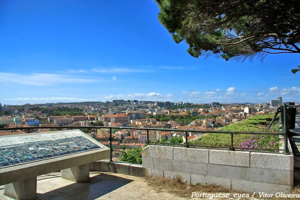
## Description Miradouro da Senhora do Monte is one of Lisbon’s most beloved viewpoints, offering a tranquil perch with unrestricted vistas across the city’s red rooftops, the Tagus River and landmarks like São Jorge Castle and the historic downtown. Tucked in the Graça neighborhood, the miradouro (viewpoint) is less crowded than some of Lisbon’s better-known terraces, making it a favorite among locals seeking a peaceful panorama and photographers hunting for unobstructed compositions. The small chapel of Senhora do Monte adds a devotional nuance to the setting, while benches and shaded nooks invite lingering. The viewpoint’s orientation gives particularly broad views to the east and south of the city, and because it is elevated, light at sunrise and sunset can be spectacular. Little-known facts: Miradouro da Senhora do Monte sits at one of the city’s highest natural points and was historically used to monitor the Tagus approaches; its quieter reputation owes partly to steeper approaches that keep the most casual visitors away. ## Location Miradouro da Senhora do Monte is located in the Graça parish of Lisbon, in the Lisbon District, Portugal. The viewpoint occupies a hilltop position above the Alfama and Graça neighborhoods and is within walking distance of São Vicente hill and several historic lanes. Getting there: The easiest ways are a short uphill walk through Graça from the tram 28 route or a ride to the Largo da Graça and a brief ascent. Tram 28 passes through Alfama and Graça and is a scenic option; buses also serve nearby stops. If using a taxi or rideshare, ask to be dropped at Largo da Senhora do Monte or the small square near the chapel. Wear comfortable shoes for the short climb. ## Tips - Timing: Sunrise and sunset are prime times for soft, warm light; sunrise is quieter and ideal for photographers. Weekday mornings are the least busy. - Safety & comfort: The area is generally safe and frequented by locals; standard precautions suffice. Bring water in warmer months and a light jacket in evenings. - Accessibility: The viewpoint involves steep streets and steps; it’s less accessible for visitors with limited mobility. - Neighborhood exploration: Combine the visit with a walk through Graça and Alfama’s lanes, sample local cafés and pastelarias nearby. - Respectful behavior: The chapel is a place of worship; observe quiet respect if services occur. ## Conclusion Miradouro da Senhora do Monte is an essential Lisbon experience for those seeking scenic calm and panoramic perspectives without the crowds of more famous terraces. Its high vantage point, local atmosphere and exceptional light conditions make it ideal for reflective moments, photography, and absorbing Lisbon’s layered skyline. ## FAQ Q: Is the miradouro crowded? A: It’s quieter than many Lisbon viewpoints but can be busy at sunset on weekends. Q: Are there cafés nearby? A: Yes, Graça and Alfama have several small cafés and bakeries within a short walk. Q: Does public transport reach it? A: Yes — Tram 28 and several buses serve the Graça area; from stops expect a short uphill walk. Q: Is there a fee to visit? A: No. The viewpoint and surrounding terraces are free and open to the public. ## Links [Detailed Guide](https://lisbonlisboaportugal.com/Alfama-Lisbon/miradouro-da-senhora-do-monte-lisbon.html)
GemVoyage Team • World
Vancouver
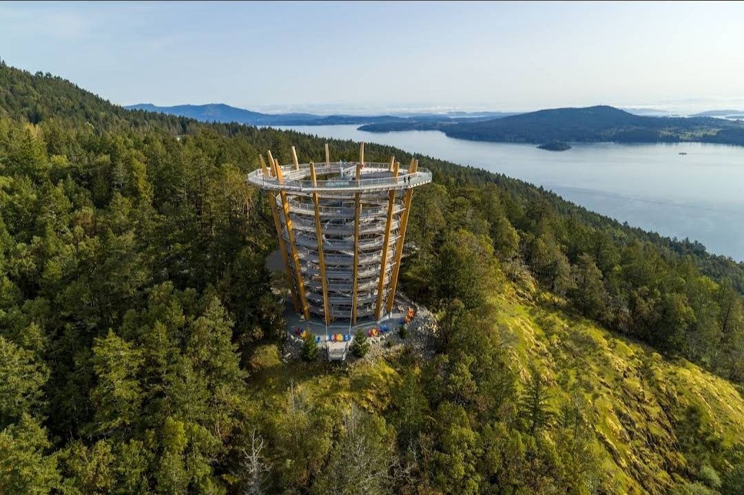
## Description The **Malahat SkyWalk Spiral Tower** is one of Canada’s most spectacular outdoor attractions, offering visitors an unforgettable way to experience the natural beauty of Vancouver Island. This unique tower features a gently sloping spiral ramp that winds its way upward for over 600 meters, leading to a stunning 250-meter elevated walkway through the treetops. At the very top, visitors are rewarded with **360-degree panoramic views** of the Saanich Peninsula, the Gulf Islands, Mount Baker in Washington State, and even glimpses of the Coast Mountains. What makes this destination truly remarkable is its **architectural design that blends seamlessly into nature**. The tower is constructed primarily from locally sourced Douglas fir and steel, combining eco-friendly practices with modern engineering. Unlike traditional observation decks, the spiral walkway makes it fully accessible to people of all ages and mobility levels. A little-known fact about the Malahat Spiral Tower is the **adventure net**—a giant webbed net suspended high above the ground at the tower’s summit. Brave visitors can step onto it and look straight down through the open center of the tower for a thrilling perspective. Another hidden gem is the **45-meter-long spiral slide** that winds its way down the inside of the tower, offering kids and adults alike an exciting alternative to walking back down. ## Location The Malahat SkyWalk Spiral Tower is located on **southern Vancouver Island, British Columbia, Canada**, about 35 kilometers (roughly 40 minutes) north of **Victoria**, the provincial capital. It sits along the Malahat Highway (Highway 1), a scenic route known for its breathtaking coastal views and winding mountain roads. The attraction is easily accessible by car, making it a popular day trip from Victoria. Visitors traveling from Vancouver can reach it by taking a ferry to Swartz Bay and then driving south toward Victoria before heading north on the Malahat Highway. For those without a car, guided tours from Victoria are also available and often include other nearby highlights. **Recommendation:** If possible, plan your visit in the morning to avoid crowds and enjoy the crisp air and soft lighting, which make the views even more magical. ## Tips To make the most out of your visit to the Malahat Spiral Tower, here are some helpful tips: * **Wear comfortable shoes:** The spiral ramp is easy to walk but requires a fair bit of strolling, so good footwear makes the experience more enjoyable. * **Check the weather:** The best views are on clear days when you can see as far as Mount Baker and the Gulf Islands. * **Try the slide:** Don’t miss the spiral slide inside the tower—it’s safe, fun, and a unique way to descend. * **Bring a camera or binoculars:** Wildlife sightings are common, including eagles, ravens, and deer in the surrounding forest. * **Buy tickets in advance:** To save time, purchase tickets online, especially during summer and holiday seasons. * **Accessibility:** The entire walkway and tower are stroller- and wheelchair-friendly, making it a great destination for families. ## Conclusion The **Malahat SkyWalk Spiral Tower** isn’t just an observation deck—it’s a full sensory experience that blends nature, adventure, and breathtaking views. From the treetop walkway to the thrill of the spiral slide and the panoramic views of land and sea, it offers something for everyone. Whether you’re a nature lover, a family traveler, or simply looking for an unforgettable outing near Victoria, this attraction deserves a spot on your bucket list. ## FAQ **1. How long does it take to visit the Malahat SkyWalk Spiral Tower?** Most visitors spend between 1.5 to 2 hours exploring the treetop walkway, climbing the spiral tower, and enjoying the views. **2. Is the Malahat SkyWalk open year-round?** Yes, it’s open in all seasons, though hours may vary. Each season offers a different experience—from lush green summers to snow-dusted winter landscapes. **3. Is the Malahat SkyWalk suitable for kids?** Absolutely! Children love the slide, and the walkway is stroller-friendly, making it a perfect family activity. **4. Can I bring my dog to the Malahat SkyWalk?** Yes, dogs on leashes are welcome along the treetop walk and the spiral tower, though they’re not allowed on the slide. **5. Is the attraction wheelchair accessible?** Yes, the entire pathway and spiral ramp are designed to be fully accessible for wheelchairs and strollers. ## Links For more information, tickets, and updates, visit these official and helpful resources: * [Malahat SkyWalk Official Website](https://malahatskywalk.com)
GemVoyage Team • World
