GemVoyage Team • World
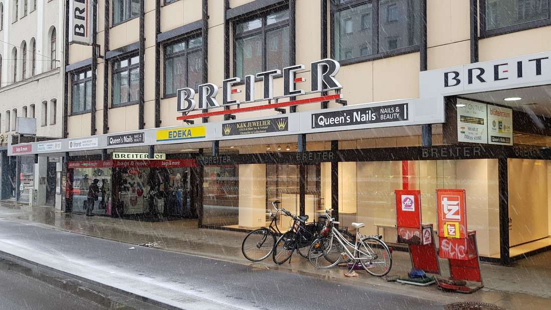
Breiterhof Passage is a discreet but culturally significant pedestrian passageway in the heart of Munich’s old town. Unlike the city’s grand squares or monumental avenues, Breiterhof Passage represents a more intimate layer of urban history, where commerce, architecture, and everyday life intersect quietly rather than dramatically.
The passage dates back to the postwar reconstruction period, when Munich rebuilt much of its historic core after World War II. Instead of restoring medieval structures wholesale, planners integrated modern functionality with traditional urban patterns. Breiterhof Passage exemplifies this approach: a short, covered walkway connecting streets while sheltering small shops, cafés, and offices. Its modest scale reflects a deliberate choice to prioritize human movement and local commerce over architectural spectacle.
What makes Breiterhof Passage unique is its contrast with Munich’s surrounding grandeur. Just steps away from busy shopping streets and historic landmarks, the passage offers a slower, enclosed environment that feels almost private. A lesser-known fact is that passages like Breiterhof were designed to maintain pedestrian permeability in dense urban blocks, preserving historic movement patterns even when buildings were rebuilt. Another overlooked detail is that many businesses here are long-standing local operations rather than international chains, giving the space a distinctly Munich character.
The passage is not a destination in itself, but a transitional urban experience. It rewards attentive visitors who appreciate the city’s smaller architectural gestures and the continuity of everyday life embedded within them.
Country: Germany
State: Bavaria
City: Munich
District: Altstadt-Lehel
Breiterhof Passage is located in Munich’s historic center, close to major shopping streets and within easy walking distance of Marienplatz.
* Travel to Marienplatz station, then walk approximately 3–5 minutes.
* Several tram lines stop near the old town perimeter, followed by a short walk.
* Ideal when exploring Altstadt-Lehel, as the passage connects naturally to pedestrian routes.
* Bike parking is available nearby, though cycling through the passage itself is not permitted.
Breiterhof Passage is a subtle reminder that cities are shaped as much by small connective spaces as by major landmarks. Modest, functional, and quietly local, it offers insight into Munich’s postwar urban identity and everyday rhythms.
1. Is Breiterhof Passage a tourist attraction?
No, it is primarily a functional pedestrian passage used by locals.
2. Is there an entrance fee?
No, access is completely free.
3. How long does it take to visit?
Only a few minutes, unless stopping at a café or shop.
4. Is it historically significant?
Yes, as part of Munich’s postwar reconstruction and pedestrian network.
5. Is it suitable for children?
Yes, though there are no child-specific activities.
6. Can it be visited at night?
Access may vary depending on building hours, but daytime visits are recommended.
Discover more hidden gems you might love.
Cairo
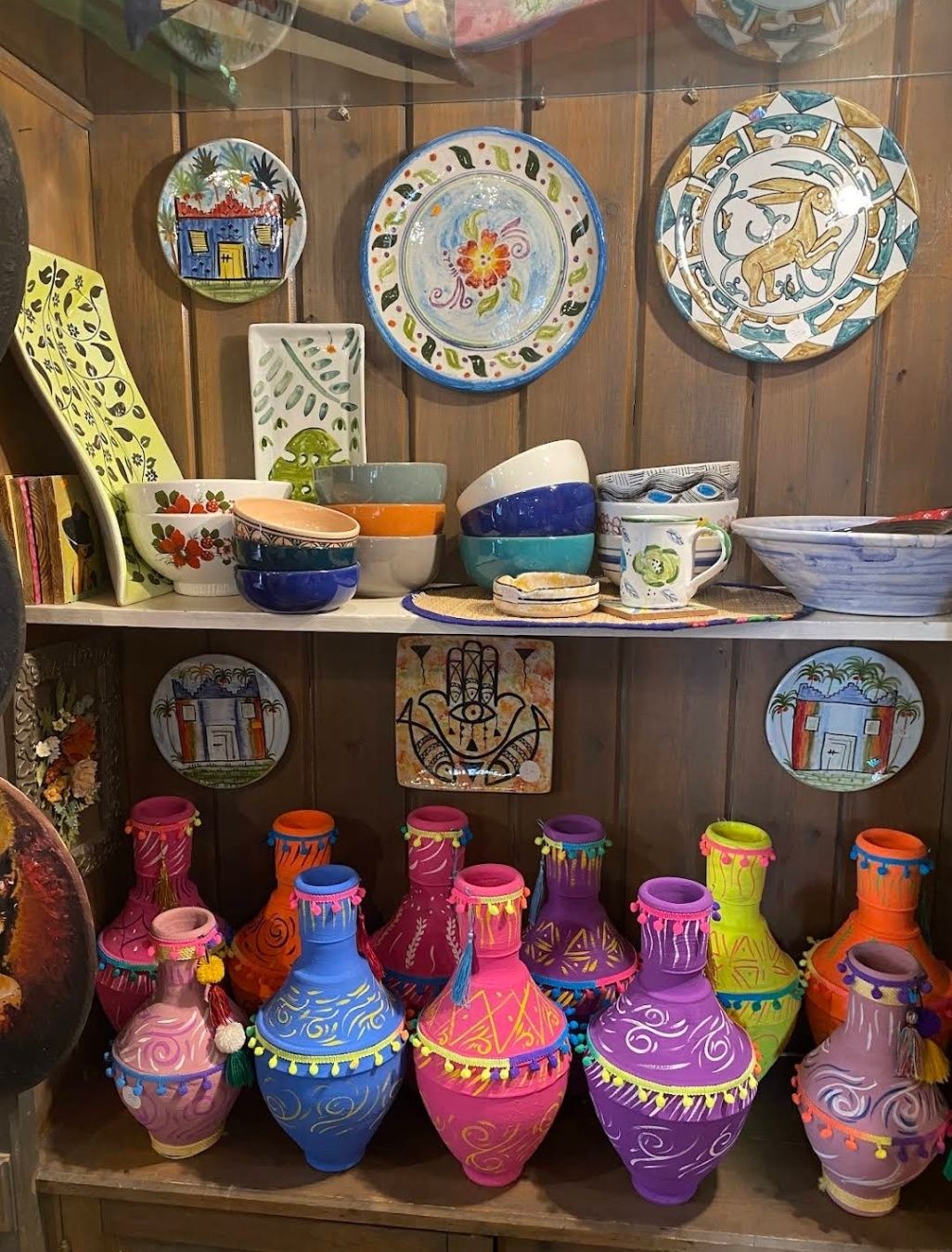
## Description **Souk Al Fustat** is one of Cairo’s most fascinating markets, blending traditional Egyptian craftsmanship with a modern, organized atmosphere. Unlike the bustling and chaotic feel of Khan El Khalili, Souk Al Fustat offers a calmer, more curated shopping experience where visitors can explore handmade goods, artisanal crafts, and cultural souvenirs in a relaxed setting. What makes this market particularly unique is its focus on **authentic, high-quality handicrafts**. Here, you’ll find exquisite pottery, handwoven textiles, blown glass, leather goods, and jewelry made by local artisans who carry on centuries-old traditions. Many items are produced using techniques passed down through generations, making every piece a little work of art. A lesser-known fact about Souk Al Fustat is that it was established in the early 2000s as part of an initiative to revive Egypt’s traditional crafts and support artisans economically. Another hidden gem is that the market is located near some of Cairo’s most historic landmarks, making it easy to combine shopping with cultural exploration in a single trip. ## Location Souk Al Fustat is located in **Old Cairo**, near **Amr Ibn Al-As Mosque** and the **Hanging Church**, within the **Fustat area** of Cairo, Egypt. The address places it right in the heart of Cairo’s oldest district, which is rich in both Islamic and Coptic heritage. Getting there is fairly simple. From downtown Cairo, you can take a taxi or a ride-hailing service like Uber, which is the most convenient option for visitors unfamiliar with the city. The drive usually takes around 20–30 minutes depending on traffic. Alternatively, you can use the **Cairo Metro** and get off at **Mar Girgis Station**, which is just a short walk from the market and other Old Cairo attractions. ## Tips To make the most out of your visit to Souk Al Fustat, consider these tips: * **Bring cash** – While some shops may accept cards, cash is the preferred method of payment, especially for smaller purchases. * **Bargain respectfully** – Unlike Khan El Khalili, prices here are often fixed, but it doesn’t hurt to politely ask for a discount if you’re buying multiple items. * **Visit nearby landmarks** – Plan your visit around Old Cairo so you can explore attractions like the Coptic Museum, Amr Ibn Al-As Mosque, and the Synagogue of Ben Ezra. * **Go in the morning or late afternoon** – This helps you avoid the midday heat and ensures a quieter shopping experience. * **Look for workshops** – Some artisans allow visitors to watch them work, offering a unique opportunity to see traditional crafts being made before your eyes. * **Support local artisans** – Many of the sellers depend on this market as their main livelihood, so buying directly from them helps preserve Egypt’s cultural heritage. ## Conclusion **Souk Al Fustat in Cairo** is more than just a marketplace—it’s a cultural hub where history, craftsmanship, and tradition come together. With its authentic handmade goods, peaceful shopping environment, and proximity to Old Cairo’s iconic landmarks, it’s the perfect spot for travelers who want to take home a meaningful piece of Egypt. ## FAQ **1. What is Souk Al Fustat known for?** It’s best known for selling authentic Egyptian handicrafts such as pottery, textiles, jewelry, glassware, and leather goods, all made by local artisans. **2. How is it different from Khan El Khalili?** Souk Al Fustat is smaller, calmer, and more organized than Khan El Khalili, focusing on quality handmade crafts rather than mass-produced souvenirs. **3. Is it family-friendly?** Yes, the market has a relaxed atmosphere, making it suitable for families with children who want to explore Egyptian crafts without the overwhelming crowds. **4. How much time should I plan for my visit?** You can comfortably explore the market in 1–2 hours, but if you combine it with nearby Old Cairo attractions, plan for a half-day trip. **5. Are prices fixed at Souk Al Fustat?** Many shops have fixed prices, but some sellers may allow light bargaining, especially if you’re purchasing multiple items. **6. When is the best time to visit?** The best times are mornings or late afternoons to avoid the heat and enjoy a more relaxed shopping experience. ## Links * [Official Egypt Tourism Website](https://www.egypt.travel)
GemVoyage Team • World
Amsterdam
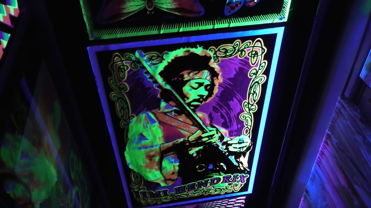
## Description Electric Ladyland Museum is one of Amsterdam’s most unusual attractions, and that is exactly why it stands out. Marketed as a museum of fluorescent art, it offers a highly specific experience centered on ultraviolet-reactive materials, immersive visual environments, and the playful boundaries between art, science, and perception. Unlike large mainstream museums, this is a niche destination with a strong point of view. For curious travelers, that makes it especially memorable. What gives the museum its appeal is its originality. Visitors do not come here for a broad survey of art history but for an encounter with a carefully curated world of glowing forms and sensory experimentation. A lesser-known fact is that Electric Ladyland has the distinction of being one of the few places devoted specifically to fluorescent art, making it unusual even in a city as creative as Amsterdam. Another detail many visitors enjoy is the hands-on, intimate scale of the museum: it feels personal and eccentric rather than institutional, which reinforces the sense that you are stepping into someone’s imaginative environment rather than a standard gallery. The museum works well for travelers who like small, offbeat experiences that break up a sightseeing schedule. It is especially good if you are interested in color, light, psychedelic visual culture, or the relationship between material and perception. The glowing displays can be surprisingly immersive, and because the concept is so focused, the visit is easy to remember long after you leave. This is not a museum you rush through. Its impact depends on letting the lighting and visual effects settle, and the experience is strongest when you approach it with curiosity rather than expectation. ## Location Electric Ladyland Museum is located in Amsterdam, North Holland, Netherlands, in the city’s central area. The exact setting is relatively modest compared with major institutions, which suits the museum’s intimate identity. Because Amsterdam is compact and walkable in many parts, it is usually easy to add the museum to a broader city route. The easiest way to get there is often on foot, by bicycle, or by public transport depending on where you are staying. Since the museum is smaller and more specialized than a major landmark, it is helpful to check entry details and opening arrangements in advance. That way you can avoid arriving at an inconvenient time or missing a guided or scheduled visit format if one applies. It works best when combined with other central Amsterdam activities, especially if you want to balance more conventional sightseeing with something genuinely unusual. ## Tips Check visit arrangements before you go. Small museums often have specific opening patterns or limited access. Do not expect a large collection. The value here is in the concept and atmosphere, not the number of rooms. Go if you like unconventional art experiences or visual phenomena. Allow yourself to spend time with the lighting effects rather than moving too quickly between spaces. Treat it as a complement to broader Amsterdam sightseeing, not as a whole-day destination. ## Conclusion Electric Ladyland Museum is one of Amsterdam’s most distinctive small attractions, offering a focused and memorable encounter with fluorescent art. It is ideal for travelers who want something creative, unusual, and unlike the city’s more standard museums. ## FAQ ### What is Electric Ladyland Museum about? It is dedicated to fluorescent art and immersive visual experiences created with ultraviolet-reactive materials. ### Is it a large museum? No. It is a smaller, more intimate attraction, which is part of its charm. ### Who will enjoy it most? Visitors who like experimental art, unusual museums, and sensory experiences will get the most out of it. ### Should I book ahead? That is often a good idea for small specialty museums, so checking current access information before visiting is wise. ## Links - [Electric Ladyland official site](https://www.electric-lady-land.com/)
GemVoyage Team • World
Rome
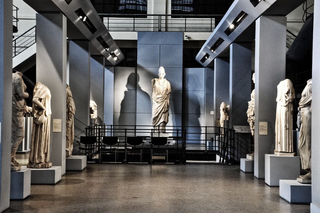
## Description Centrale Montemartini is one of Rome’s most surprising cultural experiences: an industrial power plant repurposed as a museum where classical Roman sculpture and large-scale machinery coexist in a single, dramatic setting. The raw cast-iron boilers, pipes and turbines form a deliberate and powerful backdrop for marble statues, reliefs and funerary monuments. That juxtaposition—ancient sculpture lit by museum-grade lighting against the patina of early 20th-century industrial engineering—creates striking visual and emotional contrasts that reframe familiar works from the Roman world. Originally conceived as a temporary solution while major restorations were carried out at the Capitoline Museums, the Centrale’s power-plant location quickly proved a compelling permanent home for parts of the municipal collections. The curators leaned into the setting rather than hiding it: sculptures were arranged to engage with the machinery, and exhibition narratives highlight material, technique and the passage of time. Visitors respond to the unusual dialogue between polished marble and oxidised iron; the museum reads like a meditation on Rome’s layered identity, where antiquity and modern infrastructure overlap. Beyond the immediate photogenic contrasts, Centrale Montemartini is notable for its approachable layout and variety of objects. You’ll find portraits and imperial statues, sculpted sarcophagi, and everyday objects that illuminate Roman social life. Special displays often focus on conservation practice or archaeological discoveries, and temporary exhibitions rotate, bringing contemporary scholarship and new archaeological finds into the space. For anyone interested in classical art, museum design, or the adaptive reuse of industrial architecture, Centrale Montemartini offers an unusually rich visit. ## Location Centrale Montemartini sits in the Ostiense district of Rome, a short distance from the Baths of Caracalla. The museum is accessible by metro (Circo Massimo or Garbatella stations are the closest), by several bus lines that serve the area, or by a brisk walk from the historic center if you are already exploring the nearby archaeological sites. The building’s industrial silhouette is visible even before you enter, giving a clear landmark to orient to. For planning, allow time to combine a visit with nearby landmarks: the Baths of Caracalla lie within easy walking distance and the Caffarella Park and Aventine Hill are also within reach. If traveling by taxi or rideshare, note that the museum address is well-known to drivers familiar with Rome’s cultural sites. ## Tips - Allocate 1.5–2.5 hours: the building is compact but the atmospherics and displays invite slow looking and photography. - Use the museum audio guide or pick up explanatory leaflets at the entrance to get historical context for the most important sculptures and installations. - Bring a charged camera or phone: the interplay of light, marble and metal makes for memorable photos—observe the no-flash policy where posted. - Combine your visit with the Baths of Caracalla, the Aventine viewpoints and the Testaccio neighborhood for food options afterwards. - Check the museum website for temporary exhibitions and conservation talks; these occasional programs add depth to the core collection. ## Conclusion Centrale Montemartini remains a must-see for travelers who want an offbeat but deeply satisfying museum experience in Rome. It reframes how we look at classical sculpture by placing those objects in a setting that foregrounds texture, function and the visual poetry of time. Whether you are a first-time visitor to Roman art or a repeat museumgoer seeking a fresh perspective, the Centrale’s inventive combination of history, conservation and industrial architecture rewards curiosity. ## FAQ Q: Is photography allowed? A: Generally yes for personal use, but flash and tripods may be restricted—follow signage and staff guidance. Q: Are there English guides or information? A: Yes. Audio guides, multilingual panels and printed materials are typically available; check at the ticket desk for current language options. Q: How long should I plan for a visit? A: Plan 1.5–2.5 hours to allow time for the main rooms and any temporary exhibitions or conservation displays. Q: Is the museum family friendly? A: The museum is suitable for families; spaces are manageable with strollers, though the industrial setting contains some uneven surfaces—supervise children and use designated pathways. Q: Are there accessibility arrangements? A: The museum provides accessibility options, but facilities can vary; contact the museum ahead of your visit for details on lifts, ramps and assistance. ## Links - [Centrale Montemartini (Wikipedia)](https://en.wikipedia.org/wiki/Centrale_Montemartini)
GemVoyage Team • World
Kazan
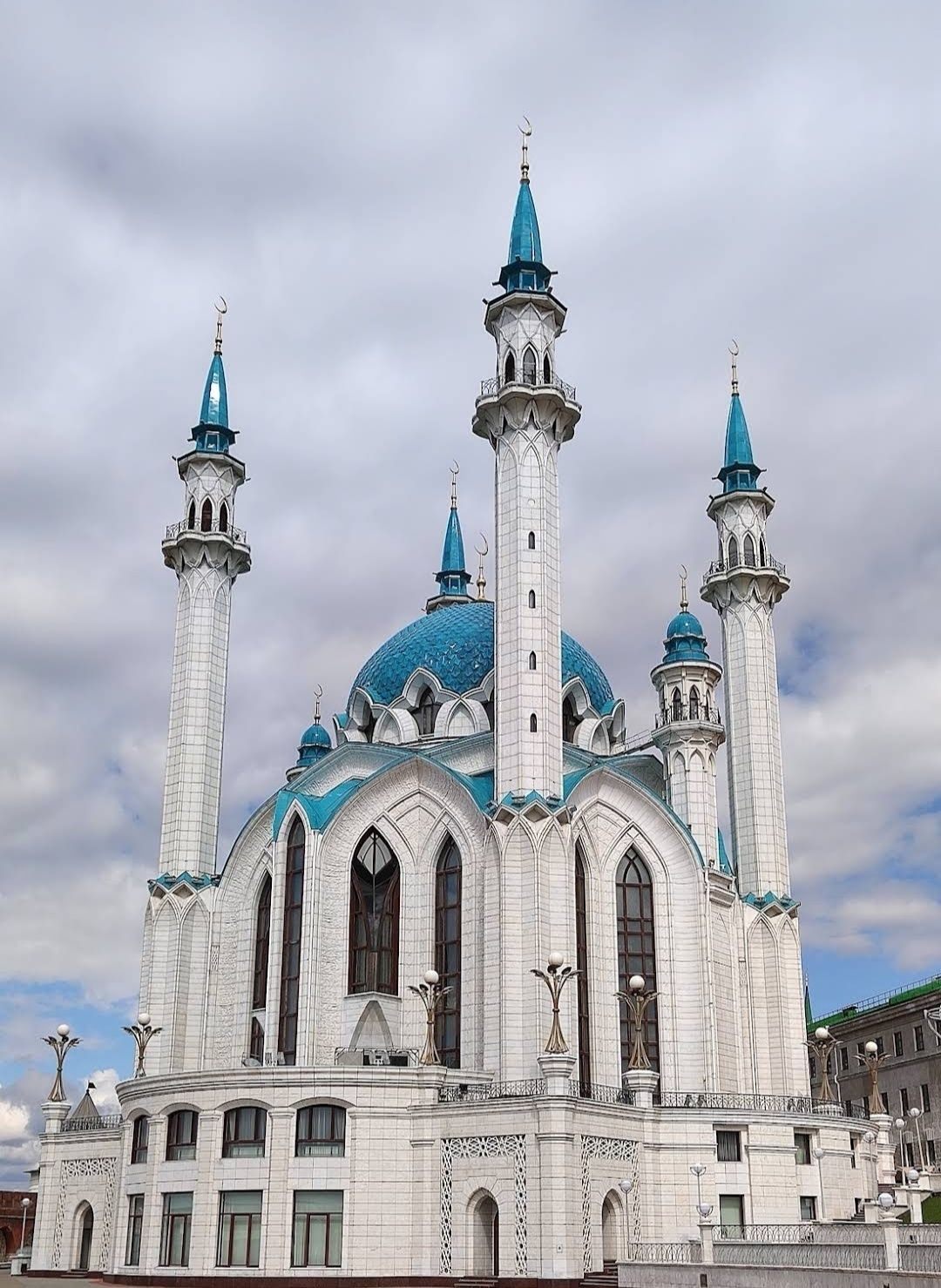
## Description The **Kul Sharif Mosque** is one of the most stunning landmarks in Russia, standing proudly inside the **Kazan Kremlin**. Recognized as both a religious and cultural icon, it represents the rich history of the Tatar people and the peaceful coexistence of different faiths in the region. Its striking blue-and-white minarets, elegant domes, and ornate interiors make it not only a place of worship but also an architectural masterpiece. Originally built in the 16th century, the mosque was destroyed in 1552 during the siege of Kazan by Ivan the Terrible. For centuries, it remained in ruins until it was magnificently rebuilt and reopened in 2005 as part of Kazan’s millennium celebrations. Today, it is one of the largest mosques in Russia and Europe, with the capacity to hold more than **6,000 worshippers**. A fascinating detail is that the mosque is named after **Kul Sharif**, a prominent Tatar religious leader, poet, and defender of Kazan who died during the 1552 siege. Another lesser-known fact is that the mosque’s design blends Islamic and Russian architectural influences, symbolizing Kazan’s unique position as a bridge between East and West. Its interiors are adorned with marble, mosaics, and exquisite chandeliers, while its museum showcases Islamic culture and history. ## Location Kul Sharif Mosque is located in **Kazan**, the capital city of the **Republic of Tatarstan**, within the **Kazan Kremlin**, a UNESCO World Heritage Site. Its central location makes it easily accessible to both locals and tourists exploring the historical heart of the city. To reach Kazan, visitors can fly into **Kazan International Airport**, which has direct flights from Moscow, St. Petersburg, and other major cities. From the airport, the city center is about a 30–40 minute drive. Within Kazan, public transportation is efficient, with buses, trams, and the **Kazan Metro**. The Kremlin, where the mosque is located, can be easily reached by metro (Kremlyovskaya Station) or by taxi. Walking tours are also popular, as the area is rich in cultural and historical landmarks. ## Tips To make the most out of your visit to the Kul Sharif Mosque, consider the following tips: * **Dress modestly** – As an active place of worship, visitors are asked to wear respectful clothing. Women may be provided with scarves if needed. * **Check visiting hours** – The mosque is open to tourists outside prayer times. Always verify the schedule before visiting. * **Explore the museum** – Inside the mosque, you’ll find a small museum dedicated to Islamic culture, manuscripts, and Tatar history. * **Combine with other attractions** – Since the mosque is inside the Kazan Kremlin, you can also visit the Annunciation Cathedral, the Presidential Palace, and the Kremlin walls. * **Enjoy night views** – The mosque is beautifully illuminated after sunset, offering a magical perspective for photography. * **Respect local customs** – Silence and respectful behavior are appreciated inside the prayer halls. ## Conclusion The **Kul Sharif Mosque in Kazan, Russia** is more than just a religious site—it’s a symbol of resilience, cultural pride, and harmony. With its breathtaking architecture, fascinating history, and central location in the Kazan Kremlin, it’s an unmissable attraction for anyone visiting Tatarstan. Whether you’re drawn by faith, history, or design, this mosque offers a truly unforgettable experience. ## FAQ **1. Is the Kul Sharif Mosque still active?** Yes, it functions as both a place of worship and a cultural landmark. Visitors are welcome outside prayer times. **2. Do I need to pay an entrance fee?** Entry to the mosque is generally free, though some museum exhibits inside may require a small fee. **3. How long should I plan for my visit?** Most visitors spend 1–2 hours exploring the mosque and museum, though you may want to set aside more time to enjoy the rest of the Kazan Kremlin. **4. Can non-Muslims enter the mosque?** Yes, the mosque welcomes people of all faiths, as long as visitors respect the dress code and customs. **5. What’s the best time to visit?** Spring and summer offer pleasant weather for exploring the city, while evenings provide the best lighting for photos of the illuminated mosque. **6. Is photography allowed inside the mosque?** Yes, photography is generally allowed, but avoid flash and always respect prayer times. ## Links * [Official Kul Sharif Mosque Website](https://kul-sharif.com) * [Visit Tatarstan – Tourism Information](https://visit-tatarstan.com)
GemVoyage Team • World
Berlin
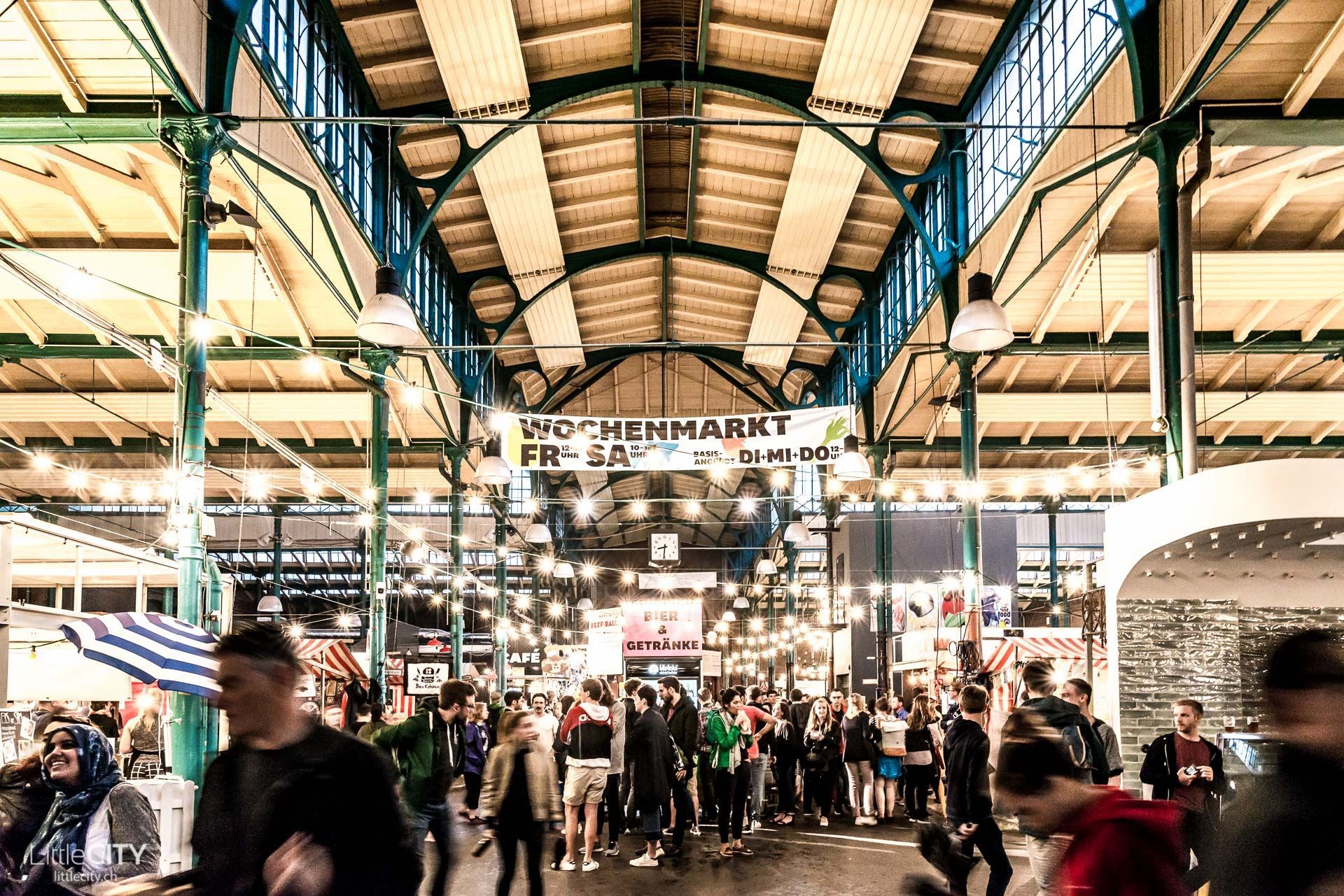
## Description Markthalle Neun is one of Berlin’s most engaging food destinations because it combines history, neighborhood identity, and culinary experimentation in a single space. Unlike a polished shopping mall or a generic indoor market, it feels deeply rooted in Kreuzberg’s local culture. The building itself carries the atmosphere of a traditional market hall, but the life inside it is contemporary and dynamic. Visitors come for food, but they stay because the market offers a sense of community and urban character that is hard to fake. One of the hall’s greatest strengths is variety. Depending on the day and the event schedule, you might encounter street food, specialty produce, artisan products, small-batch drinks, or themed market programming. That flexibility is part of why Markthalle Neun has become such an important Berlin institution. It is not frozen in one format. Instead, it adapts to local tastes and seasonal ideas while still keeping the market tradition visible. That makes it feel both authentic and current. The hall is especially known for helping local and sustainable food culture gain a stronger public profile. Many visitors think of it as a place to eat, but it is also a platform for small producers and creative cooks. A lesser-known fact is that the market has played a major role in shaping Berlin’s reputation as a city where food can be casual, ethically minded, and inventive without being stiff or overly formal. Another is that the hall’s atmosphere often feels more neighborhood-driven than tourist-driven, which gives the experience a welcome sense of local rhythm. The best visits are usually those where you arrive with time to sample, browse, and absorb the setting. The hall can feel energetic but not overwhelming, and that balance makes it pleasant for visitors who enjoy urban food culture. It is a place where lunch can turn into an afternoon, especially if there is a special market theme or event happening. Because of that, Markthalle Neun is more than a place to eat. It is a place to understand one of Berlin’s most appealing everyday social spaces. ## Location Markthalle Neun is in Berlin, Germany, in the Kreuzberg district. The location places it in one of the city’s most culturally active neighborhoods, with cafés, bars, shops, and street life all around it. Public transport is the easiest way to get there. From other central Berlin neighborhoods, you can reach Kreuzberg quickly and then continue on foot. That works especially well if you want to combine the market with a broader walk through the district. Because Kreuzberg is lively and dense, walking the neighborhood after the market can be just as rewarding as the market itself. If you are planning around a particular event or market day, check the schedule in advance. The hall’s activity changes significantly depending on what is happening there, and timing can shape the entire experience. ## Tips Arrive hungry, but do not fill up too fast. It is better to sample a few things and leave room for whatever looks best once you are inside. Check which day or theme is running before you go, because the market’s identity changes with programming. Some days are much stronger for specific types of food than others. Bring a little flexibility. The hall is most rewarding when you let yourself wander and compare options rather than trying to decide everything immediately. If you care about atmosphere as much as food, pair the visit with a Kreuzberg walk. The market becomes even more meaningful when seen as part of the neighborhood around it. The hall is also useful for travelers who want to understand Berlin through everyday culture rather than only through monuments and museums. Kreuzberg’s identity has long been shaped by migration, experimentation, and community-based creativity, and Markthalle Neun reflects that very clearly. Even if you only stop in for a snack, the space gives you a stronger sense of how Berlin’s food scene is tied to local life, not just to polished hospitality. ## Conclusion Markthalle Neun is one of Berlin’s best food-focused attractions because it combines historic market architecture with a modern, community-oriented food culture. It is a standout stop for travelers who want a taste of local life. ## FAQ **What is Markthalle Neun known for?** It is known for its food culture, market events, and strong local identity in Kreuzberg. **Is it only for lunch?** No. The market can be worth visiting at different times depending on programming and special events. **How long should I stay?** One to two hours is a good baseline, longer if you want to eat, shop, and explore the area. **Is it touristy?** It attracts visitors, but it still feels strongly tied to local Berlin food culture. **Should I check the schedule first?** Yes. The market’s offerings can change significantly depending on the day. ## Links - [Official website](https://markthalleneun.de/en/)
GemVoyage Team • World
Madagascar
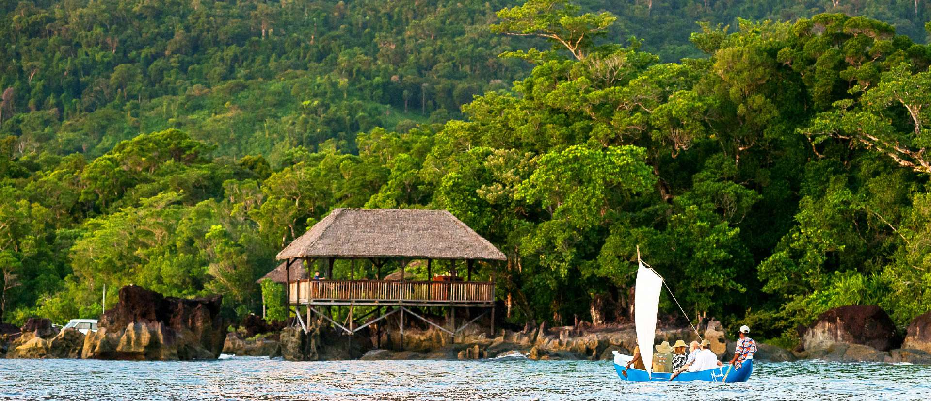
## Description Masoala National Park is Madagascar’s largest and most ecologically diverse protected area, a true Eden for nature lovers and adventurers. Located on the Masoala Peninsula in the northeast of the island, the park spans over 2,300 square kilometers of pristine rainforest and an additional 100 square kilometers of marine reserves. It’s one of the few places on Earth where lush jungle meets coral-rich coastline, creating a rare blend of terrestrial and marine biodiversity. The park is home to an astonishing array of wildlife, much of it endemic to Madagascar. Among its most famous residents is the red-ruffed lemur, found only in this region. Visitors may also encounter the elusive aye-aye, leaf-tailed geckos, tomato frogs, and over 60 species of reptiles. Birdwatchers flock to Masoala to spot rare species like the helmet vanga and the Madagascar red owl. Offshore, the marine parks protect vibrant coral reefs and host humpback whales during their migration from July to September. A little-known fact: the name “Masoala” translates to “eyes of the forest,” a poetic reference to the glowing eyes of the nocturnal aye-aye. Another fascinating detail is that the Madagascar serpent eagle, once thought extinct, was rediscovered in Masoala and now thrives in its dense canopy. ## Location Masoala National Park is located in **Madagascar**, within the **Sava Region**, near the coastal city of **Maroantsetra**. A portion of the park also extends into the **Analanjirofo Region**, making it a vast and varied landscape of rainforest, mangroves, and coral reefs. ### How to Get There: - **By Air**: Fly from Antananarivo to Maroantsetra Airport. Flights are limited, so booking in advance is essential. - **By Boat**: From Maroantsetra, the park is accessible via a 2–3 hour boat ride across Antongil Bay. This scenic journey offers glimpses of dolphins and coastal villages. - **By Tour**: Many eco-tour operators offer guided packages that include transport, accommodation, and park entry. Due to its remote location, Masoala is best visited with the help of local guides or tour companies familiar with the terrain and logistics. ## Tips for Visitors To make the most of your Masoala adventure, keep these tips in mind: - **Visit During Dry Season**: The best time to visit is from June to November. Avoid January to March due to heavy rains and cyclone risk. - **Pack Smart**: Bring waterproof gear, insect repellent, sturdy hiking shoes, and lightweight clothing. The rainforest is humid and unpredictable. - **Hire a Guide**: Local guides enhance the experience with wildlife spotting and cultural insights. Guides are mandatory for most trails. - **Explore Nosy Mangabe**: This nearby island reserve is part of the park and offers excellent chances to see the aye-aye and ancient tombs. - **Respect Wildlife**: Night walks are restricted to protect sensitive species like the aye-aye. Always follow park rules. - **Try Kayaking or Snorkeling**: The marine parks—Tampolo, Ambodilaitry, and Ifaho—are perfect for exploring coral reefs and spotting sea turtles. ## Conclusion Masoala National Park is a sanctuary of biodiversity and natural wonder. With its rare wildlife, untouched rainforest, and vibrant marine life, it offers a truly immersive experience for those seeking Madagascar’s wild heart. ## FAQ **1. What is the entrance fee for Masoala National Park?** The fee is approximately 45,000 Ariary (~16 EUR) for adults and 25,000 Ariary (~6 EUR) for children. **2. How many lemur species are found in Masoala?** The park hosts over 10 species, including the red-ruffed lemur and aye-aye. **3. Can I camp inside the park?** Yes, designated camping areas are available, especially on Nosy Mangabe Island. Guided tours often include camping options. **4. Is Masoala suitable for families?** Yes, but due to its remote location and rugged terrain, it’s best for families with older children who enjoy nature and hiking. **5. Are there accommodations near the park?** Eco-lodges and guesthouses are available in Maroantsetra and near the park’s entrance. Booking ahead is recommended. **6. What marine activities are available?** Snorkeling, kayaking, and whale watching are popular in the park’s marine reserves, especially from July to September. ## Links - [Masoala National Park – Wikipedia Overview](https://en.wikipedia.org/wiki/Masoala_National_Park) - [Masoala National Park – Official GANP Page](https://national-parks.org/madagascar/masoala)
GemVoyage Team • World

Comments