Discover extraordinary places shared by our community of travelers

Edinburgh
## **Description** Edinburgh Zoo is one of Europe’s most respected zoological parks and a highlight for animal lovers visiting the British Isles. Although it is sometimes mistakenly referred to as being in Ireland, **Edinburgh Zoo is actually located in Scotland**, just a short flight or ferry journey away from Ireland, making it a popular add-on destination for travelers exploring nearby countries. What makes Edinburgh Zoo truly unique is its strong focus on conservation, education, and animal welfare. Home to over 1,000 animals representing more than 150 species, the zoo is internationally recognized for its successful breeding programs, particularly for endangered species. One little-known fact is that Edinburgh Zoo was the **first zoo in the world to house and successfully breed penguins**, which is why it remains especially famous for its large and lively penguin colony. Another fascinating detail is that the zoo is built on **Corstorphine Hill**, giving visitors sweeping panoramic views of Edinburgh city alongside animal exhibits. Unlike many traditional zoos, the enclosures are designed to mimic natural habitats as closely as possible, allowing animals to behave more naturally while offering visitors a more immersive experience. ## **Location** Edinburgh Zoo is located in **Scotland, United Kingdom**, within the city of **Edinburgh**, in the **Corstorphine area**. It sits approximately three miles west of Edinburgh city center. For visitors coming from Ireland, the easiest way to get there is by taking a **direct flight from Dublin, Cork, or Belfast to Edinburgh Airport**, which is less than 20 minutes away from the zoo by taxi or bus. Alternatively, travelers can take a ferry from Ireland to Scotland or England and continue by train to Edinburgh. Public buses run frequently from the city center and stop directly outside the zoo entrance, making transportation simple and convenient. ## **Tips** * **Arrive early** to enjoy popular animal talks and feeding sessions, especially the penguin parade. * **Wear comfortable shoes**, as the zoo is spread across a hillside and involves a fair amount of walking. * **Check the daily schedule** online before visiting to plan your day around keeper talks and special events. * **Bring layers or waterproof clothing**, as Scottish weather can change quickly. * **Allow at least four to five hours** to explore the zoo at a relaxed pace. * **Visit on weekdays** if possible to avoid crowds, especially during school holidays. ## **Conclusion** Edinburgh Zoo is a must-visit attraction for anyone traveling near Ireland or across the UK. With its strong conservation mission, unique hillside setting, and iconic penguin colony, it offers an enriching and memorable experience for visitors of all ages. ## **FAQ** **Is Edinburgh Zoo located in Ireland?** No, Edinburgh Zoo is located in Scotland, United Kingdom. It is often visited by travelers from Ireland due to its close proximity. **How long does it take to visit Edinburgh Zoo?** Most visitors spend between four and five hours exploring the zoo. **Is Edinburgh Zoo suitable for children?** Yes, the zoo is very family-friendly and offers interactive exhibits, play areas, and educational talks. **What is Edinburgh Zoo most famous for?** The zoo is best known for its penguin colony and its global conservation efforts. **Can I reach the zoo by public transport?** Yes, several buses run directly from Edinburgh city center to the zoo entrance. ## **Links** * [Official Edinburgh Zoo Website](https://www.edinburghzoo.org.uk)
GemVoyage Team • World
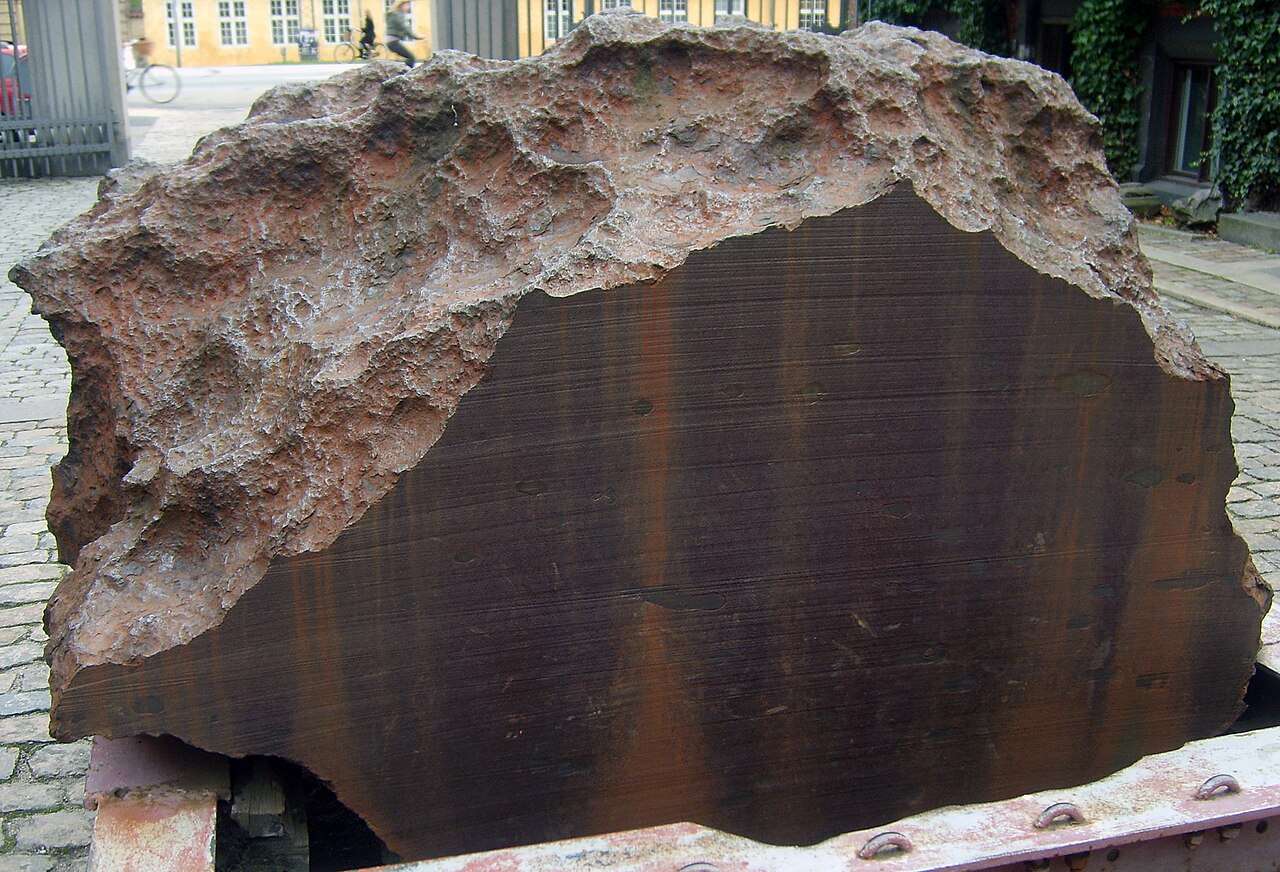
Copenhagen
## Description Agpalilik is not your typical museum exhibit—it’s a colossal fragment of an iron meteorite that fell to Earth thousands of years ago and now rests quietly outside the Natural History Museum of Denmark in Copenhagen. Weighing approximately 20 tons, this massive chunk of extraterrestrial metal is part of the Cape York meteorite, one of the largest iron meteorites ever discovered. Its sheer size and origin make it a fascinating and humbling sight for visitors. Discovered in 1963 on the Agpalilik Peninsula in northwestern Greenland by Danish geologist Dr. Vagn Buchwald, the meteorite was later transported to Denmark for study and public display. What makes Agpalilik especially compelling is its connection to the Inuit people, who used fragments of the Cape York meteorite for centuries to craft tools and weapons. The meteorite was a vital resource in a region where metal was otherwise scarce. A little-known fact: Agpalilik is one of several fragments from the Cape York meteorite shower. Others, like the famous “Ahnighito” (weighing 31 tons), are housed in the American Museum of Natural History in New York. Agpalilik’s surface still bears the marks of its long journey through space and its time buried under Greenland’s icy terrain, making it a rare opportunity to see a nearly untouched piece of the cosmos. ## Location Agpalilik is located in **Denmark**, in the **Capital Region**, within the **city of Copenhagen**. It sits just outside the entrance of the Natural History Museum of Denmark, which is part of the University of Copenhagen’s Botanical Garden complex. ### How to Get There - **By Metro**: Take the M1 or M2 line to Nørreport Station. From there, it’s a short walk to the museum. - **By Bus**: Several bus lines, including 5C and 6A, stop near Nørreport Station and the Botanical Garden. - **By Foot or Bike**: If you’re exploring central Copenhagen, the museum is easily accessible on foot or by bicycle. - **By Car**: Parking is limited in the area, so public transport is recommended. Its central location makes it an easy and worthwhile stop during a day of sightseeing in Copenhagen. ## Tips - **Visit During Daylight**: Agpalilik is displayed outdoors, so daylight hours offer the best viewing conditions. - **Pair with a Museum Visit**: Combine your visit with a tour of the Natural History Museum or a walk through the Botanical Garden. - **Touch the Meteorite**: Unlike many museum pieces, Agpalilik is accessible—you can touch a real piece of space rock. - **Read the Plaque**: Don’t miss the informative plaque that explains the meteorite’s origin and significance. - **Bring a Camera**: The meteorite’s texture and scale make for great photos, especially with the museum’s architecture in the background. - **Check for Events**: The museum occasionally hosts astronomy-themed events and lectures that complement a visit to Agpalilik. ## Conclusion Agpalilik is a rare and awe-inspiring encounter with a piece of our solar system’s history. Nestled in the heart of Copenhagen, this massive meteorite fragment offers a tangible connection to space, science, and the cultural heritage of Greenland’s Inuit communities. ## FAQ **1. Is there an entrance fee to see Agpalilik?** No, Agpalilik is displayed outside the museum and can be viewed for free. **2. Can I touch the meteorite?** Yes, visitors are allowed to touch the surface of Agpalilik. **3. What is the best time to visit?** Daytime visits are best, especially in good weather, as the meteorite is outdoors. **4. Is Agpalilik part of a larger exhibit?** While it stands alone outside, it complements the museum’s geological and astronomical exhibits inside. **5. How long should I plan for the visit?** Viewing Agpalilik takes about 15–30 minutes. Combine it with a museum tour for a longer experience. **6. Is it suitable for children?** Yes, children often find the meteorite fascinating, especially when they learn it came from space. ## Links - [Natural History Museum of Denmark – Official Website](https://snm.ku.dk/english/)
GemVoyage Team • World

Cairo
## Description The **Abdeen Palace Museum (متحف قصر عابدين)** is one of Cairo’s most magnificent historical landmarks and a must-see for lovers of history, architecture, and royal treasures. Constructed in the late 19th century under the orders of **Khedive Ismail**, the palace served as the royal residence for Egypt’s rulers from 1874 until 1952, when the monarchy was abolished. Today, it is both a functioning presidential palace and a museum complex that showcases the grandeur of Egypt’s royal past. What makes Abdeen Palace unique is its dual function: part of the palace remains an official seat of the presidency, while the museum sections are open to the public. The museum houses vast collections of weapons, medals, diplomatic gifts, rare manuscripts, and even an elaborate array of clocks and watches. The **Arms Museum** and **Medals Museum** are particular highlights, revealing not just Egypt’s history but also its connections to other nations. A lesser-known fact is that Abdeen Palace is one of the largest palaces in the world, with over **500 rooms**, though only a fraction is open to visitors. Another interesting detail is that the palace survived several periods of turmoil, including the 1952 revolution, and still stands as a symbol of both Egypt’s royal heritage and its modern political history. ## Location Abdeen Palace is located in **Downtown Cairo**, the capital of **Egypt**, in the **Cairo Governorate**. It sits in the Abdeen district, east of Tahrir Square, making it accessible from many of Cairo’s central landmarks. To get there, visitors can take a taxi, Uber, or public transport to the Abdeen area. The nearest metro stop is **Mohamed Naguib Station** on Cairo’s Metro Line 2, from which the palace is a short walk. Because Cairo traffic can be hectic, traveling by metro or planning visits during less busy hours is recommended. ## Tips * **Check opening hours:** The museum is usually open daily except Fridays, but hours can vary. Confirm before your visit. * **Wear comfortable shoes:** The palace is vast, and exploring its multiple museum wings requires a lot of walking. * **Photography rules:** Photography may be restricted in certain sections, so check guidelines upon entry. * **Hire a guide:** To appreciate the full historical context, consider hiring a local guide or audio guide. * **Combine with other attractions:** The palace’s downtown location makes it easy to pair with nearby sites like Tahrir Square, the Egyptian Museum, or Khan El Khalili bazaar. * **Respect security regulations:** Since it remains a presidential palace, expect thorough security checks at the entrance. ## Conclusion The **Abdeen Palace Museum** is more than just a royal residence—it is a treasure house of Egypt’s modern history. With its lavish architecture, rare collections, and continuing role in national life, it provides visitors with a deeper understanding of Egypt’s transition from monarchy to republic. For anyone exploring Cairo, Abdeen Palace offers a captivating mix of politics, culture, and opulence. ## FAQ **1. When was Abdeen Palace built?** It was commissioned by Khedive Ismail and completed in 1874, designed with European architectural influences. **2. How many museums are inside Abdeen Palace?** The palace contains several specialized museums, including the Arms Museum, Medals Museum, Silver Museum, and Historical Documents Museum. **3. Is the palace still used today?** Yes, part of Abdeen Palace is still used by the Egyptian Presidency for official functions, while the museum sections are open to the public. **4. How much time should I plan for a visit?** Plan at least 2–3 hours to explore the various museum wings at a comfortable pace. **5. Is photography allowed inside?** Photography rules vary; in many areas it is restricted or requires a permit. Always check before taking photos. **6. What’s the best way to get there?** The metro is a convenient choice, with Mohamed Naguib Station nearby. Otherwise, taxis and ride-hailing services are widely available in Cairo. ## Links * [Egyptian Ministry of Tourism](https://egypt.travel)
GemVoyage Team • World
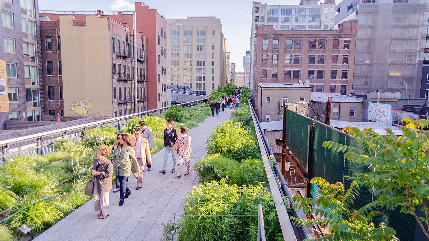
New York
## Description The High Line is one of New York City's most recognizable urban parks, but it is more than a simple green walkway. Built on a former elevated freight rail line on Manhattan's West Side, it turns industrial infrastructure into a long public promenade with gardens, city views, art installations, and quiet places to sit above the traffic. What makes it especially appealing is the way it blends architecture, landscape design, and everyday city life into one continuous experience. Visitors can move from the Meatpacking District to Hudson Yards while seeing the city from a perspective that feels both cinematic and surprisingly calm. One of the less obvious facts about the High Line is that its planting design was inspired by the wild vegetation that grew on the abandoned tracks before redevelopment began. That gives the park a natural, slightly untamed character even though it sits in one of the most developed parts of Manhattan. Another detail many first-time visitors do not expect is how much the experience changes by time of day: early morning feels reflective and peaceful, while sunset brings warm light, busier paths, and some of the best skyline photography in the city. It is a place where a short stroll can easily become a lingering afternoon. ## Location The High Line runs through the Chelsea and Hudson Yards neighborhoods on the west side of Manhattan in New York City, New York, United States. The park stretches for several blocks between the Meatpacking District and the edge of Midtown, with multiple entry points along the route. The closest subway stops vary depending on where you want to begin, but the 14th Street, 23rd Street, and 34th Street stations are among the most useful starting points. Walking from the surrounding neighborhoods is often the easiest choice because the High Line is meant to be experienced as part of a broader urban stroll. If you are planning a visit, consider starting in the Meatpacking District and walking north so you can gradually move into the newer Hudson Yards area. That direction gives a nice balance between historic warehouse blocks, galleries, and modern towers. Public transit is the best way to get there, since parking in this part of Manhattan is limited and expensive. ## Tips - Go early if you want quieter paths and easier photography without large crowds. - Wear comfortable shoes, since the walk is longer than it looks and nearby side streets invite detours. - Look for the seasonal planting and public art, because they change the mood of the route throughout the year. - Combine the visit with Chelsea Market, the Whitney Museum area, or Hudson Yards to make a fuller day. - Bring water in warm weather, since the elevated paths can feel hotter than the shaded streets below. - Stay aware of entrances and exits, because it is easy to overshoot the staircase you planned to use. ## Conclusion The High Line is a model example of how a city can transform a forgotten structure into a destination with real character. It rewards slow walking, repeated visits, and attention to detail, making it one of New York's best outdoor urban experiences. ## FAQ ### What is the best time to visit the High Line? Morning is best if you want a calmer atmosphere, softer light, and more room to move. Late afternoon and sunset are the most scenic times, but they also tend to be busier. If you are visiting in peak season, weekdays are usually less crowded than weekends. ### How long does it take to walk the High Line? Many visitors spend 45 minutes to 2 hours on the walk, depending on how often they stop for photos, art, or views. If you plan to connect it with nearby attractions, you should leave more time so the visit feels relaxed rather than rushed. ### Is the High Line suitable for families? Yes, it works well for families because it is pedestrian-only, easy to navigate, and full of visual interest. The main challenge is crowd density at popular times, so children may enjoy the walk more if you visit early or choose a less busy weekday. ### Can you access the High Line from multiple points? Yes, one of its biggest advantages is the number of access points along the route. This makes it easy to join for a short segment, exit near a neighborhood you want to explore, or use it as part of a larger walking itinerary across West Manhattan. ### What should I combine with a High Line visit? Chelsea Market, the Whitney area, the Meatpacking District, and Hudson Yards all pair naturally with the High Line. Those nearby stops turn a simple park visit into a richer day of food, art, architecture, and shopping. ## Links - [Official website](https://www.thehighline.org/) - [Wikipedia](https://en.wikipedia.org/wiki/High_Line)
GemVoyage Team • World

Jeddah
## Description The **Al Sharbatly House**, also known as **Beit Al Sharbatly**, is one of the most iconic heritage houses in **Al-Balad**, the historic district of Jeddah. This grand residence is a striking example of traditional Hijazi architecture, characterized by its intricate wooden lattice windows known as **“Rawasheen”**, coral stone walls, and spacious inner courtyards. Built during the late 19th century, the house reflects the wealth and influence of Jeddah’s prominent merchant families during the height of its trade connections across the Red Sea and Indian Ocean. What makes Al Sharbatly House unique is not just its architectural beauty but also its cultural significance. The house was once the residence of the **Egyptian Consulate** in Jeddah and later became the home of the well-known Sharbatly family, who played a vital role in the region’s economy. Today, it stands as a preserved monument within Jeddah’s UNESCO-listed Old Town, attracting both tourists and architecture enthusiasts. A lesser-known fact is that the house, like many other buildings in Al-Balad, was constructed using **coral stones sourced from the Red Sea**, combined with lime mortar. This gave the structure both strength and natural ventilation suited for Jeddah’s hot climate. Another interesting detail is that the elaborately carved wooden windows were not only decorative but also functional, allowing families to observe the busy streets outside without being seen themselves. ## Location Al Sharbatly House is located in **Al-Balad**, the historic center of **Jeddah**, in the **Makkah Province of Saudi Arabia**. This district is a living museum of Hijazi culture, with dozens of preserved houses, mosques, and souks dating back hundreds of years. Getting there is convenient. If you are traveling from **King Abdulaziz International Airport (JED)**, it takes around 30 minutes by car to reach Al-Balad. Taxis and ride-hailing services like Uber and Careem are readily available. Once inside Al-Balad, the best way to explore is on foot, as the narrow alleys and pedestrian-friendly streets are filled with heritage houses, traditional markets, and cultural landmarks. Guided walking tours are also available and highly recommended for first-time visitors. ## Tips Here are some helpful tips to make your visit to Al Sharbatly House and the Al-Balad district more enjoyable: * **Dress modestly** – As with all cultural and historical sites in Saudi Arabia, visitors should wear modest clothing in line with local customs. * **Visit in the evening** – The area comes alive at night when the houses are beautifully lit, and the markets bustle with activity. * **Hire a guide** – To fully appreciate the history and architecture, consider joining a guided tour that includes the house and other landmarks. * **Bring a camera** – The Rawasheen windows, carved doors, and narrow alleyways make for stunning photography opportunities. * **Stay hydrated** – Jeddah’s climate can be hot and humid, so carry water, especially if exploring during the day. * **Combine with nearby attractions** – Don’t miss other notable houses like Beit Nassif and the old souks in Al-Balad, which offer a full cultural immersion. ## Conclusion The **Al Sharbatly House in Jeddah** is a shining example of traditional Hijazi architecture and a key highlight of the city’s historic district. With its coral stone walls, elegant Rawasheen windows, and rich history, it offers visitors a glimpse into the heritage of one of Arabia’s most important Red Sea port cities. Whether you’re passionate about history, culture, or architecture, a visit to this house and its surroundings is a journey into Jeddah’s fascinating past. ## FAQ **1. What is Al Sharbatly House famous for?** It is known for its traditional Hijazi architecture, coral stone construction, and intricate wooden lattice windows (Rawasheen). **2. Can tourists enter Al Sharbatly House?** Access may vary, as some heritage houses in Al-Balad are open for tours, while others are preserved as cultural landmarks. Guided tours often include visits to the house. **3. Is Al-Balad a UNESCO World Heritage Site?** Yes, Jeddah’s Al-Balad district, where Al Sharbatly House is located, was inscribed on the UNESCO World Heritage List in 2014. **4. How long does it take to visit Al Sharbatly House and Al-Balad?** A half-day visit is recommended to explore the house and the surrounding historic district, though history enthusiasts may wish to spend longer. **5. When is the best time to visit?** Evenings are ideal due to cooler temperatures and the lively atmosphere in the old town. **6. What other attractions are nearby?** Nearby attractions include Beit Nassif, the Old Souk (Souq Al-Alawi), historic mosques, and several other heritage houses in Al-Balad. ## Links * [Saudi Tourism – Visit Jeddah](https://www.visitsaudi.com) * [UNESCO World Heritage – Historic Jeddah](https://whc.unesco.org/en/list/1361)
GemVoyage Team • World
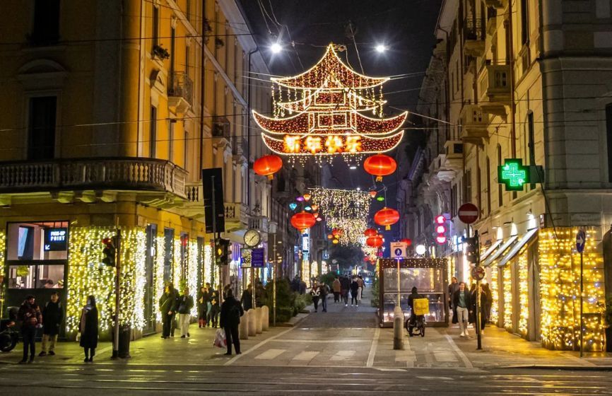
Milan
## Description **Chinatown in Milan (Quartiere Cinese di Milano)** is a lively, colorful district that blends **Italian sophistication with Chinese tradition**, creating one of the most vibrant cultural areas in northern Italy. Established in the early 20th century, it is the **oldest and largest Chinatown in Italy**, and today it thrives as a bustling hub of food, culture, and community life. The neighborhood is centered around **Via Paolo Sarpi**, a pedestrian-friendly street lined with Asian grocery stores, authentic restaurants, tea shops, and modern fashion boutiques. Red lanterns and bilingual signs decorate the streets, while the aroma of dumplings, noodles, and roasted duck fills the air. It’s a place where tradition meets innovation — where family-run Chinese bakeries coexist with trendy Milanese cafés and design studios. What makes Milan’s Chinatown unique is how seamlessly it integrates into the city’s cosmopolitan identity. Beyond being a culinary destination, it’s also a **center for art, trade, and cross-cultural exchange**. The area has become increasingly popular among young professionals and artists who appreciate its multicultural atmosphere and creative energy. A little-known fact is that Chinatown in Milan began as a **settlement of Chinese workers from Zhejiang province** in the 1920s, who came to Italy to work in the textile and leather industries. Over time, they established businesses that became essential to Milan’s fashion scene — a legacy that still endures today. Another fascinating detail: every year, the neighborhood hosts an elaborate **Chinese New Year parade**, drawing thousands of locals and tourists to celebrate with dragon dances, fireworks, and street performances. ## Location Milan’s Chinatown is located in the **northwestern part of the city center**, primarily along **Via Paolo Sarpi** in the **Porta Volta area**, **Lombardy region**, **Italy**. To get there: * **By metro:** Take **Line 2 (Green Line)** to **Moscova Station** or **Line 5 (Purple Line)** to **Monumentale Station**. Both are a short walk from Via Paolo Sarpi. * **By tram:** Tram lines **12 and 14** stop nearby. * **By foot:** It’s about a **15–20 minute walk** from the Duomo or Brera district, making it an easy stop during a city stroll. The area is pedestrian-friendly, making it perfect for exploring on foot while sampling food or browsing local shops. ## Tips * **Come hungry:** Chinatown is one of the best places in Milan for authentic Chinese, Vietnamese, and Thai cuisine. Popular dishes include **dim sum, baozi (steamed buns),** and **hand-pulled noodles**. * **Visit during Chinese New Year:** The celebrations are among the largest in Italy, featuring parades, performances, and cultural exhibits. * **Explore side streets:** Don’t just stay on Via Paolo Sarpi — nearby lanes hide charming bakeries, tea shops, and Asian supermarkets. * **Try local fusion spots:** Milan’s creativity shines through in restaurants that blend Asian and Italian flavors, reflecting the district’s evolving culinary scene. * **Shop for Asian ingredients:** Supermarkets like **Kathay** are famous for offering rare spices, sauces, and produce that are hard to find elsewhere in Italy. * **Visit in the evening:** As the lights come on, the red lanterns and street buzz create a magical, cinematic atmosphere. ## Conclusion **Chinatown in Milan** is far more than a neighborhood — it’s a living story of migration, adaptation, and community. From its early days as a textile hub to its present status as a vibrant cultural destination, it reflects Milan’s openness and diversity. Whether you’re tasting authentic dim sum, shopping for exotic ingredients, or celebrating Chinese New Year, Chinatown offers a sensory journey through the heart of modern multicultural Milan. ## FAQ **1. When was Chinatown in Milan established?** It was founded in the **1920s** by Chinese immigrants, mainly from Zhejiang province, who came to work in textile and leather industries. **2. Where exactly is it located?** It centers around **Via Paolo Sarpi**, in the **Porta Volta area** of **Milan**, **Lombardy, Italy**. **3. What can I do there?** You can explore Asian shops, enjoy authentic Chinese cuisine, visit tea houses, and attend cultural festivals such as Chinese New Year. **4. Is it safe to visit Chinatown at night?** Yes, it’s considered safe and lively, with many restaurants and bars open until late. **5. What’s the best time to visit?** Any time of year is great, but **January or February** during the **Chinese New Year** offers the most festive experience. **6. Are there Italian-Chinese fusion restaurants?** Yes, several trendy eateries combine Asian flavors with Italian ingredients, reflecting the creative spirit of Milan’s dining scene. ## Links * [Official Milano Tourism Portal](https://www.yesmilano.it)
GemVoyage Team • World
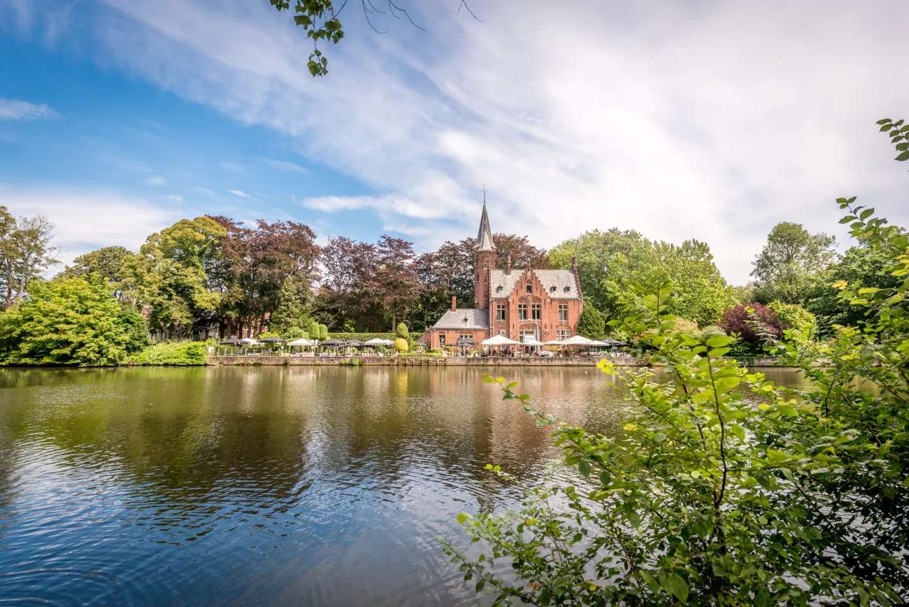
Bruges
## Description Minnewater Lake, often called the “Lake of Love,” is one of Bruges’ most enchanting and romantic spots. Nestled at the southern edge of the medieval city, this tranquil lake is surrounded by lush greenery, swans gliding across the water, and historic architecture that seems pulled from a fairy tale. It’s a place where time slows down, inviting visitors to stroll, reflect, and soak in the serene beauty of Bruges. The name “Minnewater” comes from the Dutch word “minne,” meaning love, and the lake is steeped in legend. One popular tale tells of a young woman named Minna who died of heartbreak near the lake, and her lover Stromberg buried her beneath the waters—thus giving the lake its poetic name. Today, couples often cross the Minnewater Bridge and share a kiss, believing it will seal their love forever. A little-known fact: Minnewater Lake was originally a reservoir created in the 13th century to regulate water levels and prevent flooding in Bruges. It also served as a docking point for cargo barges from Ghent until the late 18th century. The lake’s historical role in the city’s development adds depth to its romantic reputation. ## Location Minnewater Lake is located in **Belgium**, in the **Flemish Region**, within the city of **Bruges**. It sits just south of the city center, adjacent to the Begijnhof (Beguinage) and near the city ramparts. ### How to Get There: - **By Train**: From Bruges Railway Station, it’s a short 10-minute walk to the lake. Just follow signs toward Minnewaterpark. - **By Bus**: Bus lines 12 and 14 stop near the lake. Get off at Brugge Station Perron 1 and walk toward the park entrance. - **By Foot**: If you’re exploring Bruges on foot, Minnewater is easily accessible from the historic center and makes a perfect stop before or after visiting the Begijnhof. Its proximity to the train station makes it an ideal first or last stop on your Bruges itinerary. ## Tips for Visitors To make the most of your visit to Minnewater Lake, consider these helpful tips: - **Visit at Sunrise or Sunset**: The soft light and peaceful atmosphere make these times ideal for photography and quiet reflection. - **Bring a Camera**: The lake, bridge, and surrounding park offer postcard-perfect views—especially with swans in the frame. - **Explore Nearby Sites**: Don’t miss the Begijnhof, the Gunpowder Tower (Poertoren), and the neo-Gothic Kasteel de la Faille, now a restaurant. - **Pack a Picnic**: The park surrounding the lake is perfect for a relaxed lunch or snack. - **Attend a Festival**: Minnewater Park hosts occasional cultural events and music festivals—check local listings if you’re visiting in summer. - **Avoid Peak Hours**: Weekends can be crowded. For a more intimate experience, visit on a weekday morning. ## Conclusion Minnewater Lake is a poetic blend of history, legend, and natural beauty. Whether you're drawn by its romantic lore, its peaceful setting, or its role in Bruges’ medieval past, the Lake of Love offers a timeless escape in one of Europe’s most charming cities. ## FAQ **1. Is Minnewater Lake free to visit?** Yes, the lake and surrounding park are open to the public and free of charge. **2. Can I take a boat ride on Minnewater Lake?** No, boating is not permitted on the lake, as it’s part of a protected park area. **3. Is Minnewater Lake suitable for children?** Absolutely. The park is safe and spacious, with plenty of room for kids to explore. **4. Are there restaurants nearby?** Yes, including the Kasteel de la Faille, a neo-Gothic castle turned restaurant, and several cafés near the park. **5. Is Minnewater Lake accessible year-round?** Yes, the park is open year-round, though spring and summer offer the most vibrant scenery. **6. Can I visit Minnewater Lake with a dog?** Yes, dogs are welcome in the park but should be kept on a leash. ## Links - [Minnewater Lake – Visit Bruges Overview](https://www.visitbruges.be/en/things-to-do/culture-and-heritage/minnewater-lake-love) - [Minnewater Lake and Park – Discover World Guide](https://discover-world.eu/en/countries/belgium/brugge/minnewater-lake-and-park-in-bruges) - [Minnewater – Wikipedia](https://de.wikipedia.org/wiki/Minnewater)
GemVoyage Team • World
Griva
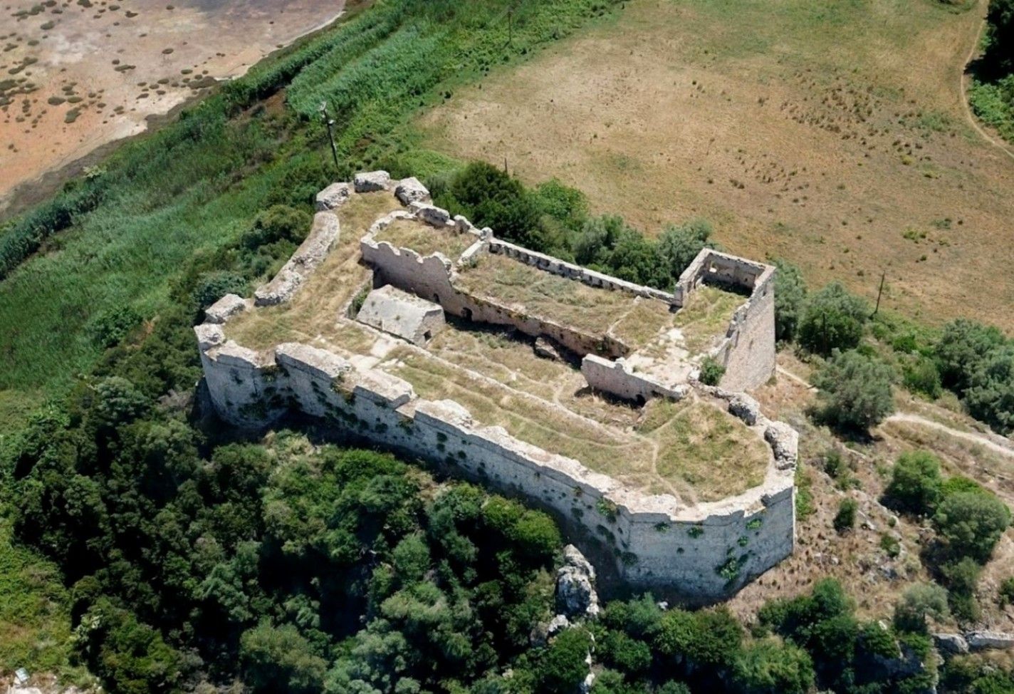
## Description **Griva Castle** (Κάστρο Γρίβα) is a lesser-known but historically significant fortress perched on a ridge in the region of Central Greece. Unlike Greece’s major medieval castles that attract heavy tourism, Griva Castle stands out for its **raw ruins, unfiltered atmosphere, and panoramic vantage point** over the surrounding mountains and valleys. The site is largely untouched by large-scale restoration efforts, which preserves an authenticity that appeals to explorers, hikers, and history enthusiasts seeking off-the-beaten-path destinations. The castle’s origins date back to the **Ottoman period**, when the structure served as a fortified outpost controlling local routes and offering surveillance over the strategic landscape. Its position was not chosen for grandeur but for **tactical visibility**; from the top of the hill, occupants could observe movements across the region long before they reached nearby settlements. Today, visitors can still walk along the remnants of its stone walls, towers, and defensive perimeters, all while imagining the military operations that once shaped the area. A little-known fact is that the castle area was later used during the **Greek War of Independence**, serving as a refuge and observation point for local fighters resisting Ottoman rule. Another interesting detail is that small-scale excavations have revealed architectural traces suggesting earlier defensive uses, which may predate the Ottoman era. What sets Griva Castle apart is the **simplicity of the experience**. There are no curated exhibitions, no ticket booths, and no commercial vendors. Instead, you step into a quiet, windswept landscape that has retained its historic atmosphere. The lack of crowds makes it ideal for slow-paced exploration, photography, and reflection. With clear weather, the views are expansive, capturing rural settlements, forested hillsides, and rolling terrain that highlight the natural beauty of central Greece. ## Location **Country:** Greece **Region:** Central Greece (Sterea Ellada) **Nearest Town:** Griva or surrounding villages depending on the specific approach The castle sits atop a hill overlooking the local countryside, accessible through rural roads and small village paths. ### How to Get There * **By car:** * The most practical option. Rural roads lead to the village area, from which a short uphill walk brings you to the castle ruins. A standard vehicle is usually sufficient, but some paths may be uneven. * **By bus:** * Limited. Regional buses connect nearby towns, but reaching the castle itself generally requires private transport. * **On foot:** * Hiking paths from the village allow visitors to reach the castle in about 15–25 minutes depending on the route chosen. * **By guided tour:** * Occasional historical or hiking groups include the site, but these are not frequent. ## Tips * **Wear proper footwear:** The terrain is rocky, uneven, and sometimes slippery after rain. * **Visit during daylight:** The area has no lighting, and navigating the ruins after sunset is unsafe. * **Bring water and snacks:** There are no facilities near the castle. * **Check the weather:** Clear skies enhance the views significantly and make the hike easier. * **Combine the visit with nearby villages:** Traditional tavernas in surrounding settlements are ideal for a post-hike meal. * **Photography enthusiasts should visit during golden hour:** The light over the surrounding hills is excellent. ## Conclusion Griva Castle is a quiet, rugged, and historically rich destination that rewards visitors willing to venture beyond mainstream tourist circuits. Its ruins, elevated position, and connection to regional history make it a compelling stop for those seeking authentic Greek landscapes and immersive outdoor exploration. ## FAQ **1. Is there an entrance fee?** No. The site is freely accessible to visitors. **2. Are the ruins safe to explore?** Generally yes, but caution is essential due to uneven paths and the absence of barriers. **3. How long does the visit take?** Most visitors spend **45 minutes to 1.5 hours** depending on hiking time and interest. **4. Is it suitable for children?** Only with supervision. Some sections have steep drops and loose stones. **5. Are guided tours available?** Occasionally, especially by local history or hiking groups, but not regularly. **6. What is the best time of year to visit?** Spring and early autumn offer comfortable temperatures and clear views. ## Links * [Greek tourism information](https://visitgreece.gr)
GemVoyage Team • World
Osun
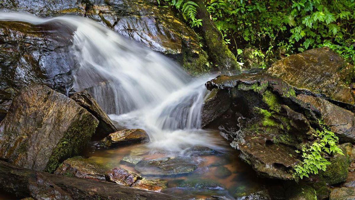
## Description **Erin Ijesha Waterfall**, also known as **Olumirin Waterfall**, is one of Nigeria’s most spectacular natural attractions. Located in Osun State, the waterfall is renowned for its **seven cascading levels**, each offering a different landscape, atmosphere, and difficulty level for visitors. The experience goes beyond a simple waterfall viewing; it is a physical ascent through layered natural terraces, tropical vegetation, and rocky pathways that reveal the geology and biodiversity of southwestern Nigeria. What makes Erin Ijesha Waterfall particularly unique is the **progression of the levels**. The first and second levels are accessible and refreshing, ideal for casual visitors. As you climb higher, the environment becomes cooler, the terrain more dramatic, and the views increasingly rewarding. The final levels lead to a plateau historically associated with ancient settlements and spiritual practices. According to oral traditions, some of these upper areas served as **refuge sites for migrating groups** and locations for community gatherings during the pre-colonial period. A little-known fact is that the waterfall has long been connected to Yoruba mythology. Local lore suggests that the waters were believed to possess cleansing qualities, and that early communities viewed the entire waterfall system as a **symbol of renewal and protection**. Another interesting detail is that the upper levels were once used as strategic vantage points due to their height and difficult access, helping local groups monitor surrounding valleys. The blend of nature, culture, and mild adventure makes Erin Ijesha Waterfall a standout destination for hikers, photographers, and anyone interested in the lesser-explored regions of Nigeria. ## Location **Country:** Nigeria **Region:** Southwest Nigeria **State:** Osun State **Nearest Town:** Ijesha (near Erin Ijesha community) The waterfall sits within a lush forested area about an hour from major towns like Ilesa. ### How to Get There * **By car:** * The most reliable method. From Ilesa or Osogbo, follow the highway toward Erin Ijesha. The entrance to the waterfall is clearly marked, and parking is available. * **By public transportation:** * Local buses and shared taxis connect Ilesa to Erin Ijesha, followed by a short walk to the site. * **By tour service:** * Some tour operators from Lagos, Ibadan, or Osogbo include the waterfall in day-trip itineraries. ## Tips * **Wear sturdy shoes:** The climb is steep in places, and water splashes make some rocks slippery. * **Bring water and stay hydrated:** The ascent to the upper levels can be physically demanding, especially in warm weather. * **Start early:** Morning visits provide cooler temperatures, softer light, and fewer crowds. * **Expect to get wet:** Mist rises from the falls, especially near the lower levels. * **Fitness level matters:** The higher levels are not recommended for visitors with mobility issues. * **Consider hiring a local guide:** They can help you navigate the steeper paths and share the historical context tied to the site. * **Avoid visiting during heavy rain:** The water flow becomes intense and pathways can become hazardous. ## Conclusion Erin Ijesha Waterfall is one of Nigeria’s most rewarding natural attractions, offering a combination of adventure, cultural history, and scenic beauty. Its seven distinct levels provide a progressively immersive experience, making it suitable for both casual travelers and more ambitious climbers. For anyone exploring southwestern Nigeria, the waterfall stands as a must-see landmark. ## FAQ **1. How many levels does Erin Ijesha Waterfall have?** The waterfall has **seven levels**, each with its own landscape and difficulty. **2. Is swimming allowed?** Light splashing and dipping are common at the lower levels, but deeper swimming is not typical due to rocky terrain. **3. How long does the hike take?** Reaching the upper levels can take **1 to 2 hours**, depending on fitness and pace. **4. Is there an entrance fee?** Yes. A modest fee is typically required for maintenance and site management. **5. Are guides available at the site?** Yes. Local guides can be hired at the entrance. **6. What is the best time to visit?** Dry season or early rainy season when the paths are safe and the water flow is strong but manageable. ## Links * [Osun State tourism info](https://www.osunstate.gov.ng)
GemVoyage Team • World
