GemVoyage Team • World
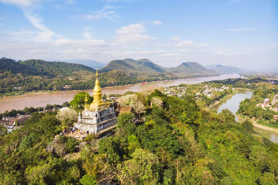
Phou Si, often referred to as Mount Phou Si or Phu Si, is a sacred hill that rises 100 meters above the UNESCO World Heritage city of Luang Prabang in Laos. It’s not just a geographical landmark—it’s a spiritual and cultural centerpiece that offers panoramic views, serene temples, and a glimpse into the soul of Lao Buddhism. The name “Phou Si” translates to “Sacred Hill,” and true to its name, it’s dotted with shrines, Buddha statues, and two prominent temples: Wat Tham Phou Si halfway up, and Wat Chom Si at the summit.
The climb to the top involves ascending over 300 steps, but the reward is a breathtaking 360-degree view of Luang Prabang, the Mekong and Nam Khan rivers, and the surrounding jungle-clad mountains. Along the way, saffron-robed monks stroll the leafy paths, incense drifts through the air, and small altars invite quiet reflection.
A little-known fact: legend has it that a powerful Naga (a mythical serpent deity) once lived on the hill, adding a mystical layer to its spiritual significance. Another hidden treasure is a small chapel said to house a footprint of the Buddha, tucked along one of the stairways—a detail often missed by hurried visitors.
Phou Si is located in Laos, within the Luang Prabang Province, in the city of Luang Prabang. It sits in the heart of the old town peninsula, bordered by the Mekong River on one side and the Nam Khan River on the other.
Its central location makes it an easy and essential stop on any Luang Prabang itinerary.
To make the most of your visit to Phou Si, consider these tips:
Phou Si is more than just a viewpoint—it’s a spiritual journey, a cultural experience, and a photographer’s dream. With its sacred temples, mythical legends, and sweeping vistas, it captures the essence of Luang Prabang and offers a moment of peace above the city’s gentle bustle.
1. How many steps are there to reach the top of Phou Si?
There are over 300 steps, depending on the route you take—328 from the Royal Palace side and 355 from the Nam Khan side.
2. What is the best time to visit Phou Si?
Sunset is the most popular time, but early morning offers tranquility and cooler temperatures.
3. Is there an entrance fee?
Yes, the fee is approximately 20,000 Kip, payable halfway up the hill.
4. Can children climb Phou Si?
Yes, but supervision is recommended due to the steep stairways.
5. Are there restrooms or shops at the summit?
No facilities at the top, but vendors sell drinks and offerings near the base.
6. Is Phou Si wheelchair accessible?
Unfortunately, due to the stair-only access, it is not suitable for visitors with mobility issues.
Discover more hidden gems you might love.
Stockholm
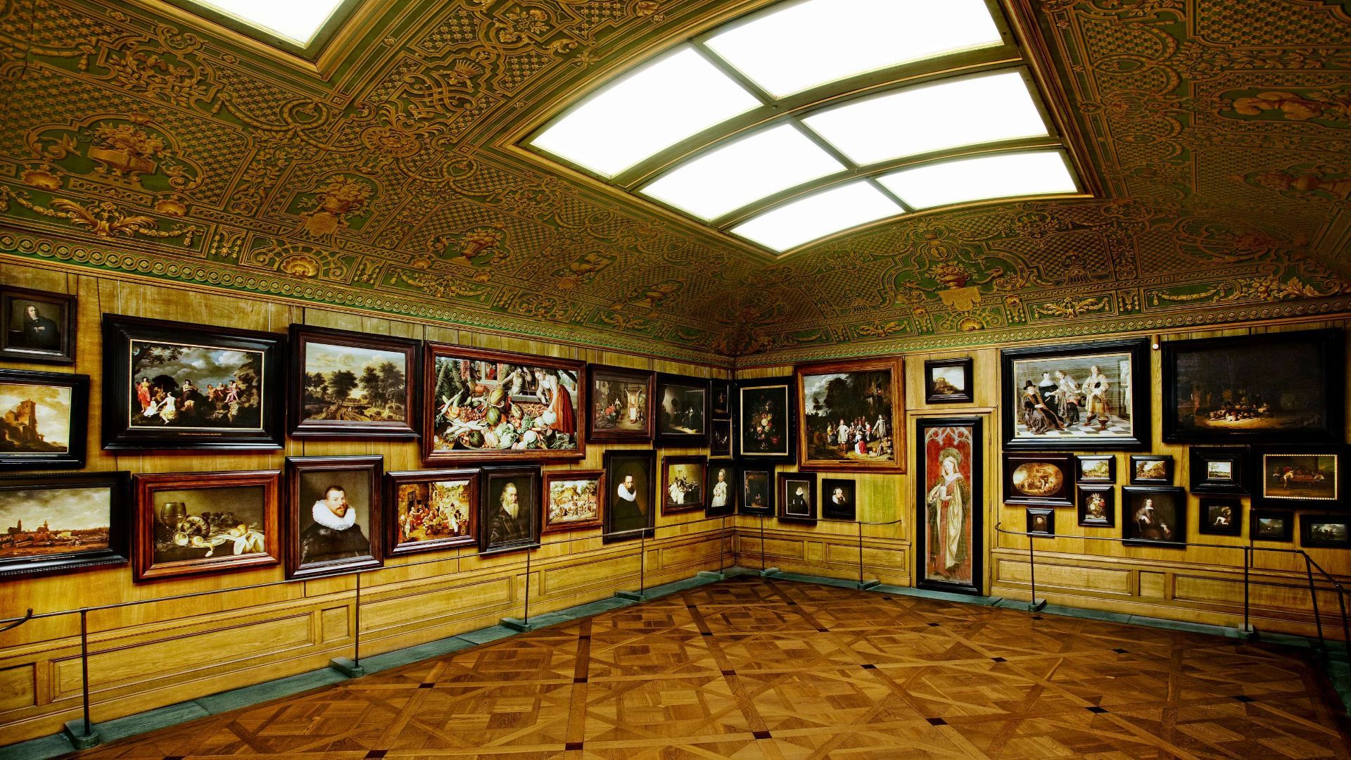
## Description The Hallwyl Museum in Stockholm offers one of the city’s most distinctive historic-house experiences. Housed in the former residence of Count and Countess von Hallwyl, the museum preserves an extraordinary late-nineteenth-century interior filled with art, furniture, decorative objects, and the feeling of a private home that has been carefully maintained rather than transformed into a generic museum. Visiting it is like stepping into a remarkably complete snapshot of upper-class domestic life in Stockholm at the turn of the century. The museum is especially appealing because it balances grandeur and intimacy. Some rooms are richly decorated and formal, while others feel like lived-in domestic spaces, making the whole building feel coherent rather than staged. One little-known fact is that the Hallwyl collection was assembled with unusual care and documentation, giving historians and visitors a detailed view of the household’s contents and routines. Another interesting detail is that the house itself reflects both status and modernity, showing how wealthy Stockholm families adopted new technologies and comforts while still displaying traditional elegance. What makes the museum memorable is the combination of its architecture, interiors, and sense of personal history. Unlike larger national museums, Hallwyl’s charm comes from concentration. Every room, object, and corridor contributes to a specific atmosphere. The visit is ideal for travelers who enjoy historic interiors, design history, or the way private homes can reveal broader social changes. It also fits well into Stockholm’s cultural landscape because it offers a different experience from the city’s more famous royal or maritime attractions. Instead of scale, it offers detail; instead of spectacle, it offers texture. ## Location The Hallwyl Museum is in central Stockholm, Sweden, near the city’s commercial and cultural core. Its location makes it easy to reach from many parts of the city and convenient to combine with shopping streets, other museums, or a broader downtown walk. The simplest way to get there is by public transport or on foot from central Stockholm. Because the city is well connected, visitors staying in the center can usually reach the museum quickly without needing a car. If you are planning a full day in central Stockholm, the museum works well as a quieter stop between busier attractions. ## Tips Take your time in the rooms; the best part of the museum is noticing the details. If you enjoy decorative arts, interiors, or social history, this museum will be especially rewarding. Check the current opening information in advance, since historic-house museums sometimes have schedule variations. Pair the visit with nearby Stockholm attractions to make the most of the central location. ## Conclusion The Hallwyl Museum is a refined and atmospheric historic house that gives visitors a rare, detailed glimpse into Stockholm’s aristocratic past. ## FAQ ### What kind of museum is Hallwyl? It is a historic house museum preserved from a wealthy Stockholm family’s residence. ### Is it good for first-time visitors to Stockholm? Yes, especially if you want a cultural site that is elegant and manageable in size. ### How long should I plan for the visit? Around one to two hours is usually enough. ### Is the museum family-friendly? Yes, though it is especially enjoyable for visitors interested in history and interiors. ### Why is it special compared with other museums? Because it preserves a remarkably complete domestic environment rather than only displaying isolated objects. ## Links - [Official website](https://hallwylskamuseet.se/en/) - [Hallwyl Museum on Wikipedia](https://en.wikipedia.org/wiki/Hallwyl_Museum)
GemVoyage Team • World
Lahore
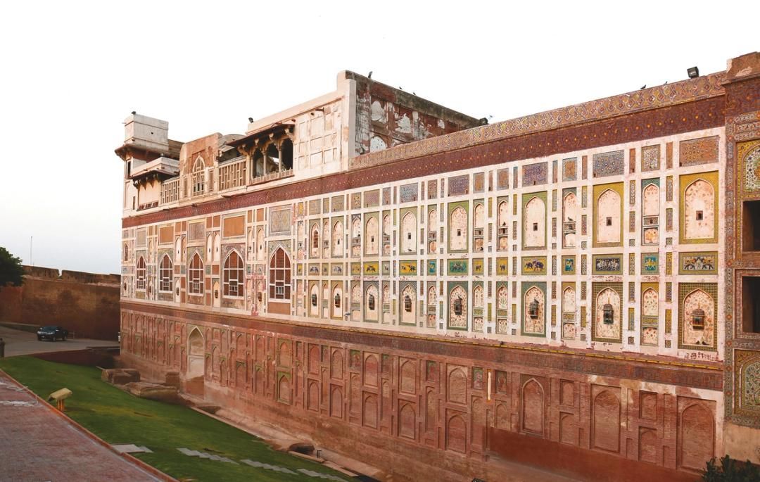
## Description The Walled City of Lahore is one of the most important historic urban districts in South Asia, and it remains one of the best places to understand Lahore beyond its modern boulevards and commercial districts. This is not a museum in the usual sense. It is a living city, layered with Mughal, Sikh, colonial, and contemporary life, where narrow streets, bazaars, mosques, havelis, gates, and food stalls all sit inside a dense and animated urban fabric. Walking here gives travelers a direct sense of how history can still function as everyday geography. What makes the Walled City especially memorable is the density of stories inside a relatively small area. Famous landmarks such as Lahore Fort and the Wazir Khan Mosque are only part of the experience. The streets between them are full of craftsmanship, household life, spices, textile traders, and small businesses that have carried local traditions forward for generations. A little-known fact is that the old city once had multiple gates that structured movement in and out of the historic center, and traces of that gate-based identity still shape how people talk about the district today. Another detail many visitors miss is that the area has been the focus of major restoration work in recent years, which means the old streets are not simply surviving on neglect; they are being actively revived, studied, and reinterpreted. For many travelers, the Walled City is the strongest argument for spending time in Lahore at all. The district makes it easy to move from monumental architecture to street-level life in a matter of minutes. You can stand in front of a grand Mughal monument, turn into a lane with a bakery or metalworker, and then step into a food stall or market that feels intensely contemporary. That overlap is what gives the old city its power. It is historic, but never frozen. It is crowded, but never empty of meaning. ## Location The Walled City of Lahore is in old Lahore, Punjab, Pakistan, centered around the historic core near landmarks such as Lahore Fort, the Badshahi Mosque, Delhi Gate, and the Shahi Guzargah route. It sits in the older part of the city, west of the modern commercial districts and north of several major roads that connect the old center to the rest of Lahore. If you are staying elsewhere in the city, the easiest way to reach it is by taxi, rideshare, or rickshaw. Public transport can help for some parts of the city, but the old city itself is best approached with a direct vehicle drop-off followed by walking. Because the streets are narrow and active, walking is the best way to experience the district once you arrive. It is worth planning the visit carefully rather than trying to see everything at once. Many travelers prefer to enter through a major gate area and then move toward one or two anchor sites rather than forcing a linear route. If possible, use a local guide or an itinerary that combines architecture, street food, and history, since that helps reveal details that are easy to miss on your own. ## Tips - Wear comfortable shoes, because the best way to experience the Walled City is on foot. - Go early or later in the afternoon to avoid the most intense heat and traffic. - Consider hiring a guide if you want the historical layers explained in context. - Dress respectfully, especially if your route includes religious sites. - Keep your schedule flexible, because the district is best enjoyed slowly. - Bring small cash for snacks, tea, and local purchases. ## Conclusion The Walled City of Lahore is a rare historic district that still feels fully alive. It rewards slow exploration, local curiosity, and patience, and it offers one of the richest urban experiences in Pakistan. ## FAQ ### Why is the Walled City of Lahore important? It is one of the oldest and most culturally significant parts of Lahore, with historic gates, monuments, bazaars, and living traditions. ### How much time should I spend there? Half a day is a practical minimum, but a full day is better if you want to include food and major monuments. ### Is it safe to visit with a guide? Yes. Visiting with a knowledgeable local guide can make the experience easier, richer, and more efficient. ### What should I see first? Lahore Fort, Wazir Khan Mosque, Delhi Gate, and the surrounding bazaars are among the most rewarding starting points. ## Links - [Walled City of Lahore Authority](https://walledcitylahore.gop.pk/) - [Wikipedia](https://en.wikipedia.org/wiki/Walled_City_of_Lahore) - [UNESCO Lahore Fort](https://whc.unesco.org/en/list/171/)
GemVoyage Team • World
Turin
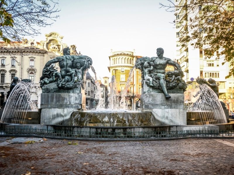
## Description Piazza Solferino is one of Turin’s most elegant and historically significant squares, offering a refined blend of architecture, green spaces, and local life. Located in the city center, the square serves as a calm yet vibrant meeting point where residents and visitors alike come to stroll, relax, or enjoy a coffee nearby. Unlike some of Turin’s more monumental piazzas, Piazza Solferino feels intimate and lived-in, making it an excellent place to experience the city at a slower pace. What makes Piazza Solferino unique is its layered history. The square is named after the Battle of Solferino (1859), a key event in Italian unification, and it stands close to sites connected to important political and cultural moments. A lesser-known fact is that the nearby area played a role in the birth of the Red Cross movement, inspired by the aftermath of the Battle of Solferino. Another interesting detail is the presence of subtle architectural transitions around the square, reflecting Turin’s shift from baroque influences to more modern urban planning during the 19th and early 20th centuries. With its central gardens, mature trees, and surrounding cafés and offices, Piazza Solferino offers a peaceful contrast to the busier shopping streets just steps away. ## Location Piazza Solferino is located in **Italy**, in the **Piedmont** region, within the city of **Turin (Torino)**. It sits in the historic center, between Corso Re Umberto and Via Cernaia, making it a natural crossroads for both locals and visitors. The square is easy to reach on foot from many major attractions, including Piazza Castello and Via Roma. Public transportation is also convenient, with multiple bus and tram lines stopping nearby. The closest metro station is **Re Umberto** on Line 1, which is just a short walk away. For visitors staying in central Turin, Piazza Solferino is often best reached by walking, allowing you to enjoy the surrounding streets and architecture. ## Tips * Visit in the morning or late afternoon to enjoy the square at its most relaxed and atmospheric. * Take a moment to sit on a bench in the central garden area and observe daily life in Turin. * Nearby cafés are ideal for a traditional Italian coffee or aperitivo after exploring the area. * Combine your visit with nearby attractions such as the Egyptian Museum or Piazza Castello. * The square often hosts small local events or gatherings, especially on weekends. * Bring a camera, as the surrounding architecture and greenery offer excellent photo opportunities. ## Conclusion Piazza Solferino is a refined and welcoming urban space that reflects Turin’s history, elegance, and everyday rhythm. Its central location, historical significance, and peaceful atmosphere make it a rewarding stop for anyone exploring the city. ## FAQ **Is Piazza Solferino worth visiting for tourists?** Yes, especially for those interested in local atmosphere, history, and architecture rather than major monuments alone. **Are there restaurants and cafés nearby?** Yes, the surrounding streets offer a wide range of cafés, restaurants, and bars. **How much time should I spend at Piazza Solferino?** Most visitors spend 20 to 40 minutes, though it can easily be longer if you stop for coffee or relaxation. **Is Piazza Solferino family-friendly?** Yes, the open space and central garden make it suitable for families and casual visits. **Does the square host events?** Occasionally, small cultural or community events take place, particularly during warmer months. ## Links * [Turismo Torino Official Website](https://www.turismotorino.org)
GemVoyage Team • World
Madagascar
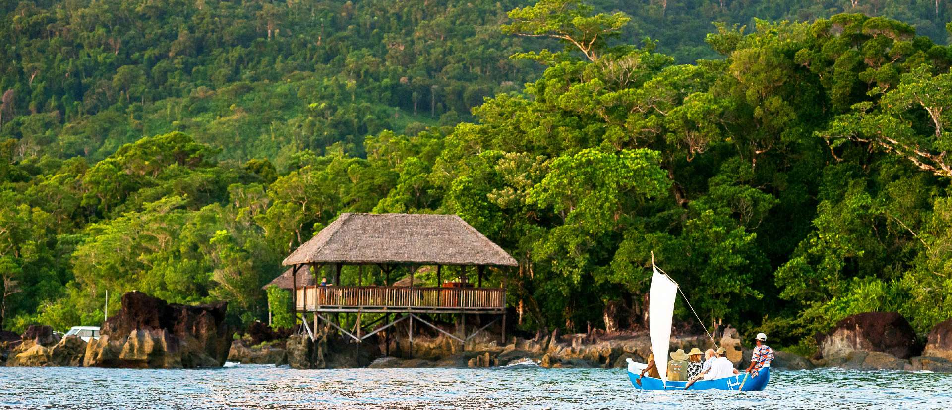
## Description Masoala National Park is Madagascar’s largest and most ecologically diverse protected area, a true Eden for nature lovers and adventurers. Located on the Masoala Peninsula in the northeast of the island, the park spans over 2,300 square kilometers of pristine rainforest and an additional 100 square kilometers of marine reserves. It’s one of the few places on Earth where lush jungle meets coral-rich coastline, creating a rare blend of terrestrial and marine biodiversity. The park is home to an astonishing array of wildlife, much of it endemic to Madagascar. Among its most famous residents is the red-ruffed lemur, found only in this region. Visitors may also encounter the elusive aye-aye, leaf-tailed geckos, tomato frogs, and over 60 species of reptiles. Birdwatchers flock to Masoala to spot rare species like the helmet vanga and the Madagascar red owl. Offshore, the marine parks protect vibrant coral reefs and host humpback whales during their migration from July to September. A little-known fact: the name “Masoala” translates to “eyes of the forest,” a poetic reference to the glowing eyes of the nocturnal aye-aye. Another fascinating detail is that the Madagascar serpent eagle, once thought extinct, was rediscovered in Masoala and now thrives in its dense canopy. ## Location Masoala National Park is located in **Madagascar**, within the **Sava Region**, near the coastal city of **Maroantsetra**. A portion of the park also extends into the **Analanjirofo Region**, making it a vast and varied landscape of rainforest, mangroves, and coral reefs. ### How to Get There: - **By Air**: Fly from Antananarivo to Maroantsetra Airport. Flights are limited, so booking in advance is essential. - **By Boat**: From Maroantsetra, the park is accessible via a 2–3 hour boat ride across Antongil Bay. This scenic journey offers glimpses of dolphins and coastal villages. - **By Tour**: Many eco-tour operators offer guided packages that include transport, accommodation, and park entry. Due to its remote location, Masoala is best visited with the help of local guides or tour companies familiar with the terrain and logistics. ## Tips for Visitors To make the most of your Masoala adventure, keep these tips in mind: - **Visit During Dry Season**: The best time to visit is from June to November. Avoid January to March due to heavy rains and cyclone risk. - **Pack Smart**: Bring waterproof gear, insect repellent, sturdy hiking shoes, and lightweight clothing. The rainforest is humid and unpredictable. - **Hire a Guide**: Local guides enhance the experience with wildlife spotting and cultural insights. Guides are mandatory for most trails. - **Explore Nosy Mangabe**: This nearby island reserve is part of the park and offers excellent chances to see the aye-aye and ancient tombs. - **Respect Wildlife**: Night walks are restricted to protect sensitive species like the aye-aye. Always follow park rules. - **Try Kayaking or Snorkeling**: The marine parks—Tampolo, Ambodilaitry, and Ifaho—are perfect for exploring coral reefs and spotting sea turtles. ## Conclusion Masoala National Park is a sanctuary of biodiversity and natural wonder. With its rare wildlife, untouched rainforest, and vibrant marine life, it offers a truly immersive experience for those seeking Madagascar’s wild heart. ## FAQ **1. What is the entrance fee for Masoala National Park?** The fee is approximately 45,000 Ariary (~16 EUR) for adults and 25,000 Ariary (~6 EUR) for children. **2. How many lemur species are found in Masoala?** The park hosts over 10 species, including the red-ruffed lemur and aye-aye. **3. Can I camp inside the park?** Yes, designated camping areas are available, especially on Nosy Mangabe Island. Guided tours often include camping options. **4. Is Masoala suitable for families?** Yes, but due to its remote location and rugged terrain, it’s best for families with older children who enjoy nature and hiking. **5. Are there accommodations near the park?** Eco-lodges and guesthouses are available in Maroantsetra and near the park’s entrance. Booking ahead is recommended. **6. What marine activities are available?** Snorkeling, kayaking, and whale watching are popular in the park’s marine reserves, especially from July to September. ## Links - [Masoala National Park – Wikipedia Overview](https://en.wikipedia.org/wiki/Masoala_National_Park) - [Masoala National Park – Official GANP Page](https://national-parks.org/madagascar/masoala)
GemVoyage Team • World
Arequipa
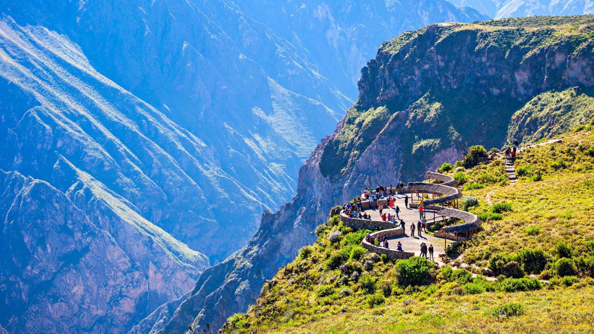
## Description Colca Canyon in southern Peru is one of the world’s deepest and most dramatic canyons, carved by the Colca River through folded volcanic and sedimentary rocks. Terraced agriculture clings to canyon walls and reflects centuries of pre-Columbian and colonial land-use systems. The canyon is famed for condor-watching at viewpoints such as Cruz del Cóndor, where giant Andean condors ride thermal updrafts above layered ridges and terraced fields. Beyond the condors, Colca’s cultural landscape includes traditional villages where residents manage terraces, raise llamas and alpacas, and produce woven textiles. Travelers can combine wildlife viewing with multi-day treks, hot-spring relaxation, and market visits to towns like Chivay for local crafts and regional cuisine. For planning and indexing, useful phrases include "Colca Canyon trek routes," "Cruz del Condor sunrise," and "Colca homestay lodges." Ecological and cultural stewardship: Local communities practice terrace maintenance and rotational agriculture that preserves soil stability and biodiversity. Sustainable tourism operators contribute to local economies through guide employment, community lodges, and cultural exchanges—seek providers who collaborate directly with village associations. ## Location Colca Canyon lies west of Arequipa city in southern Peru; the closest base towns are Chivay and Cabanaconde. Most visitors travel from Arequipa by bus or private transfer, often overnighting to catch morning condor flights. How to get there: Overnight buses and private transfers from Arequipa are common options; the journey includes scenic highland landscapes and stops at viewpoints and small towns. For multi-day treks, many itineraries begin from Cabanaconde or Sangalle (the oasis), and local guides provide route knowledge, porters, and camp logistics when necessary. Use search queries like "Arequipa to Colca Canyon bus" or "Cabanaconde trek guide" to find up-to-date transport and trekking services. Altitude and health: The Colca region ranges above 3,000 meters—allow time to acclimatize in Arequipa or the highlands, stay hydrated, and moderate exertion to reduce altitude-related risks. Cold nights are common; pack suitably warm layers for overnight treks or village stays. ## Tips - **Arrive early for condors:** Dawn and early morning hours produce the most reliable thermals and large condor flight displays at Cruz del Cóndor. - **Consider multi-day treks:** The canyon supports multi-day hikes with village homestays, campsites, and lodges for immersive experiences beyond the main lookout points. - **Hire local guides:** Guides provide route safety, cultural context, and community support; choose operators that compensate villages and porters fairly. - **Visit local markets and hot springs:** Chivay offers markets for textiles and crafts, while nearby hot springs provide a relaxing complement to trekking. - **Acclimatize to altitude:** Spend at least a night in Arequipa or another high-altitude town before strenuous activities and avoid rapid ascent. - **Respect cultural protocols:** Ask permission before photographing people or domestic rituals and buy crafts directly from artisan cooperatives when possible. ## Conclusion Colca Canyon combines a spectacular natural theater with enduring human landscapes—terraced agriculture, weaving traditions, and the Andean condor spectacle create a layered experience for travelers seeking wildlife, culture, and trekking. When planning, use targeted searches like "Colca Canyon 3-day trek" or "best condor viewpoints" to shape an itinerary that balances adventure with community benefits. ## FAQ - **Q: What’s the best time to see condors?** A: Early morning as thermals form (shortly after sunrise) is when condors are most active; clear weather improves visibility but conditions vary seasonally. - **Q: Are guided treks recommended?** A: Yes — local guides know safe routes, campsites, and cultural protocols, and hiring them supports village economies and improves the overall experience. - **Q: How long do treks in Colca Canyon usually take?** A: Treks range from single-day hikes to 2–4 day itineraries depending on route, overnight choices, and walking pace; many travelers choose a 2–3 day loop to visit Sangalle (the oasis) and return via village trails. - **Q: Is the canyon suitable for beginners?** A: Parts of the canyon are approachable for fit beginners with a guide; steep descents and ascents make some routes challenging—assess fitness, acclimatize, and choose routes accordingly. - **Q: How should I prepare for altitude?** A: Allow time in Arequipa or intermediate towns to acclimatize, hydrate, rest, and avoid heavy exertion on the first day at altitude; consult health professionals if you have concerns. ## Links - [Colca Canyon — Wikipedia](https://en.wikipedia.org/wiki/Colca_Canyon)
GemVoyage Team • World
Yokohama
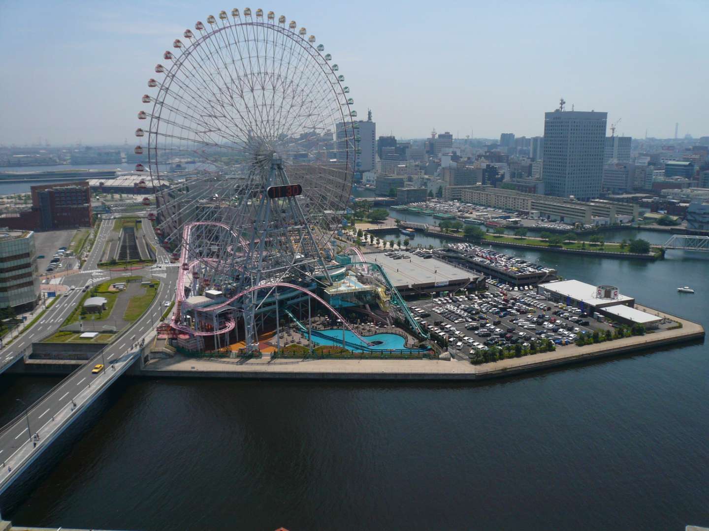
## Description Cosmo World in Yokohama is a vibrant urban amusement park that blends thrilling rides, family-friendly attractions, and waterfront views into one unforgettable experience. Located in the heart of the Minato Mirai 21 district, this compact yet dynamic park is best known for its iconic Ferris wheel, Cosmo Clock 21, which once held the title of the world’s largest Ferris wheel with a clock. Towering over the city skyline, it offers panoramic views of Yokohama Bay and the surrounding urban landscape, especially stunning at night when the wheel lights up in dazzling colors. The park is divided into three distinct zones: the Wonder Amuse Zone, Burano Street Zone, and Kids Carnival Zone. Each area caters to different age groups and interests. The Wonder Amuse Zone features high-adrenaline rides like the Diving Coaster: Vanish, a roller coaster that plunges into a tunnel beneath a pool of water. The Burano Street Zone offers quirky attractions such as mirror mazes and haunted houses, while the Kids Carnival Zone is perfect for younger children with gentle rides and arcade games. A little-known fact: Cosmo World originated from the Yokohama Exotic Showcase in 1989, and the Ferris wheel was part of a temporary exhibition before becoming a permanent fixture. Another unique detail is that admission to the park is free—you only pay for the rides you choose to enjoy, making it an accessible destination for all budgets. ## Location Cosmo World is located in **Japan**, in the **Kanagawa Prefecture**, within the city of **Yokohama**. It sits in the **Minato Mirai 21 district**, a modern waterfront area known for its shopping, entertainment, and cultural attractions. ### How to Get There - **By Train**: The park is a short walk from Minato Mirai Station (Minato Mirai Line) and Sakuragicho Station (JR Keihin-Tohoku Line and Yokohama Municipal Subway Blue Line). - **By Bus**: Several local buses stop near the Minato Mirai area. - **By Foot**: If you're exploring the waterfront, Cosmo World is easily accessible from nearby attractions like Landmark Tower and the Yokohama Red Brick Warehouse. - **By Car**: Parking is available in nearby lots, though public transport is recommended due to traffic and convenience. Its central location makes it an easy addition to any Yokohama itinerary. ## Tips - **Visit in the Evening**: The illuminated Ferris wheel and waterfront views are especially magical after sunset. - **Buy a Ride Pass**: While entry is free, purchasing a ride pass can save money if you plan to try multiple attractions. - **Check Height Restrictions**: Some rides have strict height and age requirements, so check ahead if visiting with children. - **Avoid Peak Hours**: Weekends and holidays can be crowded. Weekday afternoons are generally quieter. - **Bring Cash**: Some ticket booths and vending machines may not accept cards. - **Combine with Nearby Attractions**: Pair your visit with a trip to CupNoodles Museum or a harbor cruise for a full day of fun. ## Conclusion Cosmo World in Yokohama is a compact yet exhilarating amusement park that offers something for everyone—from heart-pounding roller coasters to scenic Ferris wheel rides. Its waterfront location, free entry, and diverse attractions make it a must-visit for families, couples, and solo travelers alike. ## FAQ **1. Is there an entrance fee to Cosmo World?** No, admission is free. You only pay for the rides you choose to go on. **2. What are the operating hours?** Typically, the park operates from 11:00 AM to 8:00 PM, but hours may vary seasonally or due to weather. **3. Is Cosmo World suitable for young children?** Yes, the Kids Carnival Zone is designed specifically for younger visitors. **4. Can I buy tickets online?** Ride tickets are generally purchased on-site. Some packages may be available through travel agencies. **5. Is the Ferris wheel wheelchair accessible?** Yes, Cosmo Clock 21 is accessible for wheelchair users. **6. Are food and drinks allowed inside the park?** Outside food and drinks are not permitted, but there are cafés and vending machines within the park. ## Links - [Cosmo World Official Website](https://cosmoworld.jp/about/?lang=en) - [Yokohama Cosmo World – Wikipedia Overview](https://en.wikipedia.org/wiki/Yokohama_Cosmo_World)
GemVoyage Team • World

Comments