GemVoyage Team • World
Deep within the lush rainforest of the Amazon lies a pair of natural wonders: Caverna do Maroaga (Maroaga Cave) and Caverna da Judeia (Judeia Cave). These caves are part of the Presidente Figueiredo municipality in northern Brazil, often nicknamed the “Land of Waterfalls and Caves” due to its unique geology and landscapes.
The Maroaga Cave is famous for its dramatic sandstone formations and a stream that flows directly from within, creating a mystical atmosphere as the water emerges from the cave’s dark interior. Sunlight filtering through the forest canopy reflects on the water, giving the cave a magical glow. Its name comes from a local indigenous chief, Maroaga, who is said to have used the cave as a hideout, adding a layer of legend to its natural beauty.
The nearby Judeia Cave is equally captivating. It features a more intimate setting, with a waterfall cascading over its entrance and forming a natural curtain of water. Walking behind the waterfall offers visitors a unique and refreshing perspective, with the sound of rushing water echoing throughout the cave.
A little-known fact is that both caves are part of the same ecological reserve, which shelters a vast variety of flora and fauna. Biologists have recorded rare species of bats and amphibians in these caves, making them not only scenic wonders but also important ecological habitats.
Caverna do Maroaga and Caverna da Judeia are located in Presidente Figueiredo, a municipality in the state of Amazonas, in northern Brazil. The region lies about 107 kilometers north of Manaus, the capital of Amazonas, along the BR-174 highway.
The most common way to reach the caves is by car or organized tour from Manaus. The drive takes about two hours and passes through dense rainforest landscapes. Once at the entrance to the reserve, guided hikes of varying lengths lead to the caves. The trails are not particularly difficult, but they can be muddy and slippery, especially during the rainy season. For international visitors, the easiest route is to fly into Manaus and then book a day trip or multi-day tour that includes the caves as part of a broader itinerary of waterfalls and natural attractions.
Caverna do Maroaga and Caverna da Judeia showcase the wild beauty and hidden wonders of Brazil’s Amazon rainforest. With their waterfalls, sandstone formations, and legendary history, they are must-visit sites for eco-tourists and adventurers seeking an authentic experience in the heart of nature. Together, they represent not just geological marvels but also living ecosystems that deserve protection and respect.
1. Do I need a guide to visit the caves?
Yes, local guides are highly recommended for safety, navigation, and to ensure the preservation of the natural environment.
2. Can I swim near the caves?
Yes, swimming is allowed in the pools and streams near the caves, but always follow local safety advice.
3. How difficult are the hikes to the caves?
The hikes are moderate in difficulty, with some slippery and uneven sections. Good footwear is essential.
4. Are the caves accessible year-round?
Yes, but the experience differs by season. The rainy season (December–May) offers stronger waterfalls, while the dry season (June–November) makes trails easier to navigate.
5. What wildlife might I see?
Bats, amphibians, tropical birds, and a wide variety of insects inhabit the area. Lucky visitors may even spot monkeys in the surrounding forest.
6. How long should I plan for a visit?
Most tours include both caves in a half-day excursion, though spending a full day allows more time to explore nearby waterfalls and trails.
Discover more hidden gems you might love.
Tunis
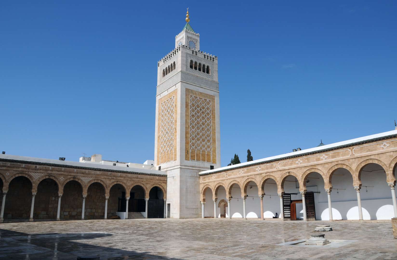
## Description Al Zaytouna Mosque, also known as Ez-Zitouna or the Mosque of the Olive, is the spiritual and intellectual heart of Tunis, Tunisia. Founded in the late 7th or early 8th century and reconstructed in the 9th century during the Aghlabid dynasty, it is the oldest mosque in Tunis and one of the most historically significant in North Africa. The mosque is not only a place of worship but also a symbol of Islamic scholarship, having served as the foundation for the University of Ez-Zitouna—one of the earliest centers of higher learning in the Muslim world. Covering an area of approximately 5,000 square meters, the mosque features nine entrances, a vast rectangular prayer hall, and a trapezoidal courtyard framed by arcades resting on over 160 ancient columns, many of which were repurposed from the ruins of Carthage. Its architecture reflects a blend of Moorish, Fatimid, and Ottoman influences, with a striking 43-meter-high minaret that echoes the design of Almohad minarets. A little-known fact: archaeological investigations in the 20th century revealed that the mosque was built atop a Byzantine-era structure, possibly a Christian basilica or fortification. Another intriguing detail is the presence of a sundial in the courtyard, historically used to determine prayer times—a rare feature in Islamic architecture. ## Location Al Zaytouna Mosque is located in **Tunisia**, in the **Tunis Governorate**, within the **city of Tunis**. It sits at the center of the historic Medina, a UNESCO World Heritage Site known for its labyrinthine alleys, traditional souks, and centuries-old buildings. ### How to Get There - **By Metro**: Take the Tunis light rail to the “Place de Barcelone” station, then walk northeast into the Medina. - **By Taxi**: Taxis are widely available in Tunis and can drop you off near the Medina’s main gates. - **By Foot**: If you're staying in central Tunis, the mosque is easily accessible on foot through the Medina’s winding streets. - **By Tour**: Many guided walking tours of the Medina include a stop at Al Zaytouna Mosque, often with historical commentary. Its central location makes it a perfect starting point for exploring the cultural and architectural treasures of old Tunis. ## Tips - **Dress Modestly**: Visitors should wear clothing that covers shoulders and knees. Women may be asked to cover their hair. - **Visit During Non-Prayer Hours**: Non-Muslim visitors are typically allowed to enter the courtyard but not the prayer hall. Visiting outside prayer times ensures a more relaxed experience. - **Hire a Local Guide**: A knowledgeable guide can provide deeper insights into the mosque’s history, architecture, and scholarly legacy. - **Explore the Surrounding Medina**: The mosque is surrounded by vibrant souks, artisan shops, and historic buildings—perfect for a half-day cultural excursion. - **Respect the Space**: As an active place of worship, visitors should maintain a quiet and respectful demeanor. - **Photography**: Photos are allowed in the courtyard, but avoid photographing worshippers or entering restricted areas. ## Conclusion Al Zaytouna Mosque is a cornerstone of Tunisian heritage, blending religious significance with architectural grandeur and scholarly tradition. Whether you're drawn by its historical depth or its serene beauty, the mosque offers a profound glimpse into the soul of Tunis. ## FAQ **1. Is there an entrance fee to visit Al Zaytouna Mosque?** No, entry is free, though donations are appreciated. Access may be limited for non-Muslims. **2. Can non-Muslims enter the mosque?** Non-Muslims are generally allowed in the courtyard but not the prayer hall. It’s best to check with local guides or signage. **3. What are the mosque’s opening hours?** The mosque is open daily, but access for visitors is typically restricted to non-prayer times, usually mid-morning to late afternoon. **4. Is the mosque wheelchair accessible?** The Medina’s narrow and uneven streets may pose challenges, but the mosque’s courtyard is relatively flat. **5. Are guided tours available?** Yes, many local guides offer tours of the Medina that include Al Zaytouna Mosque. **6. What is the best time to visit?** Early morning or late afternoon offers cooler temperatures and fewer crowds. ## Links - [Al-Zaytuna Mosque – Wikipedia Overview](https://en.wikipedia.org/wiki/Al-Zaytuna_Mosque) - [Al-Zaytouna – Britannica Entry](https://www.britannica.com/topic/Al-Zaytunah)
GemVoyage Team • World
Los Angeles
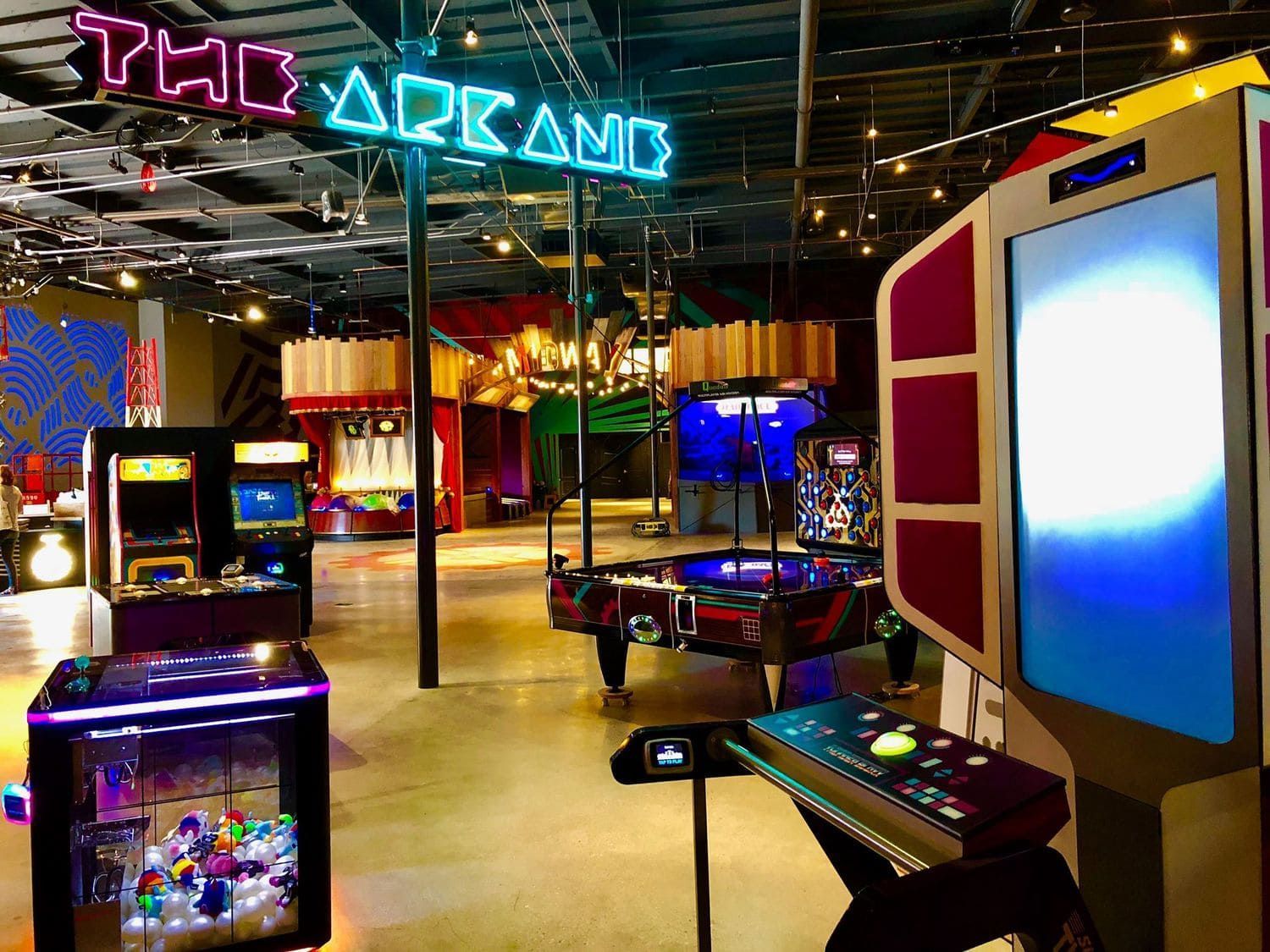
## Description Two Bit Circus is a modern micro-amusement concept that blends hands-on nostalgia with cutting-edge interactive entertainment. Designed as a social hub rather than a sprawling theme park, it curates short, intense experiences—virtual reality arenas, escape rooms, skill-based arcades, and immersive storytelling booths—so groups can mix and match activities in a single visit. The emphasis is on collaboration, shared laughter, and creative tech-driven play that appeals to friends, families, and corporate groups seeking memorable experiences. What sets Two Bit Circus apart is the careful balance between retro charm and contemporary technology. Classic arcade cabinets and carnival aesthetics sit alongside augmented reality installations and multiplayer VR experiences, creating a playful design language often described by the founders as “steampunk meets Silicon Valley.” The venue also acts as an incubator for event concepts and experiential design, with many of its ideas adopted by other entertainment venues worldwide. Beyond public attractions, Two Bit Circus often hosts private events, corporate team-building sessions, and evening social gatherings. Food, drink, and curated programming extend the experience beyond ride-based entertainment—expect pop-up events, themed nights, and collaborative challenges that keep the programming fresh. For visitors who enjoy both nostalgia and novelty, the venue’s layered experiences deliver short bursts of excitement and opportunities for friendly competition. ## Location Two Bit Circus operates within Los Angeles, California, though the venue and address have evolved over time as the concept expanded. Always check the official website or event listings for the most current location and hours. Getting there: Driving or rideshare is typically the most convenient option, and many locations provide nearby parking. Depending on the venue, public transit may be possible—plan connections ahead of time. If you’re attending a popular event, allow extra time for arrival and parking. ## Tips - Book tickets or reserve experiences ahead of time, especially on weekends and during special events when capacities fill quickly. - Combine complementary experiences (for example, a VR arena session plus an escape room) to get the most value and variety from a single visit. - Review any age, height, or health restrictions before booking; some VR or motion-based experiences may not be suitable for all guests. - Carry a charged phone for leaderboards, event check-in, and sharing moments, but follow venue rules about device use in certain experiences. - Consider group or corporate packages if you’re organizing a team-building event—these can include private space, catered food, and tailored programming. - Check the schedule for themed nights, pop-ups, or special tournaments to time your visit with unique programming. ## Conclusion Two Bit Circus offers a lively, flexible entertainment model that rewards curiosity and social play. Whether you’re seeking a date night, family outing, or corporate event, its mixture of nostalgia, technology, and quick, memorable experiences makes it a versatile option in a city known for big attractions. ## FAQ Q: Is Two Bit Circus suitable for families? A: Yes. Many attractions are family-friendly, though some experiences are geared toward older teens and adults. Always check specific activity age guidelines. Q: Are walk-ins allowed or should I book in advance? A: Some experiences accept limited walk-ins, but booking in advance is strongly recommended to secure time slots and avoid long waits. Q: Does Two Bit Circus offer food and drink? A: Many locations and event configurations include bars, cafes, or pop-up food options—check the venue’s amenities before you go. Q: Can I host a private event or corporate team-building session? A: Yes. The venue is frequently used for private hire and corporate events; packages typically include curated experiences, catering options, and dedicated staff. Q: Are there accessibility accommodations? A: Accessibility varies by location and experience; contact the venue ahead of booking to discuss needs and confirm accommodations. Q: What should I wear or bring? A: Wear comfortable clothing and shoes suitable for movement; bring any required IDs for entry and a charged phone for check-ins and digital tickets. ## Links - [Two Bit Circus (official)](https://twobitcircus.com) - [Wikipedia: Two Bit Circus](https://en.wikipedia.org/wiki/Two_Bit_Circus)
GemVoyage Team • World
Berlin
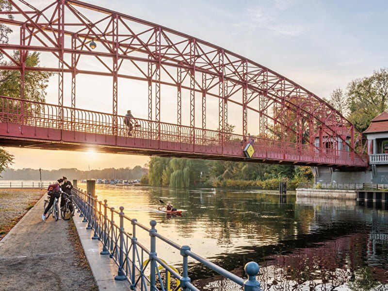
## Description **Tegeler See** is one of Berlin’s largest and most beloved lakes, offering a rare combination of **deep forest landscapes, wide open water, historic promenades, and recreational freedom** within a major European capital. Unlike the carefully curated parks of central Berlin, Tegeler See feels **expansive, natural, and quietly powerful**, a place where the city dissolves into wind, water, and tree canopy. The lake stretches across the northern edge of Berlin and forms part of a much larger **interconnected water system** linking rivers, canals, and smaller lakes. Its shoreline alternates between **elegant promenades, dense woodland, sandy bathing areas, hidden coves, and small harbors**, giving every section a distinct character. On one walk you might pass joggers and cyclists near cafés, and moments later find yourself alone on a forested shoreline with only birds and passing sailboats for company. What makes Tegeler See especially unique is its **scale and visual openness**. The lake is wide enough to feel almost coastal in certain sections. Wind patterns shape large ripples across the surface, and on clear days the sky reflects endlessly into the water. Sailboats, paddleboards, kayaks, ferries, and swimmers all share the same space, creating an ever-moving ecological and recreational system. The western and northern edges of the lake are bordered by the **Tegel Forest (Tegeler Forst)**, one of Berlin’s largest continuous woodland zones. This forest contains long hiking paths, wildlife corridors, thick pine stands, and historic hunting routes that once served Prussian royalty. This direct interface between **urban lake and protected forest** is one of Tegeler See’s defining strengths. Few European capitals offer this scale of natural immersion without leaving city limits. From an urban perspective, the lake is closely tied to the borough of **Reinickendorf** and the historic district of **Alt-Tegel**. The Alt-Tegel promenade along the eastern shoreline functions as a social spine, lined with restaurants, ice cream shops, boat docks, beer gardens, and terraces overlooking the water. This area transforms in summer into one of Berlin’s most relaxed outdoor social scenes, blending families, cyclists, couples, and long-term residents. A little-known fact is that Tegeler See was once part of the **Havel River’s natural floodplain system**, and its modern form is the result of long-term hydraulic engineering dating back centuries. Another lesser-known detail is that the famous German poet and philosopher **Gotthold Ephraim Lessing** once lived near the lake, and the nearby Tegel Palace was home to the Humboldt family, including **Alexander von Humboldt**, one of history’s most influential natural scientists. Tegeler See’s emotional identity is shaped by **seasonality**. In spring, the forest releases fresh green layers and migrating birds return. Summer brings swimming, paddleboarding, lakeside dining, and long evening sunsets. Autumn covers the surrounding hills in gold and copper tones. Winter transforms the lake into a minimalist landscape of cold light, mist, and silence, occasionally frozen at the edges. Unlike Berlin’s central landmarks, Tegeler See does not present itself as a destination of spectacle. Its appeal is built on **duration rather than intensity**. People do not come for a single photo; they come to spend hours walking, reading, boating, cycling, swimming, and simply existing beside water and forest. It is one of the few places in Berlin where **time visibly slows down**. In a city often defined by density, history, and cultural pressure, Tegeler See functions as a **pressure valve**. It absorbs excess motion and releases calm. ## Location **Tegeler See** is located in **northwestern Berlin**, primarily within the borough of **Reinickendorf**, near the historic district of **Tegel**. **City:** Berlin **State (Region):** Berlin **Country:** Germany **Primary Area:** Reinickendorf / Alt-Tegel ### How to Get There: * **By S-Bahn:** * Take **S25** to **Tegel Station**, then walk 10 minutes to the lakeside. * **By U-Bahn:** * Take **U6** to **Alt-Tegel**, which places you directly at the main promenade. * **By bus:** Multiple bus routes connect Tegel with central and northern Berlin. * **By bicycle:** A well-developed bike network connects Tegeler See to the city center. * **By car:** Parking is available but is limited on busy summer days. The lake is easily combined with visits to **Alt-Tegel old town, Tegel Forest hiking trails, and the Havel River network**. ## Tips * **Visit on weekdays if you prefer quiet:** Weekends can be very busy in summer. * **Walk both the promenade and the forest side:** Each offers a completely different experience. * **Bring swimwear in summer:** Designated bathing areas are popular and well maintained. * **Sunset is the most atmospheric time:** Especially from western shoreline viewpoints. * **Boat rentals are widely available during the warm season.** * **Dress for wind:** The open water creates noticeable temperature shifts. * **Combine with Alt-Tegel dining:** Lakeside restaurants are a core part of the experience. * **Winter visits are underrated:** The silence and mist create a dramatic, cinematic mood. ## Conclusion **Tegeler See** is Berlin at its most expansive and elemental. It is where the city trades architecture for horizon, traffic for water movement, and density for breathing space. By uniting forest, lake, promenade, and history into one continuous landscape, Tegeler See offers a version of Berlin that is **slower, wider, and deeply restorative**. ## FAQ **1. Is Tegeler See suitable for swimming?** Yes. Several **official bathing areas** operate during the summer season. **2. Can you rent boats on Tegeler See?** Yes. **Paddleboats, kayaks, and small sailboats** are available for rent. **3. Is Tegeler See family-friendly?** Yes. It is widely used by **families, cyclists, walkers, and swimmers**. **4. How long does it take to walk around Tegeler See?** Walking the full perimeter can take **2.5 to 4 hours**, depending on pace and route. **5. Is Tegeler See good in winter?** Yes, especially for **quiet walks, photography, and forest exploration**. **6. Is there wildlife around the lake?** Yes. The area supports **water birds, foxes, deer, and diverse forest species**. ## Links * [Visit Berlin](https://www.visitberlin.de)
GemVoyage Team • World
Chicago
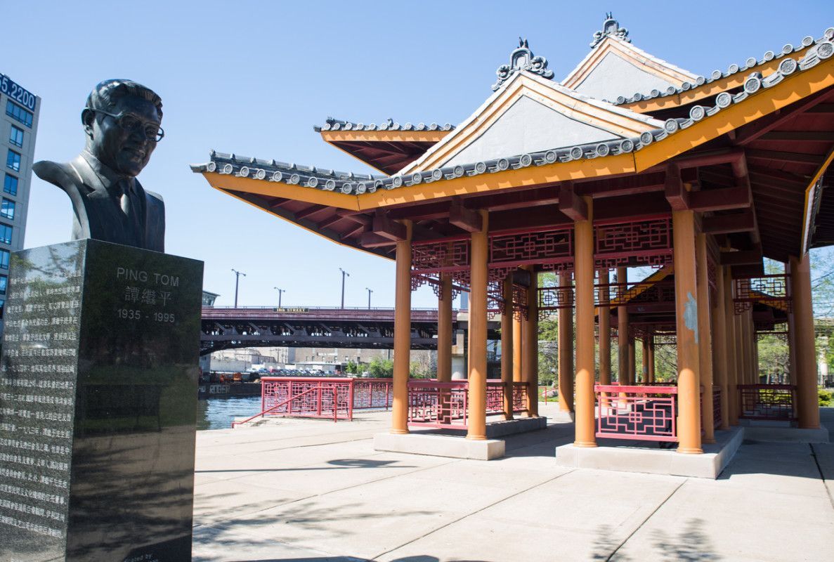
## Description Ping Tom Memorial Park is one of the most distinctive green spaces in Chicago because it feels both urban and calm at the same time. Set against the skyline and the Chicago River, it offers a combination of water views, landscaped paths, public art, and open lawns that makes it much more than a neighborhood park. For visitors who want a place that shows a different side of the city, this is one of the best spots to slow down, walk, and take in the atmosphere of Chicago’s Chinatown and riverfront. What makes the park special is the way it balances recreation, memory, and design. It was created to honor Ping Tom, a respected Chicago business leader and community advocate, but it has also become a favorite place for everyday life in the city. You will see people jogging, families gathering, photographers waiting for the light on the water, and visitors simply resting on benches with a broad view of the river. The pavilion’s architecture, inspired by traditional Chinese design, gives the park a strong sense of place and connects it to the history of the neighborhood. One little-known fact is that the park is part of a larger effort to bring public access and beauty to the south branch of the Chicago River, an area that was once much more industrial. Another detail many visitors miss is how good the park is for sunrise and late-afternoon photography, when the river reflects soft light and the downtown skyline becomes especially striking. It is also one of the easiest places in Chicago to combine a peaceful walk with a meal in Chinatown, since the park sits within walking distance of many restaurants and bakeries. The park has appeal in every season. In warm months, the river breeze and tree-lined paths make it feel refreshing even on busy days. In colder months, the open views and clean geometry of the landscape give it a quieter, almost meditative character. It is not a high-adrenaline attraction, and that is exactly why many travelers remember it so fondly. It is a place that invites you to stay a little longer than planned. For first-time visitors, the park is also useful as a way to understand how Chicago blends architecture, neighborhood identity, and public space. You can stand in one area and see the river, the city, and the cultural energy of Chinatown all at once. That layered feeling is part of what makes the park memorable. ## Location Ping Tom Memorial Park is located in Chicago, Illinois, United States, in the Chinatown neighborhood on the south branch of the Chicago River. It sits south of downtown and is closely connected to the city’s riverwalk and residential areas on the Near South Side. The address commonly associated with the park is 1700 South Wentworth Avenue, though visitors often arrive through nearby riverfront entrances and neighborhood streets. The easiest way to get there is by public transit. The CTA Red Line to Cermak-Chinatown is the most convenient option, followed by a short walk into the neighborhood and toward the river. Rideshare and taxi access are also straightforward. If you are already exploring downtown Chicago, you can make your way south by bus, bike, or a longer walk along the river corridors. Because parking in busy urban areas can be limited, public transit is usually the simplest and most relaxed choice. ## Tips - Visit in the early morning or around sunset for the best light and fewer crowds. - Wear comfortable shoes if you plan to combine the park with a Chinatown food walk. - Bring a camera or phone with a good wide-angle lens if you want skyline and river shots. - Check the weather before you go, since the open riverfront can feel windy. - Leave time for a meal nearby so the visit becomes part of a broader neighborhood experience. ## Conclusion Ping Tom Memorial Park is a calm, beautifully designed riverfront escape that pairs Chicago skyline views with the culture and energy of Chinatown. ## FAQ ### Is Ping Tom Memorial Park worth visiting? Yes. It is worth visiting if you enjoy scenic urban parks, river views, photography, and quieter public spaces that still feel connected to the city. ### How long should I spend there? Most visitors spend between 30 minutes and 1.5 hours, depending on whether they are just walking through or also taking photos and relaxing. ### Is the park good for families? Yes. It has open areas, walking paths, and a welcoming atmosphere that works well for families, couples, and solo travelers. ### Can I combine it with other attractions? Absolutely. Chinatown restaurants, local bakeries, and other Chicago riverfront spots are easy to combine with a visit. ### What is the best time of day to go? Early morning and late afternoon are the most rewarding times because the light is softer and the park feels especially peaceful. ## Links - [Chicago Park District page](https://www.chicagoparkdistrict.com/parks-facilities/tom-ping-memorial-park) - [Wikipedia article](https://en.wikipedia.org/wiki/Ping_Tom_Memorial_Park)
GemVoyage Team • World
Berlin
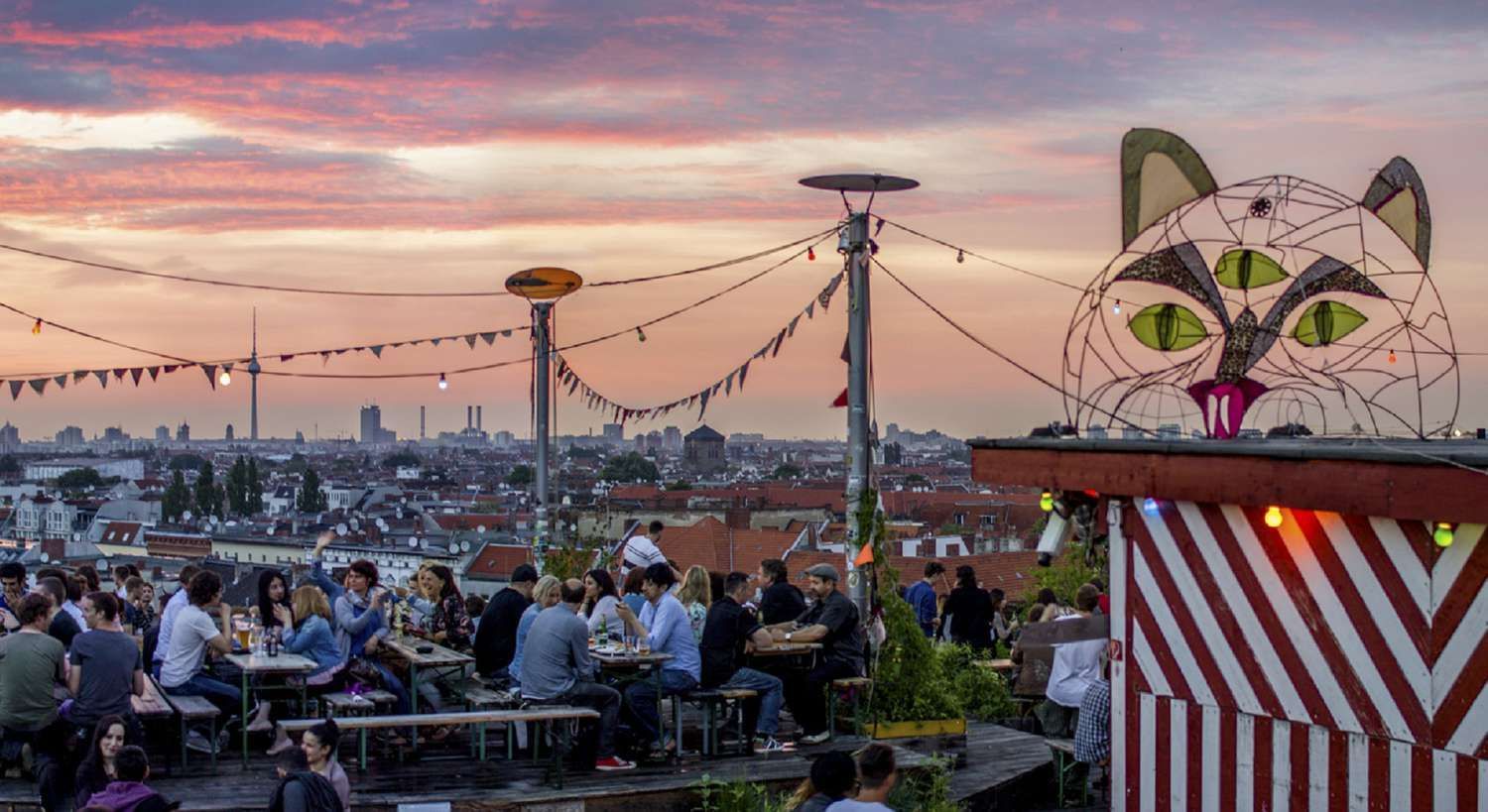
## Description Klunkerkranich is one of Berlin's most characterful rooftop destinations, known for a relaxed atmosphere, open views, creative programming, and a slightly hidden location above a shopping center. What feels immediate to visitors is a blend of casual social life and cultural programming: daytime coffee, sunset drinks, weekend markets, intimate concerts, and occasional film or theater events. The venue works because it deliberately resists being polished into a standard rooftop bar; instead it leans into an inventive, lived-in aesthetic that rewards discovery. Beyond the obvious appeal of skyline views, Klunkerkranich matters because it exemplifies Berlin's habit of repurposing ordinary urban spaces for imaginative public life. Arriving through the shopping center and taking an elevator up to the rooftop creates a small sense of adventure. Once there, you'll find mismatched seating, potted plants, string lights, and a mix of locals and visitors that encourages lingering. The programming is eclectic—local bands, DJ sets, community talks, and pop-up markets—which means the atmosphere changes with the calendar and often invites repeat visits. This is a place where architecture and community intersect: the raw, open-air structure and the surrounding skyline are a backdrop for neighborhood social life. If you're writing a Berlin itinerary, Klunkerkranich belongs in a section about alternatives to mainstream nightlife: it captures both the city's informal creativity and its social resilience. ## Location Klunkerkranich sits atop the Neukölln Arcaden shopping center in the Neukölln district of Berlin. The slightly hidden arrival—entering the mall, finding the elevator, and rising to the roof—adds to the venue's charm and helps keep it grounded in local everyday life. The location is advantageously central: well served by several S-Bahn and U-Bahn lines and an easy tram or bus ride from many parts of the city. Because the venue is rooftop-based, weather matters. Summer evenings and clear sunsets draw crowds; cooler months see more limited programing and fewer outdoor comforts. Still, the surrounding neighborhood—full of cafés, bars, and street-food options—makes Klunkerkranich an excellent addition to an evening out in Neukölln. ## Tips - Check the official event calendar and social channels for the day's lineup—concerts and ticketed events can change access and seating. - Arrive before sunset for easier entry and the best window for skyline photos; linger into the evening for music and a different mood. - Dress in layers: rooftop breezes can be cooler than street level even in summer. - Use public transportation: parking in Neukölln can be limited and transit puts you within easy walking distance. - Budget modestly for drinks and snacks; the venue's informal setup means options vary and some events may feature local vendors. - If you want a quieter experience, aim for weekday afternoon hours or look for daytime events like markets and talks. ## Conclusion Klunkerkranich is a must-visit for travelers seeking a rewarding, low-key rooftop experience in Berlin. It showcases the city's talent for turning unassuming urban infrastructure into social and cultural places. Whether you come for a golden-hour drink, an outdoor concert, or a lazy weekend market, the venue offers a human-scaled, memorable experience that contrasts nicely with Berlin's more touristed spots. ## FAQ ### Is Klunkerkranich more of a bar or a cultural venue? It is both. Regularly scheduled cultural events—small concerts, film nights, and community gatherings—sit alongside the everyday social life of a rooftop bar. The balance shifts by day and by event. ### Do I need to reserve in advance? Reservations are seldom required for casual visits but may be recommended or necessary for ticketed concerts or special events. Check the venue's event listings before you go. ### Is it open year-round? Programming changes seasonally. Summers are busiest and most active, while colder months often mean reduced outdoor offerings; occasional indoor or sheltered events may still take place. ### What is the best time to visit? Late afternoon into sunset is the ideal window for views and atmosphere. For a quieter visit, aim for weekday afternoons or daytime markets. ### Is Klunkerkranich family-friendly? It can be—many daytime events welcome a broader audience, though evening concerts and late-night sets skew toward adults. Check event details if you plan to bring children. ## Links - [Official website](https://www.klunkerkranich.org/)
GemVoyage Team • World
Osun
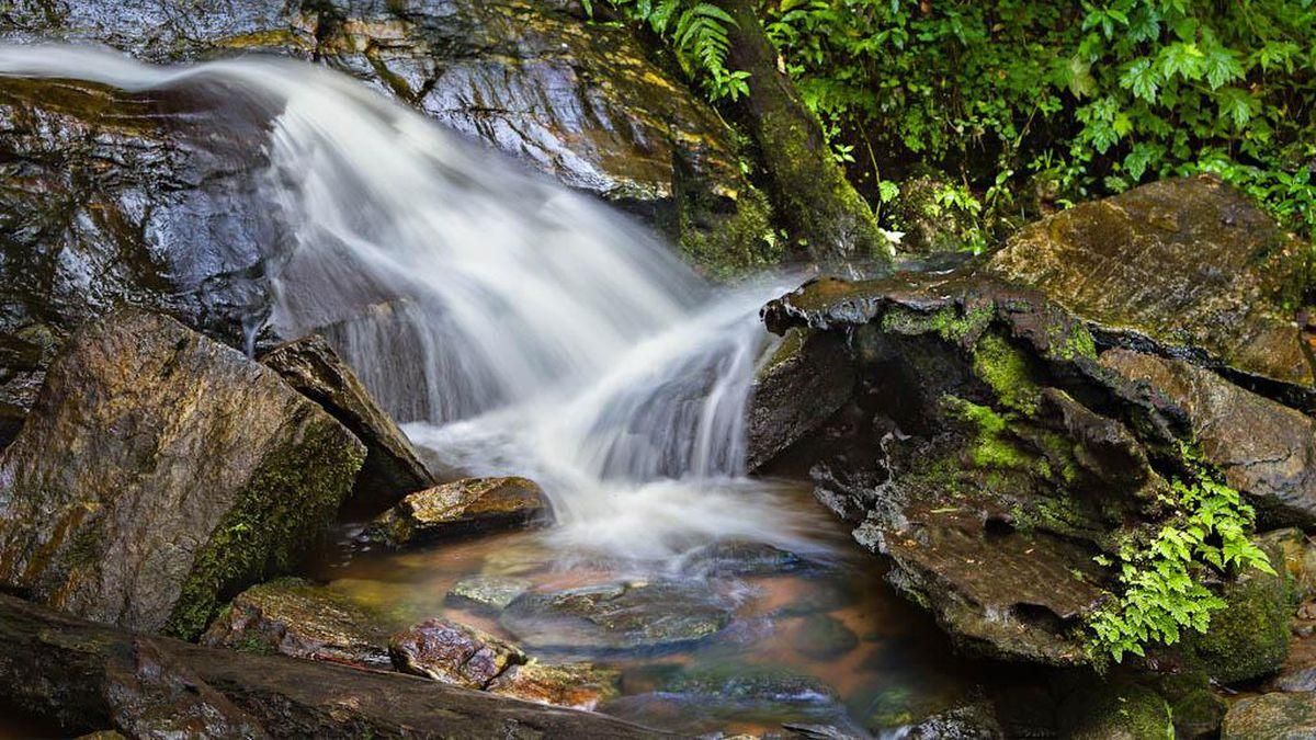
## Description **Erin Ijesha Waterfall**, also known as **Olumirin Waterfall**, is one of Nigeria’s most spectacular natural attractions. Located in Osun State, the waterfall is renowned for its **seven cascading levels**, each offering a different landscape, atmosphere, and difficulty level for visitors. The experience goes beyond a simple waterfall viewing; it is a physical ascent through layered natural terraces, tropical vegetation, and rocky pathways that reveal the geology and biodiversity of southwestern Nigeria. What makes Erin Ijesha Waterfall particularly unique is the **progression of the levels**. The first and second levels are accessible and refreshing, ideal for casual visitors. As you climb higher, the environment becomes cooler, the terrain more dramatic, and the views increasingly rewarding. The final levels lead to a plateau historically associated with ancient settlements and spiritual practices. According to oral traditions, some of these upper areas served as **refuge sites for migrating groups** and locations for community gatherings during the pre-colonial period. A little-known fact is that the waterfall has long been connected to Yoruba mythology. Local lore suggests that the waters were believed to possess cleansing qualities, and that early communities viewed the entire waterfall system as a **symbol of renewal and protection**. Another interesting detail is that the upper levels were once used as strategic vantage points due to their height and difficult access, helping local groups monitor surrounding valleys. The blend of nature, culture, and mild adventure makes Erin Ijesha Waterfall a standout destination for hikers, photographers, and anyone interested in the lesser-explored regions of Nigeria. ## Location **Country:** Nigeria **Region:** Southwest Nigeria **State:** Osun State **Nearest Town:** Ijesha (near Erin Ijesha community) The waterfall sits within a lush forested area about an hour from major towns like Ilesa. ### How to Get There * **By car:** * The most reliable method. From Ilesa or Osogbo, follow the highway toward Erin Ijesha. The entrance to the waterfall is clearly marked, and parking is available. * **By public transportation:** * Local buses and shared taxis connect Ilesa to Erin Ijesha, followed by a short walk to the site. * **By tour service:** * Some tour operators from Lagos, Ibadan, or Osogbo include the waterfall in day-trip itineraries. ## Tips * **Wear sturdy shoes:** The climb is steep in places, and water splashes make some rocks slippery. * **Bring water and stay hydrated:** The ascent to the upper levels can be physically demanding, especially in warm weather. * **Start early:** Morning visits provide cooler temperatures, softer light, and fewer crowds. * **Expect to get wet:** Mist rises from the falls, especially near the lower levels. * **Fitness level matters:** The higher levels are not recommended for visitors with mobility issues. * **Consider hiring a local guide:** They can help you navigate the steeper paths and share the historical context tied to the site. * **Avoid visiting during heavy rain:** The water flow becomes intense and pathways can become hazardous. ## Conclusion Erin Ijesha Waterfall is one of Nigeria’s most rewarding natural attractions, offering a combination of adventure, cultural history, and scenic beauty. Its seven distinct levels provide a progressively immersive experience, making it suitable for both casual travelers and more ambitious climbers. For anyone exploring southwestern Nigeria, the waterfall stands as a must-see landmark. ## FAQ **1. How many levels does Erin Ijesha Waterfall have?** The waterfall has **seven levels**, each with its own landscape and difficulty. **2. Is swimming allowed?** Light splashing and dipping are common at the lower levels, but deeper swimming is not typical due to rocky terrain. **3. How long does the hike take?** Reaching the upper levels can take **1 to 2 hours**, depending on fitness and pace. **4. Is there an entrance fee?** Yes. A modest fee is typically required for maintenance and site management. **5. Are guides available at the site?** Yes. Local guides can be hired at the entrance. **6. What is the best time to visit?** Dry season or early rainy season when the paths are safe and the water flow is strong but manageable. ## Links * [Osun State tourism info](https://www.osunstate.gov.ng)
GemVoyage Team • World

Comments