Discover extraordinary places shared by our community of travelers
Brussels
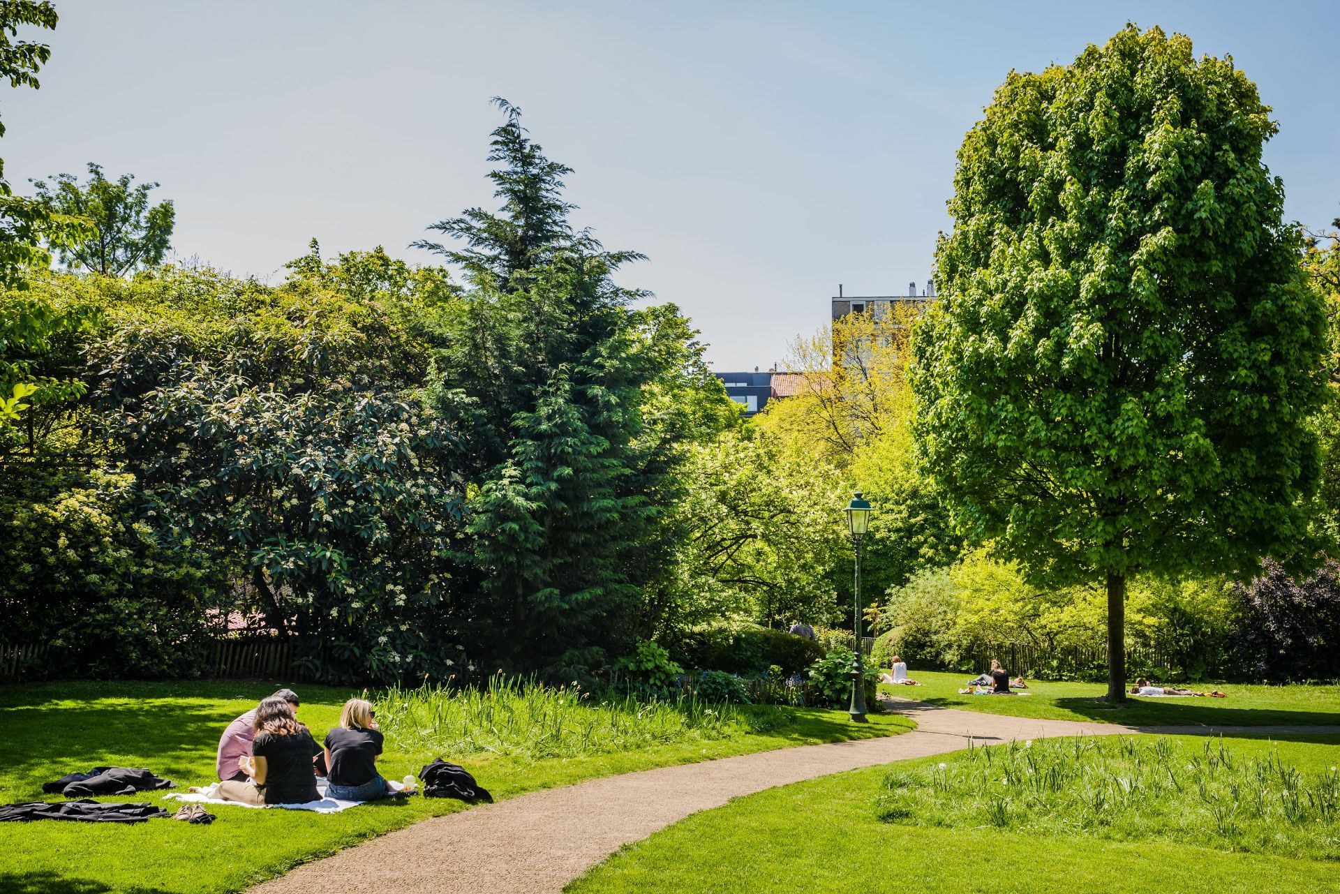
## Description Parc Tenbosch is one of Brussels’ most elegant small parks, and its appeal lies in subtlety rather than spectacle. Located in Ixelles, it offers a calm, leafy space where visitors can slow down, sit under mature trees, and enjoy a more intimate side of the city. For travelers who like parks that feel local rather than monumental, Parc Tenbosch is a strong choice. It is not the kind of place that demands an itinerary slot on its own; instead, it rewards being folded into a neighborhood walk or a café-filled afternoon. What gives the park its character is its sense of quiet design. It has the feel of a carefully tended urban refuge, with winding paths, dense planting, and enough variation in shape and texture to make a simple walk interesting. A lesser-known fact is that the park occupies a site with a layered urban past and was shaped to preserve greenery in a neighborhood that might otherwise have become entirely built up. Another detail many visitors notice only after spending time there is how different it feels from Brussels’ larger public parks: rather than broad ceremonial lawns, it offers an almost garden-like intimacy that makes it feel close to the life of the surrounding streets. For visitors, Parc Tenbosch works best as a pause. It is where you go after lunch, before a museum visit, or between neighborhood explorations. Because Ixelles is one of Brussels’ most varied and walkable districts, the park can fit naturally into a day that also includes Flagey, Avenue Louise, the Châtelain area, or a coffee stop nearby. That flexibility is part of what makes it worthwhile. You are not just visiting a park; you are using it as a calm anchor in one of the city’s busiest residential areas. The park is also a good reminder that urban travel does not always have to revolve around top-tier landmarks. Sometimes the most memorable part of a city is a place where the pace drops, the noise softens, and you get a sense of how residents actually use public space. ## Location Parc Tenbosch is located in Ixelles, Brussels-Capital Region, Belgium. It sits in a central urban setting within easy reach of several popular Brussels neighborhoods, which makes it simple to add to a walking route. The park’s placement in Ixelles means you can approach it from multiple directions depending on where you are staying or what else you want to see in the area. The easiest way to get there is usually on foot, by tram, or by a short taxi or rideshare journey from central Brussels. If you are already exploring Ixelles, the park is one of the simplest green spaces to include along the way. Public transport is convenient if you are coming from farther away, but the park is compact enough that many visitors simply fold it into a wider neighborhood walk. Because it is a neighborhood park, it is best enjoyed at a relaxed pace. Plan a short stop rather than a formal excursion, and let it serve as a quiet counterpoint to the surrounding city. ## Tips Visit when you want to rest your feet. The park is an ideal place to take a break between longer urban walks. Bring a book, snack, or coffee if you want to stay a while. The atmosphere is good for sitting and watching the neighborhood pass by. Keep expectations aligned with the scale of the park. Its charm comes from tranquility and atmosphere, not from grand size or a long list of facilities. Combine it with the surrounding district. Ixelles offers cafés, streets, and cultural stops that pair naturally with a park visit. If the weather is pleasant, go in the afternoon or early evening. That is often when the space feels most welcoming and the light is best for a walk. ## Conclusion Parc Tenbosch is a calm, attractive green refuge in the middle of Brussels’ Ixelles district. It is best for travelers who appreciate smaller urban parks and who want a place to slow down without leaving the city’s most interesting neighborhoods. ## FAQ ### Is Parc Tenbosch worth visiting? Yes, especially if you like neighborhood parks and quiet green spaces. It may not be a headline attraction, but it is rewarding as part of a relaxed Brussels itinerary. ### How long should I stay? Most visitors will spend 20 to 45 minutes, though longer stays are easy if you want to read, rest, or enjoy a picnic. ### Is it easy to combine with other sights? Very. It fits naturally into a route through Ixelles, Flagey, or the nearby café and shopping streets. ### Is the park family-friendly? Yes. Its calm setting and manageable size make it suitable for families, as long as expectations are oriented toward a peaceful urban green space rather than a large recreation park. ## Links - [Brussels parks overview](https://www.visit.brussels/en/visitors/what-to-do/brussels-parks-and-forests)
GemVoyage Team • World
Berlin
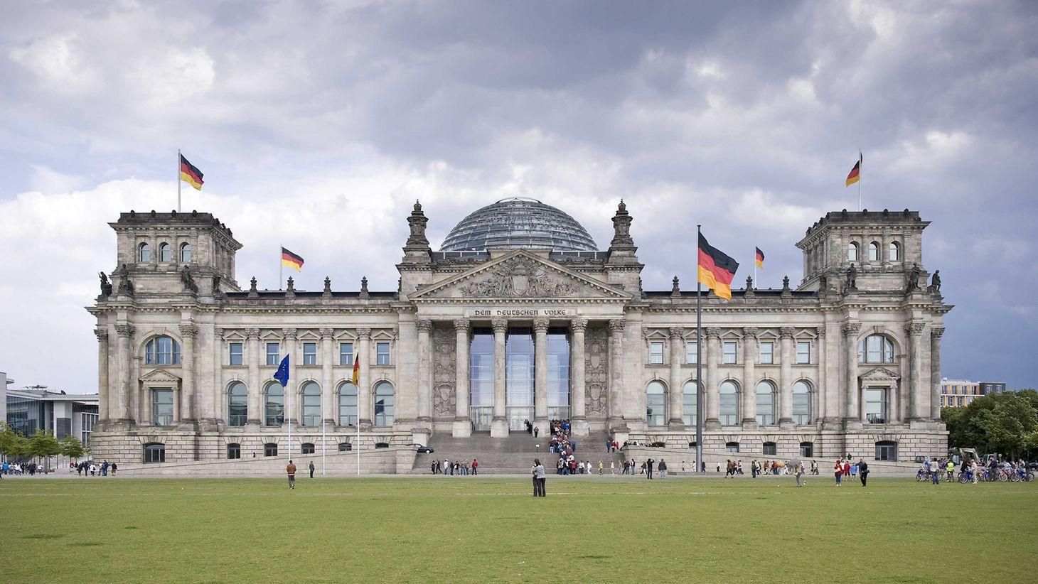
## Description The **Bundestag Building**, officially known as the **Reichstagsgebäude**, stands as one of the most significant landmarks in **Berlin** and a powerful symbol of **Germany’s turbulent history and democratic rebirth**. Combining monumental architecture with modern transparency, it serves today as the seat of the **German Federal Parliament (Deutscher Bundestag)** — and one of the most visited government buildings in the world. Originally designed by **architect Paul Wallot** and completed in **1894**, the building was intended to house the **Imperial Diet of the German Empire**. Its Neo-Renaissance façade, crowned by a grand central dome, reflected the pride and ambition of a newly unified Germany. However, the Reichstag’s history mirrors that of the nation itself — one of struggle, destruction, and renewal. In **1933**, the infamous **Reichstag fire** severely damaged the building, and it was later left in ruins during World War II. After decades of neglect during the Cold War, when Berlin was divided, the Reichstag stood near the border between East and West as a haunting reminder of Germany’s fractured identity. Following reunification, the Bundestag was **rebuilt and transformed** under the vision of **British architect Sir Norman Foster**, who completed his renovation in **1999**. The centerpiece of this reconstruction is the **modern glass dome**, an architectural marvel that symbolizes **transparency and accessibility in government**. Visitors can ascend the spiraling ramp inside the dome to enjoy **panoramic views of Berlin**, while looking down into the debating chamber below — a literal reflection of the people’s oversight over their elected representatives. A lesser-known fact is that during reconstruction, thousands of **historic graffiti inscriptions** left by Soviet soldiers in 1945 were carefully preserved on interior walls, serving as poignant reminders of the city’s wartime history. Another fascinating detail is that the **solar-powered dome** is part of an advanced energy-efficient system that makes the Bundestag one of the world’s greenest government buildings. ## Location The **Bundestag Building** is located in the **government district (Regierungsviertel)** of **Berlin**, **Germany**, near the **Brandenburg Gate** and along the **River Spree**. **Address:** Platz der Republik 1, 11011 Berlin, Germany To get there: * **By U-Bahn:** Take **U5** to **Bundestag Station**, located directly beside the building. * **By S-Bahn:** The **Berlin Hauptbahnhof (Main Station)** is about a **10-minute walk** away. * **By bus:** Routes **100** and **200** stop nearby at **Reichstag/Bundestag**. * **By foot or bike:** It’s an easy walk from the **Brandenburg Gate** or the **Tiergarten** park. ## Tips * **Book your visit in advance:** Entry to the dome and terrace is **free**, but **online registration** is required through the Bundestag’s official website due to high demand. * **Bring ID:** You’ll need a valid photo ID to enter the building for security reasons. * **Visit the dome at sunset or night:** The views of Berlin’s skyline — including the Brandenburg Gate and the Fernsehturm (TV Tower) — are spectacular after dark. * **Take the guided tour:** Learn about German history, architecture, and politics from official Bundestag guides. Tours are offered in multiple languages. * **Dress comfortably:** There’s a bit of walking and ramp climbing involved when visiting the dome. * **Combine with nearby attractions:** The **Brandenburg Gate**, **Memorial to the Murdered Jews of Europe**, and **Tiergarten** are all within walking distance. * **Photography:** Cameras are allowed — the dome’s glass reflections and city views make it a photographer’s dream. ## Conclusion The **Bundestag Building (Reichstag)** is more than a seat of government — it’s a living monument to **Germany’s journey from empire to democracy**. From its grand 19th-century origins through wartime destruction and postwar division, to its renewal as a transparent and sustainable parliament, the building embodies the nation’s resilience and progress. Visiting the Bundestag is both a **historical and symbolic experience**, offering a glimpse into the past and a view toward the future — quite literally through its luminous glass dome overlooking Berlin. ## FAQ **1. What is the difference between the Reichstag and the Bundestag?** “Reichstag” refers to the **historic building** itself, while “Bundestag” refers to **Germany’s federal parliament**, which now meets inside the Reichstag building. **2. When was the Reichstag building completed?** It was completed in **1894**, heavily damaged during World War II, and **fully restored and reopened in 1999** after reunification. **3. Who redesigned the building after reunification?** The **British architect Sir Norman Foster** led the reconstruction, adding the iconic glass dome. **4. Is it free to visit?** Yes, **entry to the Bundestag, dome, and terrace is free**, but advance **registration** is required for security reasons. **5. Can you visit the parliamentary chamber?** Yes, guided tours include access to the chamber when sessions are not in progress. Visitors can also attend plenary sessions by prior arrangement. **6. When is the best time to visit?** The **evening** is ideal for breathtaking views of Berlin at sunset, but daytime visits offer clearer views of the cityscape. **7. What are the opening hours?** The dome is usually open daily from **8 a.m. to midnight**, with last entry around **10 p.m.** (check the official site for seasonal variations). ## Links * [Official Bundestag Visitor Registration](https://www.bundestag.de/en/visittheBundestag/dome/registration-245686)
GemVoyage Team • World
Cluj
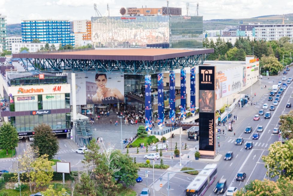
## Description **Iulius Mall Cluj** is one of Romania’s premier shopping and lifestyle destinations, offering a vibrant blend of **retail, entertainment, and community life** in the heart of **Cluj-Napoca**, the unofficial capital of Transylvania. Opened in **2007**, it quickly became more than just a shopping mall — it’s a **social and cultural hub** that captures the energy of one of Romania’s most dynamic cities. Spanning more than **80,000 square meters**, Iulius Mall Cluj features **over 250 stores**, from international fashion brands like Zara, H&M, and Massimo Dutti to local boutiques and specialty shops. But what makes it truly unique is its seamless integration of **shopping, dining, and nature** — a concept that few European malls achieve so gracefully. The mall is part of the larger **Iulius Town complex**, which includes **offices, event spaces, fitness centers**, and most notably, the **Iulius Park** — a beautifully landscaped green area surrounding a serene lake. Visitors can enjoy a peaceful walk, rent a paddleboat, or relax by the water with a coffee from one of the many cafés that line the park. During winter, the lake even transforms into a **charming ice-skating rink**. Inside, the atmosphere is lively and cosmopolitan. Shoppers can explore a vast **food court** with both Romanian and international cuisines, a **state-of-the-art cinema**, and a **fitness and wellness center**. Iulius Mall also hosts **regular events**, from fashion shows and art exhibitions to children’s workshops and live concerts, making it a place where locals and tourists alike gather for more than just retail therapy. A lesser-known fact is that Iulius Mall Cluj was the **first mall in Romania** to incorporate a large **urban park** into its complex design — a model that has since inspired similar developments across the country. It’s also part of a larger vision to make Cluj-Napoca a hub of **modern urban living**, balancing innovation, business, and leisure. ## Location **Iulius Mall Cluj** is located in the **Gheorgheni district** of **Cluj-Napoca**, in the **northwestern region of Romania**, Transylvania. **Address:** Strada Alexandru Vaida-Voevod 53-55, Cluj-Napoca, Romania To get there: * **By car:** Easily accessible via major city roads; parking is abundant and includes both indoor and outdoor spaces. * **By bus:** Several city bus lines (such as 24B, 25, and 26) stop directly in front of the mall. * **By taxi or rideshare:** Services like Bolt and Uber are widely available in Cluj-Napoca. * **From the airport:** The **Avram Iancu Cluj International Airport** is only about **15 minutes away by car or taxi**. * **By foot or bike:** The mall is connected to nearby neighborhoods through well-maintained pedestrian and cycling paths. ## Tips * **Visit Iulius Park:** Don’t miss the outdoor park — it’s perfect for a relaxing break, a family picnic, or a stroll at sunset. * **Try local food:** Many restaurants in the food court and nearby park cafés offer authentic Romanian dishes with a modern twist. * **Shop during weekdays:** The mall can get crowded on weekends; weekday mornings or afternoons offer a quieter experience. * **Catch a movie:** The **Cinema City** inside the mall offers the latest international releases in English and Romanian. * **Family-friendly activities:** There are playgrounds, kid-friendly restaurants, and frequent entertainment events for children. * **Free Wi-Fi and coworking spaces:** Ideal for remote workers or travelers looking to catch up on work while enjoying a coffee. * **Seasonal events:** Check the mall’s official website or social media for **holiday markets, concerts, and fashion events**. ## Conclusion **Iulius Mall Cluj** perfectly captures the modern spirit of **Cluj-Napoca** — youthful, vibrant, and innovative. It’s more than a shopping center; it’s a **community gathering place** where nature, culture, and commerce coexist in harmony. Whether you’re in town for a few days or living locally, a visit to Iulius Mall offers a glimpse into contemporary Romanian life — stylish, welcoming, and full of energy. From lakeside walks to luxury shopping and delicious food, it’s an essential stop on any visit to Transylvania’s most forward-thinking city. ## FAQ **1. When did Iulius Mall Cluj open?** Iulius Mall Cluj officially opened in **November 2007**, becoming the second Iulius Mall developed in Romania. **2. How big is the mall?** The mall covers more than **80,000 square meters**, featuring **over 250 stores**, restaurants, and entertainment spaces. **3. Is there parking available?** Yes — there are **thousands of parking spaces**, both underground and outdoors, many of them free for several hours. **4. What are the main attractions besides shopping?** The **Iulius Park**, **Cinema City**, **fitness center**, and frequent **cultural events** make it a popular leisure destination beyond retail. **5. Is the mall family-friendly?** Absolutely — it includes **play areas**, **family restrooms**, and numerous **activities for children** throughout the year. **6. Can I reach it easily from central Cluj?** Yes, it’s just **10–15 minutes by car** or a **short bus ride** from downtown Cluj-Napoca. **7. Are there hotels nearby?** Yes, several hotels and serviced apartments are located within walking distance, including options ideal for both short and long stays. ## Links * [Official Iulius Mall Cluj Website](https://www.iuliusmall.com/cluj) * [Visit Cluj-Napoca – Tourism Information](https://visitcluj.ro/)
GemVoyage Team • World
Taiwan
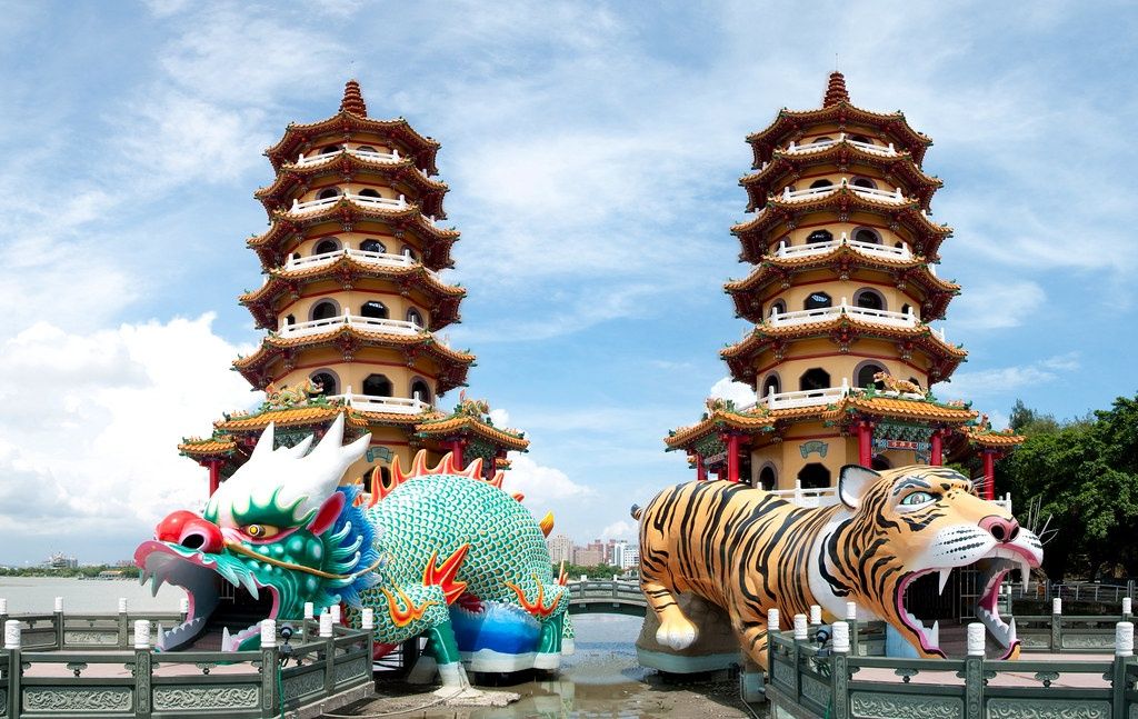
## Description The **Dragon and Tiger Pagodas (龍虎塔)** are among the most iconic landmarks in **Kaohsiung**, Taiwan’s bustling southern port city. Rising gracefully from the edge of **Lotus Pond (蓮池潭)**, these twin seven-story pagodas are not only stunning examples of traditional **Chinese temple architecture** but also powerful symbols of **spiritual balance and good fortune**. Built in **1976**, the pagodas belong to the **Cihji Palace (慈濟宮)**, a Taoist temple dedicated to the deity **Baosheng Dadi**, the God of Medicine. Each pagoda stands approximately **30 meters high** and is colorfully adorned with intricate carvings, ornate balconies, and auspicious motifs depicting dragons, tigers, phoenixes, and deities. The vibrant yellow, red, and gold hues shimmer under the sunlight, reflecting beautifully on the tranquil surface of Lotus Pond. What makes the Dragon and Tiger Pagodas unique is the **way visitors enter and exit**: you must **enter through the dragon’s mouth and exit through the tiger’s mouth**. According to local belief, this symbolizes turning bad luck into good fortune — entering the dragon (associated with strength and virtue) and leaving through the tiger (a symbol of courage and protection) ensures a spiritual cleansing and renewal of destiny. Inside the corridors of each pagoda, visitors find **mural paintings and sculptures** depicting Taoist stories, scenes from Buddhist hell, and images of celestial beings. These serve as both spiritual teachings and vivid works of art. The upper floors of the pagodas offer **panoramic views** of the Lotus Pond area, including nearby temples such as the **Spring and Autumn Pavilions**, the **Confucius Temple**, and the **Five Mile Pavilion**. A lesser-known fact is that the Dragon and Tiger Pagodas were constructed on **pontoons extending over the water**, connected to the shore by zigzagging bridges — a traditional Chinese design believed to **ward off evil spirits**, as they can only travel in straight lines. The pagodas also align perfectly with the **Feng Shui energy** of the surrounding mountains and pond, reinforcing their spiritual significance in Taiwanese culture. ## Location The **Dragon and Tiger Pagodas (龍虎塔)** are located on the **southern shore of Lotus Pond (蓮池潭)** in **Zuoying District**, **Kaohsiung City**, **Taiwan**. **Address:** No. 9, Liantan Road, Zuoying District, Kaohsiung City, Taiwan To get there: * **By MRT:** Take the **Kaohsiung MRT Red Line** to **Zuoying Station (R16)** or **Ecological District Station (R15)**, then walk or take a short taxi ride (about 5–10 minutes). * **By train:** The **Taiwan High-Speed Rail (THSR) Zuoying Station** is nearby; from there, taxis or local buses easily reach the site. * **By bus:** Buses **301, 218, or Red 51A** stop close to Lotus Pond. * **By bike or on foot:** The **Lotus Pond Scenic Area** has well-marked walking and cycling paths, perfect for leisurely exploration. ## Tips * **Enter through the dragon, exit through the tiger:** Follow the traditional route for good luck and spiritual harmony. * **Visit at sunset:** The golden light reflecting off the pond makes the pagodas even more breathtaking. * **Climb to the top:** Each level offers stunning views of Lotus Pond and the Kaohsiung skyline. * **Explore nearby attractions:** Don’t miss the **Spring and Autumn Pavilions**, **Confucius Temple**, and **Pei Chi Pavilion**, all within walking distance. * **Wear comfortable shoes:** There are several steps inside the pagodas, and the paths around the pond are best explored on foot. * **Bring a camera:** The colorful architecture and reflections on the water make it one of the most photogenic spots in southern Taiwan. * **Early morning visit:** For a more peaceful experience, visit before 9 AM when the area is quiet and temperatures are cooler. ## Conclusion The **Dragon and Tiger Pagodas** are not just architectural marvels — they are living embodiments of **Taiwanese spirituality, folklore, and artistry**. From their dazzling colors to the symbolic dragon-and-tiger design, they invite visitors into a world where legend meets serenity. Overlooking the tranquil waters of Lotus Pond, these pagodas remind every traveler of the enduring harmony between nature, faith, and human creativity. Whether you come for photography, culture, or quiet reflection, the Dragon and Tiger Pagodas offer a truly unforgettable window into Taiwan’s spiritual soul. ## FAQ **1. When were the Dragon and Tiger Pagodas built?** They were built in **1976** as part of the **Cihji Palace** complex, dedicated to the Taoist God of Medicine. **2. Why do visitors enter through the dragon and exit through the tiger?** According to tradition, entering the dragon’s mouth and exiting the tiger’s mouth symbolizes **transforming bad luck into good fortune**. **3. How tall are the pagodas?** Each pagoda is approximately **30 meters (98 feet)** tall, offering panoramic views from the upper levels. **4. Is there an entrance fee?** No — **admission is free** for all visitors. **5. What is the best time to visit?** **Early morning or late afternoon (sunset)** provides the best lighting and fewer crowds. Evening visits are also beautiful when the pagodas are illuminated. **6. Can you climb inside the pagodas?** Yes, visitors can climb to the top through interior staircases for views of **Lotus Pond and surrounding temples**. **7. Are the pagodas accessible year-round?** Yes, the site is open **daily**, though opening hours may vary slightly with the seasons. ## Links * [Taiwan Tourism Official Website](https://eng.taiwan.net.tw)
GemVoyage Team • World
Berlin
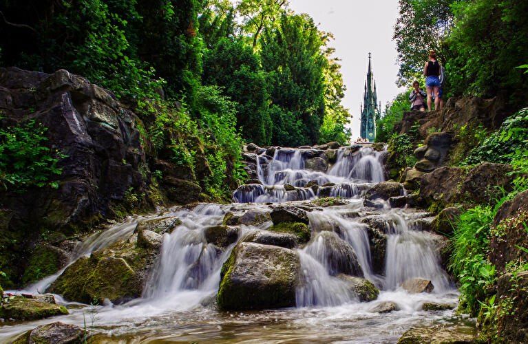
## Description **Viktoriapark** is one of Berlin’s most distinctive urban green spaces, combining **natural elevation, engineered waterfalls, panoramic city views, and national symbolism** within a compact yet dramatic landscape. Unlike Berlin’s vast flat parks such as Tiergarten or Tempelhofer Feld, Viktoriapark stands out because it rises sharply above the surrounding streets, offering one of the **best natural viewpoints in the entire city**. The park is centered around **Kreuzberg Hill**, a 66-meter-high elevation that gives the surrounding district its name. At the summit stands the imposing **National Monument for the Wars of Liberation** (Nationaldenkmal für die Befreiungskriege), a Gothic-style cast-iron monument designed by **Karl Friedrich Schinkel** and completed in 1821. The monument commemorates Prussia’s victory over Napoleon and represents one of the earliest major patriotic memorials in Germany. Its dark, spired form creates a dramatic silhouette against the sky and serves as a visual anchor for the entire park. One of Viktoriapark’s most beloved features is its **artificial waterfall system**, which cascades down the eastern slope of the hill toward Kreuzbergstraße. Built in the late 19th century, the waterfall was designed to mimic alpine mountain streams, bringing the sound, movement, and cooling atmosphere of flowing water into the dense urban fabric. During warm months, these waterfalls become the emotional heart of the park—children play at the base, couples sit on the stone steps, and photographers wait for light to catch the moving water. What makes Viktoriapark particularly compelling is the way it merges **romantic landscape design with political history**. The hill was reshaped during the 19th century to fit the ideals of romantic nationalism, where nature, sacrifice, and monumentality were meant to reinforce each other. The result is a park that feels both organic and highly symbolic at the same time. A little-known fact is that Kreuzberg Hill was once part of a **vine-growing region**, and small-scale wine production existed here in earlier centuries. Even today, a modern vineyard operates on the slope near the monument, producing limited local wine each year. Another lesser-known detail is that the waterfall only runs during the warmer months, meaning many winter visitors never realize that this dramatic feature exists at all. Beyond its historical symbolism, Viktoriapark plays a vital role in everyday neighborhood life. It is a **local refuge** for residents of Kreuzberg, attracting joggers, families, musicians, dog walkers, and sunset watchers. Unlike some of Berlin’s more monumental parks, Viktoriapark maintains a **distinctly neighborhood-driven character**, blending tourism and local daily rhythm without feeling staged. Emotionally, the park shifts moods throughout the day. Mornings are quiet and misty along the lower paths. Afternoons bring activity and movement. Evenings transform the summit into a gathering point for people watching the sun sink behind Berlin’s rooftops. From the top, visitors can often see landmarks such as the **TV Tower (Fernsehturm)** and distant church spires, reinforcing the sense of standing above the city without ever leaving it. ## Location **Viktoriapark** is located in the **Kreuzberg district of central Berlin**, close to the border with Schöneberg. **City:** Berlin **Region:** Berlin (city-state) **Country:** Germany **District:** Kreuzberg (Friedrichshain-Kreuzberg borough) ### How to Get There: * **By U-Bahn:** * **Line U6** to **Platz der Luftbrücke**, then walk about 10 minutes. * **Line U7** to **Mehringdamm**, then walk about 12–15 minutes. * **By bus:** Several bus lines stop along Mehringdamm and Kreuzbergstraße. * **By bicycle:** Well connected by bike lanes and ideal as part of a Kreuzberg cycling route. * **By taxi or ride-hailing apps:** Direct access from anywhere in central Berlin. * **On foot:** Easily reachable from Bergmannkiez and Tempelhofer Damm areas. The park’s elevated position makes it visible from many surrounding streets, acting as a **natural landmark within Kreuzberg**. ## Tips * **Visit near sunset:** The panoramic view from the monument is one of the best free sunset spots in Berlin. * **Check if the waterfall is running:** It is typically active only from spring to autumn. * **Wear comfortable shoes:** The paths include steep inclines and irregular stone steps. * **Bring a light jacket:** Wind at the top can be significantly stronger than street level. * **Combine with Bergmannkiez:** The surrounding neighborhood is full of cafés, bakeries, and local restaurants. * **Avoid peak hours for quiet time:** Late afternoons on weekends can be crowded. * **Respect the monument:** It is a protected historical site, not a climbing structure. * **Photography tip:** Early morning light illuminates the eastern slope and waterfall beautifully. ## Conclusion **Viktoriapark** is a rare Berlin green space where **natural elevation, romantic landscape design, national history, and everyday local life intersect**. From its cascading waterfalls and shaded paths to the solemn monument crowns its summit, the park offers both emotional contrast and visual depth. It is not grand in size, but in **experience, symbolism, and atmosphere**, it ranks among the most memorable outdoor spaces in the city. ## FAQ **1. What is Viktoriapark famous for?** It is best known for its **hilltop national monument, artificial waterfalls, and panoramic city views**. **2. Is Viktoriapark suitable for children?** Yes. Families visit frequently, especially near the lower waterfall areas, though supervision is required due to rocky terrain. **3. Is there an entrance fee?** No. Viktoriapark is **free and open to the public**. **4. Does the waterfall run all year?** No. It usually operates **only during the warmer months**. **5. Can you see major landmarks from Viktoriapark?** Yes. On clear days, you can spot parts of the **Berlin skyline including the TV Tower**. **6. How long should a visit take?** Most visits last **45 minutes to 1.5 hours**, depending on walking pace and time spent at viewpoints. ## Links * [Official Berlin Parks Page](https://www.berlin.de/tourismus/parks-und-gaerten/3560783-1740419-viktoriapark.html)
GemVoyage Team • World
Thessaly
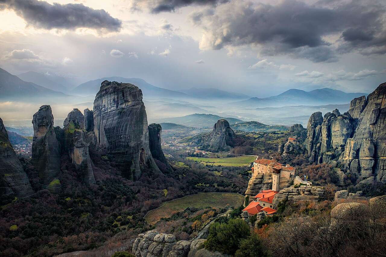
## Description The Meteora is one of Greece’s most awe-inspiring destinations, a place where nature and spirituality converge in dramatic fashion. Towering sandstone pillars rise from the plains of Thessaly, crowned by centuries-old Eastern Orthodox monasteries that seem to defy gravity. The name “Meteora” translates to “suspended in the air,” a fitting description for these monastic retreats perched atop rock formations that reach heights of over 400 meters. The site’s uniqueness lies not only in its geological wonder but also in its spiritual and historical significance. Monks began settling in the area as early as the 11th century, seeking solitude and safety from invading forces. By the 14th century, they had constructed monasteries atop the cliffs, accessible only by rope ladders and winches. Today, six of the original twenty-four monasteries remain active and open to visitors: Great Meteoron, Varlaam, Rousanou, St. Nicholas Anapausas, Holy Trinity, and St. Stephen. A little-known fact: the rock formations of Meteora are composed of sandstone and conglomerate, formed over millions of years from river deposits. Another intriguing detail is that the Monastery of Holy Trinity was featured in the James Bond film “For Your Eyes Only,” adding a touch of cinematic fame to its spiritual legacy. ## Location The Meteora is located in **Greece**, in the **Thessaly region**, near the **town of Kalabaka** and the **village of Kastraki**. It sits at the northwestern edge of the Thessalian Plain, close to the Pindus Mountains. ### How to Get There - **By Train**: From Athens, take a direct train to Kalabaka (approximately 4.5–5 hours). Trains also run from Thessaloniki via Palaiofarsalos. - **By Bus**: Buses connect Athens and Thessaloniki to Trikala, with onward connections to Kalabaka. - **By Car**: Driving from Athens takes about 4–5 hours. The route offers scenic views and flexibility for exploring nearby villages. - **By Tour**: Guided day trips from Athens or Thessaloniki are available and often include transportation, monastery visits, and local insights. Once in Kalabaka, the monasteries are accessible by car, taxi, or hiking trails. ## Tips - **Dress Appropriately**: Modest clothing is required. Men should wear long pants, and women should wear skirts below the knee and cover their shoulders. Some monasteries provide wraps at the entrance. - **Start Early**: Begin your visit in the morning to avoid crowds and enjoy cooler temperatures. - **Check Opening Hours**: Each monastery has its own schedule and may be closed on specific days. Plan accordingly. - **Wear Comfortable Shoes**: Many monasteries require climbing steps or walking on uneven terrain. - **Bring Water and Snacks**: Facilities are limited, especially on hiking trails. - **Explore Beyond the Monasteries**: The surrounding landscape offers excellent hiking, photography, and opportunities to visit traditional villages like Kastraki. ## Conclusion The Meteora is a breathtaking blend of natural grandeur and spiritual heritage. With its towering rock formations and cliff-top monasteries, it offers a profound experience for travelers seeking beauty, history, and tranquility in one of Greece’s most iconic landscapes. ## FAQ **1. How many monasteries can be visited at Meteora?** Six monasteries are open to the public, each with its own unique architecture and history. **2. Is there an entrance fee?** Yes, each monastery charges a small fee (usually around €3–5 per person). **3. Can I hike between the monasteries?** Yes, well-marked trails connect many of the monasteries. Hiking is a popular way to explore the area. **4. Are guided tours available?** Yes, local guides offer walking tours, cultural insights, and transportation options. **5. Is Meteora suitable for children?** Yes, but some monasteries require climbing steep steps, so supervision and physical readiness are important. **6. What is the best time to visit Meteora?** Spring and autumn offer mild weather and fewer crowds. Summer can be hot and busy, while winter is quieter but colder. ## Links - [Meteora – Wikipedia Overview](https://en.wikipedia.org/wiki/Meteora) - [Visit Meteora – Monastery Guide and Tours](https://visitmeteora.travel/meteora-monasteries/)
GemVoyage Team • World
Belize
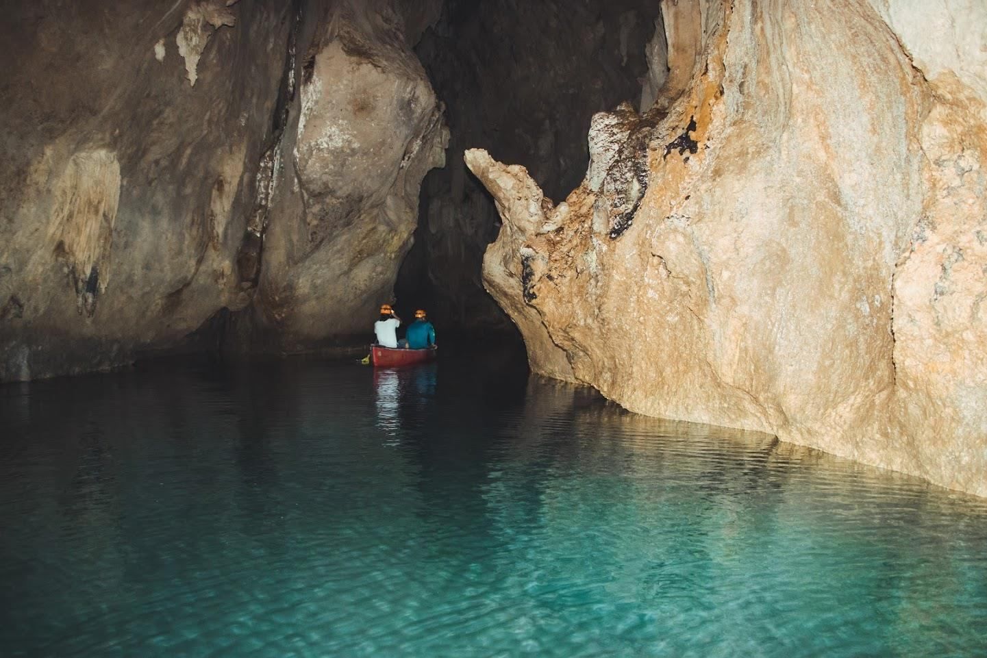
## Description **Barton Creek Cave Reserve** is one of Belize’s most compelling natural and archaeological attractions, combining dramatic limestone cave formations with deep cultural significance. Located within the lush lowland forests of western Belize, the reserve centers around **Barton Creek Cave**, a vast subterranean river cave that was once a sacred ceremonial site for the ancient Maya. Today, visitors explore the cave primarily by **canoe**, gliding silently through dark chambers illuminated only by headlamps and reflected light on the water. What makes Barton Creek Cave truly unique is this rare combination of **active exploration and archaeological context**. Unlike many caves that are viewed from walkways, here you move directly through the cave’s interior, following the same water route used by the Maya over a thousand years ago. Inside, towering stalactites, stalagmites, and cathedral-like caverns create an atmosphere that is both awe-inspiring and humbling. A little-known fact is that the cave was used specifically for **rituals connected to the Maya underworld**, known as *Xibalba*. Archaeologists have discovered ceremonial pottery, stone tools, and other ritual objects placed deep within the cave, suggesting it was not used for habitation but for spiritual purposes. Another lesser-known detail is that some ceramic pieces were intentionally broken, consistent with Maya ritual practices meant to “release” spiritual energy. Despite its popularity, Barton Creek Cave Reserve remains relatively undeveloped. There are no artificial lights inside the cave, preserving its natural state and enhancing the sense of discovery. This rawness, combined with expert local guides, makes the experience both educational and deeply immersive. ## Location **Country:** Belize **Region:** Cayo District **Nearest Town:** San Ignacio Barton Creek Cave Reserve is located approximately **30 kilometers southeast of San Ignacio**, in a rural, forested area surrounded by small Maya and farming communities. ### How to Get There * **By car:** * From San Ignacio, drive toward the village of Barton Creek. The final stretch is unpaved and may be rough, especially after rain; a high-clearance vehicle is recommended. * **By guided tour:** * The most common and convenient option. Tours include transportation, equipment, and licensed guides. * **By taxi:** * Possible from San Ignacio, but return arrangements should be planned in advance due to the remote location. ## Tips * **Choose a guided tour:** Guides are required and provide essential safety oversight and archaeological context. * **Wear water-friendly clothing:** You may get splashed, and the cave is cool and humid. * **Bring sturdy footwear:** Even though the tour is by canoe, entry and exit areas can be slippery. * **Do not touch artifacts:** Many remain in situ and are protected by law. * **Visit during the dry season:** Roads are easier to navigate, and water levels are more predictable. * **If claustrophobic, reconsider:** Some chambers are large, but the environment is still enclosed and dark. ## Conclusion Barton Creek Cave Reserve offers a rare opportunity to experience Belize’s natural beauty and ancient Maya spirituality at the same time. Its canoe-based exploration, untouched cave environment, and archaeological importance make it one of the most memorable and meaningful attractions in the Cayo District. ## FAQ **1. Do I need a guide to visit Barton Creek Cave?** Yes. All visitors must enter with a licensed guide for safety and preservation reasons. **2. Is swimming required?** No. The cave is explored by canoe, and swimming is not necessary. **3. How long does the tour take?** Typically **1.5 to 2 hours**, including preparation and exploration. **4. Is the cave suitable for children?** Yes, for older children who are comfortable in dark, enclosed spaces. **5. Can I take photos inside the cave?** Yes, but flash photography may be restricted, and touching formations or artifacts is prohibited. **6. What is the best time of year to visit?** The dry season, from roughly December to May, is generally the best time. ## Links * [Belize Tourism Board](https://www.travelbelize.org)
GemVoyage Team • World
Wroclaw
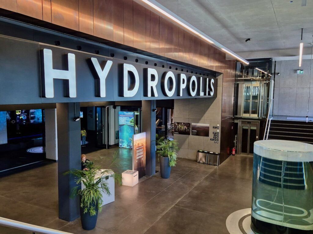
## Description **Hydropolis** is a modern, science-focused museum in Wrocław dedicated entirely to **water**—its origins, physical properties, role in shaping civilizations, and importance for life on Earth. Opened in 2015, Hydropolis stands out not as a traditional museum of static displays, but as a **fully interactive knowledge center** that combines multimedia installations, scientific exhibits, and immersive environments to explain one of humanity’s most essential resources. Housed inside a **19th-century underground water reservoir**, the museum cleverly connects content and setting. The massive brick structure, once used to store drinking water for the city, now forms a dramatic backdrop for exhibitions that explore oceans, rivers, rainfall, hydraulic engineering, and water management. This reuse of industrial heritage is central to Hydropolis’s identity and adds authenticity to the experience. What makes Hydropolis unique is its **interdisciplinary approach**. Visitors move through themed zones covering topics such as deep-sea exploration, water in the human body, ancient hydraulic systems, modern urban water infrastructure, and global water challenges. High-resolution projections, touchscreens, soundscapes, and scale models keep the content accessible without oversimplifying complex scientific concepts. A lesser-known fact is that the building itself was a **technical masterpiece of its time**, constructed in 1893 and hidden underground to preserve water temperature and pressure. Another interesting detail is that Hydropolis devotes significant space to **Poland’s relationship with water**, including flood control on the Oder River and Wrocław’s long history of bridges, canals, and engineering solutions. Hydropolis appeals to a wide audience: families, students, engineers, and travelers interested in science, sustainability, or innovative museums. ## Location **Country:** Poland **Region:** Lower Silesia **City:** Wrocław Hydropolis is located east of Wrocław’s Old Town, near the **Oder River**, in an area known for cultural institutions and green spaces. ### How to Get There * **By tram:** * Several tram lines stop within walking distance, connecting the site to the Old Town and main railway station. * **By bus:** * City buses serve the surrounding district with frequent service. * **On foot:** * About a 25–30 minute walk from the Market Square (Rynek). * **By car:** * Parking is available nearby, though public transport is often more convenient. ## Tips * **Book tickets in advance:** Time slots can sell out, especially on weekends and during school holidays. * **Allow enough time:** Plan at least **2 to 3 hours** to fully experience all exhibition zones. * **Ideal for families:** Interactive elements are well designed for children and teenagers. * **Read the explanations:** Many exhibits reward careful attention rather than quick browsing. * **Combine with nearby attractions:** The Wrocław Zoo and Centennial Hall are close and make a good same-day itinerary. * **Language accessibility:** Exhibits are available in multiple languages, including English. ## Conclusion Hydropolis is one of Poland’s most innovative museums, transforming a historic water reservoir into a compelling educational space. By blending science, history, and modern technology, it offers a deep yet engaging look at water’s role in shaping the planet and human society, making it a must-visit attraction in Wrocław. ## FAQ **1. What is Hydropolis about?** It is an interactive museum focused entirely on water—its science, history, and global importance. **2. Is Hydropolis suitable for children?** Yes. The exhibits are highly interactive and well-suited for families and school groups. **3. How long does a visit take?** Most visitors spend **2 to 3 hours**. **4. Is there an entrance fee?** Yes. Tickets are required, with discounts for children, students, and families. **5. Is Hydropolis accessible for people with disabilities?** Yes. The facility is designed to be fully accessible. **6. Is it worth visiting if I’m not interested in science?** Yes. The visual design and storytelling make the experience engaging even for non-technical visitors. ## Links * [Official Hydropolis website](https://www.hydropolis.pl) * [Wrocław tourism portal](https://visitwroclaw.eu)
GemVoyage Team • World
Graz
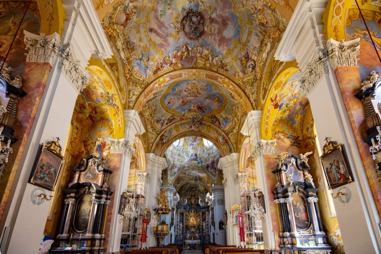
## Description **Basilika Mariatrost** is the most important pilgrimage church in the region of Styria and one of the most visually striking religious landmarks in Graz. Perched on a hill overlooking the eastern edge of the city, the basilica is a masterpiece of **Austrian Baroque architecture**, instantly recognizable by its twin towers and commanding elevated position. More than a place of worship, it represents centuries of faith, healing traditions, and regional identity. Construction of the basilica began in the early 18th century under the patronage of the Pauline Order, following reports of miraculous healings associated with a statue of the Virgin Mary. The church was intentionally built high above the surrounding landscape, reinforcing its role as a spiritual refuge removed from everyday life. Its grand staircase—over 200 steps long—adds a sense of ritual to the approach, turning the journey itself into part of the pilgrimage experience. Inside, the basilica is richly decorated with frescoes, gilded altars, and intricate stucco work. The high altar frames the revered **Marian statue**, the spiritual heart of the church. One lesser-known fact is that the church temporarily lost its religious function during Emperor Joseph II’s reforms in the late 18th century and was repurposed before later being restored as a pilgrimage site. Another notable detail is that Mariatrost was elevated to the status of a **minor basilica** by the Vatican in 1999, recognizing its historical and spiritual significance. Despite its religious importance, Basilika Mariatrost is also appreciated for its **panoramic views**, serene atmosphere, and harmonious integration with the surrounding greenery. It attracts pilgrims, architecture enthusiasts, photographers, and visitors seeking quiet contemplation. ## Location **Country:** Austria **Region:** Styria **City:** Graz **District:** Mariatrost The basilica is located in the **northeastern part of Graz**, on a wooded hill that rises above the Mariatrost district. ### How to Get There * **By tram:** * Take **Tram Line 1** from Graz city center to the final stop, **Mariatrost**. From there, it is a short walk to the basilica. * **On foot:** * Walking routes and pilgrimage paths lead uphill from the tram stop. * **By car:** * Accessible by local roads, with limited parking available nearby. * **By bicycle:** * Possible for experienced cyclists, though the ascent can be steep. ## Tips * **Climb the staircase at least once:** It enhances the sense of arrival and offers changing views. * **Visit in the morning or late afternoon:** The light is softer, and the atmosphere is quieter. * **Dress respectfully:** The basilica is an active place of worship. * **Attend a service if possible:** Music and acoustics add depth to the experience. * **Combine with a walk:** The surrounding area has pleasant walking paths and forest trails. * **Photography is best outside:** Interior photography may be restricted during services. ## Conclusion Basilika Mariatrost is both a spiritual landmark and an architectural highlight of Graz. Its elevated position, Baroque elegance, and centuries-old pilgrimage tradition make it a meaningful destination for visitors seeking history, culture, and calm above the city. ## FAQ **1. Why is Basilika Mariatrost important?** It is the most significant pilgrimage church in Styria, centered around devotion to the Virgin Mary. **2. Is there an entrance fee?** No. Entry to the basilica is free. **3. How long should I plan for a visit?** Around **45 minutes to 1.5 hours**, depending on whether you attend a service or explore the surroundings. **4. Is the basilica accessible for people with limited mobility?** Yes, though the main staircase is steep; alternative access routes are available. **5. Can tourists visit during services?** Yes, but visitors should remain respectful and avoid photography. **6. What is the best time of year to visit?** Spring and early autumn offer pleasant weather and clear views. ## Links * [Official Graz tourism site](https://www.graztourismus.at)
GemVoyage Team • World
