GemVoyage Team • World
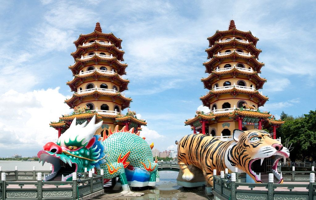
The Dragon and Tiger Pagodas (龍虎塔) are among the most iconic landmarks in Kaohsiung, Taiwan’s bustling southern port city. Rising gracefully from the edge of Lotus Pond (蓮池潭), these twin seven-story pagodas are not only stunning examples of traditional Chinese temple architecture but also powerful symbols of spiritual balance and good fortune.
Built in 1976, the pagodas belong to the Cihji Palace (慈濟宮), a Taoist temple dedicated to the deity Baosheng Dadi, the God of Medicine. Each pagoda stands approximately 30 meters high and is colorfully adorned with intricate carvings, ornate balconies, and auspicious motifs depicting dragons, tigers, phoenixes, and deities. The vibrant yellow, red, and gold hues shimmer under the sunlight, reflecting beautifully on the tranquil surface of Lotus Pond.
What makes the Dragon and Tiger Pagodas unique is the way visitors enter and exit: you must enter through the dragon’s mouth and exit through the tiger’s mouth. According to local belief, this symbolizes turning bad luck into good fortune — entering the dragon (associated with strength and virtue) and leaving through the tiger (a symbol of courage and protection) ensures a spiritual cleansing and renewal of destiny.
Inside the corridors of each pagoda, visitors find mural paintings and sculptures depicting Taoist stories, scenes from Buddhist hell, and images of celestial beings. These serve as both spiritual teachings and vivid works of art. The upper floors of the pagodas offer panoramic views of the Lotus Pond area, including nearby temples such as the Spring and Autumn Pavilions, the Confucius Temple, and the Five Mile Pavilion.
A lesser-known fact is that the Dragon and Tiger Pagodas were constructed on pontoons extending over the water, connected to the shore by zigzagging bridges — a traditional Chinese design believed to ward off evil spirits, as they can only travel in straight lines. The pagodas also align perfectly with the Feng Shui energy of the surrounding mountains and pond, reinforcing their spiritual significance in Taiwanese culture.
The Dragon and Tiger Pagodas (龍虎塔) are located on the southern shore of Lotus Pond (蓮池潭) in Zuoying District, Kaohsiung City, Taiwan.
Address: No. 9, Liantan Road, Zuoying District, Kaohsiung City, Taiwan
To get there:
The Dragon and Tiger Pagodas are not just architectural marvels — they are living embodiments of Taiwanese spirituality, folklore, and artistry. From their dazzling colors to the symbolic dragon-and-tiger design, they invite visitors into a world where legend meets serenity. Overlooking the tranquil waters of Lotus Pond, these pagodas remind every traveler of the enduring harmony between nature, faith, and human creativity. Whether you come for photography, culture, or quiet reflection, the Dragon and Tiger Pagodas offer a truly unforgettable window into Taiwan’s spiritual soul.
1. When were the Dragon and Tiger Pagodas built?
They were built in 1976 as part of the Cihji Palace complex, dedicated to the Taoist God of Medicine.
2. Why do visitors enter through the dragon and exit through the tiger?
According to tradition, entering the dragon’s mouth and exiting the tiger’s mouth symbolizes transforming bad luck into good fortune.
3. How tall are the pagodas?
Each pagoda is approximately 30 meters (98 feet) tall, offering panoramic views from the upper levels.
4. Is there an entrance fee?
No — admission is free for all visitors.
5. What is the best time to visit?
Early morning or late afternoon (sunset) provides the best lighting and fewer crowds. Evening visits are also beautiful when the pagodas are illuminated.
6. Can you climb inside the pagodas?
Yes, visitors can climb to the top through interior staircases for views of Lotus Pond and surrounding temples.
7. Are the pagodas accessible year-round?
Yes, the site is open daily, though opening hours may vary slightly with the seasons.
Discover more hidden gems you might love.
Cape Town
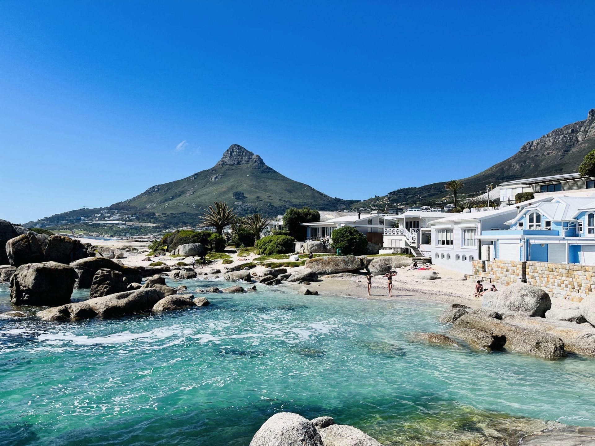
## Description Beta Beach in Bakoven is one of Cape Town’s more understated coastal spots, which is exactly what makes it appealing. Instead of the intensity of the city’s bigger, more famous beaches, Beta Beach offers a calmer setting where granite boulders, sheltered sand, and Atlantic water create a beautiful but low-key experience. The beach feels intimate and local, with views that are every bit as memorable as those at more famous shoreline destinations. What sets Beta Beach apart is the way it blends privacy and scenery. It is not a beach for large crowds or big facilities; it is a beach for people who want to pause, look out over the ocean, and enjoy the dramatic relationship between water and mountain. The Bakoven area itself has a strong residential character, which helps keep the atmosphere relaxed. One lesser-known fact is that the smaller coves in this part of the coast can look very different depending on tide and swell, so a single visit can feel dramatically different from one hour to the next. Another interesting detail is how the surrounding boulders create natural windbreaks and visual frames, making the beach especially photogenic. Beta Beach is also a good choice for travelers who want a quieter Atlantic side experience without giving up proximity to major Cape Town attractions. It works well as a short stop, a sunset watchpoint, or a place to linger between drives along the coast. The mountain backdrop and ocean light make it feel distinctly Cape Town, but in a softer, more residential register than some of the city’s busier beaches. For many visitors, that balance of accessibility and peace is the reason it becomes a favorite. ## Location Beta Beach is in Bakoven, Cape Town, Western Cape, South Africa, along the Atlantic coast near Camps Bay and the route toward the Twelve Apostles side of Table Mountain. The location is close to one of the city’s most scenic coastal corridors. The easiest way to get there is by car or ride-hailing service, especially if you are staying in central Cape Town, Camps Bay, or Sea Point. Public transport options are more limited for this particular stretch, so direct road access is usually the practical choice. Once there, plan to explore on foot so you can enjoy the coves and viewpoints at a slower pace. ## Tips Check tide and weather conditions before visiting, because the beach’s feel changes significantly with the sea. Bring sun protection and water, since the Atlantic coast can be sunny and exposed. Go near sunset for especially strong light on the water and mountains. Keep expectations realistic: this is a beautiful, quieter beach rather than a full-service resort area. ## Conclusion Beta Beach is a peaceful Cape Town coastal stop that pairs Atlantic beauty with a relaxed, local atmosphere. ## FAQ ### Is Beta Beach crowded? It is generally quieter than Cape Town’s most famous beaches, though it can still be busy at peak times. ### Can you swim there? People do swim, but Atlantic conditions can be cold and variable. ### Is it easy to find? Yes, especially if you are already traveling through Bakoven or nearby Camps Bay. ### Is it good for photography? Very much so, especially at sunrise or sunset. ### What makes it different from Camps Bay? It is smaller, quieter, and more sheltered, with a more intimate feel. ## Links - [Cape Town tourism information](https://www.capetown.travel/) - [Camps Bay on Wikipedia](https://en.wikipedia.org/wiki/Camps_Bay)
GemVoyage Team • World
Milan
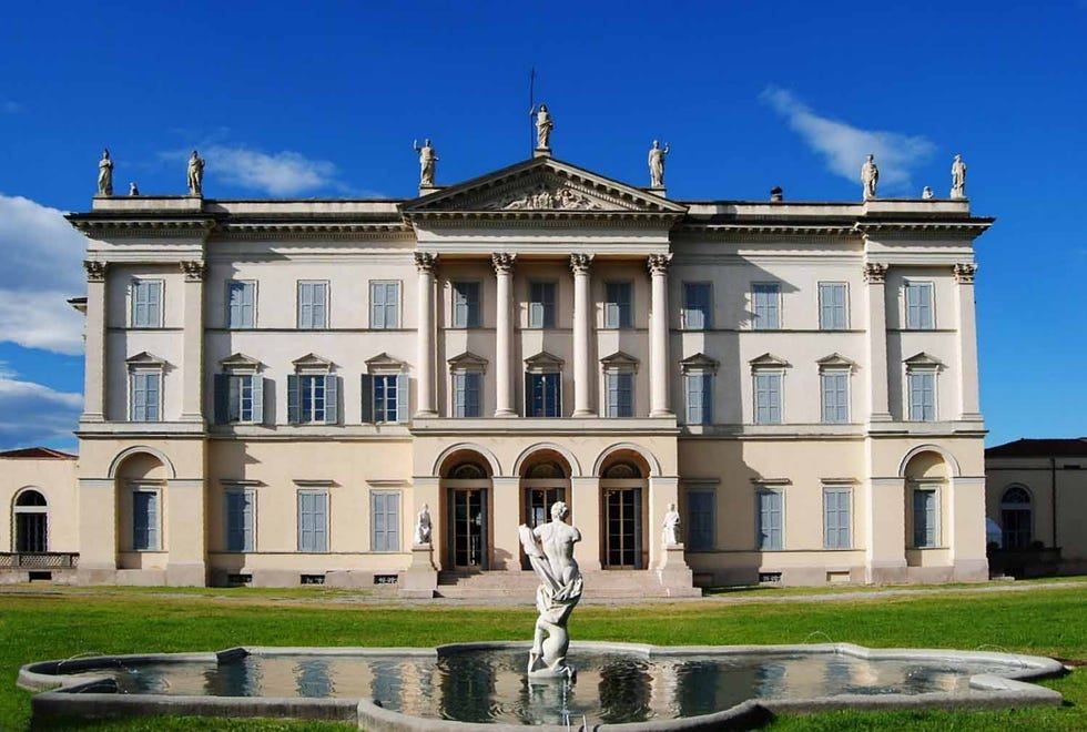
## Description Villa Tittoni Traversi, also known as Villa Cusani Tittoni Traversi, is an elegant neoclassical villa that represents an important chapter in the architectural and cultural history of the Milan area. Originally conceived as a noble residence, the villa stands out for its refined design, harmonious proportions, and its close relationship with the surrounding landscape. Today, it serves as a cultural venue, hosting exhibitions, events, and public activities that keep its historical legacy alive. What makes Villa Tittoni Traversi unique is its artistic pedigree. The villa was redesigned in the early 19th century by the renowned architect Giuseppe Piermarini, the same architect behind Milan’s Teatro alla Scala. Its interior spaces were later enriched with frescoes and decorative elements that reflect the tastes of Lombard aristocracy. A lesser-known fact is that the villa’s park was influenced by early landscape garden concepts, blending formal and naturalistic elements. Another interesting detail is that the building has passed through the hands of several prominent families, including the Cusani and Tittoni families, each leaving their mark on its design and function. The villa offers a refined yet approachable atmosphere, making it appealing to visitors interested in history, architecture, and cultural life outside Milan’s most crowded attractions. ## Location Villa Tittoni Traversi is located in **Italy**, in the **Lombardy** region, near the city of **Milan**, in the town of **Desio**, north of the city center. Although often associated with Milan due to its proximity, the villa is technically within Desio, making it an easy and worthwhile day trip from the city. Reaching the villa is convenient. Visitors can take a regional train from Milan to **Desio Station**, which is well connected and only a short walk from the villa. Several bus routes also serve the area. For those driving, Desio is easily accessible by road, and parking is generally available near the villa and its park. ## Tips * Check the villa’s event schedule in advance, as exhibitions and cultural programs vary throughout the year. * Take time to explore the surrounding park, which is ideal for relaxing walks and photography. * Guided tours may be available on specific days and can offer deeper insight into the villa’s history. * Visit on weekdays for a quieter experience, especially if events are taking place on weekends. * Combine your visit with a stroll through Desio’s historic center or nearby green spaces. * Wear comfortable shoes, particularly if you plan to explore both the interior and the park. ## Conclusion Villa Tittoni Traversi is a graceful example of Lombard neoclassical architecture and cultural heritage. Its blend of history, art, and green space makes it a rewarding destination for visitors seeking a more intimate and refined experience near Milan. ## FAQ **Is Villa Tittoni Traversi open to the public?** Yes, the villa is open to the public during exhibitions, events, and scheduled visiting hours. **How long does a visit usually take?** Most visits last between one and two hours, depending on exhibitions and time spent in the park. **Is there an entrance fee?** Entrance fees may apply during special exhibitions or events, while access to the park is often free. **Is the villa suitable for families?** Yes, the open park and cultural events make it suitable for families, though children should be supervised indoors. **Can the villa be reached easily from Milan?** Yes, it is easily accessible by train or car from Milan in under an hour. ## Links * [Villa Tittoni Official Website](https://villatittoni.it/)
GemVoyage Team • World
Los Angeles
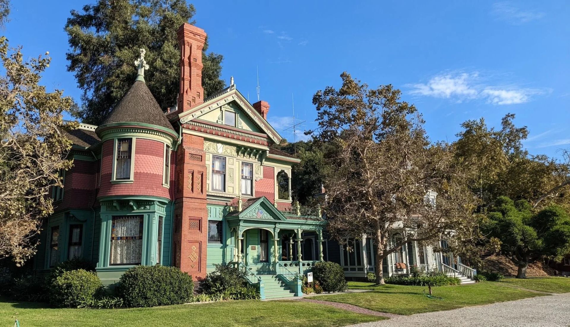
## Description Heritage Square Museum is an extraordinary open-air architectural museum that gathers Victorian and early 20th-century houses and outbuildings within a single historic district to showcase Southern California’s built environment and social history. Each structure has a carefully reconstructed exterior and interpreted interior that reveal the craftsmanship, decorative trends, and daily rhythms of life from a period when Los Angeles was transforming from a frontier town into a burgeoning metropolis. The museum stands out for the authenticity of its fabric: original trim, stained glass, tile, and millwork are preserved or painstakingly restored, and many interiors are furnished with period-appropriate objects to convey domestic stories. Preservation workshops on site keep traditional trades alive—carpentry, plasterwork, and decorative finishes are practiced as living crafts, which both supports ongoing maintenance and educates visitors about restoration techniques. Beyond architecture, Heritage Square interprets social history. Exhibits explore how families lived, worked, and entertained across different socioeconomic strata, and the museum’s programming—guided tours, living history demonstrations, and seasonal festivals—brings these narratives to life. Special events often highlight conservation issues and the ongoing need to protect historic urban fabric in the face of development pressures. For scholars, students, and casual visitors alike, the site offers layered experiences: a close reading of architectural detail, hands-on learning in workshops, and interpretive narratives that connect buildings to broader histories of migration, industry, and urban change. Its role as a rescue repository—structures moved and reassembled to avoid demolition—adds an extra dimension: many buildings carry stories of mid-century urban renewal and community efforts to preserve heritage. ## Location Heritage Square Museum is located in the Montecito Heights neighborhood of Los Angeles, California, a short drive northeast of downtown Los Angeles. The setting—on a hillside with city views—provides a scenic backdrop for exploring an era of American domestic architecture. Getting there: Driving is the most convenient option; limited on-site parking is available. Public transit can be used but often requires transfers and a short walk—check local transit schedules and plan for extra time. Rideshare and local taxis are convenient alternatives. Pair a visit with nearby cultural stops, such as the Huntington Library or local hillside parks, to create a fuller day of exploration. ## Tips - Check the museum’s tour schedule and special-event calendar before you go; guided tours offer the most context and are often led by knowledgeable docents. - Wear comfortable shoes—paths through the outdoor site can be uneven and some properties require short climbs. - Give yourself at least two hours to explore; the combination of interiors, workshops, and outdoor exhibits rewards a relaxed pace. - Bring a camera for exterior architectural photography; observe interior photography rules where posted and respect exhibit boundaries. - If interested in historic trades, inquire about workshop schedules or volunteer opportunities—many preservation skills are demonstrated on site. - Visit in spring or fall for pleasant weather and outdoor events; summer can be warm and winter may bring cooler, wetter days. ## Conclusion Heritage Square Museum preserves an essential chapter of Southern California’s architectural story. By combining rescued structures, conservation workshops, and interpretive programming, it offers a hands-on way to understand historic building crafts and the lives of the people who inhabited these homes. It is an inspiring stop for anyone interested in architecture, preservation, and urban history. ## FAQ Q: Are there guided tours? A: Yes. The museum runs scheduled guided tours and special programs; tours are recommended for first-time visitors to gain historical context and architectural insight. Q: Is the site family-friendly? A: Yes. The museum offers family-oriented programs and activities; children can learn about historic life through interactive demonstrations. Q: Can event spaces be rented? A: Select areas may be rented for private events, though availability and restrictions vary—contact the museum’s events office for details. Q: Are there volunteer opportunities or workshops? A: Yes. The museum often offers volunteer roles, preservation workshops, and demonstrations of traditional trades—check the calendar or volunteer page for current options. Q: Is the site wheelchair accessible? A: Some areas have limited accessibility due to the nature of historic structures and terrain; the museum can provide guidance on accessible routes and accommodations. Q: What’s the best way to learn about restoration techniques demonstrated on site? A: Attend preservation workshops, guided tours that focus on conservation, or scheduled demonstrations—these sessions are designed to explain both craft techniques and the rationale behind repair choices. ## Links - [Heritage Square Museum (official)](https://www.heritagesquare.org) - [Wikipedia: Heritage Square Museum](https://en.wikipedia.org/wiki/Heritage_Square_Museum)
GemVoyage Team • World
Aswan
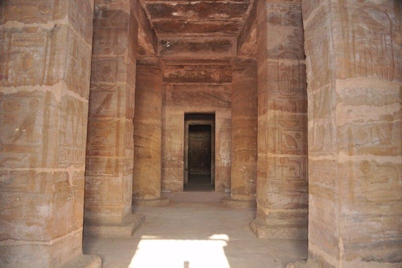
## Description **The Temple of Amada** is one of the oldest surviving stone temples in Nubia and a remarkable example of **New Kingdom Egyptian architecture** outside the Nile Valley’s main centers. Built during the reigns of **Thutmose III** and **Amenhotep II** in the 18th Dynasty (15th century BCE), the temple was dedicated to the gods **Amun-Re** and **Re-Horakhty**. While modest in size compared to the great temples of Luxor, Amada’s historical and artistic value is exceptionally high. What makes the Temple of Amada unique is its **well-preserved interior inscriptions**. The walls are covered with detailed reliefs and hieroglyphic texts that document military campaigns in Nubia and the Near East. One inscription records a victory so overwhelming that it claims the stench of defeated enemies filled the land—an unusually vivid and rare narrative detail in Egyptian temple texts. A lesser-known but crucial fact is that the temple originally stood several kilometers south of its current location. During the 1960s, it was **relocated intact** as part of UNESCO’s Nubian Monuments rescue campaign, launched to save ancient sites threatened by flooding from the construction of the Aswan High Dam. Unlike Abu Simbel, which was cut into blocks, the Temple of Amada was moved as a **single structure**, an extraordinary engineering achievement that preserved its fragile wall paintings. The temple’s proportions are elegant and restrained, with a small pylon, open courtyard, hypostyle hall, and sanctuary. Its compact scale allows visitors to closely study reliefs and inscriptions without the overwhelming crowds found at larger sites, making it especially rewarding for those interested in Egyptian history and epigraphy. ## Location **Country:** Egypt **Region:** Upper Egypt / Nubia **Nearest City:** Aswan The Temple of Amada is located approximately **20 kilometers south of Aswan**, near Lake Nasser, close to the modern village of New Amada. ### How to Get There * **By guided tour:** * Most visitors reach Amada as part of a **Lake Nasser archaeological tour**, either by road or boat. * **By car:** * Accessible via the Aswan–Abu Simbel road, though permits may be required for independent travel. * **By cruise boat:** * Some Lake Nasser cruises include Amada as a scheduled stop. ## Tips * **Visit with a guide:** The inscriptions are historically rich but easy to miss without explanation. * **Allow time inside:** The temple’s value lies primarily in its interior reliefs, not its exterior. * **Bring sun protection:** The site is exposed, and shade is limited. * **Photography is allowed:** Flash should be avoided to protect the wall paintings. * **Combine with nearby sites:** The temples of Derr and the Tomb of Pennut are often visited together. * **Best visited in winter:** Cooler temperatures make exploration far more comfortable. ## Conclusion The Temple of Amada is a quiet but powerful witness to Egypt’s imperial presence in Nubia. Its vivid inscriptions, elegant design, and dramatic modern relocation make it one of the most historically important yet underrated ancient temples in southern Egypt. ## FAQ **1. When was the Temple of Amada built?** It dates to the 18th Dynasty, primarily during the reigns of Thutmose III and Amenhotep II. **2. Why was the temple moved?** It was relocated to prevent flooding caused by the creation of Lake Nasser after the Aswan High Dam. **3. Is the temple original or reconstructed?** It is original; the entire structure was moved intact rather than rebuilt from blocks. **4. How long does a visit take?** Approximately **30–60 minutes**, depending on interest in inscriptions. **5. Is it crowded?** No. It is much quieter than major temples along the Nile. **6. Is the site suitable for casual visitors?** Yes, though history enthusiasts will appreciate it the most. ## Links * [Egypt tourism portal](https://www.experienceegypt.eg/en)
GemVoyage Team • World
Pokhara
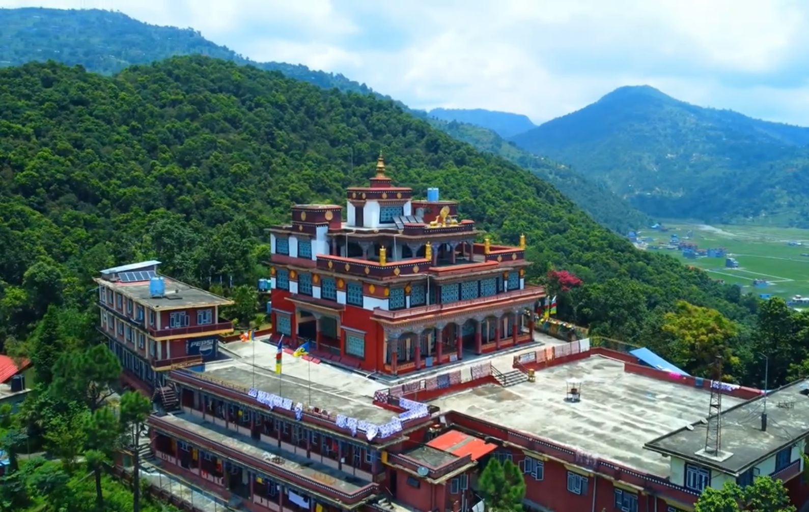
## Description **Matepani Gumba** is a serene Buddhist monastery perched on a quiet hillside in Pokhara, Nepal. It’s one of the city’s lesser-known yet most spiritually rewarding attractions. Built in the 1960s by Tibetan refugees, the monastery belongs to the **Gelug sect of Tibetan Buddhism**, often referred to as the “Yellow Hat” tradition. Its colorful architecture, peaceful ambiance, and panoramic views of Pokhara make it a must-visit for travelers seeking both cultural depth and tranquility. The interior of the monastery is breathtaking. Its main prayer hall is adorned with **intricate murals depicting scenes from Buddhist teachings**, as well as striking statues of Buddha and various deities. During prayer sessions, the air fills with the sound of chanting monks, the beating of drums, and the rhythmic call of long Tibetan horns—a mesmerizing spiritual experience. **Little-known facts**: * The monastery is home to a community of young monks in training. Visitors may often see them playing outside after prayers or diligently studying inside. * Matepani Gumba was strategically built on a hilltop not only for its peaceful isolation but also for its sweeping view of Pokhara Valley, including glimpses of **Phewa Lake** and the **Annapurna mountain range** on clear days. --- ## Location Matepani Gumba is located in **Pokhara**, within the **Gandaki Province** of **Nepal**. It sits atop a hill in the **Matepani neighborhood**, about 5 kilometers northeast of Pokhara’s Lakeside area, the main tourist hub. ### How to get there: * The most convenient way is to take a **taxi** or hire a scooter from Lakeside. The drive takes around 15–20 minutes. * Adventurous travelers can also hike up the hill. The walk is a bit steep but rewarding, as you’ll pass through local neighborhoods and enjoy peaceful surroundings along the way. --- ## Tips * **Attend a prayer session**: If possible, time your visit with the monks’ chanting rituals. These are usually held in the morning or late afternoon, and they offer an unforgettable cultural experience. * **Dress respectfully**: As a place of worship, modest clothing is expected. Remove your shoes before entering the main prayer hall. * **Bring a camera, but be mindful**: The monastery’s colorful murals and views are photogenic, but always ask before photographing monks or ceremonies. * **Combine your visit**: Matepani Gumba pairs well with other cultural sites in Pokhara, such as the World Peace Pagoda or Bindhyabasini Temple. * **Go in the morning**: The air is clear, the light is soft for photos, and you’re more likely to catch monks engaged in prayers. --- ## Conclusion Matepani Gumba is more than just a monastery—it’s a peaceful retreat where spirituality, culture, and nature come together. With its rich Tibetan Buddhist heritage, beautiful murals, and tranquil hilltop setting, it offers visitors a unique chance to step away from Pokhara’s busy streets and experience a different side of the city. Whether you’re drawn by faith, culture, or simply the desire for quiet reflection, Matepani Gumba leaves a lasting impression. --- ## FAQ **1. What is Matepani Gumba known for?** It’s a Tibetan Buddhist monastery famous for its vibrant murals, large statues, and peaceful hilltop location overlooking Pokhara. **2. Can visitors attend ceremonies at the monastery?** Yes, visitors are welcome to observe prayer sessions, but it’s important to remain quiet and respectful during rituals. **3. Is there an entrance fee?** No, entry to Matepani Gumba is generally free, though donations are appreciated to help maintain the monastery. **4. How long should I plan for a visit?** A visit usually takes 1–2 hours, depending on whether you stay for a prayer session or spend time enjoying the views. **5. Is it family-friendly?** Yes, the peaceful atmosphere and open grounds make it suitable for families, though young children should be supervised inside the prayer hall. **6. What’s the best way to reach Matepani Gumba?** The easiest option is by taxi from Lakeside, but walking or riding a scooter are also popular choices for adventurous travelers. --- ## Links * [Pokhara Tourism Board](https://ntb.gov.np/pokhara) * [Lonely Planet – Pokhara](https://www.lonelyplanet.com/nepal/pokhara)
GemVoyage Team • World
Paris
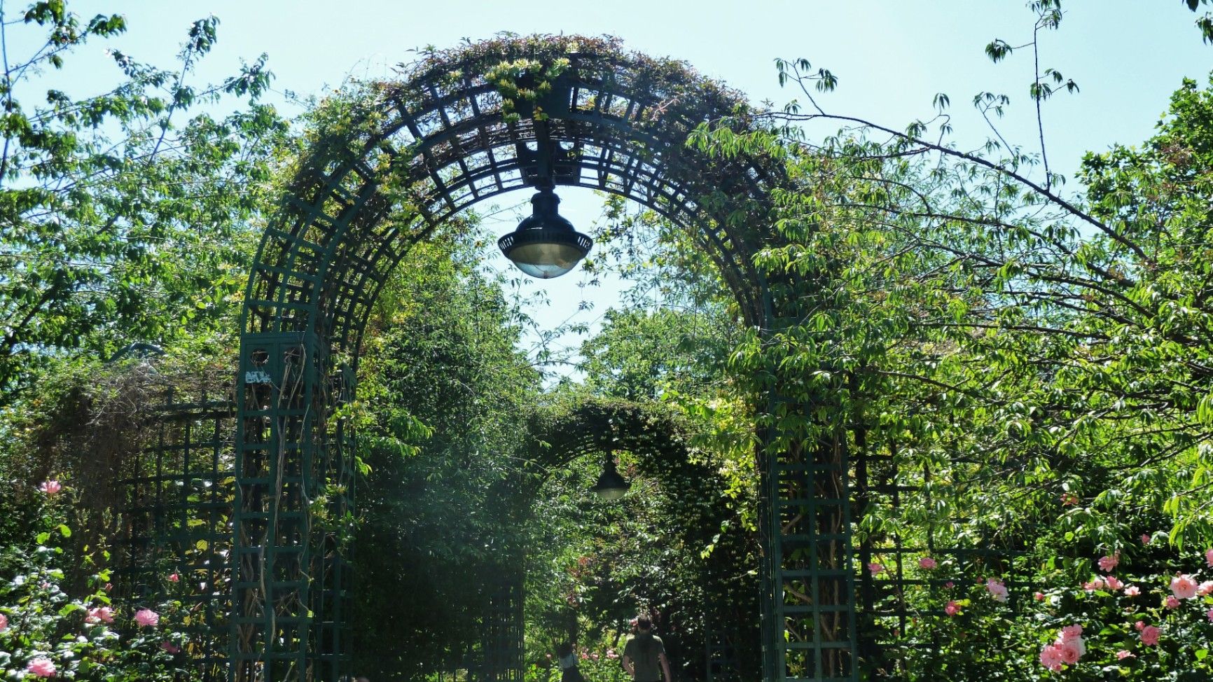
## Description The **Coulée Verte René-Dumont** is one of Paris’s most quietly transformative urban landscapes: a **4.7-kilometer elevated green corridor** built on a former 19th-century railway viaduct. Long before New York’s High Line became famous, Paris had already pioneered the idea of reclaiming industrial infrastructure and turning it into a **linear park suspended above city streets**. Opened in **1993**, the Coulée Verte stretches across eastern Paris, offering a continuous ribbon of trees, gardens, pergolas, tunnels, and walkways that float above neighborhoods, rooftops, and traffic. Rather than being a monumental tourist attraction, its strength lies in its **subtle intimacy**. The path winds between apartment balconies, over narrow streets, through shaded cuttings, and across stone viaducts, allowing visitors to experience Paris from an **unexpected vertical perspective**. The design philosophy of the park is deeply rooted in **soft landscaping rather than formal symmetry**. Instead of wide lawns or dramatic vistas, the Coulée Verte contains **layered vegetation, winding paths, seasonal flowers, bamboo groves, climbing roses, and shaded benches**. This makes it feel more like a secret garden than a grand urban park. One of the most remarkable architectural features of the route is the **Viaduc des Arts**, where the park runs along a series of brick arches originally built for railway use. Beneath these arches now sit artisan workshops, design studios, galleries, instrument makers, and boutique craftspeople. This dual-level experience—**green tranquility above and creative commerce below**—is one of the Coulée Verte’s defining identities. Unlike Paris’s grand axial parks such as the Tuileries or Luxembourg Gardens, the Coulée Verte offers a **continuously shifting urban narrative**. At one point, you are enclosed in forest-like silence; minutes later, you emerge into balcony-lined streets where residents drink coffee just meters away from your path. This creates an emotional tension between **privacy and exposure**, urban density and botanical escape. A little-known fact is that the park is named after **René Dumont**, a pioneering French agronomist and environmentalist who was also **France’s first Green Party presidential candidate**. The naming itself reinforces the park’s identity not just as a recreational space, but as a **symbol of ecological urban thinking**. Another little-known detail is that parts of the route pass directly behind residential buildings at eye level, leading to long-standing unspoken etiquette between walkers and residents regarding privacy. Today, the Coulée Verte is used daily by **joggers, dog walkers, commuters, couples, photographers, and elderly residents**, each group engaging with the space differently depending on time of day. Mornings are quiet and rhythmical. Afternoons bring families and visitors. Evenings soften into slow movement, conversation, and golden-hour light filtering through leaves onto brick and stone. The Coulée Verte does not dominate Paris visually or symbolically. Instead, it **slips through the city like a green seam**, quietly stitching nature into urban density. ## Location The **Coulée Verte René-Dumont** runs through the **12th arrondissement of Paris**, beginning near **Opéra Bastille** and extending eastward toward the **Périphérique (city ring road)**. **City:** Paris **Region:** Île-de-France **Country:** France **Primary Arrondissement:** 12th **Main Entrance Area:** Near Bastille and Avenue Daumesnil ### How to Get There: * **By metro:** * **Line 1, 5, or 8** to **Bastille Station** * **Line 6 or 8** to **Daumesnil Station** * **By RER:** **RER A** to **Nation Station**, then walk. * **By bus:** Multiple lines serve Avenue Daumesnil and the surrounding streets. * **By bicycle:** Easy access from eastern Paris cycle lanes. * **On foot:** Ideal as part of a walking route between Bastille, Bercy, and Nation. Multiple staircases and ramps provide access at different points along the route. ## Tips * **Walk the full length if possible:** The character of the park changes dramatically from west to east. * **Visit in spring or early autumn:** Vegetation is at its best and temperatures are comfortable. * **Early mornings are best for solitude:** Especially on weekdays. * **Evenings are best for atmosphere:** Soft lighting and slower rhythms dominate. * **Respect residential privacy:** Some sections run directly past apartment windows. * **Combine with Viaduc des Arts shopping:** The artisan shops beneath the arches are worth exploring. * **Bring water:** There are few vendors directly on the elevated path. * **Not ideal for fast cycling:** The path is narrow and shared heavily with pedestrians. ## Conclusion The **Coulée Verte René-Dumont** is not loud, monumental, or iconic in the traditional Parisian sense. Its power lies in **subversion and continuity**—a quiet green artery that transforms obsolete railway infrastructure into a flowing garden above the city. It offers a Paris of **movement, transition, and subtle beauty**, experienced not through grand monuments, but through shifting light, layered leaves, and elevated urban silence. ## FAQ **1. What is the Coulée Verte René-Dumont?** It is an **elevated linear park** built on an abandoned railway line in eastern Paris. **2. Is the Coulée Verte free to access?** Yes. It is **completely free and open to the public**. **3. How long does it take to walk the full route?** A full walk typically takes **1 to 1.5 hours** at a relaxed pace. **4. Is it similar to the High Line in New York?** Yes in concept, but the Coulée Verte is **older, greener, and more intimate** in character. **5. Is the park suitable for children?** Yes. It is widely used by families, though supervision is required in elevated or narrow sections. **6. Are there cafés or shops along the route?** Not directly on the path, but many cafés and bakeries are located at street level nearby. ## Links * [Paris City Guide](https://parisjetaime.com/eng/)
GemVoyage Team • World

Comments