GemVoyage Team • World
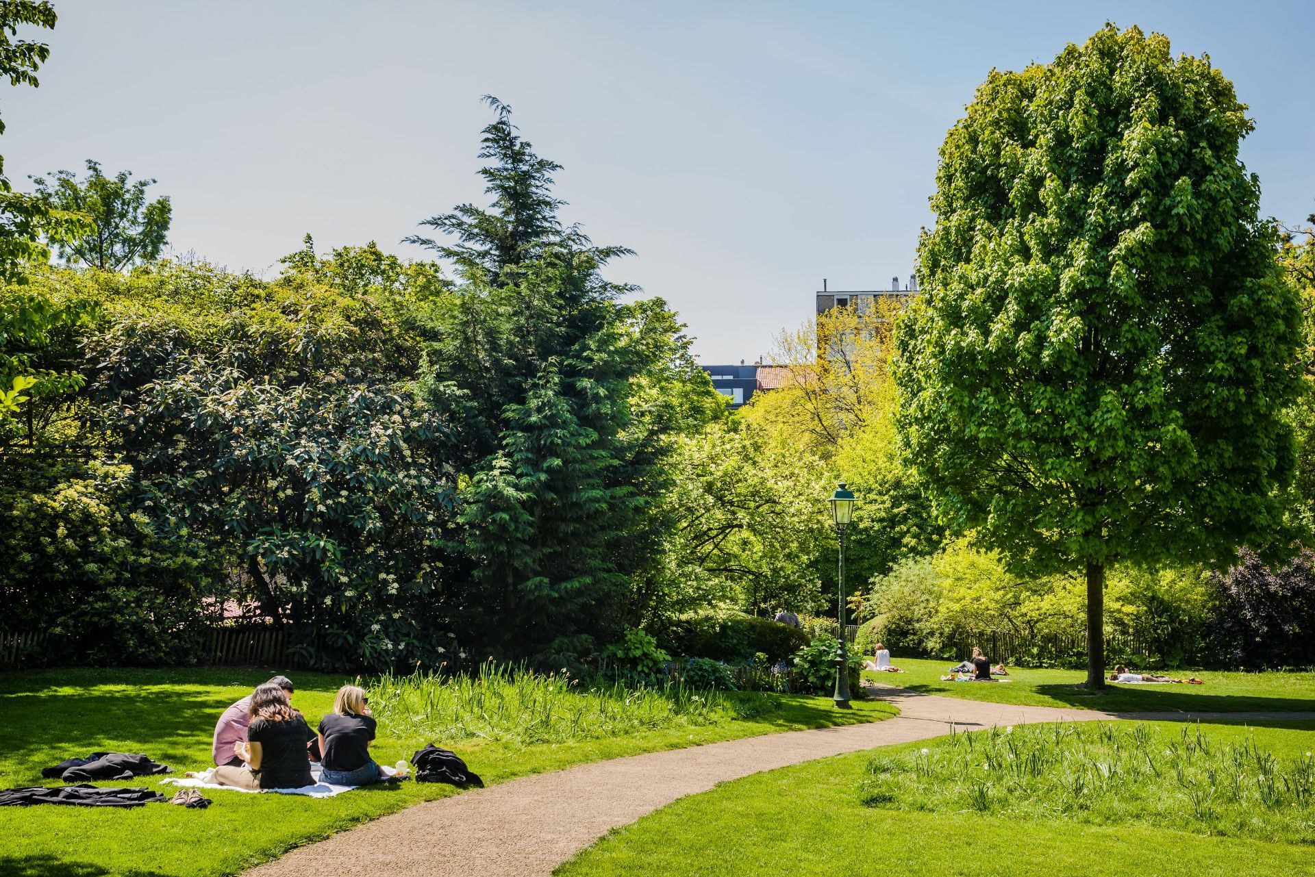
What gives the park its character is its sense of quiet design. It has the feel of a carefully tended urban refuge, with winding paths, dense planting, and enough variation in shape and texture to make a simple walk interesting. A lesser-known fact is that the park occupies a site with a layered urban past and was shaped to preserve greenery in a neighborhood that might otherwise have become entirely built up. Another detail many visitors notice only after spending time there is how different it feels from Brussels’ larger public parks: rather than broad ceremonial lawns, it offers an almost garden-like intimacy that makes it feel close to the life of the surrounding streets.
For visitors, Parc Tenbosch works best as a pause. It is where you go after lunch, before a museum visit, or between neighborhood explorations. Because Ixelles is one of Brussels’ most varied and walkable districts, the park can fit naturally into a day that also includes Flagey, Avenue Louise, the Châtelain area, or a coffee stop nearby. That flexibility is part of what makes it worthwhile. You are not just visiting a park; you are using it as a calm anchor in one of the city’s busiest residential areas.
The park is also a good reminder that urban travel does not always have to revolve around top-tier landmarks. Sometimes the most memorable part of a city is a place where the pace drops, the noise softens, and you get a sense of how residents actually use public space.
The easiest way to get there is usually on foot, by tram, or by a short taxi or rideshare journey from central Brussels. If you are already exploring Ixelles, the park is one of the simplest green spaces to include along the way. Public transport is convenient if you are coming from farther away, but the park is compact enough that many visitors simply fold it into a wider neighborhood walk.
Because it is a neighborhood park, it is best enjoyed at a relaxed pace. Plan a short stop rather than a formal excursion, and let it serve as a quiet counterpoint to the surrounding city.
Bring a book, snack, or coffee if you want to stay a while. The atmosphere is good for sitting and watching the neighborhood pass by.
Keep expectations aligned with the scale of the park. Its charm comes from tranquility and atmosphere, not from grand size or a long list of facilities.
Combine it with the surrounding district. Ixelles offers cafés, streets, and cultural stops that pair naturally with a park visit.
If the weather is pleasant, go in the afternoon or early evening. That is often when the space feels most welcoming and the light is best for a walk.
Discover more hidden gems you might love.
Berlin
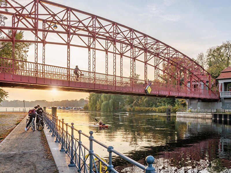
## Description **Tegeler See** is one of Berlin’s largest and most beloved lakes, offering a rare combination of **deep forest landscapes, wide open water, historic promenades, and recreational freedom** within a major European capital. Unlike the carefully curated parks of central Berlin, Tegeler See feels **expansive, natural, and quietly powerful**, a place where the city dissolves into wind, water, and tree canopy. The lake stretches across the northern edge of Berlin and forms part of a much larger **interconnected water system** linking rivers, canals, and smaller lakes. Its shoreline alternates between **elegant promenades, dense woodland, sandy bathing areas, hidden coves, and small harbors**, giving every section a distinct character. On one walk you might pass joggers and cyclists near cafés, and moments later find yourself alone on a forested shoreline with only birds and passing sailboats for company. What makes Tegeler See especially unique is its **scale and visual openness**. The lake is wide enough to feel almost coastal in certain sections. Wind patterns shape large ripples across the surface, and on clear days the sky reflects endlessly into the water. Sailboats, paddleboards, kayaks, ferries, and swimmers all share the same space, creating an ever-moving ecological and recreational system. The western and northern edges of the lake are bordered by the **Tegel Forest (Tegeler Forst)**, one of Berlin’s largest continuous woodland zones. This forest contains long hiking paths, wildlife corridors, thick pine stands, and historic hunting routes that once served Prussian royalty. This direct interface between **urban lake and protected forest** is one of Tegeler See’s defining strengths. Few European capitals offer this scale of natural immersion without leaving city limits. From an urban perspective, the lake is closely tied to the borough of **Reinickendorf** and the historic district of **Alt-Tegel**. The Alt-Tegel promenade along the eastern shoreline functions as a social spine, lined with restaurants, ice cream shops, boat docks, beer gardens, and terraces overlooking the water. This area transforms in summer into one of Berlin’s most relaxed outdoor social scenes, blending families, cyclists, couples, and long-term residents. A little-known fact is that Tegeler See was once part of the **Havel River’s natural floodplain system**, and its modern form is the result of long-term hydraulic engineering dating back centuries. Another lesser-known detail is that the famous German poet and philosopher **Gotthold Ephraim Lessing** once lived near the lake, and the nearby Tegel Palace was home to the Humboldt family, including **Alexander von Humboldt**, one of history’s most influential natural scientists. Tegeler See’s emotional identity is shaped by **seasonality**. In spring, the forest releases fresh green layers and migrating birds return. Summer brings swimming, paddleboarding, lakeside dining, and long evening sunsets. Autumn covers the surrounding hills in gold and copper tones. Winter transforms the lake into a minimalist landscape of cold light, mist, and silence, occasionally frozen at the edges. Unlike Berlin’s central landmarks, Tegeler See does not present itself as a destination of spectacle. Its appeal is built on **duration rather than intensity**. People do not come for a single photo; they come to spend hours walking, reading, boating, cycling, swimming, and simply existing beside water and forest. It is one of the few places in Berlin where **time visibly slows down**. In a city often defined by density, history, and cultural pressure, Tegeler See functions as a **pressure valve**. It absorbs excess motion and releases calm. ## Location **Tegeler See** is located in **northwestern Berlin**, primarily within the borough of **Reinickendorf**, near the historic district of **Tegel**. **City:** Berlin **State (Region):** Berlin **Country:** Germany **Primary Area:** Reinickendorf / Alt-Tegel ### How to Get There: * **By S-Bahn:** * Take **S25** to **Tegel Station**, then walk 10 minutes to the lakeside. * **By U-Bahn:** * Take **U6** to **Alt-Tegel**, which places you directly at the main promenade. * **By bus:** Multiple bus routes connect Tegel with central and northern Berlin. * **By bicycle:** A well-developed bike network connects Tegeler See to the city center. * **By car:** Parking is available but is limited on busy summer days. The lake is easily combined with visits to **Alt-Tegel old town, Tegel Forest hiking trails, and the Havel River network**. ## Tips * **Visit on weekdays if you prefer quiet:** Weekends can be very busy in summer. * **Walk both the promenade and the forest side:** Each offers a completely different experience. * **Bring swimwear in summer:** Designated bathing areas are popular and well maintained. * **Sunset is the most atmospheric time:** Especially from western shoreline viewpoints. * **Boat rentals are widely available during the warm season.** * **Dress for wind:** The open water creates noticeable temperature shifts. * **Combine with Alt-Tegel dining:** Lakeside restaurants are a core part of the experience. * **Winter visits are underrated:** The silence and mist create a dramatic, cinematic mood. ## Conclusion **Tegeler See** is Berlin at its most expansive and elemental. It is where the city trades architecture for horizon, traffic for water movement, and density for breathing space. By uniting forest, lake, promenade, and history into one continuous landscape, Tegeler See offers a version of Berlin that is **slower, wider, and deeply restorative**. ## FAQ **1. Is Tegeler See suitable for swimming?** Yes. Several **official bathing areas** operate during the summer season. **2. Can you rent boats on Tegeler See?** Yes. **Paddleboats, kayaks, and small sailboats** are available for rent. **3. Is Tegeler See family-friendly?** Yes. It is widely used by **families, cyclists, walkers, and swimmers**. **4. How long does it take to walk around Tegeler See?** Walking the full perimeter can take **2.5 to 4 hours**, depending on pace and route. **5. Is Tegeler See good in winter?** Yes, especially for **quiet walks, photography, and forest exploration**. **6. Is there wildlife around the lake?** Yes. The area supports **water birds, foxes, deer, and diverse forest species**. ## Links * [Visit Berlin](https://www.visitberlin.de)
GemVoyage Team • World

San Juan Teotihuacan
## Description Teotihuacan is a vast pre-Columbian city in central Mexico, dominated by two monumental pyramids — the Pyramid of the Sun and the Pyramid of the Moon — flanking the broad Avenue of the Dead. Once among the largest cities in the ancient world, Teotihuacan’s orthogonal layout, apartment compounds and expansive plazas reflect a complex urban society with far-reaching trade and ritual connections across Mesoamerica. The scale of Teotihuacan is what first seizes visitors: broad causeways, stepped pyramids and the linear discipline of its urban plan. Archaeologists have uncovered multi-storey apartment compounds, market areas and ceremonial platforms that together suggest a dense, highly organized city capable of hosting tens of thousands of residents at its peak. A walk along the Avenue of the Dead reveals architectural rhythms and sightlines intentionally designed to focus processions and ritual movement toward the city’s great pyramids. Climbing the Pyramid of the Sun rewards visitors with sweeping panoramas across the valley and a visceral sense of how the site would have been experienced in antiquity. The Pyramid of the Moon at the northern end of the avenue faces a ceremonial plaza that preserves carved stones and remnants of ritual deposits. Murals and painted architectural fragments found in residential and administrative compounds hint at complex iconography, trade networks reaching into Oaxaca and the Gulf coast, and religious ideas that later influenced the Aztecs. Teotihuacan continues to be a dynamic archaeological landscape: excavations reveal changing construction phases, evidence of craft production zones, and records of trade in obsidian and pottery that tie the city to a broader Mesoamerican world. While key questions remain — notably about the language(s) spoken by Teotihuacanos and the political organization behind the city’s monumental building — continuing research and improved visitor interpretation make Teotihuacan a compelling stop for history-minded travelers. ## Location Teotihuacan lies northeast of Mexico City and is easily accessible by road from the capital; many visitors use organized tours or public buses that run from Mexico City to the archaeological site. The site is about a 45–60 minute drive from the city center depending on traffic, and combined visits with nearby San Juan Teotihuacán village make for a full-day itinerary. ## Tips - **Go early to avoid heat and crowds:** Morning visits are more comfortable and quieter for photography, and the light makes the relief of murals and stonework more legible. - **Wear comfortable shoes and sun protection:** The site is extensive and largely exposed to the sun; pack a hat, sunscreen and plenty of water. - **Hire a licensed guide or join a small-group tour:** Local guides provide archaeological context, point out lesser-known structures and mural fragments, and explain the complex iconography visitors otherwise miss. - **Visit the on-site museum and neighboring sites:** The Museo de Sitio de Teotihuacán houses ceramics, figurines and explanatory panels; pair your visit with nearby craft markets and the ethnographic displays in San Juan Teotihuacán. - **Use public transport or book reliable transfers:** If driving from Mexico City, leave early to avoid congestion and allow time for parking or shuttle transfers. ## Conclusion Teotihuacan’s monumental urban presence offers a powerful sense of ancient civic order and ritual life; its pyramids and avenue remain compelling for history and archaeology enthusiasts alike. Whether you are a casual visitor drawn by striking panoramas or a history lover seeking layered archaeological narratives, Teotihuacan provides a measurable sense of scale, ritual planning and cultural connections that shaped central Mexico for centuries. ## FAQ - **Q: Can you climb the pyramids at Teotihuacan?** A: Access policies change for conservation reasons; sections of the Pyramid of the Sun have been open at times while other monuments may be restricted. Check the site’s official notices before travel and respect closures for preservation. - **Q: How long should I plan for a visit to Teotihuacan?** A: Allocate 3–5 hours for a meaningful visit: climb one pyramid, explore the plaza areas, and visit the on-site museum. Half-day visits are common; a whole day allows more relaxed exploration and time for nearby attractions. - **Q: Is Teotihuacan suitable for families and children?** A: Yes — families will find the wide avenues and open plazas easy to navigate, but bring shade, water, and comfortable walking shoes for younger children. - **Q: Are there good photography spots and when is the best light?** A: Early morning and late afternoon provide the best directional light for texture and color; the area by the Pyramid of the Sun’s summit and viewpoints along the Avenue of the Dead are popular for wide-angle shots. - **Q: What should I know about safety and facilities?** A: The site is generally safe for tourists; basic facilities include restrooms and food stalls near the entrance, but services are limited inside the archaeological zone. Keep valuables secure and follow guidance from official staff. ## Links - [Teotihuacan — Wikipedia](https://en.wikipedia.org/wiki/Teotihuacan)
GemVoyage Team • World
Stavanger
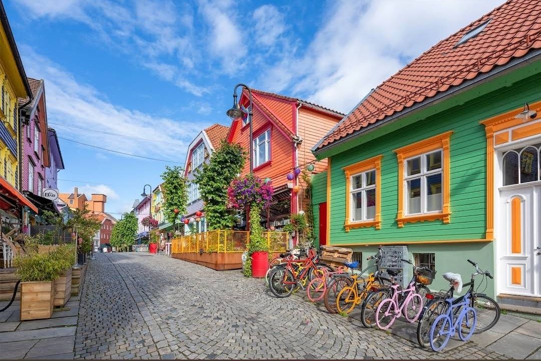
## Description **Fargegaten** stands out as one of Norway’s most visually striking streets, where entire facades burst with vivid hues. This creative transformation turned a once-dull, quiet lane into a lively, Instagram-worthy pedestrian hotspot. What started as a revitalization project has become a beloved urban gem. **Little-known facts**: * The idea originated with a local hairdresser, **Tom Kjørsvik**, who spearheaded the project to breathe life back into the street—work that stretched over four years and required approval from both landlords and the city council. * Some of the color inspirations came from retro aesthetics: the artist **Craig Flannagan**, responsible for choosing the palette, drew from influences like the 1970s TV show *Miami Vice*. --- ## Location Fargegaten is located in **Stavanger**, within the **Rogaland** county of **Norway**—specifically on the eastern stretch of **Øvre Holmegate**, between Kirkegata and Østervåg. ### How to get there * It’s easy to reach on foot from Stavanger’s city centre—just follow signs toward Øvre Holmegate. * You can also hop off at **Bus stop 10** on local sightseeing bus routes, which stop nearby. --- ## Tips * To make the most of your visit, come with your camera ready—Fargegaten is one of the most Instagrammable spots in Stavanger. * The street is pedestrian-only since **2005**, making for a relaxed, car-free experience. * Explore niche boutiques like *Den Syvende Himmel*, *Kjoledamen*, and *Bernina’s sewing shop*. From a barbershop or tattoo parlor to a dress store with handmade silkscreen prints—Fargegaten has something for curious shoppers. * After shopping, treat yourself to local flavors at one of the cozy cafés or bars. It’s a joy to sit and watch the street come alive with color and community. --- ## Conclusion Fargegaten in Stavanger is more than a pretty street—it's a community-driven masterpiece. From a faded, overlooked lane to a radiant display of color and culture, it’s a testament to local creativity, persistence, and transformation. Whether you're snapping photos, exploring boutiques, or simply soaking in the atmosphere, Fargegaten offers a joyful, memorable slice of Stavanger life. --- ## FAQ **1. Why is it called Fargegaten?** “Fargegaten” translates to “The Colour Street,” a nickname earned from its boldly painted façades that made the once-quiet Øvre Holmegate a vivid landmark. **2. Who came up with the idea to paint the street?** A local hairdresser named **Tom Kjørsvik** initiated the project, aiming to revive the neglected street. The transformation spanned over four years, involving landlords, the city council, and artist Craig Flannagan to plan the color scheme. **3. Is Fargegaten suitable for families?** Absolutely—it's pedestrian-friendly, safe, and fun to explore. With boutiques, cafés, and colorful surroundings, it offers a lively but relaxed experience that’s great for all ages. **4. What types of shops can I find there?** Expect niche boutiques, dress shops like *Den Syvende Himmel*, sewing stores like *Bernina*, barbershops, tattoo parlors, and even a store offering handmade silkscreen clothing prints (Kant). **5. Can you drive there?** No—Fargegaten has been a pedestrian-only street since 2005, and additional sections between Skagenkaien and Kirkegata were later closed to cars, making for a safe and pleasant stroll. **6. What's the best time to visit?** Any time during daylight is best—colorful façades stand out beautifully under natural light, making for perfect photo conditions and cheerful ambiance. --- ## Links * [Visit Norway](https://www.visitnorway.com/) * [Fargegaten Information](https://www.visitnorway.com/places-to-go/fjord-norway/the-stavanger-region/listings-stavanger/fargegaten-%C3%98vre-holmegate-the-colourful-street/235310/)
GemVoyage Team • World
Cairo
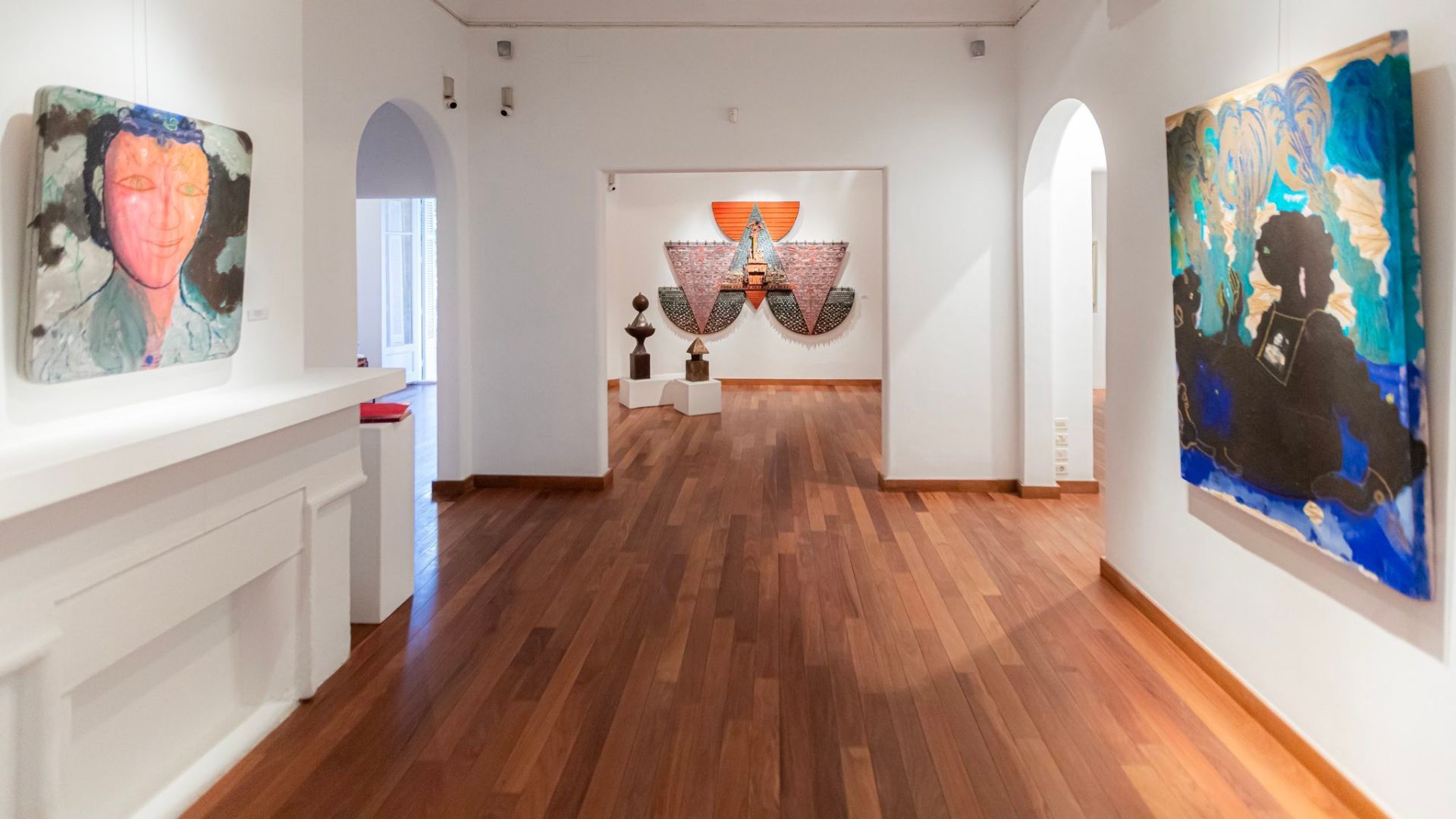
## Description Zamalek is one of Cairo's most elegant and culturally layered neighborhoods, and its art galleries give it a character that feels distinct from the city's more hurried commercial districts. Set on Gezira Island in the Nile, the area blends leafy streets, embassies, old villas, cafes, and a compact but lively contemporary art scene. Visitors come here for more than just one gallery; they come for the atmosphere of walking through a district where art, architecture, and everyday Cairo life overlap in a way that feels intimate and refined. What makes Zamalek special is how accessible its creative life is. Many galleries are tucked into residential streets or historic buildings, so the experience is as much about discovery as it is about the exhibitions themselves. You can move from one space to another on foot, stopping for coffee, browsing small bookstores, or taking in the shade of the trees that line the streets. The district has long attracted diplomats, artists, writers, and collectors, which has helped shape a culture that values conversation and experimentation. One little-known fact is that Zamalek's modern identity was influenced by the island's role in late 19th and early 20th century urban planning, when it became a showcase for Cairo's cosmopolitan elite. Another is that several of the area's smaller galleries change their exhibitions frequently, so repeat visits can feel completely different from one month to the next. That makes Zamalek especially rewarding for travelers who enjoy current art rather than static museum visits. The galleries themselves often highlight a wide range of work: painting, mixed media, sculpture, photography, printmaking, and conceptual installations. Some spaces represent established Egyptian artists, while others support younger voices and cross-disciplinary projects. As a result, you may encounter work that speaks to Cairo's daily life, regional politics, identity, memory, urban transformation, or the relationship between traditional craft and contemporary expression. Zamalek is also a good place to slow down. Cairo can be intense, and this neighborhood gives you a softer rhythm. Between gallery visits, you can wander down quiet streets, notice historic facades, and enjoy views of the river. The district's cultural character is not confined to exhibition halls; it extends into bookshops, design stores, and cafes where artists and students often gather. This makes the area feel like a living creative ecosystem rather than a tourist display. For travelers interested in culture, Zamalek is one of the most rewarding ways to experience Cairo beyond its major monuments. It reveals how contemporary Egyptian creativity lives alongside the city's long historical memory. If you want an afternoon that combines urban charm, art, and a sense of place, Zamalek delivers that with very little effort and a lot of style. ## Location Zamalek is a district on Gezira Island in the Nile River, within Cairo, Egypt. It sits in the central part of the city and is connected to both riverbanks by bridges, making it easy to reach from Downtown Cairo, Garden City, or Giza. Because the area is compact, many art galleries are best explored on foot once you arrive. The most practical way to get there is by taxi or ride-hailing service, especially if you are moving between different neighborhoods in Cairo. Public transport is also possible, but first-time visitors usually find it simpler to be dropped near a known landmark in Zamalek and then walk from gallery to gallery. If you are staying in central Cairo, the trip is usually short, though traffic can be heavy during peak hours. ## Tips Visit in the late morning or early afternoon if you want a quieter gallery experience and easier walking between venues. Check exhibition schedules in advance, because some galleries close between shows or rotate their collections frequently. Wear comfortable shoes. Zamalek is walkable, but you may cover more distance than expected if you plan to visit several galleries in one day. Pair the galleries with a cafe stop or lunch break. The neighborhood rewards unhurried exploration, and a meal between visits helps you take in the atmosphere without rushing. If you are serious about collecting or meeting artists, do not hesitate to ask gallery staff questions. Many spaces are small and personal, and conversations are often part of the experience. Keep some flexibility in your itinerary. The best discovery in Zamalek is often an unexpected side street, a temporary exhibit, or a gallery you did not plan to visit. ## Conclusion Zamalek's art galleries offer a polished but approachable introduction to Cairo's contemporary creative life, making the district ideal for visitors who want culture, walkability, and a distinct local atmosphere in one compact neighborhood. ## FAQ ### What is Zamalek known for? Zamalek is known for its leafy streets, embassies, historic villas, cafes, and a strong concentration of art galleries and cultural spaces. ### How long should I spend in Zamalek for gallery hopping? A half day is usually enough for a relaxed visit, but art lovers may want a full day to combine galleries with cafes, shops, and riverside walks. ### Is Zamalek safe for visitors? It is generally considered one of Cairo's calmer neighborhoods, especially during the day. As with any large city, basic travel awareness is still recommended. ### Are the galleries free to enter? Some galleries are free, while others may charge for special exhibitions or events. It is best to check in advance. ## Links - [Zamalek](https://en.wikipedia.org/wiki/Zamalek) - [Zamalek Art Gallery on Facebook](https://www.facebook.com/zamalekartgallery)
GemVoyage Team • World
.jpg)
Scotland
## Description The Fairy Pools on the Isle of Skye in Scotland are a series of crystal-clear, aqua-blue pools and cascading waterfalls that tumble down from the foothills of the Black Cuillin mountains. These natural pools, fed by the Allt Coire a’ Mhadaidh stream, are renowned for their ethereal beauty and have become one of Skye’s most iconic and photographed attractions. Whether you're a hiker, wild swimmer, or simply a lover of dramatic landscapes, the Fairy Pools offer a magical experience that feels straight out of folklore. The walk to the pools is relatively short—about 2.4 kilometers round trip—and follows a well-maintained gravel path that winds through heather-covered moorland. Along the way, visitors encounter a series of waterfalls and pools, each more striking than the last. The water is so clear that you can see the rocky bottoms and reflections of the surrounding hills, making it a favorite spot for photographers and nature enthusiasts. A little-known fact: the area around the Fairy Pools was the site of the last and bloodiest clan battle in Scottish history—the Battle of Coire na Creiche in 1601 between the MacLeods of Dunvegan and the MacDonalds of Sleat. Legend has it that the stream ran red with blood, a stark contrast to its current tranquil appearance. Another quirky detail is that despite their name, there’s no historical association with fairies—the name “Fairy Pools” only began appearing in guidebooks in the 20th century. ## Location The Fairy Pools are located in **Scotland**, on the **Isle of Skye**, near the village of **Carbost** in the **Highland region**. They sit at the base of the Black Cuillin mountains in **Glen Brittle**, on the western side of the island. ### How to Get There - **By Car**: From Portree, the island’s main town, it’s about a 30-minute drive (20.5 miles) via the B8009 and Glenbrittle road. The route includes single-track roads with passing places. - **By Bus**: Public transport is limited. Buses run to Carbost, but you’ll need to arrange a taxi or walk from there. - **By Tour**: Several guided tours from Portree or Inverness include the Fairy Pools as part of a day trip. - **By Foot**: The walk to the pools begins at the Fairy Pools car park, located near Glenbrittle. From the car park, it’s a 20-minute walk to the first waterfall. ## Tips - **Visit Early or Late**: The site gets crowded during peak hours, especially in summer. Early morning or late afternoon offers better light and fewer visitors. - **Wear Waterproof Footwear**: The path can be muddy and uneven, especially after rain. - **Bring Layers**: Weather on Skye is unpredictable. Pack a waterproof jacket and warm clothing. - **Wild Swimming**: Brave souls can swim in the pools, but the water is icy year-round. A wetsuit is recommended. - **Respect Nature**: Follow the Scottish Outdoor Access Code—take your litter with you and stick to marked paths. - **Parking**: There is a charge for parking at the Fairy Pools car park, which helps maintain the site. ## Conclusion The Fairy Pools on the Isle of Skye are a breathtaking blend of natural beauty and Highland mystique. With their vivid waters, dramatic mountain backdrop, and rich history, they offer a memorable experience for anyone exploring Scotland’s rugged landscapes. ## FAQ **1. Is there an entrance fee to visit the Fairy Pools?** No, the pools are free to visit, but there is a charge for parking. **2. How long is the walk to the Fairy Pools?** The round-trip walk is approximately 2.4 kilometers and takes 40 minutes to 1.5 hours depending on pace and stops. **3. Can I swim in the Fairy Pools?** Yes, wild swimming is allowed, but the water is extremely cold. A wetsuit is recommended. **4. Are the Fairy Pools suitable for children?** Yes, but children should be supervised due to uneven terrain and cold water. **5. Is the site wheelchair accessible?** No, the terrain is rugged and includes steep inclines, making it unsuitable for wheelchairs. **6. What is the best time of year to visit?** Spring and autumn offer mild weather and fewer crowds. Summer is busiest, while winter can be icy and less accessible. ## Links - [Fairy Pools Walk – Isle of Skye Guide](https://www.isleofskye.com/skye-guide/top-ten-skye-walks/fairy-pools) - [Fairy Pools – VisitScotland Overview](https://www.visitscotland.com/info/see-do/fairy-pools-p1770011) - [Fairy Pools – Wikipedia Entry](https://en.wikipedia.org/wiki/Fairy_Pools) Description The Fairy Pools on the Isle of Skye in Scotland are a series of crystal-clear, aqua-blue pools and cascading waterfalls that tumble down from the foothills of the Black Cuillin mountains. These natural pools, fed by the Allt Coire a’ Mhadaidh stream, are renowned for their ethereal beauty and have become one of Skye’s most iconic and photographed attractions. Whether you're a hiker, wild swimmer, or simply a lover of dramatic landscapes, the Fairy Pools offer a magical experience that feels straight out of folklore. The walk to the pools is relatively short—about 2.4 kilometers round trip—and follows a well-maintained gravel path that winds through heather-covered moorland. Along the way, visitors encounter a series of waterfalls and pools, each more striking than the last. The water is so clear that you can see the rocky bottoms and reflections of the surrounding hills, making it a favorite spot for photographers and nature enthusiasts. A little-known fact: the area around the Fairy Pools was the site of the last and bloodiest clan battle in Scottish history—the Battle of Coire na Creiche in 1601 between the MacLeods of Dunvegan and the MacDonalds of Sleat. Legend has it that the stream ran red with blood, a stark contrast to its current tranquil appearance. Another quirky detail is that despite their name, there’s no historical association with fairies—the name “Fairy Pools” only began appearing in guidebooks in the 20th century. Location The Fairy Pools are located in Scotland, on the Isle of Skye, near the village of Carbost in the Highland region. They sit at the base of the Black Cuillin mountains in Glen Brittle, on the western side of the island. How to Get There By Car: From Portree, the island’s main town, it’s about a 30-minute drive (20.5 miles) via the B8009 and Glenbrittle road. The route includes single-track roads with passing places. By Bus: Public transport is limited. Buses run to Carbost, but you’ll need to arrange a taxi or walk from there. By Tour: Several guided tours from Portree or Inverness include the Fairy Pools as part of a day trip. By Foot: The walk to the pools begins at the Fairy Pools car park, located near Glenbrittle. From the car park, it’s a 20-minute walk to the first waterfall. Tips Visit Early or Late: The site gets crowded during peak hours, especially in summer. Early morning or late afternoon offers better light and fewer visitors. Wear Waterproof Footwear: The path can be muddy and uneven, especially after rain. Bring Layers: Weather on Skye is unpredictable. Pack a waterproof jacket and warm clothing. Wild Swimming: Brave souls can swim in the pools, but the water is icy year-round. A wetsuit is recommended. Respect Nature: Follow the Scottish Outdoor Access Code—take your litter with you and stick to marked paths. Parking: There is a charge for parking at the Fairy Pools car park, which helps maintain the site. Conclusion The Fairy Pools on the Isle of Skye are a breathtaking blend of natural beauty and Highland mystique. With their vivid waters, dramatic mountain backdrop, and rich history, they offer a memorable experience for anyone exploring Scotland’s rugged landscapes. FAQ 1. Is there an entrance fee to visit the Fairy Pools? No, the pools are free to visit, but there is a charge for parking. 2. How long is the walk to the Fairy Pools? The round-trip walk is approximately 2.4 kilometers and takes 40 minutes to 1.5 hours depending on pace and stops. 3. Can I swim in the Fairy Pools? Yes, wild swimming is allowed, but the water is extremely cold. A wetsuit is recommended. 4. Are the Fairy Pools suitable for children? Yes, but children should be supervised due to uneven terrain and cold water. 5. Is the site wheelchair accessible? No, the terrain is rugged and includes steep inclines, making it unsuitable for wheelchairs. 6. What is the best time of year to visit? Spring and autumn offer mild weather and fewer crowds. Summer is busiest, while winter can be icy and less accessible. Links Fairy Pools Walk – Isle of Skye Guide Fairy Pools – VisitScotland Overview Fairy Pools – Wikipedia Entry 715 words37 lines4484 characters4520 bytes
GemVoyage Team • World
New York
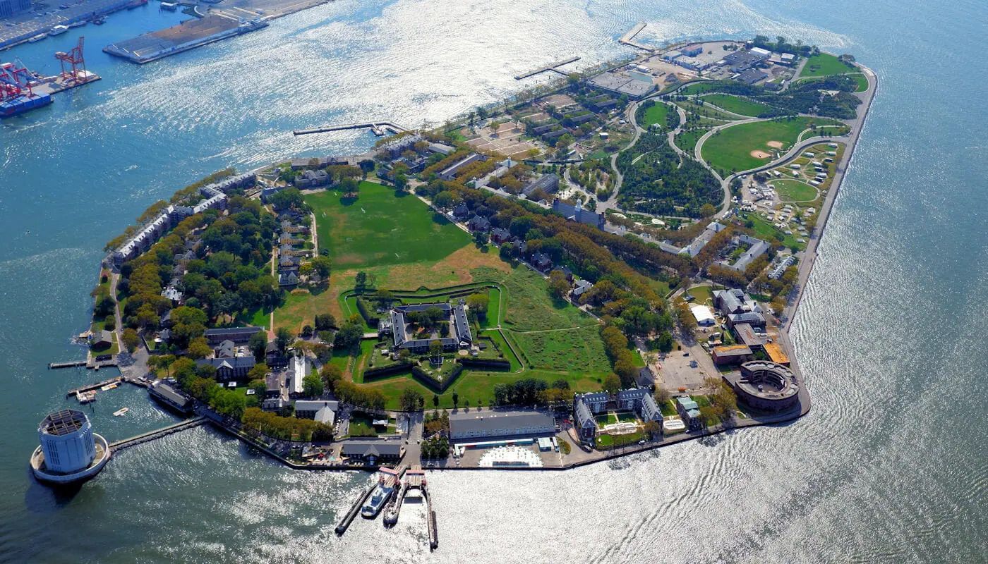
## Description Governors Island is one of New York City's best day trip destinations because it combines harbor views, historic buildings, open green space, and a sense of distance from the city without actually leaving it. The island feels spacious and refreshing in a way that is rare in Manhattan, making it appealing to visitors who want a slower rhythm, bike paths, and outdoor relaxation. The experience is especially strong in warm weather, when the ferry ride itself becomes part of the outing and the skyline views are at their most memorable. What makes Governors Island particularly interesting is that it has moved from a former military and administrative site to a public destination with recreation, arts, and heritage uses. A lesser-known fact is that much of the island's character comes from its reuse: old structures now sit alongside lawns, paths, and public programming. Another detail many first-time visitors appreciate is how easy it is to build a flexible day there, whether you want to picnic, explore, rent bikes, or simply enjoy the harbor air. ## Location Governors Island is in New York Harbor, just south of Manhattan in the United States. It is reached by ferry from designated terminals in Manhattan and sometimes Brooklyn, depending on the season and service schedule. Because access is by boat, the visit naturally feels like a break from the city. The short ride is part of what makes the island appealing and memorable. The best way to visit is to check ferry times ahead of time and plan enough hours on the island to make the crossing worthwhile. Once there, the grounds are easy to explore on foot or by bike. It is one of the most straightforward and rewarding day trips in the New York area. ## Tips - Check the ferry schedule before you go so you can make the most of your time on the island. - Bring food, water, or a picnic plan if you want to enjoy the green space more fully. - Rent a bike if you want to see more of the island without spending the whole day walking. - Go in good weather if possible, since the outdoor setting is a major part of the appeal. - Bring layers, because harbor breezes can make the island feel cooler than Manhattan. - Leave time for skyline views on the return ferry, which are often one of the highlights. ## Conclusion Governors Island is one of the easiest ways to feel removed from New York City while still being within sight of it. Its combination of history, green space, and harbor views makes it an excellent, low-stress escape. ## FAQ ### How do I get to Governors Island? You usually take a ferry from Manhattan or, depending on the season, from Brooklyn. The ferry is simple to use and is part of the experience because it gives you immediate harbor and skyline views. ### Is Governors Island worth visiting for a short trip? Yes, but it is even better if you have several hours. The island's appeal comes from unhurried exploration, open space, and the ferry ride itself, so a longer visit feels more rewarding. ### Can I bike there? Yes, and biking is one of the best ways to cover more ground. The island is well suited to cycling because it is relatively open and easy to navigate. ### Is it family-friendly? Very much so. Families often appreciate the car-free environment, open lawns, and relaxed pace. It is one of the more comfortable outdoor outings in the New York area. ### What should I bring? Water, comfortable walking shoes, sun protection, and perhaps food if you want a picnic. Because the island is such a good open-air destination, it helps to prepare for spending most of the day outside. ## Links - [Official website](https://www.govisland.com/) - [Wikipedia](https://en.wikipedia.org/wiki/Governors_Island)
GemVoyage Team • World

Comments