GemVoyage Team • World
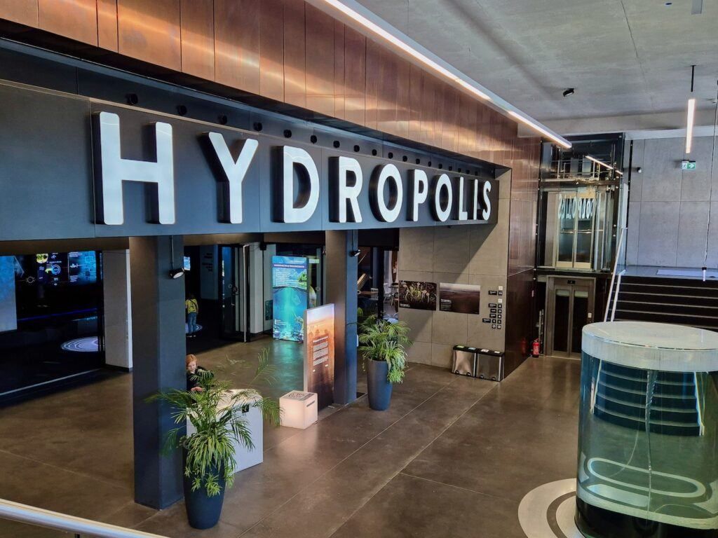
Hydropolis is a modern, science-focused museum in Wrocław dedicated entirely to water—its origins, physical properties, role in shaping civilizations, and importance for life on Earth. Opened in 2015, Hydropolis stands out not as a traditional museum of static displays, but as a fully interactive knowledge center that combines multimedia installations, scientific exhibits, and immersive environments to explain one of humanity’s most essential resources.
Housed inside a 19th-century underground water reservoir, the museum cleverly connects content and setting. The massive brick structure, once used to store drinking water for the city, now forms a dramatic backdrop for exhibitions that explore oceans, rivers, rainfall, hydraulic engineering, and water management. This reuse of industrial heritage is central to Hydropolis’s identity and adds authenticity to the experience.
What makes Hydropolis unique is its interdisciplinary approach. Visitors move through themed zones covering topics such as deep-sea exploration, water in the human body, ancient hydraulic systems, modern urban water infrastructure, and global water challenges. High-resolution projections, touchscreens, soundscapes, and scale models keep the content accessible without oversimplifying complex scientific concepts.
A lesser-known fact is that the building itself was a technical masterpiece of its time, constructed in 1893 and hidden underground to preserve water temperature and pressure. Another interesting detail is that Hydropolis devotes significant space to Poland’s relationship with water, including flood control on the Oder River and Wrocław’s long history of bridges, canals, and engineering solutions.
Hydropolis appeals to a wide audience: families, students, engineers, and travelers interested in science, sustainability, or innovative museums.
Country: Poland
Region: Lower Silesia
City: Wrocław
Hydropolis is located east of Wrocław’s Old Town, near the Oder River, in an area known for cultural institutions and green spaces.
* Several tram lines stop within walking distance, connecting the site to the Old Town and main railway station.
* City buses serve the surrounding district with frequent service.
* About a 25–30 minute walk from the Market Square (Rynek).
* Parking is available nearby, though public transport is often more convenient.
Hydropolis is one of Poland’s most innovative museums, transforming a historic water reservoir into a compelling educational space. By blending science, history, and modern technology, it offers a deep yet engaging look at water’s role in shaping the planet and human society, making it a must-visit attraction in Wrocław.
1. What is Hydropolis about?
It is an interactive museum focused entirely on water—its science, history, and global importance.
2. Is Hydropolis suitable for children?
Yes. The exhibits are highly interactive and well-suited for families and school groups.
3. How long does a visit take?
Most visitors spend 2 to 3 hours.
4. Is there an entrance fee?
Yes. Tickets are required, with discounts for children, students, and families.
5. Is Hydropolis accessible for people with disabilities?
Yes. The facility is designed to be fully accessible.
6. Is it worth visiting if I’m not interested in science?
Yes. The visual design and storytelling make the experience engaging even for non-technical visitors.
Discover more hidden gems you might love.
Siena
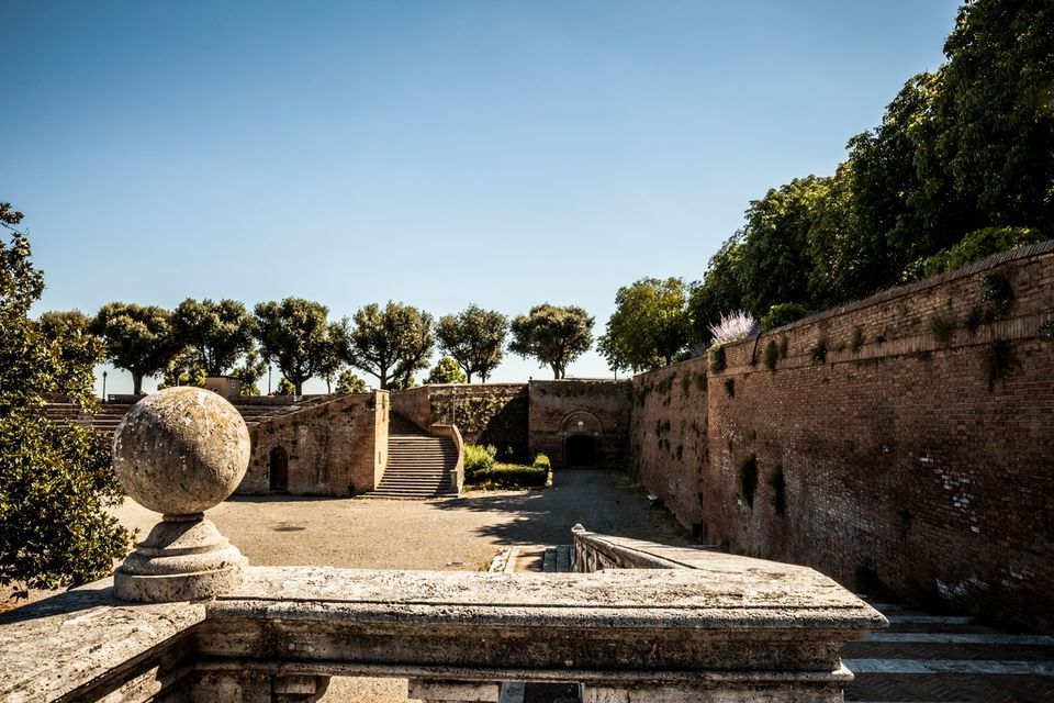
## Description Fortezza Medicea is one of Siena's most imposing landmarks because it represents a different historical layer from the city's medieval churches and squares. Built after Siena's defeat by Florence, the fortress reflects Medici power and the political reshaping of the region during the Renaissance. Unlike a decorative palace or a purely ceremonial monument, it was designed for strategic control and military presence. Today, however, it functions as a public space where history, viewpoints, and local life meet in a surprisingly relaxed way. The fortress is memorable because of its scale and shape. Its bastioned walls form a strong geometric presence above the city, and the elevated position gives visitors sweeping views over Siena and the surrounding Tuscan landscape. That combination of fortification and panorama makes it especially rewarding for travelers who appreciate places where architecture tells a political story. The walls are not just old stone; they are evidence of conquest, rule, and the reshaping of urban space. One little-known fact is that the fortress became less about defense over time and more about civic and cultural use, showing how military architecture can be repurposed for public life. Another detail many visitors miss is how the fortress helps explain the relationship between Siena and Florence. It is not just a monument standing above the city but a reminder of an era when regional power was expressed through earthworks, bastions, and visible control of the landscape. Visitors often appreciate the fortress for its calm atmosphere. While the city center of Siena can be bustling with tourists, the Fortezza Medicea feels more open and spacious. It is a good place to pause, look out across rooftops and hills, and understand how Siena sits within the broader Tuscan setting. If you are interested in military history, urban viewpoints, or Renaissance politics, the fortress is one of the city's most significant stops. ## Location Fortezza Medicea is in Siena, in Tuscany, Italy, just north of the historic center and within walking distance of major city attractions. Because it sits on elevated ground near the old core, it is easy to include in a walking tour of Siena, though the approach may involve some uphill sections depending on your starting point. If you are coming from Piazza del Campo or the cathedral area, the walk to the fortress is straightforward and can be done on foot. Buses and taxis can take you close as well, but walking is usually the best option because it lets you experience the transition from Siena's dense medieval streets to the more open fortified landscape. The most practical recommendation is to visit it while exploring Siena on foot, especially if you want to combine the fortress with other panoramic stops. Because the site is open and spacious, it works well as a late-afternoon or early-evening destination when the light becomes softer. ## Tips Go for the views as much as for the history. The fortress gives some of the best panoramas in Siena, so bring time to linger and not just pass through. If possible, combine the fortress with a walk through the surrounding park-like areas and nearby city streets. That allows you to see how the fortress integrates into Siena's urban edge rather than treating it as a disconnected monument. Read a little about the Medici and the political history of Siena before your visit. Knowing why the fortress was built changes the experience from a simple architectural stop into a clearer story about conquest and control. Visit on a day with good visibility if scenic views matter to you. The fortress is enjoyable in many conditions, but its strongest appeal is the way it frames the city and countryside. ## Conclusion Fortezza Medicea is one of Siena's most powerful historical sites, combining Renaissance military architecture, city views, and a reminder of the region's complex political past. ## FAQ ### Why was Fortezza Medicea built? It was built as a military fortress after Siena came under Medici control, serving as a symbol of political power and strategic dominance. ### Is the fortress open to visitors? Yes, the grounds and surrounding areas are generally accessible, though specific use may vary over time. ### What is the best part of visiting the fortress? The best part is the combination of panoramic views and the chance to understand Siena's political history. ### How long should I spend there? Most visitors spend between 30 minutes and an hour, depending on how much time they want for walking and views. ## Links - [Siena tourism](https://www.visitsiena.it/en/)
GemVoyage Team • World
Giresun
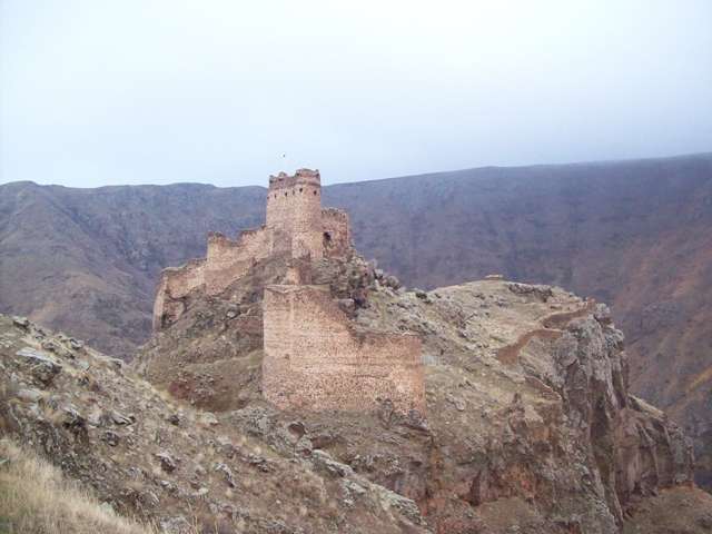
## Description The Castle of the Devil, known locally as Şeytan Kalesi, is one of Turkey’s most dramatic and mysterious fortress ruins. Perched atop a rocky bluff in the Çıldır district of Ardahan Province, this ancient stronghold commands sweeping views of the plunging Karaçay Canyon and the surrounding highlands. Its name—“Castle of the Devil”—stems from local folklore that claims an evil spirit once haunted the area, a myth that still lingers in the collective memory of nearby villagers. Dating back to the Hellenistic period, the castle has seen a succession of rulers and empires, including the Urartians, Persians, Romans, Byzantines, and Ottomans. Its strategic location in the Upper Kur Valley made it a vital military outpost and a gateway between Anatolia and the Caucasus. The fortress was continuously modified and expanded by its various occupants, and today visitors can still see remnants of cisterns, staircases descending to water sources, and a small chapel tucked within the ruins. A little-known fact is that the castle was once a Georgian stronghold known as Qajis Tsikhe, and it played a key role in regional defense for centuries. Another intriguing detail: the site reportedly housed a prison, as noted by Georgian historian Ekvtime Takaishvili in the early 20th century. ## Location The Castle of the Devil is located in **Turkey**, within the **Eastern Anatolia Region**, in the **Çıldır district of Ardahan Province**. Specifically, it lies about 1.5 kilometers northeast of the village of Yıldırımtepe, nestled deep within the rugged terrain of the Karaçay Canyon. ### How to Get There - **By Car**: The most practical way to reach the castle is by car. From Ardahan city center, it’s roughly a 45-minute drive. The final stretch includes narrow rural roads, so a vehicle with good clearance is recommended. - **By Tour**: Local tour operators in Ardahan occasionally offer guided excursions to Şeytan Kalesi, often combined with visits to Çıldır Lake and other regional landmarks. - **By Public Transport**: Public transport options are limited. Visitors relying on buses should travel to Çıldır town and arrange a taxi or private transfer from there. The journey itself is part of the adventure, with dramatic landscapes unfolding as you approach the fortress. ## Tips - **Wear Hiking Shoes**: The terrain around the castle is rocky and uneven. Good footwear is essential for exploring safely. - **Bring Water and Snacks**: There are no facilities at the site, so come prepared. - **Visit in Spring or Early Autumn**: These seasons offer the most comfortable weather and the clearest views. - **Respect the Site**: The ruins are fragile and unguarded. Avoid climbing on unstable sections and leave no trace. - **Pair with Nearby Attractions**: Combine your visit with a trip to Çıldır Lake, especially in winter when the lake freezes and offers unique activities like horse-drawn sleigh rides. - **Photography**: The castle’s dramatic setting makes it a fantastic spot for landscape photography, especially at sunrise or sunset. ## Conclusion The Castle of the Devil in Ardahan is a hauntingly beautiful relic of Turkey’s layered history. With its mythic name, panoramic views, and centuries-old architecture, it offers a compelling experience for travelers seeking both adventure and cultural depth. ## FAQ **1. Is there an entrance fee to visit the Castle of the Devil?** No, the site is open to the public and free to visit. **2. How long does it take to explore the castle?** Most visitors spend 1–2 hours exploring the ruins and enjoying the views. **3. Is the site accessible year-round?** Yes, but winter conditions can make access difficult due to snow and ice. **4. Can children visit the castle?** Yes, but due to the rugged terrain, close supervision is necessary. **5. Are guided tours available?** Occasionally, local guides and tour companies offer excursions. It’s best to inquire in Ardahan or Çıldır. **6. Is there any accommodation nearby?** Basic guesthouses and hotels are available in Çıldır and Ardahan. Booking in advance is recommended during peak seasons. ## Links - [Şeytan Castle – Wikipedia Overview](https://en.wikipedia.org/wiki/%C5%9Eeytan_Castle)
GemVoyage Team • World
Alexandria
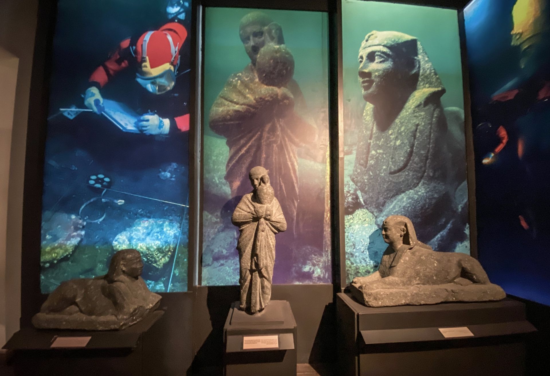
## Description Alexandria National Museum is one of the city’s most useful cultural stops because it helps visitors understand Alexandria as more than a coastal destination. The museum presents the city’s history across different periods, linking Pharaonic, Greco-Roman, Coptic, Islamic, and modern chapters into a single narrative. For travelers, this makes it especially valuable as an orientation point: you leave with a better sense of how Alexandria evolved from an ancient Mediterranean center into the modern city it is today. What makes the museum especially effective is its scale and clarity. It is not so large that it becomes exhausting, but it is substantial enough to offer real historical depth. A lesser-known fact is that the museum is housed in a restored historic building, which gives the visit a layered architectural context beyond the displays themselves. Another detail many visitors appreciate is the way the collection helps connect objects with city identity, so that artifacts do not feel detached from place. Instead, they reinforce the idea that Alexandria’s history is cumulative, cosmopolitan, and constantly reshaped by different eras. The museum is a strong choice for anyone who wants to understand why Alexandria has such a special place in Egyptian and Mediterranean history. It contextualizes the city’s role as a port, a cultural crossroads, and a site of repeated transformation. If you visit only the waterfront, you get atmosphere; if you add the national museum, you get a framework for understanding what that atmosphere means. Because the galleries are organized for accessible browsing, the museum is also suitable for visitors with limited time. You can make a focused visit without feeling that you are missing the essential story. That balance is one of its biggest strengths. ## Location Alexandria National Museum is located in Alexandria Governorate, Egypt, in the city center. Its position makes it easy to combine with other urban sights, cafés, and coastal stops. Since Alexandria is a walkable city in many sections but also spread out enough to justify taxis, the museum fits comfortably into either a walking route or a short taxi-based sightseeing plan. The easiest way to get there is by taxi or local transport from wherever you are staying in the city. If you are already exploring central Alexandria, a walk may also be practical depending on your route. Because the museum is in a central setting, it pairs naturally with other historical stops and gives structure to a city day. If you want the most rewarding visit, allow enough time to move through the collection steadily rather than rushing from room to room. ## Tips Use the museum early in your trip if you want historical orientation before visiting other landmarks. Read the labels and thematic sections carefully. The museum is most useful when you connect the objects to the city’s wider story. Plan for a visit of about 1.5 to 2 hours unless you are particularly interested in museum detail. Combine it with other Alexandria heritage stops for a fuller understanding of the city. If you are short on time, focus on the sections that tie the city’s different eras together rather than trying to absorb every detail equally. ## Conclusion Alexandria National Museum is one of the best places to understand the city’s layered identity in a compact and accessible format. It is an excellent stop for travelers who want context, not just scenery. ## FAQ ### Why visit the Alexandria National Museum? It gives a clear overview of the city’s history across different periods and helps connect the other sites you may see in Alexandria. ### Is it a large museum? It is substantial but manageable, which makes it a good choice for most travelers. ### How much time should I allow? Around 1.5 to 2 hours is usually enough for a solid visit. ### Is it good for first-time visitors? Yes. It is one of the most useful places to start if you want to understand Alexandria’s historical identity. ## Links - [Alexandria National Museum on Wikipedia](https://en.wikipedia.org/wiki/Alexandria_National_Museum) - [Egyptian Ministry of Tourism and Antiquities](https://egymonuments.gov.eg/) - [Alexandria on Wikipedia](https://en.wikipedia.org/wiki/Alexandria)
GemVoyage Team • World
San José
## Description **Fossil Land** is an interactive paleontology-themed attraction located near San José, Costa Rica. It is designed to give visitors a hands-on experience with prehistoric life, geological history, and fossil discovery. Unlike traditional museums where fossils sit behind glass, Fossil Land allows guests to **touch replicas, participate in digs, explore outdoor geological zones, and engage with educational exhibits** that simulate the process of paleontological research. The attraction combines scientific learning with adventure-style activities, making it especially popular with families, school groups, and travelers looking for something more interactive than a conventional museum visit. Visitors can try fossil excavation pits, examine casts of dinosaur bones, learn about the geological eras that shaped Costa Rica, and participate in guided workshops that explain how fossils are identified and preserved. A little-known fact is that Costa Rica, despite its volcanic and tropical landscape, has fewer natural fossil sites compared to many countries. Fossil Land was created partly to **fill this educational gap** by offering a controlled environment where visitors can explore prehistoric themes that are less visible in the country’s natural geology. Another notable detail is that the attraction integrates Costa Rica’s ecological heritage into its narrative, showing how prehistoric life connects with modern biodiversity. The result is a space that blends science education, interactive entertainment, and local environmental storytelling. It’s especially appealing for visitors looking for kid-friendly attractions in the greater San José area. ## Location **Country:** Costa Rica **Region:** Central Valley **City:** San José (greater metropolitan area; specific location varies by venue or setup depending on current exhibition sites) ### How to Get There * **By car:** Easily accessible from central San José via main city roads. Parking availability depends on the specific venue where Fossil Land is currently hosted or installed. * **By bus:** Several public buses from downtown San José reach the surrounding district. * **By ride hailing:** Services like Uber and DiDi provide fast and inexpensive access from anywhere in the metropolitan area. * **From Juan Santamaría International Airport:** A 20–40 minute drive depending on traffic. ## Tips * **Check opening hours and current location:** Fossil Land sometimes hosts temporary or traveling exhibits, so verifying the active venue is essential. * **Great for children:** The attraction is hands-on, safe, and educational. * **Plan at least 1 to 1.5 hours:** Activities, digs, and workshops take time if you want the full experience. * **Wear comfortable clothes:** Some activities involve kneeling, digging, or interacting with outdoor materials. * **Look for special events or workshops:** Fossil Land occasionally hosts themed programs related to dinosaurs, geology, or Costa Rican natural history. * **Bring water:** If visiting during outdoor sessions, hydration matters in Costa Rica’s warm climate. ## Conclusion Fossil Land is a family-friendly, interactive paleontology attraction that enriches Costa Rica’s science and nature tourism scene. With its hands-on exhibits, fossil digs, and engaging educational content, it offers a refreshing alternative to wildlife-focused activities and provides a fun, informative outing for visitors of all ages. ## FAQ **1. Is Fossil Land a museum?** Not exactly. It is an interactive paleontology attraction that combines exhibits with hands-on activities. **2. Are the fossils real?** The digs use replicas and casts, but educational displays may include authentic geological samples. **3. How long does a visit take?** Around **60–90 minutes**, depending on participation in workshops. **4. Is it suitable for small children?** Yes. Most activities are designed for families and school groups. **5. Does Fossil Land move locations?** Yes. Some exhibits relocate or operate seasonally, so checking the current location is important. **6. Can I book group visits?** Yes. Group and school reservations are often available with advance notice. ## Links * [Costa Rica tourism guide](https://www.visitcostarica.com/)
GemVoyage Team • World
Neuquén
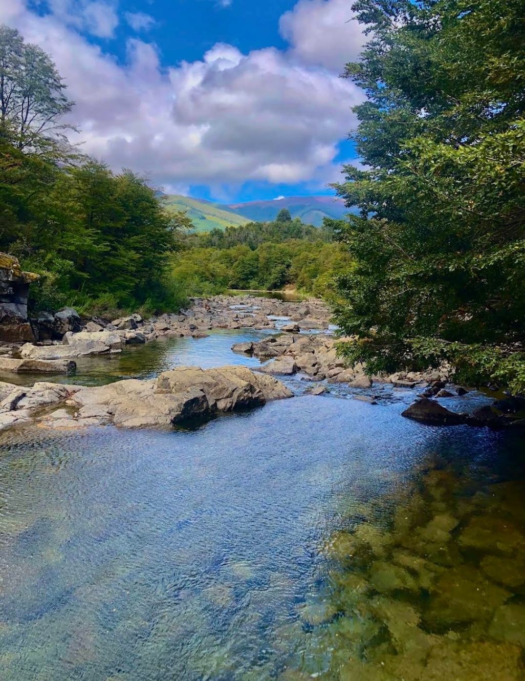
## Description Nestled within the heart of Argentina’s Patagonia, **Cascadas del Río Hermoso** is a breathtaking natural wonder that captivates visitors with its unspoiled beauty. The waterfalls are part of the Río Hermoso, which translates to “Beautiful River,” and the name is no exaggeration. Surrounded by dense forests, clear mountain air, and the soothing sound of rushing water, this destination offers a perfect blend of serenity and adventure. What makes Cascadas del Río Hermoso unique is not only its picturesque setting but also its relative tranquility compared to more popular sites like Iguazú Falls. Here, you won’t find large crowds or bustling tourist infrastructure—just raw, pristine nature. The waterfalls are small to medium in size, cascading down in multiple tiers, forming natural pools that invite visitors to rest and reflect. A little-known fact is that the river is fed by meltwater from the Andes, meaning that the water levels and flow change significantly with the seasons. Another detail often overlooked is the region’s rich biodiversity: the surrounding forests are home to species such as the Patagonian woodpecker and the elusive pudú, one of the world’s smallest deer. For nature enthusiasts, Cascadas del Río Hermoso is a rare opportunity to encounter untouched ecosystems. ## Location Cascadas del Río Hermoso is located in **Argentina, in the Neuquén Province of northern Patagonia**, within the boundaries of **Lanín National Park**. The closest town is **San Martín de los Andes**, a charming Patagonian village known for its alpine-style architecture, lakes, and outdoor activities. To get there, travelers usually fly into Aviador Carlos Campos Airport, just 20 km from San Martín de los Andes. From the town, the waterfalls can be reached by car via **Ruta Nacional 40** and then **Ruta Provincial 63**, which winds through stunning Andean landscapes. The trip itself is a highlight, with panoramic views of lakes, mountains, and valleys. Renting a car is highly recommended, as it allows for flexible stops at scenic viewpoints along the way. ## Tips * **Best Time to Visit**: Late spring to early autumn (November to March) offers the best weather and water flow. Winter can be beautiful too but access may be more difficult due to snow. * **What to Bring**: Comfortable hiking shoes, layered clothing (Patagonia weather is unpredictable), water, snacks, and a camera. * **Respect Nature**: Since this is a less-visited area, maintaining its pristine condition is important. Avoid leaving trash and stick to marked trails. * **Combine Your Trip**: Consider combining your visit with nearby attractions like Lake Lácar, Chapelco ski resort, or even the famous Seven Lakes Route. * **Local Guides**: Hiring a local guide can enrich your experience with stories about the region’s history, culture, and flora and fauna. ## Conclusion Cascadas del Río Hermoso is a tranquil, hidden treasure in Argentina’s Patagonia, offering visitors a rare chance to connect with untouched nature. Surrounded by forests, wildlife, and the pure waters of the Andes, it’s a destination that rewards travelers seeking peace, adventure, and authenticity. ## FAQ **1. How difficult is the hike to Cascadas del Río Hermoso?** The hike is considered easy to moderate. Most trails are well-marked and accessible, making it suitable for families and casual hikers. **2. Is swimming allowed in the river or waterfalls?** Yes, swimming is possible in some of the natural pools, especially during the summer months, though the water can be very cold due to glacial origins. **3. Are there entrance fees?** Since Cascadas del Río Hermoso is part of Lanín National Park, a small entrance fee may apply, depending on the season and visitor category. **4. Can I visit Cascadas del Río Hermoso year-round?** Yes, but accessibility varies. Summer and spring are ideal, while winter may present challenges due to snow-covered roads. **5. Are there facilities near the waterfalls?** Facilities are limited. Visitors should bring their own supplies, although San Martín de los Andes has plenty of options for food, lodging, and equipment rentals. ## Links * [Neuquén Province Tourism](https://www.argentina.travel/en/province/neuquen)
GemVoyage Team • World
Kampala
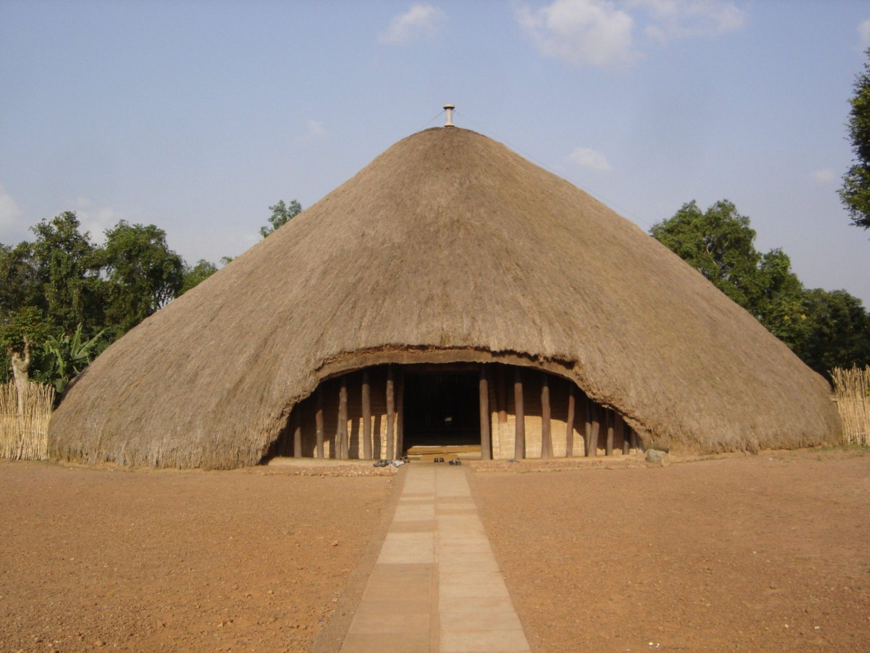
## Description The Kasubi Tombs are one of Uganda’s most important cultural and historical landmarks, serving as the burial grounds of the kings (Kabakas) of the Buganda Kingdom. Recognized as a UNESCO World Heritage Site, the Kasubi Tombs are not only a place of remembrance but also a living spiritual center where traditions, rituals, and royal customs are still actively practiced. The site reflects the deep-rooted cultural identity of the Baganda people and offers visitors a rare opportunity to experience African heritage that is both ancient and ongoing. What makes the Kasubi Tombs especially unique is their architectural style. The main structure, known as the Muzibu Azaala Mpanga, is built almost entirely from organic materials such as wood, reeds, grass, and bark cloth, showcasing remarkable traditional engineering techniques passed down through generations. A little-known fact is that the massive domed structure was once considered one of the largest thatched buildings in Africa. Another lesser-known detail is that even after a devastating fire in 2010 severely damaged the main tomb, restoration efforts were guided by traditional craftsmen using ancestral knowledge rather than modern construction methods, preserving the site’s cultural authenticity. Visiting the Kasubi Tombs is not just a historical experience; it is a deeply spiritual one that highlights the enduring connection between the Buganda monarchy, its people, and their land. ## Location The Kasubi Tombs are located in **Uganda**, in the **Central Region**, within **Kampala**, the country’s capital city. The site sits on Kasubi Hill, approximately 5 kilometers northwest of Kampala’s city center. Getting there is relatively easy. Visitors can reach the Kasubi Tombs by taxi, private car, or motorcycle taxi (boda-boda) from central Kampala. The journey usually takes 15 to 25 minutes, depending on traffic. For those unfamiliar with the area, hiring a local driver or using a guided tour is recommended, as it ensures smoother navigation and provides cultural context during the visit. ## Tips * Dress modestly and respectfully, as the site is a sacred royal burial ground. * Photography may be restricted in certain areas, especially inside the main tomb, so always ask for permission. * Consider hiring a local guide at the entrance to gain deeper insight into Buganda history and traditions. * Visit in the morning when the site is quieter and temperatures are more comfortable. * Be respectful of ongoing rituals or ceremonies, as the site is still actively used by the Buganda Kingdom. * Carry small cash for entrance fees, guides, or donations. ## Conclusion The Kasubi Tombs offer a powerful and authentic insight into Uganda’s royal history and living cultural traditions. As a sacred site and a symbol of resilience, they stand as one of Kampala’s most meaningful attractions, rewarding visitors with knowledge, reflection, and cultural understanding. ## FAQ **Why are the Kasubi Tombs important?** They are the burial place of four Buganda kings and a central spiritual site for the Buganda Kingdom. **Is the Kasubi Tombs site fully restored?** Restoration is ongoing, guided by traditional methods to maintain cultural integrity, following the 2010 fire. **How long does a visit usually take?** Most visits last between one and two hours, including a guided tour. **Is the site suitable for children?** Yes, older children can benefit from the educational and cultural aspects, though supervision is advised. **Do I need a guide to visit the Kasubi Tombs?** A guide is not mandatory but highly recommended for a fuller understanding of the site’s significance. ## Links * [UNESCO – Kasubi Tombs](https://whc.unesco.org/en/list/1022) * [Uganda Tourism Board](https://exploreuganda.com/)
GemVoyage Team • World

Comments