Discover extraordinary places shared by our community of travelers
Nida
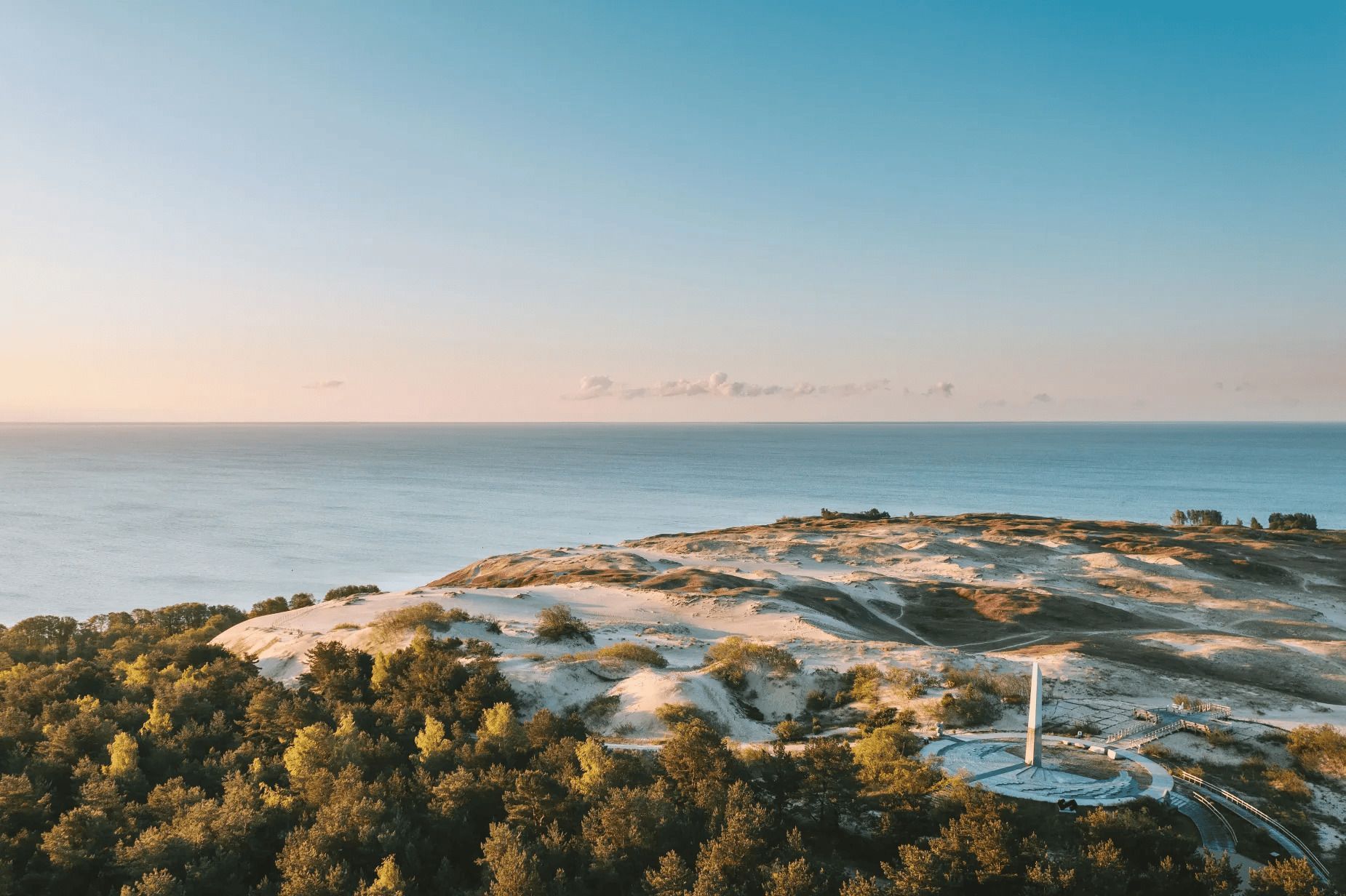
## Description The Parnidis Dune sundial on the Curonian Spit is an elegant meeting point of coastal geology and human curiosity. Carved into a prominent dune ridge near Nida, the sundial uses a simple stone gnomon and stone markers to register the sun’s arc across the sky, while the dune itself provides sweeping views over the Curonian Lagoon and the Baltic Sea. The combination of sculpted sand, long sightlines, and the shifting play of light makes the site both visually stirring and quietly contemplative. Visitors encounter an open landscape shaped by wind and water: dunes that migrate slowly with prevailing winds, vegetation adapted to sandy, saline conditions, and an expansive horizon where sky and water blend. The sundial is part functional instrument, part landscape sculpture: its hour lines and markers are calibrated to local solar time and offer an accessible way to experience astronomical motion at ground level. Restoration and maintenance are ongoing challenges because the dune is dynamic—sand moves, vegetation changes, and repairs must respect both the scientific accuracy of the instrument and the dune’s natural processes. Local authorities and conservation groups work to stabilize key paths and protect fragile slopes so that people can enjoy the views without accelerating erosion. Cultural events and astronomy programs often use the site as a natural amphitheater, further connecting visitors with the seasonal rhythms of sky and sea. ## Location Parnidis Dune is located in Nida on the Curonian Spit, within Neringa municipality in Klaipėda County on Lithuania’s western coast. The dune crowns a ridge that overlooks the Curonian Lagoon on one side and the Baltic Sea on the other, giving it dramatic vantage points in both directions. How to get there: Nida is accessible by car along the Curonian Spit road from Klaipėda; if approaching from mainland Lithuania, a ferry crossing into the spit may be necessary depending on route. Regular buses also run from Klaipėda to Nida during the tourist season. Once in Nida, the Parnidis Dune is a short, well-signed walk from the town center; follow the marked paths to the main observation points and sundial. ## Tips - Visit at sunrise or sunset for the most dramatic light and to see the sundial’s shadows lengthen. - Stay on marked trails and access ramps—dune vegetation is fragile and paths help prevent runaway erosion. - Bring windproof layers and sun protection; the exposed ridge can be quite breezy even on mild days. - Use binoculars or a telephoto lens to scan the lagoon for birds, fishing boats, and shifting sandbars. - Combine a dune visit with a walk through Nida’s quaint center and nearby cultural sites, such as the Thomas Mann museum. - Check local signage for any temporary closures or restoration work; some sections may be rerouted to protect the landscape. ## Conclusion Parnidis Dune’s sundial offers more than a neat photo opportunity: it is an invitation to feel how landscape, time, and human craft can intersect. The ridge’s panoramic views, paired with the simple mechanics of the sundial, make the place an evocative stop for anyone exploring the Curonian Spit. ## FAQ Q: Is there an admission fee to access the dune? A: There is typically no admission fee to reach Parnidis Dune itself; however, parking or guided services may charge fees. Seasonal event programming may require tickets. Q: When is the best time to photograph the sundial and landscape? A: Sunrise and sunset provide warm, low-angle light that accentuates dune textures and long shadows; golden hour is ideal for landscape photography. Q: Can I climb anywhere on the dune? A: No. To protect dune vegetation and prevent erosion, visitors should use the marked trails and observation points only; climbing fragile slopes is discouraged or prohibited. Q: Are there guided tours or astronomy events at the site? A: Yes. Local guides and cultural groups sometimes offer tours that explain the sundial’s construction and the dune’s ecology; astronomy and cultural events are occasionally scheduled—check Nida’s visitor information. Q: Is the area accessible for visitors with limited mobility? A: Some paths and viewpoints may have improved access, but the dune’s terrain is inherently uneven. Check local visitor resources for the latest information on accessible routes. ## Links - [Parnidis Dune (Wikipedia)](https://en.wikipedia.org/wiki/Parnidis_Dune)
GemVoyage Team • World
Lisbon
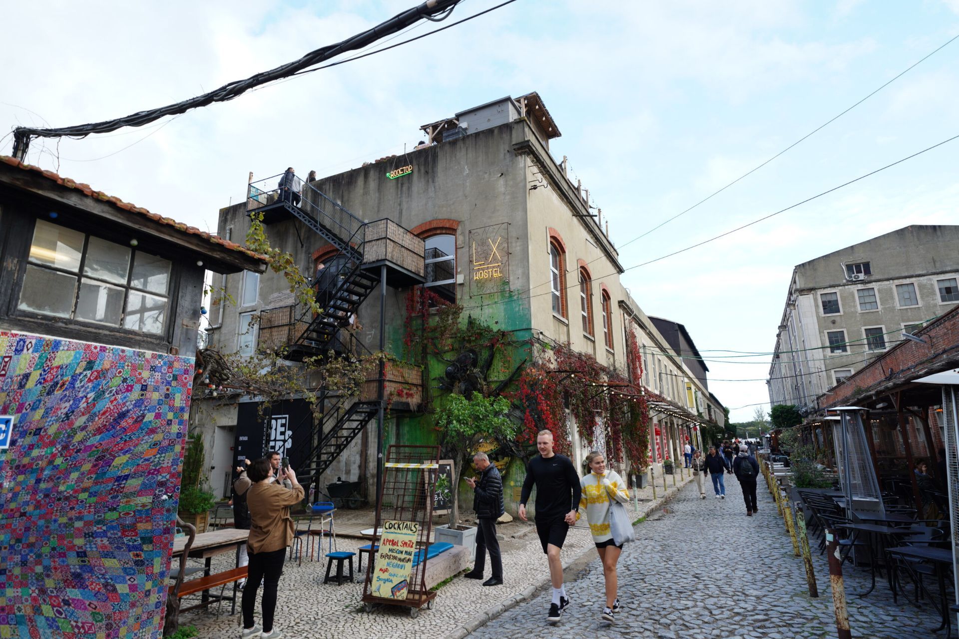
## Description LX Factory is one of Lisbon’s most vibrant examples of industrial regeneration: a former manufacturing complex in Alcântara that has been transformed into a creative quarter brimming with independent shops, galleries, artisanal restaurants, and coworking spaces. The complex retains industrial bones—exposed brick, iron beams, and tall windows—which provide a raw, textured setting for contemporary design, street art, and cultural events. What began as a loose network of creatives and small businesses has grown into a popular destination that still retains an authentic, local energy. The visitor experience at LX Factory ranges from slow browsing of concept stores and second-hand bookstores to lively evenings at rooftop bars and weekend markets. The site is notable for incubating Portuguese design brands and independent publishers; weekend markets and fair-type events often showcase handmade goods, ceramics, fashion, and design pieces that reflect Lisbon’s current creative pulse. Galleries and studios host rotating exhibitions while cafés and restaurants offer a mix of traditional Portuguese flavors and international influences. What sets LX Factory apart is the combination of scale and intimacy: the industrial courtyards and long factory halls feel spacious, yet the density of creative vendors and pop-ups creates an exploratory experience. Street art and murals lend a constantly evolving visual backdrop, while programming—book fairs, music nights, and design talks—adds depth beyond shopping and dining. ## Location LX Factory sits along the south bank of the Tagus River in Alcântara, Lisbon, near the iconic 25 de Abril Bridge. Its riverside location makes it a natural stop on a riverside itinerary, and it is within reach of central Lisbon via tram, train, or a scenic walk. Getting there: The nearest train stop is Alcântara-Mar; historic trams and buses also serve the area. Taxis and rideshares provide convenient options, and walking from central neighborhoods is possible for those who enjoy a longer stroll along the riverfront. Check transit schedules and event listings to plan visits during market days or special events. ## Tips - Visit on a weekday morning or early afternoon for calmer browsing; weekends bring lively markets and larger crowds. - Check the LX Factory event calendar in advance—book fairs, music nights, and pop-up markets can change the atmosphere and crowd levels. - Explore rooftops and courtyards for pleasant views and sunset drinks; several restaurants and bars capitalize on the industrial setting. - Carry a reusable bag for market finds and small purchases; many stalls offer handcrafted goods that make unique souvenirs. - Wear comfortable shoes to navigate the long halls and uneven surfaces—the complex rewards slow wandering. - Combine LX Factory with a riverside walk toward Belém or a visit to nearby museums to round out a day of culture. ## Conclusion LX Factory is a lively, creative hub that captures Lisbon’s blend of historic layers and contemporary innovation. It’s a must-visit for travelers looking for local design, independent culture, and a community atmosphere that still feels genuine rather than overly commercialized. ## FAQ Q: Is LX Factory family-friendly? A: Yes. Daytime markets and shops are suitable for families; some evening venues cater more to adults—plan accordingly. Q: Are there regular markets and fairs? A: Yes. Weekend markets, design fairs, and occasional book and music events are common—check the events calendar before you go. Q: Can I work from LX Factory? A: Several cafes and coworking spaces welcome remote workers; Wi-Fi availability varies by venue—ask locally or check listings. Q: What are the best times to visit to avoid crowds? A: Weekday mornings and early afternoons are typically quieter; weekends are busiest due to markets and events. Q: Are there parking options nearby? A: Limited on-site parking exists and nearby street or paid parking can be used; public transit and rideshare are convenient alternatives. Q: Are dogs allowed? A: Policies vary by tenant; outdoor areas are pet-friendly in many cases, but check with individual shops or restaurants for their rules. ## Links - [Lisbon Travel Guide](https://www.visitlisboa.com/)
GemVoyage Team • World
Zanzibar
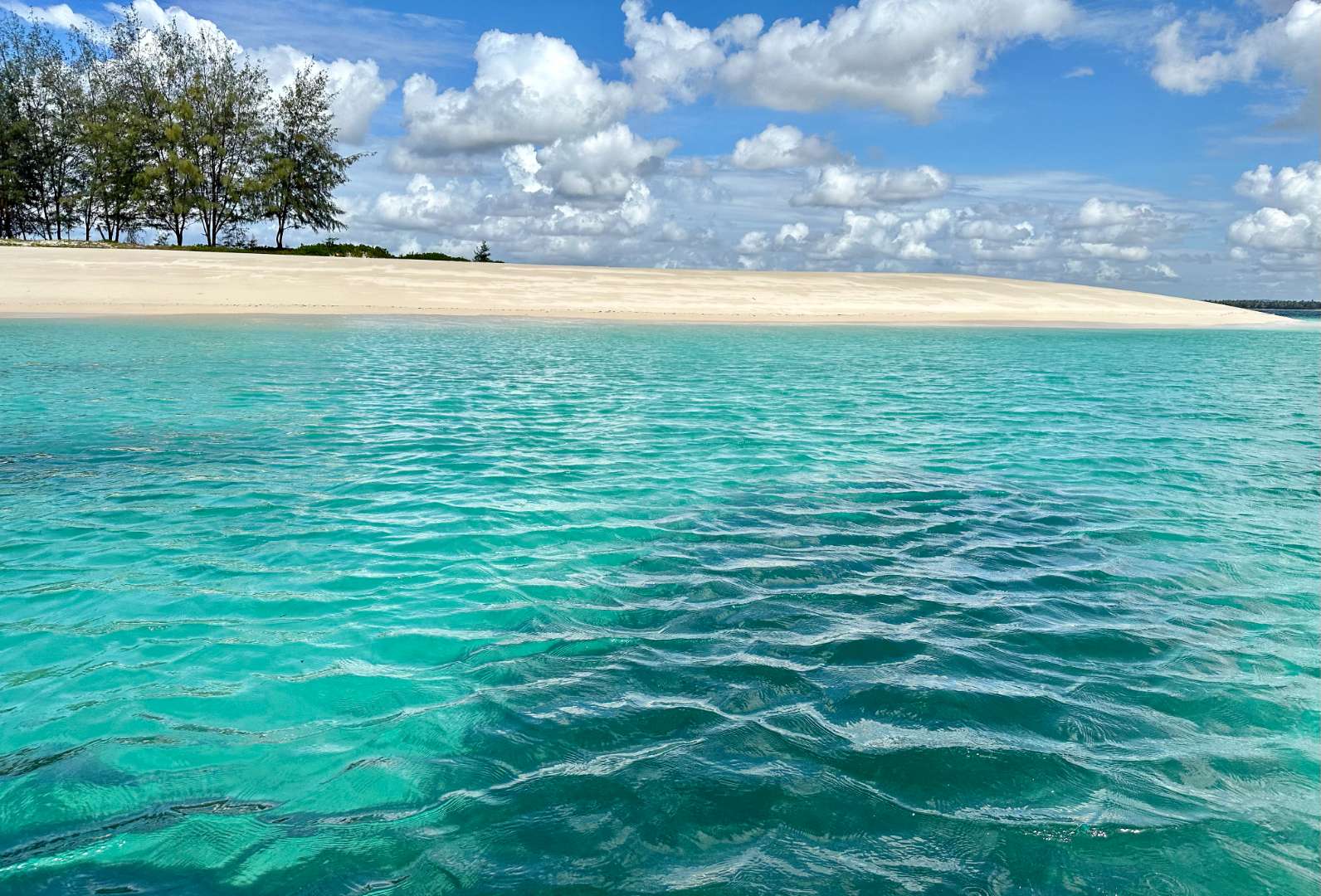
## Description Sinda Island is a hidden gem off the coast of Tanzania, often mistaken as part of Zanzibar due to its proximity and tropical allure. This uninhabited island, part of the Dar es Salaam Marine Reserve System (DMRS), offers a pristine escape into nature, far removed from the crowds and commercialization of more popular destinations. With its untouched beaches, vibrant coral reefs, and rich biodiversity, Sinda Island is a haven for eco-tourists, snorkelers, and anyone seeking tranquility. The island is actually composed of two parts—Inner and Outer Sinda—each with its own unique landscape. The coastlines feature a mix of rocky cliffs and soft sandy beaches, while the interior is covered in virgin coastal forest. One of the island’s most fascinating residents is the endangered coconut crab, which thrives in this protected habitat. The waters surrounding Sinda are shallow near the shore but drop off dramatically just a few kilometers out, creating strong tidal currents and excellent snorkeling conditions. A little-known fact: Sinda Island is home to ruins dating back to the 19th century, and it was first documented by Arab sailor Ibn Majid in 1470. These remnants of history, combined with the island’s natural beauty, make it a compelling destination for both adventure and reflection. ## Location Sinda Island is located in **Tanzania**, within the **Dar es Salaam Region**, specifically in the **Kigamboni District**. It lies southeast of Dar es Salaam, just off the coast near the Somangila ward. ### How to Get There: - **By Boat**: The most common way to reach Sinda Island is by hiring a boat from the Kigamboni coast. Local tour operators offer day trips that include snorkeling, picnicking, and guided walks. - **From Dar es Salaam**: Take a ferry across the harbor to Kigamboni, then arrange a boat transfer from one of the nearby beaches such as Kimbiji or Sinda Beach. - **By Tour Package**: Several eco-tourism companies offer curated trips to Sinda Island, often including stops at nearby reefs and islands. Because it’s a protected area, access may be regulated, so it’s best to coordinate with licensed guides or marine reserve authorities. ## Tips for Visitors To make the most of your visit to Sinda Island, consider these tips: - **Pack Light but Smart**: Bring reef-safe sunscreen, snorkeling gear, water, and snacks. There are no facilities on the island. - **Respect the Environment**: As a protected marine reserve, it’s crucial to avoid littering and disturbing wildlife. - **Snorkeling is a Must**: The coral reefs around Sinda are teeming with life—from clownfish to moray eels. Don’t miss the chance to explore them. - **Visit During Dry Season**: June to October offers the best weather and visibility for underwater activities. - **Explore the Ruins**: Ask your guide to show you the historical ruins—some are hidden within the forest and offer a glimpse into the island’s past. - **Ideal for Day Trips**: Overnight stays are not permitted, so plan for a full-day excursion. ## Conclusion Sinda Island is a serene and ecologically rich destination that blends natural beauty with historical intrigue. Whether you're snorkeling among vibrant reefs, spotting rare coconut crabs, or simply soaking in the silence, this island offers a rare kind of escape—one that’s both peaceful and profound. ## FAQ **1. Is Sinda Island part of Zanzibar?** No, it’s located off the coast of Dar es Salaam, though it shares similar tropical features. **2. Can I stay overnight on Sinda Island?** No, the island is uninhabited and part of a protected marine reserve. Only day trips are allowed. **3. What activities can I do on the island?** Snorkeling, nature walks, beach picnics, and exploring historical ruins are popular activities. **4. Is there an entrance fee?** Yes, a small conservation fee may be required. It’s usually included in guided tour packages. **5. Are there facilities on the island?** No, there are no restaurants, restrooms, or shops. Visitors must bring their own supplies. **6. Is it safe to swim around Sinda Island?** Yes, but always follow your guide’s instructions. Some areas have strong currents due to tidal shifts. ## 🔗 Links - [Sinda Island – Wikipedia](https://en.wikipedia.org/wiki/Sinda_Island) - [Tanzania Tourism – Sinda Island Marine Reserve](https://www.tanzaniatourism.com/destination/sinda-island-marine-reserve)
GemVoyage Team • World
Paris
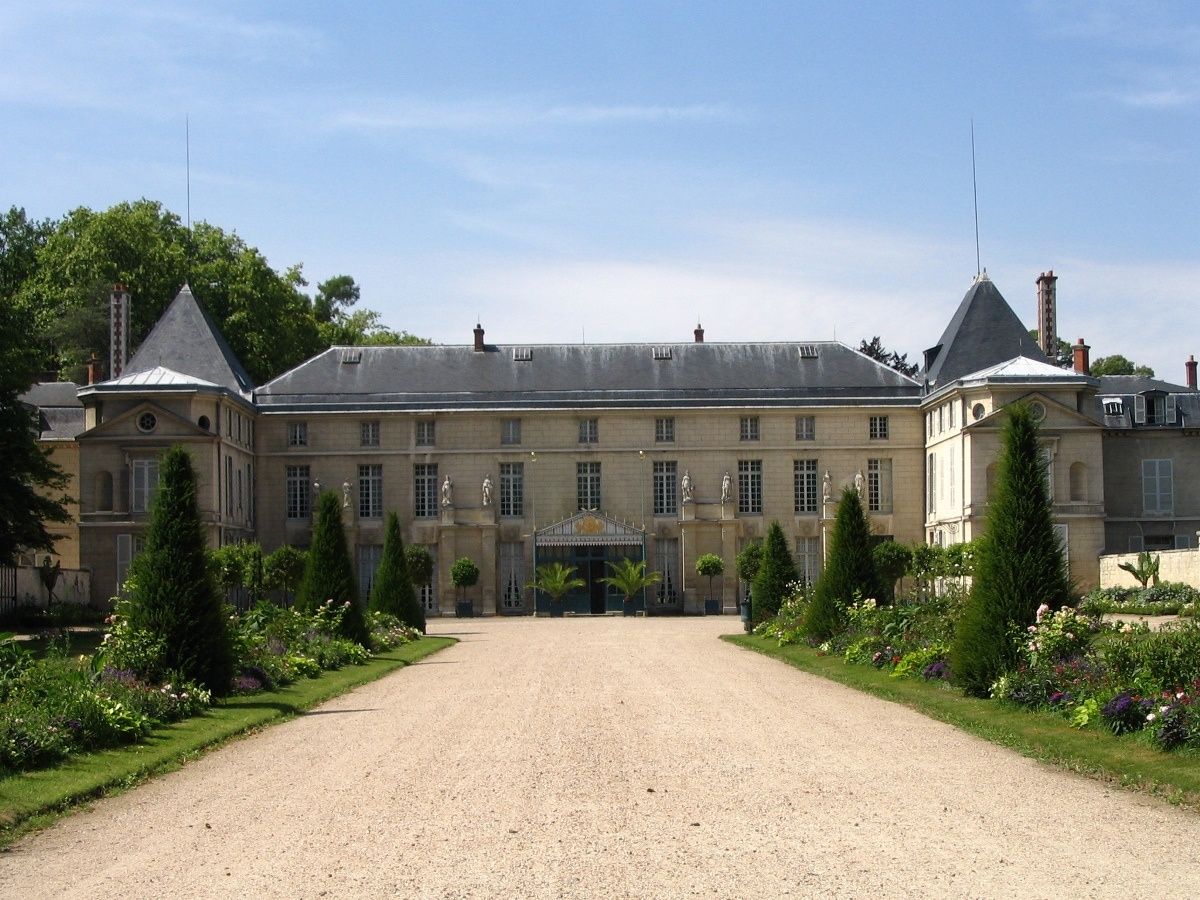
## Description The **Château de Malmaison** is one of the most historically intimate and emotionally rich landmarks of the Napoleonic era. Unlike grand imperial palaces designed to impress the masses, Malmaison was a **private retreat**—a place of strategy, domestic life, and personal ambition. It served as the residence of **Napoleon Bonaparte and Empress Joséphine** from 1799 to 1802 and later remained Joséphine’s home until her death in 1814. What makes Malmaison particularly unique is that it offers a deeply human perspective on figures often seen only through the lens of military and political power. Here, visitors encounter **Napoleon the husband and strategist**, and **Joséphine the patron of art, architecture, and botanical science**. Many decisive political meetings were held within these walls, including sessions of the **French government during Napoleon’s rise to power**. In effect, Malmaison briefly functioned as an **unofficial seat of the French state**. Architecturally, the château reflects the transition from late 18th-century aristocratic style to the early **Empire aesthetic**. Under Joséphine’s direction, the interior was redesigned by leading architects and decorators of the time, introducing **elegant neoclassical motifs, sculpted columns, rich textiles, and furniture that defined what would later be known as the Empire style**. The combination of political authority and refined domestic comfort was revolutionary for its time. The interior rooms remain remarkably authentic. Highlights include **Napoleon’s council chamber**, where official meetings took place, Joséphine’s private apartments, and the refined dining rooms used for state dinners. Furnishings, clocks, paintings, and personal objects are original or meticulously restored, giving the impression that the imperial couple has only just stepped away. Beyond politics, Malmaison holds global botanical importance. Joséphine was passionately devoted to **botanical exploration and exotic plant collection**. She transformed the estate into **one of Europe’s most important experimental botanical gardens**, introducing dozens of new plant species to France. Most famously, she established **the largest rose collection in Europe**, making Malmaison the birthplace of modern rose breeding. A little-known fact is that **Napoleon and Joséphine’s divorce was finalized while he was already Emperor**, a rare example of a ruler separating from his consort at the height of power. After the divorce, Napoleon retained Malmaison for Joséphine, allowing her to live there independently—an extraordinary privilege for the era. Another lesser-known detail is that the Russian Tsar **Alexander I visited Joséphine at Malmaison shortly before her death**, underscoring her lasting influence on European politics even after her fall from power. Today, Malmaison stands as a **museum of extraordinary intimacy**, preserving both the machinery of empire and the vulnerability of personal life. It is not a monument to victory, but a space that reveals **ambition, intelligence, loss, and legacy** at a human scale. ## Location **Château de Malmaison** is located in **Rueil-Malmaison**, a historic suburban town just west of **Paris**, in the **Île-de-France region**, France. **City:** Rueil-Malmaison **Region:** Île-de-France **Country:** France ### How to Get There: * **By RER:** Take **RER A** toward Saint-Germain-en-Laye and exit at **Rueil-Malmaison Station**, then take a bus or walk approximately 25 minutes. * **By bus:** Several local bus lines connect directly from central Paris to the château area. * **By taxi or ride-hailing apps:** A direct and convenient option from central Paris, typically 25–40 minutes depending on traffic. * **By car:** Easily accessible via Paris’s western ring roads; parking is available near the site. While not inside the historic center of Paris, the château is easy to reach and offers a calm, cultured contrast to the city’s intensity. ## Tips * **Visit the gardens as well as the interior:** The landscape is essential to understanding Joséphine’s legacy. * **Go in spring or early summer:** The rose garden is at its best during these months. * **Use the audio guide:** It adds essential political and personal context. * **Allow at least 2 hours:** One hour for the interior, one for the gardens and exhibitions. * **Arrive early:** The château is smaller than major Paris museums and can feel crowded later in the day. * **Combine with a Seine walk:** The nearby riverbanks are ideal for a relaxed post-visit stroll. * **Photography is usually permitted without flash:** Always verify current rules at entry. * **Not a grand palace experience:** If you expect Versailles-level scale, you will be disappointed; Malmaison is about intimacy and insight, not spectacle. ## Conclusion The **Château de Malmaison** offers one of the most personal and revealing encounters with the Napoleonic era. As both a political nerve center and a deeply private refuge, it captures the complexity of power, love, ambition, and legacy embodied by **Napoleon and Joséphine**. Quiet, refined, and historically profound, Malmaison stands as one of the most meaningful imperial sites in greater Paris. ## FAQ **1. What is Château de Malmaison famous for?** It is best known as the **private residence of Napoleon Bonaparte and Empress Joséphine** and a major center of early Napoleonic political life. **2. Is Château de Malmaison inside Paris?** No, it is located in **Rueil-Malmaison**, a suburb just west of Paris. **3. Can you visit the interior?** Yes, the château operates as a **fully accessible museum** with original furnishings and artifacts. **4. What happened to Joséphine after the divorce?** She remained at Malmaison until her death in **1814**, continuing her botanical and social work independently. **5. How long does a visit take?** Most visitors spend **1.5 to 2.5 hours** including the gardens. **6. Is Château de Malmaison suitable for children?** Yes, especially for older children interested in history, though the visit is primarily educational rather than interactive. ## Links * [French National Museums](https://www.culture.gouv.fr) * [Napoleonic History Resources](https://www.napoleon.org)
GemVoyage Team • World
Cairo
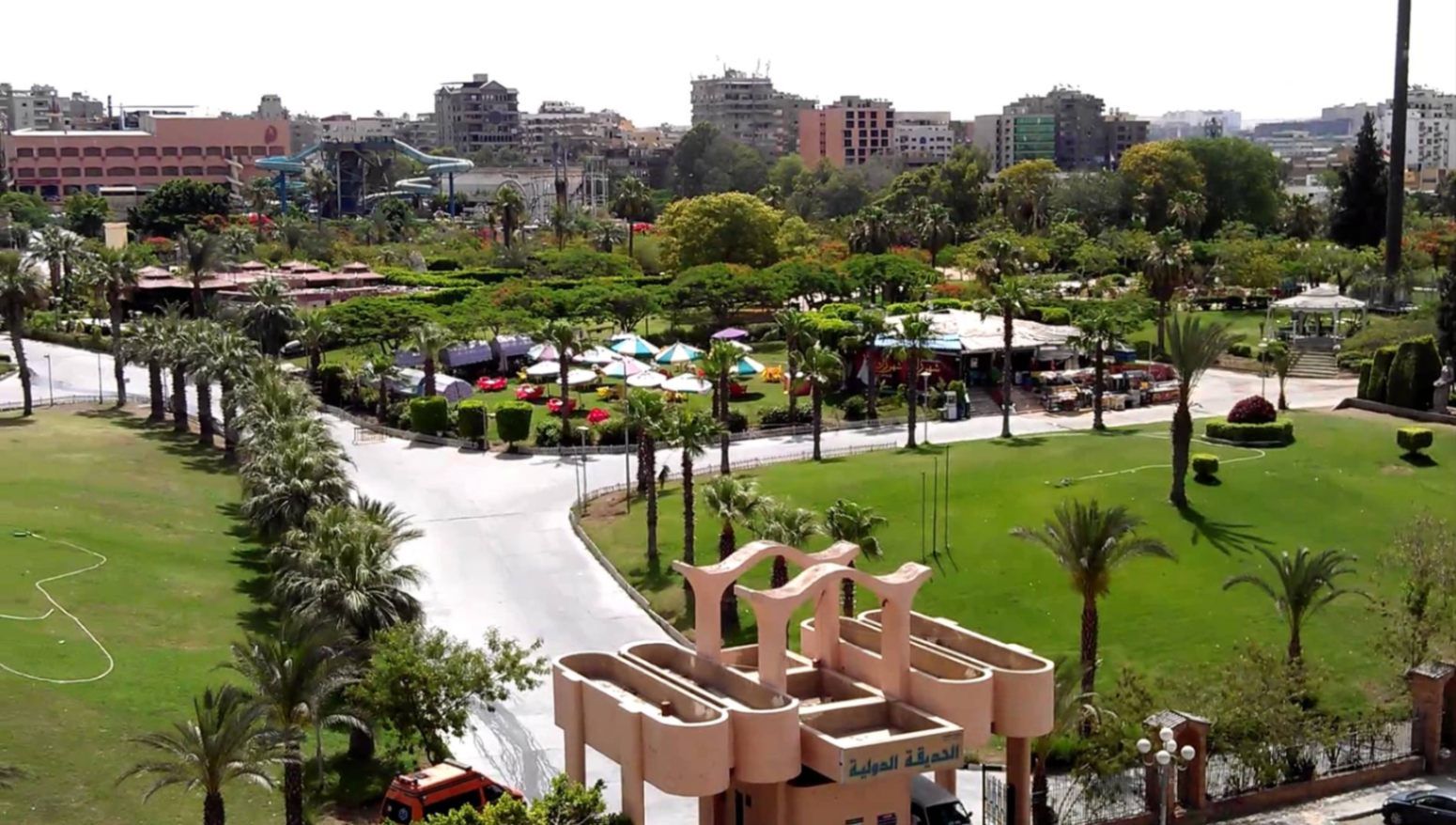
## Description **The International Park (الحديقة الدولية بالقاهرة)** is one of Cairo’s most distinctive public green spaces, designed to showcase a miniature journey through different countries and cultures within a single park. Established in the late 1980s, the park was conceived as a cultural and recreational project where landscaped areas, architectural replicas, and themed gardens represent nations from around the world. While not polished in the way of modern theme parks, its charm lies in its **ambitious concept, open space, and local atmosphere**. What makes the International Park unique is its layout: each section is inspired by a different country, featuring symbolic structures, sculptures, plants, or design elements associated with that nation. Visitors can walk from Asian-inspired pavilions to European-style gardens within minutes. This eclectic mix gives the park an almost nostalgic quality, reflecting Cairo’s vision of internationalism during the late 20th century. A lesser-known fact is that several embassies and cultural institutions contributed ideas or symbolic elements during the park’s early development, even if execution varied over time. Another interesting detail is that the park was once a major venue for **school trips and cultural festivals**, making it an important part of collective memory for many Cairenes who grew up in the 1990s. Today, the park functions primarily as a **family-friendly recreational space**. It is popular for picnics, casual walks, and affordable outings, especially for residents of eastern Cairo. While some areas show signs of aging, the park’s size, greenery, and concept still make it a refreshing escape from the dense urban environment. ## Location **Country:** Egypt **Region:** Greater Cairo **City:** Cairo **District:** Nasr City The International Park is located in **Nasr City**, one of Cairo’s largest residential districts, close to major roads and residential compounds. ### How to Get There * **By taxi or ride-hailing:** * Uber and local taxis are the most convenient option from anywhere in Cairo. * **By car:** * Easily accessible via Nasr City’s main roads, with parking available near the entrance. * **By public transport:** * Microbuses and buses serving Nasr City pass close to the park, though routes can be confusing for first-time visitors. * **From central Cairo:** * Expect a 30–45 minute drive depending on traffic. ## Tips * **Visit in the afternoon:** Late afternoon offers better weather and softer light, especially in warmer months. * **Bring your own food:** Picnic areas are common, and outside food is usually allowed. * **Wear comfortable shoes:** The park is large, and exploring all sections involves significant walking. * **Manage expectations:** Some country sections are more symbolic than detailed replicas. * **Good for children:** Open spaces allow kids to run freely, and the atmosphere is relaxed. * **Avoid peak public holidays:** The park can become crowded during major Egyptian holidays. ## Conclusion The International Park is a spacious, culturally themed green retreat that offers a simple but enjoyable experience for families and casual visitors. Its global concept, combined with its local character, makes it a nostalgic and accessible escape from Cairo’s urban intensity. ## FAQ **1. When was the International Park opened?** It was established in the late 1980s as a cultural and recreational project. **2. Is there an entrance fee?** Yes, there is a low entrance fee, making it affordable for families. **3. How long should I plan for a visit?** Most visitors spend **1.5 to 3 hours**, depending on walking pace and activities. **4. Is the park suitable for tourists?** Yes, especially for those interested in local leisure spaces rather than major monuments. **5. Are there food stalls inside?** Basic snacks may be available, but bringing your own food is recommended. **6. Is it good for photography?** Yes, particularly for casual photography and wide shots of greenery and themed structures. ## Links * [Egyptian tourism portal](https://www.experienceegypt.eg/en)
GemVoyage Team • World
Kazan
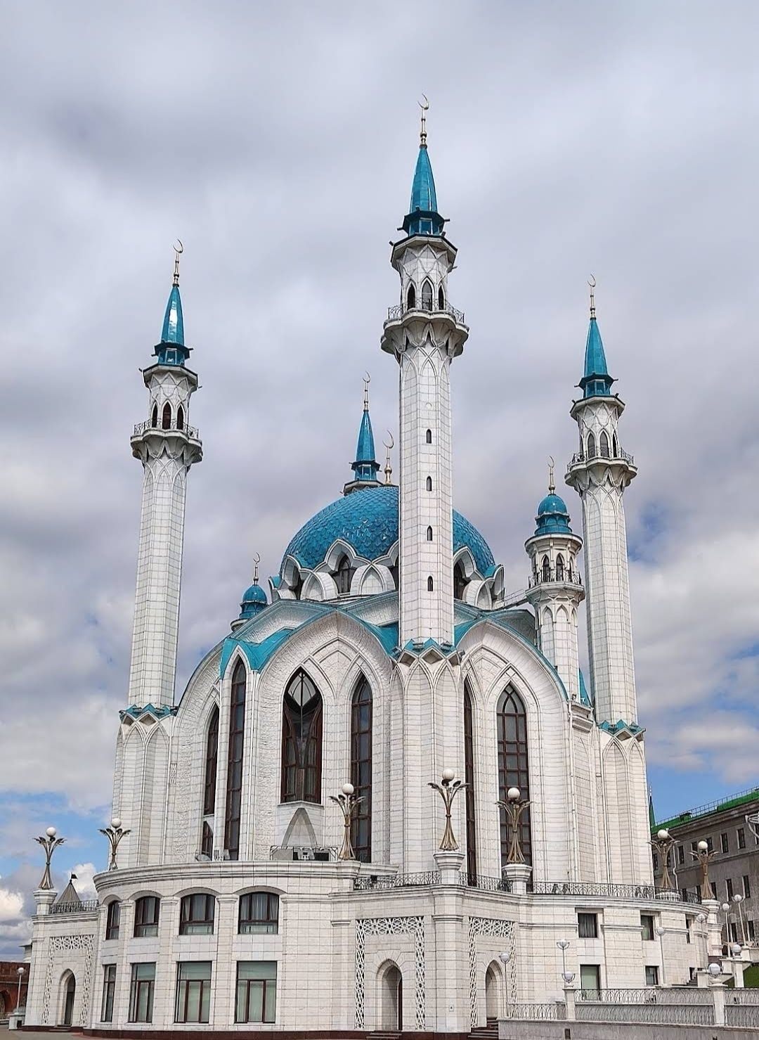
## Description The **Kul Sharif Mosque** is one of the most stunning landmarks in Russia, standing proudly inside the **Kazan Kremlin**. Recognized as both a religious and cultural icon, it represents the rich history of the Tatar people and the peaceful coexistence of different faiths in the region. Its striking blue-and-white minarets, elegant domes, and ornate interiors make it not only a place of worship but also an architectural masterpiece. Originally built in the 16th century, the mosque was destroyed in 1552 during the siege of Kazan by Ivan the Terrible. For centuries, it remained in ruins until it was magnificently rebuilt and reopened in 2005 as part of Kazan’s millennium celebrations. Today, it is one of the largest mosques in Russia and Europe, with the capacity to hold more than **6,000 worshippers**. A fascinating detail is that the mosque is named after **Kul Sharif**, a prominent Tatar religious leader, poet, and defender of Kazan who died during the 1552 siege. Another lesser-known fact is that the mosque’s design blends Islamic and Russian architectural influences, symbolizing Kazan’s unique position as a bridge between East and West. Its interiors are adorned with marble, mosaics, and exquisite chandeliers, while its museum showcases Islamic culture and history. ## Location Kul Sharif Mosque is located in **Kazan**, the capital city of the **Republic of Tatarstan**, within the **Kazan Kremlin**, a UNESCO World Heritage Site. Its central location makes it easily accessible to both locals and tourists exploring the historical heart of the city. To reach Kazan, visitors can fly into **Kazan International Airport**, which has direct flights from Moscow, St. Petersburg, and other major cities. From the airport, the city center is about a 30–40 minute drive. Within Kazan, public transportation is efficient, with buses, trams, and the **Kazan Metro**. The Kremlin, where the mosque is located, can be easily reached by metro (Kremlyovskaya Station) or by taxi. Walking tours are also popular, as the area is rich in cultural and historical landmarks. ## Tips To make the most out of your visit to the Kul Sharif Mosque, consider the following tips: * **Dress modestly** – As an active place of worship, visitors are asked to wear respectful clothing. Women may be provided with scarves if needed. * **Check visiting hours** – The mosque is open to tourists outside prayer times. Always verify the schedule before visiting. * **Explore the museum** – Inside the mosque, you’ll find a small museum dedicated to Islamic culture, manuscripts, and Tatar history. * **Combine with other attractions** – Since the mosque is inside the Kazan Kremlin, you can also visit the Annunciation Cathedral, the Presidential Palace, and the Kremlin walls. * **Enjoy night views** – The mosque is beautifully illuminated after sunset, offering a magical perspective for photography. * **Respect local customs** – Silence and respectful behavior are appreciated inside the prayer halls. ## Conclusion The **Kul Sharif Mosque in Kazan, Russia** is more than just a religious site—it’s a symbol of resilience, cultural pride, and harmony. With its breathtaking architecture, fascinating history, and central location in the Kazan Kremlin, it’s an unmissable attraction for anyone visiting Tatarstan. Whether you’re drawn by faith, history, or design, this mosque offers a truly unforgettable experience. ## FAQ **1. Is the Kul Sharif Mosque still active?** Yes, it functions as both a place of worship and a cultural landmark. Visitors are welcome outside prayer times. **2. Do I need to pay an entrance fee?** Entry to the mosque is generally free, though some museum exhibits inside may require a small fee. **3. How long should I plan for my visit?** Most visitors spend 1–2 hours exploring the mosque and museum, though you may want to set aside more time to enjoy the rest of the Kazan Kremlin. **4. Can non-Muslims enter the mosque?** Yes, the mosque welcomes people of all faiths, as long as visitors respect the dress code and customs. **5. What’s the best time to visit?** Spring and summer offer pleasant weather for exploring the city, while evenings provide the best lighting for photos of the illuminated mosque. **6. Is photography allowed inside the mosque?** Yes, photography is generally allowed, but avoid flash and always respect prayer times. ## Links * [Official Kul Sharif Mosque Website](https://kul-sharif.com) * [Visit Tatarstan – Tourism Information](https://visit-tatarstan.com)
GemVoyage Team • World
Beijing
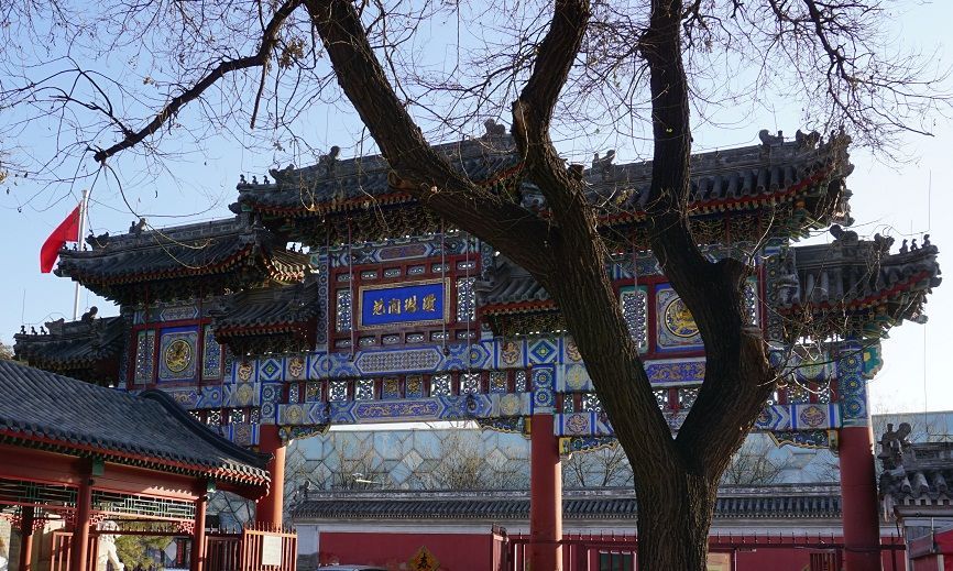
## Description The Taoist White Cloud Temple, also known as Baiyun Guan, is one of Beijing’s most important Taoist sites and one of the best places in the city to understand living religious tradition rather than imperial grandeur alone. Unlike the palaces and ceremonial complexes that often dominate Beijing itineraries, White Cloud Temple offers a quieter, more introspective experience centered on worship, ritual practice, and the continuity of Taoist culture in a modern metropolis. It is both a spiritual site and a historic monument, and that combination gives it a distinct atmosphere that feels deeply local. One of the reasons the temple stands out is that it has remained an active religious center for centuries. Visitors are not just looking at preserved architecture; they are entering a place where incense, prayer, and seasonal observance still matter. A lesser-known fact is that Baiyun Guan has long been associated with the Quanzhen school of Taoism, which helped shape its role as a major center for priestly training and ritual life. Another detail many travelers miss is that the temple complex includes multiple courtyards and halls arranged to guide visitors gradually from the street into a more contemplative inner space, which makes the visit feel like a transition rather than a simple sightseeing stop. For travelers, the appeal lies in both scale and texture. The temple is not overwhelming, yet it contains enough detail to reward slow observation. You will see ritual objects, stone inscriptions, prayer spaces, architectural ornament, and the quiet habits of worshippers who come for reasons unrelated to tourism. That authenticity matters. It gives White Cloud Temple a grounded energy that many visitors find memorable precisely because it is not trying to entertain them. Instead, it invites attention, patience, and respect. It is also an excellent introduction to Taoism for visitors who know the tradition only in abstract terms. The site demonstrates how religion, philosophy, architecture, and daily practice can coexist in one living space. In a city famous for imperial landmarks, White Cloud Temple offers a more intimate kind of historical depth. ## Location Taoist White Cloud Temple is located in Xicheng District, Beijing, China, not far from the central part of the city. Its placement makes it accessible without being swallowed by the busiest tourist corridors. Because Beijing is so large, that central-but-not-overcrowded location is a major advantage for visitors who want to combine the temple with other nearby cultural stops. The easiest way to reach the temple is by subway followed by a short walk, although taxis and rideshares are also practical. Public transit is usually the most efficient option in Beijing, especially during heavy traffic. Once you arrive, the temple is straightforward to enter, and the surrounding streets make it easy to transition from city noise into a quieter courtyard environment. If you want to build the visit into a broader Beijing day, it works well as part of a route that includes nearby historic neighborhoods, museums, or old city streets. Morning visits are often the best because the temple feels calm, the light is better for photography, and you are more likely to encounter ritual activity rather than only sightseeing crowds. ## Tips Dress modestly and behave respectfully. This is an active religious site, not just a museum. Arrive early if you want a quieter experience. The temple’s atmosphere is strongest before the day becomes too busy. Look closely at the courtyards and side halls. The most rewarding details are often not in the main entrance area but in the quieter corners. Bring cash or a card depending on current local habits, but do not assume every small purchase or offering will be handled the same way as in a Western museum setting. Take time to observe rather than rush through the complex. Baiyun Guan is best experienced as a slow walk through layered religious space. ## Conclusion The Taoist White Cloud Temple is one of Beijing’s most meaningful spiritual landmarks, combining active worship, historical continuity, and architectural calm. It is especially rewarding for travelers who want a more thoughtful and authentic view of the city. ## FAQ ### Is White Cloud Temple still active? Yes. It remains an active Taoist temple, which is part of what makes the visit so distinctive. ### How much time should I spend there? Most visitors will need 1 to 2 hours, though you can spend longer if you are interested in the history or want to observe the atmosphere more carefully. ### Is photography allowed? Policies can vary by area and current temple rules, so it is best to check on arrival and avoid photographing people without permission. ### Is this a good place for first-time visitors to Beijing? Yes, especially if you want to understand the city beyond its most famous imperial monuments. ## Links - [White Cloud Temple on Wikipedia](https://en.wikipedia.org/wiki/White_Cloud_Temple) - [Beijing official tourism](https://english.beijing.gov.cn/) - [Taoism overview](https://en.wikipedia.org/wiki/Taoism)
GemVoyage Team • World
Cape Town
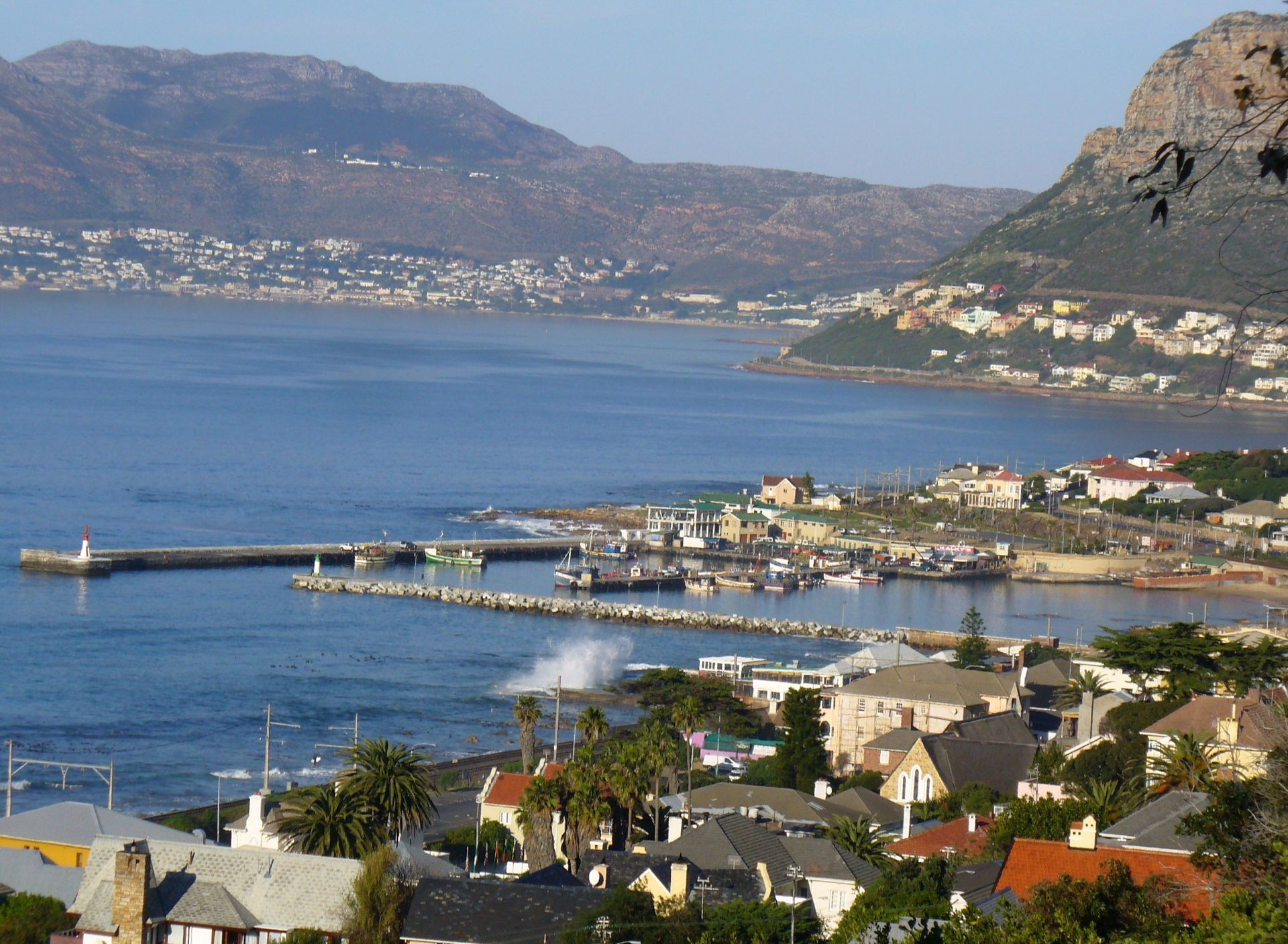
## Description Kalk Bay Harbour is one of those places that feels immediately alive. It is not a polished waterfront designed only for visitors, and that is exactly what makes it memorable. Fishing boats still work the water, gulls circle over the quays, and the rhythm of the harbor changes with the tides, the weather, and the catch of the day. In Cape Town, where many visitors focus on Table Mountain or the Atlantic coast, Kalk Bay offers a more intimate coastal experience. It is a place where everyday life and scenic charm overlap naturally. The harbor sits in the old fishing village of Kalk Bay, so the atmosphere is layered with history. Narrow streets, weathered buildings, small seafood spots, and the smell of the sea give the area a lived-in feel that is harder to find in more developed tourist precincts. One little-known detail is that Kalk Bay has long been associated with the Kalk Bay fishing community, whose routines still shape the harbor today. Another is that the surrounding bay often changes character dramatically within a few hours, which makes return visits rewarding because the light and water are rarely the same twice. What makes the harbor especially appealing is how many different experiences it offers in one compact area. You can watch fishing activity in the morning, stroll the quayside, browse nearby shops, and then settle in for coffee or seafood with views across False Bay. For travelers who like places that feel authentic rather than staged, Kalk Bay Harbour is a strong choice. It is scenic, but it is also practical, working, and slightly unpredictable. That mix gives it real personality. The harbor is also a useful place to slow down. Cape Town can be full of high-energy sightseeing, but Kalk Bay encourages a different pace. Visitors tend to linger, looking at boats, reading the sea, or simply sitting and watching local routines unfold. Even if you stay only an hour, the harbor leaves a strong impression because it feels like a slice of Cape Town that still belongs primarily to the people who live and work there. ## Location Kalk Bay Harbour is located in Kalk Bay, on the False Bay coast of Cape Town, in the Western Cape province of South Africa. The harbor sits south of the central city area, along the scenic coastal road that links the southern suburbs with Simon’s Town and the Cape Peninsula. It is easy to combine with a broader day trip through Muizenberg, St James, and the rest of the False Bay shoreline. The most practical way to reach it is by car, ride-hailing service, or by taking the Southern Line train and continuing on foot from Kalk Bay station. The walk from the station is short and pleasant, and it helps you arrive already tuned into the neighborhood’s slow coastal rhythm. If you are planning to explore several nearby stops, driving gives you the most flexibility, but parking can be tighter at busier times, especially on weekends and during holiday periods. If you are coming from central Cape Town, expect the journey to take roughly 30 to 45 minutes depending on traffic. Morning and late-afternoon visits are often best because the light is more dramatic and the harbor is especially active. The area is also accessible from other popular southern suburbs, so it works well as part of a larger False Bay outing rather than as a standalone destination. ## Tips - Go early if you want to see the harbor at its liveliest. Morning is when fishing activity is most noticeable and the atmosphere feels most local. - Bring a light jacket even on warm days. The sea breeze can be stronger than you expect, especially near the water’s edge. - Allow time to wander beyond the harbor itself. The surrounding streets and nearby coastline are part of the experience, not just the quayside. - Keep your camera ready, but do not rush the visit. The harbor rewards slow observation more than quick snapshots. - If you are planning to eat nearby, check opening hours in advance. Small coastal businesses may operate on schedules that differ from larger city restaurants. ## Conclusion Kalk Bay Harbour is a compact but deeply atmospheric stop in Cape Town, combining working coastal life, scenic views, and a strong sense of place. It is ideal for travelers who want a harbor that feels real, local, and full of character rather than overly curated. ## FAQ ### Is Kalk Bay Harbour worth visiting if I only have a short time in Cape Town? Yes. Even a short visit gives you a clear sense of the area’s character. You can watch the boats, walk the harbor edge, and experience a very different side of Cape Town from the usual landmark circuit. ### What is the best time of day to visit? Morning is usually best if you want to see the harbor working at full speed. Late afternoon is also attractive because the light softens over False Bay and the atmosphere becomes quieter. ### Can I visit Kalk Bay Harbour without a car? Yes. The train to Kalk Bay station is a practical option, followed by a short walk. Ride-hailing services are also convenient if you want a simpler door-to-door trip. ### Is the area around the harbor safe for walking around? Like any busy urban coastal area, it is best to stay aware of your surroundings, especially when it is crowded. During the day, the harbor and nearby streets are generally visited by many people and are easy to explore at a relaxed pace. ## Links - [Cape Town tourism](https://www.capetown.travel/) - [Kalk Bay on Wikipedia](https://en.wikipedia.org/wiki/Kalk_Bay)
GemVoyage Team • World
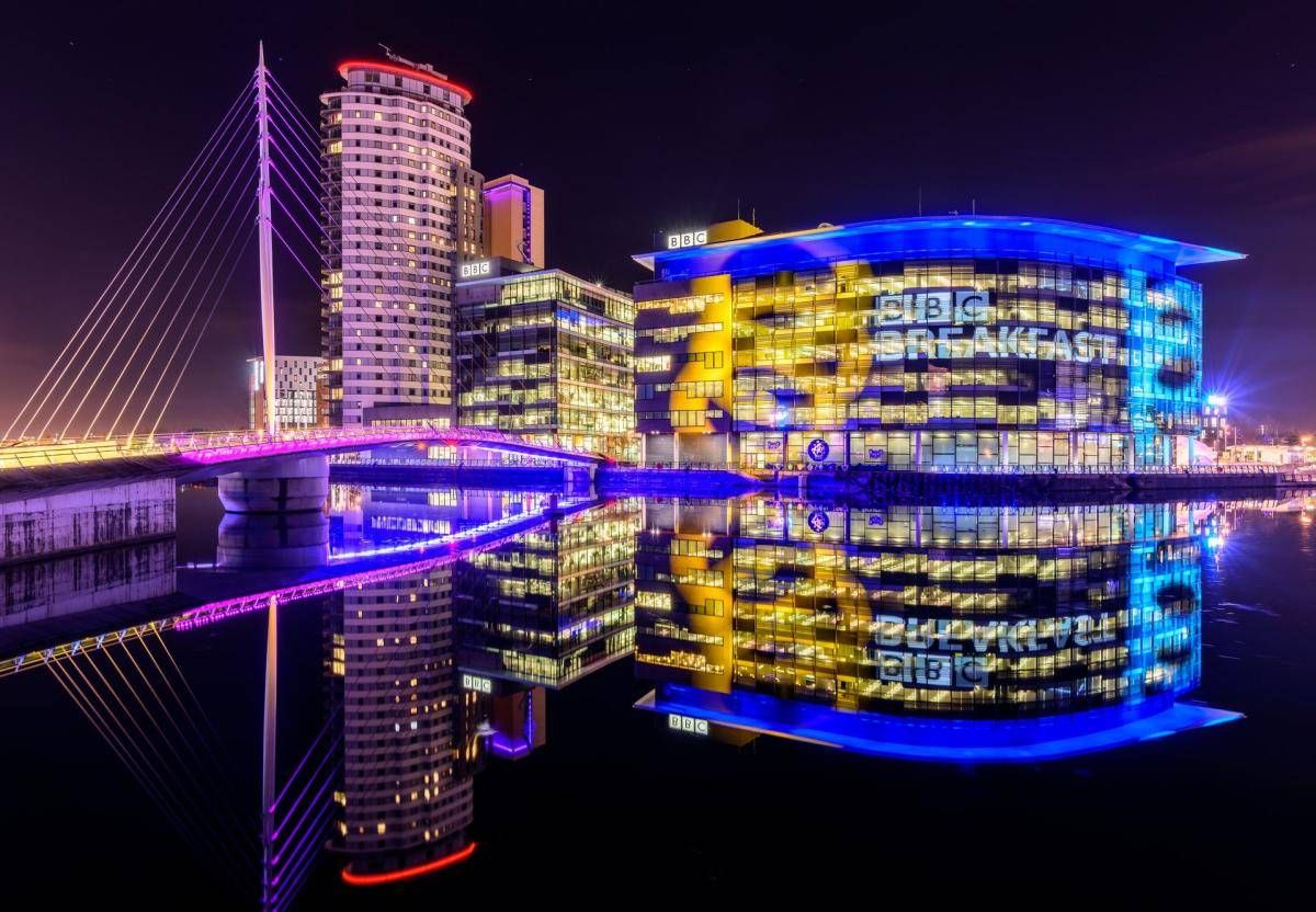
Manchester
## Description The Quays is one of Manchester’s most dynamic and visually striking waterfront areas, known for its blend of modern architecture, cultural landmarks, and leisure spaces. Once part of the historic Manchester Docks, this area has been completely transformed into a contemporary district that reflects the city’s industrial past while embracing innovation and creativity. Today, The Quays is a popular destination for both locals and visitors, offering museums, media hubs, restaurants, and scenic walking routes along the water. What makes The Quays unique is its successful regeneration story. Formerly an active dock system that played a vital role in Britain’s industrial trade, the area fell into decline in the late 20th century before being reimagined as a cultural and media center. A little-known fact is that the docks here were once among the busiest inland ports in the world. Another interesting detail is that The Quays is home to MediaCityUK, where major broadcasters operate live studios, allowing visitors to see television and radio production happening in real time. With iconic attractions such as The Lowry arts center and the Imperial War Museum North, The Quays offers a balanced mix of history, culture, and modern urban life. ## Location The Quays is located in **England**, in the **Greater Manchester** region, within the city of **Manchester**, primarily spanning the Salford Quays area. It lies just west of Manchester city center, along the Manchester Ship Canal. Getting to The Quays is easy and convenient. The Metrolink tram system provides direct access via stops such as **MediaCityUK** and **Salford Quays**, connecting the area to Manchester Piccadilly and other key parts of the city. Several bus routes also serve the area. For those arriving by car, parking is available at various nearby facilities, though public transport is often the most efficient option. ## Tips * Wear comfortable shoes, as the waterfront paths are ideal for walking and exploring the area on foot. * Visit in the late afternoon or evening to enjoy reflections on the water and vibrant nightlife. * Check event schedules at The Lowry and MediaCityUK, as performances and live broadcasts are frequent. * Combine your visit with a museum stop, especially the Imperial War Museum North, which offers free entry. * Bring a light jacket, as the waterfront can feel cooler and windier than the city center. * Photography enthusiasts will appreciate the modern skyline and waterside views, especially at sunset. ## Conclusion The Quays is a standout example of Manchester’s reinvention, transforming historic docks into a lively cultural and entertainment district. Its mix of museums, media, dining, and scenic walks makes it an essential stop for anyone exploring the city. ## FAQ **Is The Quays suitable for families?** Yes, the area is family-friendly, with open spaces, museums, and regular events suitable for all ages. **How much time should I spend at The Quays?** Most visitors spend between two and four hours, depending on activities and attractions visited. **Are there free attractions at The Quays?** Yes, attractions like the Imperial War Museum North offer free entry. **Is The Quays accessible for people with limited mobility?** Yes, the area is modern and generally well equipped with step-free access and wide pathways. **Can I eat and drink at The Quays?** Absolutely. The area offers a wide range of cafés, bars, and restaurants with waterfront views. ## Links * [The Quays Official Website](https://www.thequays.org.uk)
GemVoyage Team • World
