GemVoyage Team • World
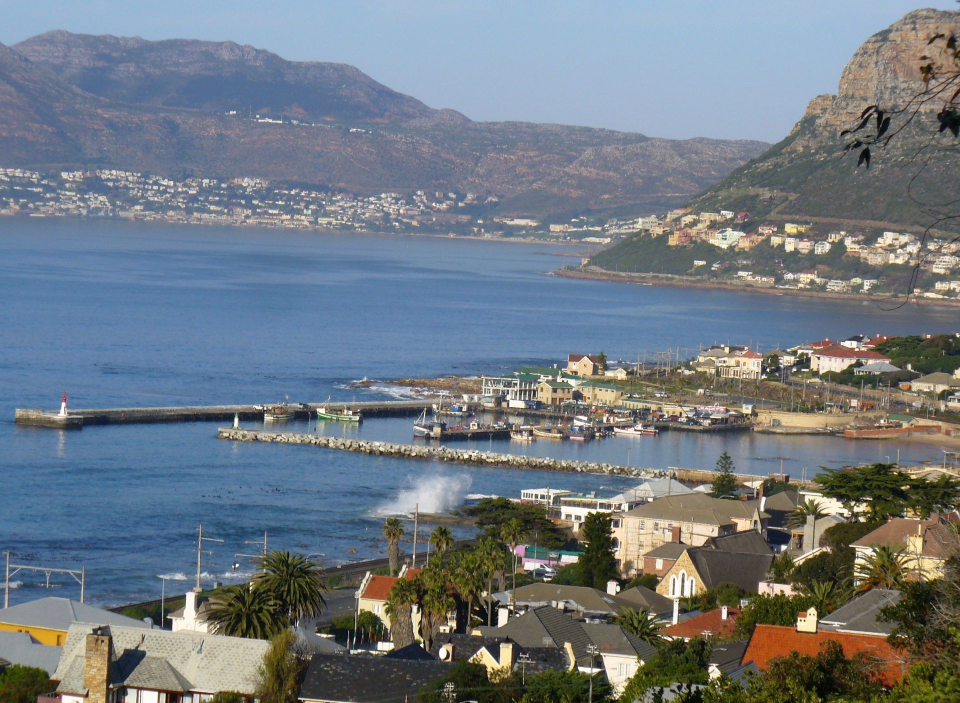
The harbor sits in the old fishing village of Kalk Bay, so the atmosphere is layered with history. Narrow streets, weathered buildings, small seafood spots, and the smell of the sea give the area a lived-in feel that is harder to find in more developed tourist precincts. One little-known detail is that Kalk Bay has long been associated with the Kalk Bay fishing community, whose routines still shape the harbor today. Another is that the surrounding bay often changes character dramatically within a few hours, which makes return visits rewarding because the light and water are rarely the same twice.
What makes the harbor especially appealing is how many different experiences it offers in one compact area. You can watch fishing activity in the morning, stroll the quayside, browse nearby shops, and then settle in for coffee or seafood with views across False Bay. For travelers who like places that feel authentic rather than staged, Kalk Bay Harbour is a strong choice. It is scenic, but it is also practical, working, and slightly unpredictable. That mix gives it real personality.
The harbor is also a useful place to slow down. Cape Town can be full of high-energy sightseeing, but Kalk Bay encourages a different pace. Visitors tend to linger, looking at boats, reading the sea, or simply sitting and watching local routines unfold. Even if you stay only an hour, the harbor leaves a strong impression because it feels like a slice of Cape Town that still belongs primarily to the people who live and work there.
The most practical way to reach it is by car, ride-hailing service, or by taking the Southern Line train and continuing on foot from Kalk Bay station. The walk from the station is short and pleasant, and it helps you arrive already tuned into the neighborhood’s slow coastal rhythm. If you are planning to explore several nearby stops, driving gives you the most flexibility, but parking can be tighter at busier times, especially on weekends and during holiday periods.
If you are coming from central Cape Town, expect the journey to take roughly 30 to 45 minutes depending on traffic. Morning and late-afternoon visits are often best because the light is more dramatic and the harbor is especially active. The area is also accessible from other popular southern suburbs, so it works well as part of a larger False Bay outing rather than as a standalone destination.
Discover more hidden gems you might love.
Paris
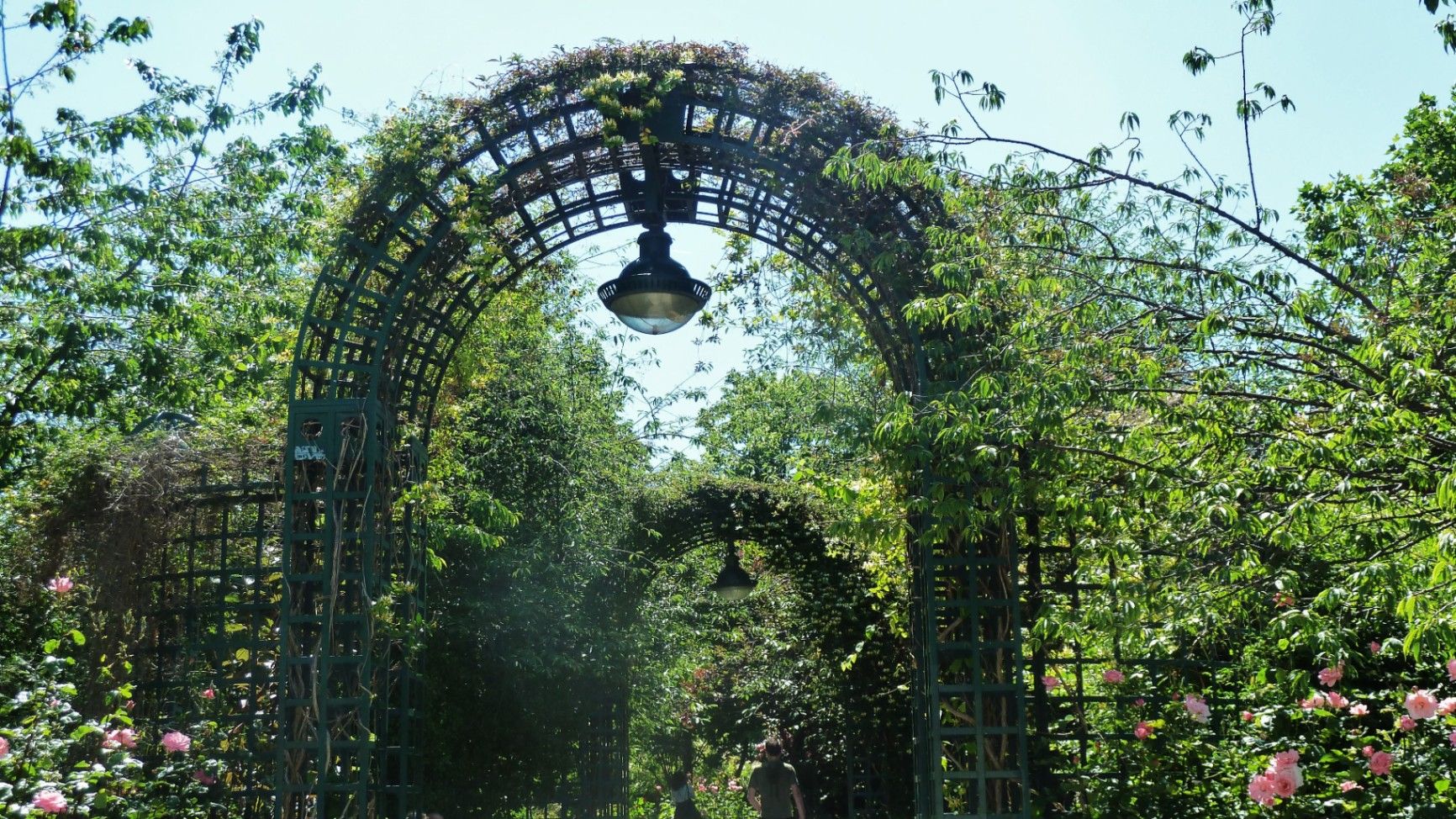
## Description The **Coulée Verte René-Dumont** is one of Paris’s most quietly transformative urban landscapes: a **4.7-kilometer elevated green corridor** built on a former 19th-century railway viaduct. Long before New York’s High Line became famous, Paris had already pioneered the idea of reclaiming industrial infrastructure and turning it into a **linear park suspended above city streets**. Opened in **1993**, the Coulée Verte stretches across eastern Paris, offering a continuous ribbon of trees, gardens, pergolas, tunnels, and walkways that float above neighborhoods, rooftops, and traffic. Rather than being a monumental tourist attraction, its strength lies in its **subtle intimacy**. The path winds between apartment balconies, over narrow streets, through shaded cuttings, and across stone viaducts, allowing visitors to experience Paris from an **unexpected vertical perspective**. The design philosophy of the park is deeply rooted in **soft landscaping rather than formal symmetry**. Instead of wide lawns or dramatic vistas, the Coulée Verte contains **layered vegetation, winding paths, seasonal flowers, bamboo groves, climbing roses, and shaded benches**. This makes it feel more like a secret garden than a grand urban park. One of the most remarkable architectural features of the route is the **Viaduc des Arts**, where the park runs along a series of brick arches originally built for railway use. Beneath these arches now sit artisan workshops, design studios, galleries, instrument makers, and boutique craftspeople. This dual-level experience—**green tranquility above and creative commerce below**—is one of the Coulée Verte’s defining identities. Unlike Paris’s grand axial parks such as the Tuileries or Luxembourg Gardens, the Coulée Verte offers a **continuously shifting urban narrative**. At one point, you are enclosed in forest-like silence; minutes later, you emerge into balcony-lined streets where residents drink coffee just meters away from your path. This creates an emotional tension between **privacy and exposure**, urban density and botanical escape. A little-known fact is that the park is named after **René Dumont**, a pioneering French agronomist and environmentalist who was also **France’s first Green Party presidential candidate**. The naming itself reinforces the park’s identity not just as a recreational space, but as a **symbol of ecological urban thinking**. Another little-known detail is that parts of the route pass directly behind residential buildings at eye level, leading to long-standing unspoken etiquette between walkers and residents regarding privacy. Today, the Coulée Verte is used daily by **joggers, dog walkers, commuters, couples, photographers, and elderly residents**, each group engaging with the space differently depending on time of day. Mornings are quiet and rhythmical. Afternoons bring families and visitors. Evenings soften into slow movement, conversation, and golden-hour light filtering through leaves onto brick and stone. The Coulée Verte does not dominate Paris visually or symbolically. Instead, it **slips through the city like a green seam**, quietly stitching nature into urban density. ## Location The **Coulée Verte René-Dumont** runs through the **12th arrondissement of Paris**, beginning near **Opéra Bastille** and extending eastward toward the **Périphérique (city ring road)**. **City:** Paris **Region:** Île-de-France **Country:** France **Primary Arrondissement:** 12th **Main Entrance Area:** Near Bastille and Avenue Daumesnil ### How to Get There: * **By metro:** * **Line 1, 5, or 8** to **Bastille Station** * **Line 6 or 8** to **Daumesnil Station** * **By RER:** **RER A** to **Nation Station**, then walk. * **By bus:** Multiple lines serve Avenue Daumesnil and the surrounding streets. * **By bicycle:** Easy access from eastern Paris cycle lanes. * **On foot:** Ideal as part of a walking route between Bastille, Bercy, and Nation. Multiple staircases and ramps provide access at different points along the route. ## Tips * **Walk the full length if possible:** The character of the park changes dramatically from west to east. * **Visit in spring or early autumn:** Vegetation is at its best and temperatures are comfortable. * **Early mornings are best for solitude:** Especially on weekdays. * **Evenings are best for atmosphere:** Soft lighting and slower rhythms dominate. * **Respect residential privacy:** Some sections run directly past apartment windows. * **Combine with Viaduc des Arts shopping:** The artisan shops beneath the arches are worth exploring. * **Bring water:** There are few vendors directly on the elevated path. * **Not ideal for fast cycling:** The path is narrow and shared heavily with pedestrians. ## Conclusion The **Coulée Verte René-Dumont** is not loud, monumental, or iconic in the traditional Parisian sense. Its power lies in **subversion and continuity**—a quiet green artery that transforms obsolete railway infrastructure into a flowing garden above the city. It offers a Paris of **movement, transition, and subtle beauty**, experienced not through grand monuments, but through shifting light, layered leaves, and elevated urban silence. ## FAQ **1. What is the Coulée Verte René-Dumont?** It is an **elevated linear park** built on an abandoned railway line in eastern Paris. **2. Is the Coulée Verte free to access?** Yes. It is **completely free and open to the public**. **3. How long does it take to walk the full route?** A full walk typically takes **1 to 1.5 hours** at a relaxed pace. **4. Is it similar to the High Line in New York?** Yes in concept, but the Coulée Verte is **older, greener, and more intimate** in character. **5. Is the park suitable for children?** Yes. It is widely used by families, though supervision is required in elevated or narrow sections. **6. Are there cafés or shops along the route?** Not directly on the path, but many cafés and bakeries are located at street level nearby. ## Links * [Paris City Guide](https://parisjetaime.com/eng/)
GemVoyage Team • World
Ontario
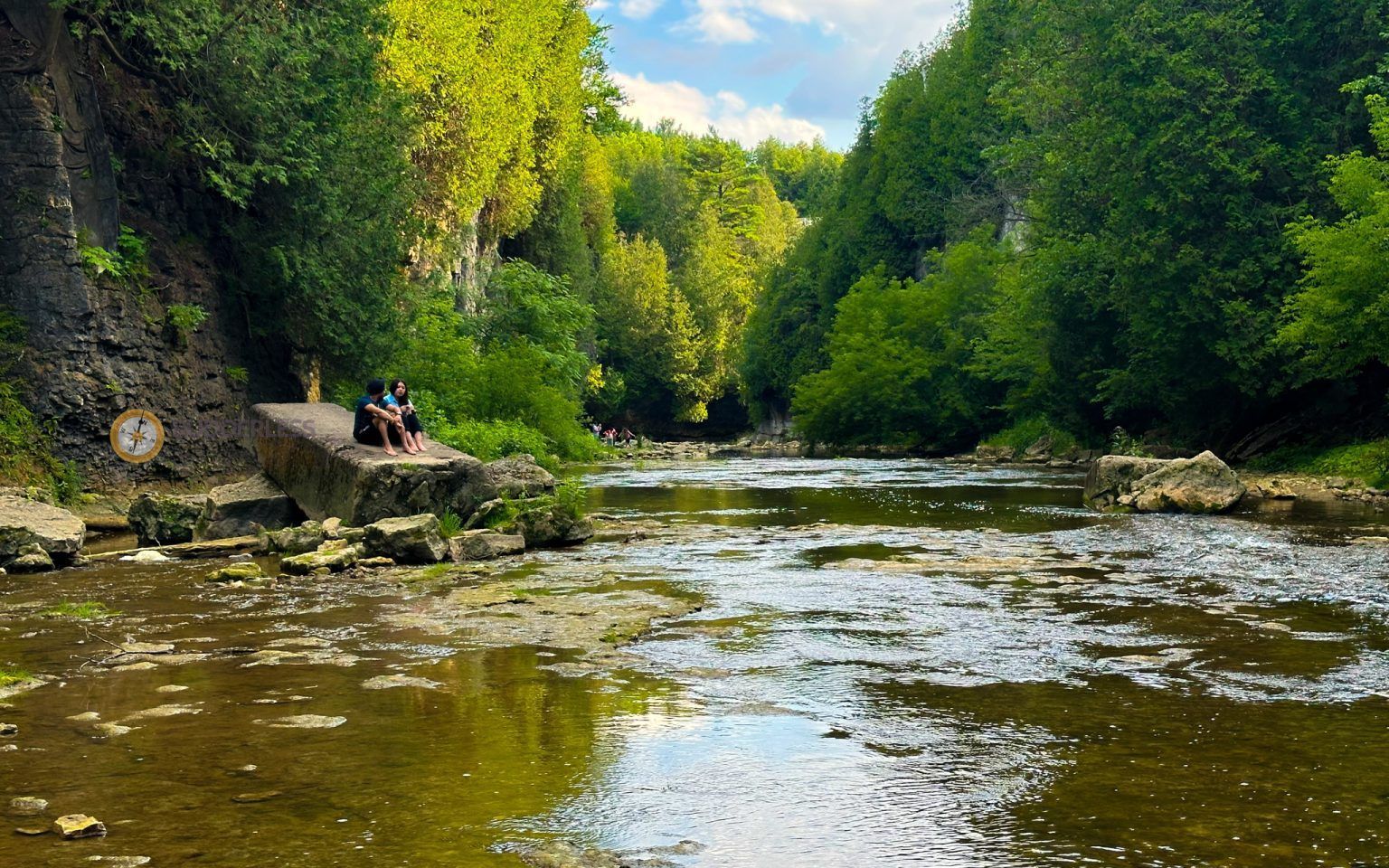
## Description Elora Gorge is one of Ontario’s most striking natural attractions, known for its steep limestone cliffs, fast-moving Grand River scenery, and a landscape that feels more dramatic than most visitors expect from southern Ontario. The gorge is part nature preserve, part outdoor recreation area, and part classic day-trip destination. People come for the views, the trails, the river access, and the feeling of standing in a place where water has carved a deep, narrow route through rock over a very long span of time. What makes Elora Gorge memorable is its contrast. The surrounding region is gently rural and easygoing, but the gorge itself is rugged and visually intense. When you stand on the edge and look down, the river appears surprisingly powerful as it moves through the canyon-like setting. The rock walls, tree cover, and water together create a scene that feels almost larger than life for a place that is relatively easy to access from nearby towns and cities. It is the kind of landscape that immediately rewards anyone who likes geology, photography, hiking, or simply being outdoors. One little-known fact about the area is how much its shape influences the mood of the visit. Even short walks feel more memorable because the viewpoint changes quickly from forest to cliff edge to river corridor. Another detail many visitors appreciate only after arriving is how seasonally different the gorge can feel. In spring, the river runs energetically and the foliage is fresh. In summer, the greens are dense and the area becomes a prime outdoor destination. In autumn, the cliffs and trees around the gorge can create a particularly vivid palette. Winter visits are quieter and more austere, but they can also be beautiful in a stark, sculptural way. Elora Gorge is also appealing because it can satisfy different travel styles. A casual visitor can enjoy the scenery and take a short walk, while a more active traveler can turn the visit into a longer outdoor outing. The gorge is one of those places where people often arrive with modest expectations and leave impressed by how photogenic and substantial it feels. ## Location Elora Gorge is in Ontario, Canada, near the village of Elora and within reach of the wider Waterloo Region and Wellington County area. The gorge is associated with the Grand River and is close enough to several southwestern Ontario cities to function as a realistic day trip. For many travelers, the easiest way to visit is by car, since that gives the most flexibility for parking, timing, and combining the gorge with nearby Elora village or other regional stops. If you are driving from Toronto, Kitchener-Waterloo, Guelph, or nearby communities, the route is straightforward enough for a day outing. Public transit is usually less convenient, so road travel is the most practical option for most visitors. Once you arrive, the experience is mostly about walking, looking, and choosing how active you want to be. If you are planning a fuller outdoor day, it makes sense to pair the gorge with village cafés, local shops, or other conservation-area activities in the surrounding region. ## Tips Wear footwear that can handle uneven paths and potentially muddy or damp ground. The gorge is beautiful, but it is not a place where fashionable footwear matters more than stability and comfort. If you want photos from scenic viewpoints, take your time and be cautious near edges and steep sections. The views are worth slowing down for, and safety should always come first. Check conditions before you go. Water levels, trail conditions, and seasonal access can change the experience significantly. A gorge that looks calm in one season can be much more energetic in another, and some areas may be better suited to certain weather conditions. If you are visiting with children, choose routes and viewpoints that match their energy and attention span. Bring water, snacks, and weather-appropriate layers. The gorge can feel cooler or windier than the nearby town, and you may spend more time outside than planned once you start enjoying the scenery. If you are interested in photography, morning and late afternoon are usually the best times for softer light. Consider making time for Elora village as well. The gorge is the headline attraction, but the surrounding area often makes the trip more satisfying. Many visitors find that pairing the natural site with a meal or wander in town creates the most balanced experience. ## Conclusion Elora Gorge is one of Ontario’s most rewarding scenic escapes, offering dramatic geology, outdoor recreation, and easy access from nearby communities. It is a strong choice for travelers who want nature without a complicated journey. ## FAQ ### Is Elora Gorge good for a quick visit? Yes. Even a short stop can be worthwhile if you want a scenic view and a brief walk. If you have more time, though, the gorge becomes much richer because you can explore the trails and surrounding area more fully. ### Is it suitable for families? It can be, provided you choose paths and viewpoints that fit your group’s comfort level. Families should pay close attention near steep edges and areas with uneven terrain. ### What is the best season to visit? There is no single best season, because each one has a different appeal. Spring and autumn are especially attractive for scenery, while summer is popular for outdoor activity and longer visits. ### Do I need to be an experienced hiker? No. There are options for casual visitors as well as more active hikers. You can tailor the trip to your own pace and interests. ### Can I see the gorge without a long hike? Yes. The attraction is accessible enough that you can enjoy views and the setting without committing to a major hike, although walking deeper into the area gives a fuller experience. ## Links - [Wikipedia](https://en.wikipedia.org/wiki/Elora_Gorge_Conservation_Area)
GemVoyage Team • World
Bosnia
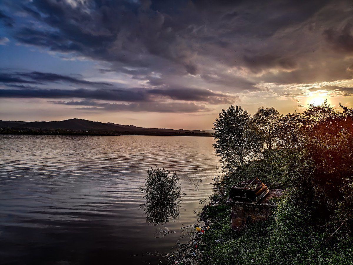
## Description **Modrac Lake (Modračko jezero)** is one of the largest artificial lakes in Bosnia and Herzegovina and a significant recreational and economic resource for the northeastern part of the country. Created in the 1960s by damming the **Spreča River**, the lake was originally built to supply water for industry and surrounding towns. Over time, it evolved into a **popular leisure destination**, especially during the summer months. What makes Modrac Lake distinctive is its **dual identity**. On one hand, it is a functional reservoir supporting industry and agriculture in the Tuzla region. On the other, it serves as a relaxed getaway for locals, offering swimming areas, weekend houses, fishing spots, and informal beaches. Unlike heavily commercialized European lakes, Modrac retains a raw, local character shaped more by everyday use than tourism planning. A lesser-known fact is that before the lake was created, several villages and agricultural lands were submerged, permanently altering the local landscape and economy. Another interesting detail is that Modrac Lake supports a **diverse fish population**, including carp, catfish, pike, and perch, making it one of the most important freshwater fishing locations in the region. The atmosphere around the lake is informal and authentic. Small cafés, seasonal food stands, and family-owned cottages line parts of the shoreline, particularly near towns and villages. This gives visitors a genuine glimpse into regional leisure culture rather than a curated tourist experience. ## Location **Country:** Bosnia and Herzegovina **Region:** Tuzla Canton **Nearest Cities:** Tuzla, Lukavac, Živinice Modrac Lake lies in **northeastern Bosnia**, about 15 kilometers southwest of Tuzla, stretching between several municipalities. ### How to Get There * **By car:** * The easiest and most flexible option. From Tuzla, the drive takes about 20–30 minutes depending on the access point. * **By taxi:** * Available from Tuzla and nearby towns, though return arrangements should be planned. * **By local transport:** * Buses connect Tuzla with nearby towns such as Lukavac and Živinice, followed by short walks to the shore. ## Tips * **Visit in summer:** July and August are the most active months, with swimming and lakeside life at its peak. * **Choose your access point carefully:** Some areas are better maintained and cleaner than others. * **Bring your own supplies:** Facilities vary greatly depending on the location. * **Fishing requires a permit:** Licenses can be obtained locally. * **Avoid swimming after heavy rain:** Water clarity can decrease due to runoff. * **Respect the environment:** As a working reservoir, preservation depends largely on visitor behavior. ## Conclusion Modrac Lake is not a polished resort, but a **functional and lived-in landscape** that plays an important role in local life. Its wide shoreline, relaxed atmosphere, and accessibility make it a meaningful destination for those interested in regional culture, outdoor relaxation, and everyday Bosnia beyond major tourist routes. ## FAQ **1. Is Modrac Lake natural or artificial?** It is an artificial lake created by damming the Spreča River. **2. Can you swim in Modrac Lake?** Yes, swimming is common in designated areas, especially during summer. **3. Is the lake clean?** Water quality varies by location and season; some areas are better maintained than others. **4. Is Modrac Lake good for fishing?** Yes. It is one of the most important fishing lakes in northeastern Bosnia. **5. Are there hotels around the lake?** Accommodation is limited; most visitors stay in Tuzla or nearby towns. **6. Is Modrac Lake suitable for tourists?** Yes, particularly for travelers seeking local experiences rather than resort-style tourism. ## Links * [Bosnia and Herzegovina tourism portal](https://www.tourismbih.com/)
GemVoyage Team • World
Tokyo
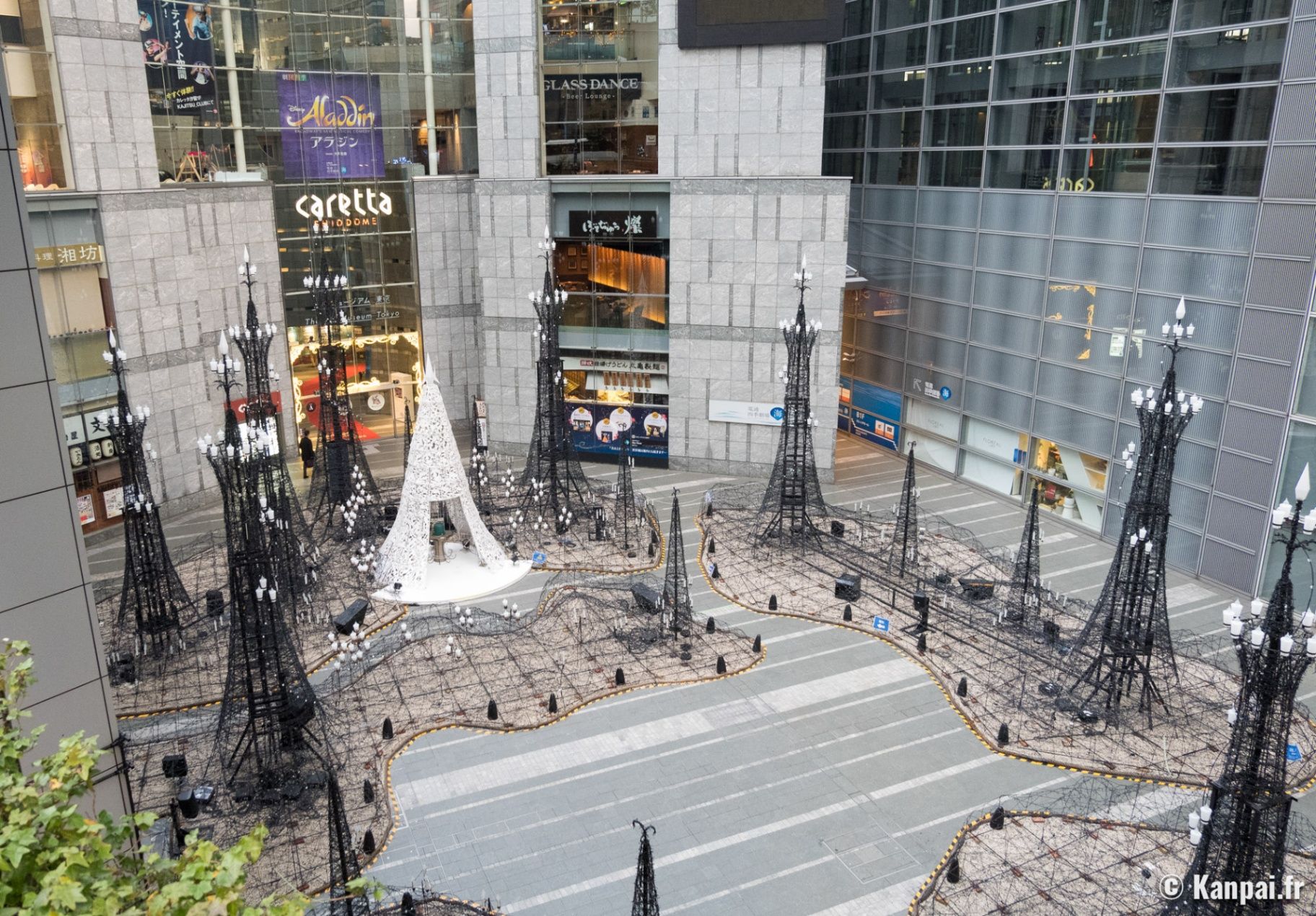
## Description **Caretta Shiodome (カレッタ汐留)** is a striking skyscraper complex in the **Shiodome district** of **Tokyo**, Japan, that perfectly embodies the city’s modern sophistication and cultural vibrancy. Rising 51 stories above the bustling streets of Minato Ward, this landmark blends **shopping, dining, art, and entertainment** into one of Tokyo’s most polished urban experiences. Opened in **2002**, Caretta Shiodome is part of the Shiodome redevelopment project that transformed an old railway yard into a futuristic business and leisure zone. Inside, visitors will find an elegant mix of **restaurants, boutique shops, a theater, a museum, and panoramic observation areas** — all designed with contemporary style and efficiency. What makes Caretta Shiodome truly unique is its seamless combination of **commerce and culture**. It houses the **Caretta Shiodome Sky View**, an observation area on the 46th floor offering spectacular views of Tokyo Bay, Odaiba, and the Rainbow Bridge. The complex is also home to the **Advertising Museum Tokyo (ADMT)**, Japan’s only museum dedicated to the history of advertising — a fascinating and often overlooked gem that reveals how Japanese media and design evolved over the decades. Another standout feature is the **Caretta Illumination**, one of Tokyo’s most beloved **winter light displays**. Each year, from November through February, the plaza outside the building is transformed into a glittering wonderland of over **250,000 LED lights**, synchronized to music. It attracts couples, photographers, and families alike, and has become a symbol of Tokyo’s festive season. A lesser-known fact is that Caretta Shiodome’s name, “Caretta,” is derived from *Caretta caretta*, the Latin name for the **loggerhead sea turtle**, symbolizing endurance, longevity, and connection to the ocean — an apt metaphor for Tokyo’s harmony between progress and nature. ## Location Caretta Shiodome is located in the **Shiodome district** of **Minato Ward**, **Tokyo, Japan**. It sits within the Shiodome City Center area, just a short walk from **Shimbashi Station** and surrounded by major landmarks like the **Hamarikyu Gardens** and **Ginza**. To get there: * **By train:** * Take the **Toei Ōedo Line** or **Yurikamome Line** to **Shiodome Station** (direct underground access). * Alternatively, take the **JR Yamanote Line** or **Tokyo Metro Ginza Line** to **Shimbashi Station**, and walk about **5 minutes** via underground passages. * **By foot:** It’s a pleasant 10-minute walk from **Ginza** or **Tsukiji** areas. * **By car:** Paid parking is available in the basement levels, though public transport is highly recommended due to central Tokyo traffic. ## Tips * **Visit during the evening:** Especially in winter, when the **Caretta Illumination** lights up the plaza with dazzling colors and music. * **Go up to the 46th or 47th floors:** For a **free panoramic view** of Tokyo Bay — one of the best free observation spots in the city. * **Dine with a view:** Restaurants like **Sky View Dining and Bar** or **KAIKAYA Shiodome** offer gourmet meals paired with sweeping skyline vistas. * **Visit the Advertising Museum Tokyo (ADMT):** Admission is free, and it’s an engaging stop for design enthusiasts and marketers. * **Combine with nearby attractions:** The **Hamarikyu Gardens** and **Ginza shopping district** are within walking distance. * **Check event schedules:** Seasonal exhibitions, performances, and cultural events are regularly held within the complex. * **Best time to visit:** Late afternoon to evening — explore the shops and museum first, then stay for dinner and the illumination. ## Conclusion **Caretta Shiodome** is a shining example of modern Tokyo — a place where art, architecture, and lifestyle converge high above the city streets. From its world-class restaurants and free observation decks to its mesmerizing light displays and creative museum, it offers something for everyone. Whether you’re looking to dine with a skyline view, learn about Japan’s advertising culture, or simply soak in the illuminated atmosphere of Tokyo at night, Caretta Shiodome delivers a distinctly urban yet deeply memorable experience. ## FAQ **1. What is Caretta Shiodome?** It’s a high-rise complex in Tokyo that features **shopping, dining, a theater, the Advertising Museum Tokyo, and seasonal events** like the Caretta Illumination. **2. Where is it located?** At **1-8-2 Higashi-Shimbashi**, **Minato-ku**, **Tokyo**, within walking distance from **Shiodome Station** and **Shimbashi Station**. **3. Is there an observation deck?** Yes — the **Sky View on the 46th and 47th floors** offers **free access** to stunning views of Tokyo Bay and the skyline. **4. What is the Caretta Illumination?** A famous **winter light display** that transforms the plaza into a sea of LED lights, usually from **November to February** each year. **5. Is the Advertising Museum Tokyo free?** Yes, **entry is free**, and it’s a must-visit for those interested in Japanese advertising, pop culture, and design history. **6. Are there restaurants with views?** Yes, several high-end restaurants and bars offer panoramic dining experiences overlooking Tokyo Bay and the Shiodome area. ## Links * [Official Caretta Shiodome Website](https://www.caretta.jp/foreign/index)
GemVoyage Team • World
Gmunden
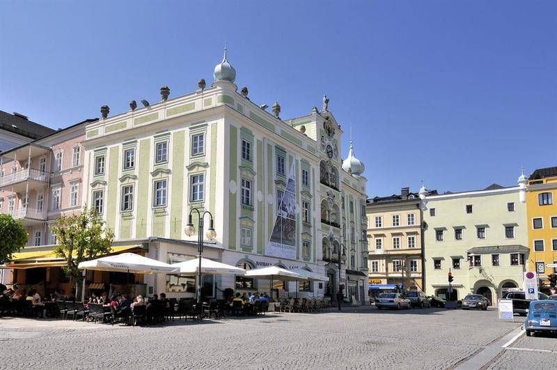
## Description The **Rathaus Gmunden** — the **Town Hall of Gmunden** — is one of Austria’s most charming and picturesque civic buildings, perfectly reflecting the town’s **historic elegance and lakeside serenity**. Standing proudly on the shore of **Traunsee Lake**, surrounded by the scenic peaks of the **Salzkammergut Mountains**, this 16th-century building combines Renaissance architecture, local craftsmanship, and cultural pride in a way few town halls do. Built between **1574 and 1577**, the Rathaus originally served as a **merchant and administrative center** during a period when Gmunden was thriving as a salt-trading hub. Its architecture features a **Renaissance façade** with beautifully arched arcades, intricate window frames, and an elegant clock tower topped with a small bell turret. The building’s exterior is painted in soft pastel hues that harmonize with the lakeside scenery, giving it a warm and inviting appearance. However, what truly makes Rathaus Gmunden stand out — and one of Austria’s most photographed town halls — is its **ceramic carillon** (a set of bells made from Gmunden pottery). Installed in **1961**, this unique feature consists of **24 hand-painted ceramic bells**, crafted by local artisans from the renowned **Gmundner Keramik** workshop, which has been producing distinctive green-flamed pottery since the 17th century. Several times a day, the bells chime melodiously across the old town, filling the air with a sound that has become a symbol of Gmunden’s artistic heritage. Few visitors realize that it is **one of the only ceramic carillons in the world** still in operation — a beautiful fusion of art, music, and tradition. Inside, the Rathaus still functions as the **seat of the local government**, but parts of it are open to visitors, showcasing historical rooms, exhibitions, and cultural displays. The nearby **Rathausplatz (Town Hall Square)** hosts markets, festivals, and outdoor concerts throughout the year, offering a lively glimpse of local life. Whether you visit for its craftsmanship, its lakeside views, or the charm of its daily chimes, Rathaus Gmunden is a small-town treasure that embodies the **soul of the Austrian Alps**. ## Location The **Rathaus Gmunden** is located in the **heart of Gmunden**, a town in **Upper Austria (Oberösterreich)**, on the **northern shore of Lake Traunsee**. **Address:** Rathausplatz 1, 4810 Gmunden, Austria To get there: * **By train:** From **Linz** or **Salzburg**, take an **ÖBB regional train** to **Gmunden Station**, then walk about **10–15 minutes** to the old town. * **By tram:** From the station, you can also take the **Traunseetram**, which stops near Rathausplatz. * **By car:** Easily accessible via the **A1 motorway**, exit **Regau** or **Laakirchen**, with several nearby parking options. * **By boat:** Ferries on **Traunsee Lake** stop at **Gmunden Seebahnhof**, just steps away from the Town Hall. * **By foot or bike:** The promenade around the lake connects the Rathaus to the main attractions of Gmunden, including **Schloss Ort** and the **Esplanade**. ## Tips * **Don’t miss the carillon performance:** The ceramic bells ring several times daily — typically at **11:00 AM**, **3:00 PM**, and **5:00 PM** (check local schedules). * **Visit the Gmundner Keramik Manufaktur:** Just outside town, you can see how the world-famous green-flamed pottery is made — a perfect complement to the Rathaus visit. * **Take photos from the lake promenade:** The Town Hall reflected in the water, with mountains in the background, is one of Austria’s most postcard-worthy views. * **Enjoy the market:** On Fridays, Rathausplatz hosts a **local farmers’ market** selling fresh regional produce, cheese, and crafts. * **Visit nearby Schloss Ort:** A short walk away, this fairytale castle on the lake is another Gmunden highlight. * **Stop for coffee by the lake:** There are several cozy cafés around Rathausplatz with views of the water and the mountains. * **Combine with a boat tour:** Scenic cruises on Traunsee often pass by the Rathaus, offering a new perspective from the lake. ## Conclusion The **Rathaus Gmunden** is far more than a historic building — it’s the **heart of a town steeped in art, tradition, and Alpine beauty**. From its Renaissance architecture to the enchanting ceramic bells that sing across Traunsee, it tells the story of a community that has blended craftsmanship and culture for centuries. Whether you’re exploring the Salzkammergut for its lakes, castles, or peaceful charm, a stop at the Rathaus Gmunden is an experience that captures the very essence of Austrian heritage. ## FAQ **1. When was the Rathaus Gmunden built?** It was constructed between **1574 and 1577** during the height of Gmunden’s salt-trading prosperity. **2. What makes the Rathaus special?** Its **ceramic carillon**, made from locally produced Gmundner pottery, is **one of the few of its kind in the world**. **3. How often does the carillon play?** The bells ring several times daily, typically at **11:00 AM, 3:00 PM, and 5:00 PM**, though times may vary seasonally. **4. Can visitors enter the Rathaus?** Yes, parts of the building are open to visitors, especially during cultural events or exhibitions. **5. Where is Gmunden located?** Gmunden lies on **Lake Traunsee** in **Upper Austria (Oberösterreich)**, roughly halfway between **Linz** and **Salzburg**. **6. Is it easy to reach from Vienna or Salzburg?** Yes — from Vienna or Salzburg, take a train to **Attnang-Puchheim**, then connect to Gmunden via a regional line (total travel time: around **2 hours**). **7. What nearby attractions should I see?** Don’t miss **Schloss Ort**, **Traunsee Lake cruises**, and the **Gmundner Keramik Factory** for a complete cultural experience. ## Links * [Gmunden Tourism Official Website](https://www.gmunden.at)
GemVoyage Team • World
Stockholm
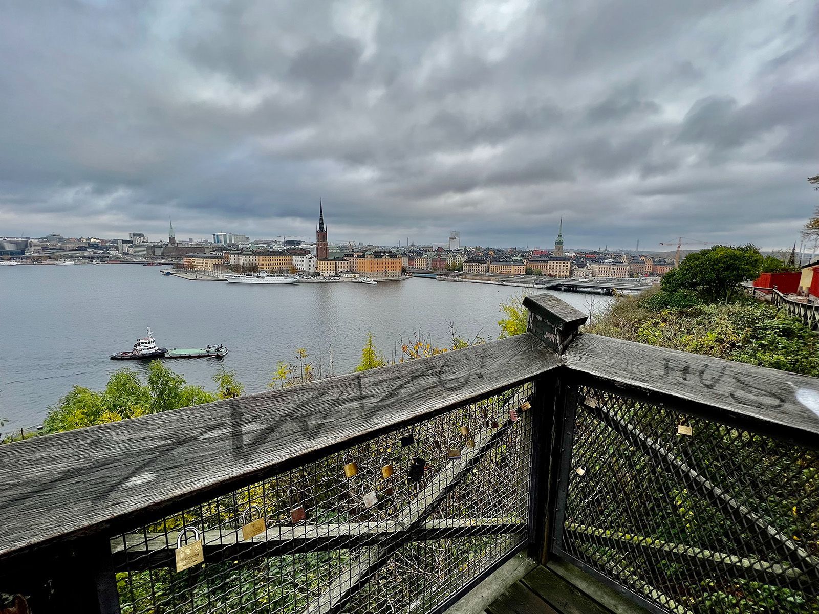
## Description Monteliusvägen is one of Stockholm’s most beloved viewpoint walks because it offers a remarkable amount of scenery for very little effort. Stretching along Mariaberget in Södermalm, the path gives visitors panoramic views over Riddarfjärden, City Hall, and the water and skyline that define Stockholm’s visual identity. It is a place where walking becomes part of the sightseeing itself, and where the city looks especially elegant in changing light. The viewpoint’s appeal lies in its mixture of accessibility and atmosphere. You do not need to climb a mountain or travel far from the center to get a memorable outlook. Instead, you can step into a residential and elevated part of the city and find a broad view that feels almost theatrical. One little-known fact is that Monteliusvägen is particularly admired by locals for how reliably it delivers a strong skyline view without the crowds associated with more obvious tourist stops. Another is that the path changes character with the seasons; winter can make the scenery crisp and graphic, while summer brings long, luminous evenings and a more relaxed mood. What also makes Monteliusvägen special is that it combines motion and pause. As you walk, the city opens and closes in layers. You might pass benches, low walls, and quiet residential details, then suddenly find a view that feels worthy of a postcard. That rhythm encourages visitors to slow down rather than rush through. It is a great place to arrive without a fixed plan, because the reward comes from both the walk and the destination. For photographers and casual visitors alike, the viewpoint is one of Stockholm’s most satisfying urban experiences. It captures the city’s relation to water, its elegant low-rise skyline, and its subtle balance between nature and urban form. A sunset visit can be particularly memorable, but the viewpoint works at many times of day because the geometry of the city and the water remains compelling even in flat light. ## Location Monteliusvägen is located on Mariaberget in Södermalm, Stockholm, Sweden, overlooking the waters of central Stockholm. It is very close to the city core, which makes it easy to include in a broader city walk. Because it sits on a ridge above the water, the route includes some uphill movement, but the climb is short and manageable. The easiest access is via Stockholm’s metro system to nearby stations such as Slussen, followed by a walk through Södermalm. From there, signage and local navigation are usually straightforward enough for most visitors to find the viewpoint. Since the area is so central, it is simple to pair it with a coffee stop, dinner, or a longer Södermalm exploration. If you want the best photo conditions, go near sunset or during the soft light of early morning. For a quieter experience, avoid peak sightseeing hours when possible. ## Tips - Go at sunset if you want the most dramatic light on the water and skyline. - Wear comfortable shoes because the approach includes some uphill walking. - Bring a jacket or layer, especially if you stay after sunset when wind can feel cooler. - Walk slowly and stop more than once. The viewpoint changes as you move along it. - Combine Monteliusvägen with another Södermalm stop so the outing feels complete. ## Conclusion Monteliusvägen is one of Stockholm’s most rewarding short walks, offering a classic view of the city with little logistical effort. It is simple, beautiful, and especially strong at sunset. ## FAQ ### Is Monteliusvägen worth it if I have only one day in Stockholm? Yes. It is one of the quickest ways to get a memorable city view without a complicated excursion. ### How long is the walk? The walking stretch is fairly short, but you will likely spend more time stopping to enjoy the views than actually moving. ### Is it very crowded? It can be popular, especially around sunset, but it still often feels calmer than the most famous Stockholm viewpoints. ### Is it family-friendly? Yes, as long as everyone is comfortable with a little uphill walking and staying attentive near ridge-edge paths. ## Links - [Visit Stockholm](https://www.visitstockholm.com/)
GemVoyage Team • World

Comments