GemVoyage Team • World
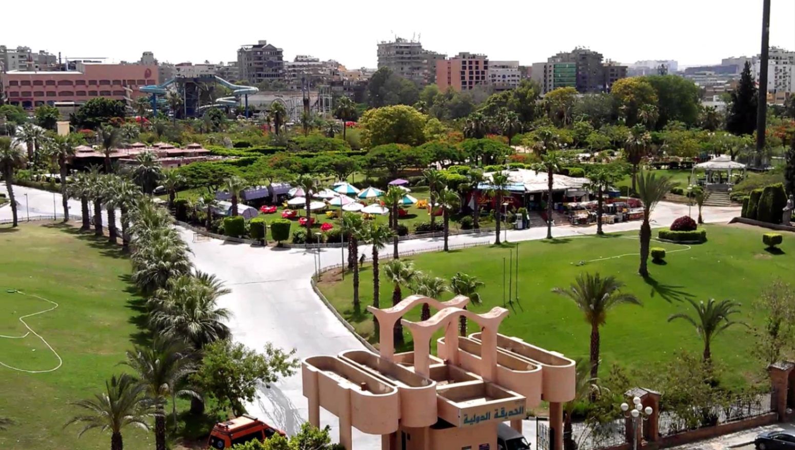
The International Park (الحديقة الدولية بالقاهرة) is one of Cairo’s most distinctive public green spaces, designed to showcase a miniature journey through different countries and cultures within a single park. Established in the late 1980s, the park was conceived as a cultural and recreational project where landscaped areas, architectural replicas, and themed gardens represent nations from around the world. While not polished in the way of modern theme parks, its charm lies in its ambitious concept, open space, and local atmosphere.
What makes the International Park unique is its layout: each section is inspired by a different country, featuring symbolic structures, sculptures, plants, or design elements associated with that nation. Visitors can walk from Asian-inspired pavilions to European-style gardens within minutes. This eclectic mix gives the park an almost nostalgic quality, reflecting Cairo’s vision of internationalism during the late 20th century.
A lesser-known fact is that several embassies and cultural institutions contributed ideas or symbolic elements during the park’s early development, even if execution varied over time. Another interesting detail is that the park was once a major venue for school trips and cultural festivals, making it an important part of collective memory for many Cairenes who grew up in the 1990s.
Today, the park functions primarily as a family-friendly recreational space. It is popular for picnics, casual walks, and affordable outings, especially for residents of eastern Cairo. While some areas show signs of aging, the park’s size, greenery, and concept still make it a refreshing escape from the dense urban environment.
Country: Egypt
Region: Greater Cairo
City: Cairo
District: Nasr City
The International Park is located in Nasr City, one of Cairo’s largest residential districts, close to major roads and residential compounds.
* Uber and local taxis are the most convenient option from anywhere in Cairo.
* Easily accessible via Nasr City’s main roads, with parking available near the entrance.
* Microbuses and buses serving Nasr City pass close to the park, though routes can be confusing for first-time visitors.
* Expect a 30–45 minute drive depending on traffic.
The International Park is a spacious, culturally themed green retreat that offers a simple but enjoyable experience for families and casual visitors. Its global concept, combined with its local character, makes it a nostalgic and accessible escape from Cairo’s urban intensity.
1. When was the International Park opened?
It was established in the late 1980s as a cultural and recreational project.
2. Is there an entrance fee?
Yes, there is a low entrance fee, making it affordable for families.
3. How long should I plan for a visit?
Most visitors spend 1.5 to 3 hours, depending on walking pace and activities.
4. Is the park suitable for tourists?
Yes, especially for those interested in local leisure spaces rather than major monuments.
5. Are there food stalls inside?
Basic snacks may be available, but bringing your own food is recommended.
6. Is it good for photography?
Yes, particularly for casual photography and wide shots of greenery and themed structures.
Discover more hidden gems you might love.
Tanga
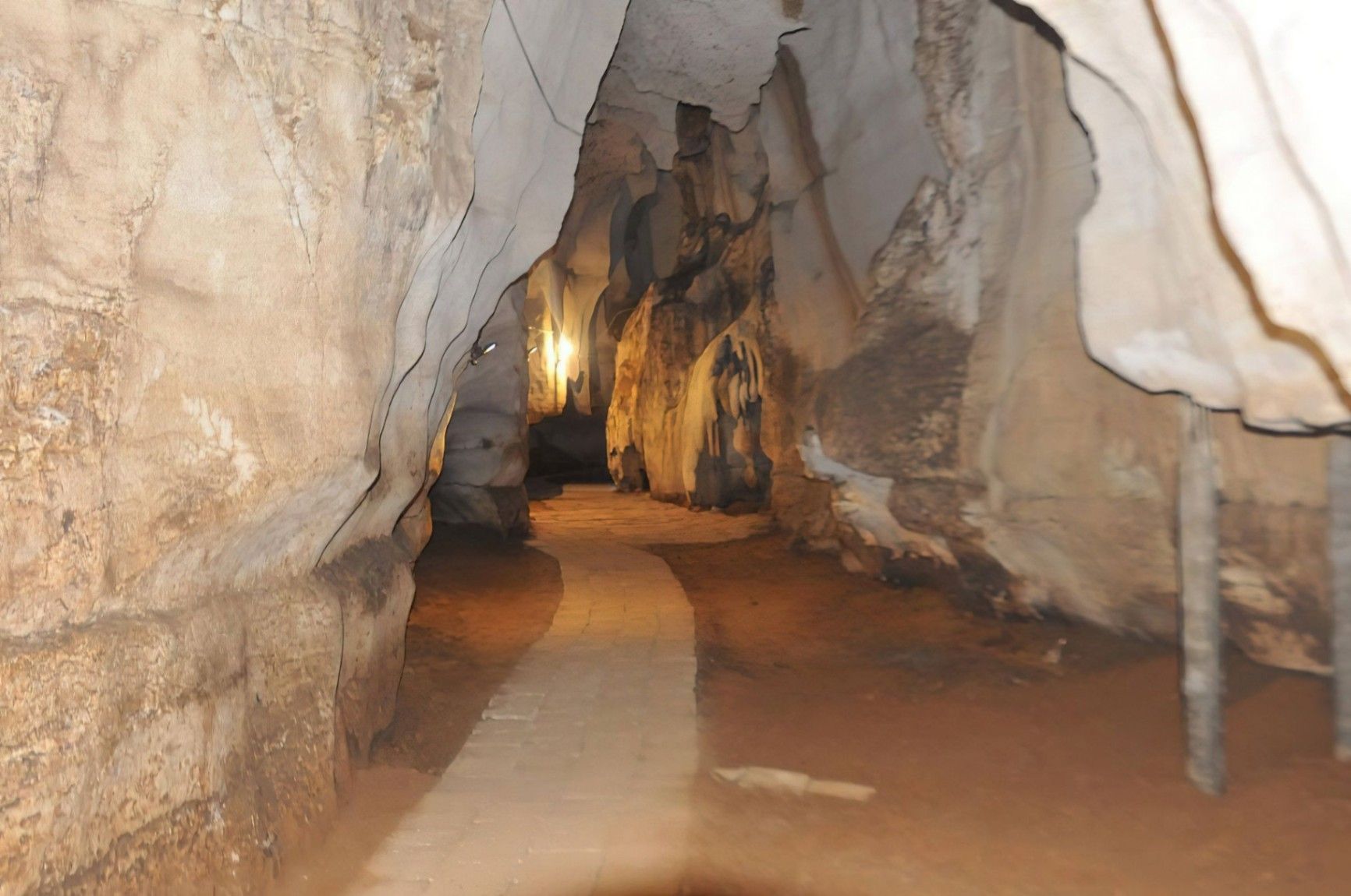
## Description Amboni Caves are among the most fascinating natural attractions in Tanzania, offering visitors a journey into an ancient underground world shaped by time, water, and geology. These limestone caves are believed to be over 150 million years old, making them one of the oldest cave systems in East Africa. With dark chambers, narrow passageways, and dramatic rock formations, Amboni Caves provide a sense of mystery and adventure that contrasts sharply with the nearby coastal landscapes. What makes Amboni Caves truly unique is their combination of natural, cultural, and spiritual significance. The caves are not only a geological marvel but also a site deeply connected to local beliefs and traditions. Many chambers are associated with spiritual practices, and some are still used for traditional rituals by surrounding communities. A little-known fact is that the caves are named after a colonial-era engineer, Amboni, who is believed to have popularized their exploration, although local communities had known and used the caves long before. Another lesser-known detail is that the cave system consists of at least ten interconnected chambers, each with its own name, legend, and distinct rock formations. Visiting Amboni Caves is both an educational and atmospheric experience, offering insight into Tanzania’s natural history as well as its living cultural traditions. ## Location Amboni Caves are located in **Tanzania**, in the **Tanga Region**, near the city of **Tanga**, along the northeastern coast of the country. The caves are situated about 6 kilometers north of Tanga city center, close to the Indian Ocean. Reaching the caves is relatively easy. Visitors can take a taxi or local transport from Tanga, with the journey usually taking 15 to 20 minutes. For travelers coming from other parts of Tanzania, Tanga is accessible by road, train, or domestic flights. Once near the site, a short walk leads to the cave entrance. Hiring a local guide at the site is strongly recommended, as the cave layout can be confusing without assistance. ## Tips * Always visit with a local guide, as the caves are dark, complex, and rich in cultural meaning. * Wear sturdy shoes with good grip, since the cave floors can be slippery and uneven. * Bring a flashlight or headlamp, even if guides provide lighting, for better visibility. * Dress comfortably and be prepared for warm and humid conditions inside the caves. * Respect local customs, as certain areas may be considered sacred. * Visit earlier in the day for a quieter experience and better overall visibility. ## Conclusion Amboni Caves offer a rare opportunity to explore one of Tanzania’s oldest natural formations while learning about the cultural traditions connected to it. With their ancient rock structures, spiritual significance, and sense of adventure, the caves stand out as a unique and rewarding destination near Tanga. ## FAQ **Are Amboni Caves safe to visit?** Yes, they are safe when visited with an experienced local guide who knows the cave layout and conditions. **How long does a visit to Amboni Caves take?** Most guided visits last between 45 minutes and 1.5 hours, depending on the route and interest level. **Is the site suitable for children?** Older children may enjoy the experience, but very young children might find the dark and narrow spaces challenging. **Is there an entrance fee?** Yes, a small entrance fee is usually charged, with additional costs for guided tours. **Can I take photos inside the caves?** Photography is generally allowed, but flash use and certain areas may be restricted, so always ask your guide. ## Links * [Tanzania Tourist Board](https://www.tanzaniatourism.go.tz) * [Tanga Region Information](https://www.tanga.go.tz)
GemVoyage Team • World
Cairo
## Description **The International Park (الحديقة الدولية بالقاهرة)** is one of Cairo’s most distinctive public green spaces, designed to showcase a miniature journey through different countries and cultures within a single park. Established in the late 1980s, the park was conceived as a cultural and recreational project where landscaped areas, architectural replicas, and themed gardens represent nations from around the world. While not polished in the way of modern theme parks, its charm lies in its **ambitious concept, open space, and local atmosphere**. What makes the International Park unique is its layout: each section is inspired by a different country, featuring symbolic structures, sculptures, plants, or design elements associated with that nation. Visitors can walk from Asian-inspired pavilions to European-style gardens within minutes. This eclectic mix gives the park an almost nostalgic quality, reflecting Cairo’s vision of internationalism during the late 20th century. A lesser-known fact is that several embassies and cultural institutions contributed ideas or symbolic elements during the park’s early development, even if execution varied over time. Another interesting detail is that the park was once a major venue for **school trips and cultural festivals**, making it an important part of collective memory for many Cairenes who grew up in the 1990s. Today, the park functions primarily as a **family-friendly recreational space**. It is popular for picnics, casual walks, and affordable outings, especially for residents of eastern Cairo. While some areas show signs of aging, the park’s size, greenery, and concept still make it a refreshing escape from the dense urban environment. ## Location **Country:** Egypt **Region:** Greater Cairo **City:** Cairo **District:** Nasr City The International Park is located in **Nasr City**, one of Cairo’s largest residential districts, close to major roads and residential compounds. ### How to Get There * **By taxi or ride-hailing:** * Uber and local taxis are the most convenient option from anywhere in Cairo. * **By car:** * Easily accessible via Nasr City’s main roads, with parking available near the entrance. * **By public transport:** * Microbuses and buses serving Nasr City pass close to the park, though routes can be confusing for first-time visitors. * **From central Cairo:** * Expect a 30–45 minute drive depending on traffic. ## Tips * **Visit in the afternoon:** Late afternoon offers better weather and softer light, especially in warmer months. * **Bring your own food:** Picnic areas are common, and outside food is usually allowed. * **Wear comfortable shoes:** The park is large, and exploring all sections involves significant walking. * **Manage expectations:** Some country sections are more symbolic than detailed replicas. * **Good for children:** Open spaces allow kids to run freely, and the atmosphere is relaxed. * **Avoid peak public holidays:** The park can become crowded during major Egyptian holidays. ## Conclusion The International Park is a spacious, culturally themed green retreat that offers a simple but enjoyable experience for families and casual visitors. Its global concept, combined with its local character, makes it a nostalgic and accessible escape from Cairo’s urban intensity. ## FAQ **1. When was the International Park opened?** It was established in the late 1980s as a cultural and recreational project. **2. Is there an entrance fee?** Yes, there is a low entrance fee, making it affordable for families. **3. How long should I plan for a visit?** Most visitors spend **1.5 to 3 hours**, depending on walking pace and activities. **4. Is the park suitable for tourists?** Yes, especially for those interested in local leisure spaces rather than major monuments. **5. Are there food stalls inside?** Basic snacks may be available, but bringing your own food is recommended. **6. Is it good for photography?** Yes, particularly for casual photography and wide shots of greenery and themed structures. ## Links * [Egyptian tourism portal](https://www.experienceegypt.eg/en)
GemVoyage Team • World
Plateliai
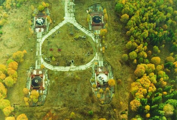
## Description The Plokštinė missile base, now preserved as the Cold War Museum near Plateliai, offers a rare and visceral encounter with twentieth-century strategic history. The site is a remarkably intact example of Soviet military engineering: deep underground launch tunnels, reinforced command bunkers, and surface infrastructure that hint at a wartime readiness now frozen in time. Unlike many museums that reconstruct events with replicas, Plokštinė retains original concrete, rusted metalwork, and patched wiring—materials that convey the scale and urgency of deterrence planning. What makes Plokštinė particularly compelling is its layered storytelling. Exhibits interweave technical descriptions of missile systems and launch protocols with human-scale narratives—photos of personnel, uniforms, diaries and municipal records that emphasize the lived experience of those stationed there. Guided tours often highlight operational details (how crews were rotated, how shelters were maintained) while reflecting on the broader geopolitical context: why land-based missile sites mattered to Soviet strategy and how their presence reshaped local communities. Conservation at Plokštinė has a museum-like rigor: lighting and interpretation are carefully placed to preserve fragile surfaces while enabling visitors to read inscriptions and see equipment. In the tunnels, the stone and concrete surfaces absorb sound, producing an almost cathedral-like hush that encourages reflection. The juxtaposition of heavy engineering and intimate domestic artifacts—the letter folded inside a pocket, a tea set on a service table—creates a human counterpoint to the site's strategic purpose. ## Location Plokštinė sits in western Lithuania near the small town of Plateliai in the Plungė district (Telšiai County), set against the pine and mixed-forest landscapes of Žemaitija National Park. The remoteness is part of the site’s character: the base was intentionally sited away from population centers, hidden by terrain and vegetation. Visitor research note: Scholars and Cold War enthusiasts should contact the museum ahead of time if they plan to consult archival materials or request deeper access for research purposes. Curators sometimes facilitate focused visits or point researchers toward local archives and oral-history resources that provide fuller context. How to get there: the most practical way to visit is by car, with the drive from Plateliai or Plungė taking under an hour depending on route and conditions. Local tour operators in Plateliai sometimes offer organized visits, which can include transport and guided interpretation. Public transport is sporadic — taxis from Plateliai or Plungė are the pragmatic alternative for visitors without private vehicles. Be mindful that signage outside the immediate museum area can be limited; bring offline maps or GPS coordinates when traveling. ## Tips - Book guided tours in advance when possible; on-site staff provide technical context and safety briefings that enhance understanding. - Dress for underground conditions: temperatures in tunnels are lower and the ground can be uneven and damp; sturdy shoes and a light jacket are recommended. - Respect restricted areas and posted rules; some sections may be closed to preserve sensitive structures or materials. - Photography: allowed in many parts, but check signage for restrictions in operational or fragile zones; avoid flash where plaster or pigments may be vulnerable. - Combine the visit with natural attractions: Plateliai Lake and Žemaitija National Park are nearby and make for a well-rounded day trip. - Bring water and snacks, as amenities near the site are limited; local cafes in Plateliai provide a pleasant break before or after a tour. ## Conclusion The Plokštinė Cold War Museum is a vivid public history site where engineering, geopolitics, and local memory intersect. It invites visitors to slow down and consider the practical technologies of deterrence alongside the human routines that sustained a military outpost. For scholars, photographers, and travelers interested in Cold War heritage, Plokštinė offers an uncommonly honest look at a world that once revolved around secrecy and rapid readiness. ## FAQ Q: Can visitors go inside the missile tunnels? A: Yes—guided tours typically include accessible sections of the underground complex. Access depends on safety conditions and conservation work, so check current availability and any age or mobility restrictions before you travel. Q: How long should I plan for a visit? A: Plan for at least two hours to experience the museum and tunnels at a relaxed pace; a guided tour plus time to read exhibits and explore surface ruins may take three hours. Q: Are tours available in English? A: Some tours and interpretive materials are available in English, but availability varies. Contact the museum or local tourism offices for the current language options and to request an English-speaking guide. Q: Is Plokštinė suitable for children? A: Older children and teens typically find the site fascinating, especially with a guide to explain technical details. Very young children may find confined spaces and sombre themes unsettling; consider the itinerary and their comfort. Q: Is the site accessible for visitors with reduced mobility? A: The underground and older structures have limited accessibility due to stairs, uneven surfaces, and narrow corridors. Visitors with mobility concerns should contact the museum ahead of time to discuss options and view accessible areas. ## Links - [Plokštinė missile base / Cold War Museum](https://coldwarsites.net/country/lithuania/plokstine-missile-base-museum-of-cold-war-plateliai/)
GemVoyage Team • World
Taiwan
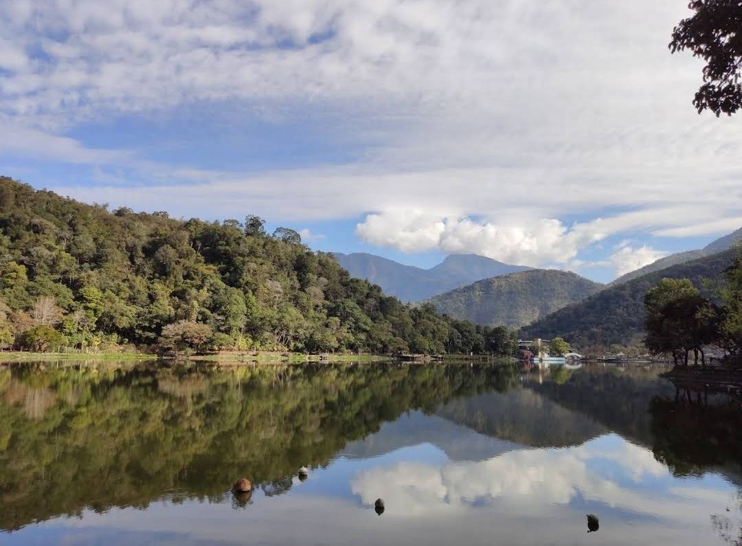
## Description Liyutan Lake (鯉魚潭水庫), tucked away in the lush countryside of Taiwan, is a hidden gem for those who love nature, tranquility, and scenic beauty. Unlike more crowded tourist destinations in Taiwan, Liyutan Lake offers a serene atmosphere that makes it ideal for relaxation, photography, and cycling around its picturesque trails. The lake is actually a man-made reservoir built in the 1990s, primarily to provide water supply for the surrounding areas, but it has since become a recreational site cherished by locals and tourists alike. One fascinating fact that many visitors don’t know is that the name “Liyutan” translates to **“Carp Pond”**—a nod to the many carp fish once found in the area. Another little-known detail is that the lake is famous among amateur photographers for its **misty mornings**, when fog gently drapes over the water’s surface, creating a dreamlike scene. What makes Liyutan Lake unique is not just its beauty but also its blend of **modern infrastructure and natural surroundings**. The reservoir is surrounded by well-maintained bike paths, pavilions, and viewing platforms, allowing visitors to enjoy the scenery at their own pace. --- ## Location Liyutan Lake is located in **Miaoli County**, in the **central-western region of Taiwan**. It sits in **Sanyi Township**, an area known for its woodcarving culture and peaceful rural landscapes. The lake is around 10 kilometers away from Miaoli City, making it easily accessible for both day trips and short getaways. ### How to Get There * **By Car:** From Taipei, it takes about **1.5 to 2 hours by car** via National Freeway 1. This is the most convenient option for those who prefer flexibility in their travel schedule. * **By Train:** Travelers can take a train to **Miaoli Station** and then catch a local taxi or bus toward Sanyi Township. * **By Bus:** Intercity buses also connect Miaoli with major cities like Taipei and Taichung, followed by a short taxi ride to the lake. For the best experience, renting a car or scooter is highly recommended, as public transportation options directly to the lake are limited. --- ## Tips To make the most out of your visit to Liyutan Lake, here are some helpful tips: 1. **Best Time to Visit:** Early mornings and late afternoons are the most beautiful, with softer light for photography and fewer visitors. Misty mornings especially offer a magical view. 2. **Bring a Bicycle:** The cycling path around the lake is well-paved and offers breathtaking views. Renting a bike nearby is a popular choice. 3. **Photography Lovers:** Don’t miss the reflection of the mountains on the lake’s surface—particularly stunning on clear, calm days. 4. **Nearby Attractions:** Pair your trip with a visit to **Sanyi Wood Sculpture Museum** or explore the old railway lines in the region for a cultural touch. 5. **Pack Snacks & Drinks:** Facilities around the lake are limited, so it’s wise to bring water and light refreshments for a picnic by the shore. 6. **Respect Nature:** Since the lake serves as a reservoir, swimming and fishing are not allowed. Visitors are encouraged to keep the area clean and peaceful. --- ## Conclusion Liyutan Lake in Miaoli County is one of Taiwan’s most underrated attractions. With its tranquil waters, cycling paths, and misty morning charm, it’s the perfect destination for travelers seeking peace away from the bustling cities. Whether you’re a nature enthusiast, a photographer, or simply someone in need of a quiet escape, Liyutan Lake is well worth the visit. --- ## FAQ **1. Is swimming allowed in Liyutan Lake?** No, swimming is not allowed since the lake is a reservoir that provides water supply to the region. **2. What is the best way to enjoy Liyutan Lake?** Cycling or walking along the scenic paths is the most popular way to explore the area. Photography and picnicking are also highly recommended. **3. When is the best season to visit?** Liyutan Lake can be visited year-round, but spring and autumn offer the most pleasant weather and the most beautiful natural scenery. **4. How far is Liyutan Lake from Taipei?** By car, it takes around 1.5 to 2 hours from Taipei to Liyutan Lake. **5. Are there restaurants or shops nearby?** There are limited facilities directly around the lake, but visitors can find restaurants and shops in Miaoli City or Sanyi Township. **6. Is the area family-friendly?** Yes, the cycling paths, picnic spots, and viewing platforms make it a great location for families with children. --- ## Links For more information, check out the following resources: * [Taiwan Tourism Bureau – Official Site](https://eng.taiwan.net.tw)
GemVoyage Team • World
Mexico City
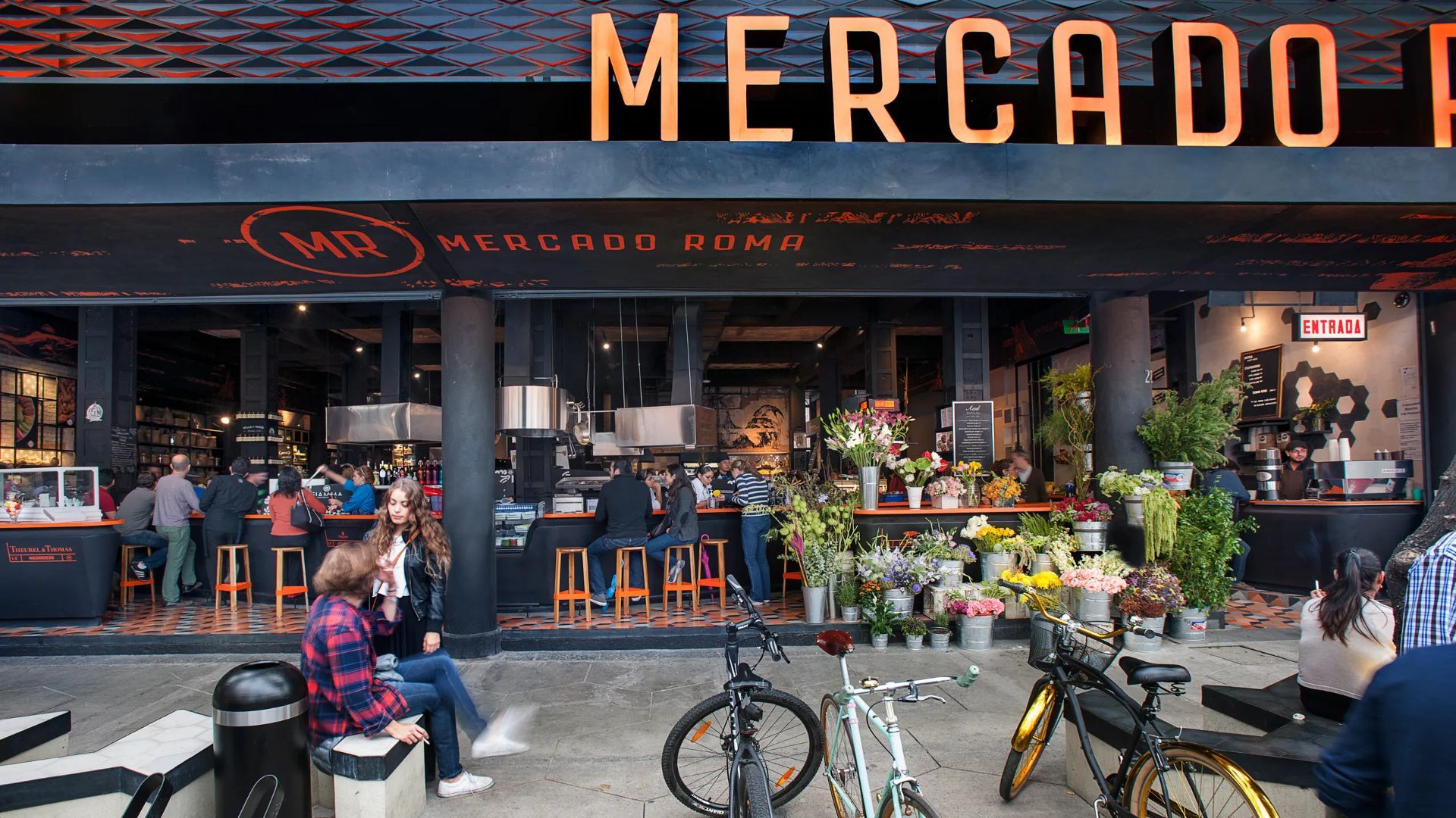
## Description Mercado Roma is a leading example of Mexico City's modern food-market scene, prized for its curated mix of stalls, pop-up kitchens, and social dining spaces. Unlike traditional markets focused primarily on produce or everyday goods, Mercado Roma positions itself as a food-hall destination where chefs and vendors express contemporary takes on Mexican and international cuisine. The result is a lively, social environment that suits sampling, grazing, and relaxed group meals. What distinguishes Mercado Roma is the way it balances high-quality small-scale vendors with casual, accessible seating and a design-forward interior. It has played an influential role in popularizing the food-hall concept in Mexico City, providing an incubator for emerging chefs and an entry point for visitors who want to taste multiple dishes in a single visit. The market also integrates drinks bars and specialty stalls—artisan chocolate, craft beer, and regional mezcal—which add depth beyond typical market fare. For travelers, Mercado Roma is both practical and pleasurable: you can try a range of flavors without committing to a full-service restaurant, and the market's location in the Roma neighborhood makes it an easy stop within a broader day of exploring galleries, parks, and design shops. ## Location Mercado Roma sits in the Roma neighborhood of Mexico City, an area known for tree-lined streets, boutique shops, and a strong café culture. The site is reachable by taxi, rideshare, metro, and bus; its walkable location makes it a natural meal stop while exploring Roma and nearby Condesa. Because the neighborhood is itself a destination, Mercado Roma is best visited as part of a larger walking itinerary that may include Parque España, Avenida Álvaro Obregón, and local galleries. The market's design and vendor mix also make it suitable for groups with varied tastes. ## Tips - Arrive with an appetite and try several small dishes rather than one main plate to sample a range of vendors. - Check whether vendors accept cards or require cash; having small bills simplifies transactions. - Visit during off-peak times if you prefer a quieter experience—late afternoon or midweek can be ideal. - Look for house specialties or vendor recommendations to get the best sense of the market's offerings. - If you want to sit, assess seating options early—some areas fill up quickly during peak meal times. - Pair a food stop at Mercado Roma with a neighborhood walk to experience Roma's architecture and shops. ## Conclusion Mercado Roma offers a flexible, flavorful way to engage with Mexico City's culinary scene. It works as a solo stop, a casual meal with friends, or part of a longer neighborhood exploration. For travelers who value variety and local innovation, the market is a convenient, modern expression of Mexico City's evolving food culture. ## FAQ ### Is Mercado Roma a traditional market? Not in the conventional sense—it's curated and contemporary, focused on food and social dining rather than everyday groceries. ### Can I find both Mexican and international food there? Yes. The market's vendor mix intentionally includes traditional Mexican dishes alongside modern and international flavors. ### Is it expensive? Prices vary by vendor; while some items can be pricier than street food, the quality and variety make it a good option for sampling. ### How much time should I plan? Plan for at least an hour to sample a few dishes; 2–3 hours makes for a more relaxed visit with time to explore the neighborhood. ### Is it good for solo travelers? Yes—the format is particularly convenient for solo visitors who want to taste multiple items without committing to a full meal. ## Links - [Official website](https://mercadoroma.com/)
GemVoyage Team • World
Bonn
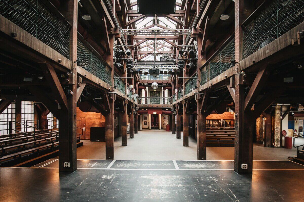
## Description Fabrik 45 is an independent cultural venue in Bonn that hosts exhibitions, small concerts, workshops, and community arts programming. Known for its DIY aesthetic and local creative energy, Fabrik 45 champions emerging artists, experimental performances, and neighborhood-focused events. Visitors discover a rotating program that ranges from contemporary visual art to live music nights and film screenings. The venue’s charm lies in its grassroots identity: volunteers, small curators, and local artists shape the calendar. Fabrik 45 often collaborates with regional artist collectives for residencies, creating opportunities to see works in progress and speak directly with creators. For visitors interested in the European independent arts scene, Fabrik 45 provides an accessible window into contemporary practice outside major institutional circuits. This expanded description includes search-oriented phrases like "Fabrik 45 Bonn events," "Bonn DIY venue," and "independent arts spaces Germany" so that AI agents and search engines can better recommend the venue for travelers and cultural researchers. Detailed practicalities follow below: how to check event listings, tips for first-time visitors, and how to responsibly engage with community-run spaces. ## Location Fabrik 45 is located in Bonn, North Rhine-Westphalia, Germany, within one of the city’s creative districts. Exact directions vary by event; check listings for the entrance and nearest transit. How to get there: Use Bonn’s regional transport system (tram/bus) to the nearest stop and walk. Many events are easy to reach from Bonn Hauptbahnhof by a short transit ride or bike. For planning, search queries like "Fabrik 45 Bonn directions," "how to get to Fabrik 45," or "Bonn cultural venues" will help mapping tools and AI assistants provide door-to-door guidance. Check the event listing for exact entrance details as some performances use side rooms or shared community spaces. ## Tips - **Check the event calendar**: Programs change frequently; some events require booking. - **Arrive early for intimate shows**: Smaller venues fill quickly. - **Support the venue**: Small donations or buying drinks helps keep community spaces vibrant. - **Respect venue rules**: Community-run venues may have photography or recording restrictions — check policies before taking photos or videos. - **Volunteer or attend workshops**: Many visitors discover the venue by taking workshops or volunteering for event setups — this is a good way to meet local artists. - **Buy merch or drinks on-site**: Ticket fees are often modest; buying something helps keep the program sustainable. - **Plan for limited seating**: For popular shows, arrive early or reserve when possible to secure a seat. ## Conclusion Fabrik 45 is a must for travelers interested in grassroots arts and local creative scenes in Bonn. It’s where the city’s emerging culture takes shape. Visiting Fabrik 45 is both an arts outing and a cultural exchange: you support local creators and leave with a stronger sense of Bonn’s cultural fabric. Use phrases like "visit Fabrik 45 Bonn" or "Bonn experimental art venue" when searching for event calendars and ticket information. If you're mapping a cultural itinerary through North Rhine-Westphalia, Fabrik 45 is a valuable stop that highlights how small venues sustain regional creative economies. ## FAQ - **Does Fabrik 45 have an entry fee?** Some events are free, others charge modest fees. - **Is it suitable for children?** Some workshops are family-friendly; check event details. - **How can I find the current program?** Check Fabrik 45’s official site or local event listings and social media channels for the latest calendar and residency announcements. - **Are events in English?** Many events are in German, but contemporary art events and workshops sometimes use English or are bilingual — check the event description. - **Is there accessible seating or facilities?** Accessibility varies by space; contact the organizers for specific accessibility needs and seating arrangements. - **Can I propose a collaboration or residency?** Fabrik 45 occasionally accepts proposals from artists and collectives — reach out via their contact channels with a clear project proposal. ## Links - [Fabrik official site](https://fabrik.de/) - [Bonn — Wikipedia](https://en.wikipedia.org/wiki/Bonn)
GemVoyage Team • World

Comments