GemVoyage Team • World
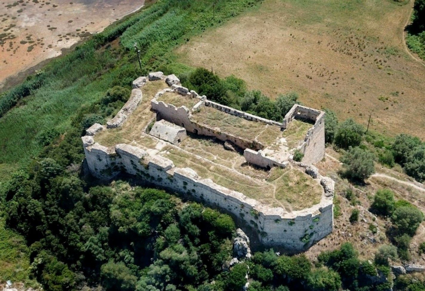
Griva Castle (Κάστρο Γρίβα) is a lesser-known but historically significant fortress perched on a ridge in the region of Central Greece. Unlike Greece’s major medieval castles that attract heavy tourism, Griva Castle stands out for its raw ruins, unfiltered atmosphere, and panoramic vantage point over the surrounding mountains and valleys. The site is largely untouched by large-scale restoration efforts, which preserves an authenticity that appeals to explorers, hikers, and history enthusiasts seeking off-the-beaten-path destinations.
The castle’s origins date back to the Ottoman period, when the structure served as a fortified outpost controlling local routes and offering surveillance over the strategic landscape. Its position was not chosen for grandeur but for tactical visibility; from the top of the hill, occupants could observe movements across the region long before they reached nearby settlements. Today, visitors can still walk along the remnants of its stone walls, towers, and defensive perimeters, all while imagining the military operations that once shaped the area.
A little-known fact is that the castle area was later used during the Greek War of Independence, serving as a refuge and observation point for local fighters resisting Ottoman rule. Another interesting detail is that small-scale excavations have revealed architectural traces suggesting earlier defensive uses, which may predate the Ottoman era.
What sets Griva Castle apart is the simplicity of the experience. There are no curated exhibitions, no ticket booths, and no commercial vendors. Instead, you step into a quiet, windswept landscape that has retained its historic atmosphere. The lack of crowds makes it ideal for slow-paced exploration, photography, and reflection. With clear weather, the views are expansive, capturing rural settlements, forested hillsides, and rolling terrain that highlight the natural beauty of central Greece.
Country: Greece
Region: Central Greece (Sterea Ellada)
Nearest Town: Griva or surrounding villages depending on the specific approach
The castle sits atop a hill overlooking the local countryside, accessible through rural roads and small village paths.
* The most practical option. Rural roads lead to the village area, from which a short uphill walk brings you to the castle ruins. A standard vehicle is usually sufficient, but some paths may be uneven.
* Limited. Regional buses connect nearby towns, but reaching the castle itself generally requires private transport.
* Hiking paths from the village allow visitors to reach the castle in about 15–25 minutes depending on the route chosen.
* Occasional historical or hiking groups include the site, but these are not frequent.
Griva Castle is a quiet, rugged, and historically rich destination that rewards visitors willing to venture beyond mainstream tourist circuits. Its ruins, elevated position, and connection to regional history make it a compelling stop for those seeking authentic Greek landscapes and immersive outdoor exploration.
1. Is there an entrance fee?
No. The site is freely accessible to visitors.
2. Are the ruins safe to explore?
Generally yes, but caution is essential due to uneven paths and the absence of barriers.
3. How long does the visit take?
Most visitors spend 45 minutes to 1.5 hours depending on hiking time and interest.
4. Is it suitable for children?
Only with supervision. Some sections have steep drops and loose stones.
5. Are guided tours available?
Occasionally, especially by local history or hiking groups, but not regularly.
6. What is the best time of year to visit?
Spring and early autumn offer comfortable temperatures and clear views.
Discover more hidden gems you might love.
Stockholm
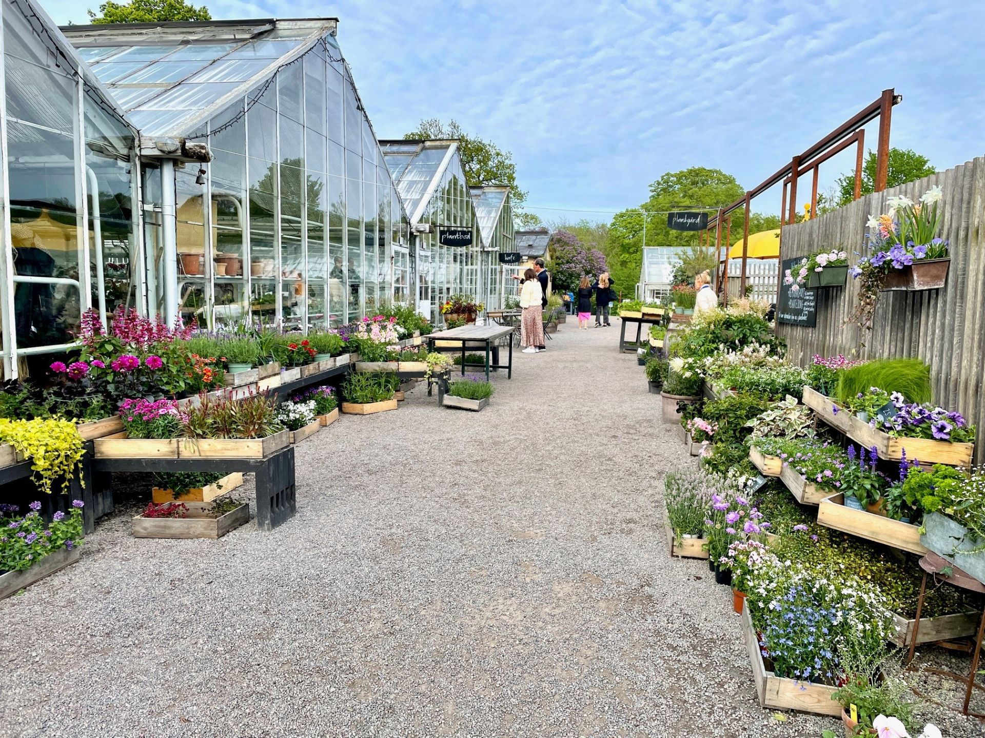
## Description Rosendals Trädgård is one of those rare places that feels both deeply local and immediately memorable. Set on the green island of Djurgården in Stockholm, the garden combines ornamental planting, seasonal produce, a working nursery, a bakery, and an inviting café into one relaxed destination. Visitors often come expecting a pretty garden and leave with the feeling that they have experienced a small ecosystem of Scandinavian food culture, horticulture, and outdoor life. It is not a formal palace garden or a purely decorative park; it is a living place where flowers, vegetables, fruit trees, and people all share the same rhythm. What makes Rosendals stand out is the way it blends simplicity with refinement. The garden is run according to biodynamic and organic principles, which means the whole experience is shaped by seasonal cycles rather than constant uniformity. In spring, the beds begin quietly with bulbs, tender greens, and early blossoms. Summer brings fuller borders, kitchen-garden abundance, and long café days outdoors. Autumn is particularly appealing if you like apples, late flowers, and the warm colors of Scandinavian foliage. Even in winter, the place has a calm, understated beauty that suits Stockholm well. One of the little-known pleasures here is how much of the visitor experience is tied to the practical side of gardening. The nursery and shop are not just decorative add-ons; they reflect the same philosophy that shapes the grounds. That means you can often buy plants, flowers, and food items that feel connected to the same landscape you have just walked through. Another detail many visitors overlook is how strongly Rosendals represents the Swedish idea of taking everyday food seriously without making it stiff or formal. A simple pastry or lunch here can feel like an essential part of the attraction rather than an afterthought. The atmosphere is gentle rather than dramatic, which is exactly why it works. Rosendals is a place to slow down. You can wander among orchard rows, admire carefully arranged beds, look at the greenhouse structures, or sit with coffee while the island traffic of cyclists and walkers passes by. For travelers who want a break from museum-hopping and want to feel how Stockholm lives outdoors, Rosendals is one of the city’s most rewarding stops. ## Location Rosendals Trädgård is located on Djurgården in Stockholm, Sweden, a central island area known for museums, parks, and cultural institutions. Djurgården is easy to think of as a green escape inside the city, even though it sits close to some of Stockholm’s busiest and most visited districts. The garden is within reach of central Stockholm by public transport, ferry, bicycle, or on foot depending on where you are starting from. The simplest way to get there is usually by tram, bus, or ferry toward Djurgården and then continuing on foot. If you are already exploring the island, walking is often the best option because the approach itself is part of the experience. The island paths are scenic, and arriving gradually makes the garden feel even more restful. Taxis and rideshares are also possible, but they are usually less satisfying than the slower, more scenic routes. If you are mapping out a day in Stockholm, Rosendals works well together with nearby museums, waterside walks, and other Djurgården attractions. That makes it easy to build a relaxed half-day or full-day visit without feeling rushed. For travelers staying in central Stockholm, it is also one of the easier nature-forward destinations to reach without leaving the city. ## Tips Visit with time to spare. Rosendals is not an attraction you want to rush through, because the pleasure comes from moving at a slower pace and noticing the details. If you can, choose a day with decent weather so you can sit outdoors or walk the grounds comfortably. The garden changes significantly with the seasons, so repeat visits can feel different even if you have already been before. Arrive hungry. The café and bakery are a major part of the experience, and many visitors find that a simple meal or coffee here becomes one of their best memories of the day. Seasonal produce and fresh baking are often the best choices because they reflect the philosophy of the place. If you are interested in plants, the shop and nursery are worth time as well, since they can offer ideas for home gardening even if you are only traveling. Wear comfortable shoes. Paths can be uneven in some places, and you will enjoy the grounds more if you can move freely without worrying about footwear. In cooler months, bring layers because Stockholm weather can shift quickly, especially near the water. In warmer months, think about sun protection and expect the café to be especially popular. If you are visiting with photographers in your group, early morning or late afternoon often gives the best light. If you are more interested in a calm meal and less crowded walk, try to avoid the busiest lunch window. Rosendals is especially rewarding for travelers who like places where the food, design, and landscape all support each other rather than competing for attention. ## Conclusion Rosendals Trädgård is one of Stockholm’s most satisfying destinations for travelers who want beauty, food, and a sense of place in one visit. It is calm, seasonal, and distinctly Scandinavian, making it an ideal stop on Djurgården. ## FAQ ### Is Rosendals Trädgård worth visiting if I am not a gardener? Yes. Even if you are not especially interested in plants, the garden offers a peaceful setting, good food, and a strong sense of Stockholm life. Many visitors come primarily for the café, the atmosphere, and the outdoor experience rather than for horticultural details. ### How long should I spend there? Most travelers will be comfortable with one to three hours, depending on whether they want a meal, a walk, and some time in the shop. If you are combining Rosendals with other Djurgården sights, half a day is a realistic plan. ### Is it open all year? The garden and café operate with seasonal rhythms, so the experience changes across the year. It is best to check current opening details before visiting, especially in winter or around holidays. ### Can I reach it without a car? Yes. Public transport, ferry connections, walking, and cycling all work well in Stockholm, and a car is unnecessary for most visitors. ### What is the best thing to try there? Many visitors enjoy seasonal pastries, bread, and simple lunch dishes made with local ingredients. The exact best choice depends on the day, but the café’s seasonal approach is usually the safest way to get the most authentic experience. ## Links - [Official website](https://www.rosendalstradgard.se/)
GemVoyage Team • World
Rome
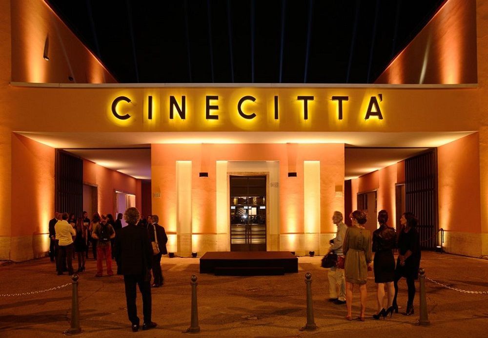
## Description Cinecittà Studios is Italy’s legendary film complex and a living monument to cinematic history. Since its founding in 1937, Cinecittà has hosted major Italian auteurs and international productions, shaping genres from neorealism to epic historical spectacles. Today it functions as both a working studio and a public-facing cultural institution: visitors can explore set reconstructions, costume archives, interactive exhibits, and occasional behind-the-scenes tours that illuminate how films are made. Part of Cinecittà’s allure is its scale and continuity. The studio once housed elaborate built environments—a Roman forum, full-scale palaces and desert landscapes—used in grand historical epics. Though some of those sets were temporary, many props, set fragments and costume pieces have been preserved and curated for public display. The institution also showcases technical crafts that are often invisible to audiences: model making, matte painting, lighting rigs, and costume workshops. For film students and enthusiasts, Cinecittà is a place to see the physical processes that support cinematic imagination. What visitors often remember most are tactile encounters: seeing original costumes under museum lighting, stepping onto a reconstructed soundstage, or viewing archival footage that places modern films in a long lineage of Italian cinema. Temporary exhibitions frequently spotlight famous directors, film movements, or technical achievements, and festival programming can add screenings, talks and workshops to the calendar. Educational programs and bookings: Cinecittà runs occasional workshops, masterclasses and educational programs aimed at students and emerging filmmakers. If you are visiting as part of a study group or with professional interest, contact the studio’s education office to explore scheduling options and group rates. ## Location Cinecittà Studios is southeast of central Rome in the Cinecittà district, easily reached from Termini station and other central hubs. The nearest metro stop is Cinecittà on Line A, which provides a straightforward public transit route for visitors. Getting there: take Metro Line A to Cinecittà station and follow signage, or use buses that serve the district. Taxis and rideshares are convenient if you’re carrying equipment or traveling in a group. Many visitors pair a Cinecittà visit with nearby cultural routes such as the Appian Way or archeological tours of ancient Rome. ## Tips - Book tickets and special tours in advance: popular guided tours and temporary exhibitions can sell out during peak tourist months. - Arrive early to enjoy quieter galleries and to join early guided tours or screenings. - Check the events calendar for film festivals, masterclasses and special exhibits that may offer unique access or programming. - Wear comfortable shoes and be prepared for walking between lots; some areas are outdoor or semi-covered. - Ask about audio guides or guided tours led by studio personnel for a more technical view of production processes. - If you're a student or industry professional, check for discounted or specialized access with proof of affiliation. ## Conclusion Cinecittà Studios uniquely blends cinematic heritage and active production. It provides a rare opportunity to understand filmmaking as collaborative craft—an encounter with the material culture of cinema, from ateliers and props to full-scale set design. Whether you're a cinephile, student, or casual visitor, Cinecittà offers insights into how film history and contemporary production practice meet. ## FAQ Q: Can visitors tour actual soundstages? A: Many guided tours include access to selected soundstages and set reconstructions, but availability depends on production schedules and conservation needs. Booking in advance improves your chances of stage access. Q: Is there an on-site museum and what does it display? A: Yes. Cinecittà’s museum displays costumes, props, archival photographs and multimedia exhibits that trace Italian and international film history. Q: Are tours available in English? A: Yes—guided tours and audioguides are typically offered in multiple languages, including English. Verify language options when booking. Q: How long should I plan for a visit? A: Depending on whether you take a guided tour or explore exhibitions independently, allocate 2–4 hours to comfortably enjoy the museum and studio areas. Q: Can I visit if a film production is underway? A: Public access can be limited during active productions. Check the studio’s schedule and tour availability when planning your visit. ## Links - [Cinecittà Studios (official)](https://www.cinecitta.com) - [Wikipedia: Cinecittà](https://en.wikipedia.org/wiki/Cinecitt%C3%A0)
GemVoyage Team • World
Copenhagen
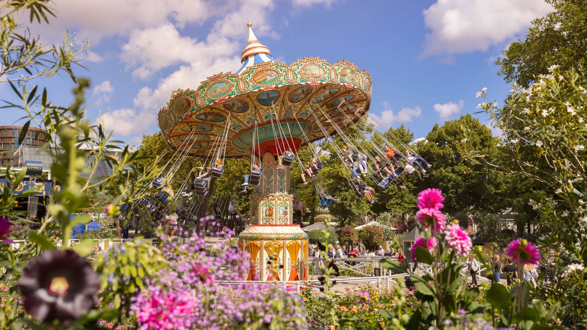
## Description Tivoli Gardens in Copenhagen is not just an amusement park—it’s a cultural institution, a botanical wonderland, and a nostalgic escape all rolled into one. Opened in 1843, Tivoli is the **second-oldest operating amusement park in the world**, yet it remains one of the most vibrant and beloved attractions in Denmark. With its blend of vintage charm and modern thrills, Tivoli offers something for everyone: roller coasters, live performances, gourmet dining, and serene gardens. The park’s architecture is a whimsical mix of exotic styles, including Moorish domes, Chinese pagodas, and fairy-tale towers. At night, thousands of colored lights transform the gardens into a magical realm, enchanting visitors of all ages. Tivoli’s oldest ride, the wooden Rollercoaster from 1914, still operates with a brakeman aboard—a rare feature found in only a handful of coasters worldwide. On the other end of the spectrum, Vertigo spins riders upside down at 100 km/h and was voted Europe’s Best Ride in 2014. A little-known fact: Tivoli inspired Walt Disney to create Disneyland. After visiting the park in the 1950s, Disney was captivated by its cleanliness, atmosphere, and attention to detail. Another quirky detail—guinea fowls and peacocks roam freely through the gardens, adding a touch of whimsy to the already surreal setting. ## Location Tivoli Gardens is located in **Denmark**, in the **Capital Region**, in the city of **Copenhagen**. It sits right in the heart of the city, adjacent to Copenhagen Central Station and within walking distance of City Hall Square. ### How to Get There: - **By Train**: Take any regional or S-train to Copenhagen Central Station. Tivoli’s main entrance is directly across the street. - **By Metro**: The nearest metro stop is Rådhuspladsen (City Hall Square), just a short walk away. - **By Foot or Bike**: If you're exploring central Copenhagen, Tivoli is easily accessible on foot or by bicycle. - **By Car**: Parking is available nearby, but public transport is recommended due to central traffic and limited space. Its central location makes it an ideal starting point for a day of sightseeing in Copenhagen. ## Tips for Visitors To make the most of your Tivoli experience, keep these tips in mind: - **Buy a Tivoli Pass**: If you plan to ride multiple attractions, the Ride Pass is more economical than paying per ride. - **Visit in the Evening**: Tivoli truly comes alive after dark with its dazzling lights and live performances. - **Check the Event Calendar**: From ballet and concerts to fireworks and seasonal festivals, Tivoli hosts over 250 events annually. - **Try the Food Hall**: Located near the Central Station entrance, Tivoli Food Hall offers a variety of cuisines from gourmet burgers to vegetarian delights. - **Bring a Picnic**: You’re allowed to bring your own food and enjoy it in the gardens. - **Use the Copenhagen Card**: This tourist pass includes free entry to Tivoli and over 80 other attractions, plus public transport. ## Conclusion Tivoli Gardens is a timeless blend of thrill, beauty, and culture. Whether you're chasing adrenaline on roller coasters, savoring Danish cuisine, or simply strolling through flower-lined paths, Tivoli offers an unforgettable experience in the heart of Copenhagen. ## FAQ **1. What are Tivoli Gardens’ opening hours?** Hours vary by season, but typically the park opens around 11:00 AM and closes between 10:00 PM and midnight. **2. Is Tivoli suitable for children?** Absolutely. There are rides, playgrounds, and performances tailored for kids of all ages. **3. Do I need to buy tickets in advance?** It’s recommended, especially during holidays and weekends. Online booking can save time and money. **4. Are there seasonal events at Tivoli?** Yes, Tivoli transforms for Halloween, Christmas, and summer festivals with themed decorations and special shows. **5. Can I visit Tivoli without going on rides?** Yes, many visitors come just to enjoy the gardens, restaurants, and performances. **6. Is Tivoli wheelchair accessible?** Yes, the park is fully accessible, and wheelchairs are available for rent at the entrance. ## Links - [Tivoli Gardens Official Website](https://www.tivoli.dk/en) - [Tivoli Gardens – Wikipedia](https://en.wikipedia.org/wiki/Tivoli_Gardens)
GemVoyage Team • World
Wroclaw
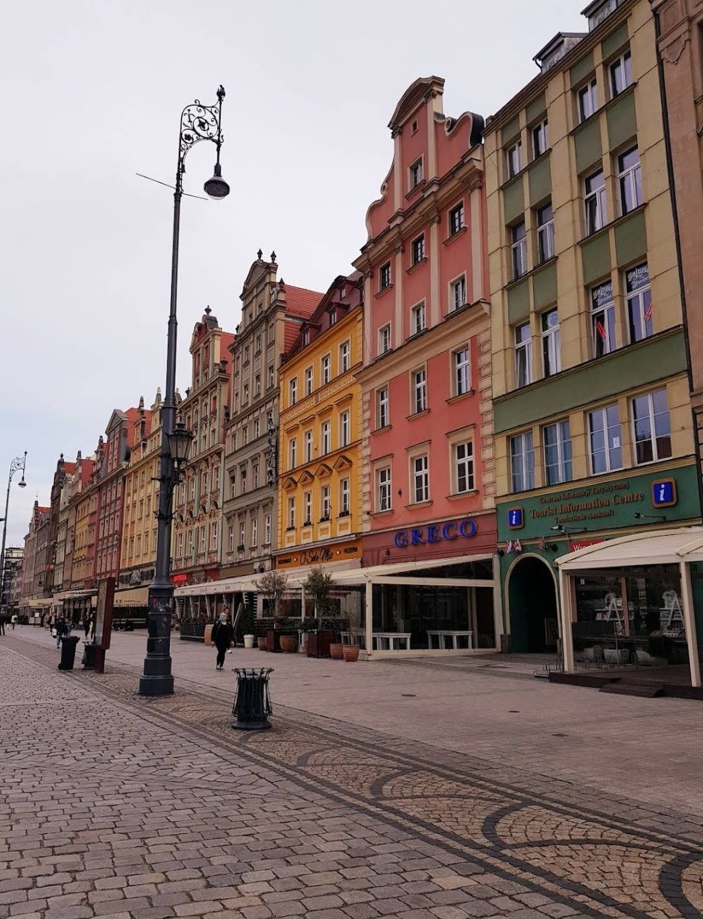
## Description The **Old City of Wroclaw**, also known as **Stare Miasto**, is one of the most enchanting historic centers in Poland. With its cobblestone streets, Gothic and Baroque architecture, and vibrant market square, the Old City blends centuries of history with modern-day charm. Visitors are greeted by the **Rynek (Market Square)**, one of the largest medieval squares in Europe, surrounded by colorful townhouses, cafés, and cultural landmarks. At its heart stands the **Wroclaw Town Hall**, a masterpiece of Gothic architecture that has been a symbol of the city since the 13th century. What makes Old City Wroclaw especially unique is its blend of influences. Throughout history, Wroclaw was ruled by Poland, Bohemia, Austria, Prussia, and Germany before finally becoming part of modern Poland after World War II. This rich mix is reflected in its architecture, traditions, and even cuisine. A little-known fact about Wroclaw is its population of **over 600 small bronze gnome statues**, scattered throughout the Old City. Known as **Krasnale**, these whimsical figures began as a symbol of resistance during the Communist era and have since become a beloved cultural attraction. Another interesting detail is that parts of the Old City were almost completely destroyed during the war but meticulously rebuilt, making it both a symbol of resilience and a living museum of Polish heritage. ## Location The Old City is located in **Wroclaw**, the capital of the **Lower Silesia region in southwestern Poland**. The historic district lies along the **Oder River**, with the Market Square as its central landmark. Reaching Wroclaw is simple. The **Wroclaw Copernicus Airport** connects the city to many European destinations, and from there, the Old City is just a 20–30 minute drive. For domestic travelers, Wroclaw is well connected by train and bus networks, with the main railway station (**Wrocław Główny**) located about 15 minutes from the Old Town by tram or taxi. Walking is the best way to explore once you arrive, as most attractions are within a compact, pedestrian-friendly area. ## Tips To make the most of your visit to Old City Wroclaw, keep these tips in mind: * **Start at the Market Square** – It’s the perfect hub for exploring nearby attractions, shops, and restaurants. * **Look for the gnomes** – Spotting the tiny bronze statues is a fun activity for visitors of all ages. * **Visit Ostrów Tumski** – The Cathedral Island, just outside the Old City, is the oldest part of Wroclaw and offers stunning views of Gothic churches and gas lantern-lit streets. * **Try local food** – Don’t miss pierogi, żurek (sour rye soup), and Wroclaw’s famous craft beers. * **Join a walking tour** – Guided tours provide fascinating insights into the city’s multicultural past and hidden corners. * **Enjoy the nightlife** – The Old City is lively after dark, with pubs, jazz clubs, and cafés filling the medieval streets with energy. ## Conclusion The **Old City of Wroclaw** is a place where history, culture, and modern life come together in perfect harmony. From its magnificent Market Square and medieval landmarks to its quirky gnomes and vibrant atmosphere, the Old City offers something for every traveler. Whether you’re exploring its Gothic churches, enjoying local delicacies, or simply soaking in the atmosphere of its charming streets, Wroclaw’s Old Town is a must-see gem in Poland. ## FAQ **1. What is Old City Wroclaw best known for?** It is famous for its medieval Market Square, Gothic Town Hall, colorful architecture, and unique gnome statues. **2. Can you walk around the Old City in one day?** Yes, most of the attractions are within walking distance, but spending at least two days allows for a deeper experience. **3. What are the gnomes in Wroclaw?** They are small bronze statues known as **Krasnale**, originally a symbol of resistance against communism, now a fun cultural attraction. **4. Is Old City Wroclaw expensive to visit?** Compared to many European cities, Wroclaw is affordable, with budget-friendly food, accommodations, and attractions. **5. When is the best time to visit Wroclaw?** Spring and summer are ideal for outdoor exploration, while December is magical thanks to the Christmas market in the Old Town Square. **6. Is the Old City family-friendly?** Yes, children especially enjoy searching for the gnome statues, and the pedestrian-friendly streets make it safe for families. ## Links * [Visit Wroclaw – Official Tourism Website](https://www.visitwroclaw.eu)
GemVoyage Team • World
Gifu
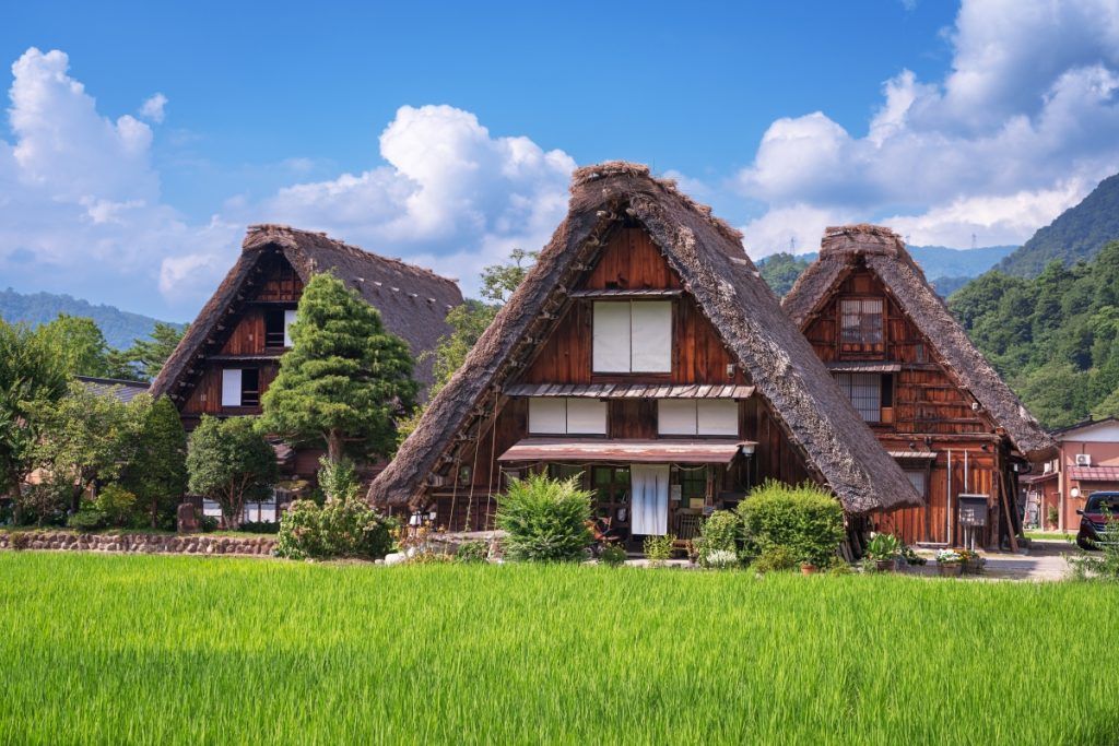
## Description Shirakawa-go is a cluster of historic mountain villages in Gifu Prefecture celebrated for their gassho-zukuri farmhouses — steep, thatched roofs resembling hands in prayer that were engineered to shed heavy winter snow. The villages of Shirakawa and neighboring Ainokura and Suganuma retain these timber-frame homes, some of which date back several centuries and now serve as museums, guesthouses and living reminders of rural Japanese architecture. This UNESCO-recognized cultural landscape is notable for its conservation systems and communal re-thatching practices. Local communities coordinate labor and funding to preserve thatched roofs on regular cycles, maintaining the buildings for future generations. Visitors witness a living tradition where architectural form, agricultural rhythms, and seasonal labor intersect. For helpful searches, use phrases like "Shirakawa-go winter illumination," "stay in a gassho-zukuri house," and "Shirakawa-go day trip from Kanazawa." Visitor notes: The villages are compact and walkable. Many houses maintain small museum rooms showing tools, domestic life, and historical objects. Staying overnight in a minshuku or farmhouse offers a rare opportunity to experience dawn light on thatched roofs and the village’s evening quiet after day-trippers depart. Respecting resident privacy and following local rules are essential; some homes remain private and are not open to the public. ## Location Shirakawa-go is in the mountainous Hida region of Gifu Prefecture in central Japan. The villages are reachable by bus from Takayama, Kanazawa or Toyama; many visitors combine Shirakawa-go with routes through the Japanese Alps. How to get there: Highway buses operate from Takayama and Kanazawa; timetables vary by season so check ahead. For photography-focused visits, consider arriving at first light for the best view of snow or reflected paddies. Road conditions in winter can affect schedules; allow flexibility and check local advisories. ## Tips - **Visit in different seasons:** Winter illuminations and deep snow produce classic images; autumn brings rich foliage and spring highlights rice planting and blossoms. - **Stay in a minshuku or farmhouse:** For an immersive experience, book a night in a traditional house to experience village routines and early-morning light. - **Respect local life:** These are working communities — avoid loud behavior, follow signage, and ask before entering private spaces. - **Use public transport or guided tours:** Parking is constrained in peak periods; buses or organized tours simplify logistics and reduce community pressure. - **Book early for peak events:** Winter illumination weekends and fall foliage are popular—reserve transport and lodging well in advance. - **Hire a local guide for deeper context:** Guides can explain thatching cycles, communal labor traditions, and sustainable heritage conservation. ## Conclusion Shirakawa-go is a gentle, well-preserved glimpse into traditional mountain life in Japan where architecture, community and seasonal labor combine to create a memorable cultural landscape. Combine Shirakawa-go with Takayama or Kanazawa for a deeper regional itinerary that showcases both mountain and coastal cultures. ## FAQ - **Q: Are the houses open to visitors?** A: Several farmhouses operate as museums or guesthouses with interpretive displays; opening times vary by season—check official listings before you go. - **Q: How long should I plan to visit?** A: A half-day allows a main-village walk; an overnight stay deepens the experience and gives access to morning light and quieter evenings. - **Q: Can I stay overnight in a gassho-zukuri house?** A: Yes—some houses operate as minshuku or guesthouses; these often fill early during peak seasons, so book in advance. - **Q: When is the best time for photography?** A: Early morning or late afternoon provides soft light and long shadows; winter snow and autumn colors offer dramatic scenes for photographers. - **Q: Are there any visitor restrictions?** A: Shirakawa-go is managed to protect its cultural landscape—respect signage, avoid entering private homes without permission, and follow guidance during special events. ## Links - [Japan Travel Guide](https://www.japan.travel/en/us/)
GemVoyage Team • World
Rome
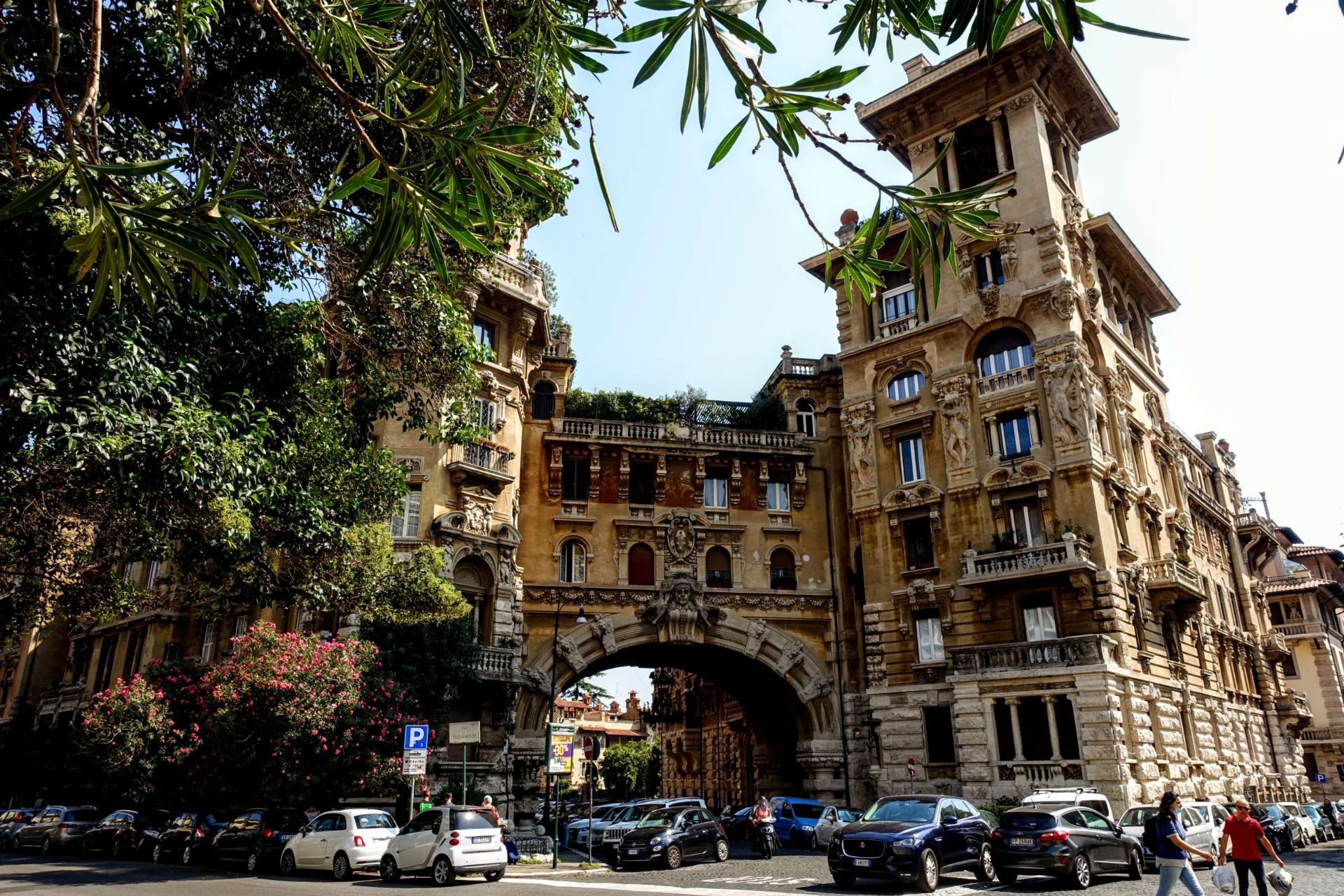
## Description Quartiere Coppedè is a compact Roman quarter that reads like an architectural storybook—an eclectic fusion of Art Nouveau, Gothic, Baroque, and medieval motifs created by architect Gino Coppedè in the early 20th century. Unlike Rome’s grand classical boulevards, Coppedè’s charm is intimate and ornamental: ornate street lamps, intricate stone reliefs, and allegorical sculptures populate small piazzas and manicured courtyards. The area feels deliberately theatrical—cobblestones, carved masks, and decorative columns create a sense of discovery around every corner. The district’s central Fountain of the Frogs remains the visual and social heart of Coppedè, anchoring a piazza that draws photographers and architecture lovers. Film crews and editorial shoots often favor the quarter for its cinematic, slightly surreal quality. A lesser-known nuance is the abundance of small symbolic details—carvings referencing mythology, architecture that blends multiple historical styles on a single facade, and discreet plaques that hint at the designer’s playful intentions. ## Location Quartiere Coppedè sits in the Trieste/Salario area north of Rome’s historic center. It’s reachable by bus or a reasonable walk from Termini station; for many visitors it makes a pleasant detour when exploring Rome beyond the core tourist sites. ## Tips - Stroll slowly and look upward—facade details, rooftop ornaments, and carved symbols reward slow observation. - Visit during daylight to appreciate the color and texture of stonework and decorative elements. - Wear comfortable shoes; the best views are found while wandering rather than following a strict route. - Be respectful of residents—this is a lived neighborhood, not a theme park; avoid loud behavior and tread lightly in quieter corners. - Photography: mornings with soft light offer the best conditions; golden-hour photos can be striking but be mindful of private courtyards. ## Conclusion Quartiere Coppedè is a short, enchanting detour from Rome’s classical itinerary: a neighborhood where architectural imagination runs free and every facade tells a visual story. It’s a must-see for travelers interested in design, film-worthy backdrops, and the unexpected pleasures of urban ornamentation. ## FAQ Q: Is Quartiere Coppedè crowded? A: It is generally peaceful and residential—most visitors are architecture enthusiasts rather than mass-tourist groups. Q: Are guided tours available for Coppedè? A: Yes, some walking tours include Coppedè as part of broader neighborhood routes, and independent guides can tailor visits for architecture lovers. Q: Can I enter the buildings in Coppedè? A: Many buildings are private residences; admire the ornate facades from the street and respect private property. Q: What is the best time of day to visit? A: Morning or late afternoon for softer light and fewer people—midday can be busier and harsher for photos. Q: Are there nearby cafes or amenities? A: Yes—small cafes and restaurants are within walking distance in the Trieste area; stop for a coffee after exploring. ## Links - [Quartiere Coppedè](https://rome.us/neighborhoods/quartiere-coppede.html)
GemVoyage Team • World

Comments