Discover extraordinary places shared by our community of travelers
Ontario
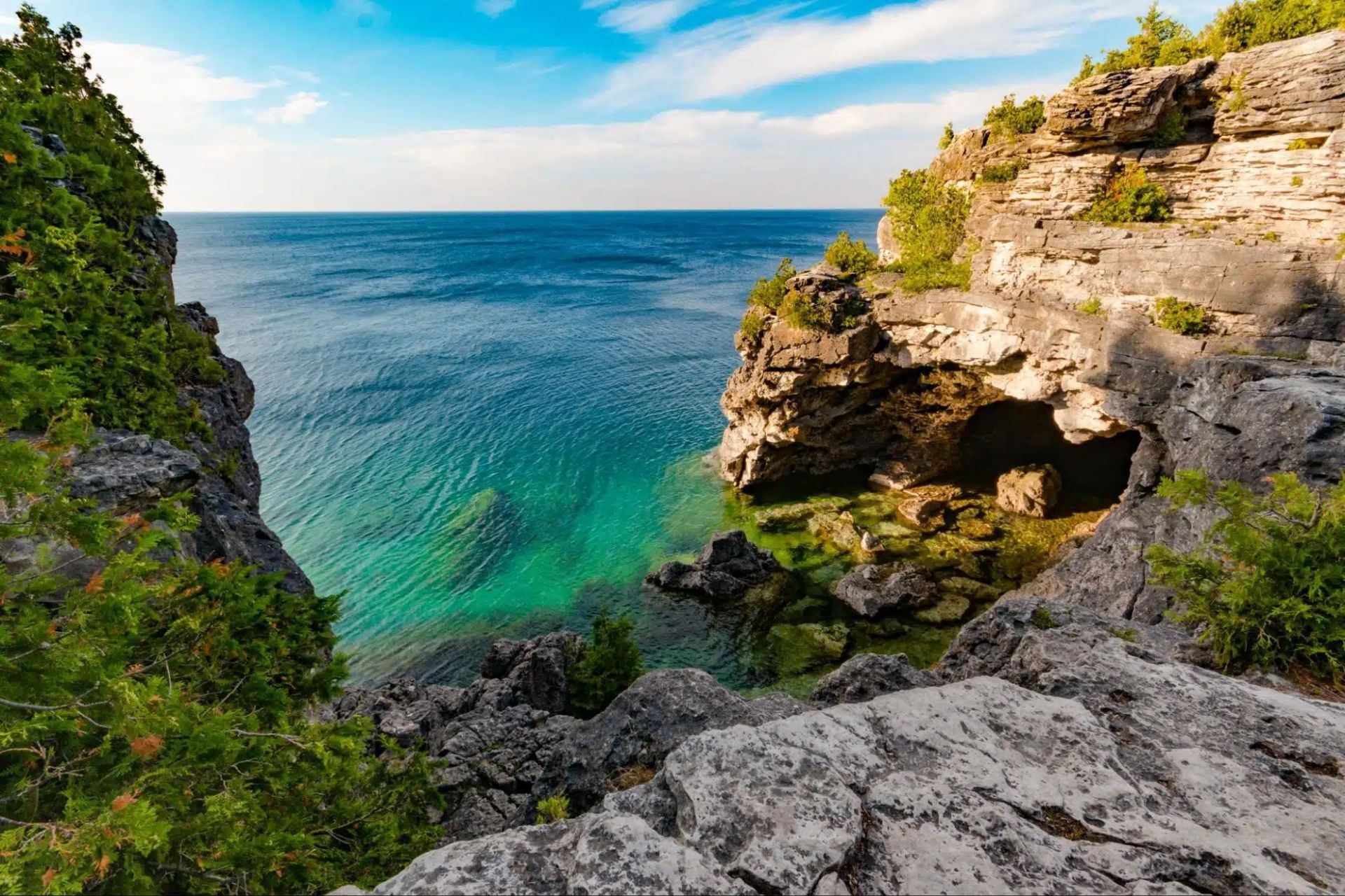
## Description The Tobermory Grotto is one of Ontario’s most recognizable natural attractions and a place that has become almost legendary among travelers who love clear water, rocky shoreline, and dramatic coastal scenery. Located along the Bruce Peninsula in Bruce Peninsula National Park, the Grotto is a sea cave and shoreline formation shaped by water and stone over a very long stretch of time. Its appeal is immediate: bright turquoise water, pale limestone cliffs, and a setting that looks more like a distant island destination than a typical inland Canadian getaway. What makes the Grotto so memorable is how strongly it contrasts with expectation. Travelers who arrive expecting a simple viewpoint often discover a landscape that feels startlingly vivid. The water color can seem almost unreal when sunlight is strong, and the surrounding rock formations create a natural frame that feels tailor-made for photography. Beyond the famous cave itself, the broader Bruce Peninsula landscape adds to the experience with forest, shoreline trails, and a sense of remote beauty that is unusually accessible for southern Ontario. One little-known fact is that the Grotto’s appearance changes dramatically with weather and light. On bright days, the water can look intensely blue-green, while overcast conditions make the scene quieter and more subdued. Another detail visitors often discover only when they arrive is that the site’s popularity has changed how it must be visited. Timing, access planning, and park rules matter more than they do at many ordinary day-use destinations. That is not a drawback so much as part of the modern experience of seeing one of Canada’s most celebrated natural spots. The Grotto is also a place that rewards patience. People often talk about it as a photo stop, but the longer you stay in the region, the more complete the experience becomes. The surrounding national park, the shoreline walk, and the broader Tobermory area all help the destination feel like a true outdoor trip rather than a single scenic moment. ## Location The Tobermory Grotto is in Bruce Peninsula National Park near Tobermory, Ontario, on the western side of the Bruce Peninsula along Georgian Bay. Tobermory is a small but well-known community at the northern end of the peninsula, and the Grotto is reached from there by road and park access rather than by urban transit. For most visitors, driving is the standard and most practical way to get there. Because the Grotto is a popular destination with limited access and park management considerations, it is wise to plan ahead rather than assuming you can simply arrive at any time. If you are coming from Toronto, London, or other parts of southern Ontario, the trip is long enough that an overnight stay in the Tobermory area can make the visit far more enjoyable. That also gives you time to explore the park properly instead of rushing in and out around the single most famous viewpoint. ## Tips Book and plan early. This is not the kind of place where improvisation always works best, especially in busy season. Parking, access rules, and timing can shape your experience significantly. If you wait until the last minute, you may find your options limited. Bring sturdy shoes and be prepared for a walk. The Grotto is scenic, but reaching it typically requires more effort than a simple roadside stop. The terrain can be rocky and uneven, so footwear matters. If you plan to swim, remember that natural water is cold even on warm days, and conditions can be less forgiving than they look from a photo. Think beyond the cave itself. The Grotto is the headline, but the whole Bruce Peninsula area is worth time. Nearby trails, shoreline views, and the general Tobermory landscape help transform the trip from a single stop into a richer outing. If possible, stay long enough to enjoy the area during different light conditions. Watch the weather. Clear sky and sunlight can make the water look especially bright, but even cloudy days have their own moody beauty. Safety, however, always matters more than the photo. Check local guidance before entering the water or walking near exposed edges. ## Conclusion The Tobermory Grotto is one of Ontario’s most impressive natural sights, blending dramatic shoreline scenery with the iconic turquoise water of Georgian Bay. It deserves the planning it requires and rewards travelers who make time for the wider peninsula. ## FAQ ### Is the Grotto worth the trip from Toronto? Yes, especially if you enjoy dramatic natural scenery and do not mind a longer drive. Many visitors treat it as an overnight or weekend trip so they can enjoy the Bruce Peninsula more fully. ### Can I swim there? Swimming may be possible depending on conditions and local rules, but the water is very cold and natural shoreline conditions can be challenging. Always check current guidance before entering the water. ### Do I need to visit in summer? Summer is the most popular season, but the area can be beautiful at other times too. The tradeoff is that access, weather, and comfort levels vary by season. ### Is the Grotto suitable for children? It can be, if you are careful and supervise closely. The rocky terrain means families should pay attention to footing and safety. ### How much time should I plan? At minimum, allow enough time for the walk, the viewpoint, and the return. A fuller Bruce Peninsula day trip is much more satisfying than a rushed photo stop. ## Links - [Official website](https://parks.canada.ca/pn-np/on/bruce/activ/experiences/grotto) - [Wikipedia](https://en.wikipedia.org/wiki/Bruce_Peninsula_National_Park)
GemVoyage Team • World
Stockholm
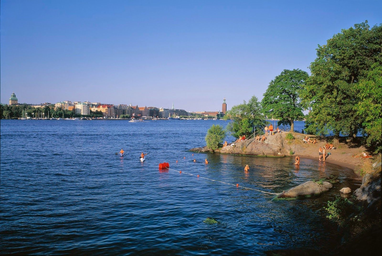
## Description Långholmen Island Beach is one of Stockholm’s most appealing summer spots because it combines waterfront relaxation with the unusual character of an island that has shifted through different uses over time. Visitors come for swimming, sunbathing, walking, and the easygoing atmosphere, but the experience is richer than a simple beach stop. The setting itself is part of the attraction: you are on an island close to the city, surrounded by water, greenery, and reminders of Stockholm’s layered history. What makes Långholmen stand out is that it feels local rather than overly polished. It is a place where residents and visitors mingle in warm weather, where people arrive with towels, picnic food, and a plan to stay for a while. It is not a tropical beach and does not try to be one; instead, it offers a distinctly Scandinavian urban waterfront experience. One lesser-known fact is that Långholmen has had very different historical roles before becoming a leisure destination, which gives the island an added sense of depth. Another interesting detail is that the area’s appeal changes dramatically by season, making it a true summer favorite in a city where outdoor life depends heavily on weather. The beach is also a good example of how Stockholm uses its water environment. Rather than separating city life from the shoreline, the city often integrates swimming and walking areas into the urban fabric. Långholmen captures that idea perfectly. You can spend time on the beach, wander nearby paths, and still feel close to the city center. For travelers, that makes it a convenient and memorable place to balance sightseeing with rest. ## Location Långholmen is a small island in central Stockholm, Sweden, connected to the city by bridges and easy to access from the Södermalm side and other central districts. Because it is so close to the urban core, it is one of the easiest island experiences in Stockholm. The simplest way to get there is by walking from nearby central neighborhoods or using public transport and then continuing on foot. Cycling also works well in Stockholm, and the island fits nicely into a bike-friendly itinerary. Once there, most of the movement is best done on foot so you can enjoy the shoreline and the surrounding green areas at an unhurried pace. ## Tips This is best visited in warm weather, especially in late spring and summer. Bring swimwear if you want to use the beach properly, but also bring a layer for cooler winds. Combine the visit with a walk around the island so you see more than just the main swimming area. Arrive earlier on sunny days if you want a quieter spot near the water. ## Conclusion Långholmen Island Beach is a relaxed city escape that gives Stockholm a rare but very welcome summer beach mood. ## FAQ ### Is Långholmen a real beach? Yes, though it is a city beach rather than a large natural seaside beach. ### Is it good for swimming? Yes, it is one of Stockholm’s popular places for summer swimming. ### How do I get there from central Stockholm? Walk, bike, or use public transport and then cross to the island on foot. ### Is it busy in summer? It can be, especially on warm weekends and sunny afternoons. ### Can I visit outside summer? Yes, but it is most enjoyable as a beach destination in the warmer months. ## Links - [Stockholm official visitor information](https://www.visitstockholm.com/) - [Långholmen on Wikipedia](https://en.wikipedia.org/wiki/Långholmen)
GemVoyage Team • World
Cape Town
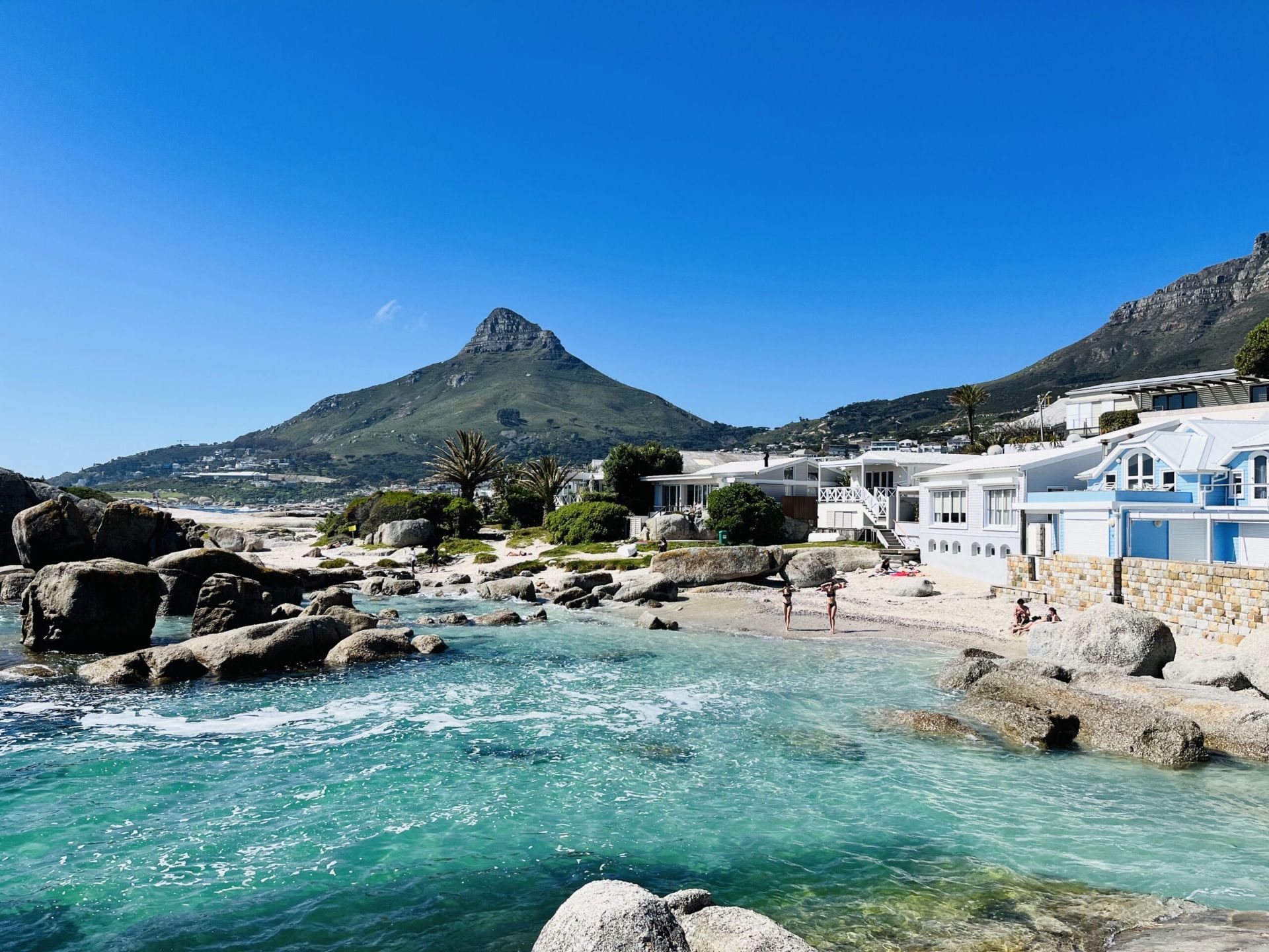
## Description Beta Beach in Bakoven is one of Cape Town’s more understated coastal spots, which is exactly what makes it appealing. Instead of the intensity of the city’s bigger, more famous beaches, Beta Beach offers a calmer setting where granite boulders, sheltered sand, and Atlantic water create a beautiful but low-key experience. The beach feels intimate and local, with views that are every bit as memorable as those at more famous shoreline destinations. What sets Beta Beach apart is the way it blends privacy and scenery. It is not a beach for large crowds or big facilities; it is a beach for people who want to pause, look out over the ocean, and enjoy the dramatic relationship between water and mountain. The Bakoven area itself has a strong residential character, which helps keep the atmosphere relaxed. One lesser-known fact is that the smaller coves in this part of the coast can look very different depending on tide and swell, so a single visit can feel dramatically different from one hour to the next. Another interesting detail is how the surrounding boulders create natural windbreaks and visual frames, making the beach especially photogenic. Beta Beach is also a good choice for travelers who want a quieter Atlantic side experience without giving up proximity to major Cape Town attractions. It works well as a short stop, a sunset watchpoint, or a place to linger between drives along the coast. The mountain backdrop and ocean light make it feel distinctly Cape Town, but in a softer, more residential register than some of the city’s busier beaches. For many visitors, that balance of accessibility and peace is the reason it becomes a favorite. ## Location Beta Beach is in Bakoven, Cape Town, Western Cape, South Africa, along the Atlantic coast near Camps Bay and the route toward the Twelve Apostles side of Table Mountain. The location is close to one of the city’s most scenic coastal corridors. The easiest way to get there is by car or ride-hailing service, especially if you are staying in central Cape Town, Camps Bay, or Sea Point. Public transport options are more limited for this particular stretch, so direct road access is usually the practical choice. Once there, plan to explore on foot so you can enjoy the coves and viewpoints at a slower pace. ## Tips Check tide and weather conditions before visiting, because the beach’s feel changes significantly with the sea. Bring sun protection and water, since the Atlantic coast can be sunny and exposed. Go near sunset for especially strong light on the water and mountains. Keep expectations realistic: this is a beautiful, quieter beach rather than a full-service resort area. ## Conclusion Beta Beach is a peaceful Cape Town coastal stop that pairs Atlantic beauty with a relaxed, local atmosphere. ## FAQ ### Is Beta Beach crowded? It is generally quieter than Cape Town’s most famous beaches, though it can still be busy at peak times. ### Can you swim there? People do swim, but Atlantic conditions can be cold and variable. ### Is it easy to find? Yes, especially if you are already traveling through Bakoven or nearby Camps Bay. ### Is it good for photography? Very much so, especially at sunrise or sunset. ### What makes it different from Camps Bay? It is smaller, quieter, and more sheltered, with a more intimate feel. ## Links - [Cape Town tourism information](https://www.capetown.travel/) - [Camps Bay on Wikipedia](https://en.wikipedia.org/wiki/Camps_Bay)
GemVoyage Team • World
Tanzania
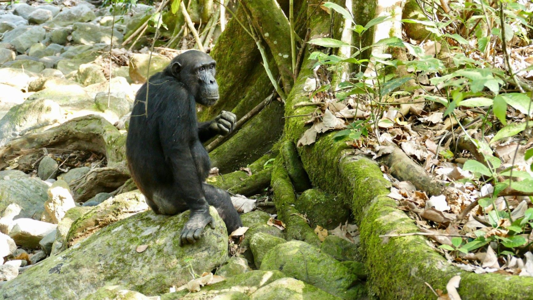
## Description Nestled on the remote eastern shores of **Lake Tanganyika**, the **Mahale Mountains National Park** is one of **Tanzania’s most untouched and magical wilderness areas**. Famous for its **wild chimpanzee population**, pristine forests, and turquoise waters, this park offers an experience unlike any other in Africa — where jungle-clad mountains meet one of the world’s oldest and deepest lakes. Covering over **1,600 square kilometers**, Mahale Mountains National Park lies at the crossroads of **rainforest, savanna, and miombo woodland**, creating a spectacularly diverse ecosystem. Its landscape is dominated by the dramatic **Mahale Mountain Range**, with **Mount Nkungwe** — the highest peak — rising to 2,462 meters above sea level. The park is most renowned for being home to one of the **largest known communities of wild chimpanzees**, with around **800 individuals**. Visitors have the rare opportunity to **trek into the forest** and observe these intelligent primates in their natural habitat — grooming, feeding, and socializing just a few meters away. The **Mimikire community** of chimps has been studied since the 1960s by Japanese researchers, making Mahale a world center for primate research and conservation. Beyond the chimpanzees, Mahale is a haven for **biodiversity**. The park shelters **leopards, bushbucks, red colobus monkeys, blue duikers, warthogs**, and hundreds of **bird species**. The crystal-clear waters of **Lake Tanganyika**, bordering the park to the west, are home to over **250 species of cichlid fish**, many found nowhere else on Earth. One of Mahale’s most fascinating aspects is its isolation — there are **no roads inside the park**. Access is only by **boat or plane**, ensuring that the park remains wild and unspoiled. Visitors walk along forest trails, wade across rivers, and travel by dhow or motorboat, surrounded by breathtaking scenery and deep tranquility. A lesser-known fact is that the area is the **ancestral home of the Tongwe people**, who once lived in the forest and practiced traditional customs linked to nature and the spirits of the mountains. Some cultural heritage still survives, adding a layer of human history to Mahale’s natural beauty. With its mix of adventure, serenity, and ecological wonder, **Mahale Mountains National Park** is a destination for those seeking a **genuine wilderness experience** — where you can track chimpanzees in the morning, swim in the world’s longest freshwater lake in the afternoon, and watch the sun set behind the Congo mountains in the distance. ## Location **Mahale Mountains National Park** is located in **western Tanzania**, along the **eastern shore of Lake Tanganyika**, opposite the **Democratic Republic of the Congo**. **Coordinates:** Approximately 6°S, 30°E To get there: * **By air:** The most convenient way is by **charter flight** from **Arusha, Dar es Salaam, or Kigoma** to the **Mahale airstrip**, followed by a **boat transfer** (typically 1–2 hours) to your lodge or campsite. * **By boat:** From **Kigoma**, you can take a **boat or dhow** along Lake Tanganyika, which takes between **6–10 hours** depending on the vessel. * **By road and boat (adventurous option):** Drive from **Kigoma** to **Kagunga village** (about 3–4 hours), then continue by boat to Mahale. Because of its remoteness, Mahale is best visited as part of a planned safari itinerary with **arranged transport and accommodation** through a tour operator or lodge. ## Tips * **Plan ahead:** Due to its remote location, logistics can be complex — book accommodation and flights well in advance. * **Chimp trekking:** The best time to see chimpanzees is during the **dry season (May to October)** when they stay closer to the lower slopes. * **Fitness required:** Trekking can involve steep and humid trails; wear comfortable shoes, long pants, and bring plenty of water. * **Stay several days:** Allow at least **3–4 nights** to enjoy chimp tracking, lake swimming, and forest hikes. * **Bring lightweight clothing:** The climate is tropical, but evenings near the lake can be cooler. * **Malaria precautions:** Use repellent and consult your doctor before travel — Mahale is a tropical zone. * **No roads, no crowds:** Be prepared for total disconnection — there is limited electricity and no phone signal in most areas. * **Combine with Katavi National Park:** Many travelers pair Mahale with nearby **Katavi**, another remote gem known for its wildlife-filled plains. ## Conclusion The **Mahale Mountains National Park** is one of Africa’s last true wildernesses — a place of **raw beauty and profound peace**. From tracking wild chimpanzees through lush forests to swimming in the crystal-clear waters of Lake Tanganyika, every moment in Mahale feels extraordinary. Its isolation ensures that it remains a haven for both wildlife and travelers seeking solitude. Visiting Mahale is not just a safari — it’s a **journey into the heart of nature**, untouched and unforgettable. ## FAQ **1. What is Mahale Mountains National Park famous for?** It’s best known for its **wild chimpanzees** and stunning **mountain–lake scenery**. **2. How many chimpanzees live in the park?** Around **800 individuals**, including the well-studied **Mimikire community**, habituated to human presence. **3. How do I reach Mahale?** Most visitors arrive by **charter flight** from **Arusha, Dar es Salaam, or Kigoma**, followed by a **boat transfer** to their lodge. **4. When is the best time to visit?** The **dry season (May–October)** is ideal for chimpanzee tracking, while **November–April** brings lush scenery and birdlife. **5. Are there accommodations inside the park?** Yes — there are a few **exclusive lodges and tented camps** along Lake Tanganyika’s shores, such as **Greystoke Mahale** and **Kungwe Beach Lodge**. **6. What other animals can be seen?** Besides chimpanzees, the park is home to **leopards, bushpigs, red colobus monkeys, giant squirrels**, and **hundreds of bird species**. **7. Can visitors swim in Lake Tanganyika?** Yes — it’s safe for swimming and snorkeling near the lodges, with **exceptionally clear freshwater** and tropical fish. ## Links * [Tanzania National Parks Authority – Mahale Mountains](https://storymaps.arcgis.com/stories/4bf12795a5b44f3482b580e692c465a4)
GemVoyage Team • World
Cairo
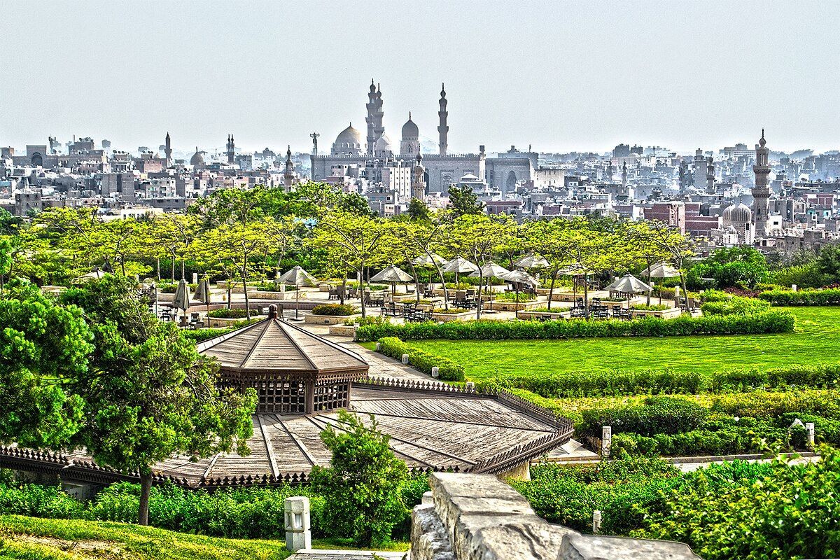
## Description Al-Azhar Park is one of Cairo’s most rewarding urban escapes, and it stands out because it is much more than a public garden. It is a carefully designed landscape set high above one of the oldest parts of the city, where visitors can look out over domes, minarets, and tightly woven streets that have defined Cairo for centuries. The contrast is what makes the park memorable: inside the gates, the noise of the city softens, the paths open up, and the view becomes the main attraction. From almost any elevated point in the park, Old Cairo looks like a living museum, with the Citadel, historic mosques, and dense neighborhoods stretching into the distance. What many visitors do not realize is that the park was created on land that had long been used as a dumping ground. The transformation was not cosmetic. It involved an ambitious restoration effort that turned a neglected hill into a civic landscape with gardens, water features, shaded walks, and family-friendly gathering spaces. That history adds an important layer to the visit, because it makes the park feel like a symbol of renewal rather than just a scenic stop. Another little-known detail is that the site was opened after years of landscaping work meant to reclaim the land while respecting the visual character of Cairo’s historic skyline. The park also has a strong social and cultural dimension. It is a place where local families come for afternoon walks, photographers come for golden-hour views, and travelers come to catch their breath between the intensity of Cairo’s monuments and traffic. Restaurants and cafés inside the park make it possible to spend several hours there without feeling rushed. That is one reason Al-Azhar Park works so well as a travel attraction: it gives you a calmer, more reflective way to experience the city, while still keeping you close to the stories that made Cairo famous. The best way to appreciate the park is to slow down. A quick visit will give you the view, but a longer stay lets you notice the layout, the planting, and the way the park frames the surrounding architecture. At different times of day, the mood changes dramatically. Morning is quieter and better for walking, while late afternoon is ideal for photos. After sunset, the historic city lights begin to glow and the park takes on a softer, more romantic atmosphere. ## Location Al-Azhar Park is in Cairo, Egypt, on elevated ground near the historic core of the city. It is especially close to Islamic Cairo and sits within easy reach of major landmarks such as the Citadel and Khan el-Khalili. Because it is positioned above the old city, part of the experience is the panoramic outlook rather than a single building or monument. If you are coming from central Cairo, the most practical approach is to take a taxi or ride-hailing car directly to the park entrance. That is the simplest option for first-time visitors because it avoids the stress of navigating dense traffic and narrow streets on your own. Travelers staying near Downtown Cairo or in the historic district can also combine the park with nearby sightseeing on the same day. For those who prefer to explore by taxi, ask the driver to take you to Al-Azhar Park and confirm the entrance before arriving, since local access points can be confusing in the surrounding neighborhood. The park is well placed for a broader Cairo itinerary. You can pair it with a visit to nearby mosques, the old market area, or the Citadel, then finish the day with a meal overlooking the city. That makes it one of the easiest attractions to build into a full sightseeing route without wasting time in transit. ## Tips Visit later in the day if possible, because the light is better and the city view becomes more striking as the sun drops. If you want photos, bring a camera or phone with a wide-angle lens setting, since the skyline is one of the main reasons to come. Wear comfortable shoes. The park is easy to walk, but it covers more ground than many first-time visitors expect, and some viewpoints are best reached on foot rather than by trying to shortcut the layout. A light layer is also useful in cooler months or on windy evenings, especially if you plan to stay until after sunset. Do not treat the park as only a quick stop. Budget enough time for a relaxed walk, a pause at a café, and a slow look at the surrounding historic district. If you are visiting Cairo in the heat, the shaded areas and the open space can make the park feel like a practical break from the city’s intensity. If you are traveling with family, this is one of the easier places in Cairo to spend a calm few hours. It is also a strong option if you want a view-driven attraction that still feels rooted in local life rather than purely touristic. ## Conclusion Al-Azhar Park is one of Cairo’s most distinctive attractions because it combines landscape design, history, and panoramic city views in a single visit. It is both a peaceful retreat and a memorable way to understand the scale and beauty of historic Cairo. ## FAQ **Is Al-Azhar Park worth visiting?** Yes. It offers some of the best views in Cairo, a pleasant walking experience, and a chance to see the city from a calmer perspective. **How much time do I need there?** Most visitors should plan for at least one to two hours, and longer if they want to eat, relax, or take photos at different viewpoints. **Can I visit in the evening?** Yes. Late afternoon and early evening are often the best times for both comfort and photography. **Is it family-friendly?** Very much so. It is one of Cairo’s more comfortable outdoor spaces for families and casual visitors. **What should I combine it with nearby?** The Citadel, Khan el-Khalili, and other Islamic Cairo landmarks fit naturally into the same day. ## Links - [Wikipedia](https://en.wikipedia.org/wiki/Al-Azhar_Park)
GemVoyage Team • World

Athens
## Description Stavros Niarchos Park is one of the most impressive modern public spaces in Athens and a compelling reason to look beyond the city’s ancient monuments. It is part of the larger Stavros Niarchos Foundation Cultural Center, and it has become known for its open lawns, long walking paths, planted slopes, water features, and elevated views. The park feels spacious and carefully composed, which is a welcome contrast to the denser parts of central Athens. The appeal of the park lies in its blend of architecture, landscape design, and civic function. It is not simply decorative. It was created to give residents and visitors a place for recreation, events, and relaxed outdoor time in a city that can otherwise feel intensely urban. A little-known detail is that the park includes an artificial hill that helps shape the site’s views and gives visitors a raised perspective over Athens and toward the sea. That design choice makes the park feel dynamic rather than flat. Another reason the park stands out is that it reflects a modern chapter in Athens’ story. Many travelers come to the city for antiquity, but this space shows that contemporary Athens also has ambitious public architecture and thoughtful urban design. The result is a place that works for many different types of visitors. Families come to stroll, runners use the paths, couples come for sunset, and architecture enthusiasts come to examine the way the landscape and buildings interact. The park is especially pleasant when the weather is good. Athens has strong sunlight for much of the year, and the open layout makes the site feel bright, clean, and alive. Because it connects cultural programming with everyday outdoor use, it is not just a park you pass through. It is a place to spend real time in, and the experience often changes depending on the hour of the day or the event calendar. ## Location Stavros Niarchos Park is in Athens, Greece, in the Kallithea area near the coastline and south of the city center. It is part of the Stavros Niarchos Foundation Cultural Center, so visitors often experience the park together with the surrounding cultural buildings and public spaces. The easiest way to get there is by public transport, taxi, or rideshare from central Athens. Depending on your starting point, tram or bus connections can also work well. If you are staying in the center, the park is simple enough to include in a half-day plan, especially if you want a break from the dense historic core of the city. Because the site is well connected and clearly marked, it is one of the more straightforward modern attractions to reach. If you have time, combine the visit with a walk through the surrounding area or a stop at the waterfront. That helps show how the park fits into Athens beyond the Acropolis-heavy itinerary most first-time travelers follow. ## Tips Visit in the late afternoon if you want better light and a more relaxed atmosphere. Sunset is especially attractive because the views across the park and toward the city become softer. Bring comfortable shoes. The site is large enough that you will want to walk it properly, and the different levels make a full circuit more interesting than a quick pass-through. Check the event calendar before you go. Public performances, concerts, or cultural activities can add a lot to the experience if your timing is right. If you are with children or want a quieter reset during a busy sightseeing day, this is one of the best modern spaces in Athens for a pause. ## Conclusion Stavros Niarchos Park shows a modern, open, and design-forward side of Athens. It is a highly enjoyable place to walk, relax, and see how contemporary public space can complement the city’s historical identity. ## FAQ **Is Stavros Niarchos Park just a park?** No. It is part of a larger cultural center with architecture, public space, and programming. **Is it worth visiting if I only have time for ancient sites?** Yes, because it gives a different and refreshing view of Athens. **How long should I spend there?** At least one to two hours, more if you want to explore thoroughly or attend an event. **Is it family-friendly?** Very much so. The open layout and walkable design make it easy to enjoy with children. **What is the best time to go?** Late afternoon or sunset is especially good for atmosphere and views. ## Links - [Official website](https://www.snfcc.org/en/) - [Wikipedia](https://en.wikipedia.org/wiki/Stavros_Niarchos_Foundation_Cultural_Center)
GemVoyage Team • World
Cologne
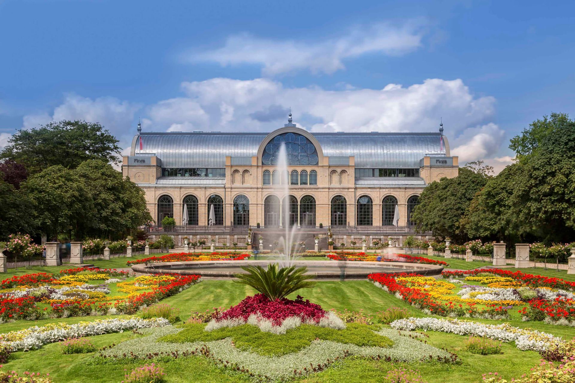
## Description Flora and Botanical Garden in Cologne is one of the city’s most pleasant and quietly impressive attractions, especially for visitors who enjoy plants, landscape design, and slower-paced sightseeing. It is not a flashy stop in the way a major cathedral or museum might be, but it offers something equally valuable: a calm, beautifully maintained space where you can see a wide range of plant life while also enjoying a historic urban garden setting. What makes the garden special is the combination of horticultural variety and atmospheric design. You can move through different themed areas, glasshouse spaces, and seasonal displays, all while staying within a park that feels genuinely integrated into the city. That balance between botany and public leisure is one of the garden’s strengths. It works for plant enthusiasts, but it also works for anyone who needs a break from crowded streets and indoor attractions. One lesser-known fact is that the Flora area has long been associated with Cologne’s tradition of public gardens and exhibition culture. The site has history as a civic landscape, which gives it a depth that goes beyond colorful flower beds. Another is that the changing seasons transform the experience dramatically. In spring and early summer, the garden can feel especially lush and full of color, while autumn adds texture and softer light. Even in winter, the layout and greenhouse areas can make the visit worthwhile. For travelers, the Cologne Botanical Garden is useful because it offers a different rhythm from the city’s more famous landmarks. It is the sort of place that makes a city trip feel less rushed and more balanced. You can walk, sit, observe, and breathe a little between visits to Cologne Cathedral, the Rhine, or the old town. That versatility is part of its appeal. ## Location Flora and Botanical Garden is in Cologne, Germany, in the northern part of the city near the zoo area. It is easy to reach from the center and can be combined with other Cologne attractions in the same day. Public transport is the most practical way to arrive. From the city center, you can take local transit and continue with a short walk, which is usually the easiest option for visitors. If you are staying near the Rhine or the old town, the garden is still accessible enough to fit into a relaxed sightseeing route. Because the garden is part of a larger park and urban landscape, it is worth checking how much time you want to spend wandering versus focusing on the main planted areas. The location makes it a natural break during a broader Cologne itinerary. ## Tips Visit in the morning if you want a quieter atmosphere and better conditions for photography. Gardens often become busier later in the day, especially in good weather. Bring comfortable walking shoes and be ready to spend more time than you expect. The pleasure of botanical gardens often comes from slow movement rather than fast highlights. If you enjoy plants, check the season before you go. Bloom times and display quality can change the character of the visit significantly. If your schedule is crowded, this attraction still works well as a restorative hour or two between major urban sights. It is not only for serious gardeners; it is for anyone who wants a more peaceful Cologne experience. ## Conclusion Flora and Botanical Garden in Cologne is a refined and restful attraction that showcases the city’s green side. It is a strong choice for visitors who appreciate nature, seasonal color, and a quieter pace of travel. ## FAQ **Is the Cologne Botanical Garden worth visiting?** Yes, especially if you enjoy gardens, peaceful walks, or seasonal landscapes. **How long should I stay?** One to two hours is a good range for a comfortable visit. **Is it easy to reach from central Cologne?** Yes. It is well connected by public transport and not difficult to combine with other city sights. **What is the best time of year to go?** Spring and summer offer the fullest plant displays, but each season has its own appeal. **Is it suitable for a short visit?** Yes. Even a brief stop can be worthwhile if you need a calm break in the city. ## Links - [Official website](https://www.stadt-koeln.de/leben-in-koeln/freizeit-natur-sport/parks/flora-und-botanischer-garten)
GemVoyage Team • World
Hong Kong
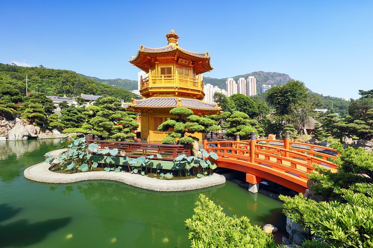
## Description Nan Lian Garden is one of Hong Kong’s most beautiful and tranquil urban escapes. Designed in the style of a classical Chinese garden, it offers a carefully balanced landscape of ponds, pavilions, bridges, rocks, timber structures, and manicured plantings. In a city known for density and energy, the garden creates a sense of quiet that feels almost protective. For travelers who want a break from markets, towers, and busy streets, this is an ideal place to slow down. The garden stands out because every part of it feels intentional. Paths curve in a way that reveals views gradually, water is placed to reflect architecture and sky, and the plant life is arranged to create a sense of harmony rather than display. It is not a large theme park style attraction; instead, it rewards observation and a slower pace. Visitors often leave surprised by how much visual richness can be packed into a relatively compact space without feeling crowded. One little-known fact is that Nan Lian Garden was designed to echo the aesthetics of the Tang dynasty, which means the landscape is guided by historical artistic principles rather than modern ornamental trends. Another detail many people miss is the garden’s ability to change character with the weather. On a bright day, the orange, red, and green tones look crisp and vivid. On a misty or overcast day, the place becomes softer and more contemplative, almost like a living painting. The nearby cultural surroundings also add depth to the visit. Many travelers pair the garden with adjacent spiritual and architectural sites because the whole area encourages a thoughtful pace. Even if you only have a short time, the garden can leave a strong impression because it feels so different from the surrounding city. It is carefully maintained but not sterile, elegant but not intimidating, and peaceful without feeling empty. Another reason the garden is memorable is that it offers a very photogenic composition without requiring any special effort. Reflections, stonework, and traditional roofs create good images from many angles. Still, the real value of the place is not just visual. It is the emotional contrast between the garden and the rest of Hong Kong. That contrast is what makes the visit feel restorative. ## Location Nan Lian Garden is located in Diamond Hill, Kowloon, Hong Kong. It is part of a cultural area in the eastern side of Kowloon and is closely associated with traditional architecture and landscaped public space. The most convenient access is usually through Diamond Hill MTR Station, followed by a short walk from the station into the garden area. Because the garden is centrally accessible by public transport, it fits easily into a Hong Kong itinerary. You do not need a special transfer or long taxi ride to get there. If you are already in Kowloon, it is especially easy to combine with nearby neighborhoods or with other cultural stops in the same district. Arriving by MTR is generally the simplest and most efficient option. ## Tips - Visit in the morning for a quieter atmosphere and better light. - Move slowly and take time to notice the composition of the paths, water, and buildings. - Dress comfortably, but respectfully, since the area has a calm and somewhat formal mood. - Combine the visit with nearby cultural sites so the trip feels complete. - Bring a camera, but do not rush the experience just to get photos. ## Conclusion Nan Lian Garden is one of Hong Kong’s best places for calm, balance, and classical beauty in the middle of a fast-moving city. ## FAQ ### Is Nan Lian Garden free to visit? Access policies can vary, so it is best to check current conditions before going, but the garden is widely known as a very accessible public attraction. ### How much time do I need there? Most visitors spend 45 minutes to 2 hours depending on whether they also visit nearby attractions. ### Is it suitable for children? Yes. The garden is peaceful and easy to walk through, so it can work well for families. ### What makes it different from other Hong Kong attractions? Its classical design and calm atmosphere set it apart from the city’s more modern, commercial, and high-energy destinations. ### What is the best time to go? Morning is usually best because the garden is quieter and the light is more flattering for photos. ## Links - [Wikipedia article](https://en.wikipedia.org/wiki/Nan_Lian_Garden)
GemVoyage Team • World

Tunis
## Description La Marsa Beach is a beloved coastal escape northeast of Tunis that combines Mediterranean charm with an approachable, local atmosphere. Far from the large resort complexes of some Mediterranean destinations, La Marsa offers a more neighborhood-oriented seaside experience: a promenade lined with cafés, bakeries, and small restaurants; stretches of sandy shore where locals swim and sunbathe; and scenic viewpoints that look across the blue Mediterranean. For visitors seeking a short seaside interlude from Tunis’s historic core, La Marsa is an ideal half-day or day-trip destination. The area’s allure stems from its balance of leisure and everyday life. Residents walk their dogs along the promenade, families picnic on the sand, and fishermen haul in their catches at dawn. This authentic feel makes La Marsa attractive to travelers who want to witness contemporary Tunisian coastal life, not just the staged beachfront experience. The neighborhood also contains pockets of cultural interest—small galleries, local bakeries serving traditional pastries, and seasonal markets—that reward time spent wandering. ## Location La Marsa is located along the Mediterranean coast, approximately a 20–40 minute drive from central Tunis depending on traffic. It is part of the larger Tunis metropolitan area and is commonly reached by taxi, rideshare, or regional train in combination with local buses. The promenade and main beach are clustered near the town center, making it easy to combine a seaside visit with cafés or a short walk through residential streets to see local homes and shops. For a relaxed day, arrive mid-morning to stroll the promenade, have a seaside lunch, and enjoy a late-afternoon walk as light softens over the water. If you want to swim, check local conditions—lifeguard presence and sea state vary by season and specific beach segments. ## Tips - Check tide and sea conditions before planning a swim day; calmer days are best for families and casual swimming. - Visit early in the day or later in the afternoon to avoid peak crowds and capture better light for photos. - Bring essentials: water, sun protection, and a towel—some smaller beaches do not have full-service rental facilities. - Sample local cafés and seafood restaurants along the promenade for a taste of Tunisian coastal cuisine. - Pair the beach with cultural stops: a short walk through La Marsa’s streets reveals bakeries, small galleries, and neighborhood markets. - If you prefer quieter spots, walk a little farther from the main promenade where smaller coves and rocky outcrops provide a calmer atmosphere. ## Conclusion La Marsa Beach is an ideal complement to a Tunis itinerary for visitors who want to add gentle sea air to a cultural visit. It offers an accessible, everyday Mediterranean experience that feels comfortably local—and it’s an excellent reminder that Tunisia’s coastline is as varied and alive as its historic medinas. ## FAQ ### Is La Marsa Beach good for a quick escape from Tunis? Yes. It’s one of the closest coastal escapes from the capital and works well for half-day or full-day visits without complicated logistics. ### Is La Marsa only a summer destination? No. While beachgoing peaks in summer, the promenade and cafés are pleasant year-round for walks and dining. ### What facilities are available? Facilities vary by spot: some stretches have cafés and basic rental services, while smaller coves may lack amenities—bring essentials if you’re unsure. ### How do I get there from central Tunis? Taxi or rideshare are the most direct options; regional trains and buses also connect the area but may require short onward transfers. ### Is La Marsa family-friendly? Generally yes—shallow water and promenade facilities make it suitable for families, though conditions vary by season and exact location. ## Links - [Wikipedia](https://en.wikipedia.org/wiki/La_Marsa)
GemVoyage Team • World
