GemVoyage Team • World
The appeal of the park lies in its blend of architecture, landscape design, and civic function. It is not simply decorative. It was created to give residents and visitors a place for recreation, events, and relaxed outdoor time in a city that can otherwise feel intensely urban. A little-known detail is that the park includes an artificial hill that helps shape the site’s views and gives visitors a raised perspective over Athens and toward the sea. That design choice makes the park feel dynamic rather than flat.
Another reason the park stands out is that it reflects a modern chapter in Athens’ story. Many travelers come to the city for antiquity, but this space shows that contemporary Athens also has ambitious public architecture and thoughtful urban design. The result is a place that works for many different types of visitors. Families come to stroll, runners use the paths, couples come for sunset, and architecture enthusiasts come to examine the way the landscape and buildings interact.
The park is especially pleasant when the weather is good. Athens has strong sunlight for much of the year, and the open layout makes the site feel bright, clean, and alive. Because it connects cultural programming with everyday outdoor use, it is not just a park you pass through. It is a place to spend real time in, and the experience often changes depending on the hour of the day or the event calendar.
The easiest way to get there is by public transport, taxi, or rideshare from central Athens. Depending on your starting point, tram or bus connections can also work well. If you are staying in the center, the park is simple enough to include in a half-day plan, especially if you want a break from the dense historic core of the city. Because the site is well connected and clearly marked, it is one of the more straightforward modern attractions to reach.
If you have time, combine the visit with a walk through the surrounding area or a stop at the waterfront. That helps show how the park fits into Athens beyond the Acropolis-heavy itinerary most first-time travelers follow.
Bring comfortable shoes. The site is large enough that you will want to walk it properly, and the different levels make a full circuit more interesting than a quick pass-through.
Check the event calendar before you go. Public performances, concerts, or cultural activities can add a lot to the experience if your timing is right.
If you are with children or want a quieter reset during a busy sightseeing day, this is one of the best modern spaces in Athens for a pause.
Is it worth visiting if I only have time for ancient sites? Yes, because it gives a different and refreshing view of Athens.
How long should I spend there? At least one to two hours, more if you want to explore thoroughly or attend an event.
Is it family-friendly? Very much so. The open layout and walkable design make it easy to enjoy with children.
What is the best time to go? Late afternoon or sunset is especially good for atmosphere and views.
Discover more hidden gems you might love.
Austin
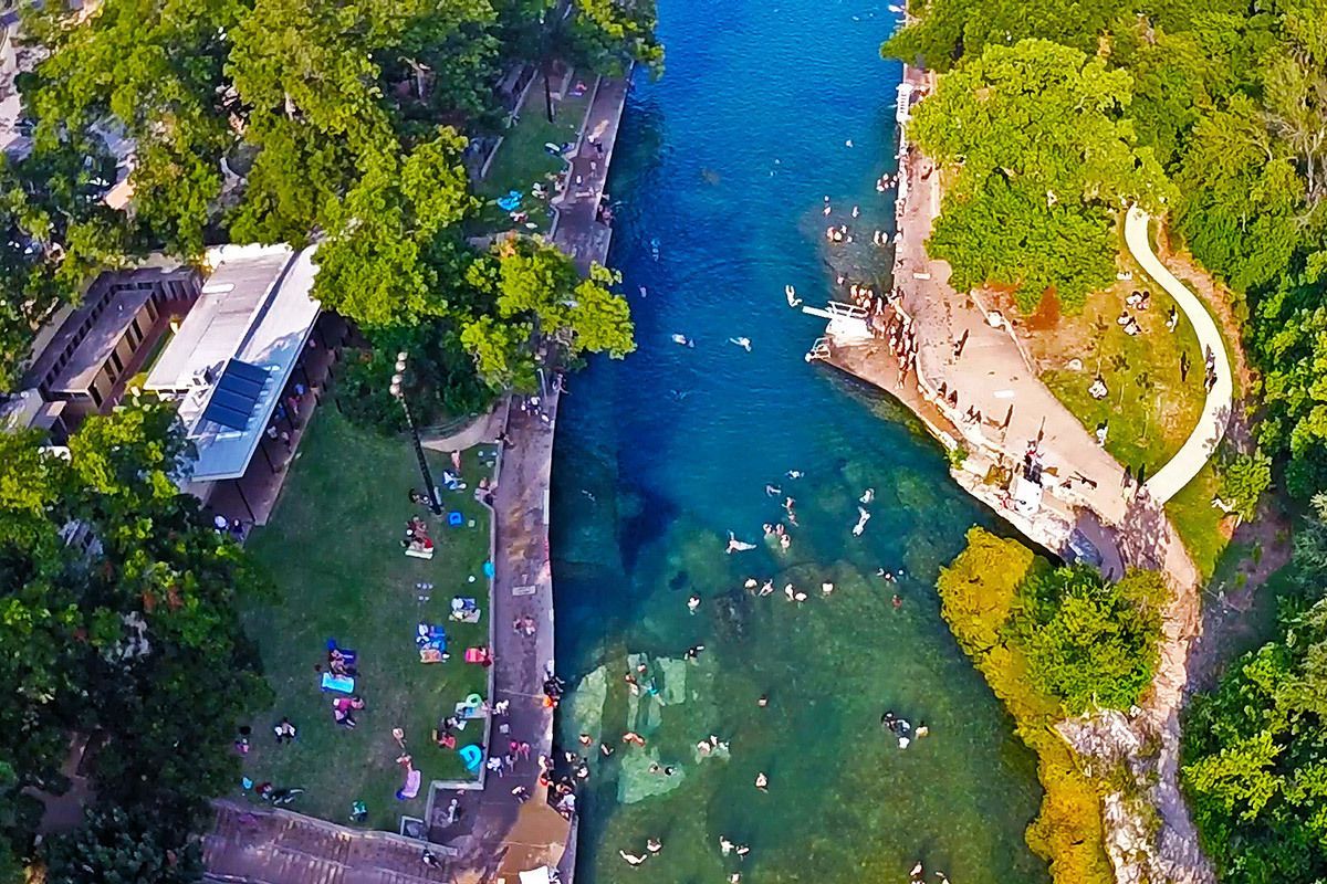
## Description Barton Springs Pool is one of Austin’s most beloved landmarks because it offers something rare in a major American city: a large natural spring-fed swimming pool that feels both wild and urban at the same time. Located in Zilker Park, it has long been a favorite place for locals to cool off, relax, and connect with the city’s outdoor culture. The pool is more than a recreational amenity. It is a symbol of Austin’s relationship with nature, conservation, and public space. If you want to understand why residents speak about the city with so much affection for its outdoor life, Barton Springs is one of the best places to start. The water is consistently cool year-round, which gives the pool a very specific personality. In summer, that feels refreshing and almost miraculous. In cooler months, it feels bracing and memorable. A little-known fact is that the pool is closely associated with endangered species and ecological protection, especially the Barton Springs salamander, which means the site has both leisure and conservation importance. Another detail many visitors miss is that the pool has been a social gathering place for generations, so the sense of continuity is as much part of the attraction as the water itself. What makes Barton Springs especially attractive is its flexibility. Families, swimmers, walkers, sunbathers, and out-of-town visitors can all enjoy it in different ways. Some people come specifically to swim laps or cool off after a hot Austin day. Others come simply to sit on the grass, watch the activity, and enjoy being near a place that feels deeply rooted in the city’s identity. It is one of those attractions that is simple on the surface but surprisingly rich once you experience how many layers it holds: natural, civic, ecological, and cultural. ## Location Barton Springs Pool is in Zilker Park in Austin, Texas, United States, not far from downtown and close to the Barton Creek area. Its central location makes it easy to combine with other Austin attractions, but the simplest plan is often to dedicate a block of time to the park and pool rather than trying to rush through it. Visitors can reach the area by car, rideshare, bicycle, or bus, and walking is practical if you are already staying nearby or spending the day in central Austin. Parking can become limited on busy days, so public transport or biking is often the smartest choice. Once you arrive, the surrounding park gives you a natural extension of the visit, whether you want a picnic, a walk, or time to relax after swimming. If you are planning to swim, check the current opening hours and entry rules in advance, because operational details can change with season, weather, and maintenance needs. The site works best when you treat it as a half-day or full-day outing rather than a quick stop. ## Tips - Go early if you want a calmer experience and easier access. - Bring what you need for swimming, because this is a place to stay a while. - Check current water and entry conditions before leaving your hotel. - Use the surrounding park for a picnic or rest after your swim. - Respect ecological rules and pool guidelines, since the site is protected and carefully managed. - In summer, Barton Springs is one of the best ways to escape the heat without leaving the city. ## Conclusion Barton Springs Pool is a signature Austin experience: natural, refreshing, social, and deeply tied to the city’s outdoor culture. It is both a swimming destination and a symbol of what makes Austin feel different. ## FAQ ### Why is Barton Springs Pool so famous? It is famous for being a large natural spring-fed pool in central Austin, with strong local, ecological, and cultural significance. ### Can you swim there all year? Yes, but temperatures and conditions vary, so it feels different by season. ### Is it family-friendly? Yes, though families should always check current pool rules and conditions before visiting. ### How long should I spend there? Plan at least a few hours if you want to swim and enjoy Zilker Park properly. ## Links - [Austin Parks and Recreation](https://www.austintexas.gov/department/barton-springs-pool) - [Wikipedia](https://en.wikipedia.org/wiki/Barton_Springs_Pool)
GemVoyage Team • World
Cairo
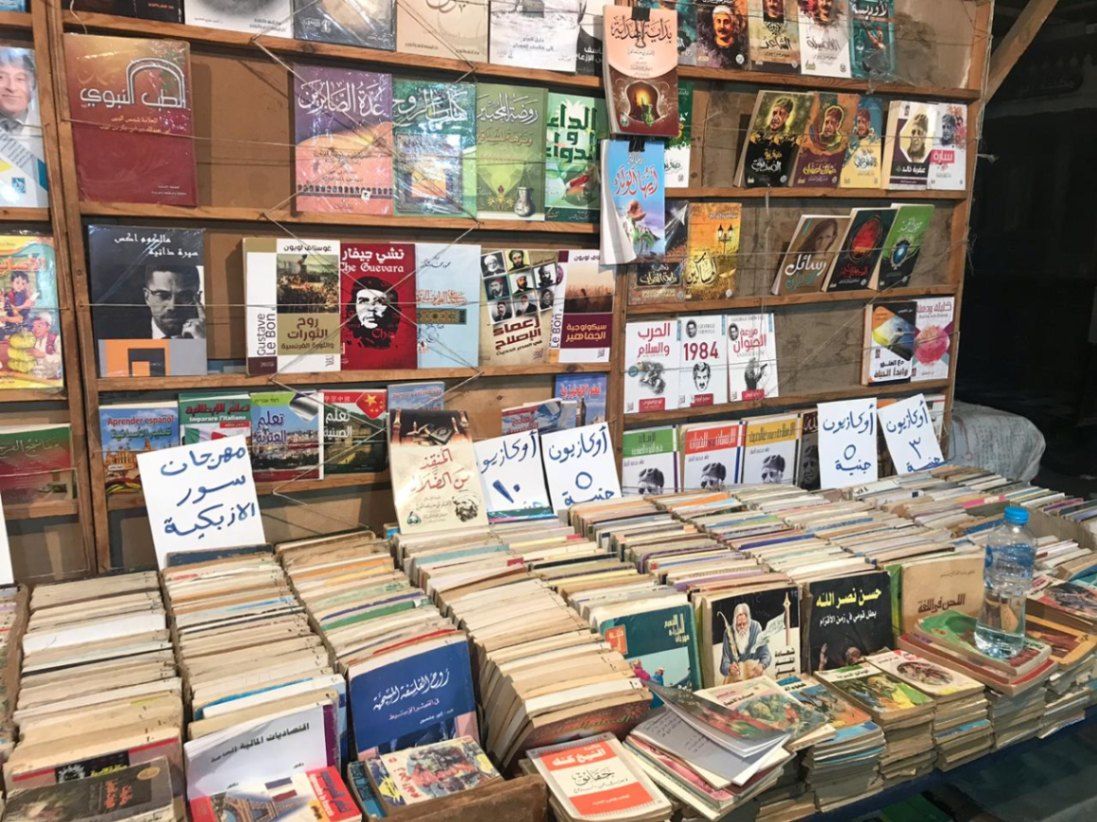
## Description Al-Azbakiyya Wall Book Market, known in Arabic as سور الأزبكية, is one of Cairo’s most distinctive and culturally rich attractions. Located near the historic Azbakeya Gardens, this open-air book market has long been a gathering place for readers, students, and collectors in search of affordable books and rare printed materials. The market is famous for its rows of simple stalls and tables stacked high with books covering every imaginable subject, from classical Arabic literature and religious texts to modern novels, academic works, and children’s books. What makes Al-Azbakiyya Wall Book Market unique is its role in preserving and circulating literary heritage at accessible prices. Many of the books sold here are second-hand, out-of-print, or rescued from private libraries, making the market a haven for hidden literary gems. A lesser-known fact is that some vendors specialize in vintage magazines, old school textbooks, and early 20th-century publications that are difficult to find elsewhere. Another interesting detail is that the market becomes especially lively during the annual Cairo International Book Fair, when sellers temporarily relocate to fairgrounds while maintaining the spirit of the original market. Beyond commerce, Sur Al-Azbakiyya represents Cairo’s deep-rooted intellectual culture, offering visitors a chance to engage with the city’s literary soul in an informal and welcoming setting. ## Location Al-Azbakiyya Wall Book Market is located in **Egypt**, in the **Cairo Governorate**, within **central Cairo**. It is situated near **Ataba Square**, close to the Azbakeya Gardens and within walking distance of several historic and commercial areas. The market is easily accessible by public transportation. The **Ataba Metro Station** serves Lines 2 and 3 and is the most convenient way to reach the area. Numerous buses and minibuses also stop nearby. Due to heavy traffic and limited parking, public transport or walking from nearby districts is strongly recommended. ## Tips * Visit in the morning to browse comfortably before the area becomes crowded. * Take your time and explore multiple stalls, as prices and selections can vary widely. * Bargaining is common and generally expected, but should be done politely. * Bring cash in small denominations, as most vendors do not accept electronic payments. * If you are looking for rare or academic books, ask vendors directly—they often keep special items tucked away. * Be mindful of your belongings, as the area can be busy. ## Conclusion Al-Azbakiyya Wall Book Market is a living cultural institution that reflects Cairo’s love for knowledge, literature, and learning. Whether you are searching for rare books or simply soaking in the atmosphere, it offers a unique and deeply local experience in the heart of the city. ## FAQ **What kind of books can I find at Al-Azbakiyya Wall Book Market?** You can find a wide range of books, including Arabic literature, religious texts, textbooks, novels, magazines, and children’s books. **Are the books new or used?** Most books are second-hand or older editions, though some new and reprinted titles may also be available. **Is the market open every day?** The market is generally open daily, though hours may vary and some stalls close on Fridays. **Can tourists who do not speak Arabic visit?** Yes, visitors are welcome, though knowledge of Arabic helps when browsing and negotiating. **Is photography allowed?** Photography is usually allowed, but it is polite to ask vendors before taking photos. ## Links * [Wiki page](https://ar.wikipedia.org/wiki/%D8%B3%D9%88%D8%B1_%D8%A7%D9%84%D8%A3%D8%B2%D8%A8%D9%83%D9%8A%D8%A9)
GemVoyage Team • World
Athens
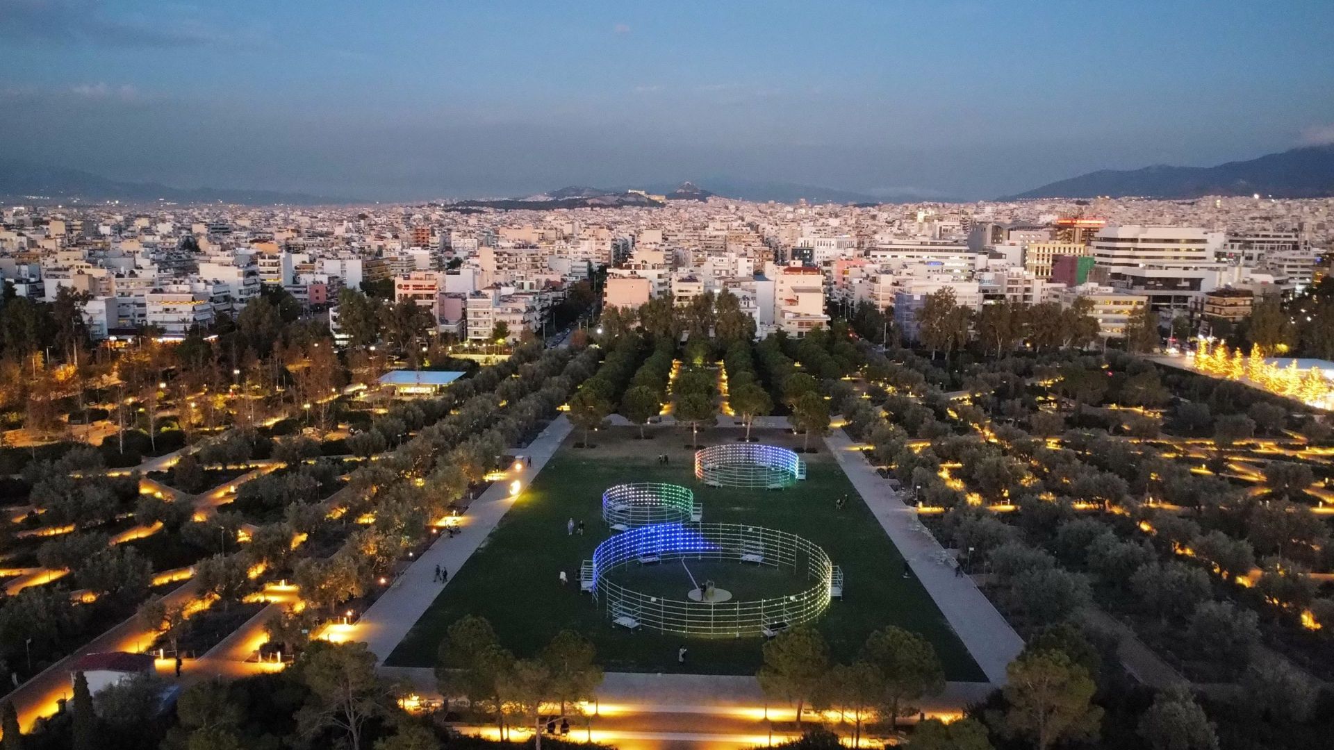
## Description Stavros Niarchos Park is one of the most impressive modern public spaces in Athens and a compelling reason to look beyond the city’s ancient monuments. It is part of the larger Stavros Niarchos Foundation Cultural Center, and it has become known for its open lawns, long walking paths, planted slopes, water features, and elevated views. The park feels spacious and carefully composed, which is a welcome contrast to the denser parts of central Athens. The appeal of the park lies in its blend of architecture, landscape design, and civic function. It is not simply decorative. It was created to give residents and visitors a place for recreation, events, and relaxed outdoor time in a city that can otherwise feel intensely urban. A little-known detail is that the park includes an artificial hill that helps shape the site’s views and gives visitors a raised perspective over Athens and toward the sea. That design choice makes the park feel dynamic rather than flat. Another reason the park stands out is that it reflects a modern chapter in Athens’ story. Many travelers come to the city for antiquity, but this space shows that contemporary Athens also has ambitious public architecture and thoughtful urban design. The result is a place that works for many different types of visitors. Families come to stroll, runners use the paths, couples come for sunset, and architecture enthusiasts come to examine the way the landscape and buildings interact. The park is especially pleasant when the weather is good. Athens has strong sunlight for much of the year, and the open layout makes the site feel bright, clean, and alive. Because it connects cultural programming with everyday outdoor use, it is not just a park you pass through. It is a place to spend real time in, and the experience often changes depending on the hour of the day or the event calendar. ## Location Stavros Niarchos Park is in Athens, Greece, in the Kallithea area near the coastline and south of the city center. It is part of the Stavros Niarchos Foundation Cultural Center, so visitors often experience the park together with the surrounding cultural buildings and public spaces. The easiest way to get there is by public transport, taxi, or rideshare from central Athens. Depending on your starting point, tram or bus connections can also work well. If you are staying in the center, the park is simple enough to include in a half-day plan, especially if you want a break from the dense historic core of the city. Because the site is well connected and clearly marked, it is one of the more straightforward modern attractions to reach. If you have time, combine the visit with a walk through the surrounding area or a stop at the waterfront. That helps show how the park fits into Athens beyond the Acropolis-heavy itinerary most first-time travelers follow. ## Tips Visit in the late afternoon if you want better light and a more relaxed atmosphere. Sunset is especially attractive because the views across the park and toward the city become softer. Bring comfortable shoes. The site is large enough that you will want to walk it properly, and the different levels make a full circuit more interesting than a quick pass-through. Check the event calendar before you go. Public performances, concerts, or cultural activities can add a lot to the experience if your timing is right. If you are with children or want a quieter reset during a busy sightseeing day, this is one of the best modern spaces in Athens for a pause. ## Conclusion Stavros Niarchos Park shows a modern, open, and design-forward side of Athens. It is a highly enjoyable place to walk, relax, and see how contemporary public space can complement the city’s historical identity. ## FAQ **Is Stavros Niarchos Park just a park?** No. It is part of a larger cultural center with architecture, public space, and programming. **Is it worth visiting if I only have time for ancient sites?** Yes, because it gives a different and refreshing view of Athens. **How long should I spend there?** At least one to two hours, more if you want to explore thoroughly or attend an event. **Is it family-friendly?** Very much so. The open layout and walkable design make it easy to enjoy with children. **What is the best time to go?** Late afternoon or sunset is especially good for atmosphere and views. ## Links - [Official website](https://www.snfcc.org/en/) - [Wikipedia](https://en.wikipedia.org/wiki/Stavros_Niarchos_Foundation_Cultural_Center)
GemVoyage Team • World
Kampala
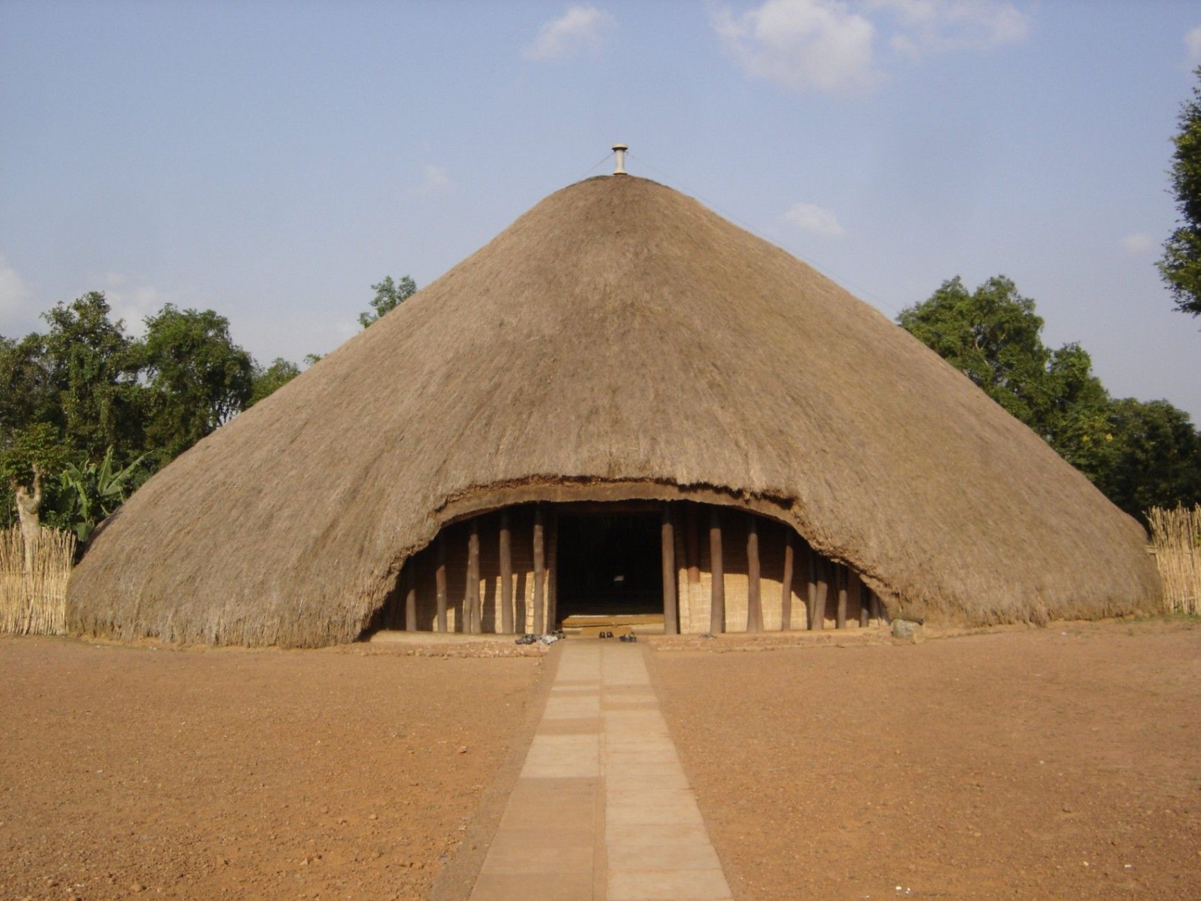
## Description The Kasubi Tombs are one of Uganda’s most important cultural and historical landmarks, serving as the burial grounds of the kings (Kabakas) of the Buganda Kingdom. Recognized as a UNESCO World Heritage Site, the Kasubi Tombs are not only a place of remembrance but also a living spiritual center where traditions, rituals, and royal customs are still actively practiced. The site reflects the deep-rooted cultural identity of the Baganda people and offers visitors a rare opportunity to experience African heritage that is both ancient and ongoing. What makes the Kasubi Tombs especially unique is their architectural style. The main structure, known as the Muzibu Azaala Mpanga, is built almost entirely from organic materials such as wood, reeds, grass, and bark cloth, showcasing remarkable traditional engineering techniques passed down through generations. A little-known fact is that the massive domed structure was once considered one of the largest thatched buildings in Africa. Another lesser-known detail is that even after a devastating fire in 2010 severely damaged the main tomb, restoration efforts were guided by traditional craftsmen using ancestral knowledge rather than modern construction methods, preserving the site’s cultural authenticity. Visiting the Kasubi Tombs is not just a historical experience; it is a deeply spiritual one that highlights the enduring connection between the Buganda monarchy, its people, and their land. ## Location The Kasubi Tombs are located in **Uganda**, in the **Central Region**, within **Kampala**, the country’s capital city. The site sits on Kasubi Hill, approximately 5 kilometers northwest of Kampala’s city center. Getting there is relatively easy. Visitors can reach the Kasubi Tombs by taxi, private car, or motorcycle taxi (boda-boda) from central Kampala. The journey usually takes 15 to 25 minutes, depending on traffic. For those unfamiliar with the area, hiring a local driver or using a guided tour is recommended, as it ensures smoother navigation and provides cultural context during the visit. ## Tips * Dress modestly and respectfully, as the site is a sacred royal burial ground. * Photography may be restricted in certain areas, especially inside the main tomb, so always ask for permission. * Consider hiring a local guide at the entrance to gain deeper insight into Buganda history and traditions. * Visit in the morning when the site is quieter and temperatures are more comfortable. * Be respectful of ongoing rituals or ceremonies, as the site is still actively used by the Buganda Kingdom. * Carry small cash for entrance fees, guides, or donations. ## Conclusion The Kasubi Tombs offer a powerful and authentic insight into Uganda’s royal history and living cultural traditions. As a sacred site and a symbol of resilience, they stand as one of Kampala’s most meaningful attractions, rewarding visitors with knowledge, reflection, and cultural understanding. ## FAQ **Why are the Kasubi Tombs important?** They are the burial place of four Buganda kings and a central spiritual site for the Buganda Kingdom. **Is the Kasubi Tombs site fully restored?** Restoration is ongoing, guided by traditional methods to maintain cultural integrity, following the 2010 fire. **How long does a visit usually take?** Most visits last between one and two hours, including a guided tour. **Is the site suitable for children?** Yes, older children can benefit from the educational and cultural aspects, though supervision is advised. **Do I need a guide to visit the Kasubi Tombs?** A guide is not mandatory but highly recommended for a fuller understanding of the site’s significance. ## Links * [UNESCO – Kasubi Tombs](https://whc.unesco.org/en/list/1022) * [Uganda Tourism Board](https://exploreuganda.com/)
GemVoyage Team • World
Montevideo
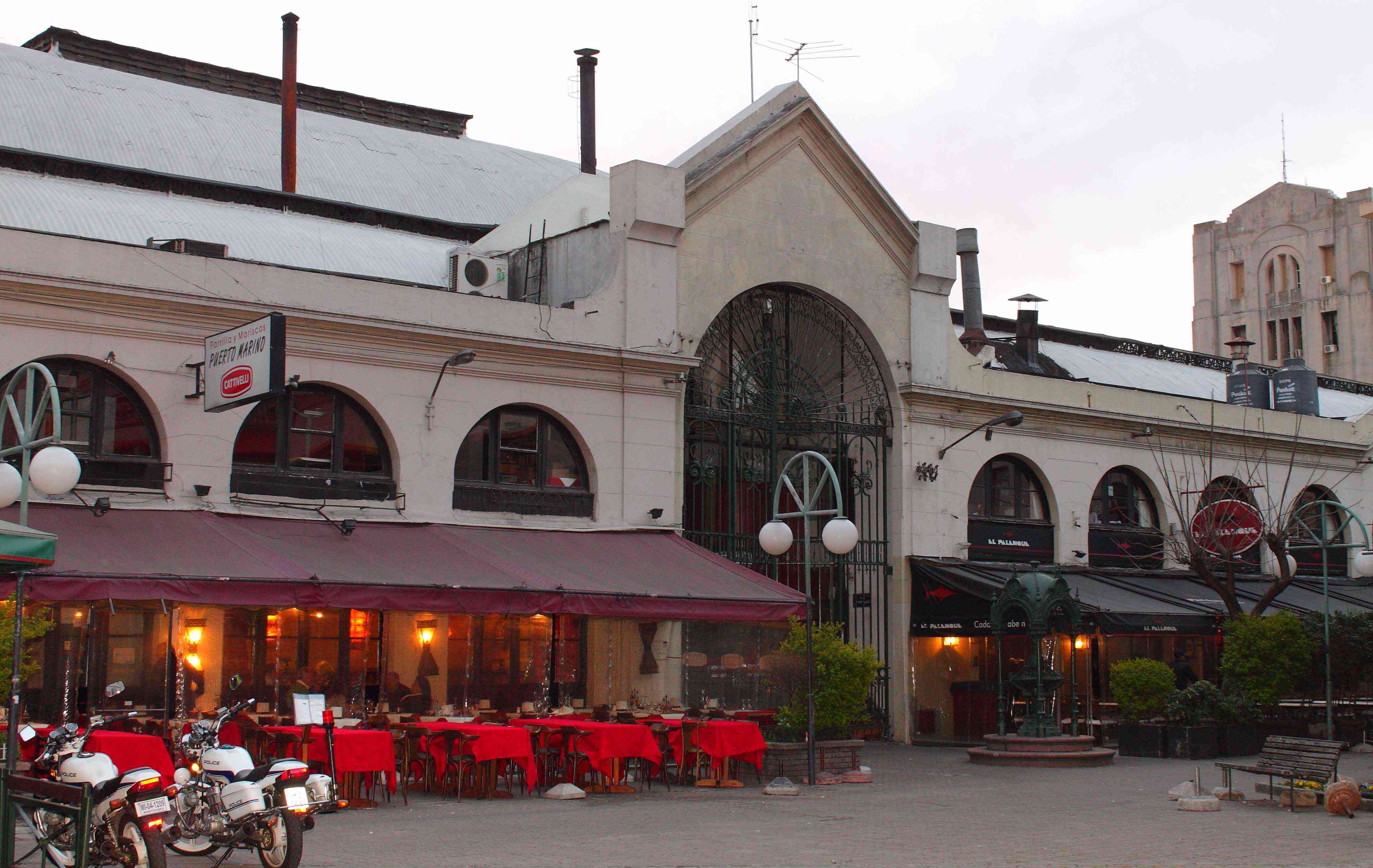
## Description Mercado del Puerto is one of the most iconic landmarks in Montevideo, Uruguay. More than just a market, it’s a cultural and gastronomic hub that captures the essence of Uruguayan traditions. Built in 1868, the building itself is a masterpiece of 19th-century iron architecture imported from Liverpool, England. The structure’s grand iron beams and vaulted ceilings give it an old-world charm that stands in contrast to the modern city outside. What truly makes Mercado del Puerto unique is its vibrant mix of sights, sounds, and flavors. Visitors are immediately drawn to the tantalizing aroma of grilled meats from the famous **parrillas** (traditional Uruguayan steakhouses). This is the perfect place to try Uruguay’s national dish: **asado** (barbecue). Beyond food, the market is filled with local artisans, lively street performers, and the friendly chatter of locals and tourists alike, making it a warm and welcoming environment. A little-known fact about Mercado del Puerto is that it was originally intended to be a train station, but when plans changed, it was transformed into a market instead. Another interesting detail is that the market becomes especially lively on weekends, when musicians and tango dancers bring the whole square to life, turning it into an open-air cultural festival. ## Location Mercado del Puerto is located in **Montevideo**, the capital city of **Uruguay**, situated along the country’s southern coast in the **Montevideo Department**. Specifically, it lies in the **Ciudad Vieja** (Old City), the historic heart of Montevideo, just steps away from the city’s main port and the Rambla waterfront promenade. Getting there is easy: * **By foot:** If you’re staying in the Old City or near the Rambla, it’s a pleasant walk. * **By bus:** Numerous city buses stop near the Old City and the port. * **By taxi or rideshare:** For convenience, especially if you’re staying farther away, a short taxi ride will get you there quickly. If you’re arriving by cruise ship, Mercado del Puerto is conveniently located within walking distance of the port terminal, making it a must-visit stop for cruise passengers. ## Tips To make the most of your visit to Mercado del Puerto, consider the following tips: 1. **Visit at lunchtime** – The market is at its most vibrant between 12:00 and 3:00 PM. This is the perfect time to enjoy freshly grilled asado paired with local wines. 2. **Try local specialties** – In addition to barbecue, don’t miss traditional dishes like *chivito* (a steak sandwich), *morcilla dulce* (sweet blood sausage with raisins and nuts), and *medio y medio* (a half-wine, half-sparkling drink). 3. **Bring cash** – While some restaurants accept cards, many smaller stalls and shops prefer cash in Uruguayan pesos. 4. **Go on weekends** – Live music, tango, and folk performances make weekends especially lively. 5. **Explore nearby attractions** – Since Mercado del Puerto is in Ciudad Vieja, take time to stroll the cobblestone streets, admire colonial architecture, and visit museums like the Museo Torres García. 6. **Watch your belongings** – Like in many busy tourist areas, keep an eye on your bags and valuables. ## Conclusion Mercado del Puerto is more than just a market—it’s the beating heart of Montevideo’s culture, food, and history. From savoring the best Uruguayan barbecue to soaking in the lively atmosphere of the Old City, a visit here offers an authentic and unforgettable experience. Whether you’re a foodie, a history buff, or simply curious, this landmark is a must-see on any trip to Uruguay. ## FAQ **1. What is Mercado del Puerto known for?** Mercado del Puerto is famous for its traditional Uruguayan barbecue (*asado*) and its vibrant cultural atmosphere with music, dance, and artisan shops. **2. Is Mercado del Puerto open every day?** Yes, it is generally open daily, but the best time to visit is around midday when the parrillas are busiest and the atmosphere is most lively. **3. How much time should I spend at Mercado del Puerto?** Most visitors spend 1–2 hours enjoying a meal and exploring the market, but if you also visit nearby attractions in Ciudad Vieja, plan for half a day. **4. Is Mercado del Puerto family-friendly?** Absolutely! Families are welcome, and children often enjoy the lively music and performances while parents savor the food. **5. Can vegetarians find food at Mercado del Puerto?** While it’s a meat-lover’s paradise, many restaurants offer vegetarian sides, salads, and grilled vegetables, though options may be limited compared to meat dishes. ## Links * [Official Tourism Website of Uruguay](https://turismo.gub.uy)
GemVoyage Team • World
Rome
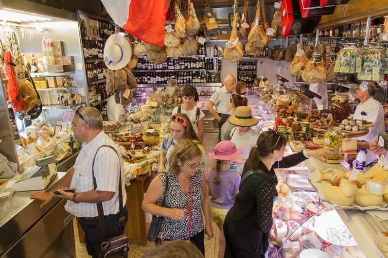
## Description Testaccio Market (Mercato Testaccio) is a lively, authentic food market at the heart of one of Rome’s most food-forward neighborhoods. Unlike the tourist-heavy markets closer to the historic center, Testaccio retains a working-market energy: long-time vendors sell seasonal fruit and vegetables, butchers and fishmongers prepare daily stock, and small eateries and street-food counters push culinary tradition forward. The market is famed for staples such as porchetta sandwiches, supplì and a wide selection of Italian cheeses and cured meats, while newer artisanal stalls introduce contemporary flavors, craft gelato and fusion snacks. What distinguishes Testaccio is its deep connection to the local history. Monte Testaccio—an artificial mound of broken amphorae from the Roman period—anchors the area’s archaeology and speaks to the neighborhood’s centuries-long role as Rome’s distribution and storage quarter. That heritage informs the food culture: local producers, family-run stalls and traditional recipes coexist with experimental kitchens, meaning a single visit can offer both classic Roman comfort foods and creative reinterpretations. The market’s compact layout makes it an ideal stop for tasting rather than full dining—sample multiple vendors over a morning and build a small feast. Culinary tours often include the market because it presents both quality ingredients and convivial daily life: you’ll hear vendors bartering, watch knives at work behind counters, and find specialty shops selling olive oil, aged cheeses and regional preserves. ## Location Testaccio Market is located in the heart of the Testaccio neighborhood, south of the Aventine Hill and a short ride from Rome’s historic center. The nearest metro stop is Piramide on Line B; several bus routes also serve the area, and many visitors walk from nearby neighborhoods like Trastevere or the Aventine for a scenic stroll. The market is close to other attractions—Pyramid of Cestius, riverfront walks and a lively restaurant scene—making it easy to build a food-focused itinerary. If you prefer to mix shopping with sightseeing, plan an early morning visit for the freshest produce and a quieter atmosphere, or go mid-afternoon to sample street food and sample plates as vendors prepare for evening trade. ## Tips - Arrive in the morning for peak freshness and to see the market at full pulse; many vendors begin packing up by late afternoon. - Be adventurous with sampling: try porchetta, supplì, fresh pasta to-go and the market’s cured meats—ask vendors for their recommendations. - Carry small change and a reusable bag; while many places accept cards now, smaller stalls still prefer cash. - If you want a guided tasting, several local food tours include the market and introduce signature stalls and historical anecdotes. - After browsing, explore nearby eateries in Testaccio for fuller meals or head to the riverfront for a relaxed walk. ## Conclusion Testaccio Market is a living portrait of Roman food culture: hands-on, edible and evolving. It’s the place to taste ingredients in their most immediate form, to listen to local foodways in conversation and to discover how centuries of commerce and community shaped a distinctly Roman palate. For culinary travelers seeking authentic flavors and friendly vendor encounters, Testaccio remains indispensable. ## FAQ Q: What are the market’s opening hours? A: Hours vary by stall, but most vendors open early morning and many close by late afternoon; specialty eateries may open again for evening service—check specific stall times if you have a destination vendor. Q: Can I eat on-site or should I take food away? A: Both. Many stalls prepare foods to eat immediately and provide small eating areas or counters; taking items to nearby picnic spots or a short walk is also common. Q: Is Testaccio Market suitable for dietary restrictions? A: Yes—ask vendors about ingredients. You can find vegetarian pasta, vegetable-based dishes and some stalls that accommodate allergies, but always ask about preparation and cross-contamination. Q: Are there guided tours of the market? A: Yes, several local food-tour operators include Testaccio in tasting itineraries; a guided tour is a great way to discover favorite stalls and sample local specialties. Q: Is the market touristy? A: Testaccio retains a local feel despite growing interest from visitors; early mornings are best for a more authentic experience. ## Links - [Testaccio](https://www.lavitaroma.com/blog/2017/03/17/testaccio-market-rome)
GemVoyage Team • World

Comments