Discover extraordinary places shared by our community of travelers
Toulouse
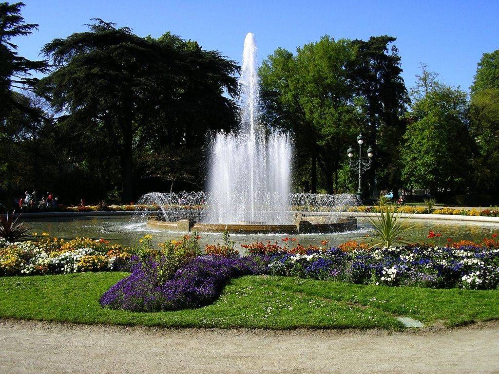
## Description The Jardin des Plantes in Toulouse is one of the city’s most beloved green spaces, offering a calm and refreshing escape from urban life. Originally created in the 18th century as a botanical garden for scientific study, it has since evolved into a public park that blends nature, history, and leisure. With its shaded paths, ponds, statues, and diverse plant life, the garden attracts families, students, and visitors looking to experience Toulouse at a gentler pace. What makes the Jardin des Plantes unique is its dual identity as both a historical botanical site and a modern recreational park. Although it no longer functions strictly as a scientific garden, many plant species and layout elements reflect its original purpose. A little-known fact is that the garden once served as a training ground for medical students studying botany and pharmacology. Another lesser-known detail is that it forms part of a larger green corridor together with the nearby Grand Rond and Jardin Royal, creating a continuous landscaped area rarely found in dense city centers. The Jardin des Plantes also features playgrounds, a carousel, and cultural installations, making it appealing to visitors of all ages while preserving a sense of historical continuity. ## Location The Jardin des Plantes is located in **France**, in the **Occitanie** region, within the city of **Toulouse**. It lies just south of the historic center, near the Muséum de Toulouse and the Canal du Midi. The garden is easily accessible by public transportation. The nearest metro station is **Palais de Justice** on Line B, which is about a 10-minute walk away. Several bus lines also serve the area. Visitors staying in central Toulouse can reach the park comfortably on foot or by bicycle, as the surrounding streets are pedestrian-friendly and well connected. ## Tips * Visit in the morning or late afternoon for a quieter and more relaxing atmosphere. * Spring and early summer are ideal for enjoying flowers and greenery at their peak. * Bring a book or picnic to fully enjoy the peaceful setting. * Families with children should check out the playground and carousel areas. * Combine your visit with the nearby Muséum de Toulouse for a full day of culture and nature. * Respect the garden rules by staying on paths and preserving plant areas. ## Conclusion The Jardin des Plantes in Toulouse offers a harmonious blend of history, nature, and everyday life. Whether you are seeking relaxation, family-friendly activities, or a scenic walk, this botanical garden remains one of the city’s most charming and accessible attractions. ## FAQ **Is the Jardin des Plantes free to enter?** Yes, entrance to the garden is free for all visitors. **How much time should I plan to spend there?** Most visitors spend between 30 minutes and two hours, depending on activities. **Is the Jardin des Plantes suitable for children?** Yes, it features playgrounds and open spaces ideal for families. **Can I picnic in the garden?** Yes, picnicking is allowed in designated areas. **Is the garden open year-round?** Yes, it is open throughout the year, though hours vary by season. ## Links * [Toulouse Tourism Official Website](https://www.toulouse-tourisme.com)
GemVoyage Team • World
Los Angeles
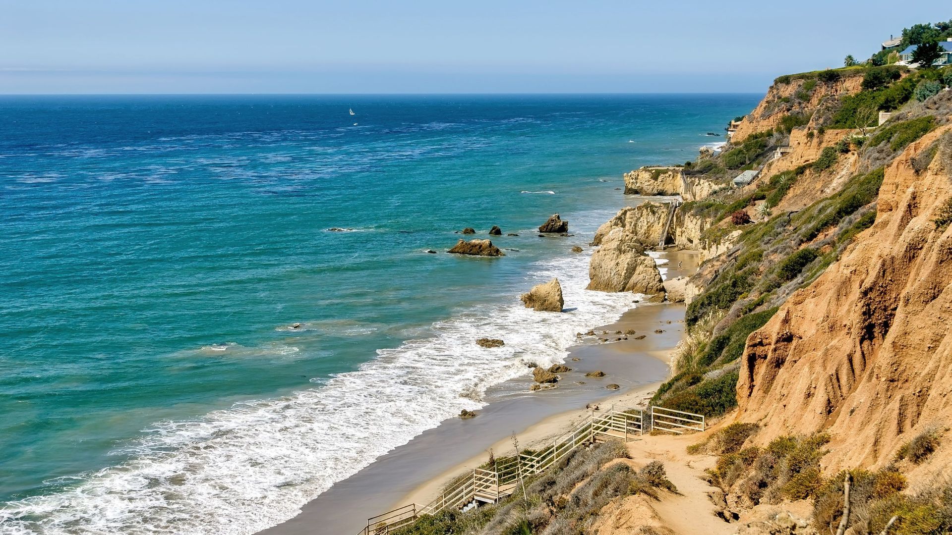
## Description El Matador State Beach is a dramatic stretch of coastline north of Malibu renowned for its sculptural sea stacks, rocky outcrops and small sand coves that create intimate scenes favored by photographers, locals and visitors seeking a more rugged California beach experience. Unlike expansive sandy beaches, El Matador’s landscape is defined by jagged rocks that rise from the surf, caves and narrow sandy pockets. Each tide reveals new textures: tide pools at low water, sea spray during higher swells, and sculpted arches that frame the Pacific during golden hour. The beach is part of the Robert H. Meyer Memorial State Beach complex and embraces a natural, relatively undeveloped character. Little-known details include a network of hidden alcoves accessible only at certain tides and a spotty but memorable chance to watch migrating whales offshore in certain seasons. The atmosphere is focused on scenic appreciation rather than typical beach amenities — visitors come to photograph, picnic, and explore rather than to find full-service concessions. ## Location El Matador State Beach is located within the Malibu coastline in Los Angeles County, California, USA, along the Pacific Coast Highway (PCH/State Route 1). It’s approximately 20–30 minutes north of central Malibu town and accessible from the PCH pull-offs. Getting there: The most common approach is by car along the Pacific Coast Highway. There is a small parking area and roadside pull-offs near Matador Beach; during busy periods parking fills quickly, and limited roadside spaces can require a short walk. From central Los Angeles, driving via Highway 1 is the most direct; rideshares are possible but may involve a short walk from parking areas. There is no direct public transit to the beach; visitors coming by transit typically need to combine buses and a walk or taxi. ## Tips - Parking & access: Arrive early in morning or late afternoon to secure parking. Expect to walk down a steep set of stairs to reach the sand; bring sturdy shoes for the descent and ascent. - Tides: Check tide charts. Low tide opens more shoreline and tide pools; high tide can restrict beach space. Be cautious near cliffs and during rising tides. - Photography: Golden hour yields spectacular silhouettes and warm light on the stacks; wide-angle and telephoto lenses are useful. Avoid walking onto slippery rocks when wet. - Amenities: There are few facilities on-site — no lifeguard on certain stretches, limited restrooms — bring water, snacks, and sun protection. - Safety: Watch for sneaker waves and changing surf conditions. Keep a safe distance from wave-swept rocks and never turn your back on the ocean. - Leave no trace: Pack out all trash and respect nesting birds or marine life in tide pools. ## Conclusion El Matador State Beach offers a compelling coastal experience that feels both cinematic and rugged: dramatic rock formations, intimate coves and exceptional sunset views. It’s a must-visit for photographers and visitors who appreciate natural, undeveloped shorelines and quiet, scenic escapes near Los Angeles. ## FAQ Q: Is there an entrance fee? A: No entrance fee, but there is limited paid parking; bring cash or card as payment methods vary. Q: Are pets allowed? A: Pets may be restricted on certain coastal state beaches; check current California State Parks rules. Q: Is the beach lifeguarded? A: Parts of the area may not be lifeguarded; swim with caution and stay aware of surf conditions. Q: Can I swim at El Matador? A: Swimming is possible but conditions can be rough; exercise caution and avoid venturing far from shore. ## Links [Wikipedia: El Matador State Beach](https://en.wikipedia.org/wiki/El_Matador_State_Beach)
GemVoyage Team • World
Brussels
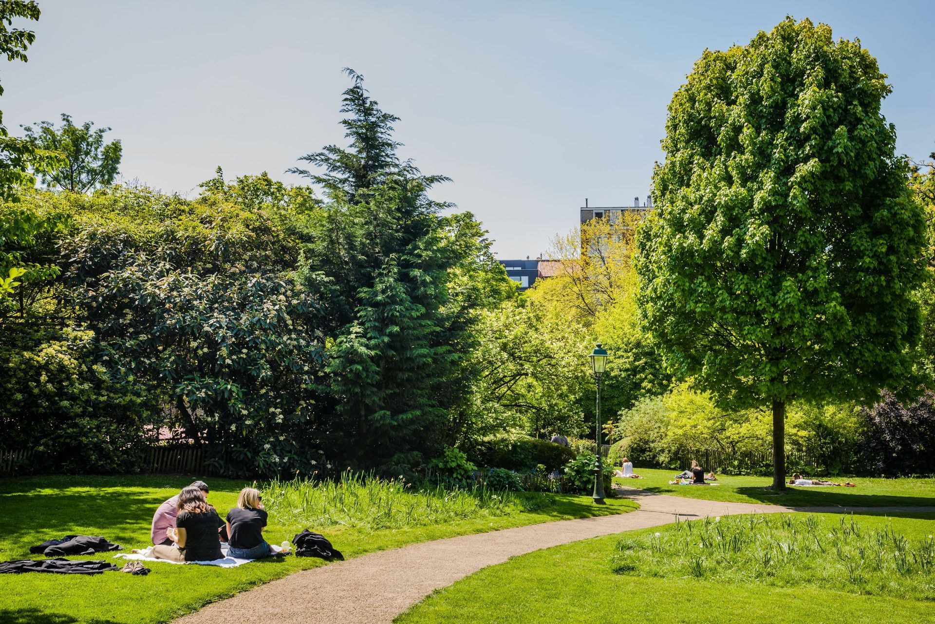
## Description Parc Tenbosch is one of Brussels’ most elegant small parks, and its appeal lies in subtlety rather than spectacle. Located in Ixelles, it offers a calm, leafy space where visitors can slow down, sit under mature trees, and enjoy a more intimate side of the city. For travelers who like parks that feel local rather than monumental, Parc Tenbosch is a strong choice. It is not the kind of place that demands an itinerary slot on its own; instead, it rewards being folded into a neighborhood walk or a café-filled afternoon. What gives the park its character is its sense of quiet design. It has the feel of a carefully tended urban refuge, with winding paths, dense planting, and enough variation in shape and texture to make a simple walk interesting. A lesser-known fact is that the park occupies a site with a layered urban past and was shaped to preserve greenery in a neighborhood that might otherwise have become entirely built up. Another detail many visitors notice only after spending time there is how different it feels from Brussels’ larger public parks: rather than broad ceremonial lawns, it offers an almost garden-like intimacy that makes it feel close to the life of the surrounding streets. For visitors, Parc Tenbosch works best as a pause. It is where you go after lunch, before a museum visit, or between neighborhood explorations. Because Ixelles is one of Brussels’ most varied and walkable districts, the park can fit naturally into a day that also includes Flagey, Avenue Louise, the Châtelain area, or a coffee stop nearby. That flexibility is part of what makes it worthwhile. You are not just visiting a park; you are using it as a calm anchor in one of the city’s busiest residential areas. The park is also a good reminder that urban travel does not always have to revolve around top-tier landmarks. Sometimes the most memorable part of a city is a place where the pace drops, the noise softens, and you get a sense of how residents actually use public space. ## Location Parc Tenbosch is located in Ixelles, Brussels-Capital Region, Belgium. It sits in a central urban setting within easy reach of several popular Brussels neighborhoods, which makes it simple to add to a walking route. The park’s placement in Ixelles means you can approach it from multiple directions depending on where you are staying or what else you want to see in the area. The easiest way to get there is usually on foot, by tram, or by a short taxi or rideshare journey from central Brussels. If you are already exploring Ixelles, the park is one of the simplest green spaces to include along the way. Public transport is convenient if you are coming from farther away, but the park is compact enough that many visitors simply fold it into a wider neighborhood walk. Because it is a neighborhood park, it is best enjoyed at a relaxed pace. Plan a short stop rather than a formal excursion, and let it serve as a quiet counterpoint to the surrounding city. ## Tips Visit when you want to rest your feet. The park is an ideal place to take a break between longer urban walks. Bring a book, snack, or coffee if you want to stay a while. The atmosphere is good for sitting and watching the neighborhood pass by. Keep expectations aligned with the scale of the park. Its charm comes from tranquility and atmosphere, not from grand size or a long list of facilities. Combine it with the surrounding district. Ixelles offers cafés, streets, and cultural stops that pair naturally with a park visit. If the weather is pleasant, go in the afternoon or early evening. That is often when the space feels most welcoming and the light is best for a walk. ## Conclusion Parc Tenbosch is a calm, attractive green refuge in the middle of Brussels’ Ixelles district. It is best for travelers who appreciate smaller urban parks and who want a place to slow down without leaving the city’s most interesting neighborhoods. ## FAQ ### Is Parc Tenbosch worth visiting? Yes, especially if you like neighborhood parks and quiet green spaces. It may not be a headline attraction, but it is rewarding as part of a relaxed Brussels itinerary. ### How long should I stay? Most visitors will spend 20 to 45 minutes, though longer stays are easy if you want to read, rest, or enjoy a picnic. ### Is it easy to combine with other sights? Very. It fits naturally into a route through Ixelles, Flagey, or the nearby café and shopping streets. ### Is the park family-friendly? Yes. Its calm setting and manageable size make it suitable for families, as long as expectations are oriented toward a peaceful urban green space rather than a large recreation park. ## Links - [Brussels parks overview](https://www.visit.brussels/en/visitors/what-to-do/brussels-parks-and-forests)
GemVoyage Team • World
Berlin
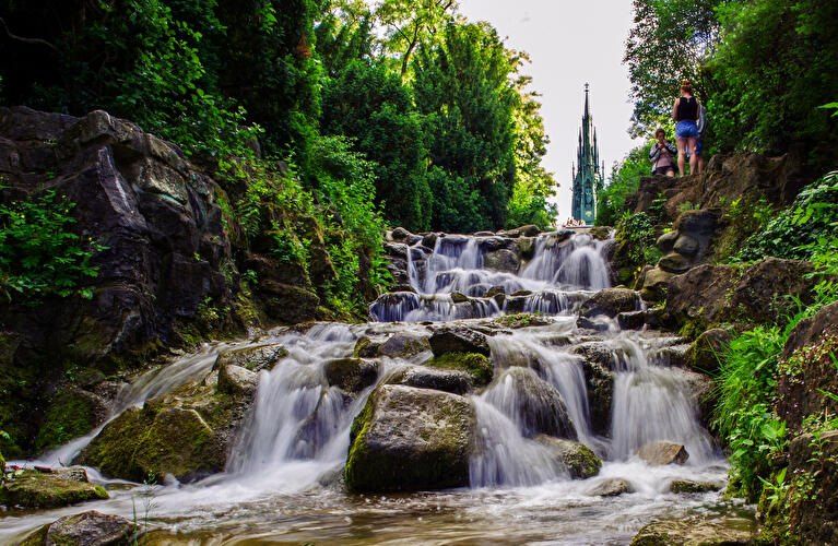
## Description **Viktoriapark** is one of Berlin’s most distinctive urban green spaces, combining **natural elevation, engineered waterfalls, panoramic city views, and national symbolism** within a compact yet dramatic landscape. Unlike Berlin’s vast flat parks such as Tiergarten or Tempelhofer Feld, Viktoriapark stands out because it rises sharply above the surrounding streets, offering one of the **best natural viewpoints in the entire city**. The park is centered around **Kreuzberg Hill**, a 66-meter-high elevation that gives the surrounding district its name. At the summit stands the imposing **National Monument for the Wars of Liberation** (Nationaldenkmal für die Befreiungskriege), a Gothic-style cast-iron monument designed by **Karl Friedrich Schinkel** and completed in 1821. The monument commemorates Prussia’s victory over Napoleon and represents one of the earliest major patriotic memorials in Germany. Its dark, spired form creates a dramatic silhouette against the sky and serves as a visual anchor for the entire park. One of Viktoriapark’s most beloved features is its **artificial waterfall system**, which cascades down the eastern slope of the hill toward Kreuzbergstraße. Built in the late 19th century, the waterfall was designed to mimic alpine mountain streams, bringing the sound, movement, and cooling atmosphere of flowing water into the dense urban fabric. During warm months, these waterfalls become the emotional heart of the park—children play at the base, couples sit on the stone steps, and photographers wait for light to catch the moving water. What makes Viktoriapark particularly compelling is the way it merges **romantic landscape design with political history**. The hill was reshaped during the 19th century to fit the ideals of romantic nationalism, where nature, sacrifice, and monumentality were meant to reinforce each other. The result is a park that feels both organic and highly symbolic at the same time. A little-known fact is that Kreuzberg Hill was once part of a **vine-growing region**, and small-scale wine production existed here in earlier centuries. Even today, a modern vineyard operates on the slope near the monument, producing limited local wine each year. Another lesser-known detail is that the waterfall only runs during the warmer months, meaning many winter visitors never realize that this dramatic feature exists at all. Beyond its historical symbolism, Viktoriapark plays a vital role in everyday neighborhood life. It is a **local refuge** for residents of Kreuzberg, attracting joggers, families, musicians, dog walkers, and sunset watchers. Unlike some of Berlin’s more monumental parks, Viktoriapark maintains a **distinctly neighborhood-driven character**, blending tourism and local daily rhythm without feeling staged. Emotionally, the park shifts moods throughout the day. Mornings are quiet and misty along the lower paths. Afternoons bring activity and movement. Evenings transform the summit into a gathering point for people watching the sun sink behind Berlin’s rooftops. From the top, visitors can often see landmarks such as the **TV Tower (Fernsehturm)** and distant church spires, reinforcing the sense of standing above the city without ever leaving it. ## Location **Viktoriapark** is located in the **Kreuzberg district of central Berlin**, close to the border with Schöneberg. **City:** Berlin **Region:** Berlin (city-state) **Country:** Germany **District:** Kreuzberg (Friedrichshain-Kreuzberg borough) ### How to Get There: * **By U-Bahn:** * **Line U6** to **Platz der Luftbrücke**, then walk about 10 minutes. * **Line U7** to **Mehringdamm**, then walk about 12–15 minutes. * **By bus:** Several bus lines stop along Mehringdamm and Kreuzbergstraße. * **By bicycle:** Well connected by bike lanes and ideal as part of a Kreuzberg cycling route. * **By taxi or ride-hailing apps:** Direct access from anywhere in central Berlin. * **On foot:** Easily reachable from Bergmannkiez and Tempelhofer Damm areas. The park’s elevated position makes it visible from many surrounding streets, acting as a **natural landmark within Kreuzberg**. ## Tips * **Visit near sunset:** The panoramic view from the monument is one of the best free sunset spots in Berlin. * **Check if the waterfall is running:** It is typically active only from spring to autumn. * **Wear comfortable shoes:** The paths include steep inclines and irregular stone steps. * **Bring a light jacket:** Wind at the top can be significantly stronger than street level. * **Combine with Bergmannkiez:** The surrounding neighborhood is full of cafés, bakeries, and local restaurants. * **Avoid peak hours for quiet time:** Late afternoons on weekends can be crowded. * **Respect the monument:** It is a protected historical site, not a climbing structure. * **Photography tip:** Early morning light illuminates the eastern slope and waterfall beautifully. ## Conclusion **Viktoriapark** is a rare Berlin green space where **natural elevation, romantic landscape design, national history, and everyday local life intersect**. From its cascading waterfalls and shaded paths to the solemn monument crowns its summit, the park offers both emotional contrast and visual depth. It is not grand in size, but in **experience, symbolism, and atmosphere**, it ranks among the most memorable outdoor spaces in the city. ## FAQ **1. What is Viktoriapark famous for?** It is best known for its **hilltop national monument, artificial waterfalls, and panoramic city views**. **2. Is Viktoriapark suitable for children?** Yes. Families visit frequently, especially near the lower waterfall areas, though supervision is required due to rocky terrain. **3. Is there an entrance fee?** No. Viktoriapark is **free and open to the public**. **4. Does the waterfall run all year?** No. It usually operates **only during the warmer months**. **5. Can you see major landmarks from Viktoriapark?** Yes. On clear days, you can spot parts of the **Berlin skyline including the TV Tower**. **6. How long should a visit take?** Most visits last **45 minutes to 1.5 hours**, depending on walking pace and time spent at viewpoints. ## Links * [Official Berlin Parks Page](https://www.berlin.de/tourismus/parks-und-gaerten/3560783-1740419-viktoriapark.html)
GemVoyage Team • World
Belize
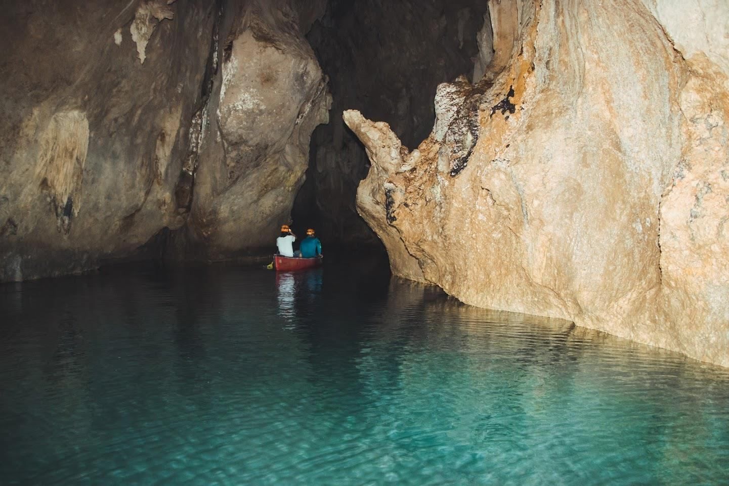
## Description **Barton Creek Cave Reserve** is one of Belize’s most compelling natural and archaeological attractions, combining dramatic limestone cave formations with deep cultural significance. Located within the lush lowland forests of western Belize, the reserve centers around **Barton Creek Cave**, a vast subterranean river cave that was once a sacred ceremonial site for the ancient Maya. Today, visitors explore the cave primarily by **canoe**, gliding silently through dark chambers illuminated only by headlamps and reflected light on the water. What makes Barton Creek Cave truly unique is this rare combination of **active exploration and archaeological context**. Unlike many caves that are viewed from walkways, here you move directly through the cave’s interior, following the same water route used by the Maya over a thousand years ago. Inside, towering stalactites, stalagmites, and cathedral-like caverns create an atmosphere that is both awe-inspiring and humbling. A little-known fact is that the cave was used specifically for **rituals connected to the Maya underworld**, known as *Xibalba*. Archaeologists have discovered ceremonial pottery, stone tools, and other ritual objects placed deep within the cave, suggesting it was not used for habitation but for spiritual purposes. Another lesser-known detail is that some ceramic pieces were intentionally broken, consistent with Maya ritual practices meant to “release” spiritual energy. Despite its popularity, Barton Creek Cave Reserve remains relatively undeveloped. There are no artificial lights inside the cave, preserving its natural state and enhancing the sense of discovery. This rawness, combined with expert local guides, makes the experience both educational and deeply immersive. ## Location **Country:** Belize **Region:** Cayo District **Nearest Town:** San Ignacio Barton Creek Cave Reserve is located approximately **30 kilometers southeast of San Ignacio**, in a rural, forested area surrounded by small Maya and farming communities. ### How to Get There * **By car:** * From San Ignacio, drive toward the village of Barton Creek. The final stretch is unpaved and may be rough, especially after rain; a high-clearance vehicle is recommended. * **By guided tour:** * The most common and convenient option. Tours include transportation, equipment, and licensed guides. * **By taxi:** * Possible from San Ignacio, but return arrangements should be planned in advance due to the remote location. ## Tips * **Choose a guided tour:** Guides are required and provide essential safety oversight and archaeological context. * **Wear water-friendly clothing:** You may get splashed, and the cave is cool and humid. * **Bring sturdy footwear:** Even though the tour is by canoe, entry and exit areas can be slippery. * **Do not touch artifacts:** Many remain in situ and are protected by law. * **Visit during the dry season:** Roads are easier to navigate, and water levels are more predictable. * **If claustrophobic, reconsider:** Some chambers are large, but the environment is still enclosed and dark. ## Conclusion Barton Creek Cave Reserve offers a rare opportunity to experience Belize’s natural beauty and ancient Maya spirituality at the same time. Its canoe-based exploration, untouched cave environment, and archaeological importance make it one of the most memorable and meaningful attractions in the Cayo District. ## FAQ **1. Do I need a guide to visit Barton Creek Cave?** Yes. All visitors must enter with a licensed guide for safety and preservation reasons. **2. Is swimming required?** No. The cave is explored by canoe, and swimming is not necessary. **3. How long does the tour take?** Typically **1.5 to 2 hours**, including preparation and exploration. **4. Is the cave suitable for children?** Yes, for older children who are comfortable in dark, enclosed spaces. **5. Can I take photos inside the cave?** Yes, but flash photography may be restricted, and touching formations or artifacts is prohibited. **6. What is the best time of year to visit?** The dry season, from roughly December to May, is generally the best time. ## Links * [Belize Tourism Board](https://www.travelbelize.org)
GemVoyage Team • World
Egypt
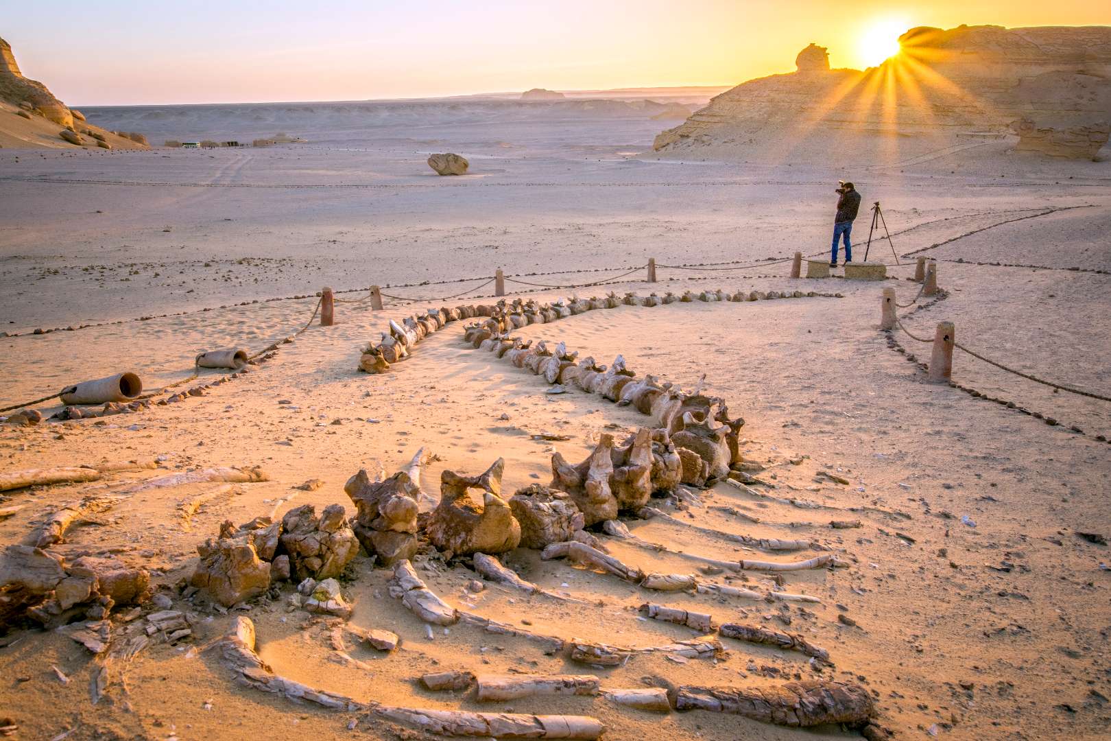
## Description The Valley of the Whales, known locally as Wadi Al-Hitan, is one of Egypt’s most extraordinary and scientifically significant natural sites. Located deep in the Western Desert, this UNESCO World Heritage Site offers a rare glimpse into the evolutionary history of whales. What makes Wadi Al-Hitan truly unique is its collection of fossilized remains of early whale species—particularly the now-extinct Archaeoceti—that vividly illustrate the transition of whales from land-dwelling mammals to fully aquatic creatures. The site contains hundreds of fossils, including complete skeletons, some of which still retain vestigial hind limbs, feet, and toes—features that modern whales no longer possess. These fossils date back approximately 40 million years and are remarkably well-preserved, with some even showing stomach contents. The surrounding desert landscape, sculpted by wind and time, adds to the surreal experience, with rock formations resembling alien sculptures and ancient seabeds. A little-known fact: the first whale fossils in Wadi Al-Hitan were discovered in the early 1900s, but the site remained largely unexplored until the 1980s when improved access and growing scientific interest led to its preservation. Another fascinating detail is that the area also contains fossils of other marine life, including sharks, rays, and sawfish, helping researchers reconstruct the ancient ecosystem of the Tethys Sea. ## Location Wadi Al-Hitan is located in **Egypt**, within the **Faiyum Governorate**, approximately 150 kilometers southwest of **Cairo**. It lies within the Wadi El-Rayan Protected Area, a vast desert reserve known for its sand dunes, lakes, and biodiversity. ### How to Get There - **By Car**: The most practical way to reach Wadi Al-Hitan is by private vehicle or organized tour. From Cairo, the drive takes about 2.5 to 3 hours. A 4x4 vehicle is recommended due to the unpaved desert roads leading to the site. - **By Tour**: Several eco-tourism operators offer guided day trips from Cairo or Faiyum, often including stops at Wadi El-Rayan and the Magic Lake. - **By Public Transport**: Public transport is not available directly to the site. Visitors must arrange private transport from Faiyum city. Due to its remote location, planning ahead is essential, and traveling with a guide is highly recommended. ## Tips - **Visit in Cooler Months**: The best time to visit is between October and April when temperatures are milder. - **Bring Essentials**: Pack water, snacks, sunscreen, and a hat. There are limited facilities at the site. - **Wear Sturdy Shoes**: The terrain is sandy and uneven, so comfortable walking shoes are a must. - **Respect the Fossils**: Do not touch or remove any fossils. The site is protected, and preservation is crucial. - **Explore the Museum**: The Fossil and Climate Change Museum at the entrance offers interactive exhibits and context for the fossils you’ll see. - **Combine with Nearby Attractions**: Pair your visit with Wadi El-Rayan’s waterfalls and lakes for a full desert adventure. ## Conclusion Wadi Al-Hitan is a captivating destination that blends natural beauty with scientific wonder. Its fossil-rich landscape tells a story millions of years old, making it one of the most important paleontological sites in the world and a must-visit for anyone intrigued by Earth’s evolutionary history. ## FAQ **1. Is there an entrance fee to Wadi Al-Hitan?** Yes, there is a small entrance fee, which may vary depending on whether you’re visiting with a guide or tour group. **2. Can I visit Wadi Al-Hitan without a guide?** While possible, it’s highly recommended to go with a guide due to the remote location and lack of signage. **3. Are there accommodations nearby?** There are eco-lodges and campsites in the Wadi El-Rayan area, but most visitors stay in Faiyum or return to Cairo. **4. Is the site suitable for children?** Yes, children can enjoy the site, especially the museum, but supervision is necessary due to the terrain and fragile fossils. **5. How long should I plan for the visit?** A typical visit lasts 2–3 hours, not including travel time. Full-day trips from Cairo are common. **6. Is photography allowed?** Yes, photography is permitted, but drones may require special permission. ## Links - [Wadi Al-Hitan – UNESCO World Heritage Centre](https://whc.unesco.org/en/list/1186) - [Wadi Al-Hitan Overview – Wikipedia](https://en.wikipedia.org/wiki/Wadi_al_Hitan)
GemVoyage Team • World
.jpg)
Washington
## Description Diablo Lake is a mesmerizing reservoir nestled in the North Cascades of Washington State, renowned for its surreal turquoise waters and dramatic alpine surroundings. Created by the Diablo Dam as part of the Skagit River Hydroelectric Project, the lake sits at an elevation of 1,201 feet and is flanked by rugged peaks, dense forests, and cascading waterfalls. Its vibrant color comes from glacial flour—fine rock particles ground by nearby glaciers and suspended in the water, reflecting sunlight in a way that gives the lake its signature hue. Visitors to Diablo Lake are treated to panoramic views of the North Cascades, including Pyramid, Colonial, and Davis Peaks. The lake is a haven for outdoor enthusiasts, offering hiking, kayaking, fishing, and camping. The Diablo Lake Trail, a moderately challenging 7.6-mile roundtrip hike, winds through old-growth forest and talus slopes, revealing stunning vistas of the lake and surrounding mountains. A little-known fact: the lake was once part of a larger plan to develop hydroelectric power in the region, spearheaded by Seattle City Light in the early 20th century. The Diablo Dam, completed in 1930, was the tallest dam in the world at the time. Another unique detail is that the lake’s overlook along Highway 20 provides one of the most photographed views in Washington, yet the area remains relatively uncrowded compared to other national park destinations. ## Location Diablo Lake is located in the **United States**, in the **state of Washington**, within **Whatcom County**. It lies in the heart of the **Ross Lake National Recreation Area**, which is part of the larger **North Cascades National Park Complex**. ### How to Get There - **By Car**: From Seattle, take I-5 north to Highway 20 (North Cascades Highway). Follow Highway 20 east for about 125 miles. The Diablo Lake Overlook is clearly marked and offers parking. - **By Public Transport**: There is no direct public transportation to Diablo Lake. Renting a car is the most practical option. - **By Bike**: Experienced cyclists can ride along Highway 20, though the route includes steep grades and limited shoulder space. The drive itself is part of the experience, with winding roads and scenic pullouts offering glimpses of the Cascade Range. ## Tips - **Visit in Late Spring to Early Fall**: Snow can linger into early summer, and Highway 20 is often closed in winter due to avalanche risk. - **Start Early**: Arrive in the morning to enjoy cooler temperatures and fewer crowds, especially at the overlook and trailheads. - **Bring Layers**: Weather in the Cascades can change rapidly. Pack for sun, rain, and wind. - **Stay at Colonial Creek Campground**: Located near the lake, this campground offers drive-in and walk-in sites, plus access to boat launches and trails. - **Try Kayaking or Canoeing**: The lake’s calm waters are ideal for paddling, with stunning views from the surface. - **Respect Wildlife and Leave No Trace**: The area is home to bears, deer, and eagles. Keep a safe distance and pack out all trash. ## Conclusion Diablo Lake is a jewel of the North Cascades, offering breathtaking scenery, rich history, and a wide range of outdoor activities. Whether you're hiking to a viewpoint, paddling across its turquoise waters, or simply soaking in the alpine air, the lake delivers a memorable experience in one of Washington’s most spectacular natural settings. ## FAQ **1. Is there an entrance fee to visit Diablo Lake?** No, there is no entrance fee for Diablo Lake or the Ross Lake National Recreation Area. **2. Can I swim in Diablo Lake?** Yes, swimming is allowed, but the water is cold year-round due to glacial runoff. **3. Are pets allowed on the trails?** Yes, dogs are allowed on leash in most areas, including the Diablo Lake Trail. **4. Is fishing permitted in Diablo Lake?** Yes, with a valid Washington State fishing license. The lake contains rainbow, brook, and bull trout. **5. Are there restrooms at the overlook or trailheads?** Yes, vault toilets are available at the Diablo Lake Overlook and Colonial Creek Campground. **6. Is Diablo Lake accessible year-round?** Access depends on Highway 20’s status. The road is typically closed from late fall to early spring due to snow. ## Links - [Diablo Lake – Wikipedia Overview](https://en.wikipedia.org/wiki/Diablo_Lake)
GemVoyage Team • World
Madagascar
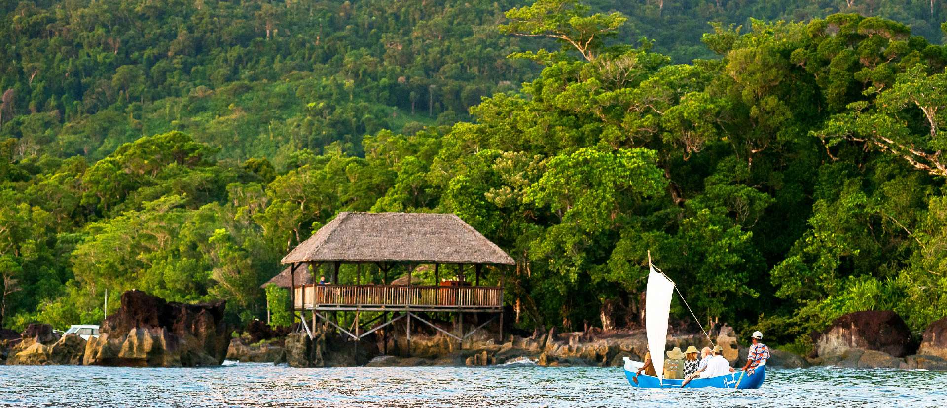
## Description Masoala National Park is Madagascar’s largest and most ecologically diverse protected area, a true Eden for nature lovers and adventurers. Located on the Masoala Peninsula in the northeast of the island, the park spans over 2,300 square kilometers of pristine rainforest and an additional 100 square kilometers of marine reserves. It’s one of the few places on Earth where lush jungle meets coral-rich coastline, creating a rare blend of terrestrial and marine biodiversity. The park is home to an astonishing array of wildlife, much of it endemic to Madagascar. Among its most famous residents is the red-ruffed lemur, found only in this region. Visitors may also encounter the elusive aye-aye, leaf-tailed geckos, tomato frogs, and over 60 species of reptiles. Birdwatchers flock to Masoala to spot rare species like the helmet vanga and the Madagascar red owl. Offshore, the marine parks protect vibrant coral reefs and host humpback whales during their migration from July to September. A little-known fact: the name “Masoala” translates to “eyes of the forest,” a poetic reference to the glowing eyes of the nocturnal aye-aye. Another fascinating detail is that the Madagascar serpent eagle, once thought extinct, was rediscovered in Masoala and now thrives in its dense canopy. ## Location Masoala National Park is located in **Madagascar**, within the **Sava Region**, near the coastal city of **Maroantsetra**. A portion of the park also extends into the **Analanjirofo Region**, making it a vast and varied landscape of rainforest, mangroves, and coral reefs. ### How to Get There: - **By Air**: Fly from Antananarivo to Maroantsetra Airport. Flights are limited, so booking in advance is essential. - **By Boat**: From Maroantsetra, the park is accessible via a 2–3 hour boat ride across Antongil Bay. This scenic journey offers glimpses of dolphins and coastal villages. - **By Tour**: Many eco-tour operators offer guided packages that include transport, accommodation, and park entry. Due to its remote location, Masoala is best visited with the help of local guides or tour companies familiar with the terrain and logistics. ## Tips for Visitors To make the most of your Masoala adventure, keep these tips in mind: - **Visit During Dry Season**: The best time to visit is from June to November. Avoid January to March due to heavy rains and cyclone risk. - **Pack Smart**: Bring waterproof gear, insect repellent, sturdy hiking shoes, and lightweight clothing. The rainforest is humid and unpredictable. - **Hire a Guide**: Local guides enhance the experience with wildlife spotting and cultural insights. Guides are mandatory for most trails. - **Explore Nosy Mangabe**: This nearby island reserve is part of the park and offers excellent chances to see the aye-aye and ancient tombs. - **Respect Wildlife**: Night walks are restricted to protect sensitive species like the aye-aye. Always follow park rules. - **Try Kayaking or Snorkeling**: The marine parks—Tampolo, Ambodilaitry, and Ifaho—are perfect for exploring coral reefs and spotting sea turtles. ## Conclusion Masoala National Park is a sanctuary of biodiversity and natural wonder. With its rare wildlife, untouched rainforest, and vibrant marine life, it offers a truly immersive experience for those seeking Madagascar’s wild heart. ## FAQ **1. What is the entrance fee for Masoala National Park?** The fee is approximately 45,000 Ariary (~16 EUR) for adults and 25,000 Ariary (~6 EUR) for children. **2. How many lemur species are found in Masoala?** The park hosts over 10 species, including the red-ruffed lemur and aye-aye. **3. Can I camp inside the park?** Yes, designated camping areas are available, especially on Nosy Mangabe Island. Guided tours often include camping options. **4. Is Masoala suitable for families?** Yes, but due to its remote location and rugged terrain, it’s best for families with older children who enjoy nature and hiking. **5. Are there accommodations near the park?** Eco-lodges and guesthouses are available in Maroantsetra and near the park’s entrance. Booking ahead is recommended. **6. What marine activities are available?** Snorkeling, kayaking, and whale watching are popular in the park’s marine reserves, especially from July to September. ## Links - [Masoala National Park – Wikipedia Overview](https://en.wikipedia.org/wiki/Masoala_National_Park) - [Masoala National Park – Official GANP Page](https://national-parks.org/madagascar/masoala)
GemVoyage Team • World
Bosnia
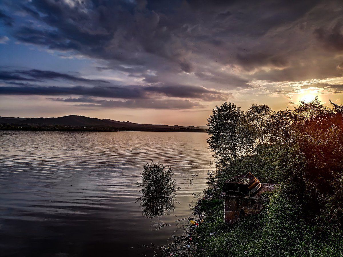
## Description **Modrac Lake (Modračko jezero)** is one of the largest artificial lakes in Bosnia and Herzegovina and a significant recreational and economic resource for the northeastern part of the country. Created in the 1960s by damming the **Spreča River**, the lake was originally built to supply water for industry and surrounding towns. Over time, it evolved into a **popular leisure destination**, especially during the summer months. What makes Modrac Lake distinctive is its **dual identity**. On one hand, it is a functional reservoir supporting industry and agriculture in the Tuzla region. On the other, it serves as a relaxed getaway for locals, offering swimming areas, weekend houses, fishing spots, and informal beaches. Unlike heavily commercialized European lakes, Modrac retains a raw, local character shaped more by everyday use than tourism planning. A lesser-known fact is that before the lake was created, several villages and agricultural lands were submerged, permanently altering the local landscape and economy. Another interesting detail is that Modrac Lake supports a **diverse fish population**, including carp, catfish, pike, and perch, making it one of the most important freshwater fishing locations in the region. The atmosphere around the lake is informal and authentic. Small cafés, seasonal food stands, and family-owned cottages line parts of the shoreline, particularly near towns and villages. This gives visitors a genuine glimpse into regional leisure culture rather than a curated tourist experience. ## Location **Country:** Bosnia and Herzegovina **Region:** Tuzla Canton **Nearest Cities:** Tuzla, Lukavac, Živinice Modrac Lake lies in **northeastern Bosnia**, about 15 kilometers southwest of Tuzla, stretching between several municipalities. ### How to Get There * **By car:** * The easiest and most flexible option. From Tuzla, the drive takes about 20–30 minutes depending on the access point. * **By taxi:** * Available from Tuzla and nearby towns, though return arrangements should be planned. * **By local transport:** * Buses connect Tuzla with nearby towns such as Lukavac and Živinice, followed by short walks to the shore. ## Tips * **Visit in summer:** July and August are the most active months, with swimming and lakeside life at its peak. * **Choose your access point carefully:** Some areas are better maintained and cleaner than others. * **Bring your own supplies:** Facilities vary greatly depending on the location. * **Fishing requires a permit:** Licenses can be obtained locally. * **Avoid swimming after heavy rain:** Water clarity can decrease due to runoff. * **Respect the environment:** As a working reservoir, preservation depends largely on visitor behavior. ## Conclusion Modrac Lake is not a polished resort, but a **functional and lived-in landscape** that plays an important role in local life. Its wide shoreline, relaxed atmosphere, and accessibility make it a meaningful destination for those interested in regional culture, outdoor relaxation, and everyday Bosnia beyond major tourist routes. ## FAQ **1. Is Modrac Lake natural or artificial?** It is an artificial lake created by damming the Spreča River. **2. Can you swim in Modrac Lake?** Yes, swimming is common in designated areas, especially during summer. **3. Is the lake clean?** Water quality varies by location and season; some areas are better maintained than others. **4. Is Modrac Lake good for fishing?** Yes. It is one of the most important fishing lakes in northeastern Bosnia. **5. Are there hotels around the lake?** Accommodation is limited; most visitors stay in Tuzla or nearby towns. **6. Is Modrac Lake suitable for tourists?** Yes, particularly for travelers seeking local experiences rather than resort-style tourism. ## Links * [Bosnia and Herzegovina tourism portal](https://www.tourismbih.com/)
GemVoyage Team • World
