GemVoyage Team • World
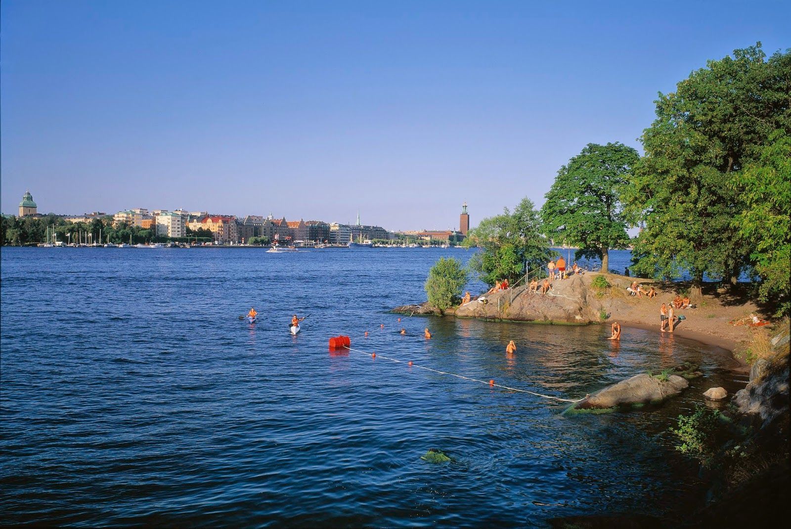
What makes Långholmen stand out is that it feels local rather than overly polished. It is a place where residents and visitors mingle in warm weather, where people arrive with towels, picnic food, and a plan to stay for a while. It is not a tropical beach and does not try to be one; instead, it offers a distinctly Scandinavian urban waterfront experience. One lesser-known fact is that Långholmen has had very different historical roles before becoming a leisure destination, which gives the island an added sense of depth. Another interesting detail is that the area’s appeal changes dramatically by season, making it a true summer favorite in a city where outdoor life depends heavily on weather.
The beach is also a good example of how Stockholm uses its water environment. Rather than separating city life from the shoreline, the city often integrates swimming and walking areas into the urban fabric. Långholmen captures that idea perfectly. You can spend time on the beach, wander nearby paths, and still feel close to the city center. For travelers, that makes it a convenient and memorable place to balance sightseeing with rest.
The simplest way to get there is by walking from nearby central neighborhoods or using public transport and then continuing on foot. Cycling also works well in Stockholm, and the island fits nicely into a bike-friendly itinerary. Once there, most of the movement is best done on foot so you can enjoy the shoreline and the surrounding green areas at an unhurried pace.
Bring swimwear if you want to use the beach properly, but also bring a layer for cooler winds.
Combine the visit with a walk around the island so you see more than just the main swimming area.
Arrive earlier on sunny days if you want a quieter spot near the water.
Discover more hidden gems you might love.
Beijing
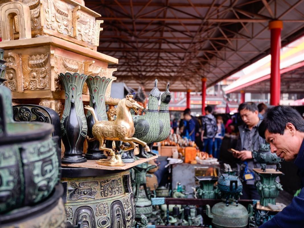
## Description Panjiayuan Antique Market is one of Beijing’s most famous shopping destinations for anyone interested in antiques, collectibles, crafts, and the thrill of browsing through a vast informal market environment. It is not a polished retail complex. It is a sprawling, energetic market where the pleasure comes from looking closely, comparing objects, and discovering what catches your eye. For travelers, that makes it one of the most characterful places to shop in Beijing, especially if you enjoy markets with a sense of surprise. The market is compelling because it contains many different worlds at once. You may find traditional crafts, replica objects, old decorative pieces, calligraphy supplies, beads, paintings, jewelry, souvenirs, and a range of goods that reflect both local taste and the expectations of visitors. A lesser-known fact is that Panjiayuan has long been associated with weekend browsing culture and has become a major destination for both serious collectors and casual shoppers. Another interesting detail is that the market’s atmosphere often changes depending on the time and day of visit, with early morning tending to be the best period for finding variety and doing serious browsing before the crowds become dense. For travelers, the real appeal is less about guaranteed rare finds and more about the experience of looking. Panjiayuan rewards patience, curiosity, and negotiation. It is the type of place where you can spend hours without realizing how much time has passed because every row offers something different. Even if you are not an antique buyer, the market is still fascinating as a cultural snapshot of Beijing’s consumer life and souvenir economy. It is also an excellent place for people who enjoy photography and people-watching, though you should be considerate and ask before taking close photos of vendors or merchandise. The market’s scale and texture make it one of the most memorable commercial spaces in the city. ## Location Panjiayuan Antique Market is located in Chaoyang District, Beijing, China, on the eastern side of the city. Its location makes it accessible from central Beijing while still feeling like a destination with its own identity. Because it is a major market rather than a single storefront, it is best approached with enough time to wander. The easiest way to reach the market is by subway followed by a short walk. Beijing’s metro is usually the most efficient transport method, especially if you want to avoid traffic. Taxis and rideshares also work well if you are carrying purchases or traveling with a group. Once you arrive, the market is straightforward to explore on foot, and the surrounding streets make it easy to orient yourself. If you are serious about browsing, mornings and weekends are often the most rewarding. If you prefer a quieter visit, go earlier in the day or plan around less busy times when possible. ## Tips Bring cash and a willingness to compare prices. Bargaining can be part of the experience, so staying alert is useful. Check items carefully before buying. Quality and authenticity vary, especially with antiques and collectible-style merchandise. Arrive early if you want the widest selection. Serious buyers often do better before the market becomes crowded. Do not expect every item to be a true antique. The market includes a wide range of goods, from genuine older objects to decorative reproductions. Leave enough time to wander without a fixed list. The market rewards discovery more than efficiency. ## Conclusion Panjiayuan Antique Market is one of Beijing’s best places for browsing, bargaining, and discovering objects with personality. It offers a lively, practical, and sometimes unpredictable market experience that many travelers remember long after they leave. ## FAQ ### Is Panjiayuan Antique Market only for collectors? No. It is popular with casual visitors too, especially those who enjoy browsing and shopping for souvenirs or decorative items. ### Can I bargain there? Often yes, though the style and room for negotiation can vary by stall and item. ### What is the best time to visit? Early morning, especially on busier market days, is often the best time for selection and atmosphere. ### Are all items antiques? No. The market includes a mix of antiques, collectibles, crafts, reproductions, and souvenir items. ## Links - [Beijing official tourism](https://english.beijing.gov.cn/) - [Chaoyang District overview](https://en.wikipedia.org/wiki/Chaoyang_District,_Beijing)
GemVoyage Team • World
Chengdu
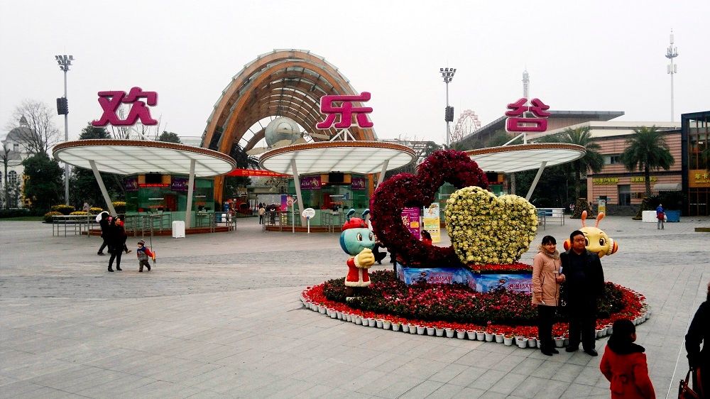
## Description Happy Valley Chengdu, known locally as 成都欢乐谷, is one of the largest and most popular theme parks in western China. Designed to appeal to visitors of all ages, the park combines high-adrenaline rides, family-friendly attractions, live entertainment, and themed zones inspired by global cultures and fantasy worlds. As part of the well-known Happy Valley chain across China, the Chengdu location stands out for its scale, variety, and strong integration of local elements. What makes Happy Valley Chengdu unique is its balance between intense thrill rides and immersive leisure experiences. Roller coasters, giant pendulum rides, and drop towers attract adrenaline seekers, while gentler attractions, parades, and interactive shows cater to families and younger visitors. A little-known fact is that some areas of the park subtly incorporate Sichuan cultural motifs in their design and performances, reflecting the region’s identity beyond the rides themselves. Another lesser-known detail is that Happy Valley Chengdu often hosts large-scale seasonal festivals, such as night-time light events and themed celebrations, which can significantly change the atmosphere of the park depending on when you visit. With its wide range of attractions and polished facilities, Happy Valley Chengdu has become a major entertainment destination not only for tourists but also for residents of Chengdu and neighboring cities. ## Location Happy Valley Chengdu is located in **China**, in **Sichuan Province**, within the city of **Chengdu**. The park sits in the Jinniu District, in the northern part of the city, making it accessible from central Chengdu while still offering a spacious layout. Getting to the park is convenient using public transportation. Visitors can take the Chengdu Metro to **Xipu** or nearby stations depending on current routes, then transfer to a bus or taxi for a short ride to the entrance. Taxis and ride-hailing apps are widely used in Chengdu and provide a straightforward option, especially for families. If traveling by car, the park has designated parking areas, though arriving early is recommended during weekends and holidays. ## Tips * Arrive early in the day to maximize your time and avoid long queues, especially during weekends and public holidays. * Check the park map and show schedules upon arrival to plan your visit efficiently. * Wear comfortable clothing and shoes, as the park is large and involves a lot of walking. * Some of the most popular rides have height or age restrictions, so review requirements in advance if visiting with children. * Visit during weekdays or outside major Chinese holidays for a more relaxed experience. * Stay until evening if possible, as night-time shows and illuminated attractions offer a different atmosphere. ## Conclusion Happy Valley Chengdu is a lively and well-rounded theme park that delivers excitement, entertainment, and memorable experiences for visitors of all ages. Whether you are seeking thrilling rides or relaxed family fun, the park offers a dynamic escape within one of China’s most vibrant cities. ## FAQ **Is Happy Valley Chengdu suitable for young children?** Yes, the park includes many family-friendly rides, play areas, and shows designed specifically for younger visitors. **How long should I plan to spend at Happy Valley Chengdu?** Most visitors spend a full day at the park to experience a wide range of attractions and shows. **Are English signs available in the park?** Some signage includes English, but having a translation app can be helpful for show schedules and ride details. **Is food available inside the park?** Yes, there are numerous food stalls and restaurants offering both Chinese and international options. **When is the best time to visit Happy Valley Chengdu?** Spring and autumn offer the most comfortable weather, while weekdays are best for avoiding crowds. ## Links * [Happy Valley Chengdu Official Website](https://cd.happyvalley.cn/)
GemVoyage Team • World
Porto
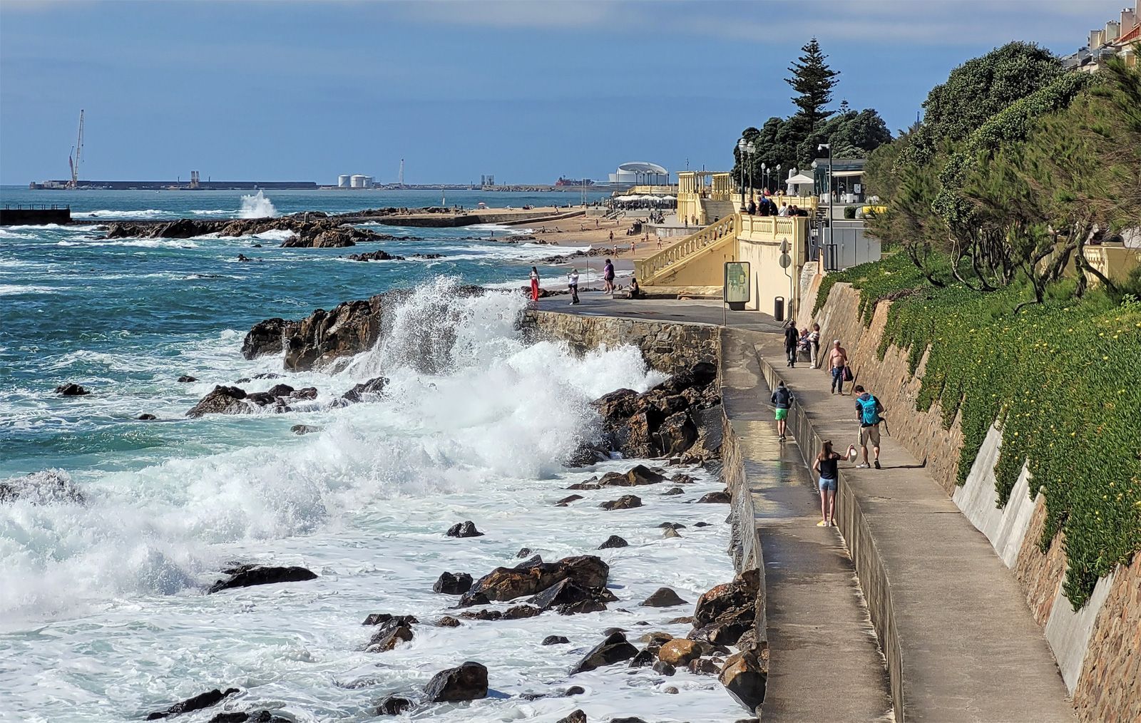
## Description Foz do Douro Promenade is one of the most enjoyable walks in Porto because it captures the city at its most open, breezy, and scenic. Located where the Douro River approaches the Atlantic Ocean, Foz do Douro is known for its waterfront paths, beaches, cafés, parks, and dramatic light. It gives visitors a different side of Porto from the historic center: less compact, more coastal, and shaped by wind, water, and long views rather than narrow medieval streets. The promenade is special because it lets you experience the transition from river to sea in a very direct way. The Douro's strong identity as a working river, a wine route, and an urban boundary becomes visible here, where the city meets larger natural forces. Walking the promenade, you can watch waves strike the seawall, see locals out for exercise or family time, and move between beaches, lighthouses, and garden spaces. It is one of those urban landscapes that works equally well for slow contemplation and active strolling. One little-known fact is that Foz has long been associated with leisure and summer life among Porto residents, especially as the city expanded and more people began seeking breezy coastal escapes close to home. Another detail many visitors miss is the extent to which the area changes mood with the weather. On a clear day, Foz feels luminous and expansive; on a windy day, it becomes dramatic and powerful. The promenade is therefore not just a route but an experience shaped by the Atlantic itself. The area also reveals a lot about Porto's identity. The city is often celebrated for its historic center and wine cellars, but Foz shows a different and equally important side: a living, modern waterfront where people come to walk, cycle, talk, and watch the sea. If you want a place in Porto that combines fresh air, urban life, and landscape, this is one of the best choices. ## Location Foz do Douro is a district in Porto, in the Norte region of Portugal, located at the mouth of the Douro River where it opens toward the Atlantic Ocean. The promenade runs along the waterfront in the western part of the city, making it farther from the old center than Ribeira but still easy to reach by public transport, taxi, or a scenic walk if you have time. One of the easiest ways to get there is by bus or tram, especially if you want to enjoy the trip without worrying about parking. Walking from the riverfront is possible and rewarding if you have a full day, but most visitors will prefer a shorter transfer followed by a long, leisurely walk along the coast. The route can be combined with stops at beaches, gardens, and small cafés along the way. For orientation, think of the promenade as a westward extension of Porto's river story. It is a place to end the day, not just begin it, because sunset and late afternoon light are especially beautiful here. ## Tips Choose a clear or mildly windy day if you want the best experience. The promenade is pleasant in many conditions, but it is most memorable when the sky and sea are visible in full color. Bring a light jacket even in warm weather. The Atlantic can cool the air quickly, especially near evening, and visitors often underestimate how different the climate feels compared with Porto's inland streets. If you enjoy a slower pace, start near the river mouth and walk toward the beaches and garden areas. That direction helps you experience the transition from urban river edge to open sea more naturally. Use the promenade as a break from sightseeing density. Porto's historic center can feel packed with monuments and steep lanes, while Foz offers breathing room and a chance to enjoy the city in a more relaxed frame. ## Conclusion Foz do Douro Promenade is one of Porto's best places for a scenic walk, combining sea air, river views, and a calm waterfront atmosphere that contrasts beautifully with the city's historic core. ## FAQ ### Why do people visit Foz do Douro? People visit for the seaside atmosphere, promenade walks, beaches, cafés, and the chance to see where the Douro River meets the Atlantic. ### Is Foz do Douro good for sunsets? Yes. The area is one of the best places in Porto for evening light and coastal views. ### Can I walk or cycle there? Yes. The waterfront is ideal for walking and cycling, and both locals and visitors use it for exercise and leisure. ### How far is it from downtown Porto? It is farther than the central historic districts, but still easy to reach by public transport or taxi. ## Links - [Porto tourism](https://visitporto.travel/) - [Wikipedia article](https://en.wikipedia.org/wiki/Foz_do_Douro)
GemVoyage Team • World

Pakistan
## Description **Nangma Valley**, located in northern Pakistan’s Gilgit-Baltistan region, is a breathtaking alpine valley that remains one of the country’s best-kept secrets. Renowned for its majestic granite spires, lush meadows, and pristine alpine landscapes, Nangma Valley is a paradise for trekkers, climbers, and photographers. What sets Nangma Valley apart is its untouched natural beauty and relative seclusion compared to more famous destinations like Hunza or Skardu. The valley is dotted with soaring rock towers—some over **5,000 meters** high—making it one of the premier destinations for **rock climbing and mountaineering** in Pakistan. Peaks such as **K7**, **K6**, and **Amin Brakk (the “Great Tower”)** have attracted world-class climbers from around the globe, yet the area still retains its peaceful, uncommercialized character. A lesser-known fact about Nangma Valley is that it is often referred to as **the “Yosemite of Pakistan”**, thanks to its sheer granite walls and the way sunlight paints the cliffs golden at dawn and dusk. The valley is also home to small Balti villages, where visitors can experience traditional hospitality and life in one of the most remote corners of the world. ## Location Nangma Valley lies in **Gilgit-Baltistan**, in the **Karakoram Range** of **northern Pakistan**, near the town of **Hushe** in the **Ghangche District**. It is about 130 kilometers east of **Skardu**, the main gateway to the region. To reach Nangma Valley, travelers first fly or drive to **Skardu**—flights from Islamabad are the most common route, taking about an hour (weather permitting). From Skardu, a scenic drive of approximately 5–6 hours leads to Hushe Village, from where the trek to Nangma Valley begins. The trek itself is moderate and usually takes around **3–4 hours** on foot, passing through alpine pastures and along a clear glacial stream. ## Tips * **Best time to visit:** The valley is most accessible between **June and September**, when the weather is mild, and the snow has melted. * **Pack for mountain weather:** Even in summer, temperatures can drop sharply at night. Warm layers and a sleeping bag are essential. * **Bring proper trekking gear:** Good hiking boots, walking poles, and waterproof clothing are highly recommended. * **Hire local guides and porters:** The Balti guides are knowledgeable about routes, weather, and local customs, and hiring them supports the local economy. * **Camping:** There are several scenic camping sites, such as at the base of Amin Brakk and near the Nangma Glacier. Always follow Leave No Trace principles. * **Photography:** Sunrise and sunset offer the best light for photographing the granite spires and surrounding peaks. * **Acclimatize properly:** Even though Nangma Valley is not at extreme altitude, gradual acclimatization helps prevent altitude sickness. ## Conclusion **Nangma Valley** is a hidden gem for those seeking adventure, solitude, and awe-inspiring mountain scenery. Its towering granite peaks, green meadows, and crystal-clear streams make it one of the most spectacular yet underexplored trekking destinations in Pakistan. Whether you’re an experienced climber or a nature lover looking for tranquility, Nangma Valley promises a journey deep into the heart of the Karakoram’s beauty and serenity. ## FAQ **1. Where is Nangma Valley located?** It’s in Gilgit-Baltistan, near Hushe Village in the Ghangche District, approximately 130 km from Skardu. **2. How do I reach Nangma Valley from Islamabad?** You can fly to Skardu (around 1 hour) or take a 20–22 hour drive via the Karakoram Highway. From Skardu, continue by jeep to Hushe and then trek into the valley. **3. Do I need a trekking permit?** No official permit is required for Nangma Valley itself, but registering with local authorities or the Hushe tourism office is recommended. **4. Is the trek difficult?** The trek to the main campsites is moderate, suitable for most fit travelers. Climbers aiming for higher peaks will need advanced equipment and experience. **5. Can I find accommodation nearby?** Basic guesthouses are available in Hushe Village. In the valley, visitors usually camp or stay in tents arranged by local guides. **6. Is Nangma Valley safe for tourists?** Yes. The valley is peaceful, and local communities are known for their warm hospitality. However, it’s best to travel with a guide and inform authorities of your plans. ## Links * [Pakistan Tourism Development Corporation](https://www.tourism.gov.pk) * [Adventure Pakistan – Trekking and Expeditions](https://www.adventurepakistan.com)
GemVoyage Team • World
Stockholm
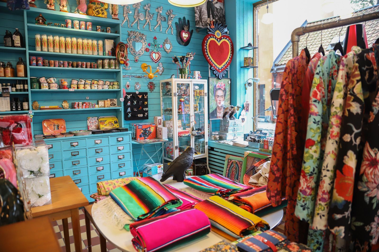
## Description Södermalm has a reputation as one of Stockholm’s most creative and self-assured districts, and its vintage shops are a big part of that identity. The area draws people who like fashion with history, pieces with character, and browsing that feels more like discovery than consumption. Unlike retail zones built around uniform shopping streets, Södermalm’s vintage scene is scattered through a district that already feels interesting to walk through. That means the shopping experience is inseparable from the neighborhood itself. The appeal of Södermalm vintage shops is not only the clothes. It is the curation, the neighborhood energy, and the sense that the area has a long memory. Stockholm’s relationship with design, sustainability, and thoughtful consumption makes secondhand shopping feel especially natural here. You can find everything from well-preserved Scandinavian basics to statement pieces, accessories, workwear, and occasional design objects. Some shops specialize tightly; others feel like treasure hunts where the best finds appear when you least expect them. One little-known fact is that Södermalm’s secondhand culture is closely tied to the district’s broader reputation for indie creativity and alternative style. Another is that many visitors underestimate how pleasant the neighborhood is for walking between shops. Even when one store is busy, the next street might feel calm, which keeps the experience relaxed and exploratory rather than transactional. For travelers who enjoy fashion but dislike generic mall shopping, this is an especially good environment. There is also a practical advantage. Vintage shopping in Södermalm can be combined with cafés, viewpoints, galleries, and neighborhood walks, so the district never feels like a single-purpose retail stop. It becomes part shopping outing, part urban exploration, and part cultural snapshot of Stockholm itself. The result is a richer visit than simply buying clothes. You are also seeing how locals shape style, reuse, and everyday city life. ## Location The vintage shops are located across Södermalm, an island district in central Stockholm, Sweden. Södermalm sits south of Gamla Stan and is one of the easiest central areas of Stockholm to explore on foot. The shopping spots are spread through several streets and pockets of the district, so the experience works best when you treat it as a neighborhood walk rather than a fixed single destination. The easiest way to reach Södermalm is by Stockholm’s metro system, bus network, or on foot from the city center. Medborgarplatsen, Slussen, and other nearby stations are practical starting points depending on which part of the district you want to explore. Because the best finds are often spread out, a comfortable pair of shoes helps more than a tightly scheduled plan. If you are visiting in winter, plan for shorter daylight hours and use indoor stops such as cafés to break up the walk. In warmer months, the district is especially pleasant because moving between shops feels almost like a mini city tour in itself. ## Tips - Start with a broad walk through the district before committing to specific shops. That helps you understand the neighborhood layout. - Look for quality as much as price. The best vintage pieces in Stockholm often stand out because of condition, cut, and timeless design. - Bring a reusable bag or extra room in your luggage if you plan to buy clothing or small home items. - Pair shopping with coffee or lunch so you can pace yourself and avoid rushed decisions. - Visit more than one shop style. A good vintage outing in Södermalm usually mixes curated boutiques, thrift stores, and neighborhood secondhand spots. ## Conclusion Södermalm’s vintage shops offer more than shopping. They give you a stylish way to experience one of Stockholm’s most characterful districts while discovering clothing and objects that feel personal, sustainable, and distinctly local. ## FAQ ### Is Södermalm good for vintage shopping even if I am not a fashion expert? Yes. The neighborhood is easy to browse casually, and many stores are approachable even if you are not hunting for something specific. The pleasure is as much in the atmosphere as in the purchase. ### Are the shops expensive? Prices vary a lot. Some stores are highly curated and price pieces accordingly, while others are more affordable. Stockholm generally has a reputation for quality over bargain-bin pricing. ### How much time should I set aside? At least a few hours if you want to enjoy the area properly. The best experience comes from mixing browsing with time for walking, coffee, and neighborhood exploration. ### Can I combine vintage shopping with other sightseeing? Definitely. Södermalm is close to scenic viewpoints, restaurants, and central Stockholm landmarks, so it fits easily into a larger city day. ## Links - [Södermalm on Wikipedia](https://en.wikipedia.org/wiki/S%C3%B6dermalm) - [Visit Stockholm](https://www.visitstockholm.com/)
GemVoyage Team • World
Toronto
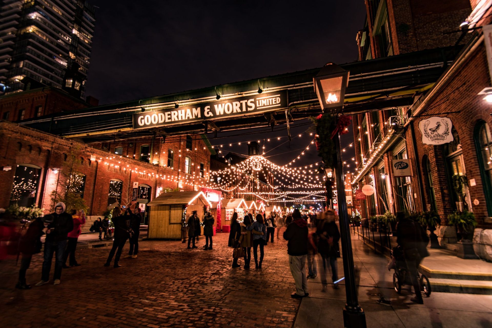
## Description The Distillery District is one of Toronto’s most distinctive neighborhoods, and it feels almost purpose-built for travelers who enjoy atmosphere. Set within a preserved historic industrial complex, the district combines red brick architecture, pedestrian streets, galleries, restaurants, shops, event spaces, and public art into a compact destination that is easy to explore and hard to forget. It is stylish without feeling anonymous, and historic without feeling static. That combination makes it one of the city’s strongest examples of adaptive reuse done well. The district’s appeal begins with the architecture. The old industrial buildings create a strong visual identity, and the pedestrian-only layout encourages visitors to slow down and notice details. You do not just move through the Distillery District; you linger in it. The cobbled or brick-lined atmosphere, the converted warehouses, and the layered signage all contribute to the sense that this is a place where Toronto’s past has been carefully repurposed for modern use. At the same time, the neighborhood is lively rather than museum-like. Food, shopping, exhibitions, and events keep it active year-round. One little-known fact is that the district’s visual character has made it a popular location for film, photography, and seasonal events, especially when the area is decorated or adapted for festivals. Another detail visitors sometimes miss is that the district works best as an experience rather than a checklist. It is tempting to arrive, take a few photos, and leave, but the better approach is to let yourself sit down for a meal, look into side courtyards, and notice how the district changes with time of day and season. For travelers who enjoy cities with strong identities, the Distillery District is especially satisfying because it offers more than a single attraction. It is a district you can inhabit for a few hours. You can browse, eat, photograph, rest, and then continue on to other downtown areas. That versatility is a big part of why it remains one of Toronto’s most reliable visitor destinations. ## Location The Distillery District is in downtown Toronto, Ontario, just east of the central core. Its location makes it accessible from many parts of the city by streetcar, bus, rideshare, bicycle, or on foot if you are already nearby. Because it is pedestrian-friendly, the visit starts to feel distinct as soon as you enter the district, and that separateness is part of the appeal. If you are planning a wider downtown itinerary, the district fits well with waterfront walks, downtown shopping, and other central attractions. It is also easy to combine with holiday events or seasonal markets when those are taking place. For many visitors, the most practical option is to use public transit or walk from nearby neighborhoods so that parking does not become a distraction from the experience. ## Tips Allow enough time to enjoy the district properly. The Distillery District is at its best when you slow down, sit for a coffee or meal, and wander without rushing. If you only pass through in ten minutes, you will miss much of what makes it special. Go if you like photography, but also go if you like dining. The area’s visual appeal is obvious, yet its food and drink scene are equally central to the experience. A good meal or café stop can anchor the visit and make the historic setting feel more vivid. Check whether there are special events happening. Seasonal markets, art installations, performances, and holiday programming can transform the district significantly. That can be a major advantage if you like lively environments, though it also means the area may be busier than usual. Visit on a weekday if you want a quieter experience. Weekends and event periods can be excellent for energy and atmosphere, but they also bring crowds. There is no wrong choice, only different moods depending on what you want from the visit. ## Conclusion The Distillery District is one of Toronto’s best examples of historic urban space reimagined for modern life. It combines architecture, food, culture, and walkability in a way that feels polished but still characterful. ## FAQ ### Why is it called the Distillery District? The name comes from its industrial origins and the historic distilling complex that once occupied the site. That heritage is still visible in the architecture and layout. ### Is it worth visiting if I only have one afternoon in Toronto? Yes. It is one of the city’s most efficient and visually rewarding districts for a short visit. ### Is the area family-friendly? Yes, especially for daytime visits. The pedestrian layout and public spaces make it easy to navigate with children. ### What is the best time to go? It depends on your goals. Quiet weekday visits suit slow exploration, while evenings and event periods suit people who want more energy and activity. ### Can I just walk around without spending much money? Absolutely. You can enjoy the architecture, art, and atmosphere without committing to shopping or dining, although many visitors choose to stay for a meal. ## Links - [Official website](https://www.thedistillerydistrict.com/) - [Wikipedia](https://en.wikipedia.org/wiki/Distillery_District)
GemVoyage Team • World

Comments