Discover extraordinary places shared by our community of travelers
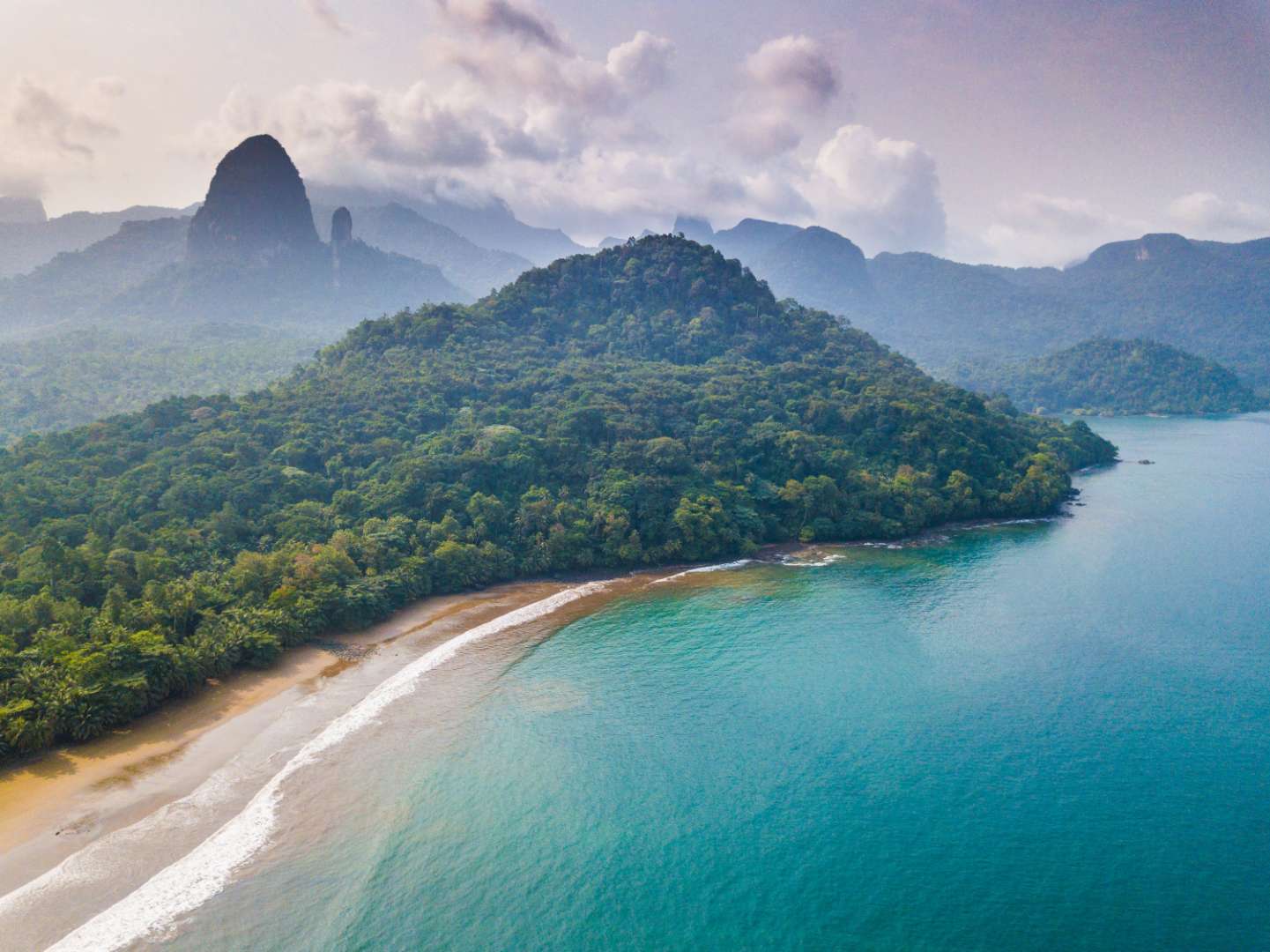
São Tomé and Príncipe
## Description São Tomé Island is a lush, volcanic paradise floating in the Gulf of Guinea, off the western coast of Central Africa. As the larger of the two main islands that make up the nation of São Tomé and Príncipe, it offers a rare blend of untouched nature, vibrant culture, and colonial charm. With its emerald rainforests, dramatic coastlines, and warm, welcoming locals, São Tomé is a destination that feels like a well-kept secret. The island is dominated by Pico de São Tomé, a towering peak that rises to 2,024 meters and is surrounded by dense jungle and misty cloud forests. Much of the island’s interior is protected within the Obô Natural Park, a biodiversity hotspot teeming with endemic species, waterfalls, and hiking trails. Along the coast, you’ll find palm-fringed beaches, fishing villages, and remnants of Portuguese colonial architecture. A little-known fact: São Tomé is located just north of the equator, and you can actually stand on the equator itself by visiting the nearby Ilhéu das Rolas islet. Another fascinating detail is that the island is part of the Cameroon Volcanic Line, a geological formation that includes several volcanic islands and mountains stretching from Cameroon into the Atlantic Ocean. ## Location São Tomé Island is located in the **Democratic Republic of São Tomé and Príncipe**, in the **Gulf of Guinea**, off the coast of **Central Africa**. The capital city, **São Tomé**, is situated on the northeastern coast of the island and serves as the political, cultural, and economic hub. ### How to Get There: - **By Air**: The main gateway is São Tomé International Airport (TMS), which receives flights from Lisbon, Accra, Luanda, and other regional hubs. - **From Europe**: TAP Air Portugal offers direct flights from Lisbon several times a week. - **From Africa**: Regional carriers connect São Tomé with cities like Libreville, Luanda, and Accra. - **Local Transport**: Once on the island, taxis, minibuses, and rental cars are available. Hiring a local guide is highly recommended for exploring remote areas. ## Tips for Visitors To make the most of your São Tomé adventure, keep these tips in mind: - **Best Time to Visit**: June to September is the dry season and ideal for hiking and beach activities. Avoid December to February, which is the rainy season. - **Currency**: The local currency is the São Tomé and Príncipe dobra (STN). Euros are widely accepted, especially in hotels and restaurants. - **Language**: Portuguese is the official language. Learning a few basic phrases can go a long way. - **Local Cuisine**: Don’t miss dishes like moqueca de peixe (fish stew), banana pão (breadfruit), and blá-blá (smoked fish). - **Eco-Tourism**: Respect the island’s fragile ecosystems. Stick to marked trails and avoid disturbing wildlife. - **Connectivity**: Internet access is limited in rural areas. Download maps and travel info in advance. ## Conclusion São Tomé Island is a captivating blend of volcanic landscapes, rich biodiversity, and cultural depth. Whether you're trekking through cloud forests, lounging on secluded beaches, or exploring colonial-era plantations, the island offers a peaceful and authentic escape from the modern world. ## FAQ **1. Is São Tomé Island safe for tourists?** Yes, São Tomé is considered one of the safest countries in Africa. Petty theft can occur, so basic precautions are advised. **2. Do I need a visa to visit São Tomé?** Visa requirements vary by nationality. EU citizens can enter visa-free for short stays. Check with your local embassy before traveling. **3. What is the official language of São Tomé?** Portuguese is the official language. Creole languages like Forro and Angolar are also spoken. **4. Can I hike Pico de São Tomé?** Yes, but it’s a challenging multi-day trek. Hiring a guide is essential due to the dense forest and changing weather. **5. Are there good beaches on São Tomé Island?** Absolutely. Praia das Conchas, Praia Jalé, and Praia Micondó are among the most beautiful and least crowded. **6. Is São Tomé suitable for family travel?** Yes, though infrastructure is basic. Families should plan ahead for accommodations and transport. ## Links - [São Tomé Island – Wikipedia](https://en.wikipedia.org/wiki/S%C3%A3o_Tom%C3%A9_%28island%29) - [Visit São Tomé – Official Tourism Portal](https://www.visitsaotomeprincipe.st/)
GemVoyage Team • World
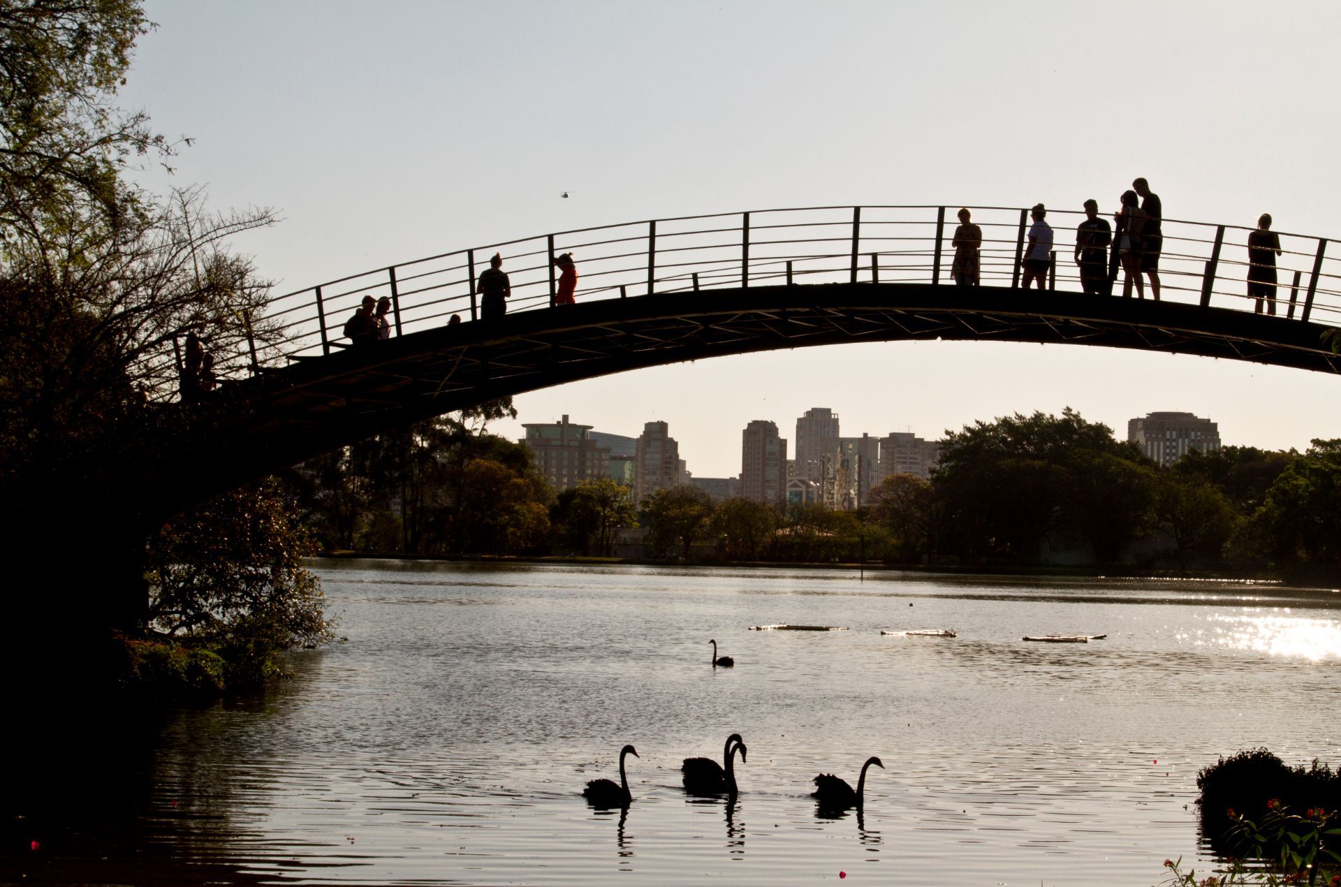
São Paulo
## Description Ibirapuera Park is one of São Paulo’s best-known green spaces, but the real delight for many visitors is not just the major landmarks. It is the quieter corners that reveal why the park matters so much to locals. In a city famous for its intensity, scale, and relentless movement, Ibirapuera provides room to breathe. The park is broad enough to absorb crowds without feeling overwhelming, and its quieter paths, shaded lawns, and tucked-away benches make it easy to find a slower rhythm even on busy days. The park is more than a recreational area. It is a cultural landscape where nature, architecture, exercise, and informal social life come together. You may pass runners, families on blankets, office workers taking breaks, and visitors moving between museums or exhibition spaces. Yet the quieter parts of the park offer a different kind of experience. Instead of chasing the main sights, you can wander into less-trafficked zones, pause under the trees, and notice how the park changes from one pocket of space to another. One little-known fact is that Ibirapuera was designed with major urban ambition in mind, which is why the park feels so integrated with the city rather than separated from it. Another is that the park’s atmosphere can shift dramatically depending on where you stand; some areas feel expansive and ceremonial, while others feel almost hidden and intimate. That contrast is what makes the quieter corners so rewarding. They reveal a softer side of one of Latin America’s great metropolitan parks. For travelers, the appeal lies in balance. You can enjoy famous São Paulo institutions and still have time to sit somewhere calm enough to reflect on the city’s scale. In that sense, Ibirapuera is not only a park but also a reset point. It offers visitors the chance to experience a dense metropolis without being consumed by it. ## Location Ibirapuera Park is located in São Paulo, Brazil, primarily in the southern-central part of the city near neighborhoods such as Vila Mariana and Moema. It is one of the most accessible major parks in São Paulo and sits within reach of both cultural institutions and residential districts, which makes it easy to combine with other city sightseeing. The park is best reached by ride-hailing service, taxi, bus, or a combination of metro and walking depending on where you start. Because the park has multiple entrances and a large footprint, it helps to decide in advance which part you want to visit. If your goal is the quieter side of the park, enter with enough time to wander rather than heading only to one landmark. That way you can move between open lawns, tree-lined paths, and calmer internal areas without feeling rushed. From central São Paulo, travel time varies widely with traffic, so the best strategy is to leave room in your schedule. Mornings and late afternoons are often the most comfortable times to visit because temperatures are milder and the park’s quieter zones feel more spacious. ## Tips - Visit on a weekday if you want the calmest experience. Weekends are lively and fun, but they are also busier. - Bring water, sunscreen, and comfortable shoes. The park is large enough that you will do more walking than expected. - If you want the quietest corners, keep moving away from the most obvious landmarks and main event spaces. - Plan at least part of your visit for sitting and observing instead of only walking. The park’s atmosphere is part of the attraction. - Combine the park with a museum or cultural stop nearby so the day feels balanced between activity and rest. ## Conclusion The quieter corners of Ibirapuera Park show a gentler, more reflective side of São Paulo. It is a place to slow down, recharge, and see how a great city park can feel both grand and personal at the same time. ## FAQ ### Why focus on the quiet corners instead of the park’s main attractions? Because the quieter spaces show a different personality. They are where the park feels restorative, local, and less performative, which can be especially valuable in a city as energetic as São Paulo. ### Is Ibirapuera Park suitable for a short visit? Yes. Even a brief stop can be worthwhile if you know which entrance or area you want to explore. A short visit is enough to enjoy the atmosphere, but longer stays let you appreciate the park’s variety. ### When is the best time to go? Mornings and late afternoons are usually the most pleasant. The light is better, temperatures are easier, and the park’s calmer areas are more enjoyable. ### Can I visit if I am not interested in museums or events? Absolutely. The park works very well as a green urban retreat on its own, especially if you enjoy walking, people-watching, or simply resting in a landscaped setting. ## Links - [Ibirapuera Park official website](https://parqueibirapuera.org/) - [Ibirapuera Park on Wikipedia](https://en.wikipedia.org/wiki/Ibirapuera_Park)
GemVoyage Team • World
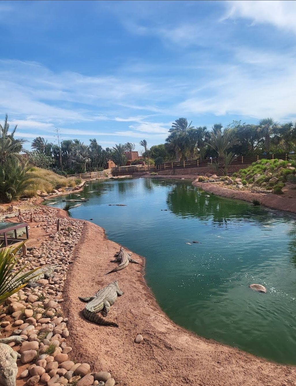
Agadir
## Description **Crocopark Agadir** is Morocco’s first crocodile park, offering visitors a fascinating journey into the world of one of nature’s most ancient and powerful reptiles. Opened in 2015, the park is home to over **300 Nile crocodiles**, along with turtles, iguanas, anacondas, and a wide range of exotic plants. More than just a zoo, Crocopark is a well-designed ecological park that combines education, conservation, and family-friendly entertainment. What makes Crocopark unique is its immersive design. Guests wander along carefully planned pathways, bridges, and observation decks that provide safe yet close-up views of crocodiles basking in the sun, gliding through the water, or snapping their jaws during feeding sessions. The park also emphasizes environmental education, helping visitors learn about the importance of biodiversity and conservation. **Little-known facts**: * The crocodiles at Crocopark originally came from a farm in Djerba, Tunisia, and were brought to Morocco as part of a conservation project. * The park also doubles as a **botanical garden**, featuring over **4,000 plant species**, including rare and exotic varieties from across the world. --- ## Location Crocopark is located in **Agadir**, a major coastal city in the **Souss-Massa region of Morocco**. It sits about 14 kilometers east of Agadir’s city center, along the Marrakech–Agadir highway, making it easy to reach for both locals and tourists. ### How to get there: * **By car**: The park is a 20–25 minute drive from central Agadir. Parking is available on-site. * **By taxi**: Taxis are widely available in Agadir and offer a convenient way to reach Crocopark directly. * **By tour service**: Many local tour operators include Crocopark as part of day trips around Agadir. --- ## Tips * **Arrive for feeding time**: Watching the crocodiles being fed is one of the highlights of the visit. Feeding sessions are typically scheduled at set times throughout the day. * **Wear comfortable shoes**: The park covers a large area with multiple trails, so expect to do plenty of walking. * **Bring sunscreen and water**: Agadir is sunny most of the year, and outdoor exploration can get hot. * **Visit the botanical garden**: Don’t just focus on the reptiles—the park’s lush gardens are equally impressive, with rare cacti, tropical flowers, and shaded rest areas. * **Plan for families**: Crocopark is kid-friendly, offering educational experiences and safe viewing points, making it a great family outing. --- ## Conclusion Crocopark in Agadir is more than a wildlife attraction—it’s a unique combination of a crocodile sanctuary and a botanical garden. With its impressive collection of Nile crocodiles, exotic reptiles, and thousands of plant species, it offers an enriching and exciting experience for visitors of all ages. Whether you’re interested in conservation, botany, or simply enjoying an unusual day out, Crocopark is one of Agadir’s must-visit destinations. --- ## FAQ **1. What animals can I see at Crocopark?** The main attraction is Nile crocodiles, but you can also see turtles, iguanas, snakes, and a wide variety of plants. **2. How long does a visit usually take?** Most visitors spend around 2–3 hours exploring the park, including the reptile areas and the botanical gardens. **3. Is Crocopark suitable for children?** Yes, the park is family-friendly, with safe observation decks and educational displays designed for all ages. **4. When is the best time to visit Crocopark?** Morning or late afternoon visits are best to avoid the midday heat, though feeding times are also worth planning around. **5. Is there food available inside the park?** Yes, there are cafés and rest areas within Crocopark where visitors can buy snacks and refreshments. **6. Do I need to book tickets in advance?** While you can buy tickets on-site, booking in advance online is recommended during peak tourist seasons. --- ## Links * [Agadir Tourism – Official Site](https://www.visitagadir.com/) * [Morocco Tourism – Official Portal](https://www.visitmorocco.com/en)
GemVoyage Team • World
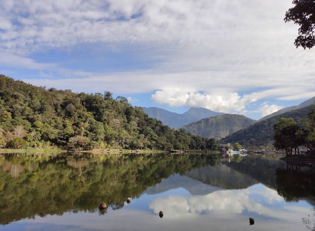
Taiwan
## Description Liyutan Lake (鯉魚潭水庫), tucked away in the lush countryside of Taiwan, is a hidden gem for those who love nature, tranquility, and scenic beauty. Unlike more crowded tourist destinations in Taiwan, Liyutan Lake offers a serene atmosphere that makes it ideal for relaxation, photography, and cycling around its picturesque trails. The lake is actually a man-made reservoir built in the 1990s, primarily to provide water supply for the surrounding areas, but it has since become a recreational site cherished by locals and tourists alike. One fascinating fact that many visitors don’t know is that the name “Liyutan” translates to **“Carp Pond”**—a nod to the many carp fish once found in the area. Another little-known detail is that the lake is famous among amateur photographers for its **misty mornings**, when fog gently drapes over the water’s surface, creating a dreamlike scene. What makes Liyutan Lake unique is not just its beauty but also its blend of **modern infrastructure and natural surroundings**. The reservoir is surrounded by well-maintained bike paths, pavilions, and viewing platforms, allowing visitors to enjoy the scenery at their own pace. --- ## Location Liyutan Lake is located in **Miaoli County**, in the **central-western region of Taiwan**. It sits in **Sanyi Township**, an area known for its woodcarving culture and peaceful rural landscapes. The lake is around 10 kilometers away from Miaoli City, making it easily accessible for both day trips and short getaways. ### How to Get There * **By Car:** From Taipei, it takes about **1.5 to 2 hours by car** via National Freeway 1. This is the most convenient option for those who prefer flexibility in their travel schedule. * **By Train:** Travelers can take a train to **Miaoli Station** and then catch a local taxi or bus toward Sanyi Township. * **By Bus:** Intercity buses also connect Miaoli with major cities like Taipei and Taichung, followed by a short taxi ride to the lake. For the best experience, renting a car or scooter is highly recommended, as public transportation options directly to the lake are limited. --- ## Tips To make the most out of your visit to Liyutan Lake, here are some helpful tips: 1. **Best Time to Visit:** Early mornings and late afternoons are the most beautiful, with softer light for photography and fewer visitors. Misty mornings especially offer a magical view. 2. **Bring a Bicycle:** The cycling path around the lake is well-paved and offers breathtaking views. Renting a bike nearby is a popular choice. 3. **Photography Lovers:** Don’t miss the reflection of the mountains on the lake’s surface—particularly stunning on clear, calm days. 4. **Nearby Attractions:** Pair your trip with a visit to **Sanyi Wood Sculpture Museum** or explore the old railway lines in the region for a cultural touch. 5. **Pack Snacks & Drinks:** Facilities around the lake are limited, so it’s wise to bring water and light refreshments for a picnic by the shore. 6. **Respect Nature:** Since the lake serves as a reservoir, swimming and fishing are not allowed. Visitors are encouraged to keep the area clean and peaceful. --- ## Conclusion Liyutan Lake in Miaoli County is one of Taiwan’s most underrated attractions. With its tranquil waters, cycling paths, and misty morning charm, it’s the perfect destination for travelers seeking peace away from the bustling cities. Whether you’re a nature enthusiast, a photographer, or simply someone in need of a quiet escape, Liyutan Lake is well worth the visit. --- ## FAQ **1. Is swimming allowed in Liyutan Lake?** No, swimming is not allowed since the lake is a reservoir that provides water supply to the region. **2. What is the best way to enjoy Liyutan Lake?** Cycling or walking along the scenic paths is the most popular way to explore the area. Photography and picnicking are also highly recommended. **3. When is the best season to visit?** Liyutan Lake can be visited year-round, but spring and autumn offer the most pleasant weather and the most beautiful natural scenery. **4. How far is Liyutan Lake from Taipei?** By car, it takes around 1.5 to 2 hours from Taipei to Liyutan Lake. **5. Are there restaurants or shops nearby?** There are limited facilities directly around the lake, but visitors can find restaurants and shops in Miaoli City or Sanyi Township. **6. Is the area family-friendly?** Yes, the cycling paths, picnic spots, and viewing platforms make it a great location for families with children. --- ## Links For more information, check out the following resources: * [Taiwan Tourism Bureau – Official Site](https://eng.taiwan.net.tw)
GemVoyage Team • World
Lisbon
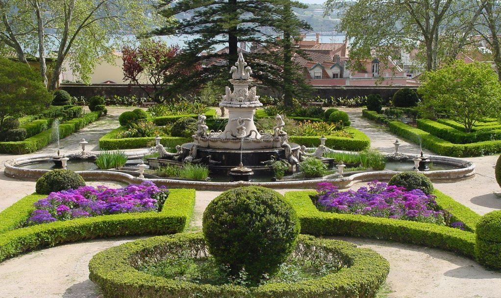
## Description Tapada da Ajuda is an understated botanical and historic estate in Lisbon that blends expansive green spaces, curated plant collections, and serene promenades overlooking parts of the city and the Tagus River. Once part of royal hunting grounds, the site now functions as a living garden with educational plantings, shaded avenues, and quieter corners perfect for reflection. Tapada da Ajuda is especially valuable for travelers seeking a restorative nature break away from Lisbon’s busy tourist corridors. Beyond the botanical interest, the area retains traces of Portugal’s horticultural exchanges—plants and specimens brought back from historic maritime voyages have influenced the garden’s diversity. The estate also hosts temporary exhibitions and occasional guided walks that interpret the site’s botanical, historical, and ecological significance. ## Location Tapada da Ajuda sits in western Lisbon close to the Ajuda district and not far from riverside Belém. It is typically accessed by tram, bus, or taxi from central Lisbon. Many visitors combine a visit here with stops at Ajuda National Palace and Belém cultural sites. ## Tips - Visit in spring or early summer for the richest blooms and milder weather; autumn can also be pleasant with changing foliage. - Wear comfortable shoes—paths vary from paved promenades to softer trails through planted areas. - Bring water, sun protection, and a small picnic to enjoy shaded groves. - Check local timetables for special exhibitions and guided tours to make the most of the historical context. - Consider pairing the visit with Ajuda Palace and a riverside walk to create a full half-day itinerary. ## Conclusion Tapada da Ajuda offers a restorative garden visit within Lisbon that balances botanical variety with historical resonance. For travelers who appreciate quiet green spaces, plant collections, and a slower urban rhythm, Tapada provides an elegant counterpoint to the city’s busier attractions. ## FAQ Q: Is there an admission fee for Tapada da Ajuda? A: Access policies can vary—some areas are free while special exhibitions or guided events may charge a fee; check official local listings before visiting. Q: Are guided tours offered at Tapada da Ajuda? A: Occasionally—local botanical groups or cultural institutions host guided walks and talks; look for schedules or contact visitor services. Q: Is Tapada da Ajuda suitable for families with children? A: Yes—open lawns and shaded paths make it a family-friendly destination, though supervision near uneven paths is recommended. Q: Is the terrain wheelchair accessible? A: Parts of the estate have paved routes, but some trails are uneven; accessibility varies—contact local services for specific route advice. Q: What’s the best season to visit? A: Spring offers the most varied blooms; early summer and autumn also have distinct seasonal highlights. ## Links - [Ajuda](https://getlisbon.com/discovering/jacarandas-of-lisbon/)
GemVoyage Team • World

Tirana
## Description The Grand Park of Tirana is one of the city’s most important public spaces and one of the best places to understand how Tirana balances urban growth with everyday leisure. Often treated simply as a park, it is actually a large and layered landscape that includes walking paths, shaded areas, open lawns, the artificial lake, family spaces, cafés, and quiet corners where people come to jog, socialize, or simply rest away from the intensity of the city center. For visitors, it offers an easy way to experience a more relaxed side of Tirana without leaving the capital. What makes the Grand Park special is its role as a civic landscape. It is not only a place for tourists; it is part of daily life for residents. People use it in the morning for exercise, in the afternoon for strolls, and in the evening for gatherings. That local rhythm gives the park a real sense of authenticity. One little-known fact is that the area around the lake and its green edges has changed significantly over time, reflecting broader shifts in how Tirana has developed as a modern city. Another interesting point is that the park’s size makes it one of the city’s most important environmental buffers, helping create a calmer microclimate in a fast-growing urban area. The Grand Park is also a good place for visitors who want to slow down their sightseeing. Tirana can feel energetic and busy, and the park offers balance. You can walk, rent a bike in some areas, sit by the water, or simply watch the city’s social life unfold. It is not a museum-like attraction with a fixed narrative; it is a lived-in urban landscape. That flexibility is part of its appeal, because it can fit into a trip in many different ways: as a morning workout, a midday break, a sunset walk, or a family outing. ## Location The Grand Park of Tirana is in southern-central Tirana, Albania, extending around the artificial lake and nearby green spaces. Because it covers a large area, there is no single exact “entrance” experience; instead, visitors usually approach it from the city side that is most convenient for their itinerary. The easiest way to get there is by taxi, ride-hailing, or a long walk from central Tirana. Many travelers also reach the park from nearby neighborhoods on foot. If you are already exploring central landmarks, it makes sense to build in a walking break and head toward the lake. Since the park is broad, choose a route that matches the part you want to see most, whether that is the waterfront, the tree-lined paths, or the recreational zones. ## Tips Go early in the day or near sunset for the most pleasant temperatures and the nicest light around the lake. Wear comfortable shoes because the park is best enjoyed on foot. If you like a local atmosphere, spend time watching how residents use the park rather than focusing only on the scenery. Bring water and expect a leisurely pace; this is a place for lingering, not rushing. ## Conclusion The Grand Park of Tirana is a spacious urban retreat that gives visitors a calmer, more local perspective on the Albanian capital. ## FAQ ### Is the Grand Park of Tirana good for tourists? Yes. It is one of the easiest and most enjoyable places to experience daily life in Tirana. ### Can I walk around the lake? Yes, the park is designed for walking and recreation, though routes vary by area. ### Is it family-friendly? Very much so. It is one of the city’s most popular family and leisure spaces. ### How long should I spend there? Anywhere from one hour to half a day, depending on whether you want a short walk or a longer picnic-style visit. ### What is the best time to go? Early morning and late afternoon are usually the most pleasant times. ## Links - [Tirana tourism information](https://visit-tirana.com/) - [Grand Park of Tirana on Wikipedia](https://en.wikipedia.org/wiki/Grand_Park_of_Tirana)
GemVoyage Team • World
Cape Town
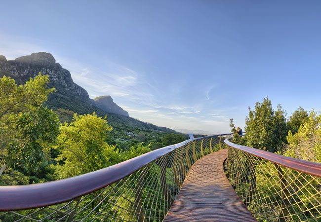
## Description Newlands Forest is one of Cape Town’s most accessible green escapes, especially for travelers who want a walk in nature without committing to a major mountain expedition. Located on the southern slopes of Table Mountain, it offers a softer, shadier, and more intimate side of the city’s mountain landscape. The forest feels close to urban life yet separated enough to create genuine calm, which is why it is popular with walkers, runners, families, and anyone needing a quieter outdoor break. The forest is attractive because it gives you variety in a small space. Paths wind through trees, slopes, and scenic pockets that change with light and season. In some sections the canopy feels dense and almost enclosed; in others, the forest opens enough to remind you how close you are to one of the world’s most distinctive mountain systems. One little-known fact is that Newlands Forest is often chosen by locals who want a manageable outing rather than a full mountain climb. Another is that the forest’s location means it can function as both a fitness space and a restorative natural retreat. Visitors often appreciate the contrast between the forest and the city. Cape Town can feel dramatically coastal or highly urban, but Newlands Forest offers a middle ground where the city seems far enough away to rest the mind while still being reachable without complicated planning. That accessibility is one of its major strengths. You do not need to be an expert hiker to enjoy it. Even a short walk can be rewarding because the atmosphere itself is the attraction. The area also has a calm, local character that makes it feel welcoming. People come here for different reasons and at different paces, so the forest never feels like it belongs to only one type of visitor. Whether you want exercise, shade, birdlife, or a quiet pause in your day, Newlands Forest can accommodate it. That flexibility makes it an especially useful stop for people spending several days in Cape Town and looking for a restorative half-day outdoors. ## Location Newlands Forest is located in Newlands, in the southern part of Cape Town, Western Cape, South Africa, on the lower slopes of Table Mountain National Park. It is close to residential areas, sports venues, and other southern suburbs, which makes it one of the easier nature spots to access from within the city. The simplest way to get there is by car or ride-hailing service. Depending on where you start, public transport may be less direct, so a point-to-point ride is often the most practical option. Parking and trail access can vary by exact route, so it helps to decide ahead of time whether you want a short stroll, a longer hike, or a connection to a broader mountain route. Because the forest is part of a bigger natural system, weather conditions matter. Dry, clear days are usually most comfortable, and early starts are helpful if you want a peaceful atmosphere and cooler temperatures. ## Tips - Wear proper walking shoes even for a short visit. Paths can be uneven in places. - Bring water and sun protection, especially if you plan to continue beyond shaded sections. - Start early in the day for quieter trails and more comfortable temperatures. - Stick to marked paths and pay attention to trail conditions. - Use the forest as part of a broader Cape Town nature day if you want a balanced outing. ## Conclusion Newlands Forest offers Cape Town visitors an easy, restorative encounter with the mountain environment. It is a place to walk, breathe, and reset without needing to leave the city far behind. ## FAQ ### Is Newlands Forest suitable for beginners? Yes. Many routes and walks in the area are approachable, though you should still choose a route that matches your comfort level. ### How long should I plan to stay? A short visit can be as little as an hour, but you can easily extend it into a half-day depending on your route and pace. ### Is it more of a hike or a walk? It can be either. Some visitors treat it as a gentle walk, while others use it as the starting point for more active hiking. ### Is it busy? It can be popular, especially on pleasant days and weekends, but it still often feels calmer than many other city-based attractions. ## Links - [Newlands Forest on Wikipedia](https://en.wikipedia.org/wiki/Newlands_Forest)
GemVoyage Team • World
Bonn
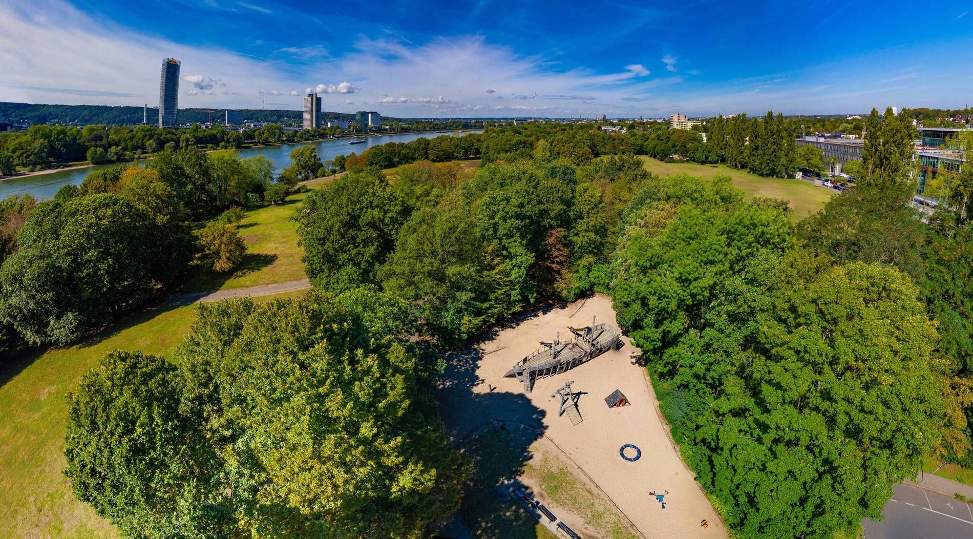
## Description Rheinaue Park is one of Bonn’s most pleasant urban green spaces because it combines openness, variety, and a strong sense of everyday usefulness. It is the kind of park that feels instantly welcoming. Instead of presenting itself as a highly formal landscape or a single-activity site, it offers lawns, water features, walking paths, and room to simply be outside. For travelers, that makes it a gentle and flexible stop; for locals, it functions as a regular escape from the city’s pace. The park stands out because of its scale and composition. Broad open areas give it a relaxed, spacious feeling, while the presence of water and planted sections creates enough visual interest to keep a long walk engaging. One little-known fact is that the park was shaped by a major landscape design approach rather than emerging as a simple leftover green area, which explains why it feels so intentional and balanced. Another is that it works especially well in different weather conditions: sunny days bring picnic energy and wide horizons, while overcast days make the water and greenery feel especially calm. Visitors often appreciate that Rheinaue Park feels lived-in rather than overly staged. People come here to walk, cycle, picnic, exercise, or spend time with family and friends. That mixed use gives the park a stable, local rhythm. It is not an attraction you rush through. It is a place that rewards taking your time, noticing how people use the space, and choosing your own pace. The park is also useful for travelers who want an easy outdoor break without a complicated plan. After time in Bonn’s museums, old town, or riverfront, Rheinaue offers a reset. You can settle into a bench, cross open lawns, follow a trail near the water, or simply enjoy the change of scale from city streets to open parkland. It is the sort of place that may not dominate a guidebook cover but ends up becoming one of the most restful parts of a trip. ## Location Rheinaue Park is located in Bonn, North Rhine-Westphalia, Germany, stretching through a large green area in the city and near the Rhine. Its size and layout make it accessible from several directions, and it functions as one of Bonn’s major recreational landscapes. The easiest way to reach the park is by local public transport, bicycle, or car depending on where you start in the city. Because Bonn is relatively manageable, many visitors find that a bike or short transit ride works especially well. The park’s openness means that once you arrive, you can decide how long or how far you want to walk without needing a rigid route. If you are planning a relaxed visit, choose good weather and give yourself time to move slowly. The park is best experienced as a place for lingering rather than ticking off sights. ## Tips - Bring water or a picnic if you want to make the most of the open lawns. - Use the park for a slow walk or bike ride rather than trying to treat it as a quick stop. - Visit in good weather if you want the full effect of the open landscape. - Leave time for sitting. The park is as much about atmosphere as activity. - Combine it with Bonn’s riverfront or central sights if you want a fuller day out. ## Conclusion Rheinaue Park is Bonn’s easygoing green escape, offering space, water views, and a calm setting that works well for both local routines and traveler downtime. It is simple, generous, and quietly rewarding. ## FAQ ### Is Rheinaue Park a tourist attraction or mainly a local park? It serves both purposes. Tourists can enjoy the space and scenery, while locals use it regularly for exercise, relaxation, and social time. ### How much time should I spend there? Anywhere from an hour to several hours, depending on whether you want just a walk or a more relaxed picnic-style visit. ### Is it good for children? Yes. The open space and easy paths make it a flexible destination for families. ### When is the best time to visit? Spring, summer, and early autumn are especially pleasant, though the park can be enjoyable year-round. ## Links - [Bonn official website](https://www.bonn.de/)
GemVoyage Team • World
Ontario
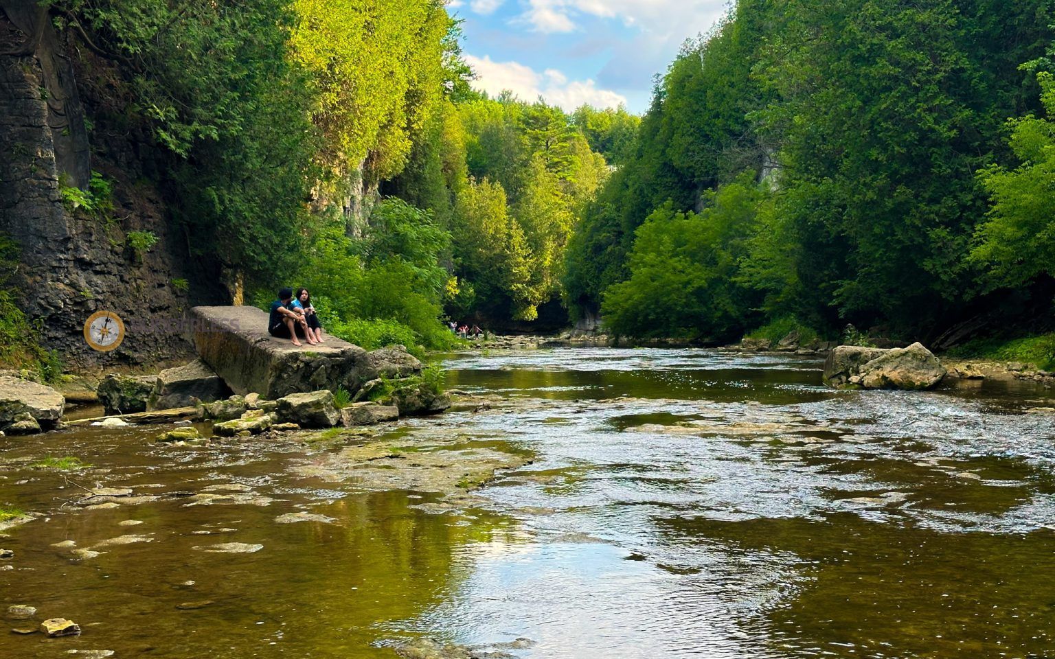
## Description Elora Gorge is one of Ontario’s most striking natural attractions, known for its steep limestone cliffs, fast-moving Grand River scenery, and a landscape that feels more dramatic than most visitors expect from southern Ontario. The gorge is part nature preserve, part outdoor recreation area, and part classic day-trip destination. People come for the views, the trails, the river access, and the feeling of standing in a place where water has carved a deep, narrow route through rock over a very long span of time. What makes Elora Gorge memorable is its contrast. The surrounding region is gently rural and easygoing, but the gorge itself is rugged and visually intense. When you stand on the edge and look down, the river appears surprisingly powerful as it moves through the canyon-like setting. The rock walls, tree cover, and water together create a scene that feels almost larger than life for a place that is relatively easy to access from nearby towns and cities. It is the kind of landscape that immediately rewards anyone who likes geology, photography, hiking, or simply being outdoors. One little-known fact about the area is how much its shape influences the mood of the visit. Even short walks feel more memorable because the viewpoint changes quickly from forest to cliff edge to river corridor. Another detail many visitors appreciate only after arriving is how seasonally different the gorge can feel. In spring, the river runs energetically and the foliage is fresh. In summer, the greens are dense and the area becomes a prime outdoor destination. In autumn, the cliffs and trees around the gorge can create a particularly vivid palette. Winter visits are quieter and more austere, but they can also be beautiful in a stark, sculptural way. Elora Gorge is also appealing because it can satisfy different travel styles. A casual visitor can enjoy the scenery and take a short walk, while a more active traveler can turn the visit into a longer outdoor outing. The gorge is one of those places where people often arrive with modest expectations and leave impressed by how photogenic and substantial it feels. ## Location Elora Gorge is in Ontario, Canada, near the village of Elora and within reach of the wider Waterloo Region and Wellington County area. The gorge is associated with the Grand River and is close enough to several southwestern Ontario cities to function as a realistic day trip. For many travelers, the easiest way to visit is by car, since that gives the most flexibility for parking, timing, and combining the gorge with nearby Elora village or other regional stops. If you are driving from Toronto, Kitchener-Waterloo, Guelph, or nearby communities, the route is straightforward enough for a day outing. Public transit is usually less convenient, so road travel is the most practical option for most visitors. Once you arrive, the experience is mostly about walking, looking, and choosing how active you want to be. If you are planning a fuller outdoor day, it makes sense to pair the gorge with village cafés, local shops, or other conservation-area activities in the surrounding region. ## Tips Wear footwear that can handle uneven paths and potentially muddy or damp ground. The gorge is beautiful, but it is not a place where fashionable footwear matters more than stability and comfort. If you want photos from scenic viewpoints, take your time and be cautious near edges and steep sections. The views are worth slowing down for, and safety should always come first. Check conditions before you go. Water levels, trail conditions, and seasonal access can change the experience significantly. A gorge that looks calm in one season can be much more energetic in another, and some areas may be better suited to certain weather conditions. If you are visiting with children, choose routes and viewpoints that match their energy and attention span. Bring water, snacks, and weather-appropriate layers. The gorge can feel cooler or windier than the nearby town, and you may spend more time outside than planned once you start enjoying the scenery. If you are interested in photography, morning and late afternoon are usually the best times for softer light. Consider making time for Elora village as well. The gorge is the headline attraction, but the surrounding area often makes the trip more satisfying. Many visitors find that pairing the natural site with a meal or wander in town creates the most balanced experience. ## Conclusion Elora Gorge is one of Ontario’s most rewarding scenic escapes, offering dramatic geology, outdoor recreation, and easy access from nearby communities. It is a strong choice for travelers who want nature without a complicated journey. ## FAQ ### Is Elora Gorge good for a quick visit? Yes. Even a short stop can be worthwhile if you want a scenic view and a brief walk. If you have more time, though, the gorge becomes much richer because you can explore the trails and surrounding area more fully. ### Is it suitable for families? It can be, provided you choose paths and viewpoints that fit your group’s comfort level. Families should pay close attention near steep edges and areas with uneven terrain. ### What is the best season to visit? There is no single best season, because each one has a different appeal. Spring and autumn are especially attractive for scenery, while summer is popular for outdoor activity and longer visits. ### Do I need to be an experienced hiker? No. There are options for casual visitors as well as more active hikers. You can tailor the trip to your own pace and interests. ### Can I see the gorge without a long hike? Yes. The attraction is accessible enough that you can enjoy views and the setting without committing to a major hike, although walking deeper into the area gives a fuller experience. ## Links - [Wikipedia](https://en.wikipedia.org/wiki/Elora_Gorge_Conservation_Area)
GemVoyage Team • World
