GemVoyage Team • World
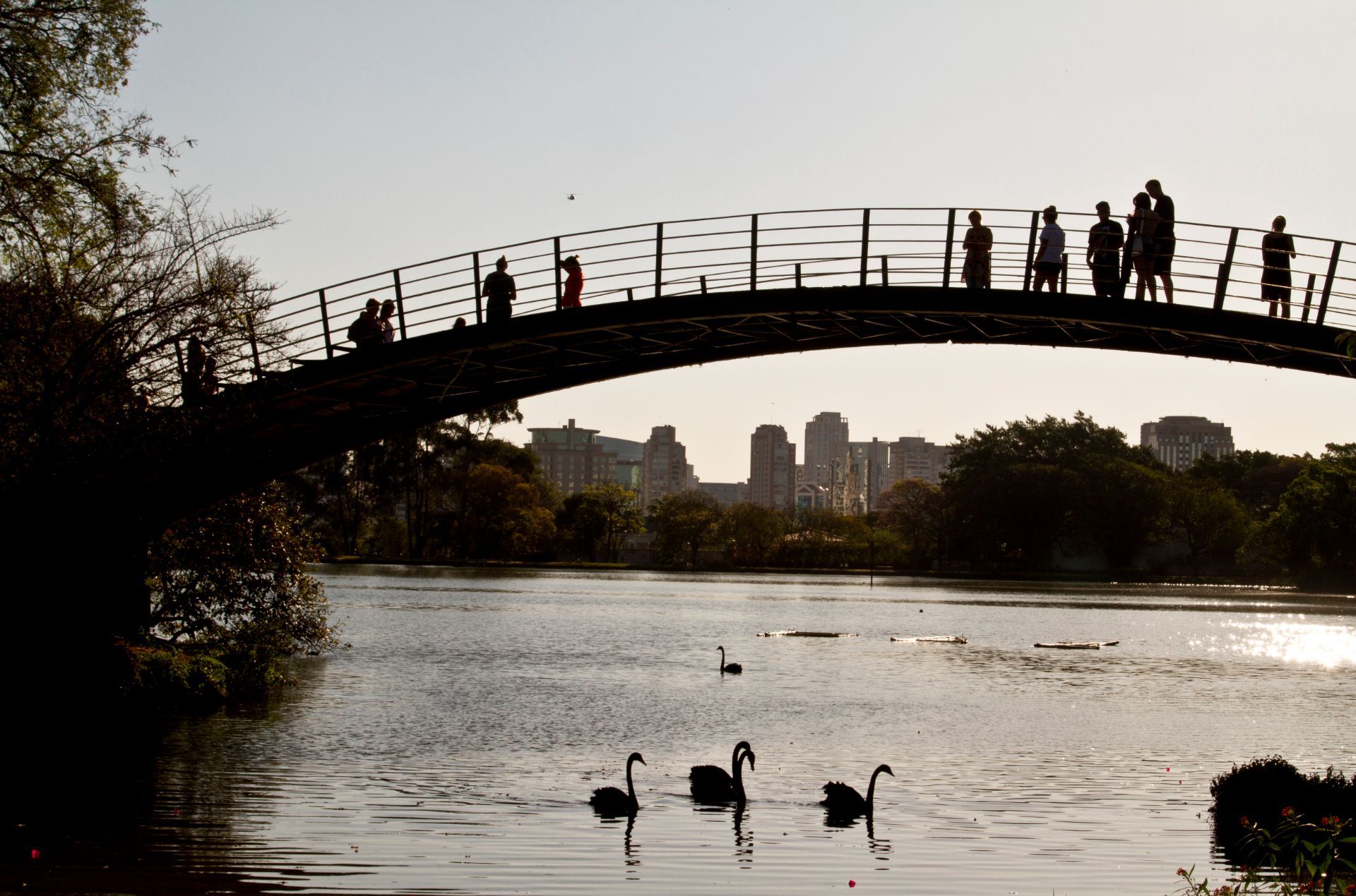
The park is more than a recreational area. It is a cultural landscape where nature, architecture, exercise, and informal social life come together. You may pass runners, families on blankets, office workers taking breaks, and visitors moving between museums or exhibition spaces. Yet the quieter parts of the park offer a different kind of experience. Instead of chasing the main sights, you can wander into less-trafficked zones, pause under the trees, and notice how the park changes from one pocket of space to another.
One little-known fact is that Ibirapuera was designed with major urban ambition in mind, which is why the park feels so integrated with the city rather than separated from it. Another is that the park’s atmosphere can shift dramatically depending on where you stand; some areas feel expansive and ceremonial, while others feel almost hidden and intimate. That contrast is what makes the quieter corners so rewarding. They reveal a softer side of one of Latin America’s great metropolitan parks.
For travelers, the appeal lies in balance. You can enjoy famous São Paulo institutions and still have time to sit somewhere calm enough to reflect on the city’s scale. In that sense, Ibirapuera is not only a park but also a reset point. It offers visitors the chance to experience a dense metropolis without being consumed by it.
The park is best reached by ride-hailing service, taxi, bus, or a combination of metro and walking depending on where you start. Because the park has multiple entrances and a large footprint, it helps to decide in advance which part you want to visit. If your goal is the quieter side of the park, enter with enough time to wander rather than heading only to one landmark. That way you can move between open lawns, tree-lined paths, and calmer internal areas without feeling rushed.
From central São Paulo, travel time varies widely with traffic, so the best strategy is to leave room in your schedule. Mornings and late afternoons are often the most comfortable times to visit because temperatures are milder and the park’s quieter zones feel more spacious.
Discover more hidden gems you might love.
Norway
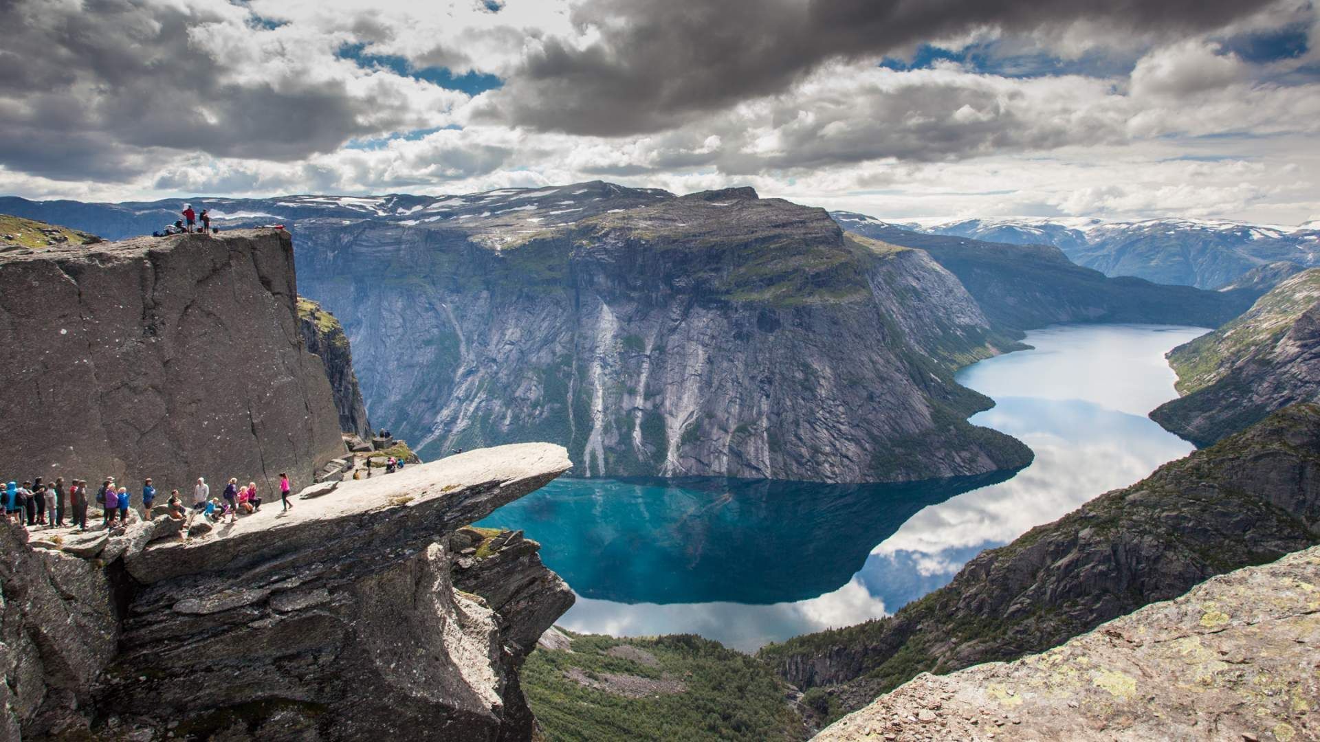
## Description Trolltunga (“Troll’s Tongue”) is one of Norway’s most photographed and dramatic viewpoints: a narrow rock shelf jutting horizontally from a mountain about 700 meters above Ringedalsvatnet lake near Odda. The slab provides a heady vantage point for daring photos — standing at the lip feels like stepping out over the fjord and valley below. The route to Trolltunga is an epic alpine hike across tundra, streams and exposed plateaus, rewarding determined trekkers with panoramic Norway: steep cliffs, glassy water and a raw northern landscape. Beyond the photogenic ledge, Trolltunga stands out for its demanding yet accessible backcountry experience. The modern popularity surged through social media; traditionally, this was a remote local hike. Management measures, permits, and local transport services have evolved to handle seasonal traffic while protecting the path and surrounding vegetation. ## Location Trolltunga sits above the town of Odda in Vestland county, western Norway. The usual trailhead is at Skjeggedal, accessed by a short shuttle from parking and visitor centers. Many hikers base themselves in Odda or nearby villages and use local shuttles or guided hiking operators to reach the trailhead. The total round-trip hike is roughly 22–28 kilometers depending on route, often taking 10–12+ hours for a typical day trip. Seasonality matters: roadside parking and trail access are managed during summer to reduce environmental impact and improve safety. In winter and shoulder seasons the route becomes technical and requires winter mountaineering skills and equipment. ## Tips - **Prepare for a long day:** Bring layers, a warm waterproof jacket, sturdy boots, plenty of food, and ample water. The trail is long with sustained elevation gain and exposed terrain. - **Start early or plan an overnight:** To avoid peak crowds and to allow a relaxed pace, begin pre-dawn or plan an overnight in a mountain cabin or campsite. Early starts also improve light for photography and reduce the chance of afternoon weather changes. - **Choose guided or self-guided based on experience:** Guided hikes add local knowledge and reduce navigation stress; experienced hikers can plan self-guided excursions but should be disciplined with timing. - **Respect safety and common-sense rules:** The ledge has no formal barriers. Avoid risky poses near the edge, especially in windy or wet conditions. Keep children close and prioritize safety over photographs. - **Pack for changing conditions:** Tundra and plateau weather can shift quickly. Bring a waterproof shell, insulating mid-layer, hat and gloves even in summer. A headlamp, spare batteries, and a basic repair kit for footwear are helpful. - **Leave no trace:** Stay on marked trails to protect vegetation, pack out all waste, and follow any local guidance about camping and trail use. - **Consider alternatives for accessibility:** For those unable to complete the full hike, photo viewpoints and shorter trails in the region offer dramatic scenery with less effort. ## Conclusion Trolltunga is an emblem of Norway’s wild beauty and an achievement for hikers — the dramatic viewpoint and sweeping fjord panoramas make the long approach worthwhile for those prepared for a sustained mountain day. With thoughtful preparation and respect for local rules, the route rewards visitors with some of Scandinavia’s most iconic views and a memorable sense of accomplishment. ## FAQ - **Q: How difficult is the hike to Trolltunga?** A: The route is long and strenuous with sustained elevation and exposed terrain. It suits fit hikers with good preparation; novices should consider guided options or shorter nearby hikes. - **Q: How long does the hike take?** A: Typical round-trip time is 10–12+ hours for 22–28 kilometers depending on fitness and conditions. Allow extra time for photography and rest stops. - **Q: Can you camp on the route?** A: Wild camping is practiced in Norway but follow local regulations and Leave No Trace principles. Some guided itineraries include overnight options or staged hut-to-hut plans. - **Q: Are there safety services or mountain rescue?** A: Mountain rescue services exist regionally, but mobile coverage can be patchy. Going with a guide or letting someone know your itinerary improves safety; carry basic emergency gear. - **Q: When is the best time to hike Trolltunga?** A: Summer (June–September) is the primary hiking season with milder weather and long daylight. Shoulder seasons require careful planning; winter requires mountaineering skills. - **Q: Is the viewpoint crowded?** A: Popular times can be crowded, especially mid-morning in summer. Start early for quieter conditions and better light. ## Links - [Trolltunga — Wikipedia](https://en.wikipedia.org/wiki/Trolltunga)
GemVoyage Team • World
Lille
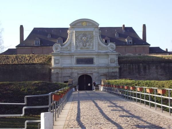
## Description The Citadel of Lille is one of the most impressive military structures in France and a major reason the city is often mentioned in discussions of European fortress design. Built in the 17th century under the direction of Vauban, the citadel is a star-shaped defensive complex that demonstrates both engineering precision and political ambition. It was intended to protect Lille after the city came under French control, and today it stands as a reminder of how military architecture could also shape a city's identity and landscape. What makes the citadel special is that it is not only technically significant but also visually elegant. Its geometric form, wide moats, robust bastions, and open green surroundings make it feel like a fortress designed by someone who understood both defense and urban order. Even if you are not deeply interested in military history, the citadel is compelling because of how it connects architecture, public space, and the natural environment. It is both a monument and a park-like setting, which gives it a very different feeling from densely built old-town landmarks. One little-known fact is that the Citadel of Lille is sometimes referred to as the "queen of citadels" because of its importance in Vauban's defensive system. Another detail many visitors miss is how well the structure fits into the modern city. Although originally conceived for warfare, the citadel now helps define a recreational and cultural zone where walking, cycling, family outings, and visits to nearby attractions all take place. That transformation from military stronghold to civic landmark is part of what makes the site interesting today. The citadel also helps visitors understand Lille's broader history. The city sat near contested borders for centuries, so fortifications were more than symbolic; they were necessary tools of survival and control. Standing at the citadel, you can sense the strategic value of the location and see how a military engineer like Vauban thought about terrain, sightlines, and access. For architecture lovers, history enthusiasts, and casual walkers alike, it is one of Lille's most rewarding destinations. ## Location The Citadel of Lille is in Lille, in the Hauts-de-France region of France, west of the historic center near the Deûle River and surrounding parkland. Its location makes it easy to combine with a broader exploration of Lille's old quarters, especially if you are already spending time around the city center. Unlike a fortress in a remote military zone, this citadel sits comfortably within the urban fabric while still feeling spacious. Getting there is simple by foot, bicycle, or local transport. If you are staying in central Lille, a walk to the citadel is pleasant and reveals how the city's layout changes as you move from dense streets to more open green space. Buses and taxis can also bring you close, but many visitors prefer to use the approach as part of a longer stroll. Because the citadel is surrounded by parks and walking routes, it works especially well as part of a relaxed day outdoors. You can combine it with the nearby zoo, river paths, or other west-side attractions if you want to make the most of the area. ## Tips Allow time for the surroundings as well as the fortress itself. The citadel's setting in parkland is one of its greatest strengths, and the experience improves when you treat it as part of a broader walk rather than a quick photo stop. If you are interested in military history, read a little about Vauban before visiting. His work shaped many French fortifications, and understanding his methods makes the citadel much more meaningful. Visit in good weather if you want to enjoy the outdoor environment fully. The site is enjoyable year-round, but clear conditions make the geometry and scale easier to appreciate. Bring comfortable shoes or use a bicycle if you plan to cover more of the surrounding area. The citadel fits naturally into an active day in Lille and is especially pleasant for travelers who enjoy a mix of history and open-air walking. ## Conclusion The Citadel of Lille is a landmark of French military architecture and a beautiful place to understand the strategic history of the city while enjoying one of its most open and pleasant landscapes. ## FAQ ### Who built the Citadel of Lille? It was designed by Vauban, the famous French military engineer, in the 17th century. ### Why is the citadel important? It is important because it is one of the best examples of Vauban's fortification work and a key part of Lille's historical defense. ### Can you visit the citadel today? Yes. The area is accessible and widely used for walking and recreation, though access may vary in specific sections. ### Is it close to Lille's city center? Yes. It is located west of the center and is easy to reach on foot or by local transport. ## Links - [Lille tourism](https://www.lilletourism.com/) - [Wikipedia article](https://en.wikipedia.org/wiki/Citadel_of_Lille)
GemVoyage Team • World
Accra
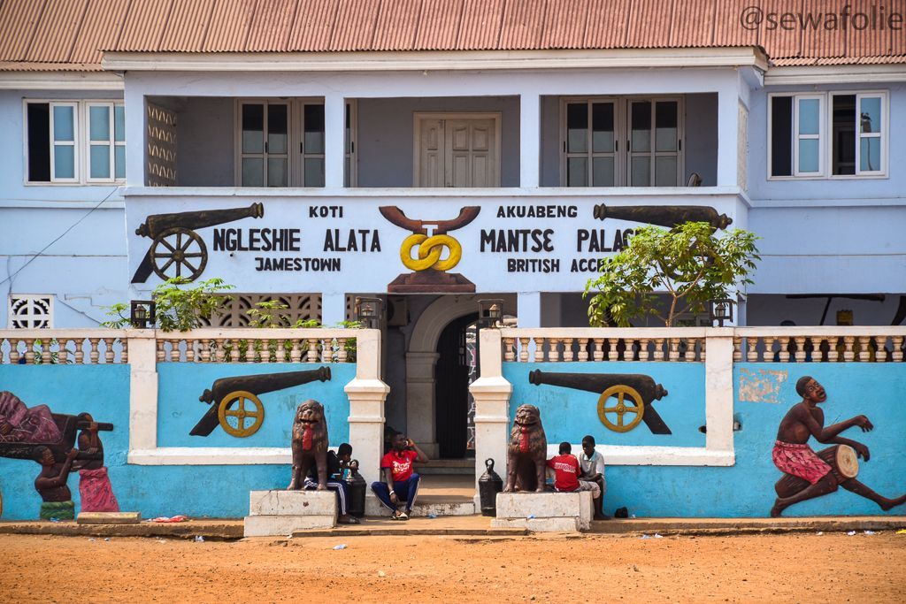
## Description Jamestown District is one of the most historically important and visually distinctive areas in Accra. Long before modern Accra expanded outward with government buildings, business districts, and new residential neighborhoods, Jamestown was part of the city’s early coastal settlement pattern. Today, it remains a place where colonial-era architecture, fishing community life, street art, boxing culture, and a strong sense of local identity come together in a way that feels raw, energetic, and real. What makes Jamestown especially worth visiting is its contrast. Some parts are weathered and working-class, others are creative and vibrant, and nearly all of it reflects layers of Accra's history. Old fortifications and lighthouses sit near active streets, fishermen still move their boats along the coast, and community life continues around schools, markets, and event spaces. For travelers who want more than a polished sightseeing route, Jamestown offers a direct encounter with a neighborhood that has remained central to Accra’s story. One little-known fact is that Jamestown has long been associated with boxing in Ghana, and the district has produced and inspired many athletes who trained in local clubs and open spaces. Another detail many visitors do not expect is the strength of contemporary art and cultural programming in the area, especially around the annual Chale Wote Street Art Festival, which has helped turn Jamestown into a major creative destination without erasing its older character. The district is also a place where historical memory matters. Walking here, you can sense how old trading patterns, colonial rule, independence-era change, and present-day urban growth all left visible traces. It is not a preserved museum quarter, and that is part of its appeal. Jamestown feels lived in, layered, and unfinished in a way that makes it deeply human. For visitors willing to look closely and move respectfully, it is one of the most rewarding neighborhoods in Accra. ## Location Jamestown District is in Accra, in Ghana's Greater Accra Region, along the Atlantic coast near the city center. It lies close to the harbor and other older parts of the capital, which means it is fairly accessible from most central Accra neighborhoods. Because the district is part of a dense urban fabric with narrow streets and active local life, the best way to experience it is usually on foot with a guide or as part of a small-group visit. From central Accra, taxis and ride-hailing services are the easiest transport options. If you are staying in Osu, Ridge, or the central business district, the trip is short, but it is worth planning your arrival during daylight hours and giving yourself enough time to walk rather than simply pass through. Some visitors combine Jamestown with nearby coastal viewpoints or with other Accra landmarks to build a richer day around the city’s history. Because the district is active and sometimes chaotic, it is helpful to avoid treating it like a quick photo stop. Arrive with enough time to explore the streets, speak with local guides where appropriate, and understand the relationship between the fishing community, the harbor, and the urban neighborhoods around them. ## Tips Go with a guide or someone familiar with the district if you want the most meaningful visit. Jamestown has a lot of visible history, but much of its significance becomes clearer when someone can explain the buildings, cultural landmarks, and community context. Visit during the day and keep your movements respectful. Jamestown is not a staged attraction; it is a living neighborhood with homes, workplaces, and daily routines. Ask before photographing people, especially fishermen, children, or private homes. That simple habit changes the tone of the visit completely. Wear comfortable shoes and prepare for heat and dust. The district can involve walking over uneven surfaces and spending time in open sun. Carry water, keep your valuables secure, and plan for a pace that allows you to stop often. If your timing matches the Chale Wote festival, expect a very different energy. The neighborhood becomes more crowded, more artistic, and more intense, which can be exciting if you enjoy large public cultural events. Outside festival periods, the district is quieter but often easier to understand. ## Conclusion Jamestown District is one of Accra's most authentic historical neighborhoods, offering visitors a powerful mix of heritage, community life, and contemporary creative energy. ## FAQ ### What is Jamestown District known for? Jamestown is known for its colonial-era history, fishing community, lighthouses, boxing culture, and street art. ### Is Jamestown safe to visit? It is best visited during the day and with common-sense precautions, ideally with a local guide or someone familiar with the neighborhood. ### Can I visit Jamestown on my own? Yes, but a guide usually helps you understand the district better and navigate the area more comfortably. ### What is the best time to visit Jamestown? Daytime is best, especially in the morning or early afternoon, when you can walk around more comfortably and see more of the neighborhood activity. ## Links - [Wikipedia article](https://en.wikipedia.org/wiki/Jamestown,_Accra) - [Ghana Tourism Authority](https://visitghana.com/)
GemVoyage Team • World

Copenhagen
## Description The Hans Christian Andersen Experience in Copenhagen is a cultural attraction dedicated to one of Denmark’s most famous figures and one of the world’s most influential storytellers. Rather than functioning as a traditional museum, the experience is designed as an immersive walk-through journey that brings Andersen’s life and fairy tales to life through sets, soundscapes, projections, and storytelling elements. Visitors are invited to step directly into the imaginative universe behind timeless stories such as *The Little Mermaid*, *The Ugly Duckling*, and *The Emperor’s New Clothes*. What makes the Hans Christian Andersen Experience unique is its narrative-driven design. Instead of focusing heavily on historical artifacts, the attraction emphasizes emotion, atmosphere, and imagination, mirroring the way Andersen himself told stories. Visitors move through scenes inspired by both his personal life and his fictional worlds, gaining insight into how his hardships, travels, and observations shaped his writing. A little-known fact is that Andersen struggled with poverty and social insecurity early in his life, themes that quietly echo throughout many of his fairy tales. Another lesser-known detail is that some installations are inspired by Andersen’s own paper cuttings, an art form he practiced privately and which reflects his intricate creative mind. This experience appeals to both adults and children, offering a reflective and engaging way to understand why Andersen’s stories continue to resonate across cultures and generations. ## Location The Hans Christian Andersen Experience is located in **Denmark**, in the **Capital Region**, within the city of **Copenhagen**. It sits in the historic city center, close to City Hall Square (Rådhuspladsen) and within walking distance of Tivoli Gardens and Strøget, Copenhagen’s main shopping street. Getting there is easy using public transportation. The nearest metro stations are **Rådhuspladsen** and **Gammel Strand**, both a short walk away. Numerous buses also stop nearby. For visitors already exploring central Copenhagen, the attraction is conveniently reached on foot or by bicycle, which is a popular way to get around the city. ## Tips * Allow about one hour for your visit, though literature enthusiasts may want more time to explore each section carefully. * The experience is largely indoors, making it a good option during colder or rainy weather. * Some displays rely on lighting and sound effects, which may feel intense for very young children. * Photography is usually allowed, but flash may be restricted in certain areas. * Combine your visit with nearby attractions such as Tivoli Gardens or a walk through the historic city center. * Reading a few Andersen fairy tales beforehand can enhance your appreciation of the scenes and references. ## Conclusion The Hans Christian Andersen Experience offers a thoughtful and imaginative introduction to Denmark’s most beloved storyteller. Through immersive design and emotional storytelling, it allows visitors to connect with both the man and the fairy tales that shaped global literature. ## FAQ **Is the Hans Christian Andersen Experience suitable for children?** Yes, it is suitable for children, though some darker fairy-tale themes may be better appreciated by older kids. **How long does the visit take?** Most visitors spend around 45 minutes to one hour inside the experience. **Is the experience available in English?** Yes, information and displays are available in English, along with other major languages. **Is this a traditional museum?** No, it is an immersive storytelling experience rather than an artifact-based museum. **Do I need to book tickets in advance?** Advance booking is recommended during peak tourist seasons, though walk-in tickets are often available. ## Links * [Hans Christian Andersen Experience Official Website](https://www.visitcopenhagen.com/copenhagen/planning/hans-christian-andersen-experience-gdk591356)
GemVoyage Team • World
Cairo
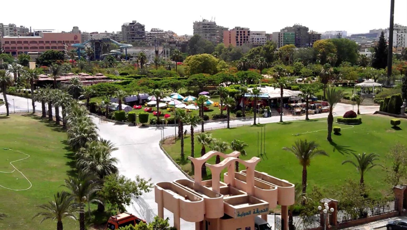
## Description **The International Park (الحديقة الدولية بالقاهرة)** is one of Cairo’s most distinctive public green spaces, designed to showcase a miniature journey through different countries and cultures within a single park. Established in the late 1980s, the park was conceived as a cultural and recreational project where landscaped areas, architectural replicas, and themed gardens represent nations from around the world. While not polished in the way of modern theme parks, its charm lies in its **ambitious concept, open space, and local atmosphere**. What makes the International Park unique is its layout: each section is inspired by a different country, featuring symbolic structures, sculptures, plants, or design elements associated with that nation. Visitors can walk from Asian-inspired pavilions to European-style gardens within minutes. This eclectic mix gives the park an almost nostalgic quality, reflecting Cairo’s vision of internationalism during the late 20th century. A lesser-known fact is that several embassies and cultural institutions contributed ideas or symbolic elements during the park’s early development, even if execution varied over time. Another interesting detail is that the park was once a major venue for **school trips and cultural festivals**, making it an important part of collective memory for many Cairenes who grew up in the 1990s. Today, the park functions primarily as a **family-friendly recreational space**. It is popular for picnics, casual walks, and affordable outings, especially for residents of eastern Cairo. While some areas show signs of aging, the park’s size, greenery, and concept still make it a refreshing escape from the dense urban environment. ## Location **Country:** Egypt **Region:** Greater Cairo **City:** Cairo **District:** Nasr City The International Park is located in **Nasr City**, one of Cairo’s largest residential districts, close to major roads and residential compounds. ### How to Get There * **By taxi or ride-hailing:** * Uber and local taxis are the most convenient option from anywhere in Cairo. * **By car:** * Easily accessible via Nasr City’s main roads, with parking available near the entrance. * **By public transport:** * Microbuses and buses serving Nasr City pass close to the park, though routes can be confusing for first-time visitors. * **From central Cairo:** * Expect a 30–45 minute drive depending on traffic. ## Tips * **Visit in the afternoon:** Late afternoon offers better weather and softer light, especially in warmer months. * **Bring your own food:** Picnic areas are common, and outside food is usually allowed. * **Wear comfortable shoes:** The park is large, and exploring all sections involves significant walking. * **Manage expectations:** Some country sections are more symbolic than detailed replicas. * **Good for children:** Open spaces allow kids to run freely, and the atmosphere is relaxed. * **Avoid peak public holidays:** The park can become crowded during major Egyptian holidays. ## Conclusion The International Park is a spacious, culturally themed green retreat that offers a simple but enjoyable experience for families and casual visitors. Its global concept, combined with its local character, makes it a nostalgic and accessible escape from Cairo’s urban intensity. ## FAQ **1. When was the International Park opened?** It was established in the late 1980s as a cultural and recreational project. **2. Is there an entrance fee?** Yes, there is a low entrance fee, making it affordable for families. **3. How long should I plan for a visit?** Most visitors spend **1.5 to 3 hours**, depending on walking pace and activities. **4. Is the park suitable for tourists?** Yes, especially for those interested in local leisure spaces rather than major monuments. **5. Are there food stalls inside?** Basic snacks may be available, but bringing your own food is recommended. **6. Is it good for photography?** Yes, particularly for casual photography and wide shots of greenery and themed structures. ## Links * [Egyptian tourism portal](https://www.experienceegypt.eg/en)
GemVoyage Team • World
Paris
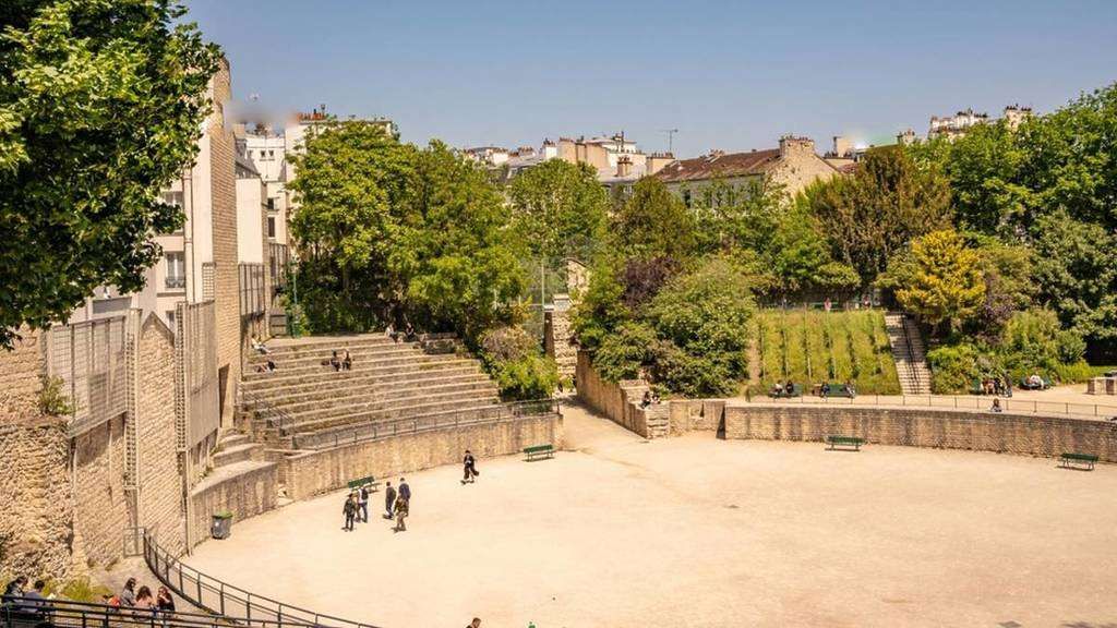
## Description **Arènes de Lutèce** is one of Paris’s most unexpected and historically significant sites: a **Roman amphitheater hidden in plain sight** within the Latin Quarter. Dating back to the **1st century CE**, it is among the oldest surviving monuments in the city and a rare physical reminder of Lutetia, the Gallo-Roman settlement that preceded modern Paris. Unlike the grand, fully preserved amphitheaters of southern France or Italy, the Arènes de Lutèce is fragmentary, modest in scale, and deeply embedded in its urban surroundings. This is precisely what makes it compelling. The remains include portions of the arena floor, tiered seating, subterranean chambers, and traces of the stage wall. In its prime, the amphitheater could accommodate **up to 15,000 spectators**, hosting gladiatorial combats, animal hunts, and theatrical performances. What sets the Arènes de Lutèce apart is its **history of disappearance and rediscovery**. After the fall of the Roman Empire, the structure was gradually dismantled and buried beneath medieval buildings. By the Middle Ages, its existence was largely forgotten. It was not rediscovered until the 19th century during urban works, and even then, much of it was threatened by redevelopment. The site was ultimately saved following public campaigns supported by prominent cultural figures, including Victor Hugo. A lesser-known fact is that the amphitheater served multiple secondary purposes over time. During the Middle Ages, stones from the structure were reused in nearby buildings, effectively dissolving it into the fabric of the city. Another overlooked detail is that today’s visible remains represent **only a fraction** of the original structure; much of it still lies beneath surrounding streets and buildings, preserved underground rather than reconstructed. Today, the Arènes de Lutèce functions as a **public space rather than a formal museum**. Locals play pétanque on the arena floor, children run along the ancient stone seating, and visitors sit quietly where Roman spectators once gathered. This coexistence of daily life and antiquity is rare in Paris and gives the site a lived-in authenticity that no curated exhibition could replicate. ## Location **Country:** France **Region:** Île-de-France **City:** Paris **Arrondissement:** 5th (Latin Quarter) The Arènes de Lutèce is located between Rue Monge and Rue de Navarre, in one of Paris’s most historic and intellectually rich neighborhoods. ### How to Get There * **By metro:** * Line 7 to **Place Monge**, then a 3–5 minute walk. * Line 10 to **Cardinal Lemoine**, followed by a short walk. * **By bus:** * Several bus lines serve the Latin Quarter and stop nearby. * **On foot:** * Easily reachable from the Panthéon, Jardin des Plantes, or the Seine’s Left Bank. * **By bicycle:** * Bike lanes and public bike stations are available in the area. ## Tips * **Visit during quiet hours:** Early mornings or weekdays offer a calmer atmosphere. * **Bring context with you:** There is minimal on-site interpretation; prior reading enhances appreciation. * **Respect the space:** It is both a historical site and a neighborhood park. * **Look for subtle details:** Notice the stonework and seating curves to visualize the original structure. * **Combine with nearby landmarks:** The Latin Quarter offers exceptional historical density within walking distance. * **Photography is allowed:** But be mindful of locals using the space. ## Conclusion The Arènes de Lutèce is a rare example of ancient history woven directly into the rhythm of modern urban life. Quiet, understated, and profoundly authentic, it offers a powerful reminder that Paris did not begin in the Middle Ages, but in the Roman world beneath its streets. ## FAQ **1. Is there an entrance fee?** No, entry to the Arènes de Lutèce is free. **2. How old is the amphitheater?** It dates back to the 1st century CE. **3. How long should I spend there?** Around **20 to 40 minutes**, depending on interest. **4. Is it a reconstructed site?** No, it consists of original remains with minimal restoration. **5. Is it suitable for children?** Yes, it is an open and informal space often used by families. **6. Why is it not better known?** Its modest size and lack of monumental reconstruction keep it off many tourist itineraries. ## Links * [Paris tourism official site](https://parisjetaime.com/eng/)
GemVoyage Team • World

Comments