GemVoyage Team • World
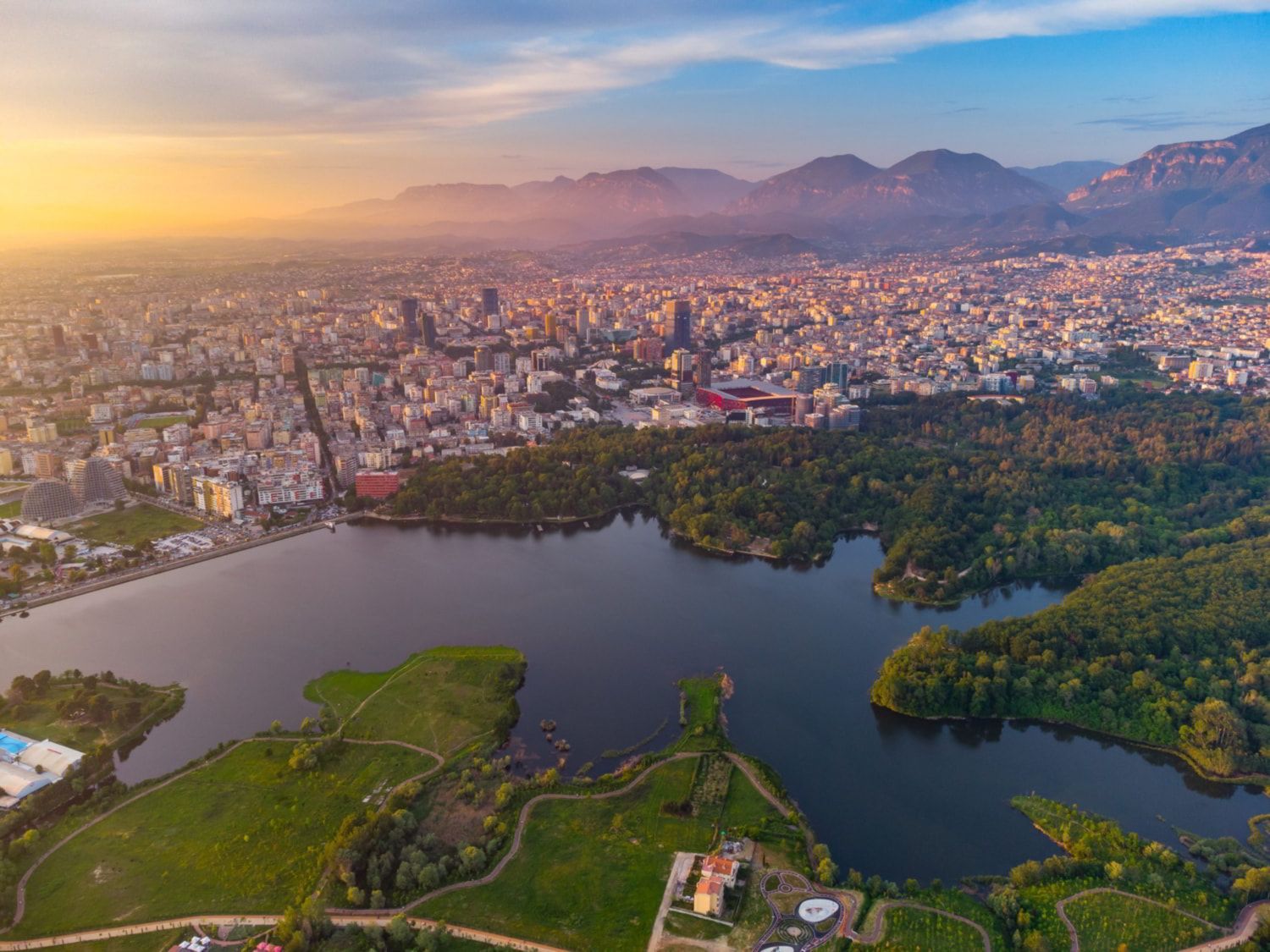
What makes the Grand Park special is its role as a civic landscape. It is not only a place for tourists; it is part of daily life for residents. People use it in the morning for exercise, in the afternoon for strolls, and in the evening for gatherings. That local rhythm gives the park a real sense of authenticity. One little-known fact is that the area around the lake and its green edges has changed significantly over time, reflecting broader shifts in how Tirana has developed as a modern city. Another interesting point is that the park’s size makes it one of the city’s most important environmental buffers, helping create a calmer microclimate in a fast-growing urban area.
The Grand Park is also a good place for visitors who want to slow down their sightseeing. Tirana can feel energetic and busy, and the park offers balance. You can walk, rent a bike in some areas, sit by the water, or simply watch the city’s social life unfold. It is not a museum-like attraction with a fixed narrative; it is a lived-in urban landscape. That flexibility is part of its appeal, because it can fit into a trip in many different ways: as a morning workout, a midday break, a sunset walk, or a family outing.
The easiest way to get there is by taxi, ride-hailing, or a long walk from central Tirana. Many travelers also reach the park from nearby neighborhoods on foot. If you are already exploring central landmarks, it makes sense to build in a walking break and head toward the lake. Since the park is broad, choose a route that matches the part you want to see most, whether that is the waterfront, the tree-lined paths, or the recreational zones.
Wear comfortable shoes because the park is best enjoyed on foot.
If you like a local atmosphere, spend time watching how residents use the park rather than focusing only on the scenery.
Bring water and expect a leisurely pace; this is a place for lingering, not rushing.
Discover more hidden gems you might love.
Mexico City
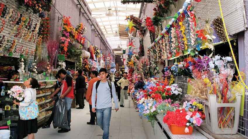
## Description La Merced Market is one of **Mexico City’s largest and most iconic traditional markets**, a bustling labyrinth of colors, aromas, and flavors that captures the essence of everyday Mexican life. For centuries, it has served as a vital trading hub where locals shop for fresh produce, meats, spices, textiles, and even artisanal crafts. Today, it stands as both a cultural landmark and a culinary paradise, drawing in visitors eager to experience authentic Mexican street food and local traditions. What makes La Merced unique is its **immense size and variety**—it is estimated to cover more than **400,000 square meters** and contains thousands of stalls spread across multiple buildings and outdoor areas. Here, you can find everything from exotic fruits and chilies to traditional sweets and handmade kitchen tools. A little-known fact is that La Merced’s history dates back to the **16th century**, when it served as an indigenous trading ground after the Spanish conquest. Another fascinating detail is that the market is considered one of the **most diverse food hubs in Latin America**, with vendors selling ingredients that reflect Mexico’s rich cultural fusion, from pre-Hispanic staples to colonial-era imports. ## Location La Merced Market is located in **Mexico City, Mexico**, within the **Venustiano Carranza borough**, just east of the city’s historic center. Its exact location makes it an easy stop for anyone exploring the heart of the capital. ### Recommendation on How to Get There The most convenient way to reach La Merced is by **Mexico City Metro**. Simply take **Line 1 (the pink line)** and get off at **La Merced Station**, which connects directly to the market area. Taxis and rideshare apps like Uber are also widely available, but due to traffic in the historic center, the metro is often the fastest and most affordable option. If you are walking from the **Zócalo**, the market is about 20 minutes away on foot. ## Tips To make the most of your visit to La Merced Market, here are some useful tips: * **Go Early**: Arriving in the morning lets you see the market at its most vibrant and ensures the freshest food options. * **Bring Cash**: Most vendors do not accept cards, so carry small bills and coins for easy purchases. * **Sample the Street Food**: Try classics like **tacos de suadero, tlacoyos, fresh fruit juices, and tamales**. * **Dress Comfortably**: The market is vast and can get crowded, so wear light clothing and comfortable shoes. * **Be Mindful of Safety**: As with any large urban market, keep an eye on your belongings and avoid flashing valuables. * **Explore Beyond Food**: The market also offers textiles, pottery, household goods, and religious items worth browsing. * **Hire a Guide (Optional)**: If it’s your first visit, consider joining a guided food tour for a deeper understanding of the market’s history and hidden gems. ## Conclusion La Merced Market is not just a shopping destination—it’s a cultural experience that immerses visitors in the **authentic spirit of Mexico City**. With its overwhelming variety of goods, historic roots, and unbeatable street food scene, it is a must-visit for anyone who wants to discover the daily life and flavors of Mexico beyond the typical tourist spots. ## FAQ **1. What is La Merced Market famous for?** It is famous for its massive size, wide variety of products, and authentic Mexican street food. **2. What are the market’s opening hours?** La Merced is generally open **every day from early morning until late evening**, though hours may vary by stall. **3. Is La Merced safe for tourists?** Yes, it’s generally safe if you remain cautious—stick to the busier areas, keep your belongings secure, and avoid visiting at night. **4. Can I find vegetarian or vegan food options at La Merced?** Yes, there are many vegetarian-friendly dishes such as tlacoyos, quesadillas with squash blossoms, and fresh fruit juices. **5. How does La Merced compare to other markets in Mexico City?** While markets like Coyoacán or San Juan are smaller and more tourist-oriented, La Merced offers a raw, authentic, and immersive local experience. **6. Is it worth visiting with kids?** Yes, though parents should be prepared for large crowds and keep children close by in the busier sections. ## Links * [Mexico City Official Tourism Website](https://mexicocity.cdmx.gob.mx/)
GemVoyage Team • World
Bali
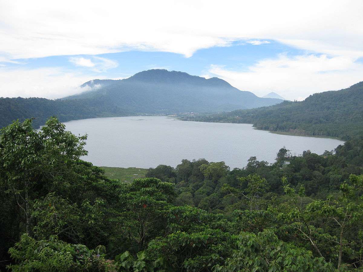
## Description Lake Tamblingan is one of Bali’s most enchanting natural wonders—a serene caldera lake nestled in the highlands of northern Bali. Surrounded by dense rainforest and ancient temples, it offers a tranquil escape from the island’s bustling tourist hubs. Unlike the more commercialized lakes nearby, Tamblingan remains largely untouched, preserving its spiritual and ecological integrity. Formed inside an ancient volcanic caldera, Lake Tamblingan is part of the “Twin Lakes” trio, alongside Lake Buyan and Lake Bratan. The lake’s surface sits at an elevation of 1,217 meters (3,993 feet), giving it a cool alpine climate that contrasts with Bali’s tropical lowlands. The misty mornings, mirror-like waters, and lush surroundings make it a favorite among photographers and nature lovers. One little-known fact is that the lake is surrounded by temples dating back to the 10th century, remnants of the ancient Tamblingan civilization. Among these is Pura Dalem Tamblingan, located near the village of Gubug. Another fascinating detail: the lake’s water level fluctuates dramatically with the seasons. During heavy rains, some temples become partially submerged, creating surreal scenes that look like something out of a dream. ## Location Lake Tamblingan is located in **Indonesia**, on the island of **Bali**, within the **Buleleng Regency**. It lies near the village of **Munduk**, at the foot of **Mount Lesung**, in the northern highlands of the island. ### How to Get There: - **By Car or Scooter**: The most flexible way to reach Lake Tamblingan is by hiring a private driver or renting a scooter. From Ubud or Canggu, the journey takes around 2–2.5 hours. - **By Tour**: Several eco and trekking tours include Lake Tamblingan in their itinerary, often paired with visits to Lake Buyan and the surrounding jungle. - **Navigation Tip**: Set your GPS to “Camp Tamblingan” rather than just “Lake Tamblingan” to avoid being misdirected. The drive itself is scenic, winding through rice terraces, waterfalls, and cloud forests. ## Tips for Visitors To make the most of your visit to Lake Tamblingan, consider these helpful tips: - **Visit at Sunrise**: Early morning offers the most magical light and misty atmosphere. It’s also the best time for photography. - **Dress Warmly**: The highland climate can be surprisingly chilly, especially at dawn. Bring layers. - **Trekking Options**: Join a guided trek through the rainforest to explore hidden temples and wildlife. Don’t forget hiking shoes and insect repellent. - **Photography**: Bring a tripod for long exposure shots. The lake is popular for pre-wedding and landscape photography. - **Respect Local Customs**: Many temples around the lake are still active. Dress modestly and be respectful when visiting. - **Entrance Fee**: A small fee (around 10,000 IDR) is charged at the gate, which covers access to both Lake Tamblingan and Lake Buyan. ## Conclusion Lake Tamblingan is a peaceful, mystical destination that showcases Bali’s natural beauty and spiritual heritage. With its pristine waters, ancient temples, and cool mountain air, it’s a perfect retreat for those seeking tranquility, adventure, or a deeper connection to the island’s cultural roots. ## FAQ **1. What is the best time to visit Lake Tamblingan?** The dry season (April to October) is ideal for trekking and photography. However, the rainy season creates dramatic water levels and misty landscapes. **2. Is there an entrance fee?** Yes, a small fee of around 10,000 IDR grants access to Lake Tamblingan and Lake Buyan. **3. Can I swim in Lake Tamblingan?** Swimming is not recommended due to spiritual significance and lack of designated swimming areas. **4. Are there guided tours available?** Yes, several local operators offer trekking and cultural tours around the lake and nearby temples. **5. How long should I plan to stay?** A half-day visit is sufficient for sightseeing and photography. Full-day treks are available for more immersive experiences. **6. Is Lake Tamblingan suitable for children?** Yes, but trekking paths may be challenging for very young children. Families should opt for shorter walks or scenic viewpoints. ## Links - [Lake Tamblingan – Wikipedia](https://en.wikipedia.org/wiki/Lake_Tamblingan)
GemVoyage Team • World
Petén
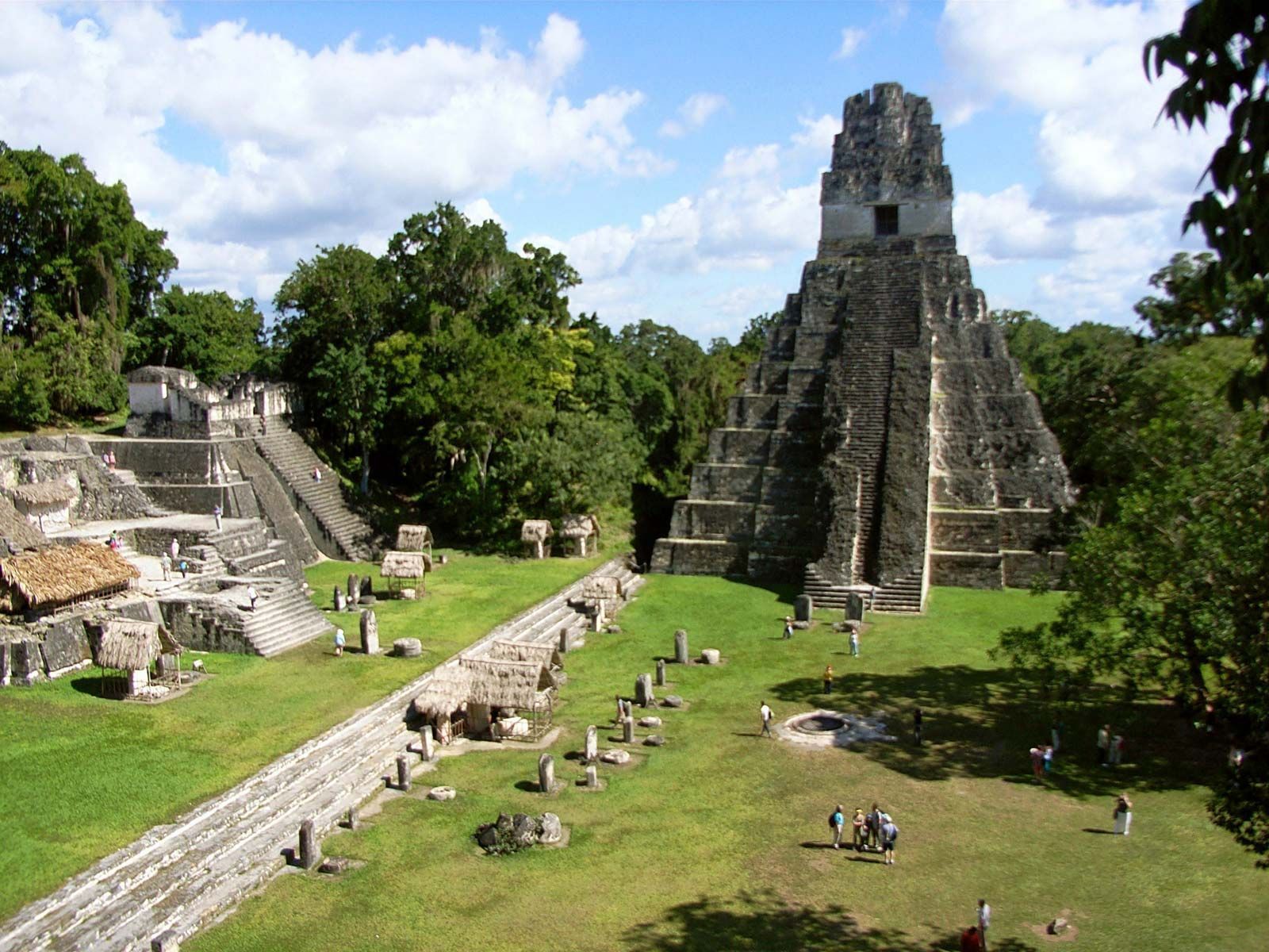
## Description Tikal is one of the most important archaeological sites of the ancient Maya civilization, located within the dense lowland rainforests of Petén, Guatemala. The city’s towering limestone pyramids and plazas emerge above the jungle canopy, offering dramatic skyline views and a palpable sense of antiquity. During its Classic period, Tikal was a major political and ceremonial center; excavated palaces, stelae and ballcourts tell stories of dynasties, calendrical knowledge and cosmology. Visitors to Tikal are rewarded by a blend of monumental architecture and biodiverse rainforest. The temples and palaces rise through the tree canopy, so that from the tops of several structures you can peer over treetops to see other pyramids peeking through the foliage. This interplay between built environment and ecology is central to Tikal’s power: the jungle both conceals and reveals the city, a dramatic reminder of centuries of abandonment and recovery. Tikal’s primary plaza, monumental ballcourts, and the iconic Temple IV and Temple II complexes preserve stelae with carved inscriptions, verifiable sequences of rulers and artistic programs that speak to the city’s political sophistication. Archaeological work also reveals complex water-management features, reservoirs and causeways that allowed the city to sustain a significant population despite a seasonal tropical climate. Walking among Tikal’s temples at sunrise — when the jungle stirs and howler monkeys call — is an evocative way to connect with a complex culture of architecture, ritual and astronomy. Early morning light transforms the stone into warm tones and dramatically silhouettes the temple profiles against the rising sun, making sunrise a photographer’s favorite. Guides can point out hieroglyphic inscriptions, sacred alignments and the role of celestial observation in Maya ritual life. ## Location Tikal National Park is in Guatemala’s northern Petén department. The site is reachable via a short flight to Flores (Mundo Maya International Airport, FLV) or by road from Flores town, which serves as the usual visitor base. Most visitors use Flores as a staging point and arrange shuttle transfers, guided tours, or independent day trips to the park. ## Tips - **Arrive at dawn for temples and wildlife:** Early mornings provide cooler light, bird activity and quieter conditions before larger tour groups arrive. Dawn visits also let you catch the moment when the jungle wakes up. - **Hire a knowledgeable guide:** Licensed local guides provide historical context, translate glyphs and explain how architecture relates to Maya cosmology — essential for getting more from the site. - **Bring insect repellent and sun protection:** The lowland rainforest environment includes biting insects and strong sunlight in exposed plazas. Lightweight long sleeves and repellent are useful. - **Plan logistics from Flores:** Book shuttle transfers or organized tours in advance during high season, and consider staying overnight near the site for sunset or sunrise experiences. - **Support responsible tourism:** Choose certified guides and operators that follow park rules and contribute to local community economies. ## Conclusion Tikal is both a monumental archaeological treasure and a living jungle experience: temples puncturing the canopy, dawn rituals and carved monuments make it an essential site for understanding Maya civilization. For travelers seeking a mix of natural soundscapes, wildlife encounters and a deep cultural history, Tikal offers an immersive and emotionally resonant experience. ## FAQ - **Q: How long should I spend at Tikal?** A: A full day is ideal to cover the main plazas, climb at least one temple for panoramic views, and explore the northern and central complexes. Two days allow for a slower pace, birding and visiting lesser-known complexes. - **Q: Can visitors climb the temples at Tikal?** A: Access to climbable areas varies — some temples allow limited ascent to designated viewpoints while others are closed to protect fragile structures. Follow current park rules and signage. - **Q: What wildlife might I see at Tikal?** A: Expect to see howler monkeys, toucans, parrots, motmots and a range of tropical birds; early morning is best for birdwatching and animal activity. - **Q: Is it safe for solo travelers and families?** A: The site is generally safe during daylight hours. Follow standard travel precautions: use licensed guides, secure belongings, carry water and avoid isolated areas after dark. - **Q: Are there accommodations near the park?**n+ A: Flores and nearby villages offer a range of lodgings from budget hostels to mid-range hotels; staying in Flores provides easy access to flights and transportation. ## Links - [Tikal — Wikipedia](https://en.wikipedia.org/wiki/Tikal)
GemVoyage Team • World
Prague
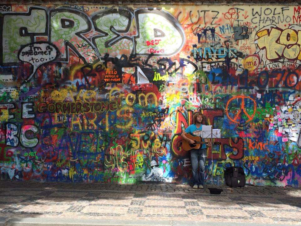
## Description The Lennon Wall in Prague is more than just a colorful stretch of graffiti—it’s a living canvas of freedom, peace, and artistic expression. Located in the historic Malá Strana district, this wall has been a symbol of resistance and hope since the 1980s. After the assassination of John Lennon in 1980, an anonymous artist painted his portrait and lyrics from Beatles songs on the wall. What followed was a spontaneous outpouring of messages, poems, and protest art, especially from Czech youth who saw Lennon as a symbol of Western ideals and freedom during the oppressive communist regime. Over the years, the wall has evolved into a dynamic, ever-changing mural. Layers of paint have buried the original artwork, but the spirit remains. Today, it features vibrant messages of love, peace, and solidarity, often reflecting global movements and local causes. Though the wall is now semi-regulated—with spray painting banned and only designated areas open to public contributions—it continues to attract artists and visitors from around the world. A little-known fact: the wall is owned by the Sovereign Military Order of Malta, whose nearby buildings include a church and embassy. Until 2019, anyone could freely paint on the wall, but due to misuse, it’s now monitored by CCTV and curated by selected artists. ## Location The Lennon Wall is located in **Czechia (Czech Republic)**, in the **Prague Region**, within the city of **Prague**. Specifically, it sits in **Velkopřevorské náměstí (Grand Priory Square)** in the **Malá Strana** neighborhood, just a short walk from the iconic Charles Bridge. ### How to Get There: - **By Foot**: From Charles Bridge, it’s a 5-minute walk through the charming streets of Malá Strana. - **By Tram**: Take tram lines 12, 15, 20, or 22 to Malostranské náměstí, then walk toward the French Embassy. - **By Metro**: The nearest metro station is Malostranská (Line A), followed by a short walk. - **By Bus**: Bus line 194 stops at Malostranské náměstí, close to the wall. Its central location makes it an easy and worthwhile stop on any Prague itinerary. ## Tips for Visitors To make the most of your visit to the Lennon Wall, keep these tips in mind: - **Visit Early or Late**: The wall gets crowded during midday, especially with tour groups. Early morning or evening offers a quieter experience. - **Bring a Marker**: While spray painting is banned, you can still leave a message with a marker in designated areas. - **Respect the Art**: Avoid defacing existing artwork. The wall is a shared space for expression, not vandalism. - **Pair with Nearby Attractions**: Combine your visit with a stroll through Kampa Island or a walk across Charles Bridge. - **Photography**: The wall changes frequently, so it’s a great spot for unique photos. Look for Beatles lyrics or peace symbols hidden among the layers. - **Learn the History**: Guided walking tours often include the Lennon Wall and provide deeper insight into its role during the communist era. ## Conclusion The Lennon Wall in Prague is a vibrant testament to the power of art and free expression. Born from grief and rebellion, it has grown into a global symbol of peace, creativity, and resilience. Whether you're a Beatles fan, a history buff, or simply a curious traveler, the wall offers a colorful and meaningful experience in the heart of Prague. ## FAQ **1. Is there an entrance fee to visit the Lennon Wall?** No, the wall is in a public square and free to visit. **2. Can I paint on the Lennon Wall?** Spray painting is banned, but you can leave messages with markers in designated areas. **3. What is the significance of the Lennon Wall?** It began as a tribute to John Lennon and became a symbol of protest against the communist regime in Czechoslovakia. **4. How often does the wall change?** Constantly. New artwork and messages appear regularly, making each visit unique. **5. Is the wall monitored?** Yes, it’s under CCTV surveillance to prevent vandalism and ensure respectful contributions. **6. What else is nearby?** Charles Bridge, Kampa Island, and the French Embassy are all within walking distance. ## Links - [Lennon Wall – Wikipedia Overview](https://en.wikipedia.org/wiki/Lennon_Wall) - [Prague Tourist Information – Lennon Wall Guide](https://praguetouristinformation.com/en/sightseeing/lesser-town/john-lennon-wall)
GemVoyage Team • World
Ostrava
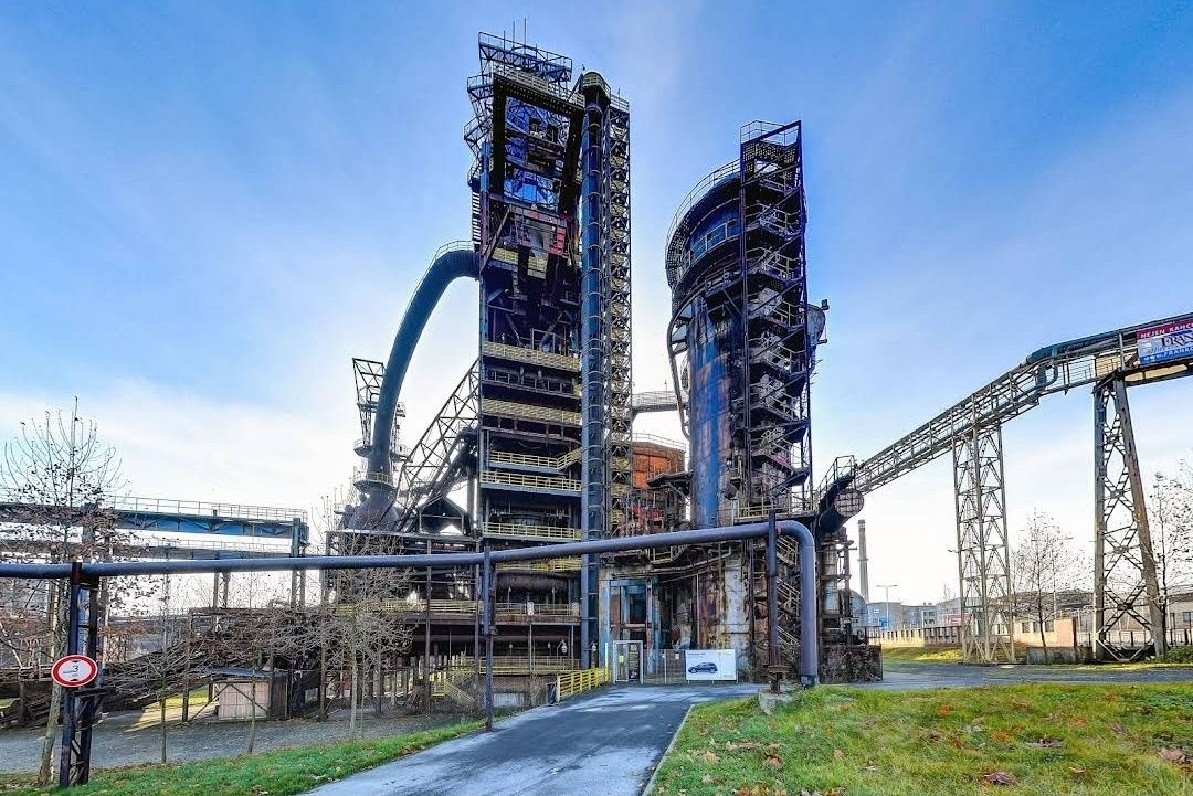
## Description The **Bolt Tower** is one of the most striking symbols of Ostrava, Czech Republic, blending modern architecture with the city’s rich industrial past. Rising from the remains of a former blast furnace at the **Lower Vítkovice industrial complex**, this futuristic structure stands as a testament to the city’s transformation from a coal and steel hub into a vibrant cultural destination. Completed in 2015, the tower was named after legendary Jamaican sprinter **Usain Bolt**, who personally attended the opening ceremony. With its sleek, glass-and-steel design perched atop an old furnace, Bolt Tower symbolizes speed, energy, and forward motion while preserving a strong connection to history. One of the most unique aspects of the tower is that it combines **modern architecture with industrial heritage**—a contemporary structure extending the life of a blast furnace that once powered the region’s economy. Inside, visitors can enjoy a panoramic café, exhibition spaces, and a sky-high observation deck that offers some of the best views in Ostrava. A little-known fact is that Bolt Tower reaches a total height of **77 meters**, making it the highest accessible point in Ostrava. Another interesting detail is that its construction was part of a broader effort to redevelop the Lower Vítkovice complex into a UNESCO-listed cultural and educational center, now hosting concerts, festivals, and exhibitions. ## Location Bolt Tower is located in the **Lower Vítkovice (Dolní Vítkovice) area** of **Ostrava**, the third-largest city in the **Moravian-Silesian Region of the Czech Republic**. The tower sits within the former industrial heart of the city, now transformed into a major cultural attraction. Getting there is straightforward. From **Ostrava’s city center**, the site is only about 2 kilometers away. Visitors can easily take a tram (line 1 or 2) to the **Dolní Vítkovice stop**, which is just a short walk from the tower. If traveling by train, Ostrava’s **hlavní nádraží (main station)** is a quick 10-minute ride by public transport. For international visitors, Ostrava is accessible by train from Prague, Brno, or Kraków, and the **Leoš Janáček Airport** is just 20 kilometers away. ## Tips Here are some helpful tips to make your visit to Bolt Tower more enjoyable: * **Book tickets in advance** – Especially during weekends or events at Lower Vítkovice, the observation deck and café can get busy. * **Visit in the evening** – The city lights at night create a spectacular view, and the tower itself is beautifully illuminated. * **Dress appropriately** – The observation deck is open-air, so it can get windy, especially in autumn and winter. * **Combine with a tour of Lower Vítkovice** – Don’t miss the guided tours of the former blast furnaces and other industrial sites nearby. * **Enjoy the café** – The tower’s café offers not just drinks and snacks, but also a relaxing atmosphere with unbeatable views. * **Check the events calendar** – Lower Vítkovice often hosts concerts, exhibitions, and festivals, which can make your visit even more special. ## Conclusion The **Bolt Tower in Ostrava** is more than just a lookout point—it’s a bold symbol of transformation and renewal. By combining modern design with the remains of a historic blast furnace, it offers visitors a unique perspective on Ostrava’s past and future. Whether you come for the breathtaking views, the cultural experiences, or simply to enjoy a coffee above the city skyline, Bolt Tower is an unmissable highlight of the Czech Republic’s industrial heritage. ## FAQ **1. Why is it called Bolt Tower?** It was named after Usain Bolt, the world-famous sprinter, who attended the opening and symbolized speed and energy. **2. How tall is Bolt Tower?** The tower reaches a total height of 77 meters, making it the highest accessible point in Ostrava. **3. Can I visit the inside of the blast furnace as well?** Yes, guided tours of the Lower Vítkovice blast furnaces and industrial complex are available and highly recommended. **4. Is Bolt Tower family-friendly?** Absolutely. Children can enjoy the observation deck and the impressive industrial setting, though young kids should be supervised due to heights. **5. When is the best time to visit?** Late afternoon or evening is ideal for enjoying both daytime views and the city lights at night. **6. Do I need to buy a separate ticket for the café?** No, access to the café is included with the general admission ticket to Bolt Tower. ## Links * [Visit Ostrava – Tourism Information](https://www.visitostrava.eu)
GemVoyage Team • World
Cologne
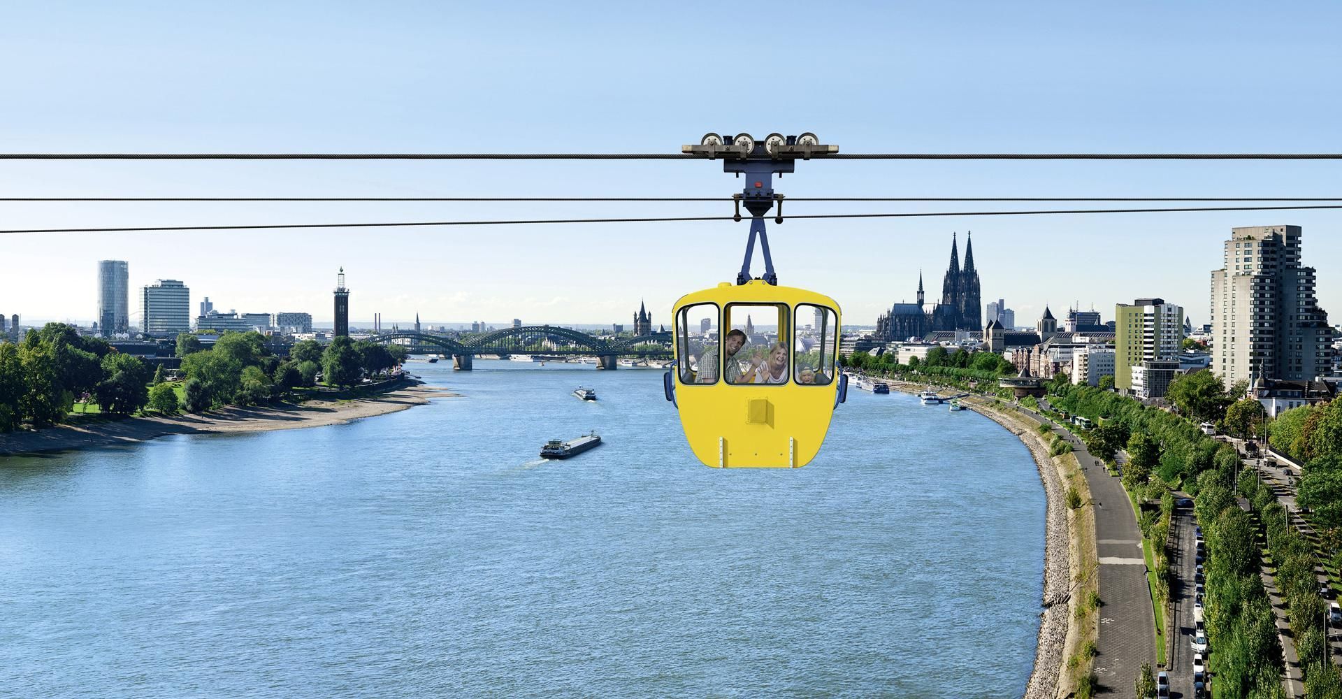
## Description The Cologne Cable Car, also known as the Rhine Ropeway, is one of the city’s most enjoyable short experiences because it turns a simple river crossing into a memorable view-filled ride. Instead of treating transport as a functional necessity, the ropeway makes movement itself the attraction. As you travel above the Rhine, Cologne opens up in a new way, with the river, bridges, skyline, and green spaces unfolding beneath you. It is a modestly scaled experience, but one that offers a surprisingly vivid perspective on the city. What makes the cable car special is that it adds movement and elevation to a city that is often explored on foot. From above, familiar landmarks look different. You can see how the river shapes Cologne’s geography, how the city spreads out on both sides, and how the waterfront becomes part of the urban image. For many visitors, the ride is also a welcome break from walking. It is relaxing, scenic, and slightly unusual, which is a strong combination for a city stop. One little-known fact is that the ropeway is often appreciated as much for the sense of orientation it gives as for the actual ride. It helps visitors understand how Cologne sits in relation to the Rhine. Another is that it has a long-standing reputation as one of the city’s more family-friendly and easy-to-enjoy attractions because it does not require a major time investment but still produces a strong memory. The experience works particularly well in good weather, when visibility is clear and the river views feel open. It also pairs nicely with other riverside activities or a park visit. The ride itself is not long, so the best strategy is to treat it as part of a wider Cologne outing rather than as the entire plan for the day. Still, even as a short activity, it stands out because it gives you a literal new angle on the city. ## Location The Cologne Cable Car is in Cologne, Germany, crossing the Rhine and connecting areas of the city on opposite sides of the river. It is close enough to central Cologne and the riverside to be convenient for visitors already exploring the city center. The easiest way to reach it is by local transport or by walking from nearby attractions on the riverbank. Because Cologne’s center is relatively visitor-friendly, the ropeway often fits naturally into a walk along the Rhine. Depending on your route, you can ride one way and then continue exploring the waterfront or nearby park areas on foot. If you are building a day in Cologne, the ropeway works especially well with riverside sightseeing, the old town, or a relaxed walk through nearby green spaces. It is a small addition that can make the whole day feel more varied. ## Tips Go on a clear day if possible. Visibility makes a huge difference to the experience. Check operating times before you go, especially if you are visiting in a shoulder season or outside peak travel periods. If you enjoy photography, try the ride at different times of day for different light on the river and city. Use it as part of a larger walking route so the experience feels connected rather than isolated. Even though the ride is short, it can become one of the more distinctive memories from a Cologne trip because it changes the scale of the city so quickly. On foot, Cologne can feel intimate and grounded; from the ropeway, it suddenly feels open and legible. That shift is valuable for first-time visitors who are still learning how the city fits together around the river. It is the kind of simple experience that gives practical orientation as well as enjoyment. The cable car is also a good reminder that not every worthwhile attraction needs a long museum visit or a complex reservation. Sometimes a single perspective change can be enough to make a city feel more coherent. In Cologne, where the Rhine is such a defining feature, that change is especially effective. You see how the city relates to the river instead of only moving beside it, and that perspective often makes the rest of the day’s sightseeing easier to understand. ## Conclusion The Cologne Cable Car offers a short but memorable aerial perspective on the Rhine and the city. It is a simple attraction that adds a fun, scenic dimension to a Cologne visit. ## FAQ **How long is the cable car ride?** It is a short crossing, designed more for scenery than for distance. **Is it worth doing?** Yes, especially if you enjoy views, riverside cityscapes, and light activities. **Can I use it as transport?** It can function that way, but most visitors treat it as an attraction. **Is it good for families?** Yes, it is one of the more relaxed and accessible Cologne experiences. **When is the best time to ride?** On a clear day with good visibility, ideally when the light is favorable. ## Links - [Official website](https://www.koelner-seilbahn.de/en/) - [Wikipedia](https://en.wikipedia.org/wiki/Cologne_Cable_Car)
GemVoyage Team • World

Comments