Discover extraordinary places shared by our community of travelers
Laos
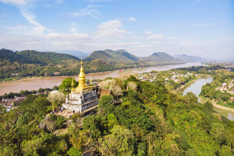
## Description Phou Si, often referred to as Mount Phou Si or Phu Si, is a sacred hill that rises 100 meters above the UNESCO World Heritage city of Luang Prabang in Laos. It’s not just a geographical landmark—it’s a spiritual and cultural centerpiece that offers panoramic views, serene temples, and a glimpse into the soul of Lao Buddhism. The name “Phou Si” translates to “Sacred Hill,” and true to its name, it’s dotted with shrines, Buddha statues, and two prominent temples: Wat Tham Phou Si halfway up, and Wat Chom Si at the summit. The climb to the top involves ascending over 300 steps, but the reward is a breathtaking 360-degree view of Luang Prabang, the Mekong and Nam Khan rivers, and the surrounding jungle-clad mountains. Along the way, saffron-robed monks stroll the leafy paths, incense drifts through the air, and small altars invite quiet reflection. A little-known fact: legend has it that a powerful Naga (a mythical serpent deity) once lived on the hill, adding a mystical layer to its spiritual significance. Another hidden treasure is a small chapel said to house a footprint of the Buddha, tucked along one of the stairways—a detail often missed by hurried visitors. ## Location Phou Si is located in **Laos**, within the **Luang Prabang Province**, in the city of **Luang Prabang**. It sits in the heart of the old town peninsula, bordered by the Mekong River on one side and the Nam Khan River on the other. ### How to Get There: - **By Foot**: Most visitors reach Phou Si by walking from nearby attractions like the Royal Palace Museum or the Night Market. The two main stairways are accessible from Sisavangvong Road and Thanon Phousi. - **By Tuk-Tuk**: If you're staying farther out, a tuk-tuk can drop you off at either entrance. - **By Bicycle**: Luang Prabang is bike-friendly, and cycling to the base of Phou Si is a scenic option. Its central location makes it an easy and essential stop on any Luang Prabang itinerary. ## Tips for Visitors To make the most of your visit to Phou Si, consider these tips: - **Go for Sunset**: The summit offers one of the best sunset views in Laos. Arrive early to secure a good spot—it's popular! - **Bring Water**: The climb can be steep and humid, especially in the afternoon. Hydration is key. - **Wear Comfortable Shoes**: The stairways are uneven in places, so sturdy footwear is recommended. - **Respect the Sacredness**: Dress modestly and be mindful of local customs. Offerings like incense and flowers are available for purchase along the way. - **Explore Both Routes**: Ascend via the Nam Khan side for scenic statues and descend via the Royal Palace side for a shorter walk. - **Entrance Fee**: Expect to pay around 20,000 Kip (~$2.50 USD), collected halfway up the hill. ## Conclusion Phou Si is more than just a viewpoint—it’s a spiritual journey, a cultural experience, and a photographer’s dream. With its sacred temples, mythical legends, and sweeping vistas, it captures the essence of Luang Prabang and offers a moment of peace above the city’s gentle bustle. ## FAQ **1. How many steps are there to reach the top of Phou Si?** There are over 300 steps, depending on the route you take—328 from the Royal Palace side and 355 from the Nam Khan side. **2. What is the best time to visit Phou Si?** Sunset is the most popular time, but early morning offers tranquility and cooler temperatures. **3. Is there an entrance fee?** Yes, the fee is approximately 20,000 Kip, payable halfway up the hill. **4. Can children climb Phou Si?** Yes, but supervision is recommended due to the steep stairways. **5. Are there restrooms or shops at the summit?** No facilities at the top, but vendors sell drinks and offerings near the base. **6. Is Phou Si wheelchair accessible?** Unfortunately, due to the stair-only access, it is not suitable for visitors with mobility issues. ## Links - [Mount Phou Si – Wikipedia](https://en.wikipedia.org/wiki/Phou_Si)
GemVoyage Team • World
Bruges
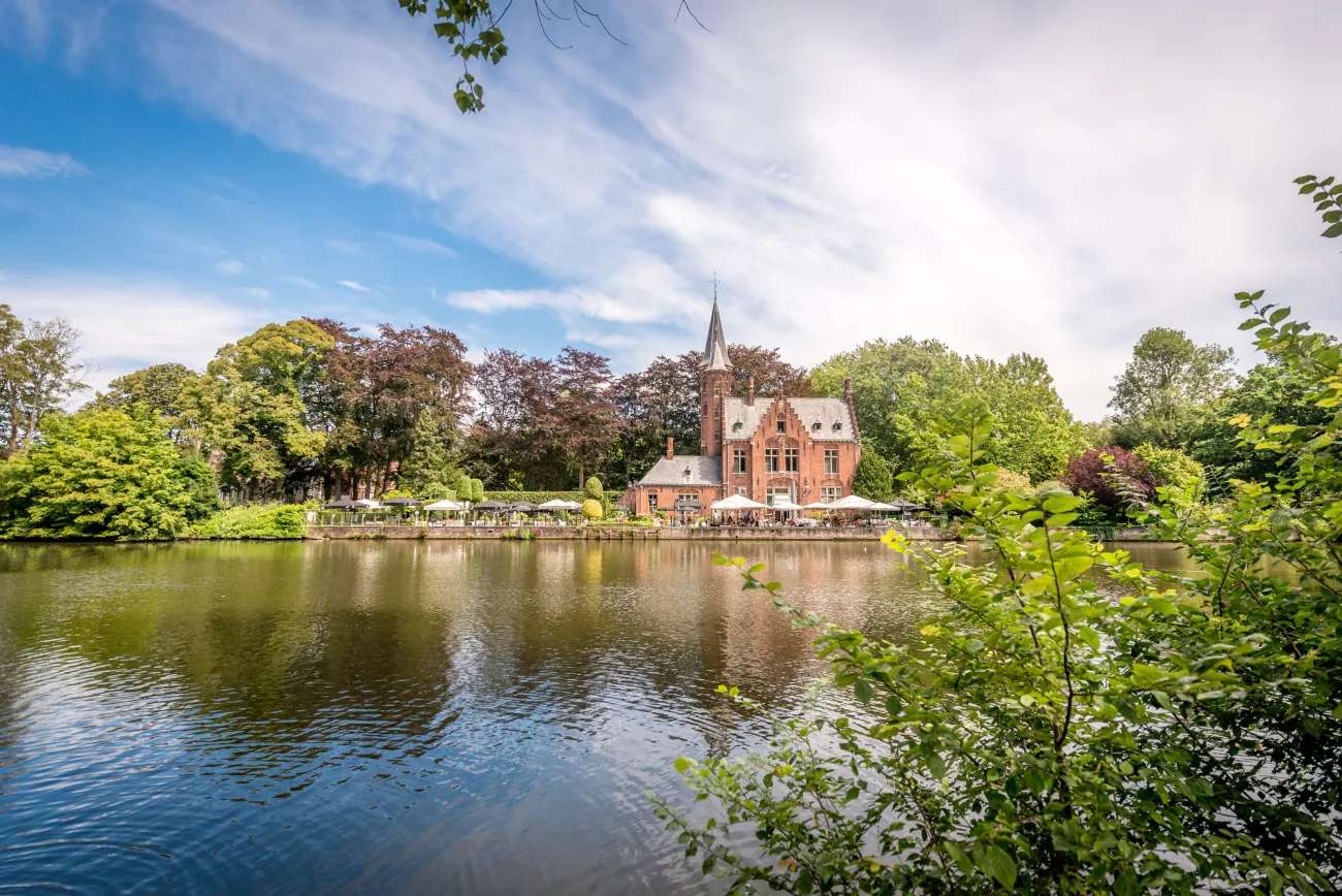
## Description Minnewater Lake, often called the “Lake of Love,” is one of Bruges’ most enchanting and romantic spots. Nestled at the southern edge of the medieval city, this tranquil lake is surrounded by lush greenery, swans gliding across the water, and historic architecture that seems pulled from a fairy tale. It’s a place where time slows down, inviting visitors to stroll, reflect, and soak in the serene beauty of Bruges. The name “Minnewater” comes from the Dutch word “minne,” meaning love, and the lake is steeped in legend. One popular tale tells of a young woman named Minna who died of heartbreak near the lake, and her lover Stromberg buried her beneath the waters—thus giving the lake its poetic name. Today, couples often cross the Minnewater Bridge and share a kiss, believing it will seal their love forever. A little-known fact: Minnewater Lake was originally a reservoir created in the 13th century to regulate water levels and prevent flooding in Bruges. It also served as a docking point for cargo barges from Ghent until the late 18th century. The lake’s historical role in the city’s development adds depth to its romantic reputation. ## Location Minnewater Lake is located in **Belgium**, in the **Flemish Region**, within the city of **Bruges**. It sits just south of the city center, adjacent to the Begijnhof (Beguinage) and near the city ramparts. ### How to Get There: - **By Train**: From Bruges Railway Station, it’s a short 10-minute walk to the lake. Just follow signs toward Minnewaterpark. - **By Bus**: Bus lines 12 and 14 stop near the lake. Get off at Brugge Station Perron 1 and walk toward the park entrance. - **By Foot**: If you’re exploring Bruges on foot, Minnewater is easily accessible from the historic center and makes a perfect stop before or after visiting the Begijnhof. Its proximity to the train station makes it an ideal first or last stop on your Bruges itinerary. ## Tips for Visitors To make the most of your visit to Minnewater Lake, consider these helpful tips: - **Visit at Sunrise or Sunset**: The soft light and peaceful atmosphere make these times ideal for photography and quiet reflection. - **Bring a Camera**: The lake, bridge, and surrounding park offer postcard-perfect views—especially with swans in the frame. - **Explore Nearby Sites**: Don’t miss the Begijnhof, the Gunpowder Tower (Poertoren), and the neo-Gothic Kasteel de la Faille, now a restaurant. - **Pack a Picnic**: The park surrounding the lake is perfect for a relaxed lunch or snack. - **Attend a Festival**: Minnewater Park hosts occasional cultural events and music festivals—check local listings if you’re visiting in summer. - **Avoid Peak Hours**: Weekends can be crowded. For a more intimate experience, visit on a weekday morning. ## Conclusion Minnewater Lake is a poetic blend of history, legend, and natural beauty. Whether you're drawn by its romantic lore, its peaceful setting, or its role in Bruges’ medieval past, the Lake of Love offers a timeless escape in one of Europe’s most charming cities. ## FAQ **1. Is Minnewater Lake free to visit?** Yes, the lake and surrounding park are open to the public and free of charge. **2. Can I take a boat ride on Minnewater Lake?** No, boating is not permitted on the lake, as it’s part of a protected park area. **3. Is Minnewater Lake suitable for children?** Absolutely. The park is safe and spacious, with plenty of room for kids to explore. **4. Are there restaurants nearby?** Yes, including the Kasteel de la Faille, a neo-Gothic castle turned restaurant, and several cafés near the park. **5. Is Minnewater Lake accessible year-round?** Yes, the park is open year-round, though spring and summer offer the most vibrant scenery. **6. Can I visit Minnewater Lake with a dog?** Yes, dogs are welcome in the park but should be kept on a leash. ## Links - [Minnewater Lake – Visit Bruges Overview](https://www.visitbruges.be/en/things-to-do/culture-and-heritage/minnewater-lake-love) - [Minnewater Lake and Park – Discover World Guide](https://discover-world.eu/en/countries/belgium/brugge/minnewater-lake-and-park-in-bruges) - [Minnewater – Wikipedia](https://de.wikipedia.org/wiki/Minnewater)
GemVoyage Team • World
Osun
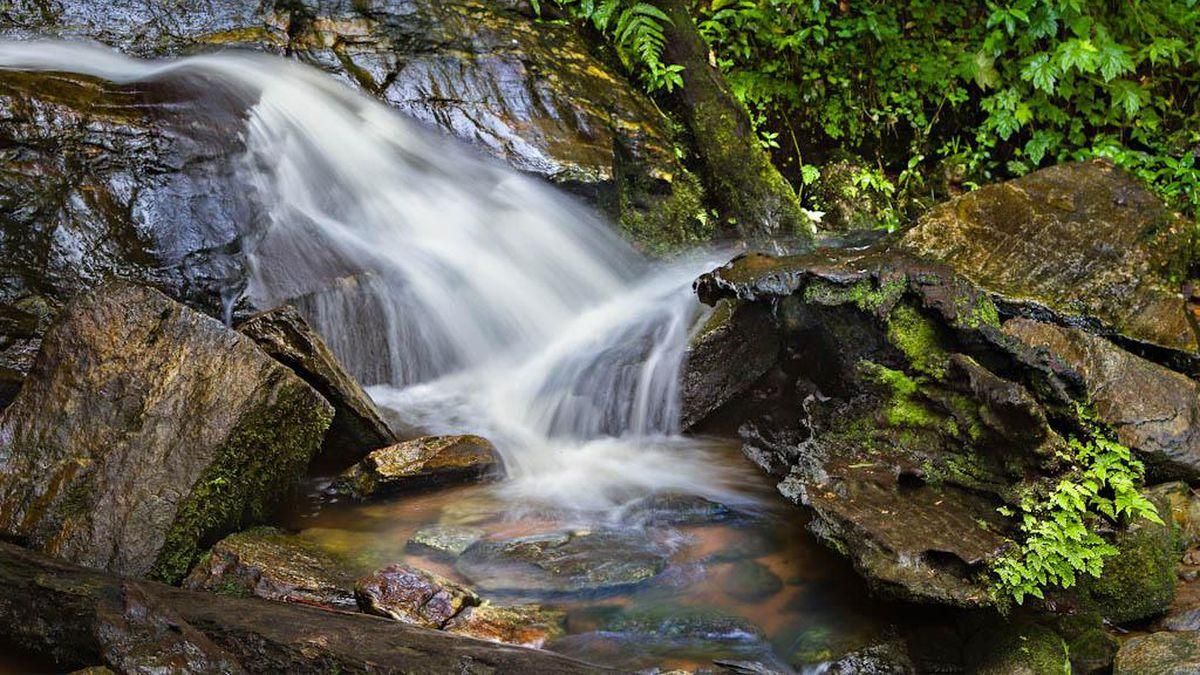
## Description **Erin Ijesha Waterfall**, also known as **Olumirin Waterfall**, is one of Nigeria’s most spectacular natural attractions. Located in Osun State, the waterfall is renowned for its **seven cascading levels**, each offering a different landscape, atmosphere, and difficulty level for visitors. The experience goes beyond a simple waterfall viewing; it is a physical ascent through layered natural terraces, tropical vegetation, and rocky pathways that reveal the geology and biodiversity of southwestern Nigeria. What makes Erin Ijesha Waterfall particularly unique is the **progression of the levels**. The first and second levels are accessible and refreshing, ideal for casual visitors. As you climb higher, the environment becomes cooler, the terrain more dramatic, and the views increasingly rewarding. The final levels lead to a plateau historically associated with ancient settlements and spiritual practices. According to oral traditions, some of these upper areas served as **refuge sites for migrating groups** and locations for community gatherings during the pre-colonial period. A little-known fact is that the waterfall has long been connected to Yoruba mythology. Local lore suggests that the waters were believed to possess cleansing qualities, and that early communities viewed the entire waterfall system as a **symbol of renewal and protection**. Another interesting detail is that the upper levels were once used as strategic vantage points due to their height and difficult access, helping local groups monitor surrounding valleys. The blend of nature, culture, and mild adventure makes Erin Ijesha Waterfall a standout destination for hikers, photographers, and anyone interested in the lesser-explored regions of Nigeria. ## Location **Country:** Nigeria **Region:** Southwest Nigeria **State:** Osun State **Nearest Town:** Ijesha (near Erin Ijesha community) The waterfall sits within a lush forested area about an hour from major towns like Ilesa. ### How to Get There * **By car:** * The most reliable method. From Ilesa or Osogbo, follow the highway toward Erin Ijesha. The entrance to the waterfall is clearly marked, and parking is available. * **By public transportation:** * Local buses and shared taxis connect Ilesa to Erin Ijesha, followed by a short walk to the site. * **By tour service:** * Some tour operators from Lagos, Ibadan, or Osogbo include the waterfall in day-trip itineraries. ## Tips * **Wear sturdy shoes:** The climb is steep in places, and water splashes make some rocks slippery. * **Bring water and stay hydrated:** The ascent to the upper levels can be physically demanding, especially in warm weather. * **Start early:** Morning visits provide cooler temperatures, softer light, and fewer crowds. * **Expect to get wet:** Mist rises from the falls, especially near the lower levels. * **Fitness level matters:** The higher levels are not recommended for visitors with mobility issues. * **Consider hiring a local guide:** They can help you navigate the steeper paths and share the historical context tied to the site. * **Avoid visiting during heavy rain:** The water flow becomes intense and pathways can become hazardous. ## Conclusion Erin Ijesha Waterfall is one of Nigeria’s most rewarding natural attractions, offering a combination of adventure, cultural history, and scenic beauty. Its seven distinct levels provide a progressively immersive experience, making it suitable for both casual travelers and more ambitious climbers. For anyone exploring southwestern Nigeria, the waterfall stands as a must-see landmark. ## FAQ **1. How many levels does Erin Ijesha Waterfall have?** The waterfall has **seven levels**, each with its own landscape and difficulty. **2. Is swimming allowed?** Light splashing and dipping are common at the lower levels, but deeper swimming is not typical due to rocky terrain. **3. How long does the hike take?** Reaching the upper levels can take **1 to 2 hours**, depending on fitness and pace. **4. Is there an entrance fee?** Yes. A modest fee is typically required for maintenance and site management. **5. Are guides available at the site?** Yes. Local guides can be hired at the entrance. **6. What is the best time to visit?** Dry season or early rainy season when the paths are safe and the water flow is strong but manageable. ## Links * [Osun State tourism info](https://www.osunstate.gov.ng)
GemVoyage Team • World
Bali
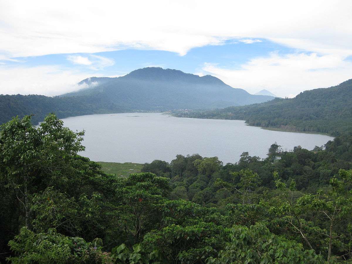
## Description Lake Tamblingan is one of Bali’s most enchanting natural wonders—a serene caldera lake nestled in the highlands of northern Bali. Surrounded by dense rainforest and ancient temples, it offers a tranquil escape from the island’s bustling tourist hubs. Unlike the more commercialized lakes nearby, Tamblingan remains largely untouched, preserving its spiritual and ecological integrity. Formed inside an ancient volcanic caldera, Lake Tamblingan is part of the “Twin Lakes” trio, alongside Lake Buyan and Lake Bratan. The lake’s surface sits at an elevation of 1,217 meters (3,993 feet), giving it a cool alpine climate that contrasts with Bali’s tropical lowlands. The misty mornings, mirror-like waters, and lush surroundings make it a favorite among photographers and nature lovers. One little-known fact is that the lake is surrounded by temples dating back to the 10th century, remnants of the ancient Tamblingan civilization. Among these is Pura Dalem Tamblingan, located near the village of Gubug. Another fascinating detail: the lake’s water level fluctuates dramatically with the seasons. During heavy rains, some temples become partially submerged, creating surreal scenes that look like something out of a dream. ## Location Lake Tamblingan is located in **Indonesia**, on the island of **Bali**, within the **Buleleng Regency**. It lies near the village of **Munduk**, at the foot of **Mount Lesung**, in the northern highlands of the island. ### How to Get There: - **By Car or Scooter**: The most flexible way to reach Lake Tamblingan is by hiring a private driver or renting a scooter. From Ubud or Canggu, the journey takes around 2–2.5 hours. - **By Tour**: Several eco and trekking tours include Lake Tamblingan in their itinerary, often paired with visits to Lake Buyan and the surrounding jungle. - **Navigation Tip**: Set your GPS to “Camp Tamblingan” rather than just “Lake Tamblingan” to avoid being misdirected. The drive itself is scenic, winding through rice terraces, waterfalls, and cloud forests. ## Tips for Visitors To make the most of your visit to Lake Tamblingan, consider these helpful tips: - **Visit at Sunrise**: Early morning offers the most magical light and misty atmosphere. It’s also the best time for photography. - **Dress Warmly**: The highland climate can be surprisingly chilly, especially at dawn. Bring layers. - **Trekking Options**: Join a guided trek through the rainforest to explore hidden temples and wildlife. Don’t forget hiking shoes and insect repellent. - **Photography**: Bring a tripod for long exposure shots. The lake is popular for pre-wedding and landscape photography. - **Respect Local Customs**: Many temples around the lake are still active. Dress modestly and be respectful when visiting. - **Entrance Fee**: A small fee (around 10,000 IDR) is charged at the gate, which covers access to both Lake Tamblingan and Lake Buyan. ## Conclusion Lake Tamblingan is a peaceful, mystical destination that showcases Bali’s natural beauty and spiritual heritage. With its pristine waters, ancient temples, and cool mountain air, it’s a perfect retreat for those seeking tranquility, adventure, or a deeper connection to the island’s cultural roots. ## FAQ **1. What is the best time to visit Lake Tamblingan?** The dry season (April to October) is ideal for trekking and photography. However, the rainy season creates dramatic water levels and misty landscapes. **2. Is there an entrance fee?** Yes, a small fee of around 10,000 IDR grants access to Lake Tamblingan and Lake Buyan. **3. Can I swim in Lake Tamblingan?** Swimming is not recommended due to spiritual significance and lack of designated swimming areas. **4. Are there guided tours available?** Yes, several local operators offer trekking and cultural tours around the lake and nearby temples. **5. How long should I plan to stay?** A half-day visit is sufficient for sightseeing and photography. Full-day treks are available for more immersive experiences. **6. Is Lake Tamblingan suitable for children?** Yes, but trekking paths may be challenging for very young children. Families should opt for shorter walks or scenic viewpoints. ## Links - [Lake Tamblingan – Wikipedia](https://en.wikipedia.org/wiki/Lake_Tamblingan)
GemVoyage Team • World
Tirana
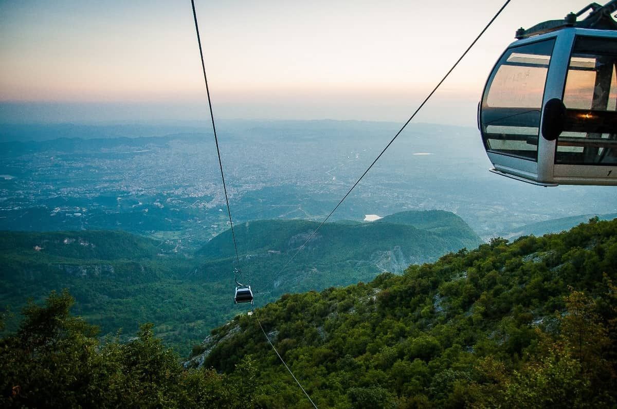
## Description The Dajti Mountain Cable Car, often known as Dajti Express, is one of Tirana’s most memorable experiences because it turns the journey itself into the attraction. Instead of treating the mountains as a distant backdrop, the cable car lifts you gradually from the city’s edge into a greener, quieter world with wide views over the Albanian capital and beyond. For visitors who want to understand Tirana’s geography in a single motion, it is an ideal introduction. What makes the ride special is the contrast. One moment you are near the urban fringe, where streets, buildings, and traffic define the scene; the next, you are moving above slopes and trees with a far more relaxed atmosphere. That dramatic shift is part of the appeal. You do not need to be an adventure traveler to enjoy it. The cable car is accessible, scenic, and unusually effective at showing how quickly the landscape rises around the city. One little-known fact is that Mount Dajti has long served as a natural escape for Tirana residents who want cooler air and open space without going far from the city. Another is that the cable car experience is often most rewarding on days with clear visibility, when the city and surrounding hills spread out in layers below you. The view changes with weather and season, so repeat visitors often discover a different mood each time. The attraction is also useful because it can anchor a full half-day rather than just a single ride. Once you arrive at the upper station, you can enjoy the mountain environment, look out over the city, eat, walk, or simply take in the more spacious setting. That makes the cable car more than transportation. It is a gentle transition from urban Albania to a mountain viewpoint with a strong sense of release. ## Location The cable car operates on the eastern outskirts of Tirana, Albania, ascending toward Mount Dajti and the surrounding national park area. It is close enough to the city to make for an easy excursion, but far enough to feel like a proper escape. Because it is on the edge of the urban area, it is especially convenient to pair with other Tirana sights in the same day. The simplest way to get there is by taxi, ride-hailing service, or private car. Public transport options may require more planning, so many visitors prefer a direct ride to the departure point. If you are staying in central Tirana, plan for a comfortable transfer rather than assuming you can walk. Once at the base station, the cable car itself is straightforward and easy to use. To make the most of the visit, choose a clear day if possible and avoid squeezing the ride into the last minutes of your schedule. The experience is best when you can spend time both on the ascent and at the top. ## Tips - Go on a clear day for the best views. Visibility is a major part of the experience. - Check operating hours and weather conditions before leaving central Tirana. - Bring a light layer, especially if you plan to stay at the top. The temperature can feel different from the city. - Combine the cable car with time at the summit rather than treating it only as a quick ride. - Use the ride to understand Tirana’s geography. It is one of the easiest ways to see how the city meets the surrounding hills. ## Conclusion The Dajti Mountain Cable Car is a simple but memorable way to rise above Tirana and enjoy a calmer, greener setting. It turns a mountain outing into an easy, scenic experience that works for many kinds of travelers. ## FAQ ### Is the cable car suitable for families? Yes. It is a relaxed activity that does not require special fitness or equipment, which makes it a good option for a wide range of visitors. ### How long should I plan for the visit? Plan for more than just the ride. The ascent, time at the top, and return journey together can easily become a half-day outing. ### Is it better to go in the morning or afternoon? Either can work, but morning often offers clearer air and a calmer start. Late afternoon can also be attractive if you want softer light and a more relaxed pace. ### Do I need a guide? No. The cable car is easy to use on your own, and most visitors can enjoy it independently.
GemVoyage Team • World
Denmark
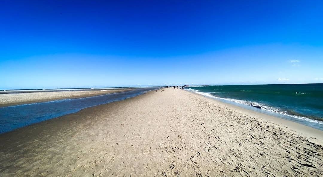
## Description **Grenen** is one of Denmark’s most extraordinary natural landmarks, where two seas—the **Skagerrak** and the **Kattegat**—dramatically meet. At the northernmost tip of Jutland, visitors can witness the unique sight of waves colliding from different directions, creating a visible line in the water. This natural phenomenon makes Grenen one of Denmark’s most visited and photographed attractions. The area is not just about the sea—it’s a place of raw beauty. The sandbar stretches far out into the water, and as you walk along the beach, you’ll be surrounded by endless skies, shifting sands, and fresh sea air. Many visitors find it both a peaceful and powerful experience. **Little-known facts**: * Grenen has been gradually moving northeast for centuries due to sand and tidal currents. The spit extends a few meters every year, reshaping the coastline bit by bit. * The area is also a paradise for birdwatchers. Because of its geographical location, Grenen is one of the best places in Denmark to spot migratory birds, especially in spring and autumn. --- ## Location Grenen is located just outside **Skagen**, a charming coastal town at the very top of **North Jutland**, in **Denmark**. Skagen itself is known for its distinctive yellow houses with red-tiled roofs and its long artistic tradition, but Grenen is the crown jewel of the area. ### How to get there: * From **Skagen town center**, Grenen is about 3 kilometers away. Visitors can walk, cycle, or take the famous **Sandormen tractor bus**, which transports people directly to the tip of the spit. * If you’re coming from other parts of Denmark, you can reach Skagen by train or bus via Frederikshavn, or by car along the scenic coastal roads. Once in Skagen, Grenen is well signposted and easy to access. --- ## Tips * **Wear suitable shoes**: The sandy terrain can be uneven, and the walk to the very tip can take around 20–30 minutes. Comfortable shoes or sandals are recommended. * **Don’t swim**: Although it may be tempting, swimming at Grenen is strictly discouraged. The currents where the two seas meet are extremely strong and unpredictable. * **Try the Sandormen ride**: The tractor-pulled bus called *Sandormen* has been operating since 1947 and is a fun, practical way to reach the very end of the spit. * **Bring a camera**: The meeting of the seas is a stunning photo opportunity, especially at sunset when the sky lights up in beautiful colors. * **Visit Skagen’s attractions too**: After Grenen, explore Skagen’s art museums, lighthouses, and the nearby Råbjerg Mile, Denmark’s largest migrating sand dune. --- ## Conclusion Grenen is more than just Denmark’s northern tip—it’s a rare natural spectacle where two seas clash, shaping the land and leaving visitors in awe. Its ever-changing landscape, combined with rich wildlife and historical charm, makes it a must-see for anyone traveling to North Jutland. Whether you walk barefoot in the sand, take the Sandormen, or simply sit and admire the horizon, a visit to Grenen promises memories of Denmark’s wild and beautiful coastline. --- ## FAQ **1. What makes Grenen special?** Grenen is where the Skagerrak and Kattegat seas meet, creating a visible collision of waves. It’s also one of Denmark’s most scenic natural areas. **2. Can you swim at Grenen?** No, swimming is not allowed due to extremely strong and dangerous currents at the meeting point of the seas. **3. How do you get to the very tip of Grenen?** You can walk along the beach from Skagen or take the Sandormen tractor bus, which drives visitors directly to the point. **4. Is Grenen suitable for children and families?** Yes, Grenen is family-friendly. Kids usually enjoy the tractor ride and spotting seals or birds along the coast, but parents should keep them away from the water’s edge. **5. Are there animals to see at Grenen?** Yes, Grenen is known for bird migration, and you may also see seals resting on the sandbanks. **6. When is the best time to visit Grenen?** Grenen is open year-round, but the best times are spring and summer for pleasant weather, or autumn for dramatic skies and bird migration. --- ## Links * [Visit Denmark – Grenen](https://www.visitdenmark.com/denmark/plan-your-trip/grenen-skagen-gdk640520) * [Sandormen Tractor Bus – Official Info](https://www.sandormen.dk/)
GemVoyage Team • World
Tokyo
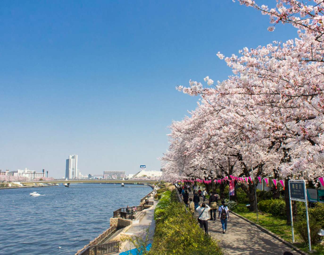
## Description Sumida Park is a serene riverside oasis in the heart of Tokyo, offering a refreshing contrast to the city’s fast-paced urban energy. Stretching along both banks of the Sumida River, the park is located between the Azumabashi and Sakurabashi bridges and provides stunning views of the Tokyo Skytree rising above the skyline. It’s a favorite spot for locals and tourists alike, especially during spring when the park transforms into one of Tokyo’s most celebrated cherry blossom viewing locations. The park’s history dates back to the Edo period, when the riverbanks were popular gathering spots for hanami (cherry blossom viewing), festivals, and leisurely strolls. Today, Sumida Park continues that tradition with over 600 cherry trees lining the paths, creating a tunnel of blossoms that draws thousands of visitors each year. In summer, the park becomes a prime viewing location for the Sumida River Fireworks Festival, one of Japan’s oldest and most spectacular pyrotechnic displays. A little-known fact: the cherry trees in Sumida Park were planted under the orders of shogun Tokugawa Yoshimune in the 18th century, making the park not only a natural retreat but also a living piece of Tokyo’s cultural heritage. Another quirky detail is the nearby Asahi Beer Tower, visible from the park, which was designed to resemble a frothy mug of beer—a playful architectural nod to the area’s modern flair. ## Location Sumida Park is located in **Japan**, in the **Kanto region**, within the **city of Tokyo**. It spans the **Taito and Sumida wards**, with entrances near the historic Asakusa district and the Sumida River waterfront. ### How to Get There - **By Train**: The park is a five-minute walk from Asakusa Station, served by the Ginza Line, Asakusa Line, Tobu Isesaki Line, and Tsukuba Express. - **By Bus**: Several local buses stop near Asakusa and Sumida Park. - **By Water Bus**: The Tokyo Water Bus docks near the park and offers scenic rides to destinations like Odaiba and Hamarikyu Gardens. - **By Foot or Bike**: The park is easily accessible from nearby neighborhoods and is ideal for walking or cycling along the river. Its central location makes it a convenient stop during a day of sightseeing in eastern Tokyo. ## Tips - **Visit During Cherry Blossom Season**: Late March to early April is peak bloom time. Arrive early to avoid crowds and secure a good picnic spot. - **Stay for the Fireworks**: If visiting in late July, plan to attend the Sumida River Fireworks Festival. Arrive hours in advance for a good viewing location. - **Bring a Camera**: The park offers excellent photo opportunities, especially with Tokyo Skytree in the background. - **Explore Both Sides of the River**: Cross the Sakurabashi pedestrian bridge to enjoy views from both banks. - **Pack a Picnic**: There are no large restaurants inside the park, but nearby Asakusa has plenty of takeout options. - **Check for Events**: Seasonal festivals and cultural performances are often held in the park—check local listings for details. ## Conclusion Sumida Park is a tranquil yet culturally rich destination in Tokyo, offering scenic river views, seasonal beauty, and a deep connection to the city’s history. Whether you're admiring cherry blossoms, watching fireworks, or simply enjoying a quiet walk, the park provides a memorable escape in the heart of the metropolis. ## FAQ **1. Is there an entrance fee to Sumida Park?** No, the park is free and open to the public year-round. **2. When is the best time to visit Sumida Park?** Spring (late March to early April) for cherry blossoms and summer (late July) for the fireworks festival. **3. Are there restrooms and facilities in the park?** Yes, there are public restrooms and seating areas throughout the park. **4. Can I bring pets to Sumida Park?** Yes, pets are allowed but should be kept on a leash and cleaned up after. **5. Is the park wheelchair accessible?** Most paths are flat and accessible, though some areas may have uneven terrain. **6. Are there guided tours available?** While not specific to the park, many Asakusa walking tours include Sumida Park as part of their itinerary. ## Links - [Sumida Park – Japan National Tourism Organization](https://www.japan.travel/en/spot/2114/)
GemVoyage Team • World
Pakistan
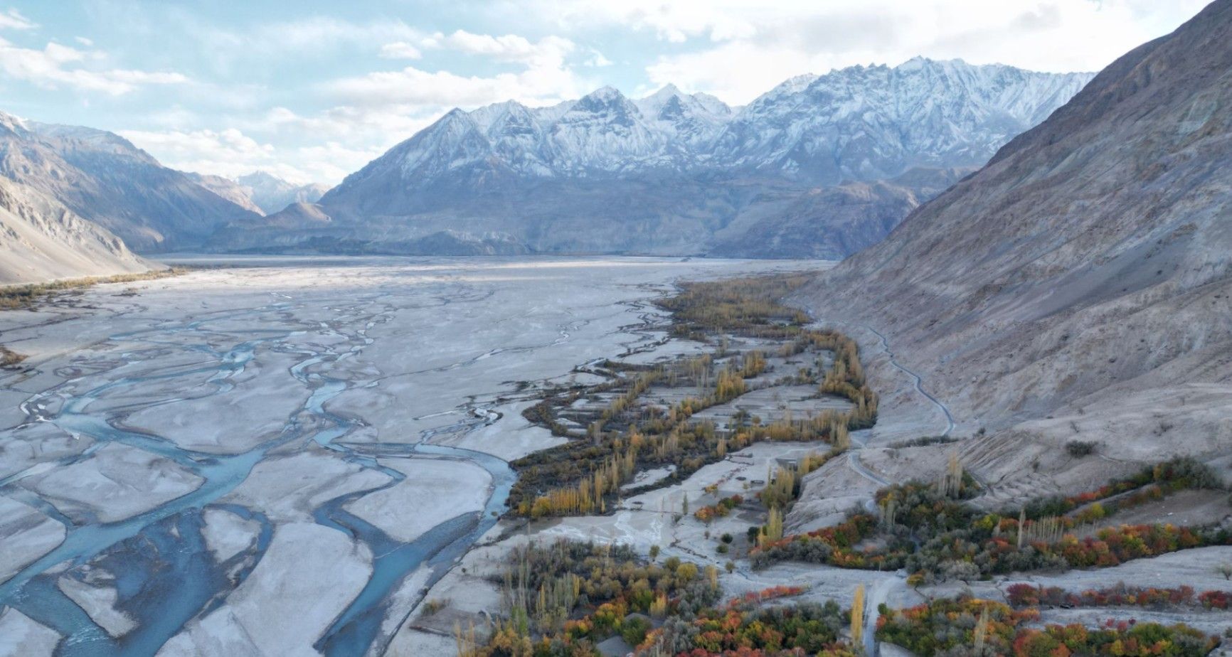
## Description **Nangma Valley**, located in northern Pakistan’s Gilgit-Baltistan region, is a breathtaking alpine valley that remains one of the country’s best-kept secrets. Renowned for its majestic granite spires, lush meadows, and pristine alpine landscapes, Nangma Valley is a paradise for trekkers, climbers, and photographers. What sets Nangma Valley apart is its untouched natural beauty and relative seclusion compared to more famous destinations like Hunza or Skardu. The valley is dotted with soaring rock towers—some over **5,000 meters** high—making it one of the premier destinations for **rock climbing and mountaineering** in Pakistan. Peaks such as **K7**, **K6**, and **Amin Brakk (the “Great Tower”)** have attracted world-class climbers from around the globe, yet the area still retains its peaceful, uncommercialized character. A lesser-known fact about Nangma Valley is that it is often referred to as **the “Yosemite of Pakistan”**, thanks to its sheer granite walls and the way sunlight paints the cliffs golden at dawn and dusk. The valley is also home to small Balti villages, where visitors can experience traditional hospitality and life in one of the most remote corners of the world. ## Location Nangma Valley lies in **Gilgit-Baltistan**, in the **Karakoram Range** of **northern Pakistan**, near the town of **Hushe** in the **Ghangche District**. It is about 130 kilometers east of **Skardu**, the main gateway to the region. To reach Nangma Valley, travelers first fly or drive to **Skardu**—flights from Islamabad are the most common route, taking about an hour (weather permitting). From Skardu, a scenic drive of approximately 5–6 hours leads to Hushe Village, from where the trek to Nangma Valley begins. The trek itself is moderate and usually takes around **3–4 hours** on foot, passing through alpine pastures and along a clear glacial stream. ## Tips * **Best time to visit:** The valley is most accessible between **June and September**, when the weather is mild, and the snow has melted. * **Pack for mountain weather:** Even in summer, temperatures can drop sharply at night. Warm layers and a sleeping bag are essential. * **Bring proper trekking gear:** Good hiking boots, walking poles, and waterproof clothing are highly recommended. * **Hire local guides and porters:** The Balti guides are knowledgeable about routes, weather, and local customs, and hiring them supports the local economy. * **Camping:** There are several scenic camping sites, such as at the base of Amin Brakk and near the Nangma Glacier. Always follow Leave No Trace principles. * **Photography:** Sunrise and sunset offer the best light for photographing the granite spires and surrounding peaks. * **Acclimatize properly:** Even though Nangma Valley is not at extreme altitude, gradual acclimatization helps prevent altitude sickness. ## Conclusion **Nangma Valley** is a hidden gem for those seeking adventure, solitude, and awe-inspiring mountain scenery. Its towering granite peaks, green meadows, and crystal-clear streams make it one of the most spectacular yet underexplored trekking destinations in Pakistan. Whether you’re an experienced climber or a nature lover looking for tranquility, Nangma Valley promises a journey deep into the heart of the Karakoram’s beauty and serenity. ## FAQ **1. Where is Nangma Valley located?** It’s in Gilgit-Baltistan, near Hushe Village in the Ghangche District, approximately 130 km from Skardu. **2. How do I reach Nangma Valley from Islamabad?** You can fly to Skardu (around 1 hour) or take a 20–22 hour drive via the Karakoram Highway. From Skardu, continue by jeep to Hushe and then trek into the valley. **3. Do I need a trekking permit?** No official permit is required for Nangma Valley itself, but registering with local authorities or the Hushe tourism office is recommended. **4. Is the trek difficult?** The trek to the main campsites is moderate, suitable for most fit travelers. Climbers aiming for higher peaks will need advanced equipment and experience. **5. Can I find accommodation nearby?** Basic guesthouses are available in Hushe Village. In the valley, visitors usually camp or stay in tents arranged by local guides. **6. Is Nangma Valley safe for tourists?** Yes. The valley is peaceful, and local communities are known for their warm hospitality. However, it’s best to travel with a guide and inform authorities of your plans. ## Links * [Pakistan Tourism Development Corporation](https://www.tourism.gov.pk) * [Adventure Pakistan – Trekking and Expeditions](https://www.adventurepakistan.com)
GemVoyage Team • World
.jpg)
Scotland
## Description The Fairy Pools on the Isle of Skye in Scotland are a series of crystal-clear, aqua-blue pools and cascading waterfalls that tumble down from the foothills of the Black Cuillin mountains. These natural pools, fed by the Allt Coire a’ Mhadaidh stream, are renowned for their ethereal beauty and have become one of Skye’s most iconic and photographed attractions. Whether you're a hiker, wild swimmer, or simply a lover of dramatic landscapes, the Fairy Pools offer a magical experience that feels straight out of folklore. The walk to the pools is relatively short—about 2.4 kilometers round trip—and follows a well-maintained gravel path that winds through heather-covered moorland. Along the way, visitors encounter a series of waterfalls and pools, each more striking than the last. The water is so clear that you can see the rocky bottoms and reflections of the surrounding hills, making it a favorite spot for photographers and nature enthusiasts. A little-known fact: the area around the Fairy Pools was the site of the last and bloodiest clan battle in Scottish history—the Battle of Coire na Creiche in 1601 between the MacLeods of Dunvegan and the MacDonalds of Sleat. Legend has it that the stream ran red with blood, a stark contrast to its current tranquil appearance. Another quirky detail is that despite their name, there’s no historical association with fairies—the name “Fairy Pools” only began appearing in guidebooks in the 20th century. ## Location The Fairy Pools are located in **Scotland**, on the **Isle of Skye**, near the village of **Carbost** in the **Highland region**. They sit at the base of the Black Cuillin mountains in **Glen Brittle**, on the western side of the island. ### How to Get There - **By Car**: From Portree, the island’s main town, it’s about a 30-minute drive (20.5 miles) via the B8009 and Glenbrittle road. The route includes single-track roads with passing places. - **By Bus**: Public transport is limited. Buses run to Carbost, but you’ll need to arrange a taxi or walk from there. - **By Tour**: Several guided tours from Portree or Inverness include the Fairy Pools as part of a day trip. - **By Foot**: The walk to the pools begins at the Fairy Pools car park, located near Glenbrittle. From the car park, it’s a 20-minute walk to the first waterfall. ## Tips - **Visit Early or Late**: The site gets crowded during peak hours, especially in summer. Early morning or late afternoon offers better light and fewer visitors. - **Wear Waterproof Footwear**: The path can be muddy and uneven, especially after rain. - **Bring Layers**: Weather on Skye is unpredictable. Pack a waterproof jacket and warm clothing. - **Wild Swimming**: Brave souls can swim in the pools, but the water is icy year-round. A wetsuit is recommended. - **Respect Nature**: Follow the Scottish Outdoor Access Code—take your litter with you and stick to marked paths. - **Parking**: There is a charge for parking at the Fairy Pools car park, which helps maintain the site. ## Conclusion The Fairy Pools on the Isle of Skye are a breathtaking blend of natural beauty and Highland mystique. With their vivid waters, dramatic mountain backdrop, and rich history, they offer a memorable experience for anyone exploring Scotland’s rugged landscapes. ## FAQ **1. Is there an entrance fee to visit the Fairy Pools?** No, the pools are free to visit, but there is a charge for parking. **2. How long is the walk to the Fairy Pools?** The round-trip walk is approximately 2.4 kilometers and takes 40 minutes to 1.5 hours depending on pace and stops. **3. Can I swim in the Fairy Pools?** Yes, wild swimming is allowed, but the water is extremely cold. A wetsuit is recommended. **4. Are the Fairy Pools suitable for children?** Yes, but children should be supervised due to uneven terrain and cold water. **5. Is the site wheelchair accessible?** No, the terrain is rugged and includes steep inclines, making it unsuitable for wheelchairs. **6. What is the best time of year to visit?** Spring and autumn offer mild weather and fewer crowds. Summer is busiest, while winter can be icy and less accessible. ## Links - [Fairy Pools Walk – Isle of Skye Guide](https://www.isleofskye.com/skye-guide/top-ten-skye-walks/fairy-pools) - [Fairy Pools – VisitScotland Overview](https://www.visitscotland.com/info/see-do/fairy-pools-p1770011) - [Fairy Pools – Wikipedia Entry](https://en.wikipedia.org/wiki/Fairy_Pools) Description The Fairy Pools on the Isle of Skye in Scotland are a series of crystal-clear, aqua-blue pools and cascading waterfalls that tumble down from the foothills of the Black Cuillin mountains. These natural pools, fed by the Allt Coire a’ Mhadaidh stream, are renowned for their ethereal beauty and have become one of Skye’s most iconic and photographed attractions. Whether you're a hiker, wild swimmer, or simply a lover of dramatic landscapes, the Fairy Pools offer a magical experience that feels straight out of folklore. The walk to the pools is relatively short—about 2.4 kilometers round trip—and follows a well-maintained gravel path that winds through heather-covered moorland. Along the way, visitors encounter a series of waterfalls and pools, each more striking than the last. The water is so clear that you can see the rocky bottoms and reflections of the surrounding hills, making it a favorite spot for photographers and nature enthusiasts. A little-known fact: the area around the Fairy Pools was the site of the last and bloodiest clan battle in Scottish history—the Battle of Coire na Creiche in 1601 between the MacLeods of Dunvegan and the MacDonalds of Sleat. Legend has it that the stream ran red with blood, a stark contrast to its current tranquil appearance. Another quirky detail is that despite their name, there’s no historical association with fairies—the name “Fairy Pools” only began appearing in guidebooks in the 20th century. Location The Fairy Pools are located in Scotland, on the Isle of Skye, near the village of Carbost in the Highland region. They sit at the base of the Black Cuillin mountains in Glen Brittle, on the western side of the island. How to Get There By Car: From Portree, the island’s main town, it’s about a 30-minute drive (20.5 miles) via the B8009 and Glenbrittle road. The route includes single-track roads with passing places. By Bus: Public transport is limited. Buses run to Carbost, but you’ll need to arrange a taxi or walk from there. By Tour: Several guided tours from Portree or Inverness include the Fairy Pools as part of a day trip. By Foot: The walk to the pools begins at the Fairy Pools car park, located near Glenbrittle. From the car park, it’s a 20-minute walk to the first waterfall. Tips Visit Early or Late: The site gets crowded during peak hours, especially in summer. Early morning or late afternoon offers better light and fewer visitors. Wear Waterproof Footwear: The path can be muddy and uneven, especially after rain. Bring Layers: Weather on Skye is unpredictable. Pack a waterproof jacket and warm clothing. Wild Swimming: Brave souls can swim in the pools, but the water is icy year-round. A wetsuit is recommended. Respect Nature: Follow the Scottish Outdoor Access Code—take your litter with you and stick to marked paths. Parking: There is a charge for parking at the Fairy Pools car park, which helps maintain the site. Conclusion The Fairy Pools on the Isle of Skye are a breathtaking blend of natural beauty and Highland mystique. With their vivid waters, dramatic mountain backdrop, and rich history, they offer a memorable experience for anyone exploring Scotland’s rugged landscapes. FAQ 1. Is there an entrance fee to visit the Fairy Pools? No, the pools are free to visit, but there is a charge for parking. 2. How long is the walk to the Fairy Pools? The round-trip walk is approximately 2.4 kilometers and takes 40 minutes to 1.5 hours depending on pace and stops. 3. Can I swim in the Fairy Pools? Yes, wild swimming is allowed, but the water is extremely cold. A wetsuit is recommended. 4. Are the Fairy Pools suitable for children? Yes, but children should be supervised due to uneven terrain and cold water. 5. Is the site wheelchair accessible? No, the terrain is rugged and includes steep inclines, making it unsuitable for wheelchairs. 6. What is the best time of year to visit? Spring and autumn offer mild weather and fewer crowds. Summer is busiest, while winter can be icy and less accessible. Links Fairy Pools Walk – Isle of Skye Guide Fairy Pools – VisitScotland Overview Fairy Pools – Wikipedia Entry 715 words37 lines4484 characters4520 bytes
GemVoyage Team • World
