GemVoyage Team • World
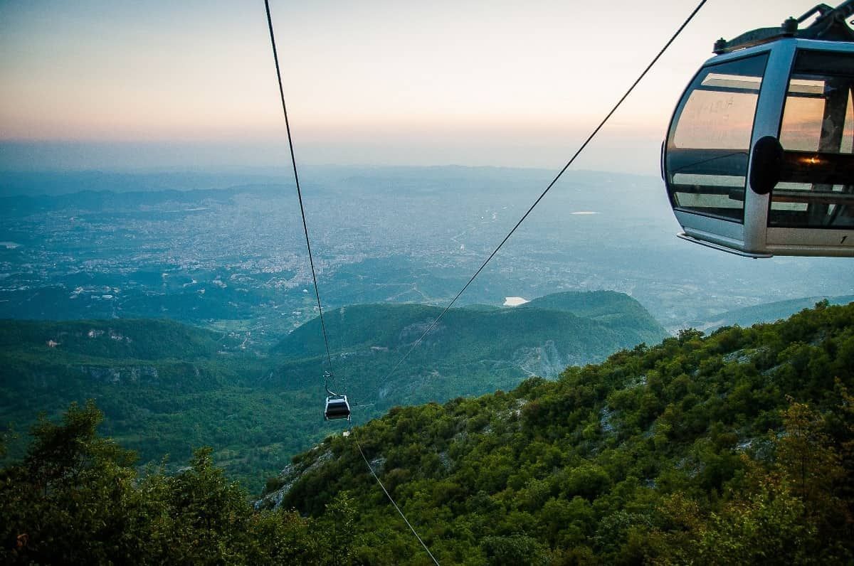
What makes the ride special is the contrast. One moment you are near the urban fringe, where streets, buildings, and traffic define the scene; the next, you are moving above slopes and trees with a far more relaxed atmosphere. That dramatic shift is part of the appeal. You do not need to be an adventure traveler to enjoy it. The cable car is accessible, scenic, and unusually effective at showing how quickly the landscape rises around the city.
One little-known fact is that Mount Dajti has long served as a natural escape for Tirana residents who want cooler air and open space without going far from the city. Another is that the cable car experience is often most rewarding on days with clear visibility, when the city and surrounding hills spread out in layers below you. The view changes with weather and season, so repeat visitors often discover a different mood each time.
The attraction is also useful because it can anchor a full half-day rather than just a single ride. Once you arrive at the upper station, you can enjoy the mountain environment, look out over the city, eat, walk, or simply take in the more spacious setting. That makes the cable car more than transportation. It is a gentle transition from urban Albania to a mountain viewpoint with a strong sense of release.
The simplest way to get there is by taxi, ride-hailing service, or private car. Public transport options may require more planning, so many visitors prefer a direct ride to the departure point. If you are staying in central Tirana, plan for a comfortable transfer rather than assuming you can walk. Once at the base station, the cable car itself is straightforward and easy to use.
To make the most of the visit, choose a clear day if possible and avoid squeezing the ride into the last minutes of your schedule. The experience is best when you can spend time both on the ascent and at the top.
Discover more hidden gems you might love.
Cape Town
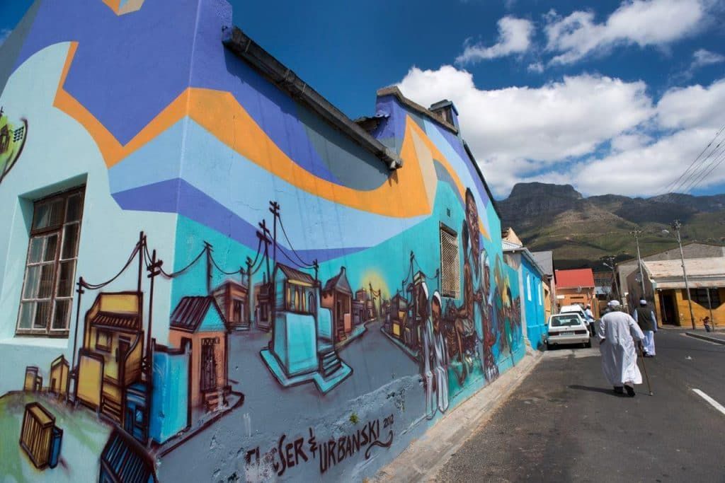
## Description Woodstock Street Art is one of the most vivid ways to experience Cape Town beyond the standard postcard view. Woodstock itself has long been associated with creative energy, urban change, and a strong independent character, and the neighborhood’s walls have become an ever-changing canvas for local and international artists. What makes it special is not just the color or scale of the murals, but the fact that the art is integrated into a living neighborhood rather than isolated in a formal gallery space. Every corner can feel like a discovery, and each block tells a different story about identity, politics, memory, and imagination. Unlike a single museum collection, street art in Woodstock changes constantly. Some murals are large and highly detailed, others are quick, expressive statements. That variety is part of the appeal. Visitors can see work that reflects social issues, community pride, satire, environmental themes, and the evolving face of Cape Town itself. Because the art lives on real buildings and infrastructure, the setting gives it an edge that is hard to replicate indoors. The texture of peeling walls, warehouse façades, and narrow streets adds meaning to the work and makes photographs feel more grounded and authentic. One little-known aspect of Woodstock’s street art scene is how strongly it reflects the neighborhood’s broader reinvention. The area has become one of Cape Town’s most recognizable creative districts, but many of the artworks also respond to the tensions that come with urban change, displacement, and heritage. Another detail that visitors sometimes miss is that the best experience often comes from moving slowly and looking above eye level as well as at street level. Murals are not limited to obvious walls; some of the most memorable pieces appear in alleys, on shutter doors, or on the sides of buildings that you might pass too quickly if you are not paying attention. The result is a destination that rewards curiosity. Woodstock Street Art is not polished in the traditional tourist sense, and that is exactly why it feels alive. It offers a way to understand Cape Town as a city of layers, where creativity and social commentary coexist with everyday street life. For travelers who like walking neighborhoods that feel both artistic and real, it is one of the city’s most compelling stops. ## Location Woodstock is a neighborhood in Cape Town, South Africa, situated close to the central city area and not far from the harbor and Table Mountain routes. Its location makes it easy to combine with other Cape Town sightseeing, especially if you are already exploring the city bowl or nearby cultural districts. Because the artwork is spread through streets and side roads rather than gathered in one single venue, the exact experience depends on the route you choose. The most practical way to explore is usually on foot with a map, a local guide, or a curated street art walk. Some travelers prefer joining a guided tour because guides can explain the meaning behind individual murals and help visitors navigate the area more confidently. Taxis and rideshares can drop you off at a convenient starting point, but the actual appreciation comes from walking slowly. If you are comfortable with urban exploration, pairing your visit with a café stop or market break in Woodstock can make the outing feel more complete. ## Tips Go in daylight. Street art is best appreciated when colors, textures, and details are visible, and daylight also makes navigation easier. A morning or early afternoon visit often gives you better light for photographs and a calmer pace for walking. If you are planning to take many pictures, bring a charged phone or camera because there will likely be more walls and details than you expect. Consider a guide if you want context. Some murals are visually striking on their own, but the stories behind them make the experience richer. A guide can also help you notice pieces that blend into the surroundings or point out artists and themes you might otherwise miss. If you prefer to explore independently, spend extra time reading plaques, following side streets, and looking for smaller works in doorways and corners. Dress practically. Comfortable shoes matter because you will likely walk more than you think. A light bag, water, and sun protection are wise choices, especially during warmer months. It is also sensible to stay aware of your surroundings and follow local advice about which streets are most convenient to explore. Combine the visit with food or coffee. Woodstock has a creative food scene, and stopping for a meal can make the district feel more approachable. Street art is at its best when it becomes part of a broader neighborhood experience rather than a quick photo stop. The more time you give Woodstock, the more the neighborhood’s layered personality becomes visible. ## Conclusion Woodstock Street Art offers a powerful introduction to Cape Town’s creative side. It is colorful, thought-provoking, and best enjoyed as a slow walk through a neighborhood that continues to reinvent itself. ## FAQ ### Is Woodstock Street Art safe to visit? Many visitors explore Woodstock during the day without problems, but like any urban neighborhood, it is smart to stay aware, travel in daylight, and follow local advice. A guided tour can be a good choice if you want extra reassurance. ### Do I need a guide? Not necessarily, but a guide adds value if you want context about the artists and the neighborhood’s history. Independent travelers can still enjoy the area by walking slowly and paying attention to smaller works. ### How long should I spend there? One to two hours can be enough for a quick walk, but more time is better if you want photography, coffee, and a relaxed pace. If you are using the visit to understand the neighborhood rather than just collect images, plan for longer. ### Are the murals always the same? No. That is one of the defining characteristics of street art. Works can be painted over, replaced, or altered, which means the area can look different from one visit to the next. ### Can I visit independently? Yes. Many people do. A map and basic awareness are usually enough for a self-guided visit, although some travelers prefer a structured tour for convenience and context. ## Links - [Wikipedia](https://en.wikipedia.org/wiki/Woodstock,_Cape_Town) - [Cape Town Tourism](https://www.capetown.travel/)
GemVoyage Team • World
Berlin
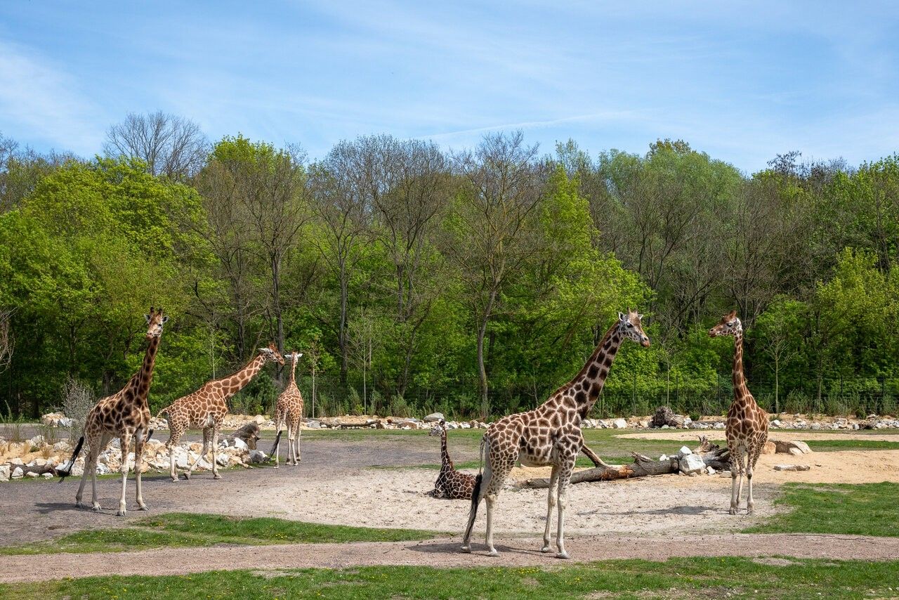
## Description Tierpark Berlin is one of the most impressive zoological parks in Europe and a standout attraction in the German capital. Unlike traditional city zoos, Tierpark Berlin is designed as a vast landscape park where animals live in spacious, naturalistic enclosures spread across rolling lawns, wooded areas, and historic parkland. With more than 160 hectares to explore, it offers a relaxed and immersive experience that feels closer to a nature reserve than a conventional zoo. What makes Tierpark Berlin truly unique is its scale and setting. It is the largest zoo in Europe by area, allowing animals such as elephants, giraffes, bison, and big cats to roam in environments that closely resemble their natural habitats. A little-known fact is that the zoo is located on the former grounds of Friedrichsfelde Palace, an 18th-century baroque residence that still stands at the heart of the park and is open to visitors. Another lesser-known detail is that Tierpark Berlin was established in 1955 in what was then East Berlin, serving as the counterpart to Zoo Berlin in the western part of the city during the Cold War. Today, Tierpark Berlin combines animal conservation, education, and leisure, making it especially appealing for families, nature lovers, and visitors seeking a slower-paced zoo experience. ## Location Tierpark Berlin is located in **Germany**, in the city-state of **Berlin**, within the **Lichtenberg** district. It lies in the eastern part of the city, surrounded by residential neighborhoods and green spaces. Getting there is simple using public transportation. The most convenient option is the U-Bahn (metro): take Line U5 to **Tierpark** station, which exits directly in front of the main entrance. Several bus and tram lines also stop nearby. For visitors traveling by car, parking is available close to the entrances, though public transport is generally the easiest and most efficient way to reach the zoo. ## Tips * Allow plenty of time for your visit; exploring Tierpark Berlin properly can take four to six hours or more. * Wear comfortable walking shoes, as distances inside the park are long. * Consider renting a wagon or using the park’s internal transport options if visiting with small children. * Bring snacks or enjoy one of the on-site cafés and restaurants, especially during longer visits. * Visit on weekdays or outside school holidays to enjoy a quieter atmosphere. * Check feeding times and animal talks in advance for a more educational experience. ## Conclusion Tierpark Berlin offers a unique zoo experience defined by space, greenery, and a strong focus on animal welfare. Its combination of wildlife, historic surroundings, and relaxed atmosphere makes it one of Berlin’s most rewarding attractions for visitors of all ages. ## FAQ **How is Tierpark Berlin different from Zoo Berlin?** Tierpark Berlin is much larger and more spacious, focusing on landscape-style enclosures, while Zoo Berlin is more compact and centrally located. **How long does a visit usually take?** Most visitors spend between four and six hours, though a full day is ideal for seeing everything at a relaxed pace. **Is Tierpark Berlin suitable for children?** Yes, it is very family-friendly, with playgrounds, open spaces, and child-focused facilities. **Is the zoo accessible for people with limited mobility?** Yes, the park has wide paths and is generally accessible, though the large size may require planning. **Can I visit Tierpark Berlin year-round?** Yes, the zoo is open throughout the year, with seasonal highlights in every season. ## Links * [Tierpark Berlin Official Website](https://www.tierpark-berlin.de) * [Visit Berlin Official Tourism Website](https://www.visitberlin.de)
GemVoyage Team • World
Salto
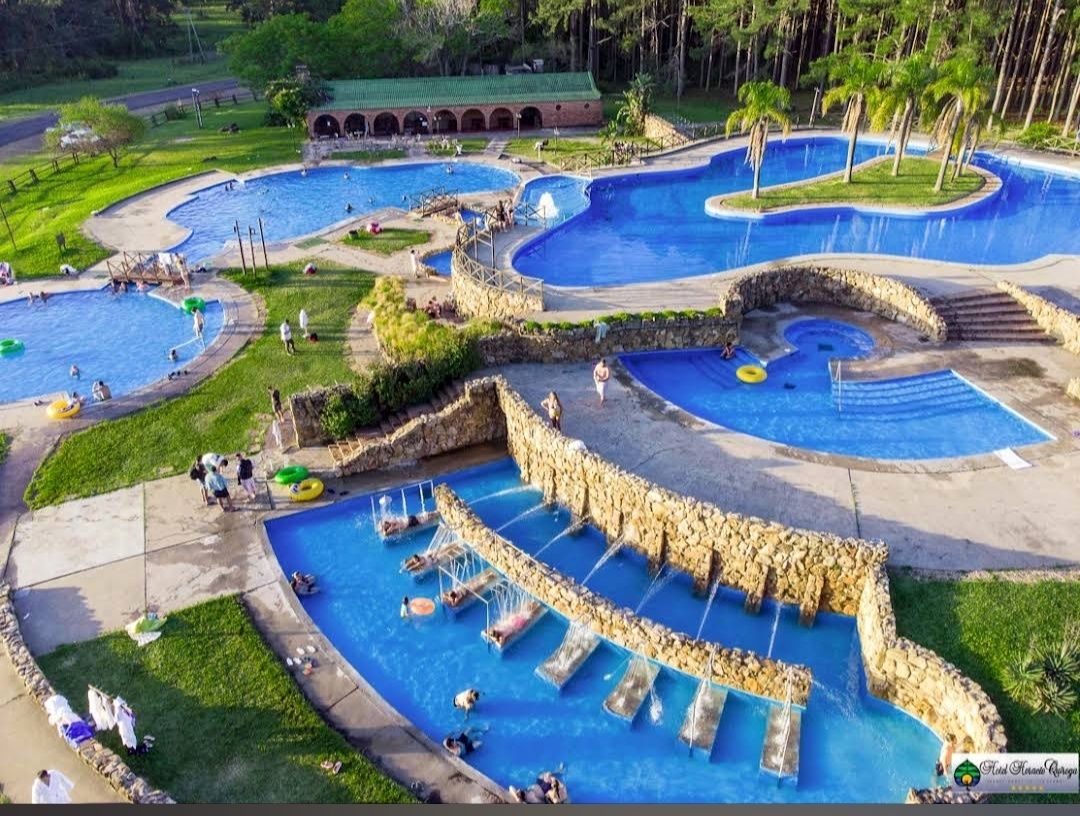
## Description **Parque Aquático Termas de Salto Grande** is one of Uruguay’s most popular thermal water parks, offering a unique blend of relaxation, recreation, and family fun. Located near the Salto Grande Dam, the park is famous for its naturally heated pools, which are fed by underground hot springs rich in minerals. These thermal waters are believed to have therapeutic properties, making the park not just an entertainment venue but also a wellness destination. The park features a variety of attractions, including outdoor and indoor pools, water slides, jacuzzis, and dedicated children’s areas. Families can enjoy thrilling rides while others unwind in the warm, soothing waters. The design of the park strikes a balance between leisure and adventure, making it suitable for visitors of all ages. **Little-known facts**: * The thermal waters in Salto reach temperatures of **38–46°C**, perfect for relaxation and health benefits. They are said to help with circulation, joint pain, and stress relief. * The park is part of the larger **Salto Grande hot springs circuit**, which is considered one of the most important in Uruguay and the entire Río de la Plata region. --- ## Location Parque Aquático Termas de Salto Grande is located in the **city of Salto**, in **northwestern Uruguay**, within the **Salto Department**. The park lies just a few kilometers from the **Salto Grande Dam**, which sits on the Uruguay River and borders Argentina. ### How to get there: * From **Salto city center**, the park is around 10 kilometers away. Taxis, local buses, or rental cars are convenient options. * Visitors traveling from **Montevideo** (about 500 kilometers away) can reach Salto by long-distance bus or a domestic flight. From there, it’s a short drive to the park. * If coming from **Argentina**, the park is easily accessible through the Concordia–Salto International Bridge, making it a popular cross-border attraction. --- ## Tips * **Bring swimwear and sandals**: Comfortable water-friendly clothing is essential, and sandals are useful for walking around hot pavements. * **Plan a full day**: With multiple pools, slides, and relaxation areas, you’ll want plenty of time to enjoy everything. * **Visit on weekdays**: The park can get very crowded on weekends and holidays, so weekdays are more peaceful. * **Stay hydrated**: The warm thermal waters can dehydrate you faster than you might expect, so drink plenty of water. * **Combine with nearby attractions**: The Salto region offers other hot spring complexes, like Termas del Daymán, and cultural attractions in Salto city itself. --- ## Conclusion Parque Aquático Termas de Salto Grande combines the thrill of a water park with the healing benefits of natural hot springs. Whether you’re seeking wellness, family fun, or just a relaxing escape, the park delivers an experience that is both entertaining and rejuvenating. With its unique thermal waters, diverse facilities, and prime location near Salto Grande, it’s one of Uruguay’s standout destinations. --- ## FAQ **1. What makes Parque Aquático Termas de Salto Grande special?** Its natural thermal pools, therapeutic waters, and mix of fun attractions like slides and jacuzzis make it a unique destination in Uruguay. **2. Is it family-friendly?** Yes, the park has areas designed specifically for children, making it a great choice for families. **3. What is the water temperature in the pools?** The thermal water ranges between 38°C and 46°C, depending on the pool. **4. Do I need to bring my own food?** The park has on-site restaurants and snack bars, but visitors can also bring their own food if they prefer. **5. Can I visit from Argentina?** Yes, the park is very close to the border with Argentina, and many visitors come via the Concordia–Salto bridge. **6. How much time should I plan for my visit?** Most visitors spend at least half a day, but a full day allows you to enjoy both relaxation and water attractions. --- ## Links * [Salto Tourism – Official Website](https://www.salto.gub.uy/) * [Uruguay Natural – Official Tourism Site](https://www.uruguaynatural.com/)
GemVoyage Team • World
Barcelona
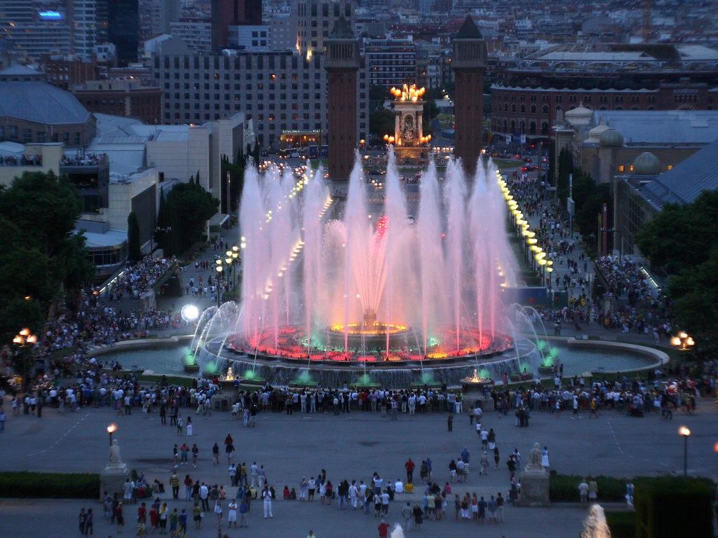
## Description The **Magic Fountain of Montjuïc (Font Màgica de Montjuïc)** is one of Barcelona’s most iconic and mesmerizing public attractions. Known for its dazzling **choreographed water shows synchronized with music and colorful lighting**, the fountain delivers a sensory spectacle that blends engineering, art, and performance into a single unforgettable experience. Every evening when it operates, thousands of visitors gather along the wide steps of Montjuïc to witness jets of water soar and dance in perfect rhythm with classical music, film soundtracks, and modern hits. The fountain was originally built for the **1929 Barcelona International Exposition**, an event that transformed Montjuïc into a cultural and architectural centerpiece of the city. At the time, its use of light and hydraulics was considered revolutionary. Over the years, it has been modernized with **computer-controlled lighting systems and advanced sound synchronization**, allowing for increasingly complex and dynamic performances. What makes the Magic Fountain unique is the scale of its performance. The fountain uses **over 7 billion combinations of water and light**, powered by nearly **3,000 liters of water per second** and illuminated by thousands of lights. The result is a constantly evolving visual narrative where water becomes a living, moving art form. A little-known fact is that the original designer, **Carles Buïgas**, envisioned the fountain as a symbol of modernity and innovation at a time when few cities had experimented with illuminated water displays. Another interesting detail is that the fountain is powered using **recirculated water**, making it a partially sustainable attraction despite its large scale. Beyond the show itself, the location adds to the magic. Set between the towering **Palau Nacional** (home to the National Art Museum of Catalonia) and **Plaça d’Espanya**, the fountain is framed by grand avenues, cascading stairways, and monumental architecture. The atmosphere becomes especially enchanting after sunset, when music echoes through the open plaza and the illuminated fountain reflects against the stone façades of Montjuïc. The Magic Fountain is not just a tourist attraction—it is also a gathering place for locals and a stage for national celebrations, festivals, and special performances. It captures Barcelona’s spirit of **creativity, openness, and celebration**, making it one of the city’s most beloved landmarks. ## Location The **Magic Fountain of Montjuïc** is located at the base of **Montjuïc Hill**, between **Plaça d’Espanya** and the **Palau Nacional**, in **Barcelona, Catalonia, Spain**. **Address:** Plaça de Carles Buïgas, 08038 Barcelona, Spain ### How to Get There: * **By metro:** Take **L1 (Red Line)** or **L3 (Green Line)** to **Espanya Station**. From there, it’s a 5-minute walk. * **By bus:** Routes **13, 23, 37, 46, 65, 79, 150** stop near Plaça d’Espanya. * **By foot:** Walk down from the **National Art Museum of Catalonia (MNAC)** along the fountains and wide staircases. * **By taxi or ride-hailing apps:** Simply ask for “Magic Fountain of Montjuïc.” * **By bike or scooter:** Dedicated lanes and parking areas are available around Plaça d’Espanya. Its central location makes it easy to combine with nearby attractions such as **Montjuïc Cable Car**, **Poble Espanyol**, **MNAC**, and **Las Arenas Shopping Center**. ## Tips * **Check show schedules:** The fountain does not operate daily year-round. Schedules change seasonally and during drought restrictions. * **Arrive early:** Good seating fills up quickly during peak tourist seasons, especially in summer. * **Best viewing spots:** The steps leading up to MNAC provide excellent elevated views of the performance. * **Visit after dark:** Night shows are the most impressive, as the lighting effects are fully visible. * **Bring a light jacket:** Even in summer, evenings can feel cool due to the water mist. * **Tripods are not ideal:** The area can be crowded, and tripods may be restricted or uncomfortable to use. * **Combine with an MNAC sunset visit:** Walk down from the museum at golden hour for a perfectly timed arrival at the fountain. * **Free attraction:** No tickets are required—just show up and enjoy. ## Conclusion The **Magic Fountain of Montjuïc** is one of Barcelona’s most magical experiences, offering a spectacular blend of **music, motion, light, and monumental architecture**. Rooted in the city’s history yet constantly evolving with modern technology, it remains a living symbol of Barcelona’s creative energy. Whether you are visiting for the first time or returning to the city, an evening at the Magic Fountain is a powerful reminder of how urban spaces can be transformed into stages of wonder and shared celebration. ## FAQ **1. Is the Magic Fountain free to visit?** Yes, the fountain shows are completely **free and open to the public**. **2. How long does each show last?** Each performance typically lasts between **10 and 20 minutes**, with repeated cycles throughout the evening. **3. Does the fountain operate year-round?** No, the schedule varies by season and may be suspended due to **water conservation measures or maintenance**. **4. Is the show suitable for children?** Yes, it is very family-friendly and often a highlight for children due to the lights and music. **5. What type of music is played?** The shows feature a mix of **classical music, movie soundtracks, opera, pop, and Spanish favorites**. **6. Can I combine it with other attractions in the same evening?** Yes. Many visitors pair the show with visits to **MNAC**, **Poble Espanyol**, or dinner near **Plaça d’Espanya**. ## Links * [Google Maps – Magic Fountain of Montjuïc](https://maps.app.goo.gl/Uy1j2aMu6UGy3QYm6)
GemVoyage Team • World
Milan
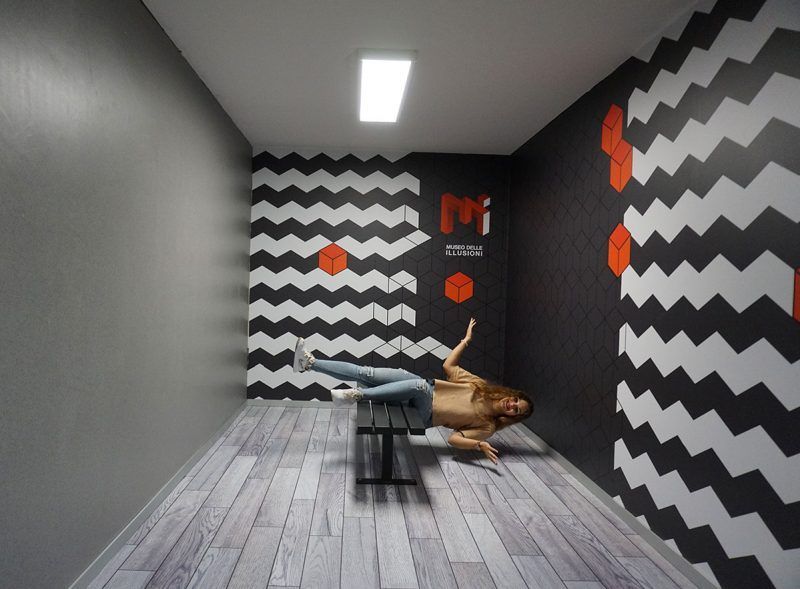
## Description The **Museo delle Illusioni – MDI** in Milan is a contemporary museum designed to challenge the viewer’s understanding of **vision, perception, spatial logic, and cognitive bias**. Unlike traditional museums that focus on historical artifacts or fine arts, MDI operates at the intersection of **science, psychology, and interactive entertainment**, offering an environment where visitors actively participate in the experience rather than observe passively. The space is filled with **optical illusions, perspective rooms, rotating installations, holograms, paradox structures, and sensory challenges** that push visitors to reconsider how the brain interprets visual information. Every room is intentionally constructed to distort scale, depth, orientation, and movement. The museum’s core idea is simple but effective: **what you see is not always what exists**, and the brain can be easily misled when context changes. What differentiates Milan’s MDI from similar illusion museums elsewhere is its emphasis on **sleek design and technical precision**. Installations are engineered with high production quality and clean aesthetics consistent with Milan’s reputation as a design capital. The lighting, angles, and surfaces are calibrated to deliver strong photographic effects, making the museum particularly popular among visitors who enjoy **creative photography and social media content**. Many exhibits demonstrate foundational principles of **Gestalt psychology, neuroscience, and geometry**, though without overwhelming visitors with complex scientific language. The goal is to make scientific concepts **intuitive, experiential, and playful**. By physically stepping into illusions, visitors experience cognitive phenomena that are normally confined to textbooks or laboratory experiments. A little-known fact is that several rooms in the museum use **forced perspective techniques** originally borrowed from early film production and Renaissance stage design. Another interesting detail is that some of the illusions at MDI come from a global research network of visual-perception experts who continually update the installations based on emerging cognitive science findings. Emotionally, the museum operates on a gradient between surprise and curiosity. Children laugh at rooms where gravity seems reversed, adults puzzle over patterns that appear to move, and groups experiment with depth tricks to produce impossible photographs. The museum’s strength lies in its ability to make **intellectual play accessible**, bridging the gap between learning and entertainment. MDI is not a large museum, and it does not intend to be. Its impact comes from **concentration, novelty, and careful choreography**. A visit typically moves quickly, but the density of experiences ensures that visitors remain mentally engaged throughout. In a city known for design excellence, the Museo delle Illusioni offers a refreshing and contemporary counterpoint: an environment where **visual culture becomes an interactive game**, and where perception becomes the main exhibit. ## Location The **Museo delle Illusioni – MDI** is located in the central area of Milan, close to major attractions and easily accessible on foot or by public transport. **City:** Milan **Region:** Lombardy (Lombardia) **Country:** Italy **Address Area:** Near **Porta Venezia** and the **Corso Buenos Aires** district ### How to Get There: * **By metro:** * **M1 (Red Line)** to **Porta Venezia**; the museum is a short 5–7 minute walk. * **By tram:** Various tram lines stop along Corso Venezia and Via Palestro. * **By bus:** Several city buses serve the area around Porta Venezia. * **By car:** Parking is limited and often busy; public transport is strongly recommended. * **On foot:** The museum is easily combined with strolls through **Giardini Indro Montanelli** and nearby galleries. Its central location makes it convenient to pair with shopping, dining, or museum visits in the same outing. ## Tips * **Pre-book tickets:** The museum is popular and time slots fill quickly, especially on weekends. * **Bring a fully charged phone or camera:** Many installations are designed for interactive photography. * **Visit during off-peak hours:** Early afternoons on weekdays offer the best conditions for photos without crowds. * **Expect a short but dense visit:** Most people spend **45–75 minutes** inside. * **Some illusions require participation:** Be ready to pose, experiment, and move around. * **Families will find the space especially engaging:** The illusions work well for children and adults alike. * **Check for rotating exhibits:** Some temporary installations appear seasonally. ## Conclusion The **Museo delle Illusioni – MDI in Milan** delivers an intelligent, playful, and visually rich exploration of how the mind constructs reality. With its polished installations, scientific underpinnings, and strong interactive component, it stands out as one of the city’s most modern cultural experiences. It offers not only entertainment, but also a clear reminder that **perception is fundamentally subjective**. ## FAQ **1. How long does a typical visit take?** Most visitors spend **about one hour** exploring the installations. **2. Is the museum suitable for children?** Yes. It is highly **family-friendly**, with exhibits designed for all ages. **3. Do I need to book in advance?** Yes. **Online reservation** is recommended to secure preferred time slots. **4. Can I take photos inside?** Absolutely. Photography is encouraged, and many rooms are designed for it. **5. Is the museum accessible?** Most areas are accessible for visitors with reduced mobility, though some illusions may be difficult to experience physically. **6. Is it crowded?** It depends on the time and day. **Weekends and holidays** are the busiest. ## Links * [Museo delle Illusioni – Milan Official Website](https://moimilano.it/en/)
GemVoyage Team • World
Paris
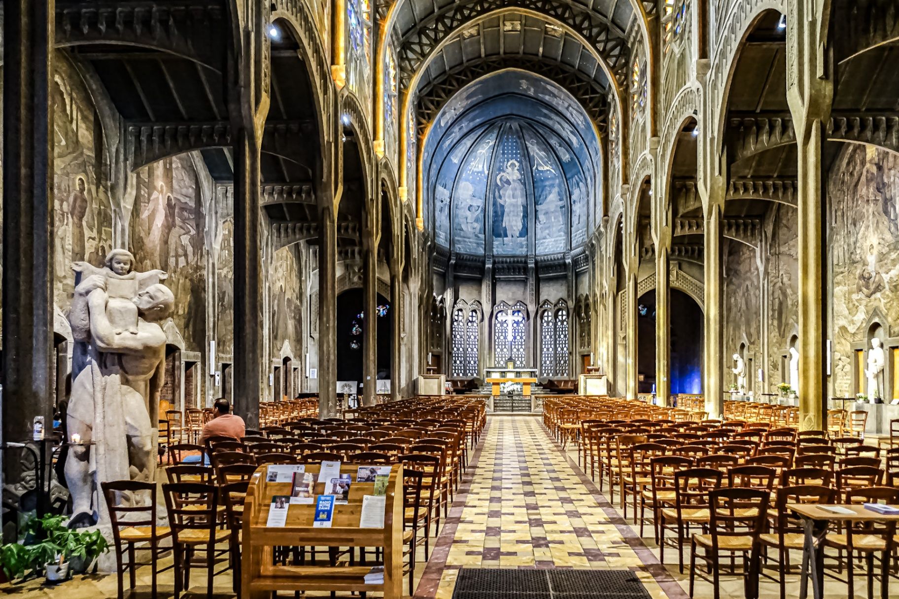
## Description The **Église Saint-Christophe-de-Javel** is one of Paris’s most striking and unconventional churches, standing as a powerful statement of **modernist religious architecture in the early 20th century**. Unlike the Gothic cathedrals and Baroque churches that dominate the Parisian religious landscape, Saint-Christophe-de-Javel was built using **reinforced concrete**, embracing industrial materials and architectural modernity at a time when such choices were still considered radical for sacred buildings. Constructed between **1926 and 1930**, the church was designed to serve the rapidly expanding working-class population of the **Javel district**, which had become a major industrial zone dominated by factories, workshops, and labor housing. The church’s architectural identity reflects this environment: **solid, functional, stripped of excess ornament**, yet deeply symbolic through proportion, light, and structure. The most defining feature is the **massive concrete nave**, whose exposed structural elements create a sense of raw strength and vertical ascension. Rather than relying on traditional stone vaulting, the church uses **modern engineering principles** to achieve its spacious interior. This gives the building a powerful, almost monumental atmosphere that feels both spiritual and industrial at the same time. Inside, the mood shifts dramatically through the use of **colored stained glass**, designed by **Marguerite Huré**, a pioneer of abstract religious glass art. Instead of depicting traditional figurative biblical scenes, many of the windows focus on **symbolic color composition and geometric light patterns**, allowing light itself to become the primary spiritual medium. The church is dedicated to **Saint Christopher**, the patron saint of travelers and workers—an especially fitting dedication for a parish built in an industrial transport district along the Seine. The building served not only as a religious space, but also as a **social anchor for factory workers and their families**, reinforcing its identity as a church of the modern urban age. A little-known fact is that Saint-Christophe-de-Javel was among the **first churches in France to fully embrace reinforced concrete as its primary structural material**, decades before such construction would become common in religious architecture. Another lesser-known detail is that the project was influenced by the ideas of **Dom Paul Bellot**, a Benedictine monk-architect famous for merging modern materials with sacred geometry—making this church part of a broader European movement to redefine how faith could be expressed through contemporary form. Today, Saint-Christophe-de-Javel remains both a functioning parish church and a **quiet architectural landmark**, largely overlooked by mass tourism. For visitors interested in architecture, urban history, and modern religious design, it offers a rare opportunity to see how spirituality was reinterpreted through the language of concrete, geometry, and light. ## Location **Église Saint-Christophe-de-Javel** is located in the **15th arrondissement of Paris**, along the **left bank of the Seine**, near the **Pont Mirabeau** and the former industrial zones of Javel. **City:** Paris **Region:** Île-de-France **Country:** France **Arrondissement:** 15th **Area:** Javel ### How to Get There: * **By metro:** Take **Line 10** to **Javel–André Citroën Station**, then walk about 5 minutes. * **By RER:** Use **RER C** to **Javel Station**, then walk along the Seine. * **By bus:** Several bus lines serve the Javel and Beaugrenelle area. * **By taxi or ride-hailing apps:** A direct and convenient option from anywhere in Paris. * **By bicycle:** The riverside bike path along the Seine leads directly past the church. The location makes it easy to combine the visit with **Parc André Citroën, Beaugrenelle shopping district, and a scenic Seine river walk**. ## Tips * **Visit during daylight hours:** Natural light through the stained glass is essential to the interior atmosphere. * **Check parish opening times:** As an active church, visiting hours may differ from service times. * **Silence is expected:** This is not a tourist-heavy site and remains a place of worship. * **Architecture lovers should bring binocular vision:** The scale and proportions are best appreciated from multiple viewpoints inside the nave. * **Combine with a Seine stroll:** The contrast between riverside leisure and industrial-modern architecture is striking. * **Do not expect ornate decoration:** This church speaks through structure and light, not sculpture and gold. * **Photography is usually permitted without flash:** Always confirm locally. ## Conclusion The **Église Saint-Christophe-de-Javel** is a compelling example of how **modern materials and industrial aesthetics were fused with sacred architecture** in early 20th-century Paris. Built for workers, shaped by concrete, and illuminated by abstract stained glass, the church stands as a quiet monument to faith in the age of machines. It is a destination for those who seek architecture with depth, restraint, and historical purpose rather than visual excess. ## FAQ **1. What makes Saint-Christophe-de-Javel unique among Paris churches?** It is constructed primarily from **reinforced concrete**, making it one of the earliest modernist churches in Paris. **2. Is the church still active?** Yes. It remains an **active Catholic parish** with regular services. **3. Who was the church built for?** It was built to serve the **industrial working-class population of the Javel district**. **4. Are there famous artworks inside?** Yes. The **stained-glass windows by Marguerite Huré** are especially significant in the history of abstract religious art. **5. Is there an entrance fee?** No. Entry is **free**, as the building functions as a public parish church. **6. How long does a visit typically take?** Most visitors spend **20 to 40 minutes**, depending on interest in architecture and photography. ## Links * [Visit Paris](https://parisjetaime.com/eng/)
GemVoyage Team • World

Comments