GemVoyage Team • World
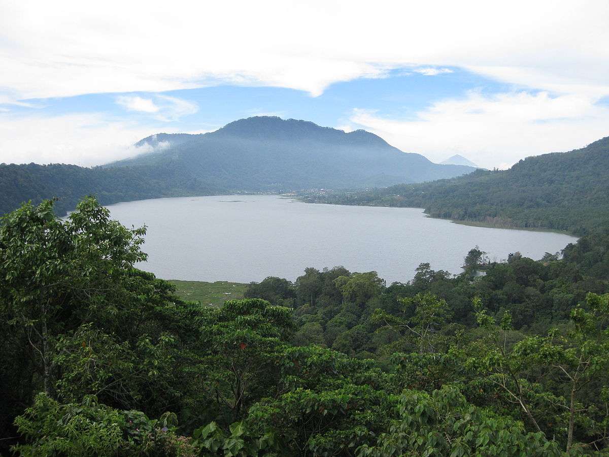
Lake Tamblingan is one of Bali’s most enchanting natural wonders—a serene caldera lake nestled in the highlands of northern Bali. Surrounded by dense rainforest and ancient temples, it offers a tranquil escape from the island’s bustling tourist hubs. Unlike the more commercialized lakes nearby, Tamblingan remains largely untouched, preserving its spiritual and ecological integrity.
Formed inside an ancient volcanic caldera, Lake Tamblingan is part of the “Twin Lakes” trio, alongside Lake Buyan and Lake Bratan. The lake’s surface sits at an elevation of 1,217 meters (3,993 feet), giving it a cool alpine climate that contrasts with Bali’s tropical lowlands. The misty mornings, mirror-like waters, and lush surroundings make it a favorite among photographers and nature lovers.
One little-known fact is that the lake is surrounded by temples dating back to the 10th century, remnants of the ancient Tamblingan civilization. Among these is Pura Dalem Tamblingan, located near the village of Gubug. Another fascinating detail: the lake’s water level fluctuates dramatically with the seasons. During heavy rains, some temples become partially submerged, creating surreal scenes that look like something out of a dream.
Lake Tamblingan is located in Indonesia, on the island of Bali, within the Buleleng Regency. It lies near the village of Munduk, at the foot of Mount Lesung, in the northern highlands of the island.
The drive itself is scenic, winding through rice terraces, waterfalls, and cloud forests.
To make the most of your visit to Lake Tamblingan, consider these helpful tips:
Lake Tamblingan is a peaceful, mystical destination that showcases Bali’s natural beauty and spiritual heritage. With its pristine waters, ancient temples, and cool mountain air, it’s a perfect retreat for those seeking tranquility, adventure, or a deeper connection to the island’s cultural roots.
1. What is the best time to visit Lake Tamblingan?
The dry season (April to October) is ideal for trekking and photography. However, the rainy season creates dramatic water levels and misty landscapes.
2. Is there an entrance fee?
Yes, a small fee of around 10,000 IDR grants access to Lake Tamblingan and Lake Buyan.
3. Can I swim in Lake Tamblingan?
Swimming is not recommended due to spiritual significance and lack of designated swimming areas.
4. Are there guided tours available?
Yes, several local operators offer trekking and cultural tours around the lake and nearby temples.
5. How long should I plan to stay?
A half-day visit is sufficient for sightseeing and photography. Full-day treks are available for more immersive experiences.
6. Is Lake Tamblingan suitable for children?
Yes, but trekking paths may be challenging for very young children. Families should opt for shorter walks or scenic viewpoints.
Discover more hidden gems you might love.
Paris
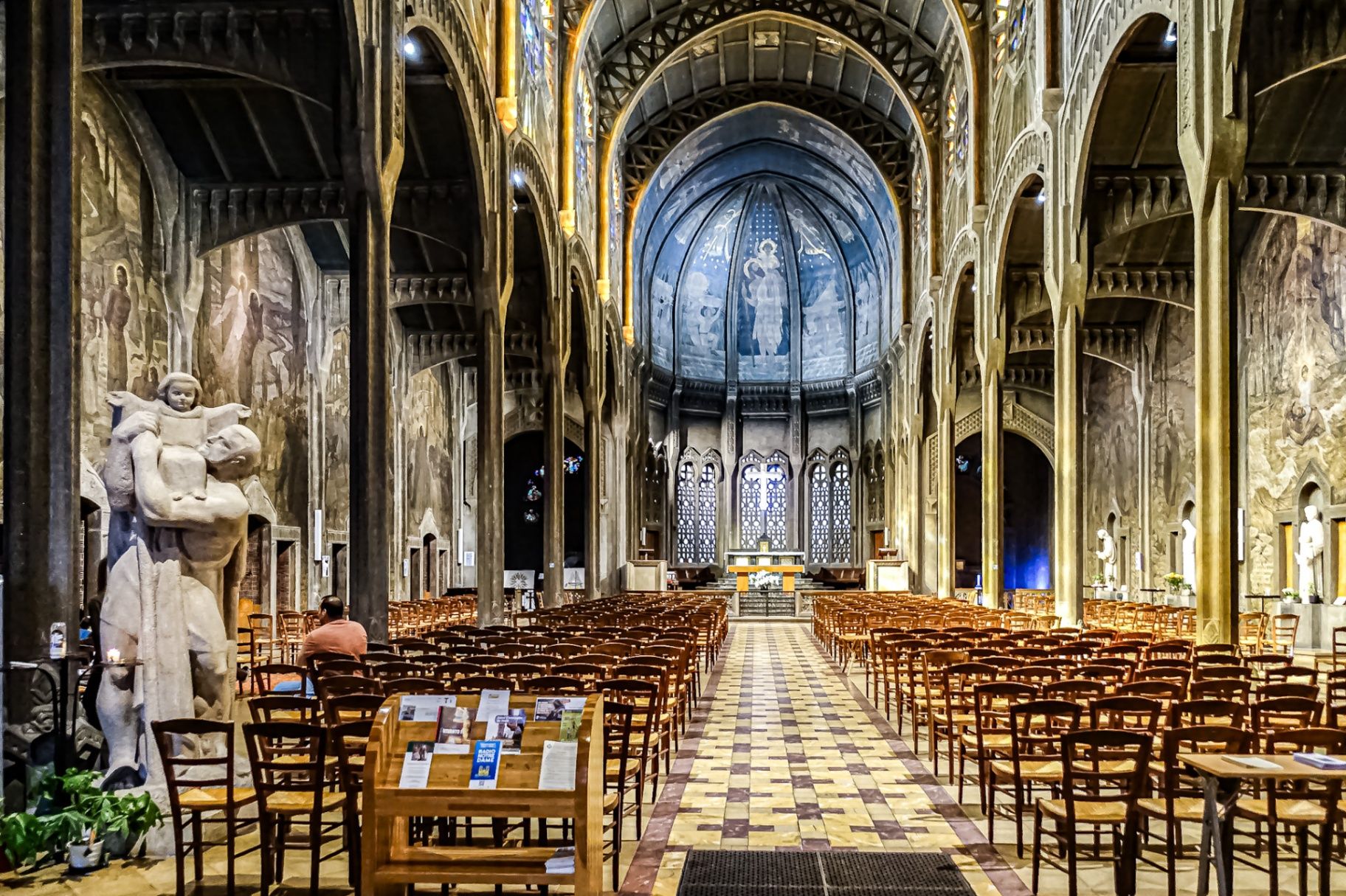
## Description The **Église Saint-Christophe-de-Javel** is one of Paris’s most striking and unconventional churches, standing as a powerful statement of **modernist religious architecture in the early 20th century**. Unlike the Gothic cathedrals and Baroque churches that dominate the Parisian religious landscape, Saint-Christophe-de-Javel was built using **reinforced concrete**, embracing industrial materials and architectural modernity at a time when such choices were still considered radical for sacred buildings. Constructed between **1926 and 1930**, the church was designed to serve the rapidly expanding working-class population of the **Javel district**, which had become a major industrial zone dominated by factories, workshops, and labor housing. The church’s architectural identity reflects this environment: **solid, functional, stripped of excess ornament**, yet deeply symbolic through proportion, light, and structure. The most defining feature is the **massive concrete nave**, whose exposed structural elements create a sense of raw strength and vertical ascension. Rather than relying on traditional stone vaulting, the church uses **modern engineering principles** to achieve its spacious interior. This gives the building a powerful, almost monumental atmosphere that feels both spiritual and industrial at the same time. Inside, the mood shifts dramatically through the use of **colored stained glass**, designed by **Marguerite Huré**, a pioneer of abstract religious glass art. Instead of depicting traditional figurative biblical scenes, many of the windows focus on **symbolic color composition and geometric light patterns**, allowing light itself to become the primary spiritual medium. The church is dedicated to **Saint Christopher**, the patron saint of travelers and workers—an especially fitting dedication for a parish built in an industrial transport district along the Seine. The building served not only as a religious space, but also as a **social anchor for factory workers and their families**, reinforcing its identity as a church of the modern urban age. A little-known fact is that Saint-Christophe-de-Javel was among the **first churches in France to fully embrace reinforced concrete as its primary structural material**, decades before such construction would become common in religious architecture. Another lesser-known detail is that the project was influenced by the ideas of **Dom Paul Bellot**, a Benedictine monk-architect famous for merging modern materials with sacred geometry—making this church part of a broader European movement to redefine how faith could be expressed through contemporary form. Today, Saint-Christophe-de-Javel remains both a functioning parish church and a **quiet architectural landmark**, largely overlooked by mass tourism. For visitors interested in architecture, urban history, and modern religious design, it offers a rare opportunity to see how spirituality was reinterpreted through the language of concrete, geometry, and light. ## Location **Église Saint-Christophe-de-Javel** is located in the **15th arrondissement of Paris**, along the **left bank of the Seine**, near the **Pont Mirabeau** and the former industrial zones of Javel. **City:** Paris **Region:** Île-de-France **Country:** France **Arrondissement:** 15th **Area:** Javel ### How to Get There: * **By metro:** Take **Line 10** to **Javel–André Citroën Station**, then walk about 5 minutes. * **By RER:** Use **RER C** to **Javel Station**, then walk along the Seine. * **By bus:** Several bus lines serve the Javel and Beaugrenelle area. * **By taxi or ride-hailing apps:** A direct and convenient option from anywhere in Paris. * **By bicycle:** The riverside bike path along the Seine leads directly past the church. The location makes it easy to combine the visit with **Parc André Citroën, Beaugrenelle shopping district, and a scenic Seine river walk**. ## Tips * **Visit during daylight hours:** Natural light through the stained glass is essential to the interior atmosphere. * **Check parish opening times:** As an active church, visiting hours may differ from service times. * **Silence is expected:** This is not a tourist-heavy site and remains a place of worship. * **Architecture lovers should bring binocular vision:** The scale and proportions are best appreciated from multiple viewpoints inside the nave. * **Combine with a Seine stroll:** The contrast between riverside leisure and industrial-modern architecture is striking. * **Do not expect ornate decoration:** This church speaks through structure and light, not sculpture and gold. * **Photography is usually permitted without flash:** Always confirm locally. ## Conclusion The **Église Saint-Christophe-de-Javel** is a compelling example of how **modern materials and industrial aesthetics were fused with sacred architecture** in early 20th-century Paris. Built for workers, shaped by concrete, and illuminated by abstract stained glass, the church stands as a quiet monument to faith in the age of machines. It is a destination for those who seek architecture with depth, restraint, and historical purpose rather than visual excess. ## FAQ **1. What makes Saint-Christophe-de-Javel unique among Paris churches?** It is constructed primarily from **reinforced concrete**, making it one of the earliest modernist churches in Paris. **2. Is the church still active?** Yes. It remains an **active Catholic parish** with regular services. **3. Who was the church built for?** It was built to serve the **industrial working-class population of the Javel district**. **4. Are there famous artworks inside?** Yes. The **stained-glass windows by Marguerite Huré** are especially significant in the history of abstract religious art. **5. Is there an entrance fee?** No. Entry is **free**, as the building functions as a public parish church. **6. How long does a visit typically take?** Most visitors spend **20 to 40 minutes**, depending on interest in architecture and photography. ## Links * [Visit Paris](https://parisjetaime.com/eng/)
GemVoyage Team • World
São Tomé and Príncipe
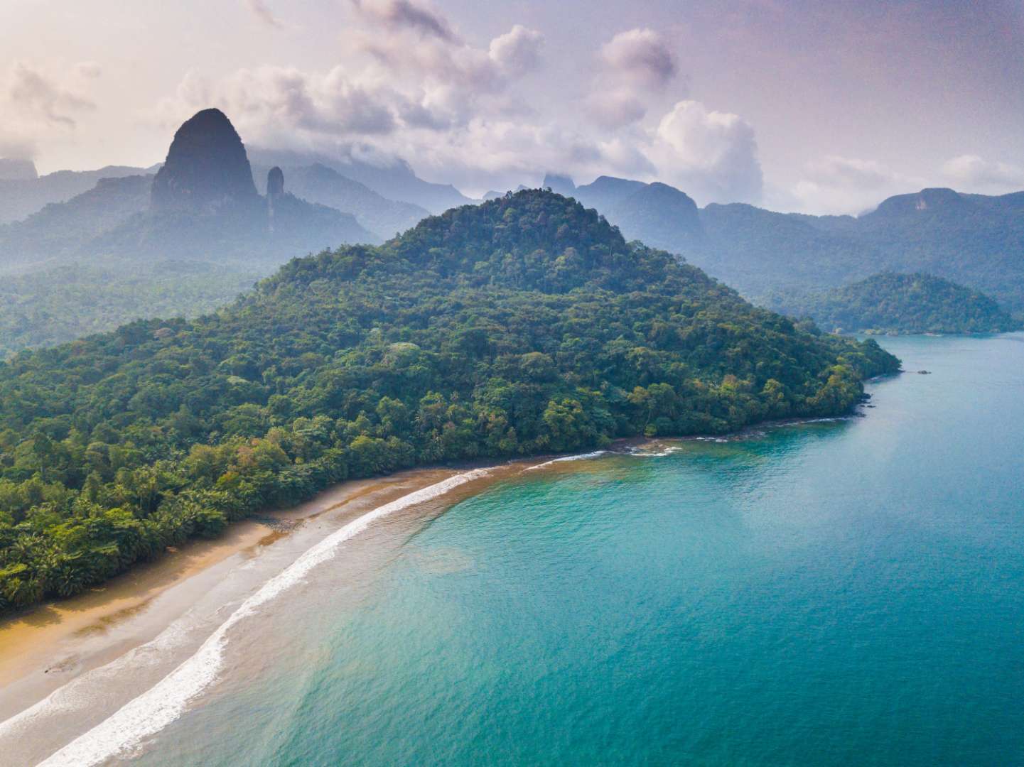
## Description São Tomé Island is a lush, volcanic paradise floating in the Gulf of Guinea, off the western coast of Central Africa. As the larger of the two main islands that make up the nation of São Tomé and Príncipe, it offers a rare blend of untouched nature, vibrant culture, and colonial charm. With its emerald rainforests, dramatic coastlines, and warm, welcoming locals, São Tomé is a destination that feels like a well-kept secret. The island is dominated by Pico de São Tomé, a towering peak that rises to 2,024 meters and is surrounded by dense jungle and misty cloud forests. Much of the island’s interior is protected within the Obô Natural Park, a biodiversity hotspot teeming with endemic species, waterfalls, and hiking trails. Along the coast, you’ll find palm-fringed beaches, fishing villages, and remnants of Portuguese colonial architecture. A little-known fact: São Tomé is located just north of the equator, and you can actually stand on the equator itself by visiting the nearby Ilhéu das Rolas islet. Another fascinating detail is that the island is part of the Cameroon Volcanic Line, a geological formation that includes several volcanic islands and mountains stretching from Cameroon into the Atlantic Ocean. ## Location São Tomé Island is located in the **Democratic Republic of São Tomé and Príncipe**, in the **Gulf of Guinea**, off the coast of **Central Africa**. The capital city, **São Tomé**, is situated on the northeastern coast of the island and serves as the political, cultural, and economic hub. ### How to Get There: - **By Air**: The main gateway is São Tomé International Airport (TMS), which receives flights from Lisbon, Accra, Luanda, and other regional hubs. - **From Europe**: TAP Air Portugal offers direct flights from Lisbon several times a week. - **From Africa**: Regional carriers connect São Tomé with cities like Libreville, Luanda, and Accra. - **Local Transport**: Once on the island, taxis, minibuses, and rental cars are available. Hiring a local guide is highly recommended for exploring remote areas. ## Tips for Visitors To make the most of your São Tomé adventure, keep these tips in mind: - **Best Time to Visit**: June to September is the dry season and ideal for hiking and beach activities. Avoid December to February, which is the rainy season. - **Currency**: The local currency is the São Tomé and Príncipe dobra (STN). Euros are widely accepted, especially in hotels and restaurants. - **Language**: Portuguese is the official language. Learning a few basic phrases can go a long way. - **Local Cuisine**: Don’t miss dishes like moqueca de peixe (fish stew), banana pão (breadfruit), and blá-blá (smoked fish). - **Eco-Tourism**: Respect the island’s fragile ecosystems. Stick to marked trails and avoid disturbing wildlife. - **Connectivity**: Internet access is limited in rural areas. Download maps and travel info in advance. ## Conclusion São Tomé Island is a captivating blend of volcanic landscapes, rich biodiversity, and cultural depth. Whether you're trekking through cloud forests, lounging on secluded beaches, or exploring colonial-era plantations, the island offers a peaceful and authentic escape from the modern world. ## FAQ **1. Is São Tomé Island safe for tourists?** Yes, São Tomé is considered one of the safest countries in Africa. Petty theft can occur, so basic precautions are advised. **2. Do I need a visa to visit São Tomé?** Visa requirements vary by nationality. EU citizens can enter visa-free for short stays. Check with your local embassy before traveling. **3. What is the official language of São Tomé?** Portuguese is the official language. Creole languages like Forro and Angolar are also spoken. **4. Can I hike Pico de São Tomé?** Yes, but it’s a challenging multi-day trek. Hiring a guide is essential due to the dense forest and changing weather. **5. Are there good beaches on São Tomé Island?** Absolutely. Praia das Conchas, Praia Jalé, and Praia Micondó are among the most beautiful and least crowded. **6. Is São Tomé suitable for family travel?** Yes, though infrastructure is basic. Families should plan ahead for accommodations and transport. ## Links - [São Tomé Island – Wikipedia](https://en.wikipedia.org/wiki/S%C3%A3o_Tom%C3%A9_%28island%29) - [Visit São Tomé – Official Tourism Portal](https://www.visitsaotomeprincipe.st/)
GemVoyage Team • World
Toronto
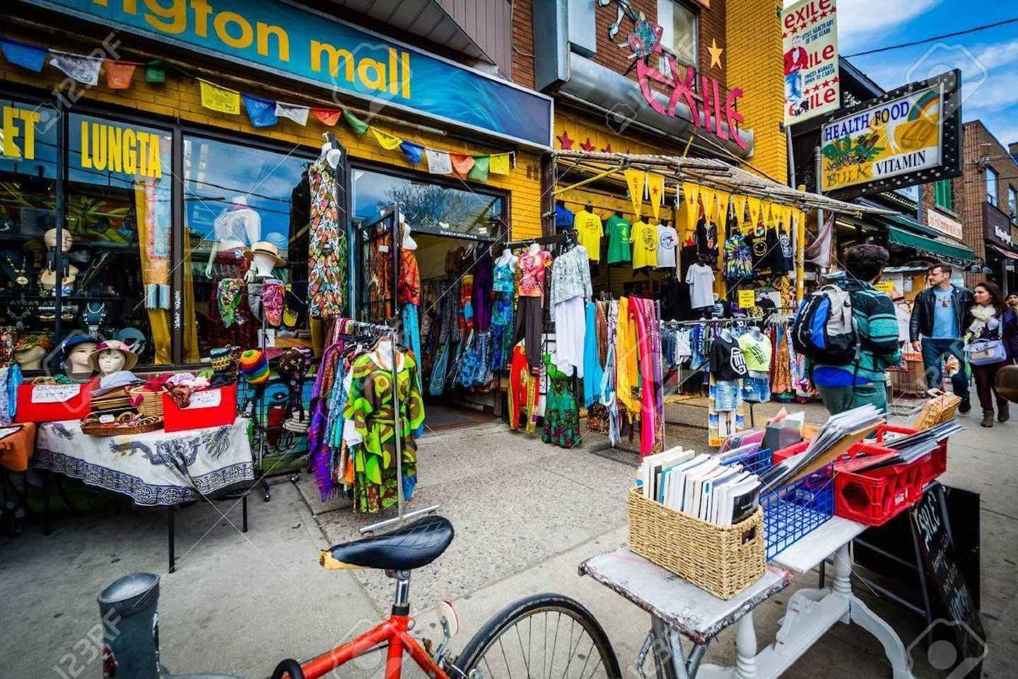
## Description Kensington Market is one of Toronto’s best-known neighborhoods for travelers who want atmosphere, variety, and a strong sense of place. It is not a traditional market in the narrow sense, but rather a dense urban district filled with independent shops, vintage clothing stores, grocers, cafés, bakeries, produce stands, restaurants, and street life that spills into the sidewalks. The area is famous for its mix of cultures and its long history as a neighborhood shaped by waves of immigration, creative entrepreneurship, and community reinvention. Walking through Kensington Market feels less like visiting a single attraction and more like stepping into a living collage of Toronto itself. What makes Kensington special is its refusal to feel polished in a predictable way. Its charm comes from variety, visual noise, and the sense that each storefront has its own personality. One block might be packed with produce, the next with music, used books, or handmade goods. Small alleyways and side streets often reveal murals, patios, and tiny surprises that reward unhurried visitors. The neighborhood also has a social rhythm of its own, especially on weekends when it becomes a magnet for browsers, food lovers, and people simply looking for a place that feels energetic and alive. One lesser-known aspect of Kensington Market is how strongly it reflects Toronto’s broader history of change. It has repeatedly adapted to new residents, new businesses, and shifting urban pressures while still preserving a distinctly independent feel. Another detail many first-time visitors miss is that Kensington is best experienced by combining observation with participation. The neighborhood is not only for looking at; it is for tasting, talking, trying, and wandering. A great visit often includes a snack, a coffee, a small purchase, and a few minutes spent people-watching from a curb or patio. Kensington Market is also a useful place to understand Toronto’s everyday creativity. It does not announce itself with monumental architecture or famous landmarks. Instead, it builds its identity from layers of storefront signage, murals, commerce, and community life. That makes it one of the city’s most authentic urban experiences, especially for travelers who prefer neighborhoods over tourist compounds. ## Location Kensington Market is in downtown Toronto, Ontario, close to Chinatown, the University of Toronto area, and several of the city’s central neighborhoods. Its location makes it easy to reach from much of central Toronto by streetcar, subway, bus, taxi, rideshare, or on foot if you are already nearby. Because the streets are compact and the area is highly walkable, most visitors explore it best on foot once they arrive. If you are planning a broader downtown day, Kensington pairs naturally with nearby cultural areas, galleries, food stops, and city walking routes. For visitors staying in the core, it is one of the easiest districts to add to an itinerary without needing a car. Public transit is usually the most practical option, and because parking can be limited or inconvenient, it is often better to leave the car behind entirely. ## Tips Go hungry and keep your schedule flexible. Kensington Market is one of the best neighborhoods in Toronto for spontaneous eating, browsing, and detours. If you try to over-plan the experience, you may miss what makes it fun. The best visits usually happen when you leave room for unplanned discoveries, whether that means a bakery stop, a vintage find, or a street musician drawing a crowd. Visit at different times if you can. Weekdays can feel more relaxed, while weekends are livelier and more crowded. Both moods have value, and the best choice depends on whether you want a calmer wander or a more animated urban scene. Morning visits are often easier if you want to take in the shops before they become too busy. Wear comfortable shoes. Kensington is compact, but it encourages a lot of walking, stopping, and turning into side streets. If you are interested in photography, the neighborhood is rich in texture, but be respectful of businesses and residents while you shoot. Try to support local vendors when you can, because the district’s character depends on the continued presence of independent operators. Do not expect uniformity. Some visitors want one clear “best” thing to do, but Kensington works differently. The point is the accumulation of impressions. The neighborhood is most rewarding when you let its diversity define the visit. ## Conclusion Kensington Market is one of Toronto’s essential neighborhoods, offering food, culture, and urban character in one dense and memorable walk. It is ideal for travelers who want to see the city through everyday life rather than landmarks alone. ## FAQ ### Is Kensington Market a real market? It is more accurately described as a neighborhood with a historic market identity rather than a single enclosed marketplace. Visitors come for the district’s shops, food, and street atmosphere. ### How long should I spend there? A short visit can take an hour, but two to four hours is better if you want to browse, eat, and explore side streets. Many travelers end up staying longer than planned. ### Is it expensive? It depends on where you stop. You can spend very little by simply walking around, but food, vintage goods, and specialty items can range from affordable to premium depending on the business. ### Is it family-friendly? Yes, especially during daytime hours. Families often enjoy the food variety, the pedestrian-friendly feel, and the colorful street life. ### What is the best way to experience it? Walk slowly, sample something local, and leave room for curiosity. Kensington is best when you treat it as a neighborhood to be explored rather than a checklist of attractions. ## Links - [Wikipedia](https://en.wikipedia.org/wiki/Kensington_Market)
GemVoyage Team • World
Manchester
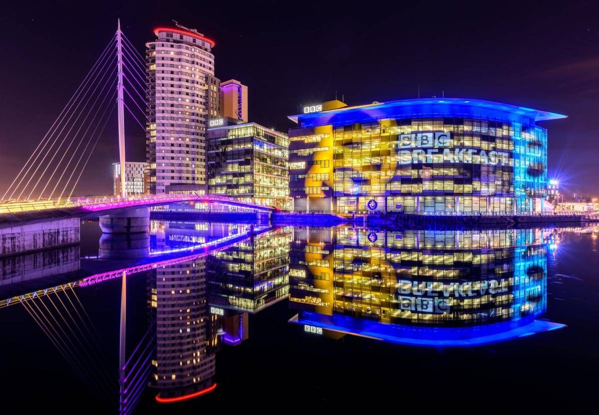
## Description The Quays is one of Manchester’s most dynamic and visually striking waterfront areas, known for its blend of modern architecture, cultural landmarks, and leisure spaces. Once part of the historic Manchester Docks, this area has been completely transformed into a contemporary district that reflects the city’s industrial past while embracing innovation and creativity. Today, The Quays is a popular destination for both locals and visitors, offering museums, media hubs, restaurants, and scenic walking routes along the water. What makes The Quays unique is its successful regeneration story. Formerly an active dock system that played a vital role in Britain’s industrial trade, the area fell into decline in the late 20th century before being reimagined as a cultural and media center. A little-known fact is that the docks here were once among the busiest inland ports in the world. Another interesting detail is that The Quays is home to MediaCityUK, where major broadcasters operate live studios, allowing visitors to see television and radio production happening in real time. With iconic attractions such as The Lowry arts center and the Imperial War Museum North, The Quays offers a balanced mix of history, culture, and modern urban life. ## Location The Quays is located in **England**, in the **Greater Manchester** region, within the city of **Manchester**, primarily spanning the Salford Quays area. It lies just west of Manchester city center, along the Manchester Ship Canal. Getting to The Quays is easy and convenient. The Metrolink tram system provides direct access via stops such as **MediaCityUK** and **Salford Quays**, connecting the area to Manchester Piccadilly and other key parts of the city. Several bus routes also serve the area. For those arriving by car, parking is available at various nearby facilities, though public transport is often the most efficient option. ## Tips * Wear comfortable shoes, as the waterfront paths are ideal for walking and exploring the area on foot. * Visit in the late afternoon or evening to enjoy reflections on the water and vibrant nightlife. * Check event schedules at The Lowry and MediaCityUK, as performances and live broadcasts are frequent. * Combine your visit with a museum stop, especially the Imperial War Museum North, which offers free entry. * Bring a light jacket, as the waterfront can feel cooler and windier than the city center. * Photography enthusiasts will appreciate the modern skyline and waterside views, especially at sunset. ## Conclusion The Quays is a standout example of Manchester’s reinvention, transforming historic docks into a lively cultural and entertainment district. Its mix of museums, media, dining, and scenic walks makes it an essential stop for anyone exploring the city. ## FAQ **Is The Quays suitable for families?** Yes, the area is family-friendly, with open spaces, museums, and regular events suitable for all ages. **How much time should I spend at The Quays?** Most visitors spend between two and four hours, depending on activities and attractions visited. **Are there free attractions at The Quays?** Yes, attractions like the Imperial War Museum North offer free entry. **Is The Quays accessible for people with limited mobility?** Yes, the area is modern and generally well equipped with step-free access and wide pathways. **Can I eat and drink at The Quays?** Absolutely. The area offers a wide range of cafés, bars, and restaurants with waterfront views. ## Links * [The Quays Official Website](https://www.thequays.org.uk)
GemVoyage Team • World
Bonn
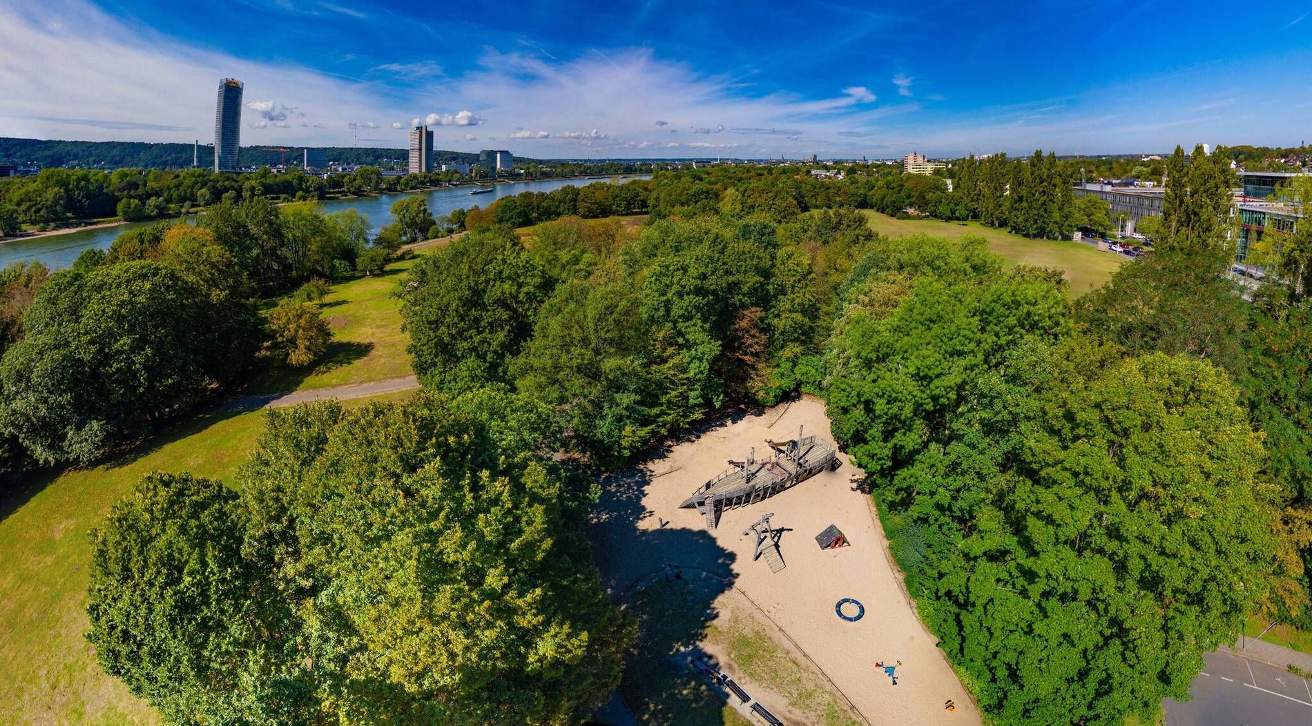
## Description Rheinaue Park is one of Bonn’s most pleasant urban green spaces because it combines openness, variety, and a strong sense of everyday usefulness. It is the kind of park that feels instantly welcoming. Instead of presenting itself as a highly formal landscape or a single-activity site, it offers lawns, water features, walking paths, and room to simply be outside. For travelers, that makes it a gentle and flexible stop; for locals, it functions as a regular escape from the city’s pace. The park stands out because of its scale and composition. Broad open areas give it a relaxed, spacious feeling, while the presence of water and planted sections creates enough visual interest to keep a long walk engaging. One little-known fact is that the park was shaped by a major landscape design approach rather than emerging as a simple leftover green area, which explains why it feels so intentional and balanced. Another is that it works especially well in different weather conditions: sunny days bring picnic energy and wide horizons, while overcast days make the water and greenery feel especially calm. Visitors often appreciate that Rheinaue Park feels lived-in rather than overly staged. People come here to walk, cycle, picnic, exercise, or spend time with family and friends. That mixed use gives the park a stable, local rhythm. It is not an attraction you rush through. It is a place that rewards taking your time, noticing how people use the space, and choosing your own pace. The park is also useful for travelers who want an easy outdoor break without a complicated plan. After time in Bonn’s museums, old town, or riverfront, Rheinaue offers a reset. You can settle into a bench, cross open lawns, follow a trail near the water, or simply enjoy the change of scale from city streets to open parkland. It is the sort of place that may not dominate a guidebook cover but ends up becoming one of the most restful parts of a trip. ## Location Rheinaue Park is located in Bonn, North Rhine-Westphalia, Germany, stretching through a large green area in the city and near the Rhine. Its size and layout make it accessible from several directions, and it functions as one of Bonn’s major recreational landscapes. The easiest way to reach the park is by local public transport, bicycle, or car depending on where you start in the city. Because Bonn is relatively manageable, many visitors find that a bike or short transit ride works especially well. The park’s openness means that once you arrive, you can decide how long or how far you want to walk without needing a rigid route. If you are planning a relaxed visit, choose good weather and give yourself time to move slowly. The park is best experienced as a place for lingering rather than ticking off sights. ## Tips - Bring water or a picnic if you want to make the most of the open lawns. - Use the park for a slow walk or bike ride rather than trying to treat it as a quick stop. - Visit in good weather if you want the full effect of the open landscape. - Leave time for sitting. The park is as much about atmosphere as activity. - Combine it with Bonn’s riverfront or central sights if you want a fuller day out. ## Conclusion Rheinaue Park is Bonn’s easygoing green escape, offering space, water views, and a calm setting that works well for both local routines and traveler downtime. It is simple, generous, and quietly rewarding. ## FAQ ### Is Rheinaue Park a tourist attraction or mainly a local park? It serves both purposes. Tourists can enjoy the space and scenery, while locals use it regularly for exercise, relaxation, and social time. ### How much time should I spend there? Anywhere from an hour to several hours, depending on whether you want just a walk or a more relaxed picnic-style visit. ### Is it good for children? Yes. The open space and easy paths make it a flexible destination for families. ### When is the best time to visit? Spring, summer, and early autumn are especially pleasant, though the park can be enjoyable year-round. ## Links - [Bonn official website](https://www.bonn.de/)
GemVoyage Team • World
Rome
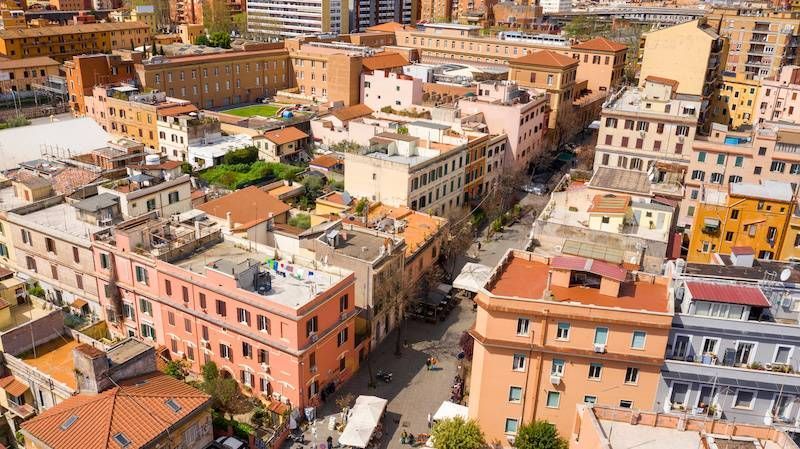
## Description Pigneto is a bohemian quarter on the eastern edge of Rome's historic center that has emerged as a center for alternative culture, independent cafés, music venues, and street art. Historically a working-class neighborhood, Pigneto's present-day energy combines laid-back local life with a creative fringe: intimate live-music bars, experimental restaurants, and murals that reward aimless wandering. Film scholars and cultural tourists sometimes note Pigneto's connection to Italian neorealist cinema—streets and squares there still convey a lived-in authenticity that feels less curated than tourist-focused central neighborhoods. What makes Pigneto appealing to travelers is the neighborhood's layered, discoverable quality: new cafés sit beside traditional trattorie, and small galleries share corners with vinyl shops. The street art is dispersed rather than concentrated, so walking (or taking a short local bus) remains the best way to discover murals, installations, and community projects. Search-friendly phrases include "Pigneto Rome street art", "Pigneto nightlife guide", and "alternative Rome neighborhoods"—queries that pair well with local blog posts and neighborhood guides. ## Location Pigneto lies east of Rome's center, convenient to Termini Station and the San Lorenzo district. The neighborhood is served by Line C (Pigneto station) and several local buses; it's a short taxi ride from central hubs. Because Pigneto is largely compact, most visitors explore on foot, moving between squares, cafes, and parklets that form the neighborhood's social hubs. ## Tips - Walk slowly and explore side streets: many of the district's best murals and hidden bars are off main roads. - Try aperitivo: early-evening aperitivo culture is vibrant—enjoy a pre-dinner drink alongside small plates at neighborhood bars. - Visit for live music nights: several small venues host jazz, indie, and experimental music on specific nights—check venue pages for schedules. - Respect local life: Pigneto has an active residential community—keep noise reasonable late at night and support neighborhood businesses. - Bring cash for smaller venues: while many places accept cards, some bars and small galleries operate cash-only. ## Conclusion Pigneto is a compelling stop for travelers who prefer neighborhood immersion to classic sightseeing. Its street art, convivial bars, and creative energy reward the curious explorer: you can spend an evening hopping intimate venues, or a whole day documenting murals and sampling modern Roman casual dining. ## FAQ Q: Is Pigneto safe for solo travelers? A: Generally yes—Pigneto is popular with locals and visitors alike; normal urban precautions apply, especially late at night. Q: When is the best time to visit for nightlife? A: Evenings from Thursday to Saturday are lively; midweek nights may have smaller shows and quieter streets. Q: Can I find guided street-art walks? A: Yes—local guides and small walking tours occasionally operate in Pigneto; independent bloggers and tour platforms often list scheduled walks. Q: Are there good places to eat for food restrictions? A: Pigneto has a variety of eateries including vegetarian and vegan-friendly spots; check menus online or ask staff for recommendations. Q: Is Pigneto family-friendly during the day? A: During daytime Pigneto is family-friendly with cafes and parks; evenings focus more on bar culture. ## Links - [Pigneto Guide](https://www.romehacks.com/pigneto-neighbourhood-rome/)
GemVoyage Team • World

Comments