Discover extraordinary places shared by our community of travelers
Neuquén
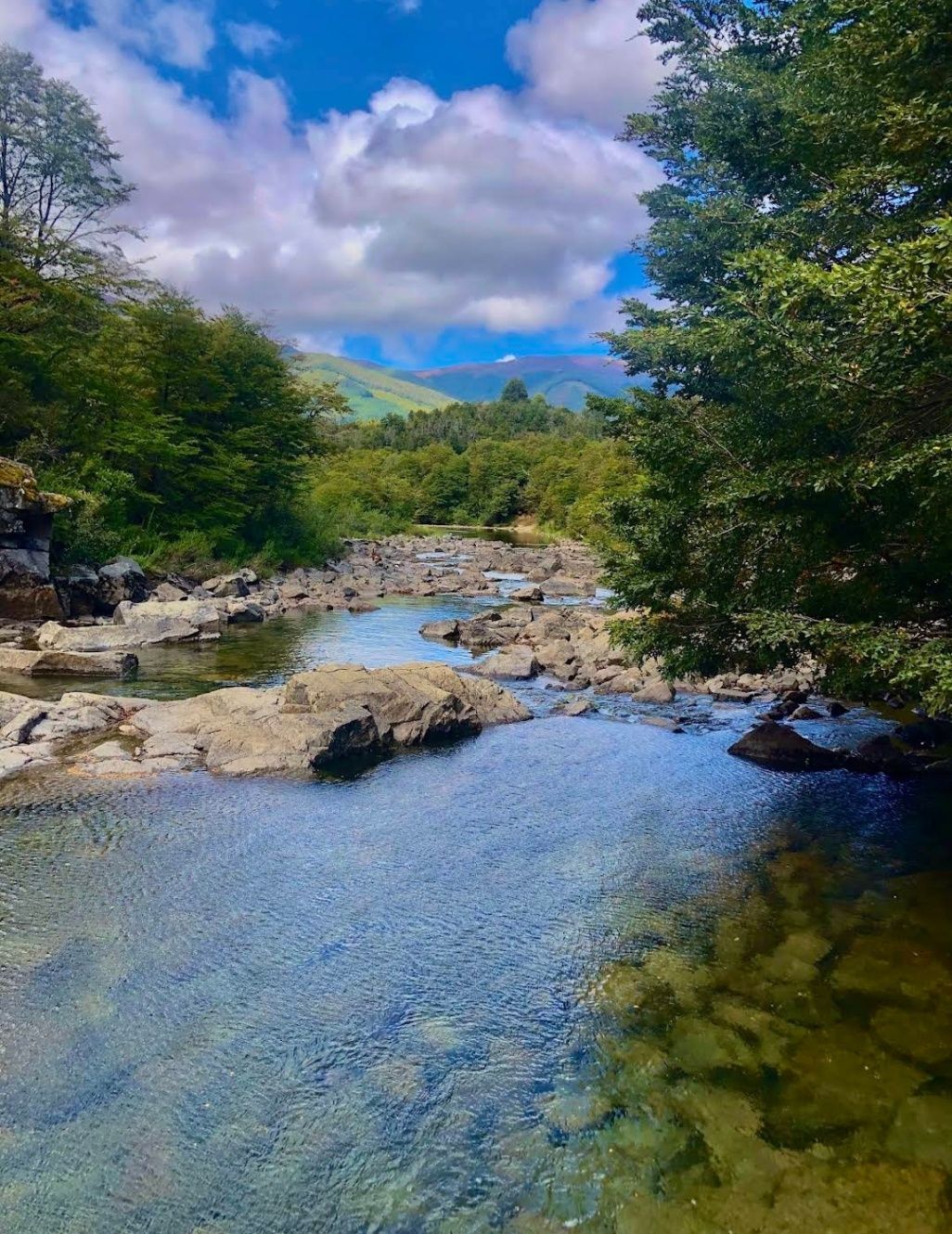
## Description Nestled within the heart of Argentina’s Patagonia, **Cascadas del Río Hermoso** is a breathtaking natural wonder that captivates visitors with its unspoiled beauty. The waterfalls are part of the Río Hermoso, which translates to “Beautiful River,” and the name is no exaggeration. Surrounded by dense forests, clear mountain air, and the soothing sound of rushing water, this destination offers a perfect blend of serenity and adventure. What makes Cascadas del Río Hermoso unique is not only its picturesque setting but also its relative tranquility compared to more popular sites like Iguazú Falls. Here, you won’t find large crowds or bustling tourist infrastructure—just raw, pristine nature. The waterfalls are small to medium in size, cascading down in multiple tiers, forming natural pools that invite visitors to rest and reflect. A little-known fact is that the river is fed by meltwater from the Andes, meaning that the water levels and flow change significantly with the seasons. Another detail often overlooked is the region’s rich biodiversity: the surrounding forests are home to species such as the Patagonian woodpecker and the elusive pudú, one of the world’s smallest deer. For nature enthusiasts, Cascadas del Río Hermoso is a rare opportunity to encounter untouched ecosystems. ## Location Cascadas del Río Hermoso is located in **Argentina, in the Neuquén Province of northern Patagonia**, within the boundaries of **Lanín National Park**. The closest town is **San Martín de los Andes**, a charming Patagonian village known for its alpine-style architecture, lakes, and outdoor activities. To get there, travelers usually fly into Aviador Carlos Campos Airport, just 20 km from San Martín de los Andes. From the town, the waterfalls can be reached by car via **Ruta Nacional 40** and then **Ruta Provincial 63**, which winds through stunning Andean landscapes. The trip itself is a highlight, with panoramic views of lakes, mountains, and valleys. Renting a car is highly recommended, as it allows for flexible stops at scenic viewpoints along the way. ## Tips * **Best Time to Visit**: Late spring to early autumn (November to March) offers the best weather and water flow. Winter can be beautiful too but access may be more difficult due to snow. * **What to Bring**: Comfortable hiking shoes, layered clothing (Patagonia weather is unpredictable), water, snacks, and a camera. * **Respect Nature**: Since this is a less-visited area, maintaining its pristine condition is important. Avoid leaving trash and stick to marked trails. * **Combine Your Trip**: Consider combining your visit with nearby attractions like Lake Lácar, Chapelco ski resort, or even the famous Seven Lakes Route. * **Local Guides**: Hiring a local guide can enrich your experience with stories about the region’s history, culture, and flora and fauna. ## Conclusion Cascadas del Río Hermoso is a tranquil, hidden treasure in Argentina’s Patagonia, offering visitors a rare chance to connect with untouched nature. Surrounded by forests, wildlife, and the pure waters of the Andes, it’s a destination that rewards travelers seeking peace, adventure, and authenticity. ## FAQ **1. How difficult is the hike to Cascadas del Río Hermoso?** The hike is considered easy to moderate. Most trails are well-marked and accessible, making it suitable for families and casual hikers. **2. Is swimming allowed in the river or waterfalls?** Yes, swimming is possible in some of the natural pools, especially during the summer months, though the water can be very cold due to glacial origins. **3. Are there entrance fees?** Since Cascadas del Río Hermoso is part of Lanín National Park, a small entrance fee may apply, depending on the season and visitor category. **4. Can I visit Cascadas del Río Hermoso year-round?** Yes, but accessibility varies. Summer and spring are ideal, while winter may present challenges due to snow-covered roads. **5. Are there facilities near the waterfalls?** Facilities are limited. Visitors should bring their own supplies, although San Martín de los Andes has plenty of options for food, lodging, and equipment rentals. ## Links * [Neuquén Province Tourism](https://www.argentina.travel/en/province/neuquen)
GemVoyage Team • World
Connacht
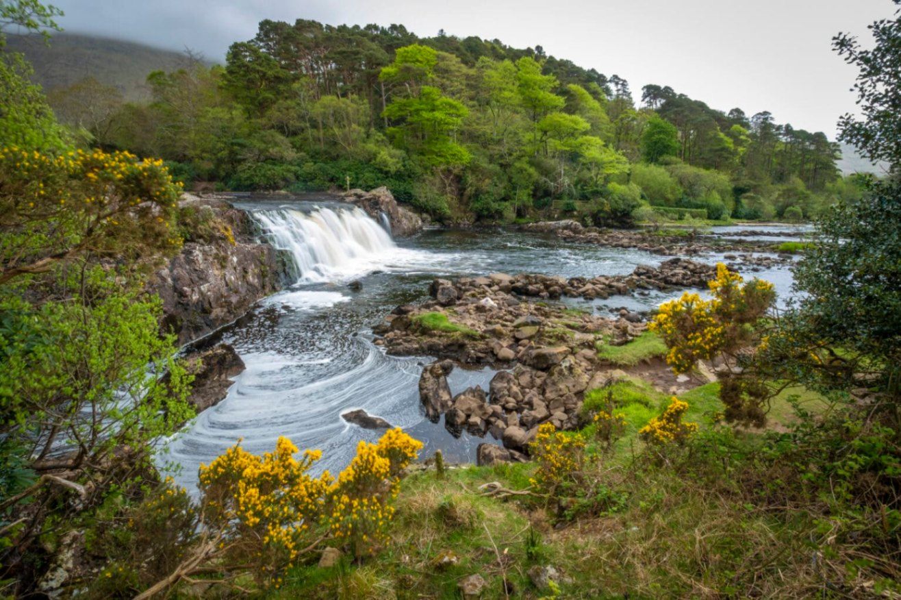
## Description **Aasleagh Falls** is one of Ireland’s most quietly dramatic natural sights, where freshwater from the Connemara mountains meets the tidal waters of Killary Harbour. Unlike towering waterfalls designed to impress through height alone, Aasleagh Falls is defined by **movement, light, and setting**. Its power and appearance change constantly depending on rainfall, tide levels, and weather conditions, making every visit slightly different. The waterfall is formed by the **Erriff River**, which descends rapidly over smooth rock shelves just before flowing into Killary Harbour, Ireland’s only fjord. At high tide, seawater pushes upriver, partially submerging the lower cascades and creating a rare visual effect where fresh and saltwater interact. At low tide, the falls appear more forceful and exposed, revealing multiple channels and textures in the rock. What makes Aasleagh Falls particularly special is its **sense of isolation and scale relative to its surroundings**. Backed by rugged mountains and often framed by mist or low clouds, the falls feel far removed from modern life despite being accessible by road. A lesser-known fact is that the area around the falls has long been a **salmon fishing site**, and anglers can sometimes be seen working the waters nearby. Another overlooked detail is that the name “Aasleagh” is derived from Irish, roughly translating to a “rocky place,” a fitting description of the terrain shaped by water over millennia. Aasleagh Falls is not fenced, ticketed, or curated. It exists as it always has: exposed, elemental, and dependent on nature rather than infrastructure. This rawness is central to its appeal. ## Location **Country:** Ireland **Province:** Connacht **County:** Mayo **Nearby Area:** Leenane / Killary Harbour Aasleagh Falls is located at the eastern end of **Killary Harbour**, near the border between County Mayo and County Galway, in one of Ireland’s most scenic regions. ### How to Get There * **By car:** * From Westport, drive toward Leenane via the N59. The falls are located just before entering the village and are visible from the roadside. * **By bus:** * Limited rural bus services operate in the area; schedules are infrequent and not ideal for flexible visits. * **On foot or by bicycle:** * Possible if staying nearby, but weather and narrow roads should be considered. There is no formal parking lot; roadside pull-ins are commonly used. ## Tips * **Visit after rainfall:** The falls are most impressive following heavy rain. * **Check the tide:** Low tide reveals more of the cascade structure. * **Wear waterproof footwear:** The ground can be wet and uneven. * **Be cautious near the edge:** There are no safety barriers. * **Combine with scenic drives:** The surrounding roads offer some of Ireland’s best coastal and mountain views. * **Bring a camera:** Light conditions change rapidly and can be spectacular. ## Conclusion Aasleagh Falls is a powerful example of Ireland’s understated natural beauty. Its shifting form, dramatic setting, and lack of commercialization make it ideal for visitors seeking authenticity, solitude, and a deeper connection with the landscape. ## FAQ **1. Is there an entrance fee to Aasleagh Falls?** No, access is completely free. **2. How tall is the waterfall?** It is relatively low in height, but wide and dynamic rather than vertical. **3. When is the best time to visit?** After rainfall and during low tide for the most dramatic views. **4. Is it suitable for children?** Yes, with close supervision due to the lack of barriers. **5. Can you swim near the falls?** Swimming is not recommended due to strong currents and tidal influence. **6. How long should I plan to stay?** Around **20 to 30 minutes**, longer if photographing or exploring the area. ## Links * [Discover Ireland](https://www.discoverireland.ie/)
GemVoyage Team • World
Sinai
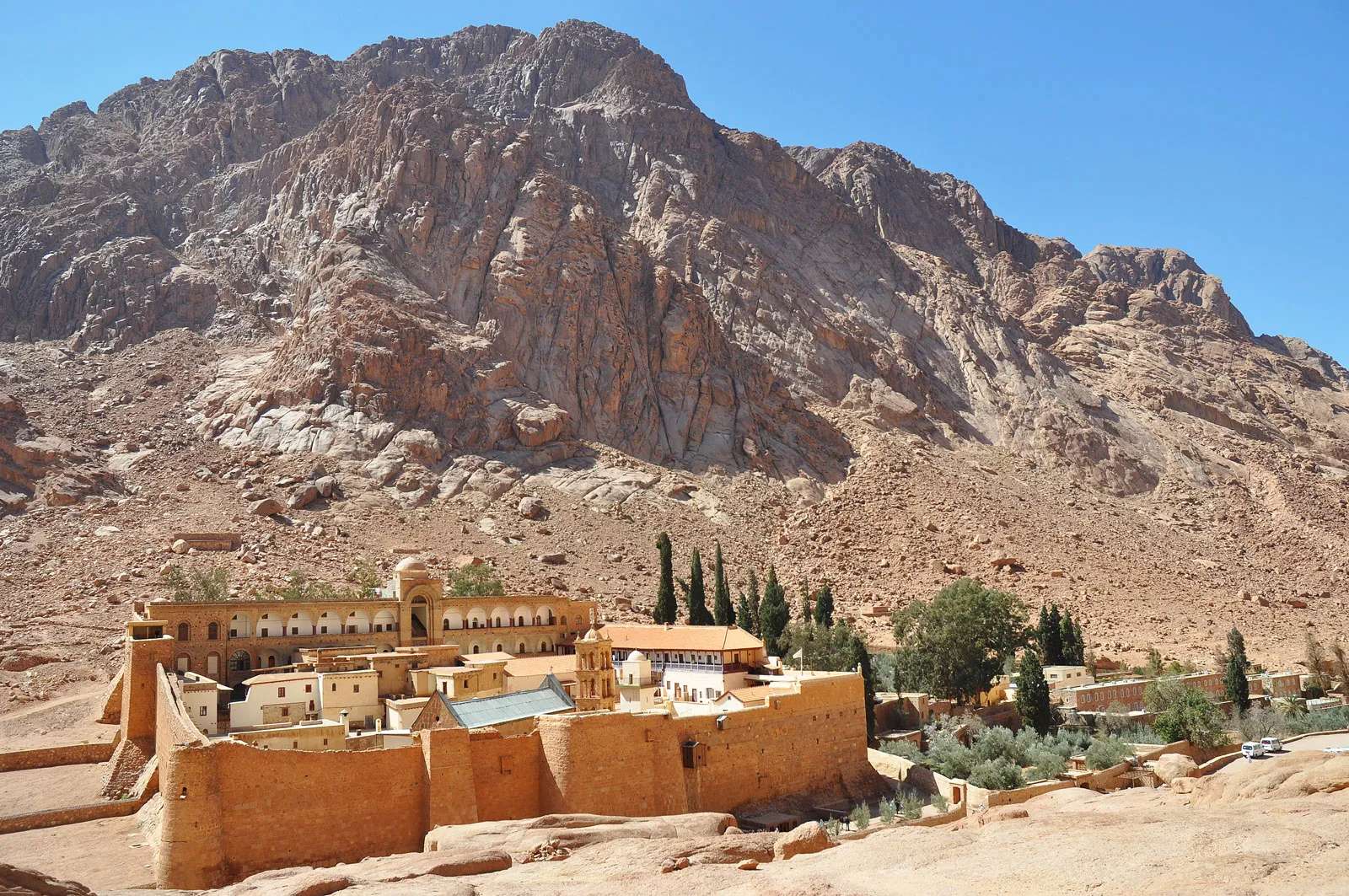
## Description Mount Catherine (Jebel Katherîn) is the highest peak in Egypt, rising to an elevation of 2,629 meters (8,625 feet) above sea level. Nestled in the rugged terrain of the southern Sinai Peninsula, this majestic mountain offers not only breathtaking views but also a deep spiritual and historical resonance. It’s named after Saint Catherine of Alexandria, whose remains were said to have been miraculously transported to the summit by angels. Today, it’s a popular destination for hikers, pilgrims, and adventurers seeking solitude, challenge, and connection to ancient traditions. Unlike the more frequented Mount Sinai (Jebel Musa), which is traditionally associated with Moses receiving the Ten Commandments, Mount Catherine is quieter and less commercialized. The summit rewards climbers with panoramic views of the surrounding desert and mountains, often blanketed in snow during winter—a rare sight in Egypt. At the peak, a small chapel dedicated to Saint Catherine stands as a testament to the mountain’s religious significance. A little-known fact: the mountain is part of the Saint Catherine Protectorate, Egypt’s largest nature reserve, which is home to rare flora and fauna, including Nubian ibex and Sinai agamas. Another intriguing detail is that the summit’s chapel is one of the highest Christian shrines in the Middle East. ## Location Mount Catherine is located in **Egypt**, within the **South Sinai Governorate**, near the town of **Saint Catherine**. It lies in the heart of the Sinai Peninsula, surrounded by dramatic granite peaks and desert valleys. ### How to Get There: - **By Car**: From Cairo, it’s approximately a 6–8 hour drive via the Suez Tunnel and through the desert highways. From Sharm El-Sheikh, the drive takes about 3–4 hours. - **By Bus**: Regular buses run from Cairo and Dahab to Saint Catherine town. From there, local guides can arrange transport to the trailhead. - **By Tour**: Many adventure and pilgrimage tours include Mount Catherine in their itinerary, often combined with visits to Mount Sinai and Saint Catherine’s Monastery. It’s recommended to travel with a licensed guide, especially for the hike, as the terrain can be challenging and weather conditions unpredictable. ## Tips for Visitors To make the most of your Mount Catherine experience, consider these tips: - **Start Early**: Begin your hike before dawn to reach the summit by sunrise. The views are spectacular, and temperatures are cooler. - **Hire a Local Guide**: Guides from Saint Catherine town are knowledgeable and can enhance your experience with historical and cultural insights. - **Dress in Layers**: Even in summer, temperatures can drop significantly at higher elevations. Bring warm clothing and sturdy hiking boots. - **Bring Supplies**: Carry water, snacks, a flashlight, and a first aid kit. There are no facilities on the trail. - **Respect the Environment**: The area is ecologically sensitive. Stick to marked paths and avoid littering. - **Visit the Monastery**: Saint Catherine’s Monastery, located nearby, is one of the oldest Christian monasteries in the world and a UNESCO World Heritage Site. ## Conclusion Mount Catherine is a place of awe-inspiring beauty and spiritual depth. Whether you're drawn by its status as Egypt’s highest peak or its sacred legacy, the mountain offers a rewarding journey into nature, history, and reflection. ## FAQ **1. How long does it take to hike Mount Catherine?** The hike typically takes 6–8 hours round trip, depending on your pace and weather conditions. **2. Is Mount Catherine harder to climb than Mount Sinai?** Yes, it’s more challenging due to its elevation and less-developed trails. It’s recommended for experienced hikers. **3. Can I hike Mount Catherine without a guide?** While possible, it’s not advisable. The terrain is remote and can be confusing. A guide ensures safety and enhances the experience. **4. Is there accommodation near Mount Catherine?** Yes, the town of Saint Catherine offers guesthouses and eco-lodges catering to hikers and pilgrims. **5. What’s the best time to visit?** Spring (March–May) and autumn (September–November) offer the best weather. Winter can be cold and snowy, while summer is extremely hot. **6. Are there religious services at the summit chapel?** Occasionally, special services are held, but it’s not staffed regularly. Visitors are welcome to enter and reflect. ## Links - [Saint Catherine’s Monastery – Official Site](https://sinaimonastery.com/index.php/en)
GemVoyage Team • World
England
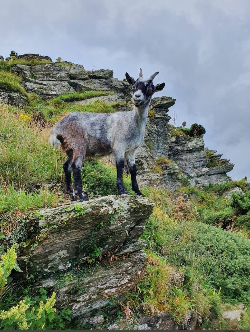
## Description The Valley of Rocks in England is one of North Devon’s most remarkable natural landmarks, known for its dramatic rock formations, sweeping sea views, and intriguing history. Unlike most valleys carved by rivers, the Valley of Rocks is a “dry valley” formed during the Ice Age, making it a rare geological wonder in the UK. Walking through the valley feels like stepping into a mythical landscape. Towering rocks with names like Castle Rock and Ragged Jack rise high above the path, their shapes sparking centuries of local legends. The valley has inspired famous writers such as William Wordsworth and Samuel Taylor Coleridge, who drew upon its dramatic scenery for their poetry. A little-known fact is that the Valley of Rocks was once home to a Victorian cricket ground, possibly one of the most scenic sports fields ever created. While matches no longer take place, the flat ground remains a quirky reminder of the valley’s unusual past. Another fascinating feature is its herd of feral goats, descendants of animals introduced long ago, which continue to roam freely along the cliffs and rocky ledges. This combination of wild beauty, historical curiosities, and literary inspiration makes the Valley of Rocks an unforgettable destination for anyone visiting North Devon. ## Location The Valley of Rocks lies just outside the small town of Lynton, within Exmoor National Park in North Devon, England. Running parallel to the coastline of the Bristol Channel, the valley offers some of the most spectacular sea views in the region. For those traveling by car, the valley is around a 90-minute drive from Exeter or just over an hour from Barnstaple, the nearest major town. Parking is available close to the valley, making it convenient for families and casual walkers. If you’re traveling by public transport, trains connect Exeter to Barnstaple, followed by a bus journey to Lynton. From there, the valley is only a 15–20 minute walk along a coastal path. For a truly unique journey, take the Lynton and Lynmouth Cliff Railway, a Victorian water-powered funicular that links Lynmouth harbor with the clifftop town of Lynton, before strolling out to the valley. ## Tips for Visiting To ensure you make the most of your trip to the Valley of Rocks, consider these practical tips: - Wear sturdy shoes. The paths are rocky and uneven, so comfortable walking shoes are a must. - Bring a camera. From sweeping views over the Bristol Channel to close-up encounters with wild goats, the valley is a photographer’s dream. - Pack a picnic. There are no cafés in the valley itself, but it’s a perfect spot for a scenic outdoor meal. Just watch out for curious goats! - Explore the South West Coast Path. The valley forms part of this famous long-distance trail, so even a short walk gives you access to dramatic coastal scenery. - Check the weather. Coastal winds can be strong, and conditions change quickly. Bring a jacket, even in summer. - Visit nearby towns. Pair your visit with a trip to Lynton and Lynmouth, both known for their charming shops, tea rooms, and coastal views. - Respect wildlife. The feral goats are iconic, but remember they are wild. Admire them from a safe distance. ## Conclusion The Valley of Rocks in England is a true hidden gem of the North Devon coastline, offering a mix of natural wonder, history, and wildlife that few places can match. Whether you’re hiking the cliffs, spotting wild goats, or simply soaking up the coastal views, this unique valley promises an unforgettable experience. A visit here is not just a walk through a landscape but a journey through time, legend, and nature at its most dramatic. ## Frequently Asked Questions - What is special about the Valley of Rocks in England? The Valley of Rocks is unique because it is a dry valley formed during the Ice Age, unlike most valleys carved by rivers. It features dramatic rock formations, sweeping sea views, and wild goats roaming freely along the cliffs. Its unusual geology and rich history make it a must-see attraction in North Devon. - Where exactly is the Valley of Rocks located? The Valley of Rocks is located just outside the town of Lynton, in North Devon, England, within Exmoor National Park. It runs parallel to the Bristol Channel coastline and is easily accessible on foot from Lynton. - How do I get to the Valley of Rocks? You can reach the Valley of Rocks by car from Exeter (about 90 minutes) or Barnstaple (just over an hour). For public transport, take a train from Exeter to Barnstaple, then a bus to Lynton. From Lynton, the valley is a 15–20 minute walk along a coastal path. Another option is the historic Lynton and Lynmouth Cliff Railway, which connects Lynmouth to Lynton. - Are there wild goats in the Valley of Rocks? Yes! One of the valley’s most iconic features is its herd of feral goats, which are descendants of goats introduced centuries ago. They roam freely across the rocks and cliffs, adding to the valley’s wild and rugged charm. - Can you walk through the Valley of Rocks? Absolutely. The valley is popular with walkers of all levels. Short, easy paths allow families and casual visitors to explore, while more challenging trails connect with the South West Coast Path, offering breathtaking views across the sea and cliffs. - What is the best time to visit the Valley of Rocks? The valley is beautiful year-round, but the best time to visit is late spring to early autumn when the weather is milder and the views are clear. Sunset is particularly stunning, as the rocks glow golden in the fading light ## Useful Links for Planning Your Visit If you’d like to learn more about the Valley of Rocks and the surrounding area, these official resources will help you plan your trip: 1. [Valley of Rocks Information](https://www.exmoor-nationalpark.gov.uk/exmoor-for-everyone/things-to-do/the-valley-of-rocks) 2. [Visit Lynton & Lynmouth](https://visitlyntonandlynmouth.com/)
GemVoyage Team • World
Bernese Oberland
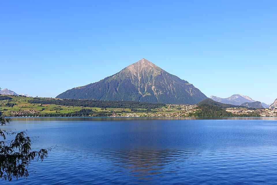
## Description Niesen Mountain, often referred to as the “Swiss Pyramid,” is one of Switzerland’s most visually striking peaks. Its near-perfect triangular shape resembles the iconic Egyptian pyramids, making it a favorite subject for artists like Paul Klee and Ferdinand Hodler. Rising to an elevation of 2,362 meters (7,749 feet), Niesen offers panoramic views over Lake Thun, the Bernese Alps, and the Simmen and Kander valleys. What makes Niesen truly unique isn’t just its shape—it’s the experience of getting to the summit. Visitors can ascend via the **Niesenbahn**, a historic funicular railway that’s been operating since 1910. The ride itself is a scenic journey, taking just 30 minutes to reach the top. But here’s a little-known fact: running alongside the funicular is the **world’s longest stairway**, with a staggering 11,674 steps. While it’s not open to the public for regular use, it hosts an annual stair run event that draws athletes from around the globe. Another charming detail? The mountain’s original name was “Yesen,” derived from the yellow gentian flower, which still blooms on its slopes today. ## Location Niesen is located in **Switzerland**, within the **Canton of Bern**, specifically in the **Bernese Oberland** region. The mountain overlooks **Lake Thun** and lies between the municipalities of **Wimmis** and **Reichenbach im Kandertal**. ### How to Get There: - **By Train**: Take a train to **Mülenen**, a small village that serves as the base station for the Niesenbahn funicular. - **By Car**: Mülenen is accessible via the A6 motorway. Parking is available near the funicular station. - **By Public Transport**: Swiss Travel Pass holders enjoy discounted fares on the funicular, making it an ideal choice for tourists. Once in Mülenen, hop on the funicular for a scenic ride to the summit. ## Tips for Visitors To make the most of your visit to Niesen, consider the following tips: - **Time Your Visit**: The mountain is open from mid-April to mid-November. For the most breathtaking views, aim for a sunrise or sunset trip—overnight stays at the Berghaus Niesen Kulm offer this magical experience. - **Book Ahead**: The funicular and restaurant can get busy during peak season. Booking tickets and meals in advance is highly recommended. - **Dress Appropriately**: Weather can change quickly at high altitudes. Bring layers, even in summer. - **Photography**: Don’t forget your camera—the glass pavilion at the summit offers unobstructed views perfect for landscape shots. - **Dining**: Try the full-moon dinner or breakfast buffet at the summit restaurant for a truly memorable culinary experience. - **Family Friendly**: Story rides and cultural events make Niesen a great destination for kids too. ## Conclusion Niesen Mountain is more than just a scenic peak—it’s a blend of natural beauty, historical charm, and cultural significance. Whether you're drawn by its pyramid shape, the thrill of the funicular ride, or the serenity of alpine views, Niesen offers an unforgettable Swiss experience. ## FAQ **1. What is the elevation of Niesen Mountain?** Niesen stands at 2,362 meters (7,749 feet) above sea level. **2. How do I reach the summit?** You can take the Niesenbahn funicular from Mülenen, which takes about 30 minutes to reach the top. **3. Is the stairway open to the public?** No, the 11,674-step stairway is only accessible during the annual Niesen stair run event. **4. When is the best time to visit Niesen?** Between mid-April and mid-November. Sunrise and sunset visits are especially stunning. **5. Are there accommodations at the summit?** Yes, the Berghaus Niesen Kulm offers cozy rooms and dining options with spectacular views. **6. Is Niesen suitable for children?** Absolutely. There are story rides and cultural activities designed for families. ## Links - [Official Niesen Website](https://www.niesen.ch/en/) - [Switzerland Tourism – Niesen](https://www.myswitzerland.com/en-us/destinations/niesen/)
GemVoyage Team • World
Samogitia
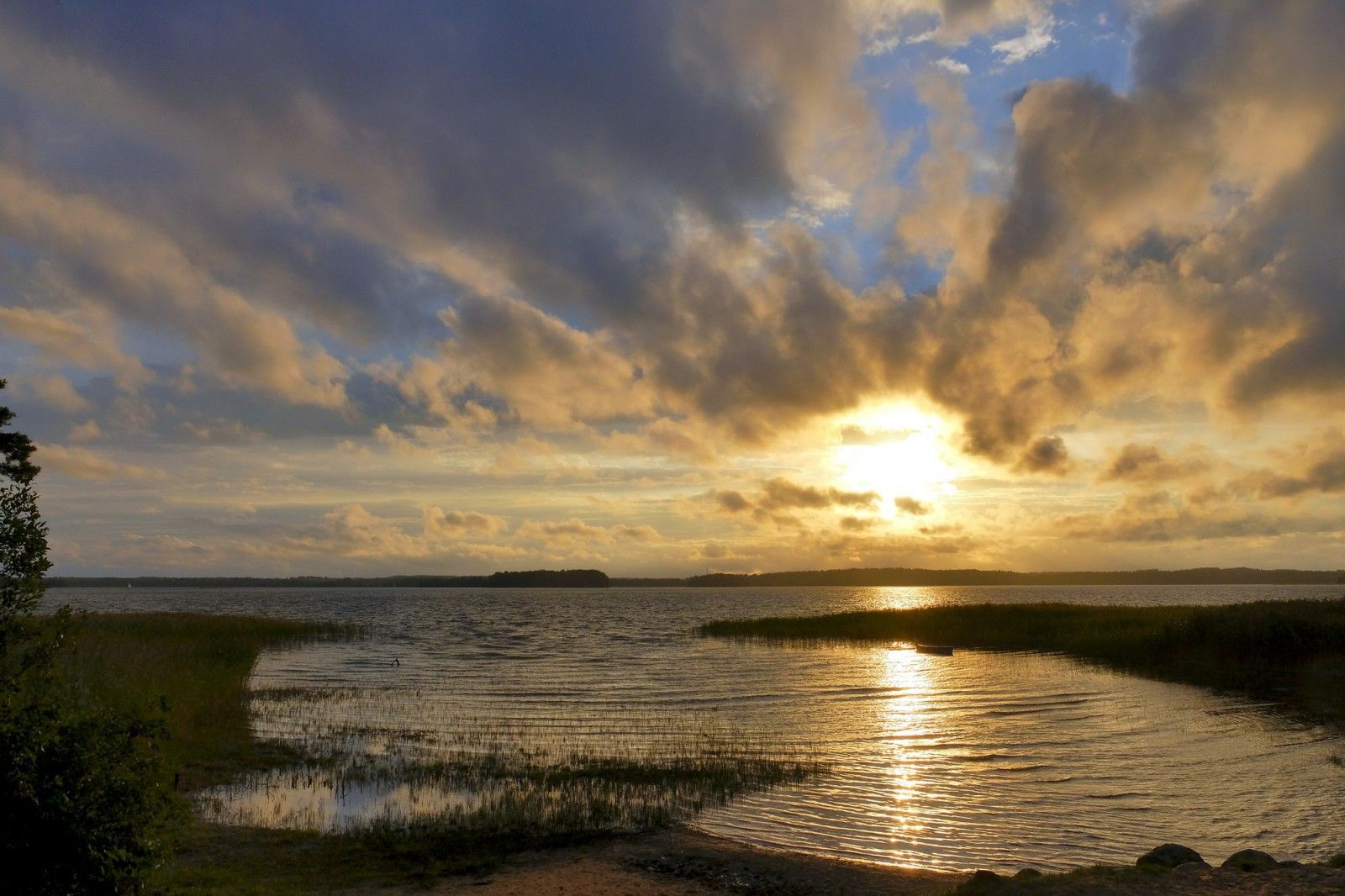
## Description Žemaitija National Park, anchored by the scenic Plateliai Lake, is a standout example of Lithuania’s western Samogitian landscape: rolling forests, glacial lakes, and a rich cultural heritage. What makes this park unique is the combination of water-centered recreation and preserved rural traditions. Plateliai Lake is the largest lake in the park and offers a classic Lithuanian landscape of glassy water, wooded shores, and scattered islets. Visitors will find peaceful village life, historic manors, and small museums that present local folklore and ethnography. A little-known fact: the park preserves several sites tied to Samogitian cultural identity, including local craft traditions and seasonal rites which are still observed in nearby villages. Another lesser-known element is the network of underwater archaeological finds in Plateliai Lake—remnants of older settlements and boating artifacts discovered by divers, now sometimes referenced by local guides. The park’s mix of outdoor activity and intangible cultural heritage makes it a destination for nature lovers, photographers, and anyone interested in rural Lithuanian traditions. In addition to swimming and boating on the lake, there are marked hiking and cycling trails, observation points for birdwatching, and a few modest but charming guesthouses that connect visitors with local cuisine and hospitality. ## Location Žemaitija National Park is in northwestern Lithuania, in the historical region of Samogitia (Žemaitija), near the town of Plateliai in Plungė district, Telšiai County. The park sits roughly 100–150 km northwest of Kaunas and about the same southwest of Vilnius, making it accessible as a multi-day stop on a trip across Lithuania. How to get there: by car the most flexible option—use the A1/A11 roads from Kaunas or the route via Šiauliai depending on start point. From Vilnius, trains and buses to Telšiai or Plungė followed by a short local bus or taxi ride to Plateliai are practical. During summer tourist season local tour operators run trips that include lake boat trips and guided hikes. ## Tips - Best time: late spring through early autumn for boating and hiking; autumn colors are vivid and ideal for photography. - Bring insect repellent for forest trails and a lightweight waterproof jacket—weather can change quickly. - Rent a kayak or small boat in Plateliai to explore secluded bays; sunrise on the lake is particularly tranquil. - Respect local customs and private land boundaries—many trails cross pastoral land. - If interested in cultural programming, check Plateliai museum opening times in advance; some craft demonstrations are seasonal. - Book accommodation in advance during weekends and public holidays. ## Conclusion Žemaitija National Park and Plateliai Lake offer a balanced, authentic Lithuanian experience: tranquil lakeside scenery, woodlands, and a living connection to Samogitian cultural life. It suits visitors who enjoy gentle outdoor activities combined with opportunities to learn about regional traditions. ## FAQ Q: Is Plateliai Lake suitable for swimming? A: Yes—there are safe swimming spots and beaches, but always follow local signage and conditions. Q: Can I rent boats or kayaks on the lake? A: Yes, local operators in Plateliai rent boats and kayaks in season. Q: Are there guided tours of the park? A: Local guides and visitor centers can arrange guided hikes, birdwatching, and cultural visits—book ahead in high season. Q: Is the park family-friendly? A: Yes, with easy trails, picnic sites, and gentle water activities suitable for families. Q: Are there marked cycling routes? A: Yes, several mapped cycling routes traverse scenic roads and trails in the park. ## Links - [Žemaitija National Park (Wikipedia)](https://en.wikipedia.org/wiki/%C5%BDemaitija_National_Park)
GemVoyage Team • World
Sedgefield
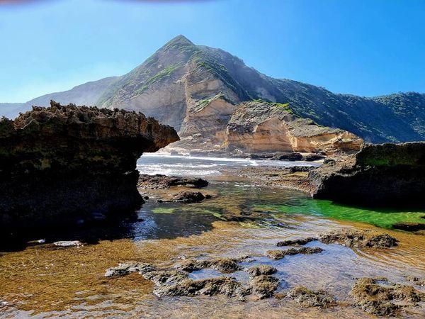
## Description **Gericke’s Point** is one of the hidden gems of South Africa’s Garden Route. Famous for its striking sandstone cliff that resembles the profile of a lion’s head, this natural landmark offers both geological beauty and incredible biodiversity. At low tide, the area transforms into a natural aquarium, revealing tidal pools brimming with colorful marine life such as starfish, sea anemones, and small fish. The rock formation itself is over 150 million years old, part of the ancient Table Mountain sandstone system. Its unusual shape and size make it one of the most photogenic spots along the coast. Beyond its geology, Gericke’s Point is also a birdwatcher’s paradise, with seabirds often seen diving for fish and dolphins occasionally passing offshore. A little-known fact is that the tidal pools here are considered some of the most diverse along the Garden Route, making it a favorite spot for marine biologists and nature enthusiasts. Another fascinating detail is that the rock face has long been a landmark for sailors navigating the coast between Sedgefield and Wilderness. ## Location Gericke’s Point is located near **Sedgefield**, a small town along the **Garden Route** in the **Western Cape Province** of **South Africa**. It lies about 25 kilometers from Knysna and around 40 kilometers from George. To reach the point, visitors typically start at Swartvlei Beach near Sedgefield. From there, a scenic beach walk of about 2–3 kilometers leads to the rock formation. The best time to go is at low tide, when the tidal pools are accessible and the walk is safe. Travelers driving the Garden Route can easily stop at Sedgefield, with parking available near the beach entrance. ## Tips * **Check the tide tables:** Low tide is the only safe and rewarding time to visit. High tide can make the walk dangerous. * **Wear sturdy shoes:** Although the walk is along the beach, exploring the tidal pools requires footwear with good grip. * **Bring a camera:** The lion-shaped rock formation and vibrant tidal pools make for excellent photography opportunities. * **Pack water and sun protection:** There are no facilities along the beach walk, so carry essentials with you. * **Respect marine life:** Avoid disturbing or removing creatures from the tidal pools—this is a fragile ecosystem. * **Stay for sunset:** The area is particularly stunning in the golden light of late afternoon, with the rock formation silhouetted against the ocean. ## Conclusion Gericke’s Point is more than just a rock formation—it is a window into South Africa’s geological past and a living showcase of coastal biodiversity. With its tidal pools, dramatic cliffs, and sweeping ocean views, it offers a perfect mix of adventure and tranquility along the Garden Route. For travelers seeking a memorable nature experience off the beaten path, Gericke’s Point is not to be missed. ## FAQ **1. How long is the walk to Gericke’s Point?** The walk from Swartvlei Beach to Gericke’s Point takes about 30–40 minutes each way, depending on pace and tide conditions. **2. Is it safe to swim near Gericke’s Point?** Swimming is possible in some tidal pools, but the open ocean can be rough. Always exercise caution and avoid strong currents. **3. Can children visit the point?** Yes, children often enjoy exploring the tidal pools, but they should be supervised closely due to slippery rocks and the incoming tide. **4. Is there an entrance fee?** No, Gericke’s Point is free to access, though parking at Swartvlei Beach may sometimes require a small fee. **5. What wildlife might I see?** In addition to tidal pool creatures, visitors may spot dolphins offshore, oystercatchers, and other seabirds. In whale season (June–November), southern right whales are sometimes visible. **6. When is the best time to visit?** The best time is at low tide and preferably in the morning or late afternoon when temperatures are milder and light conditions are ideal. ## Links * [Visit Garden Route – Sedgefield](https://www.visitgardenrouteandkleinkaroo.com) * [South African Tourism – Garden Route](https://www.southafrica.net)
GemVoyage Team • World
Kalymnos
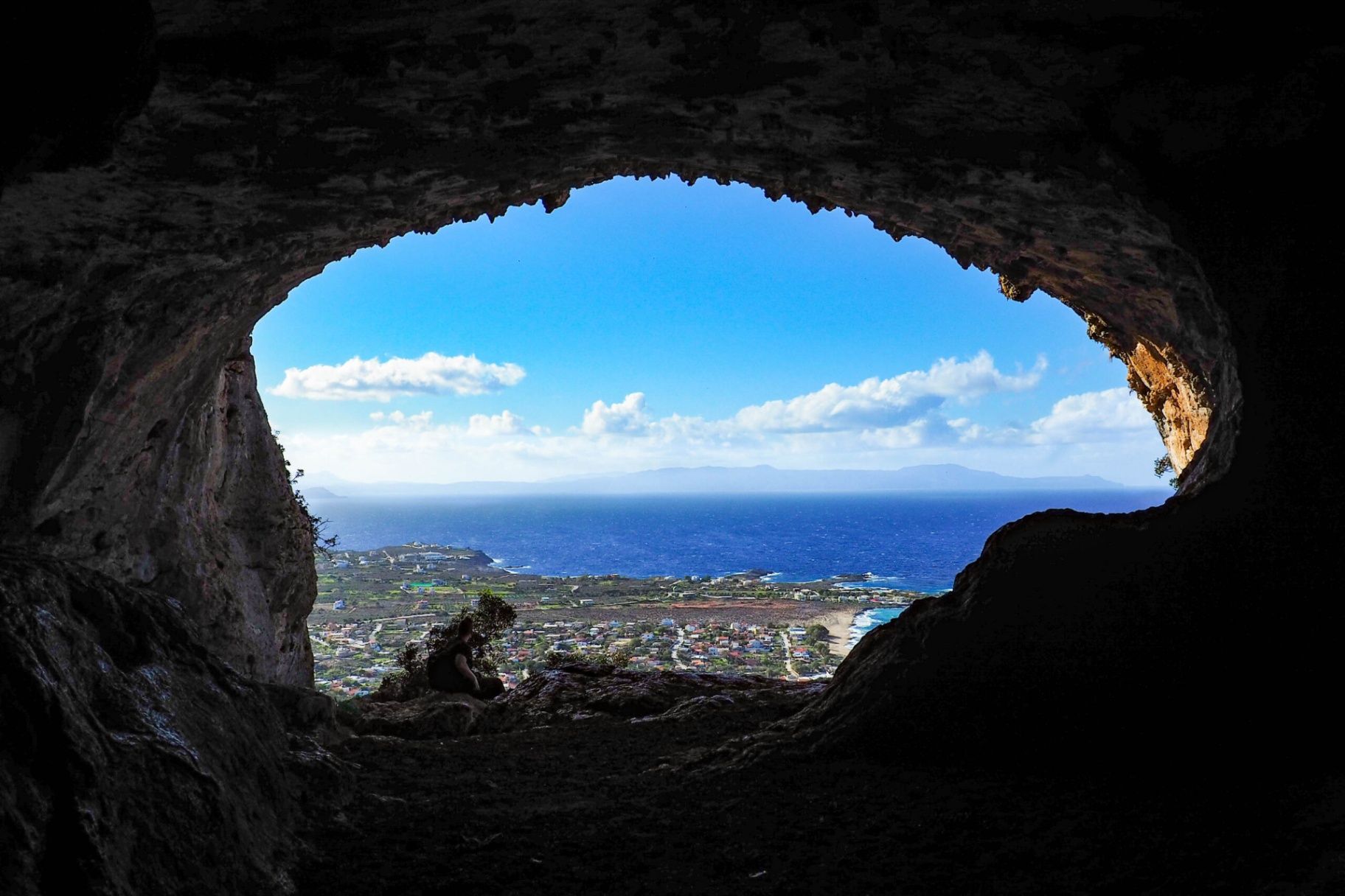
## Description The **Lerá Cave (Σπήλαιο Λερά)** is one of the lesser-known yet historically and mythologically significant caves in Greece. Nestled on the island of **Kalymnos** in the Dodecanese, the cave has been a place of worship since antiquity. Archaeological findings suggest that it was used as a sanctuary dedicated to deities such as **Zeus**, **Hera**, and possibly **Apollo**, highlighting its importance in ancient Greek religious practices. The interior of the cave is both impressive and atmospheric. Visitors are greeted by stalactites, natural chambers, and an aura that recalls the sacred rituals once held there. Some areas still contain traces of ancient votive offerings, fragments of altars, and inscriptions. Unlike more famous caves in Greece, such as those on Crete, Lerá Cave remains largely untouched by mass tourism, making it a fascinating site for travelers seeking authenticity and tranquility. A little-known fact is that the cave continued to be used in later centuries, even during Christian times, when it was adapted for chapels and local worship. This continuity of use gives the Lerá Cave a rare cultural layering that spans thousands of years. ## Location Lerá Cave is located on the island of **Kalymnos**, part of the **Dodecanese** island group in the southeastern **Aegean Sea**, **Greece**. The cave lies on the slopes of Mount Vathy, above the picturesque Vathy Valley, about 9 kilometers from Pothia, the island’s capital. To reach the cave, visitors typically begin from Vathy village and then hike up a marked path leading to the cave entrance. The hike can be moderately challenging, involving rocky paths, so proper footwear is essential. Travelers arriving on Kalymnos usually come by ferry from Kos or Rhodes, or by domestic flights to Kalymnos Island National Airport. Once on the island, local taxis or rented vehicles can bring you close to the trailhead. ## Tips * **Wear sturdy shoes:** The trail to the cave is uneven and rocky, so hiking footwear is strongly recommended. * **Bring a flashlight:** While some natural light enters, the cave interior can be dark, and a torch helps you explore safely. * **Combine with a hike:** The path to Lerá Cave offers panoramic views over the Vathy Valley and Aegean Sea—make the most of the journey, not just the destination. * **Respect the site:** Remember the cave’s sacred history; avoid touching archaeological remains or leaving litter. * **Visit in cooler hours:** Early morning or late afternoon hikes are more comfortable, especially in summer when temperatures are high. * **Consider a guide:** Local guides provide insights into the myths and history tied to the cave, enriching the visit. ## Conclusion The **Lerá Cave** is more than a natural formation—it is a place where geology, mythology, and history converge. With its ancient role as a sanctuary, its natural beauty, and its enduring aura of mystery, it stands as one of Kalymnos’s hidden treasures. For travelers seeking an off-the-beaten-path cultural experience in Greece, a visit to Lerá Cave is deeply rewarding. ## FAQ **1. What was Lerá Cave used for in antiquity?** It served as a sanctuary dedicated to gods like Zeus, Hera, and possibly Apollo, where locals made offerings and conducted rituals. **2. How difficult is the hike to the cave?** The hike is moderately challenging due to rocky terrain. It is accessible to most visitors with proper footwear and reasonable fitness. **3. Is the cave suitable for children?** Yes, but with caution. The path and cave interior can be uneven, so supervision is essential for younger children. **4. Do I need a guide to visit Lerá Cave?** Not strictly, but hiring a local guide enhances the experience by providing historical, mythological, and archaeological context. **5. Is there an entrance fee?** No, Lerá Cave is free to visit, though donations to local cultural associations are sometimes welcomed. **6. Can I combine this visit with other attractions?** Yes, the cave is near Vathy Valley, known for its orchards and harbor, and can easily be combined with a cultural or nature tour of Kalymnos. ## Links * [Dodecanese Islands Tourism](https://www.visitgreece.gr)
GemVoyage Team • World
Amazonas
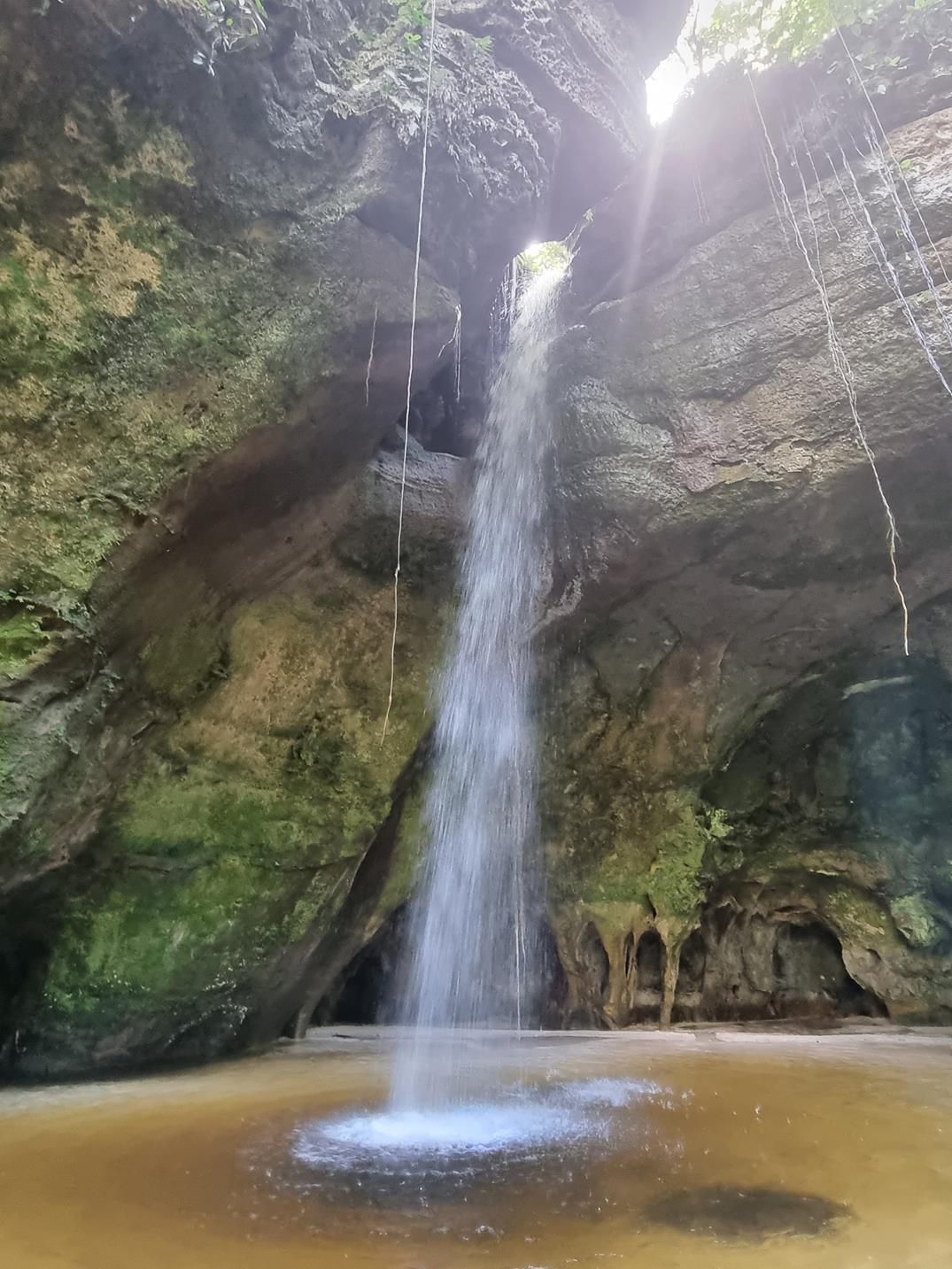
## Description Deep within the lush rainforest of the Amazon lies a pair of natural wonders: **Caverna do Maroaga (Maroaga Cave)** and **Caverna da Judeia (Judeia Cave)**. These caves are part of the Presidente Figueiredo municipality in northern Brazil, often nicknamed the “Land of Waterfalls and Caves” due to its unique geology and landscapes. The **Maroaga Cave** is famous for its dramatic sandstone formations and a stream that flows directly from within, creating a mystical atmosphere as the water emerges from the cave’s dark interior. Sunlight filtering through the forest canopy reflects on the water, giving the cave a magical glow. Its name comes from a local indigenous chief, Maroaga, who is said to have used the cave as a hideout, adding a layer of legend to its natural beauty. The nearby **Judeia Cave** is equally captivating. It features a more intimate setting, with a waterfall cascading over its entrance and forming a natural curtain of water. Walking behind the waterfall offers visitors a unique and refreshing perspective, with the sound of rushing water echoing throughout the cave. A little-known fact is that both caves are part of the same ecological reserve, which shelters a vast variety of flora and fauna. Biologists have recorded rare species of bats and amphibians in these caves, making them not only scenic wonders but also important ecological habitats. ## Location Caverna do Maroaga and Caverna da Judeia are located in **Presidente Figueiredo**, a municipality in the state of **Amazonas**, in northern **Brazil**. The region lies about 107 kilometers north of **Manaus**, the capital of Amazonas, along the BR-174 highway. The most common way to reach the caves is by car or organized tour from Manaus. The drive takes about two hours and passes through dense rainforest landscapes. Once at the entrance to the reserve, guided hikes of varying lengths lead to the caves. The trails are not particularly difficult, but they can be muddy and slippery, especially during the rainy season. For international visitors, the easiest route is to fly into Manaus and then book a day trip or multi-day tour that includes the caves as part of a broader itinerary of waterfalls and natural attractions. ## Tips * **Wear proper footwear:** Hiking boots or sturdy shoes are recommended, as the trails can be wet and uneven. * **Hire a guide:** Local guides not only ensure safety but also provide insights into the caves’ legends, geology, and biodiversity. * **Bring swimwear and a towel:** The waterfalls and streams around the caves are perfect for cooling off after a hike. * **Pack insect repellent:** The Amazon rainforest is home to mosquitoes and other insects, especially near water sources. * **Visit during the dry season:** From June to November, the trails are easier to access, although the rainy season offers stronger waterfalls and a wilder atmosphere. * **Respect the environment:** Avoid leaving litter, and do not disturb the caves’ wildlife, particularly bats and amphibians. ## Conclusion Caverna do Maroaga and Caverna da Judeia showcase the wild beauty and hidden wonders of Brazil’s Amazon rainforest. With their waterfalls, sandstone formations, and legendary history, they are must-visit sites for eco-tourists and adventurers seeking an authentic experience in the heart of nature. Together, they represent not just geological marvels but also living ecosystems that deserve protection and respect. ## FAQ **1. Do I need a guide to visit the caves?** Yes, local guides are highly recommended for safety, navigation, and to ensure the preservation of the natural environment. **2. Can I swim near the caves?** Yes, swimming is allowed in the pools and streams near the caves, but always follow local safety advice. **3. How difficult are the hikes to the caves?** The hikes are moderate in difficulty, with some slippery and uneven sections. Good footwear is essential. **4. Are the caves accessible year-round?** Yes, but the experience differs by season. The rainy season (December–May) offers stronger waterfalls, while the dry season (June–November) makes trails easier to navigate. **5. What wildlife might I see?** Bats, amphibians, tropical birds, and a wide variety of insects inhabit the area. Lucky visitors may even spot monkeys in the surrounding forest. **6. How long should I plan for a visit?** Most tours include both caves in a half-day excursion, though spending a full day allows more time to explore nearby waterfalls and trails. ## Links * [Amazons Wiki](https://en.wikipedia.org/wiki/Amazonas_(Brazilian_state))
GemVoyage Team • World
