GemVoyage Team • World
The Valley of Rocks in England is one of North Devon’s most remarkable natural landmarks, known for its dramatic rock formations, sweeping sea views, and intriguing history. Unlike most valleys carved by rivers, the Valley of Rocks is a “dry valley” formed during the Ice Age, making it a rare geological wonder in the UK.
Walking through the valley feels like stepping into a mythical landscape. Towering rocks with names like Castle Rock and Ragged Jack rise high above the path, their shapes sparking centuries of local legends. The valley has inspired famous writers such as William Wordsworth and Samuel Taylor Coleridge, who drew upon its dramatic scenery for their poetry.
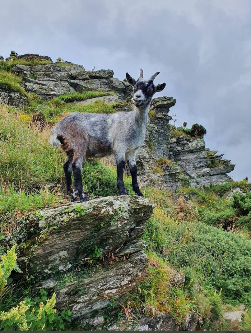
A little-known fact is that the Valley of Rocks was once home to a Victorian cricket ground, possibly one of the most scenic sports fields ever created. While matches no longer take place, the flat ground remains a quirky reminder of the valley’s unusual past. Another fascinating feature is its herd of feral goats, descendants of animals introduced long ago, which continue to roam freely along the cliffs and rocky ledges.
This combination of wild beauty, historical curiosities, and literary inspiration makes the Valley of Rocks an unforgettable destination for anyone visiting North Devon.
The Valley of Rocks lies just outside the small town of Lynton, within Exmoor National Park in North Devon, England. Running parallel to the coastline of the Bristol Channel, the valley offers some of the most spectacular sea views in the region.
For those traveling by car, the valley is around a 90-minute drive from Exeter or just over an hour from Barnstaple, the nearest major town. Parking is available close to the valley, making it convenient for families and casual walkers.
If you’re traveling by public transport, trains connect Exeter to Barnstaple, followed by a bus journey to Lynton. From there, the valley is only a 15–20 minute walk along a coastal path. For a truly unique journey, take the Lynton and Lynmouth Cliff Railway, a Victorian water-powered funicular that links Lynmouth harbor with the clifftop town of Lynton, before strolling out to the valley.
To ensure you make the most of your trip to the Valley of Rocks, consider these practical tips:
The Valley of Rocks is unique because it is a dry valley formed during the Ice Age, unlike most valleys carved by rivers. It features dramatic rock formations, sweeping sea views, and wild goats roaming freely along the cliffs. Its unusual geology and rich history make it a must-see attraction in North Devon.
The Valley of Rocks is located just outside the town of Lynton, in North Devon, England, within Exmoor National Park. It runs parallel to the Bristol Channel coastline and is easily accessible on foot from Lynton.
You can reach the Valley of Rocks by car from Exeter (about 90 minutes) or Barnstaple (just over an hour). For public transport, take a train from Exeter to Barnstaple, then a bus to Lynton. From Lynton, the valley is a 15–20 minute walk along a coastal path. Another option is the historic Lynton and Lynmouth Cliff Railway, which connects Lynmouth to Lynton.
Yes! One of the valley’s most iconic features is its herd of feral goats, which are descendants of goats introduced centuries ago. They roam freely across the rocks and cliffs, adding to the valley’s wild and rugged charm.
Absolutely. The valley is popular with walkers of all levels. Short, easy paths allow families and casual visitors to explore, while more challenging trails connect with the South West Coast Path, offering breathtaking views across the sea and cliffs.
The valley is beautiful year-round, but the best time to visit is late spring to early autumn when the weather is milder and the views are clear. Sunset is particularly stunning, as the rocks glow golden in the fading light
If you’d like to learn more about the Valley of Rocks and the surrounding area, these official resources will help you plan your trip:
Discover more hidden gems you might love.
Arequipa
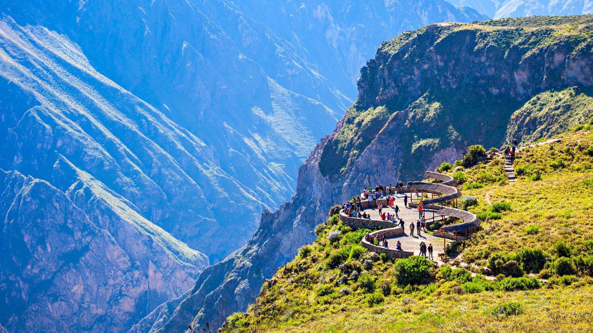
## Description Colca Canyon in southern Peru is one of the world’s deepest and most dramatic canyons, carved by the Colca River through folded volcanic and sedimentary rocks. Terraced agriculture clings to canyon walls and reflects centuries of pre-Columbian and colonial land-use systems. The canyon is famed for condor-watching at viewpoints such as Cruz del Cóndor, where giant Andean condors ride thermal updrafts above layered ridges and terraced fields. Beyond the condors, Colca’s cultural landscape includes traditional villages where residents manage terraces, raise llamas and alpacas, and produce woven textiles. Travelers can combine wildlife viewing with multi-day treks, hot-spring relaxation, and market visits to towns like Chivay for local crafts and regional cuisine. For planning and indexing, useful phrases include "Colca Canyon trek routes," "Cruz del Condor sunrise," and "Colca homestay lodges." Ecological and cultural stewardship: Local communities practice terrace maintenance and rotational agriculture that preserves soil stability and biodiversity. Sustainable tourism operators contribute to local economies through guide employment, community lodges, and cultural exchanges—seek providers who collaborate directly with village associations. ## Location Colca Canyon lies west of Arequipa city in southern Peru; the closest base towns are Chivay and Cabanaconde. Most visitors travel from Arequipa by bus or private transfer, often overnighting to catch morning condor flights. How to get there: Overnight buses and private transfers from Arequipa are common options; the journey includes scenic highland landscapes and stops at viewpoints and small towns. For multi-day treks, many itineraries begin from Cabanaconde or Sangalle (the oasis), and local guides provide route knowledge, porters, and camp logistics when necessary. Use search queries like "Arequipa to Colca Canyon bus" or "Cabanaconde trek guide" to find up-to-date transport and trekking services. Altitude and health: The Colca region ranges above 3,000 meters—allow time to acclimatize in Arequipa or the highlands, stay hydrated, and moderate exertion to reduce altitude-related risks. Cold nights are common; pack suitably warm layers for overnight treks or village stays. ## Tips - **Arrive early for condors:** Dawn and early morning hours produce the most reliable thermals and large condor flight displays at Cruz del Cóndor. - **Consider multi-day treks:** The canyon supports multi-day hikes with village homestays, campsites, and lodges for immersive experiences beyond the main lookout points. - **Hire local guides:** Guides provide route safety, cultural context, and community support; choose operators that compensate villages and porters fairly. - **Visit local markets and hot springs:** Chivay offers markets for textiles and crafts, while nearby hot springs provide a relaxing complement to trekking. - **Acclimatize to altitude:** Spend at least a night in Arequipa or another high-altitude town before strenuous activities and avoid rapid ascent. - **Respect cultural protocols:** Ask permission before photographing people or domestic rituals and buy crafts directly from artisan cooperatives when possible. ## Conclusion Colca Canyon combines a spectacular natural theater with enduring human landscapes—terraced agriculture, weaving traditions, and the Andean condor spectacle create a layered experience for travelers seeking wildlife, culture, and trekking. When planning, use targeted searches like "Colca Canyon 3-day trek" or "best condor viewpoints" to shape an itinerary that balances adventure with community benefits. ## FAQ - **Q: What’s the best time to see condors?** A: Early morning as thermals form (shortly after sunrise) is when condors are most active; clear weather improves visibility but conditions vary seasonally. - **Q: Are guided treks recommended?** A: Yes — local guides know safe routes, campsites, and cultural protocols, and hiring them supports village economies and improves the overall experience. - **Q: How long do treks in Colca Canyon usually take?** A: Treks range from single-day hikes to 2–4 day itineraries depending on route, overnight choices, and walking pace; many travelers choose a 2–3 day loop to visit Sangalle (the oasis) and return via village trails. - **Q: Is the canyon suitable for beginners?** A: Parts of the canyon are approachable for fit beginners with a guide; steep descents and ascents make some routes challenging—assess fitness, acclimatize, and choose routes accordingly. - **Q: How should I prepare for altitude?** A: Allow time in Arequipa or intermediate towns to acclimatize, hydrate, rest, and avoid heavy exertion on the first day at altitude; consult health professionals if you have concerns. ## Links - [Colca Canyon — Wikipedia](https://en.wikipedia.org/wiki/Colca_Canyon)
GemVoyage Team • World
Paris
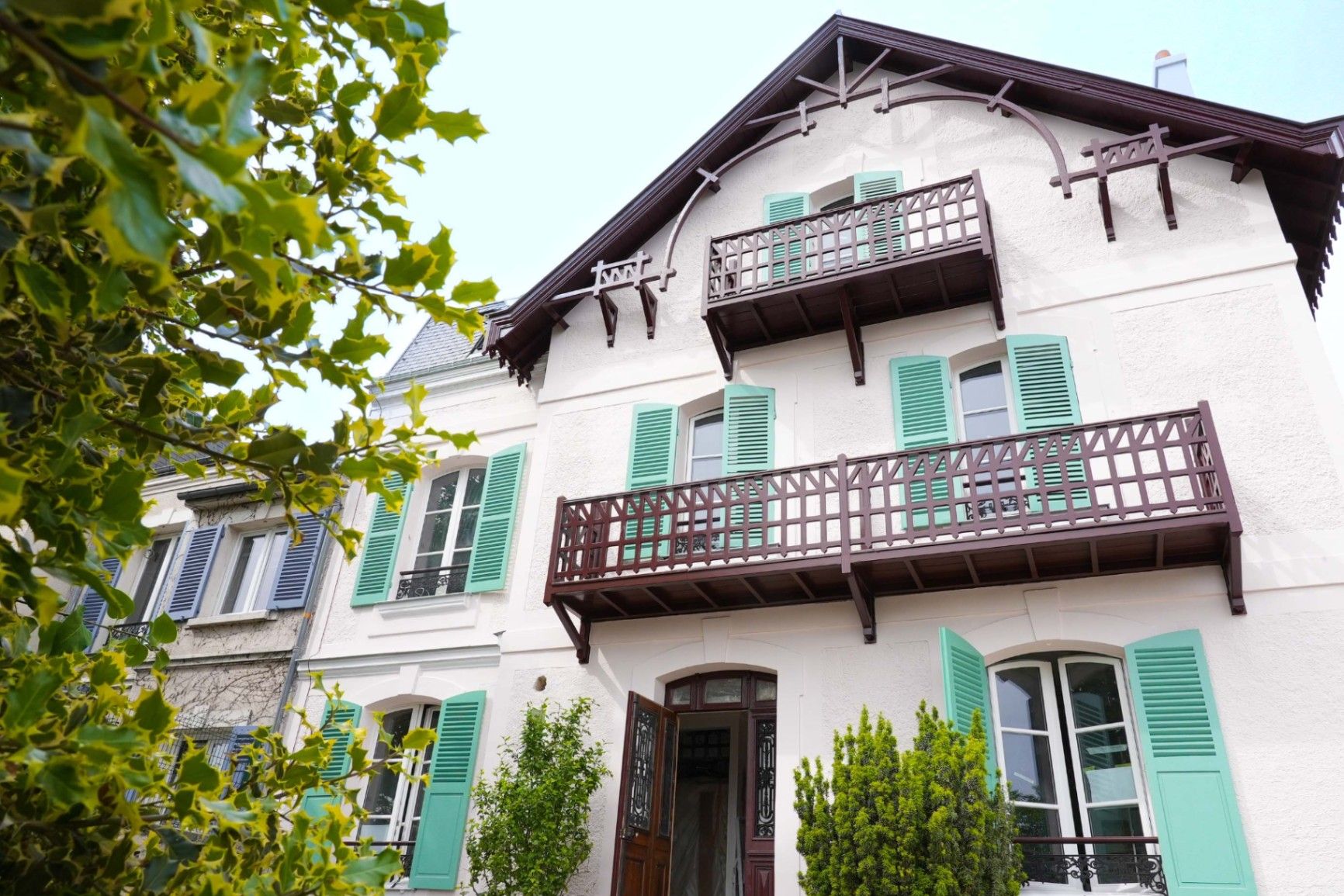
## Description **Maison Impressionniste Claude Monet Argenteuil** is a carefully reconstructed space dedicated to the years when Claude Monet lived and worked in Argenteuil, a suburb northwest of Paris. Although not the original residence, the house functions as a faithful evocation of Monet’s daily environment between 1871 and 1878, a period widely considered formative for the **Impressionist movement**. This is where Monet refined his techniques of capturing light, atmosphere, and everyday scenes, and where he produced some of his most celebrated works, including views of the Seine, gardens, and his own home life. The house is arranged to resemble the domestic context that influenced Monet’s early mastery. Rooms are curated with period furniture, reproductions of key paintings, personal objects, and interpretive displays illustrating how Monet painted outdoors, how he experimented with color, and how Argenteuil became a meeting point for artists such as Renoir, Manet, and Sisley. The staging provides an accessible narrative of Monet as a young pioneer, long before his later fame at Giverny. A little-known fact is that Argenteuil was once a **boating and leisure capital** for Parisians, and Monet frequently painted regattas and pleasure craft from the riverbanks near his home. Another lesser-known detail is that Monet’s time in Argenteuil coincided with substantial urban development, which threatened some of the very landscapes he painted. This tension between modernization and natural beauty appears subtly throughout his Argenteuil canvases. Today, the Maison Impressionniste offers a more intimate and less crowded alternative to major Impressionist institutions in Paris. It gives visitors the chance to walk through reconstructed interiors that feel personal rather than monumental and to understand the roots of what would become Monet’s global artistic influence. ## Location **City:** Argenteuil (Greater Paris area) **Region:** Île-de-France **Country:** France The house is situated in a residential part of Argenteuil, within walking distance of the Seine and the locations that inspired many of Monet’s paintings. ### How to Get There * **By train:** * From **Gare Saint-Lazare** in Paris, take a Transilien J train to **Argenteuil Station**. From there, it is a short walk or a brief bus ride. * **By bus:** * Several suburban bus lines connect Argenteuil with northern districts of Paris. * **By car:** * The area is accessible via the A15 or A86, but parking can be limited in residential streets. * **On foot from the center of Argenteuil:** * A pleasant 10–15 minute walk through town streets leads directly to the museum. ## Tips * **Visit on a weekday** to avoid periods when small tour groups pass through. * **Combine it with a Seine riverside walk**, retracing the landscapes Monet depicted in his Argenteuil period. * **Plan 45–60 minutes**, as the museum is compact but detailed. * **Photography policies may vary**, so check signage before taking photos inside. * **The museum often hosts temporary exhibits** on Impressionism and plein-air painting; check ahead for program changes. * **Bring context:** Reviewing Monet’s Argenteuil works beforehand will enrich the visit, as many are referenced in the interpretive materials. ## Conclusion Maison Impressionniste Claude Monet Argenteuil offers an intimate and historically grounded perspective on Monet’s early Impressionist years. The reconstructed spaces, the focus on daily life, and the proximity to the landscapes that shaped his artistic eye make it a meaningful stop for those seeking a deeper understanding of how Impressionism emerged and matured. ## FAQ **1. Is the house original?** No. It is a faithful reconstruction designed to evoke Monet’s home during his Argenteuil years. **2. How long did Monet live in Argenteuil?** From 1871 to 1878, a key period of his early Impressionist development. **3. Can visitors see original artworks?** The museum primarily displays reproductions and interpretive materials; original works are held in major museums in Paris and abroad. **4. Is the visit suitable for children?** Yes. The rooms are accessible, and the museum offers educational materials for younger visitors. **5. How long should I plan for the visit?** Around 1 hour, depending on reading speed and interest in the exhibits. **6. Is the museum wheelchair accessible?** Accessibility can vary; checking ahead with the museum is recommended. ## Links * [Official tourism information for Argenteuil](https://www.argenteuil.fr)
GemVoyage Team • World
Aqaba
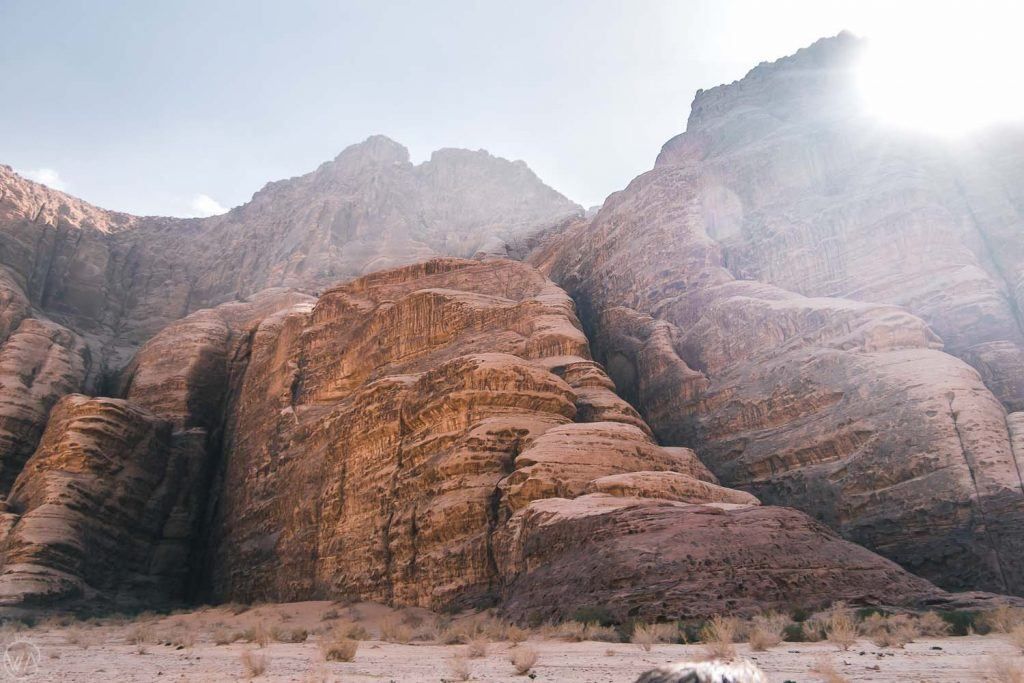
## Description **Jabal Umm ad Dami** is the highest mountain in Jordan, rising to approximately **1,854 meters above sea level**. Located deep in the southern desert near the Saudi border, it offers a dramatically different experience from the country’s more famous historical sites. Rather than monuments or ruins, Jabal Umm ad Dami is about **scale, silence, and raw landscape**. The mountain dominates the horizon with a stark, rocky profile that feels both remote and elemental. What makes Jabal Umm ad Dami truly special is the **sense of isolation and elevation** it provides. From the summit, on clear days, it is possible to see across vast stretches of desert and, remarkably, into **Saudi Arabia**, the Red Sea, and even parts of the Sinai Peninsula. This expansive visibility is rare in the region and contributes to the mountain’s reputation as one of Jordan’s most rewarding viewpoints. Geologically, the mountain is part of the same ancient granite formations that shape the surrounding desert, giving it rugged textures and warm reddish hues, especially striking at sunrise and sunset. Unlike heavily trafficked peaks elsewhere in the world, Jabal Umm ad Dami remains **largely untouched by mass tourism**, preserving a sense of authenticity and wilderness. A lesser-known fact is that the mountain has long been used as a **navigation landmark by Bedouin tribes**, who relied on its prominence to orient themselves across the desert. Another overlooked detail is that, despite being Jordan’s highest point, the climb is considered **moderate rather than technical**, making it accessible to fit hikers without advanced mountaineering skills when guided properly. Jabal Umm ad Dami is not a place of crowds or amenities. Its appeal lies in its honesty: an uncompromising desert mountain that rewards effort with perspective. ## Location **Country:** Jordan **Region:** Aqaba Governorate **Nearest Area:** Wadi Rum Desert **Proximity:** Near the Jordan–Saudi Arabia border The mountain lies south of the protected desert landscapes of **Wadi Rum**, often referred to as the “Valley of the Moon,” though it sits outside the main tourist circuit. ### How to Get There * **From Aqaba:** * Travel north toward Wadi Rum by car, then continue south with a **4x4 vehicle**. * **With a local guide:** * The most practical and safest option. Bedouin guides know the terrain and access routes. * **From Wadi Rum:** * Many guided excursions combine Wadi Rum exploration with a hike to Jabal Umm ad Dami. * **Public transport:** * Not available for the final approach; private transport is required. Independent travel without proper navigation and a suitable vehicle is strongly discouraged. ## Tips * **Hire a local Bedouin guide:** This is not optional if you want a safe and meaningful experience. * **Start early:** Heat and exposure increase significantly later in the day. * **Bring sufficient water:** There are no water sources on or near the mountain. * **Wear sturdy footwear:** The terrain is rocky and uneven. * **Check weather conditions:** Wind can be strong at the summit. * **Combine with camping:** An overnight desert camp enhances the experience significantly. ## Conclusion Jabal Umm ad Dami is Jordan at its most elemental: vast, quiet, and uncompromising. As the country’s highest point, it offers unmatched views and a powerful sense of perspective, rewarding visitors who value wilderness and authenticity over convenience. ## FAQ **1. Is Jabal Umm ad Dami difficult to climb?** The hike is moderate but requires fitness, proper footwear, and guidance. **2. Do I need a guide to visit?** Yes, a local guide is strongly recommended for safety and navigation. **3. How long does the hike take?** The ascent and descent typically take **3 to 4 hours** in total. **4. Is it suitable for beginners?** Yes, for physically fit beginners accompanied by an experienced guide. **5. Can you see Saudi Arabia from the summit?** Yes, visibility into Saudi Arabia is possible on clear days. **6. Is there an entrance fee?** Fees vary depending on tour operators and guide arrangements. ## Links * [Wiki Page](https://en.wikipedia.org/wiki/Wadi_Rum)
GemVoyage Team • World
Paris
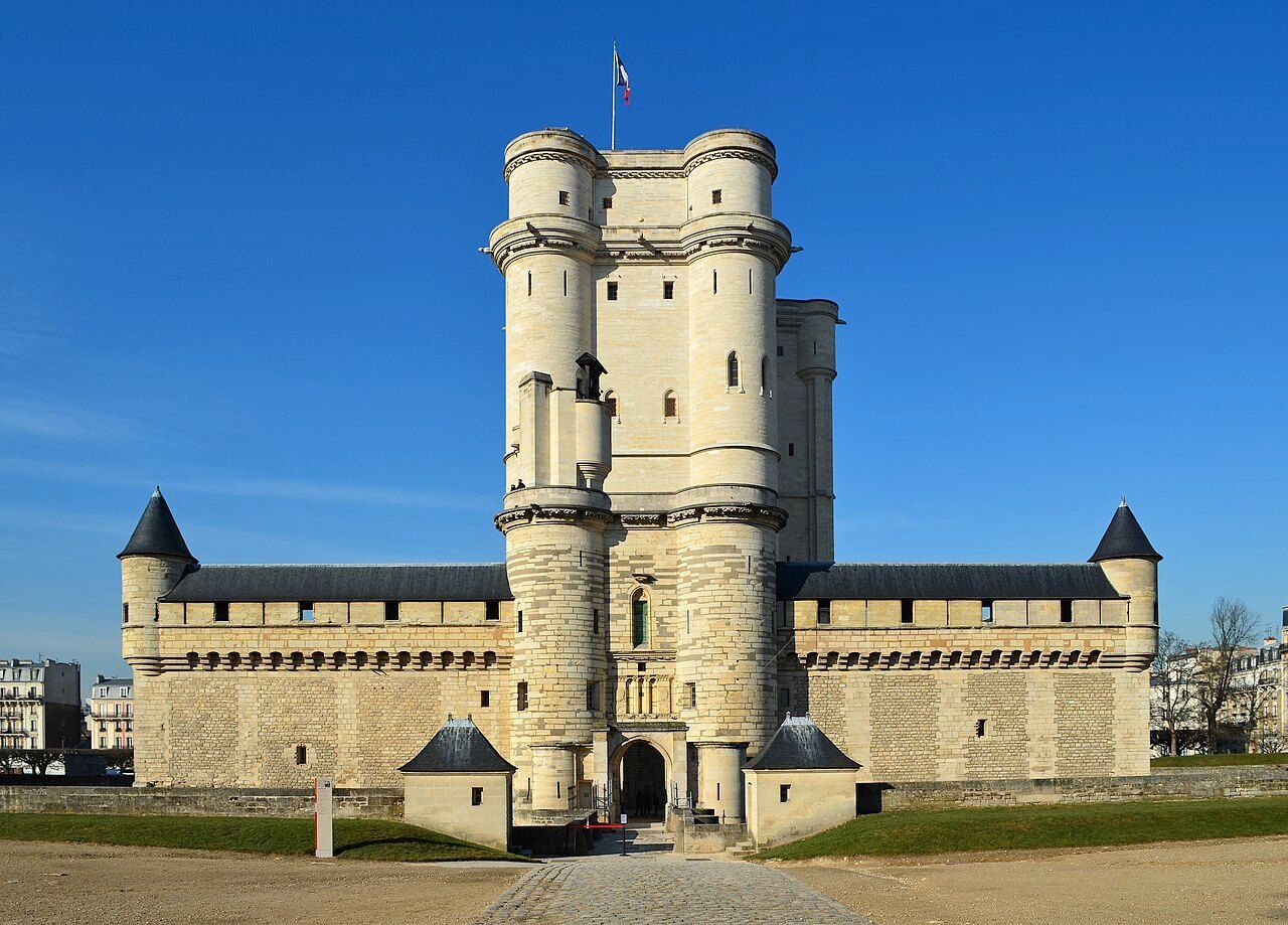
## Description The **Château de Vincennes** is one of France’s most historically significant royal fortresses and a remarkable example of **medieval military architecture** in the heart of modern Paris. Located just east of the city, this vast castle stands as a symbol of the **power, prestige, and evolution of the French monarchy** from the Middle Ages through the Renaissance. Originally built as a **hunting lodge for King Louis VII in the 12th century**, the site was transformed into a formidable **royal fortress** by **King Philip VI** and **King Charles V** during the 14th century. The result was one of Europe’s largest and most impressive medieval castles, complete with towering walls, fortified gates, and a majestic **52-meter (170-foot) keep** — the tallest medieval fortified tower in Europe. The keep, surrounded by a deep moat, served as both a **royal residence** and a **symbol of authority**. Inside, visitors can explore beautifully preserved **royal apartments**, **chapels**, and **ceremonial halls** that once housed some of France’s most powerful monarchs, including **Charles V**, **Henry IV**, and **Louis XIV**. Before Versailles rose to prominence, Vincennes was the main royal residence of the French crown. What makes the Château de Vincennes truly unique is its **dual character** — both royal and defensive. The complex includes a massive **curtain wall with nine towers**, a **drawbridge**, and a **gothic-style chapel** modeled after Sainte-Chapelle in central Paris. Over the centuries, it also served as a **royal prison**, holding famous figures such as **the Marquis de Sade**, **Denis Diderot**, and **Mirabeau**. A lesser-known fact is that the **castle was occupied by Napoleon Bonaparte’s troops**, later used as a **military arsenal**, and even served as a **command center during World War II**. Despite its turbulent past, the site remains remarkably well-preserved and offers a fascinating journey through 800 years of French history. Today, the Château de Vincennes stands as a peaceful yet awe-inspiring monument — less crowded than central Paris landmarks, making it an ideal destination for history enthusiasts seeking authenticity and atmosphere. ## Location The **Château de Vincennes** is located in the **suburb of Vincennes**, directly east of **central Paris**, within the **Val-de-Marne (Île-de-France)** region. It sits adjacent to the **Bois de Vincennes**, Paris’s largest public park. To get there: * **By metro:** Take **Line 1** to **Château de Vincennes Station**, which is just outside the main entrance. * **By RER:** The **RER A** also stops at **Vincennes Station**, about a **5-minute walk** from the castle. * **By bus:** Several Paris bus lines serve the area, including **46, 112, and 114**. * **By car:** Easily accessible via the **Périphérique** (Porte de Vincennes exit), with nearby paid parking available. * **By bike or on foot:** The surrounding **Bois de Vincennes** area offers scenic paths leading directly to the château. ## Tips * **Take the guided tour:** It offers rich historical context about the kings, prisoners, and architects who shaped the site. * **Visit the Sainte-Chapelle de Vincennes:** A stunning Gothic chapel that rivals its Parisian namesake in beauty and craftsmanship. * **Climb the keep:** The panoramic view from the top reveals both the castle’s vast grounds and the Paris skyline. * **Go early or late in the day:** To enjoy a quieter experience and capture the best light for photos. * **Combine with nearby attractions:** After your visit, explore the **Bois de Vincennes**, **Parc Floral de Paris**, or the **zoo** — all within walking distance. * **Family-friendly:** Wide courtyards and open spaces make it a great outing for families and children. * **Check for exhibitions:** The castle regularly hosts **temporary exhibitions, medieval fairs, and reenactments**. ## Conclusion The **Château de Vincennes** is a living testament to the grandeur and endurance of French royal history. With its soaring towers, Gothic chapel, and centuries of royal intrigue, it offers visitors a journey from the medieval era to modern France — all within reach of central Paris. Far less crowded than the city’s major monuments, it’s a place where you can truly feel the **power, elegance, and mystery** of France’s royal past. Whether you’re fascinated by architecture, military history, or French monarchy, the Château de Vincennes promises an experience both majestic and intimate. ## FAQ **1. When was the Château de Vincennes built?** Construction began in the **14th century** under **Philip VI** and **Charles V**, though the site dates back to a 12th-century royal hunting lodge. **2. What is the château known for?** It is renowned as **France’s largest medieval royal fortress**, featuring Europe’s tallest keep and a beautifully preserved Gothic chapel. **3. How can I get there from central Paris?** Take **Metro Line 1** directly to **Château de Vincennes Station** — it’s the last stop on the line and just a few minutes’ walk from the castle. **4. Are guided tours available?** Yes, guided tours in French and English are offered daily and provide detailed insights into the château’s rich history. **5. How long should I plan for a visit?** Allow about **2–3 hours** to explore the keep, chapel, and grounds at a comfortable pace. **6. Is it suitable for children?** Yes — children often enjoy exploring the towers and open courtyards, and there are family-friendly tours available. **7. When is the best time to visit?** Spring and early autumn offer pleasant weather and fewer crowds, though the château is open year-round. ## Links * [Wikipedia page](https://en.wikipedia.org/wiki/Ch%C3%A2teau_de_Vincennes)
GemVoyage Team • World

Tokyo
## Description Shimokitazawa is one of Tokyo's most beloved neighborhoods for travelers who want a creative, youthful, and slightly offbeat urban experience. Known for its indie shops, vintage fashion, small music venues, cafes, bars, and relaxed street culture, the area feels like a counterpoint to the polished intensity of central Tokyo. It is dense enough to feel exciting but compact enough to explore without stress, which makes it ideal for wandering. The neighborhood's appeal lies in its mix of everyday life and subculture. You can spend an afternoon browsing record stores, secondhand clothing shops, zines, and design goods, then stop for coffee or a casual meal in a tiny restaurant tucked into a side street. The area has long been associated with theater, music, and youth culture, so even when it is busy it retains an unmistakable creative identity. Many visitors describe it as a place where Tokyo becomes more approachable and personal. One little-known fact is that Shimokitazawa's reputation as a vintage hub grew gradually over decades, rather than through a single development plan, which gives its retail landscape an organic feel. Another is that the neighborhood has been shaped by rail infrastructure and urban redevelopment, yet it still preserves a strong sense of small-scale community in its alleys and side streets. That balance between change and continuity is central to its character. The streets themselves are part of the experience. Unlike hyper-structured shopping districts, Shimokitazawa encourages detours. A turn into a narrow lane may reveal a tiny jazz bar, an art space, or a cafe with a deliberately handmade interior. This makes the neighborhood especially rewarding for repeat visits, because the pleasure comes from discovering layers rather than checking off landmarks. Food is another reason to stay longer than expected. Shimokitazawa has everything from casual ramen and curry to dessert shops and specialty coffee. The density of places to eat means you can shape the day around browsing, resting, and browsing again. In the evening the district softens into a social district, with bars and live venues drawing a crowd that is varied but usually relaxed. For travelers who want a neighborhood that captures a more intimate and creative side of Tokyo, Shimokitazawa is an excellent choice. It is stylish without feeling exclusive and lively without feeling overwhelming. That combination is rare, and it is what keeps the area high on many repeat visitors' lists. ## Location Shimokitazawa is a neighborhood in Setagaya, Tokyo, Japan, located in the western part of the inner city. It is known for the station area and the streets that radiate from it. The easiest way to get there is by train, especially via the Odakyu Line or Keio Inokashira Line. Once you arrive, the district is best explored on foot. Because the neighborhood is compact, you can comfortably combine shopping, food, and nightlife in one visit. ## Tips Go without a rigid plan. The neighborhood is best enjoyed through spontaneous exploration. Visit both daytime and evening if you can. Daytime is better for shopping, while evening brings a more social atmosphere. Bring cash or a card that works widely in Japan, since smaller shops may have different payment preferences. If you are interested in vintage fashion, be prepared to spend time. Good finds often take patience. Look for smaller side streets rather than staying only near the station exits. Use Shimokitazawa as a half-day or full-day stop, depending on how much you want to browse and eat. ## Conclusion Shimokitazawa offers one of Tokyo's most distinctive neighborhood experiences, blending indie culture, vintage shopping, and relaxed urban energy in a compact and walkable district. ## FAQ ### What is Shimokitazawa famous for? It is famous for vintage clothing, independent cafes, small live music venues, theater, and a creative neighborhood atmosphere. ### Is Shimokitazawa worth visiting for first-time travelers to Tokyo? Yes, especially if you want a more local and youthful district beyond the major sightseeing areas. ### How much time do I need there? At least half a day, though many visitors stay longer because of the shopping and food options. ### Is Shimokitazawa good for nightlife? Yes, but it is a more relaxed nightlife scene than the biggest entertainment districts in Tokyo. ## Links - [Shimokitazawa](https://en.wikipedia.org/wiki/Shimokitazawa) - [Tokyo tourism](https://www.gotokyo.org/en/)
GemVoyage Team • World
Ontario
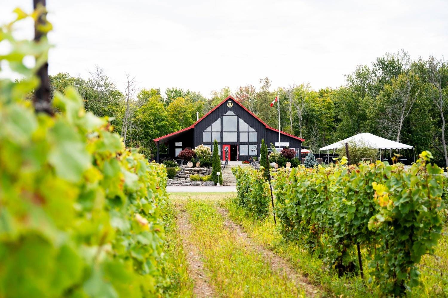
## Description Prince Edward County has become one of Ontario’s most appealing wine destinations, and its wineries are a major reason travelers now plan weekends and day trips to the region. The county combines vineyards, rural roads, lake air, farm landscapes, and a growing food culture into an experience that feels refined without losing its laid-back provincial charm. Unlike a single attraction, the wineries of Prince Edward County function as a connected landscape, where each stop contributes to a broader sense of place. What makes the area special is the relationship between wine and setting. The county’s cool-climate conditions help shape the style of wine produced here, and the region’s open fields and lakeside influence make the scenery especially enjoyable between tastings. Visitors often come for Chardonnay, Pinot Noir, sparkling wine, and other locally produced bottles, but the deeper reward is the way the entire county has developed around small producers, hospitality, and a slower pace of travel. One little-known fact is that Prince Edward County’s wine scene feels young compared with some global wine regions, yet it has gained a strong reputation because of the quality of its producers and the distinct character of the landscape. Another detail that many first-time visitors notice is how much the county encourages a full-day or weekend rhythm. The wineries are best enjoyed when you allow time for scenic driving, lunch, and perhaps an overnight stay rather than trying to compress everything into a short stop. The experience also works well for travelers who are not wine experts. You do not need technical knowledge to appreciate the hospitality, the rural atmosphere, and the chance to sample local production in a beautiful setting. Prince Edward County is one of those destinations where the landscape and the tasting room experience strengthen each other. Even travelers who visit mostly for food, photos, or a relaxing escape often come away with a deeper appreciation for Ontario wine country. ## Location The wineries are spread throughout Prince Edward County in Ontario, Canada, an island-like peninsula region on Lake Ontario northeast of Toronto. The county is most practical to visit by car, since the wineries are dispersed and the enjoyment comes from moving between them at your own pace. Public transport is limited for this type of trip, so driving is by far the most convenient option. Prince Edward County is close enough for a weekend from Toronto or other parts of southern Ontario, but the drive is long enough that many visitors prefer to stay overnight. Doing so gives you a better chance to enjoy tastings responsibly and explore the county’s food, small towns, and lakeside scenery. Once you arrive, winery visits can be paired with restaurants, farm shops, beaches, and scenic routes. ## Tips Plan transportation carefully if you intend to taste multiple wines. Designate a driver, book a tour, or arrange another safe transportation method before you begin. The county is spread out enough that responsible planning matters. Choose a few wineries instead of trying to do too many. Part of the charm here is slowing down, not racing from one tasting room to the next. A smaller number of thoughtful stops usually gives a better experience than an exhausting checklist. Book in advance when possible. Popular producers, weekend slots, and special tasting experiences can fill quickly, especially during peak travel seasons. Reservations can make the day smoother and prevent disappointment. Leave time for food and scenery. The county is as much about the wider setting as the wine itself. Adding lunch, a drive through rural roads, or a short lake-side walk can make the visit feel much more complete. ## Conclusion Prince Edward County’s wineries offer one of Ontario’s most rewarding rural travel experiences, blending quality wine, scenic landscapes, and a relaxed pace. It is a destination that works best when you give it time. ## FAQ ### Do I need to be a wine expert to visit? No. The region is welcoming to casual visitors, and many people enjoy the experience simply as a scenic tasting trip. ### Is one day enough? One day can work for a focused visit, but an overnight stay usually makes the trip much more enjoyable and less rushed. ### Are the wineries family-friendly? Many are welcoming to daytime visitors, but policies vary. It is best to check individual winery rules before bringing children. ### What kinds of wine is the region known for? Prince Edward County is especially respected for cool-climate styles, including sparkling wine and elegant white and red wines. ### Can I visit without a car? It is possible through tours and arranged transport, but a car is the most practical way to see the region’s dispersed wineries. ## Links - [Wikipedia](https://en.wikipedia.org/wiki/Prince_Edward_County,_Ontario)
GemVoyage Team • World

Comments