GemVoyage Team • World
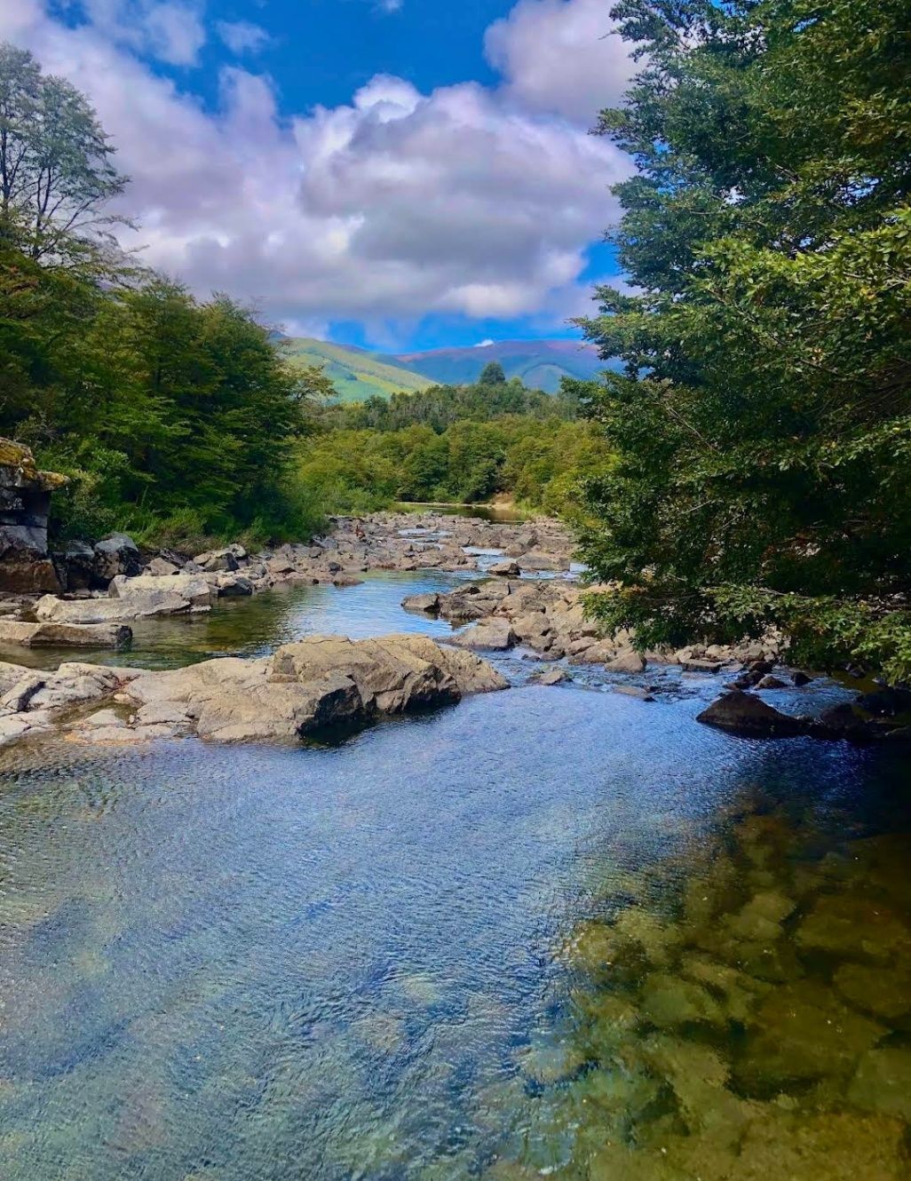
Nestled within the heart of Argentina’s Patagonia, Cascadas del Río Hermoso is a breathtaking natural wonder that captivates visitors with its unspoiled beauty. The waterfalls are part of the Río Hermoso, which translates to “Beautiful River,” and the name is no exaggeration. Surrounded by dense forests, clear mountain air, and the soothing sound of rushing water, this destination offers a perfect blend of serenity and adventure.
What makes Cascadas del Río Hermoso unique is not only its picturesque setting but also its relative tranquility compared to more popular sites like Iguazú Falls. Here, you won’t find large crowds or bustling tourist infrastructure—just raw, pristine nature. The waterfalls are small to medium in size, cascading down in multiple tiers, forming natural pools that invite visitors to rest and reflect.
A little-known fact is that the river is fed by meltwater from the Andes, meaning that the water levels and flow change significantly with the seasons. Another detail often overlooked is the region’s rich biodiversity: the surrounding forests are home to species such as the Patagonian woodpecker and the elusive pudú, one of the world’s smallest deer. For nature enthusiasts, Cascadas del Río Hermoso is a rare opportunity to encounter untouched ecosystems.
Cascadas del Río Hermoso is located in Argentina, in the Neuquén Province of northern Patagonia, within the boundaries of Lanín National Park. The closest town is San Martín de los Andes, a charming Patagonian village known for its alpine-style architecture, lakes, and outdoor activities.
To get there, travelers usually fly into Aviador Carlos Campos Airport, just 20 km from San Martín de los Andes. From the town, the waterfalls can be reached by car via Ruta Nacional 40 and then Ruta Provincial 63, which winds through stunning Andean landscapes. The trip itself is a highlight, with panoramic views of lakes, mountains, and valleys. Renting a car is highly recommended, as it allows for flexible stops at scenic viewpoints along the way.
Cascadas del Río Hermoso is a tranquil, hidden treasure in Argentina’s Patagonia, offering visitors a rare chance to connect with untouched nature. Surrounded by forests, wildlife, and the pure waters of the Andes, it’s a destination that rewards travelers seeking peace, adventure, and authenticity.
1. How difficult is the hike to Cascadas del Río Hermoso?
The hike is considered easy to moderate. Most trails are well-marked and accessible, making it suitable for families and casual hikers.
2. Is swimming allowed in the river or waterfalls?
Yes, swimming is possible in some of the natural pools, especially during the summer months, though the water can be very cold due to glacial origins.
3. Are there entrance fees?
Since Cascadas del Río Hermoso is part of Lanín National Park, a small entrance fee may apply, depending on the season and visitor category.
4. Can I visit Cascadas del Río Hermoso year-round?
Yes, but accessibility varies. Summer and spring are ideal, while winter may present challenges due to snow-covered roads.
5. Are there facilities near the waterfalls?
Facilities are limited. Visitors should bring their own supplies, although San Martín de los Andes has plenty of options for food, lodging, and equipment rentals.
Discover more hidden gems you might love.
Utena County
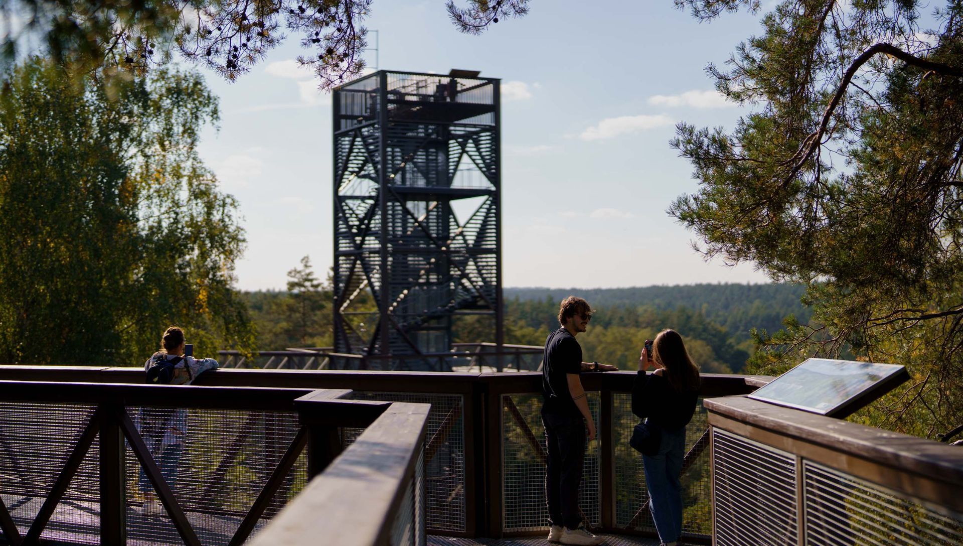
## Description The Anykščiai Treetop Walking Path is an elevated walkway that lifts visitors into the forest canopy near the town of Anykščiai, providing rare, treetop-level perspectives over pine and spruce stands and the winding valley of the Šventoji River. Running across a series of boardwalks and culminating in an observation tower, the path reveals forest structure, understory dynamics, and panoramic views that are otherwise hidden from ground level. What distinguishes this attraction is its combination of accessibility, interpretive design, and conservation-minded construction. The path’s elevated platforms and carefully designed supports minimize soil compaction and root disturbance, protecting vulnerable plant communities below. Along the walkway, interpretive panels introduce visitors to forest ecology, native species, the role of wetlands, and regional conservation initiatives. The experience is both sensory and educational: the canopy’s light, wind, and birdlife offer memorable immersion, while the tower’s panoramic platform rewards visitors with far-reaching vistas of the Šventoji River valley. The path was created with families and broad accessibility in mind—gentle gradients, safety railings, and wide decks make it suitable for many visitors, although final accessibility varies across specific sections. The project reflects a deliberate effort to balance public access, education, and nature protection, making it a model for low-impact environmental tourism. ## Location The Anykščiai Treetop Walking Path is situated near the town of Anykščiai in Utena County, northeastern Lithuania, an area celebrated for its literary history and distinctive wooden architecture. The site is accessible from Vilnius and Kaunas by regional bus services to Anykščiai; local shuttles or taxis can bring visitors the short distance to the trailhead. On-site parking is available during visiting hours, and the town provides dining and accommodation options for longer stays. ## Tips - **Assess height comfort:** The elevated platforms are safe but may be challenging for those with acute fear of heights. Move at your own pace and use railings. - **Bring optics and cameras:** Binoculars and cameras enhance birdwatching and landscape photography from the tower and platforms. - **Visit in warm months:** Late spring through early autumn offers full foliage, active birdlife, and accessible boardwalks; check seasonal opening times for winter closures. - **Dress for the outdoors:** Wear comfortable walking shoes and layered clothing; the canopy can be cooler and windier than the forest floor. - **Combine with Anykščiai cultural sites:** Pair the treetop walk with a visit to the town’s literary museums and wooden architecture for a blended nature-and-culture day. ## Conclusion The Anykščiai Treetop Walking Path is an accessible, interpretive experience that invites visitors to discover forest ecology from a new vantage point. It combines low-impact design, educational materials, and dramatic views—ideal for families, school groups, and nature enthusiasts interested in immersive environmental learning. ## FAQ - **Q: Is the Anykščiai treetop path suitable for wheelchairs or strollers?** A: Some sections are designed to be accessible, but full accessibility can vary—contact the site in advance for details on ramps and platform access. - **Q: How much time should I plan for a visit?** A: Plan 1–2 hours to walk the path, ascend the observation tower, and read interpretive panels; longer if you want to picnic or birdwatch. - **Q: Is there an entrance fee or opening season?** A: Many treetop paths charge a modest fee and operate seasonally—confirm current hours and rates on the official site or local tourist information. - **Q: Are dogs allowed on the treetop path?** A: Policy varies; some paths allow well-controlled dogs on short leashes while others restrict pets to protect wildlife—check rules before bringing pets. - **Q: Can the path be used for school or group education?** A: Yes—interpretive panels and safe design make it ideal for school groups; contact local organizers to arrange guided programs or group rates. - **Q: Is the path safe in wet weather?** A: Walkways can be slippery when wet—use caution and appropriate footwear. Some sections may be closed during severe weather for safety. ## Links -- [Hike Information](https://saugoma.lt/en/objects/objects-the-treetop-walking-path)
GemVoyage Team • World
Cordoba
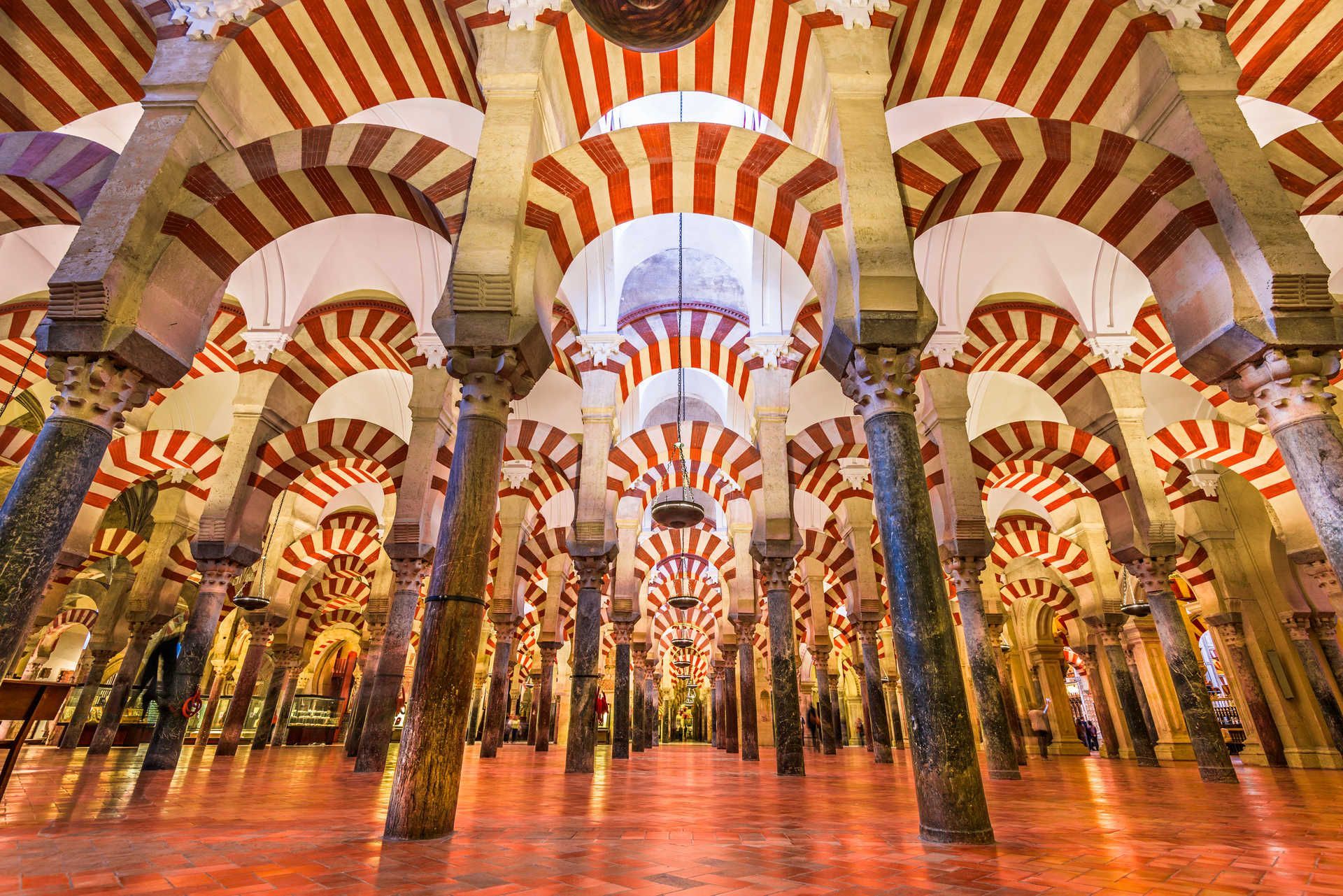
## Description The Mezquita de Córdoba (commonly referred to as the Mosque–Cathedral of Córdoba) is one of Spain’s most striking architectural masterpieces, blending Islamic and Christian elements into a single, atmospheric monument. Its forest of red-and-white double arches, an ingenious structural and aesthetic solution developed in the 8th and 9th centuries, creates a hypnotic interior rhythm that has captivated visitors for centuries. What makes the Mezquita distinctive is not only its scale and decorative richness, but also its layered history: first a Visigothic site, then a grand mosque during Al-Andalus, and later converted into a cathedral after the Reconquista. The result is an unusual palimpsest of art and faith, where horseshoe arches, ornate mihrab mosaics, and later Renaissance chapels coexist in one vast interior. Little-known facts: the current cathedral nave was inserted into the mosque in the 16th century after repeated political and religious negotiations, leaving a striking contrast between the Muslim prayer hall and a centrally placed Christian choir. Another subtle detail is that several columns were recycled from nearby Roman and Visigothic ruins, embedding older materials into this Islamic monument. ## Location The Mezquita is located in Córdoba, Andalusia, southern Spain. It sits in the historic core (the Judería), a compact medieval district adjacent to the Guadalquivir River. The precise address is Plaza del Campo Santo de los Mártires, 1, Córdoba, Andalusia, Spain. Getting there: Córdoba is on Spain’s high-speed rail network (AVE) with frequent trains from Madrid (about 1 hour 45 minutes) and Seville (about 45 minutes). From Córdoba’s main train station (Estación Córdoba Central), the Mezquita is a 15–20 minute walk through the old town; taxis and local buses are also available. If you’re driving, look for parking near Avenida del Alcázar; from there the old town is a short walk. Once inside the historic center, much is best experienced on foot. ## Tips - Buy tickets in advance: The Mezquita can get extremely crowded, especially during high season. Pre-booked tickets with a timed entry avoid long queues. - Visit at quieter times: Early morning just after opening or late afternoon before closing are the best times for photography and to avoid tour groups. - Dress respectfully: As an active cathedral, modest clothing is appreciated. - Allow time for the surrounding quarter: The Judería, Calleja de las Flores, and the Roman bridge are part of the full Córdoba experience—plan at least 2–3 hours to explore the mosque-cathedral and nearby streets. - Use an audio guide or a knowledgeable guide: There’s a lot of layered history; a guide helps unpack architectural changes, symbolic elements, and the timeline of conversions. - Combine with other sites: Pair the Mezquita with the Alcázar of the Christian Monarchs and the Medina Azahara archaeological site for a broader historical view. ## Conclusion The Mezquita de Córdoba is an unforgettable site where architecture tells a story of cultural exchange, conquest, and coexistence. Its forest of arches, rich mosaics, and the surprising placement of the cathedral nave inside a former grand mosque make it a must-visit for lovers of history, architecture, and complex heritage. A mindful visit, planned for quieter hours, will reveal subtleties many miss on a quick stop. ## FAQ Q: Is the Mezquita still used for religious services? A: Yes. While much of the building functions as a major cultural monument and tourist site, the cathedral section hosts Christian religious services. Q: How long should I plan to visit? A: Expect 1.5–3 hours to explore the main areas and enjoy nearby streets. Add more time if visiting exhibitions or local museums. Q: Are photography and flash allowed? A: Photography is usually allowed without flash; however, rules can change for certain ceremonies or exhibitions—follow posted signs. Q: Is the Mezquita accessible for visitors with reduced mobility? A: Parts of the site have limited accessibility due to historic flooring and narrow passages; check official accessibility information and consider contacting the site before arrival. ## Links - [Wikipedia: Mezquita–Cathedral of Córdoba](https://en.wikipedia.org/wiki/Mosque–Cathedral_of_C%C3%B3rdoba) - [Official tourism page for Córdoba (visit cordoba)](https://www.turismodecordoba.org)
GemVoyage Team • World
Victoria
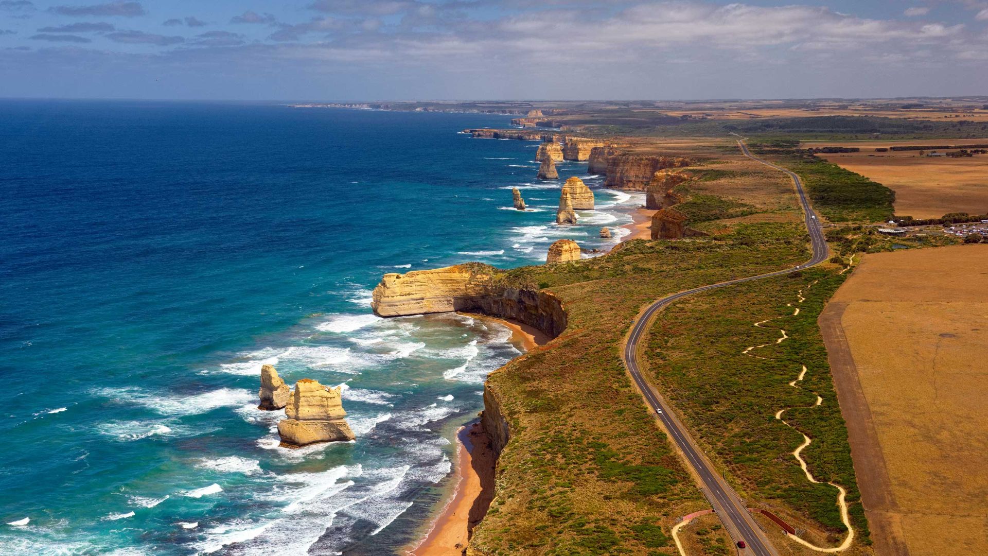
## Description The Great Ocean Road is one of the world’s most celebrated coastal drives, winding along Victoria’s southwestern shoreline past rugged cliffs, surf beaches and sculpted limestone stacks such as the Twelve Apostles. Built by returned WWI soldiers and dedicated as a war memorial, the road combines engineering, natural wonders and seaside towns with cafes, galleries and surf culture. Dramatic viewpoints, rainforest gorges (like Great Otway National Park) and wildlife sightings (koalas, kangaroos and seabirds) make the route a versatile exploration corridor. What distinguishes the route is its dramatic juxtaposition of surf, limestone geology and accessible townscapes. Photographers and road trippers prize the series of staged viewpoints where walking tracks descend to coves and panoramic platforms look out to offshore stacks. Beyond the famous stacks, the route offers fern gullies and waterfalls in the Otways, coastal walks to hidden beaches, and small towns where food and surf culture combine. Many travelers craft multi-day itineraries that combine coastal hikes, wildlife spotting and culinary stops, from coffee in Torquay to seafood in Apollo Bay and heritage-listed lookouts around Port Campbell. The road’s memorial origins also allow visitors to reflect on the engineering feat and the region’s social history while enjoying one of Australia’s most scenic drives. ## Location The Great Ocean Road runs from Torquay to Allansford near Warrnambool in Victoria, Australia, with key stops including Anglesea, Lorne, Apollo Bay and the Twelve Apostles viewpoint at Port Campbell. Melbourne is the primary gateway, roughly a 1.5–3 hour drive to the start depending on traffic. ## Tips - **Avoid peak holiday traffic and plan overnight stops:** The route is popular during Australian school holidays; split the drive into staged stops to avoid fatigue and to enjoy hikes. - **Plan time for short walks and lookout detours:** Many of the best views require small detours and short walks; factor these into your itinerary rather than only driving. - **Mind driving conditions and seasonal weather:** Wind, sea spray and rain can change conditions quickly — watch for strong crosswinds and take care on narrow coastal roads. - **Book accommodation and tours in advance during peak season:** Lorne, Apollo Bay and Port Campbell fill quickly in summer — reserve ahead if travel dates are fixed. - **Pack layers and photography gear:** Coastal light changes quickly; bring windproof layers, a tripod for sunrise/sunset shots and protective gear for salt spray. ## Conclusion The Great Ocean Road pairs dramatic coastal geology with accessible townscapes and outdoor experiences, making it an essential Australian road trip for nature lovers and photographers. Thoughtful pacing and an eye for sidetracks reveal quieter coves, rainforest secrets and local food scenes that complement the iconic seascapes. ## FAQ - **Q: How long does the full drive along the Great Ocean Road take?** A: The direct driving time without stops is around 6–7 hours, but most travelers allocate 2–3 days to properly enjoy walks, viewpoints and coastal towns. - **Q: Can I drive the Great Ocean Road in a single day from Melbourne?** A: You can, but it will be rushed; an overnight stop (or two) allows for sunrise/sunset photography, hikes, and a relaxed pace. - **Q: Are there guided tours, or is it best to self-drive?** A: Both options are common: guided day tours suit short itineraries from Melbourne, while self-driving gives freedom to explore side tracks and lesser-known beaches. - **Q: What wildlife can I expect to see?** A: Look for koalas in eucalyptus stands, kangaroos in paddocks near dusk, seabirds along the cliffs and occasional whales on migration seasons from coastal lookouts. - **Q: Is the route safe for cyclists and motorcyclists?** A: Many cyclists and motorcyclists enjoy sections of the route, but be prepared for narrow lanes, tourist traffic, and windy coastal conditions; follow local safety advice. ## Links - [Great Ocean Road — Wikipedia](https://en.wikipedia.org/wiki/Great_Ocean_Road)
GemVoyage Team • World
Zaragoza
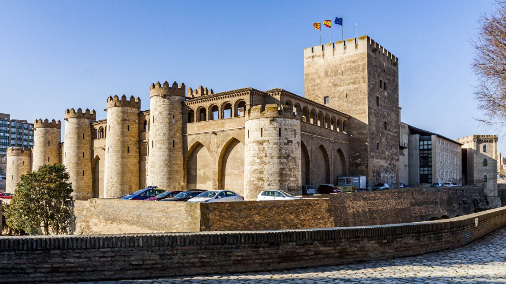
## Description The **Palacio de la Aljafería** is one of Spain’s most remarkable monuments, a living testimony to the country’s diverse cultural and architectural history. Built in the second half of the 11th century by the Muslim rulers of Zaragoza, the palace originally served as a fortified royal residence during the taifa kingdom period. Its delicate arches, intricate stucco work, and lush courtyards reflect the splendor of Islamic art at its peak in the Iberian Peninsula. What makes Aljafería unique is the way its history is layered within its walls. After the Christian conquest of Zaragoza in 1118, the palace was transformed into the residence of the Catholic monarchs, Ferdinand and Isabella, who added Renaissance elements while preserving much of the Islamic structure. Later, it served as a military barracks, and today it houses the regional parliament of Aragón. Few buildings in Spain embody such a continuous blend of Islamic, Christian, and modern political life. A little-known fact is that the palace inspired key architectural motifs in Spain’s most famous Moorish monument, the **Alhambra in Granada**. Another fascinating detail is that the palace appears in literature: it is the setting for *Las Cortes de la Muerte*, a play by Lope de Vega, reflecting its enduring cultural significance. ## Location The Aljafería Palace is located in **Zaragoza**, the capital of the **Aragón** region in northeastern **Spain**. The palace lies just west of Zaragoza’s city center, on Calle de los Diputados, about 20 minutes on foot from the Plaza del Pilar, where the Basilica of Our Lady of the Pillar stands. Visitors arriving by train to Zaragoza-Delicias station can reach the palace in around 10 minutes by bus or taxi. From Madrid or Barcelona, Zaragoza is easily accessible by high-speed AVE train in just over 1.5 hours, making the Aljafería an ideal stop for travelers exploring northern Spain. Walking or public transport is the best way to reach the palace once in the city. ## Tips * **Book in advance:** Entry is limited, and guided tours often sell out quickly, especially in peak tourist seasons. * **Take a guided tour:** Guides explain the symbolism of the Islamic decorations and the historical transitions that shaped the palace. * **Check opening hours:** The palace is closed on certain public holidays and has reduced hours in winter. * **Combine with other sites:** Pair your visit with the Basilica del Pilar and La Seo Cathedral for a full picture of Zaragoza’s religious and cultural heritage. * **Photography tip:** Morning light is best for photographing the courtyards and intricate arches. Flash photography inside is not permitted. * **Allow enough time:** Set aside at least 1.5–2 hours to fully enjoy the architecture, exhibitions, and gardens. ## Conclusion The **Aljafería Palace** is a masterpiece of Islamic architecture in Spain, later enriched with Christian and Renaissance elements. Its rich history, architectural beauty, and continued political role make it one of Zaragoza’s most important landmarks. For travelers seeking to understand Spain’s layered cultural identity, the Aljafería is an unmissable destination. ## FAQ **1. What is the Aljafería Palace best known for?** It is best known for its Islamic architecture from the taifa period, its later Christian additions, and its role as the seat of the Aragonese parliament. **2. How much time do I need to visit?** A thorough visit takes about 1.5 to 2 hours, especially if you join a guided tour. **3. Is the palace family-friendly?** Yes, the palace is suitable for families. Children often enjoy exploring its courtyards and fortress-like exterior. **4. Are guided tours available in English?** Yes, guided tours in English and other languages are available but should be booked in advance. **5. Is the palace included in UNESCO World Heritage?** The Aljafería itself is not individually listed, but it is part of the broader UNESCO designation of **Mudejar Architecture of Aragón**, recognized for its cultural significance. **6. Can I buy tickets online?** Yes, tickets can be purchased online through official Zaragoza or Aragón tourism websites. ## Links * [Official Tourism of Aragón – Aljafería Palace](https://www.turismodearagon.com) * [Zaragoza Tourism – Palacio de la Aljafería](https://www.zaragoza.es/turismo)
GemVoyage Team • World
Accra
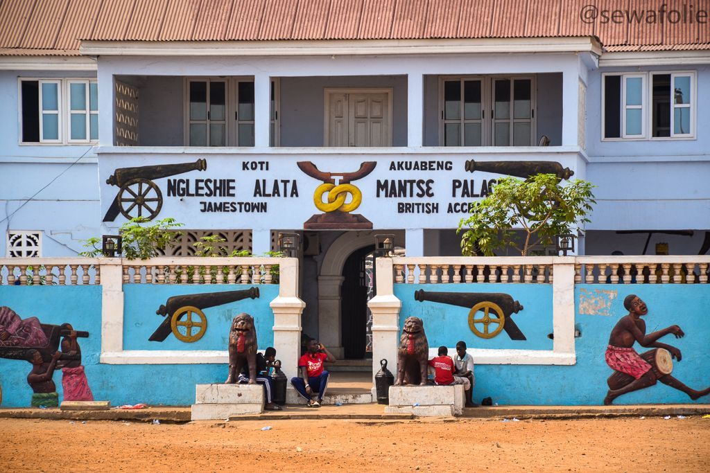
## Description Jamestown District is one of the most historically important and visually distinctive areas in Accra. Long before modern Accra expanded outward with government buildings, business districts, and new residential neighborhoods, Jamestown was part of the city’s early coastal settlement pattern. Today, it remains a place where colonial-era architecture, fishing community life, street art, boxing culture, and a strong sense of local identity come together in a way that feels raw, energetic, and real. What makes Jamestown especially worth visiting is its contrast. Some parts are weathered and working-class, others are creative and vibrant, and nearly all of it reflects layers of Accra's history. Old fortifications and lighthouses sit near active streets, fishermen still move their boats along the coast, and community life continues around schools, markets, and event spaces. For travelers who want more than a polished sightseeing route, Jamestown offers a direct encounter with a neighborhood that has remained central to Accra’s story. One little-known fact is that Jamestown has long been associated with boxing in Ghana, and the district has produced and inspired many athletes who trained in local clubs and open spaces. Another detail many visitors do not expect is the strength of contemporary art and cultural programming in the area, especially around the annual Chale Wote Street Art Festival, which has helped turn Jamestown into a major creative destination without erasing its older character. The district is also a place where historical memory matters. Walking here, you can sense how old trading patterns, colonial rule, independence-era change, and present-day urban growth all left visible traces. It is not a preserved museum quarter, and that is part of its appeal. Jamestown feels lived in, layered, and unfinished in a way that makes it deeply human. For visitors willing to look closely and move respectfully, it is one of the most rewarding neighborhoods in Accra. ## Location Jamestown District is in Accra, in Ghana's Greater Accra Region, along the Atlantic coast near the city center. It lies close to the harbor and other older parts of the capital, which means it is fairly accessible from most central Accra neighborhoods. Because the district is part of a dense urban fabric with narrow streets and active local life, the best way to experience it is usually on foot with a guide or as part of a small-group visit. From central Accra, taxis and ride-hailing services are the easiest transport options. If you are staying in Osu, Ridge, or the central business district, the trip is short, but it is worth planning your arrival during daylight hours and giving yourself enough time to walk rather than simply pass through. Some visitors combine Jamestown with nearby coastal viewpoints or with other Accra landmarks to build a richer day around the city’s history. Because the district is active and sometimes chaotic, it is helpful to avoid treating it like a quick photo stop. Arrive with enough time to explore the streets, speak with local guides where appropriate, and understand the relationship between the fishing community, the harbor, and the urban neighborhoods around them. ## Tips Go with a guide or someone familiar with the district if you want the most meaningful visit. Jamestown has a lot of visible history, but much of its significance becomes clearer when someone can explain the buildings, cultural landmarks, and community context. Visit during the day and keep your movements respectful. Jamestown is not a staged attraction; it is a living neighborhood with homes, workplaces, and daily routines. Ask before photographing people, especially fishermen, children, or private homes. That simple habit changes the tone of the visit completely. Wear comfortable shoes and prepare for heat and dust. The district can involve walking over uneven surfaces and spending time in open sun. Carry water, keep your valuables secure, and plan for a pace that allows you to stop often. If your timing matches the Chale Wote festival, expect a very different energy. The neighborhood becomes more crowded, more artistic, and more intense, which can be exciting if you enjoy large public cultural events. Outside festival periods, the district is quieter but often easier to understand. ## Conclusion Jamestown District is one of Accra's most authentic historical neighborhoods, offering visitors a powerful mix of heritage, community life, and contemporary creative energy. ## FAQ ### What is Jamestown District known for? Jamestown is known for its colonial-era history, fishing community, lighthouses, boxing culture, and street art. ### Is Jamestown safe to visit? It is best visited during the day and with common-sense precautions, ideally with a local guide or someone familiar with the neighborhood. ### Can I visit Jamestown on my own? Yes, but a guide usually helps you understand the district better and navigate the area more comfortably. ### What is the best time to visit Jamestown? Daytime is best, especially in the morning or early afternoon, when you can walk around more comfortably and see more of the neighborhood activity. ## Links - [Wikipedia article](https://en.wikipedia.org/wiki/Jamestown,_Accra) - [Ghana Tourism Authority](https://visitghana.com/)
GemVoyage Team • World
Milan
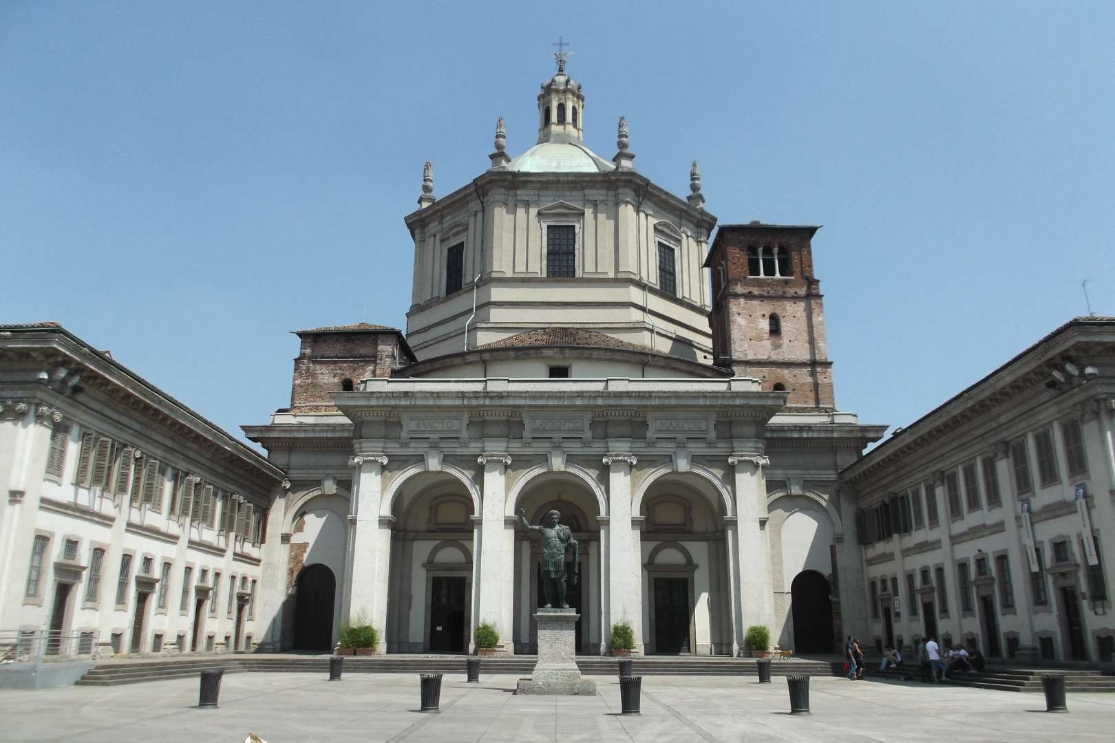
## Description The Basilica of San Lorenzo Maggiore in Milan is one of the city’s oldest and most architecturally intriguing churches, offering a rich tapestry of history, religion, and design. Originally constructed between the late 4th and early 5th centuries, the basilica has undergone numerous reconstructions, resulting in a unique blend of Early Christian, Renaissance, and Baroque styles. Its imposing central dome and symmetrical layout make it a standout among Milan’s ecclesiastical landmarks. What sets San Lorenzo apart is its daring architectural originality. Art historians have noted its resemblance to the great churches of Constantinople, many of which no longer exist. The basilica’s interior features elegant marble columns, intricate mosaics, and the stunning Chapel of Saint Aquilino, which houses 4th-century Byzantine mosaics and remnants of Roman construction materials. Outside, the Colonne di San Lorenzo—sixteen Roman columns dating from the 3rd century—stand as a dramatic prelude to the church and are among the few surviving relics of ancient Mediolanum. A little-known fact: archaeological investigations suggest that the basilica may have been built atop a Roman amphitheater, and some of its foundational materials were repurposed from other Roman sites. Another fascinating detail is that the basilica’s dedication to Saint Lawrence was only confirmed in 590 AD, long after its initial construction. ## Location The Basilica of San Lorenzo Maggiore is located in **Italy**, in the **Lombardy region**, within the **city of Milan**. Its exact address is **Corso di Porta Ticinese, 39**, situated near the medieval Porta Ticinese and within walking distance of the Navigli district and the city center. ### How to Get There - **By Metro**: Take Line M2 to Sant’Ambrogio or Line M3 to Missori, then walk about 10–15 minutes. - **By Tram**: Tram line 3 stops at “Ticinese Molino delle Armi,” just steps from the basilica. - **By Foot**: From the Duomo, it’s a pleasant 15-minute walk through historic streets. - **By Bike or Scooter**: Milan’s bike-sharing and e-scooter services offer a scenic and efficient way to reach the basilica. Its central location makes it easy to include in a day of sightseeing, especially when paired with nearby attractions like the Basilica of Sant’Eustorgio or the Navigli canals. ## Tips - **Visit the Chapel of Saint Aquilino**: Don’t miss this side chapel, which contains some of the oldest mosaics in Milan and offers a glimpse into the city’s Roman past. - **Go Early or Late**: The basilica is less crowded in the morning or late afternoon, allowing for a more peaceful visit. - **Dress Modestly**: As with all religious sites, respectful attire is recommended. - **Explore the Piazza**: The square in front of the basilica is lively and atmospheric, often filled with street performers and locals. - **Check for Mass Times**: If you’re interested in attending a service, consult the basilica’s schedule in advance. - **Photography**: Photos are allowed, but avoid flash and be mindful during services. ## Conclusion Basilica San Lorenzo Maggiore is a captivating blend of ancient history and spiritual heritage. With its Roman columns, Byzantine mosaics, and architectural grandeur, it offers a compelling experience for anyone exploring Milan’s rich cultural landscape. ## FAQ **1. Is there an entrance fee to visit the basilica?** No, entry to the basilica is free. Donations are welcome. **2. What are the opening hours?** Monday to Friday: 8:00 AM – 12:30 PM and 3:00 PM – 6:30 PM Saturday and Sunday: 9:00 AM – 1:00 PM and 3:00 PM – 7:00 PM **3. Can non-Catholics visit the basilica?** Yes, the basilica is open to all visitors, regardless of religious background. **4. Is the basilica wheelchair accessible?** Some areas may be challenging due to steps and uneven flooring, but the main entrance and nave are generally accessible. **5. Are guided tours available?** Yes, some local tour operators include San Lorenzo in their walking tours of Milan’s historic center. **6. What is the best time of year to visit?** Spring and autumn offer mild weather and fewer crowds, making them ideal for sightseeing. ## Links - [Basilica of San Lorenzo – Wikipedia Overview](https://en.wikipedia.org/wiki/Basilica_of_San_Lorenzo,_Milan) - [San Lorenzo Maggiore – Official Website](http://www.sanlorenzomaggiore.com/)
GemVoyage Team • World

Comments