GemVoyage Team • World
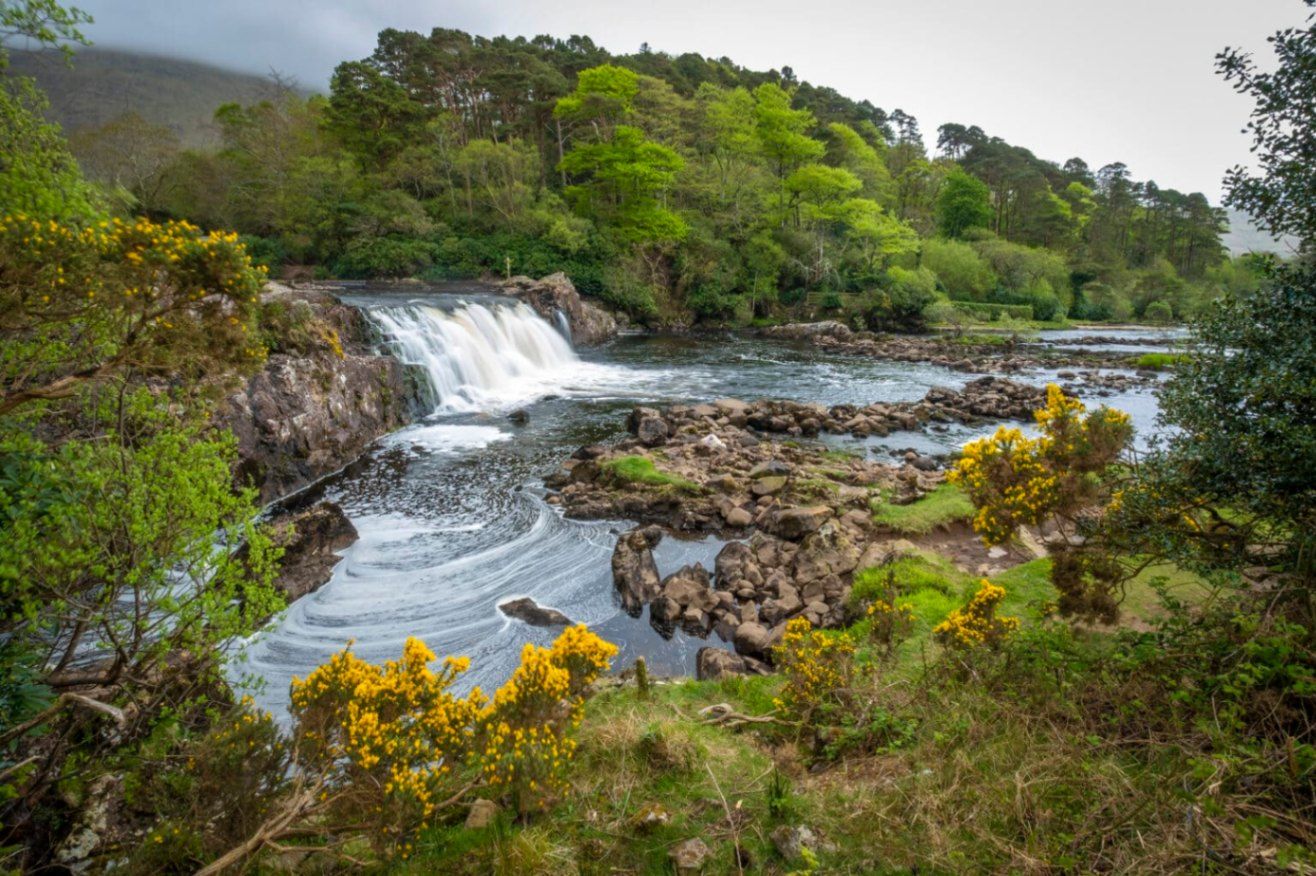
Aasleagh Falls is one of Ireland’s most quietly dramatic natural sights, where freshwater from the Connemara mountains meets the tidal waters of Killary Harbour. Unlike towering waterfalls designed to impress through height alone, Aasleagh Falls is defined by movement, light, and setting. Its power and appearance change constantly depending on rainfall, tide levels, and weather conditions, making every visit slightly different.
The waterfall is formed by the Erriff River, which descends rapidly over smooth rock shelves just before flowing into Killary Harbour, Ireland’s only fjord. At high tide, seawater pushes upriver, partially submerging the lower cascades and creating a rare visual effect where fresh and saltwater interact. At low tide, the falls appear more forceful and exposed, revealing multiple channels and textures in the rock.
What makes Aasleagh Falls particularly special is its sense of isolation and scale relative to its surroundings. Backed by rugged mountains and often framed by mist or low clouds, the falls feel far removed from modern life despite being accessible by road. A lesser-known fact is that the area around the falls has long been a salmon fishing site, and anglers can sometimes be seen working the waters nearby. Another overlooked detail is that the name “Aasleagh” is derived from Irish, roughly translating to a “rocky place,” a fitting description of the terrain shaped by water over millennia.
Aasleagh Falls is not fenced, ticketed, or curated. It exists as it always has: exposed, elemental, and dependent on nature rather than infrastructure. This rawness is central to its appeal.
Country: Ireland
Province: Connacht
County: Mayo
Nearby Area: Leenane / Killary Harbour
Aasleagh Falls is located at the eastern end of Killary Harbour, near the border between County Mayo and County Galway, in one of Ireland’s most scenic regions.
* From Westport, drive toward Leenane via the N59. The falls are located just before entering the village and are visible from the roadside.
* Limited rural bus services operate in the area; schedules are infrequent and not ideal for flexible visits.
* Possible if staying nearby, but weather and narrow roads should be considered.
There is no formal parking lot; roadside pull-ins are commonly used.
Aasleagh Falls is a powerful example of Ireland’s understated natural beauty. Its shifting form, dramatic setting, and lack of commercialization make it ideal for visitors seeking authenticity, solitude, and a deeper connection with the landscape.
1. Is there an entrance fee to Aasleagh Falls?
No, access is completely free.
2. How tall is the waterfall?
It is relatively low in height, but wide and dynamic rather than vertical.
3. When is the best time to visit?
After rainfall and during low tide for the most dramatic views.
4. Is it suitable for children?
Yes, with close supervision due to the lack of barriers.
5. Can you swim near the falls?
Swimming is not recommended due to strong currents and tidal influence.
6. How long should I plan to stay?
Around 20 to 30 minutes, longer if photographing or exploring the area.
Discover more hidden gems you might love.
Bosnia
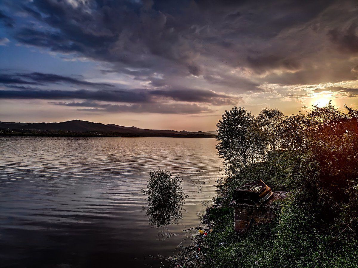
## Description **Modrac Lake (Modračko jezero)** is one of the largest artificial lakes in Bosnia and Herzegovina and a significant recreational and economic resource for the northeastern part of the country. Created in the 1960s by damming the **Spreča River**, the lake was originally built to supply water for industry and surrounding towns. Over time, it evolved into a **popular leisure destination**, especially during the summer months. What makes Modrac Lake distinctive is its **dual identity**. On one hand, it is a functional reservoir supporting industry and agriculture in the Tuzla region. On the other, it serves as a relaxed getaway for locals, offering swimming areas, weekend houses, fishing spots, and informal beaches. Unlike heavily commercialized European lakes, Modrac retains a raw, local character shaped more by everyday use than tourism planning. A lesser-known fact is that before the lake was created, several villages and agricultural lands were submerged, permanently altering the local landscape and economy. Another interesting detail is that Modrac Lake supports a **diverse fish population**, including carp, catfish, pike, and perch, making it one of the most important freshwater fishing locations in the region. The atmosphere around the lake is informal and authentic. Small cafés, seasonal food stands, and family-owned cottages line parts of the shoreline, particularly near towns and villages. This gives visitors a genuine glimpse into regional leisure culture rather than a curated tourist experience. ## Location **Country:** Bosnia and Herzegovina **Region:** Tuzla Canton **Nearest Cities:** Tuzla, Lukavac, Živinice Modrac Lake lies in **northeastern Bosnia**, about 15 kilometers southwest of Tuzla, stretching between several municipalities. ### How to Get There * **By car:** * The easiest and most flexible option. From Tuzla, the drive takes about 20–30 minutes depending on the access point. * **By taxi:** * Available from Tuzla and nearby towns, though return arrangements should be planned. * **By local transport:** * Buses connect Tuzla with nearby towns such as Lukavac and Živinice, followed by short walks to the shore. ## Tips * **Visit in summer:** July and August are the most active months, with swimming and lakeside life at its peak. * **Choose your access point carefully:** Some areas are better maintained and cleaner than others. * **Bring your own supplies:** Facilities vary greatly depending on the location. * **Fishing requires a permit:** Licenses can be obtained locally. * **Avoid swimming after heavy rain:** Water clarity can decrease due to runoff. * **Respect the environment:** As a working reservoir, preservation depends largely on visitor behavior. ## Conclusion Modrac Lake is not a polished resort, but a **functional and lived-in landscape** that plays an important role in local life. Its wide shoreline, relaxed atmosphere, and accessibility make it a meaningful destination for those interested in regional culture, outdoor relaxation, and everyday Bosnia beyond major tourist routes. ## FAQ **1. Is Modrac Lake natural or artificial?** It is an artificial lake created by damming the Spreča River. **2. Can you swim in Modrac Lake?** Yes, swimming is common in designated areas, especially during summer. **3. Is the lake clean?** Water quality varies by location and season; some areas are better maintained than others. **4. Is Modrac Lake good for fishing?** Yes. It is one of the most important fishing lakes in northeastern Bosnia. **5. Are there hotels around the lake?** Accommodation is limited; most visitors stay in Tuzla or nearby towns. **6. Is Modrac Lake suitable for tourists?** Yes, particularly for travelers seeking local experiences rather than resort-style tourism. ## Links * [Bosnia and Herzegovina tourism portal](https://www.tourismbih.com/)
GemVoyage Team • World
Chicago
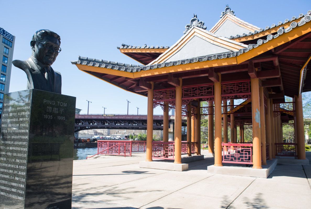
## Description Ping Tom Memorial Park is one of the most distinctive green spaces in Chicago because it feels both urban and calm at the same time. Set against the skyline and the Chicago River, it offers a combination of water views, landscaped paths, public art, and open lawns that makes it much more than a neighborhood park. For visitors who want a place that shows a different side of the city, this is one of the best spots to slow down, walk, and take in the atmosphere of Chicago’s Chinatown and riverfront. What makes the park special is the way it balances recreation, memory, and design. It was created to honor Ping Tom, a respected Chicago business leader and community advocate, but it has also become a favorite place for everyday life in the city. You will see people jogging, families gathering, photographers waiting for the light on the water, and visitors simply resting on benches with a broad view of the river. The pavilion’s architecture, inspired by traditional Chinese design, gives the park a strong sense of place and connects it to the history of the neighborhood. One little-known fact is that the park is part of a larger effort to bring public access and beauty to the south branch of the Chicago River, an area that was once much more industrial. Another detail many visitors miss is how good the park is for sunrise and late-afternoon photography, when the river reflects soft light and the downtown skyline becomes especially striking. It is also one of the easiest places in Chicago to combine a peaceful walk with a meal in Chinatown, since the park sits within walking distance of many restaurants and bakeries. The park has appeal in every season. In warm months, the river breeze and tree-lined paths make it feel refreshing even on busy days. In colder months, the open views and clean geometry of the landscape give it a quieter, almost meditative character. It is not a high-adrenaline attraction, and that is exactly why many travelers remember it so fondly. It is a place that invites you to stay a little longer than planned. For first-time visitors, the park is also useful as a way to understand how Chicago blends architecture, neighborhood identity, and public space. You can stand in one area and see the river, the city, and the cultural energy of Chinatown all at once. That layered feeling is part of what makes the park memorable. ## Location Ping Tom Memorial Park is located in Chicago, Illinois, United States, in the Chinatown neighborhood on the south branch of the Chicago River. It sits south of downtown and is closely connected to the city’s riverwalk and residential areas on the Near South Side. The address commonly associated with the park is 1700 South Wentworth Avenue, though visitors often arrive through nearby riverfront entrances and neighborhood streets. The easiest way to get there is by public transit. The CTA Red Line to Cermak-Chinatown is the most convenient option, followed by a short walk into the neighborhood and toward the river. Rideshare and taxi access are also straightforward. If you are already exploring downtown Chicago, you can make your way south by bus, bike, or a longer walk along the river corridors. Because parking in busy urban areas can be limited, public transit is usually the simplest and most relaxed choice. ## Tips - Visit in the early morning or around sunset for the best light and fewer crowds. - Wear comfortable shoes if you plan to combine the park with a Chinatown food walk. - Bring a camera or phone with a good wide-angle lens if you want skyline and river shots. - Check the weather before you go, since the open riverfront can feel windy. - Leave time for a meal nearby so the visit becomes part of a broader neighborhood experience. ## Conclusion Ping Tom Memorial Park is a calm, beautifully designed riverfront escape that pairs Chicago skyline views with the culture and energy of Chinatown. ## FAQ ### Is Ping Tom Memorial Park worth visiting? Yes. It is worth visiting if you enjoy scenic urban parks, river views, photography, and quieter public spaces that still feel connected to the city. ### How long should I spend there? Most visitors spend between 30 minutes and 1.5 hours, depending on whether they are just walking through or also taking photos and relaxing. ### Is the park good for families? Yes. It has open areas, walking paths, and a welcoming atmosphere that works well for families, couples, and solo travelers. ### Can I combine it with other attractions? Absolutely. Chinatown restaurants, local bakeries, and other Chicago riverfront spots are easy to combine with a visit. ### What is the best time of day to go? Early morning and late afternoon are the most rewarding times because the light is softer and the park feels especially peaceful. ## Links - [Chicago Park District page](https://www.chicagoparkdistrict.com/parks-facilities/tom-ping-memorial-park) - [Wikipedia article](https://en.wikipedia.org/wiki/Ping_Tom_Memorial_Park)
GemVoyage Team • World
Amsterdam
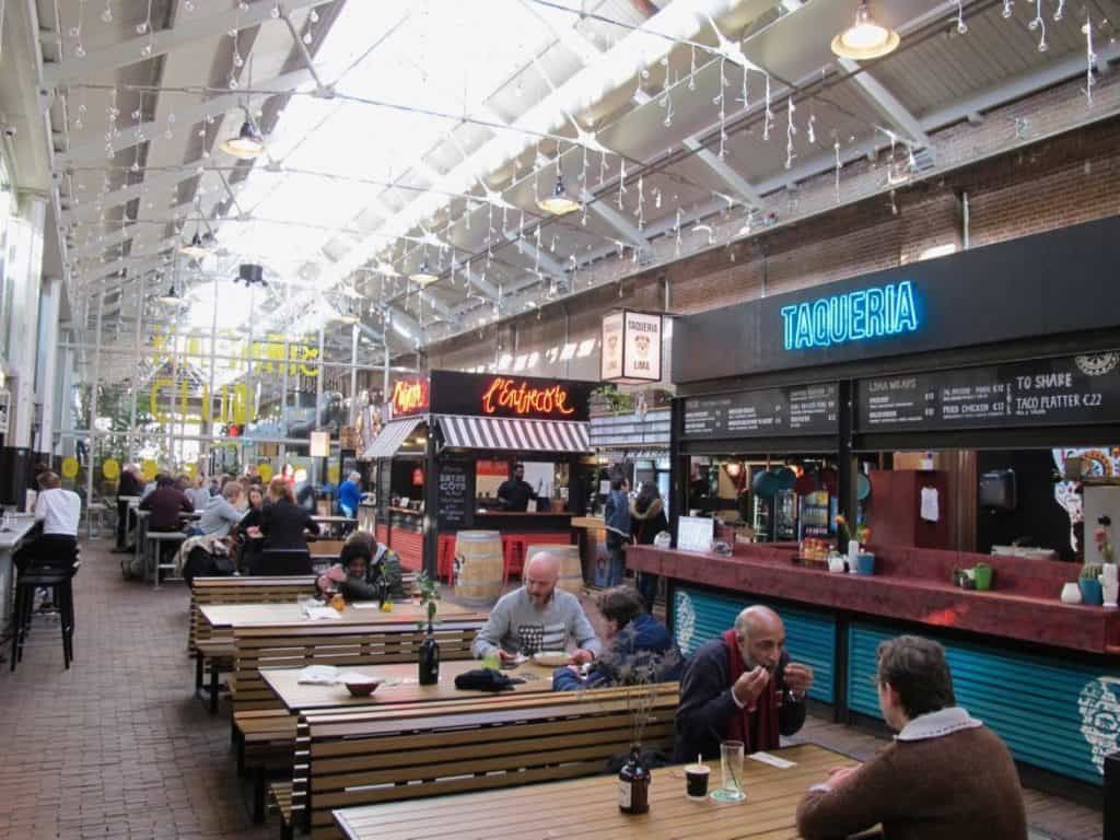
## Description De Hallen Foodhallen is one of Amsterdam’s most successful examples of adaptive reuse, turning a former tram depot into a vibrant indoor destination where food, design, and urban culture meet. Located in Amsterdam West, the complex blends a market atmosphere with a polished contemporary setting, so it feels both casual and curated. For food travelers, it is especially appealing because it concentrates many different flavors in one indoor space, making it easy to compare dishes, sample small plates, and settle in for a social meal without committing to a single restaurant. What makes Foodhallen so compelling is that it captures a distinctly Amsterdam approach to city life: practical, stylish, and communal without being overly formal. A lesser-known fact is that the building forms part of the wider De Hallen redevelopment, which transformed industrial infrastructure into a cultural and social hub with a cinema, library, boutiques, and creative spaces. Another detail worth noticing is how the setting changes the dining experience. Because the market is indoors and largely weatherproof, it works well year-round, which is a major advantage in a city where the climate can be unpredictable. The food itself is the main reason people come back. Instead of traditional market stalls with produce, Foodhallen offers a mix of street food and prepared dishes from different vendors, often ranging from Dutch comfort food to international plates and modern snacks. That diversity makes it useful for groups, because people with different tastes can all find something appealing. It is equally suitable for a solo traveler looking for a lively lunch as it is for a relaxed evening with friends. The atmosphere tends to be energetic but not chaotic, and the design of the hall gives the entire space a sense of urban polish. Another reason it ranks high with visitors is its location in a neighborhood that feels more local than postcard-touristy, yet still easy to reach. If you enjoy seeing how Amsterdam works outside the canal belt, De Hallen Foodhallen is one of the smartest stops to make. ## Location De Hallen Foodhallen is located inside the De Hallen complex in Amsterdam West, North Holland, Netherlands. The neighborhood sits a short distance from the historic center, which makes the venue easy to reach while still giving you a sense of a different side of the city. Amsterdam West is known for its residential streets, creative energy, and a more lived-in atmosphere than the most heavily visited central districts. The easiest way to get there is by tram, bike, or a short taxi ride from central Amsterdam. Public transport is typically the most convenient option for first-time visitors, and cycling can be a strong choice if you are comfortable navigating the city like a local. Once inside the complex, the Foodhallen is easy to find because it is one of the main anchor attractions. It is worth combining the visit with a broader look at De Hallen itself, especially if you are interested in architecture or urban regeneration. You can also use it as part of a neighborhood day out, exploring nearby streets, cafés, and shops before or after your meal. ## Tips Visit hungry but not starving. The venue is designed for sampling and sharing, so leaving some room for variety will make the experience more enjoyable. If you are with a group, agree on a general budget before ordering. The temptation to try several vendors can add up quickly, especially when drinks are included. Go at off-peak times if you want a calmer experience. Lunch and early evening can be lively, while late afternoons often offer a little more breathing room. Take your time choosing. The food hall format works best when you walk the full space first and compare what each vendor offers rather than committing immediately to the first appealing stall. Keep the visit flexible. De Hallen has more to offer than food alone, so leaving time for the broader complex makes the outing feel richer. ## Conclusion De Hallen Foodhallen is a polished and enjoyable Amsterdam food destination that balances variety, atmosphere, and design. Its indoor format, good location, and wide range of vendors make it an easy recommendation for travelers who want a lively meal in a memorable setting. ## FAQ ### Is De Hallen Foodhallen expensive? It can be mid-range to moderately expensive depending on what you order, but the variety makes it possible to eat well at different budgets. Small plates and sharing can help control costs. ### Is it good for families? Yes. The indoor setting, broad food selection, and casual environment make it suitable for families, especially when weather is poor or you want a relaxed place to eat together. ### Do I need reservations? Usually not for simply visiting the food hall, though some nearby venues or specific events may be different. If you plan to dine at a popular time, arriving earlier is a smart move. ### What is the best time to visit? Late lunch, early evening, or a quieter weekday visit often works well. The best time depends on whether you want a buzzing atmosphere or a more relaxed browsing experience. ## Links - [Foodhallen Amsterdam](https://foodhallen.nl/en/venues/amsterdam) - [De Hallen Amsterdam](https://dehallen-amsterdam.nl/en/)
GemVoyage Team • World
Stockholm
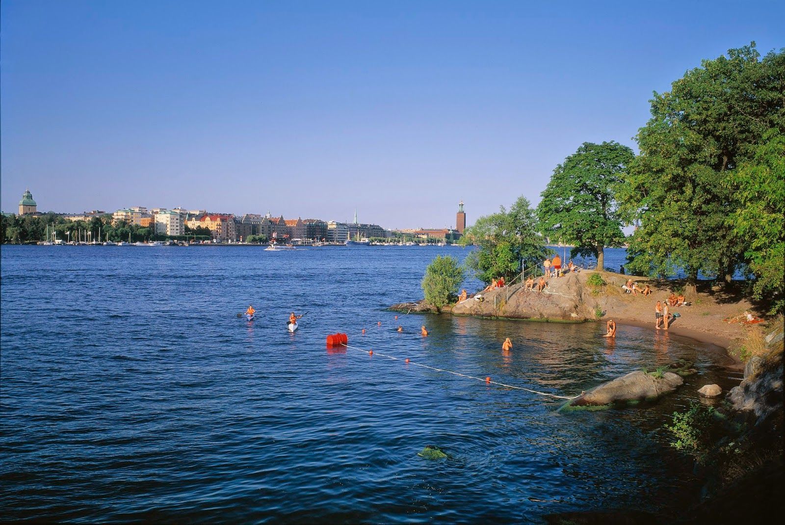
## Description Långholmen Island Beach is one of Stockholm’s most appealing summer spots because it combines waterfront relaxation with the unusual character of an island that has shifted through different uses over time. Visitors come for swimming, sunbathing, walking, and the easygoing atmosphere, but the experience is richer than a simple beach stop. The setting itself is part of the attraction: you are on an island close to the city, surrounded by water, greenery, and reminders of Stockholm’s layered history. What makes Långholmen stand out is that it feels local rather than overly polished. It is a place where residents and visitors mingle in warm weather, where people arrive with towels, picnic food, and a plan to stay for a while. It is not a tropical beach and does not try to be one; instead, it offers a distinctly Scandinavian urban waterfront experience. One lesser-known fact is that Långholmen has had very different historical roles before becoming a leisure destination, which gives the island an added sense of depth. Another interesting detail is that the area’s appeal changes dramatically by season, making it a true summer favorite in a city where outdoor life depends heavily on weather. The beach is also a good example of how Stockholm uses its water environment. Rather than separating city life from the shoreline, the city often integrates swimming and walking areas into the urban fabric. Långholmen captures that idea perfectly. You can spend time on the beach, wander nearby paths, and still feel close to the city center. For travelers, that makes it a convenient and memorable place to balance sightseeing with rest. ## Location Långholmen is a small island in central Stockholm, Sweden, connected to the city by bridges and easy to access from the Södermalm side and other central districts. Because it is so close to the urban core, it is one of the easiest island experiences in Stockholm. The simplest way to get there is by walking from nearby central neighborhoods or using public transport and then continuing on foot. Cycling also works well in Stockholm, and the island fits nicely into a bike-friendly itinerary. Once there, most of the movement is best done on foot so you can enjoy the shoreline and the surrounding green areas at an unhurried pace. ## Tips This is best visited in warm weather, especially in late spring and summer. Bring swimwear if you want to use the beach properly, but also bring a layer for cooler winds. Combine the visit with a walk around the island so you see more than just the main swimming area. Arrive earlier on sunny days if you want a quieter spot near the water. ## Conclusion Långholmen Island Beach is a relaxed city escape that gives Stockholm a rare but very welcome summer beach mood. ## FAQ ### Is Långholmen a real beach? Yes, though it is a city beach rather than a large natural seaside beach. ### Is it good for swimming? Yes, it is one of Stockholm’s popular places for summer swimming. ### How do I get there from central Stockholm? Walk, bike, or use public transport and then cross to the island on foot. ### Is it busy in summer? It can be, especially on warm weekends and sunny afternoons. ### Can I visit outside summer? Yes, but it is most enjoyable as a beach destination in the warmer months. ## Links - [Stockholm official visitor information](https://www.visitstockholm.com/) - [Långholmen on Wikipedia](https://en.wikipedia.org/wiki/Långholmen)
GemVoyage Team • World
Cairo
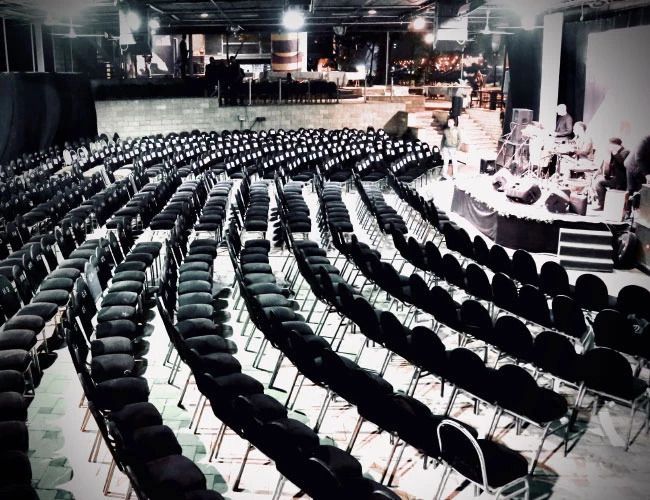
## Description El Sawy Culturewheel (often written as Sawy Cultural Wheel) is a dynamic cultural center in Cairo known for its eclectic program of theater, music, workshops, literary evenings, and community arts activities. Established by Egyptian cultural entrepreneur Mohamed El-Sawy, the center was conceived as a grassroots venue that supports independent artists, nurtures emerging talents, and brings diverse audiences together. The venue’s programming ranges from experimental theater and jazz nights to film discussions and children’s arts workshops, creating an urban cultural laboratory distinctly different from state-run institutions. What sets the Culturewheel apart is its commitment to accessibility and community engagement. It frequently offers affordable events, artists’ talks, and interdisciplinary collaborations that reflect contemporary Egyptian cultural life. A less obvious feature is the center’s role as a networking node—many artists and creative collectives in Cairo trace early collaborations back to events hosted at El Sawy, making it a quiet engine of the city’s cultural ecosystem. ## Location El Sawy Culturewheel is based on Gezira Island in the Zamalek district of central Cairo, Egypt, near the Nile’s western bank. Its central location on Gezira makes it easy to reach from many Cairo neighborhoods. Getting there: From downtown Cairo (Tahrir Square, downtown hotels) a short taxi or ride-share trip reaches Zamalek in under 20 minutes depending on traffic. Some visitors prefer the tram or river ferry options when available; walking across the Qasr El Nil bridge and heading into Zamalek is also feasible for those staying nearby. Parking can be limited during busy events, so public transport or a ride-hailing service is often most convenient. ## Tips - Check the schedule in advance: The Culturewheel’s program changes frequently; review upcoming events on their official channels or social pages to secure tickets for popular shows. - Arrive early: Some events are small and seat availability is limited; arriving early ensures a good seat and time to meet artists or buy refreshments. - Explore related venues: Zamalek has galleries, bookstores, and cafes; make an evening of it by combining a performance with dinner or a gallery visit. - Language: Many performances are in Arabic; however, cultural evenings often include bilingual presentations, translations, or summaries for international visitors—check event details if language is a concern. - Bring cash for smaller events and local craft stalls; bigger performances may accept card or online booking. ## Conclusion El Sawy Culturewheel is Cairo’s pulse for grassroots cultural life—an energetic space where performance, dialogue, and creativity intersect. For visitors interested in contemporary Egyptian arts or seeking a local, community-centered experience, the Culturewheel offers an accessible, varied, and memorable cultural program. ## FAQ Q: What kind of events are held at the Culturewheel? A: The center hosts theater, live music, film nights, literary readings, workshops, and children’s activities. Q: Is there an official timetable? A: Yes. Events are scheduled regularly—check the Culturewheel’s official announcement channels for the latest listings. Q: Are events in English? A: Many events are primarily in Arabic, but there are occasional bilingual events and programs aimed at international audiences. Q: Is the venue family-friendly? A: The center runs children’s workshops and family-oriented events—review event descriptions to verify suitability. ## Links - [Wikipedia: El Sawy Culturewheel](https://en.wikipedia.org/wiki/El_Sawy_Culturewheel) - [El Sawy Culturewheel official website](https://www.culturewheel.com/en)
GemVoyage Team • World
Vienna
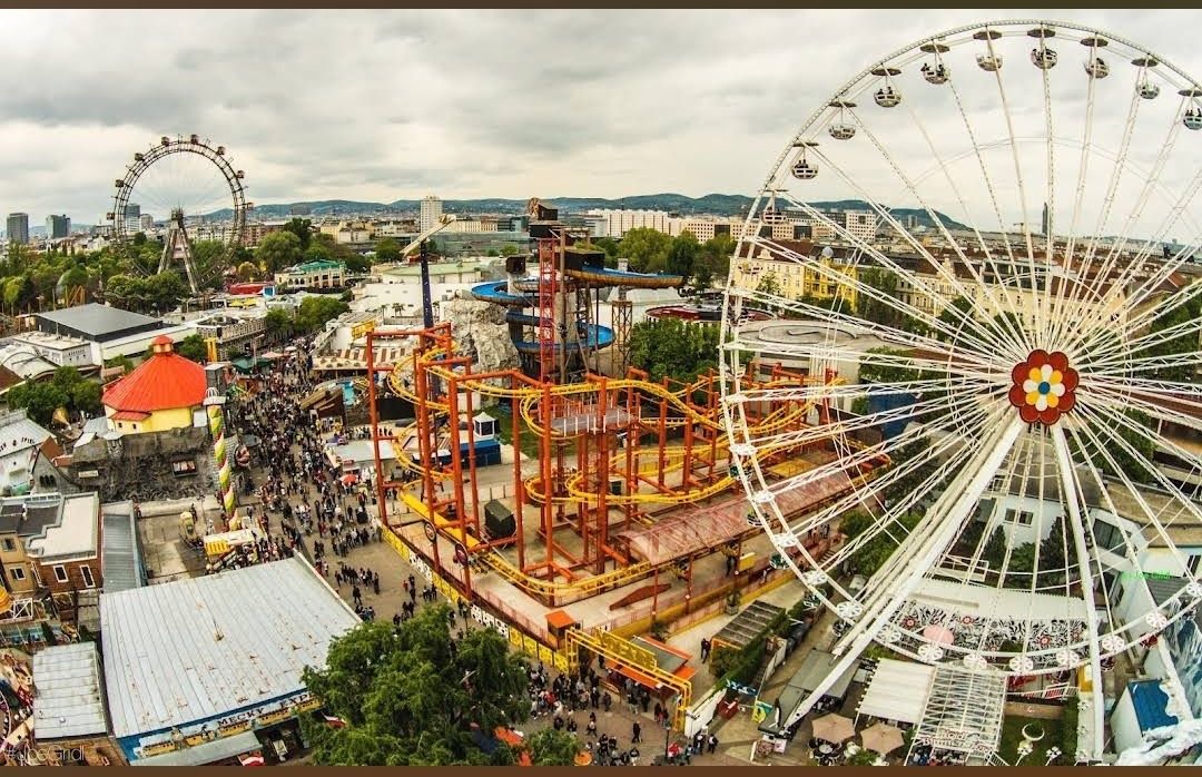
## Description **Prater Funpark** in Vienna, commonly referred to as the **Wurstelprater**, is one of Europe’s most iconic amusement parks and a beloved attraction for both locals and tourists. Nestled within the vast Prater public park, this funfair has been entertaining visitors for over 250 years. It’s a place where history, nostalgia, and modern thrills come together, offering everything from traditional carousels and bumper cars to cutting-edge roller coasters and high-adrenaline rides. What makes the Prater unique is its blend of old-world charm and contemporary entertainment. The park’s symbol, the **Wiener Riesenrad** (Giant Ferris Wheel), dates back to 1897 and is one of Vienna’s most recognized landmarks. Riding the Ferris wheel provides not only fun but also breathtaking panoramic views of the city. At the same time, newer attractions like turbo coasters and virtual reality experiences ensure that thrill-seekers are never bored. **Little-known facts**: * The Prater was originally an imperial hunting ground before being opened to the public in 1766. The amusement park grew organically from stalls, performers, and small rides. * Unlike most theme parks, **entry to the Prater Funpark is free**. Visitors pay only for the rides and attractions they choose, making it a flexible experience for all budgets. --- ## Location Prater Funpark is located in **Vienna**, the capital of **Austria**, within the **Leopoldstadt district**. It sits inside the larger **Prater public park**, a green oasis that stretches over six square kilometers and also includes walking paths, meadows, and sports facilities. ### How to get there: * **By metro**: The fastest way is to take the U1 or U2 subway lines to the station **Praterstern**, which is just a short walk from the park. * **By tram**: Trams 0 and 5 also stop near Prater. * **By foot or bike**: Visitors staying in central Vienna can enjoy a scenic walk or bike ride to the park, as it’s close to the city center. --- ## Tips * **Visit in the evening**: The Prater comes alive after sunset when the rides light up, creating a magical carnival atmosphere. * **Don’t miss the Giant Ferris Wheel**: It’s the park’s most famous attraction and a must for first-time visitors. * **Plan your budget**: Since entry is free but rides are paid individually, decide beforehand how many attractions you’d like to try. Ride prices vary, so bringing cash can be useful. * **Try the local food stalls**: Beyond rides, the park is known for its traditional Austrian snacks like bratwurst, pretzels, and candied nuts. * **Combine with a stroll in the Prater park**: After the excitement of the rides, the surrounding green spaces offer a relaxing contrast. * **Check seasonal events**: The park hosts festivals, concerts, and themed events throughout the year, especially during summer and around Christmas. --- ## Conclusion Prater Funpark in Vienna is more than just an amusement park—it’s a cultural institution that blends history, fun, and nostalgia. With its mix of historic attractions like the Wiener Riesenrad and thrilling modern rides, it offers something for everyone, from families to adrenaline junkies. Whether you go for the rides, the food, or the atmosphere, the Prater promises an unforgettable Viennese experience. --- ## FAQ **1. Is there an entrance fee for Prater Funpark?** No, entrance is free. Visitors only pay for the rides and attractions they choose. **2. What is the most famous ride at Prater?** The **Wiener Riesenrad (Giant Ferris Wheel)** is the park’s most iconic attraction and a symbol of Vienna. **3. When is the best time to visit?** Evenings are particularly magical with illuminated rides, but daytime visits are better for families with young children. **4. How long should I plan to spend at Prater?** Most visitors spend 2–4 hours, though you could easily spend a whole day enjoying the rides and the larger Prater park. **5. Is Prater open year-round?** The park is open all year, but many rides operate seasonally, typically from March to October. The Giant Ferris Wheel and some attractions remain open in winter. **6. Can I find food and drinks inside the park?** Yes, the park is filled with restaurants, snack stalls, and beer gardens serving Austrian and international food. --- ## Links * [Prater Wien – Official Website](https://www.praterwien.com/) * [Wiener Riesenrad – Official Website](https://www.wienerriesenrad.com/)
GemVoyage Team • World

Comments