GemVoyage Team • World
The Valley of the Whales, known locally as Wadi Al-Hitan, is one of Egypt’s most extraordinary and scientifically significant natural sites. Located deep in the Western Desert, this UNESCO World Heritage Site offers a rare glimpse into the evolutionary history of whales. What makes Wadi Al-Hitan truly unique is its collection of fossilized remains of early whale species—particularly the now-extinct Archaeoceti—that vividly illustrate the transition of whales from land-dwelling mammals to fully aquatic creatures.
The site contains hundreds of fossils, including complete skeletons, some of which still retain vestigial hind limbs, feet, and toes—features that modern whales no longer possess. These fossils date back approximately 40 million years and are remarkably well-preserved, with some even showing stomach contents. The surrounding desert landscape, sculpted by wind and time, adds to the surreal experience, with rock formations resembling alien sculptures and ancient seabeds.
A little-known fact: the first whale fossils in Wadi Al-Hitan were discovered in the early 1900s, but the site remained largely unexplored until the 1980s when improved access and growing scientific interest led to its preservation. Another fascinating detail is that the area also contains fossils of other marine life, including sharks, rays, and sawfish, helping researchers reconstruct the ancient ecosystem of the Tethys Sea.
Wadi Al-Hitan is located in Egypt, within the Faiyum Governorate, approximately 150 kilometers southwest of Cairo. It lies within the Wadi El-Rayan Protected Area, a vast desert reserve known for its sand dunes, lakes, and biodiversity.
Due to its remote location, planning ahead is essential, and traveling with a guide is highly recommended.
Wadi Al-Hitan is a captivating destination that blends natural beauty with scientific wonder. Its fossil-rich landscape tells a story millions of years old, making it one of the most important paleontological sites in the world and a must-visit for anyone intrigued by Earth’s evolutionary history.
1. Is there an entrance fee to Wadi Al-Hitan?
Yes, there is a small entrance fee, which may vary depending on whether you’re visiting with a guide or tour group.
2. Can I visit Wadi Al-Hitan without a guide?
While possible, it’s highly recommended to go with a guide due to the remote location and lack of signage.
3. Are there accommodations nearby?
There are eco-lodges and campsites in the Wadi El-Rayan area, but most visitors stay in Faiyum or return to Cairo.
4. Is the site suitable for children?
Yes, children can enjoy the site, especially the museum, but supervision is necessary due to the terrain and fragile fossils.
5. How long should I plan for the visit?
A typical visit lasts 2–3 hours, not including travel time. Full-day trips from Cairo are common.
6. Is photography allowed?
Yes, photography is permitted, but drones may require special permission.
Discover more hidden gems you might love.
Mexico City
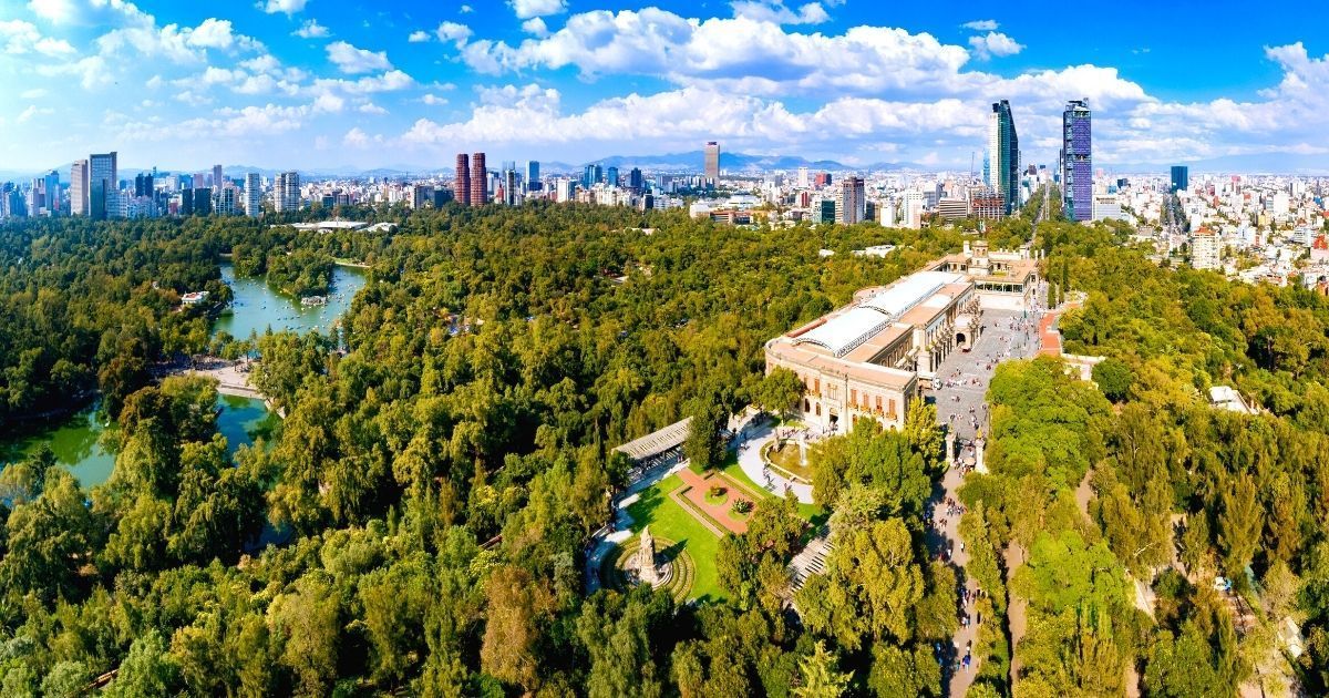
## Description Chapultepec Forest (Bosque de Chapultepec) is one of the largest and most consequential urban parks in the Americas, a living green lung at the heart of Mexico City that blends natural landscapes with civic life, culture, and history. More than a municipal park, Chapultepec is a multilayered cultural landscape: wide oak and pine groves, winding paths, boating lakes, formal gardens, archaeological sites, and a string of world-class museums make it a singular destination for both visitors and residents. Its scale and diversity mean you can shift within minutes from a quiet shaded trail to a museum day or a lakeside picnic, and that versatility is precisely what makes Chapultepec so valuable. Chapultepec's importance is historical as well as recreational. The hill that holds Chapultepec Castle was once an Aztec refuge and later a site of colonial and early republican power. The Castillo de Chapultepec offers sweeping views across the city and houses collections that relate to Mexico’s political story. Meanwhile, the National Museum of Anthropology and other cultural institutions in the park hold artifacts and exhibitions of global significance. The juxtaposition of high-culture museums and everyday park life—runners, families, vendors, and informal musicians—gives Chapultepec a dynamic sense of place that resists being reduced to a single label. From a traveler’s perspective, Chapultepec is best approached as a set of distinct neighborhoods. The first section concentrates major museums and tourist attractions; the second section contains quiet lawns and intimate groves used more by locals; the third section opens into larger, less manicured green areas with a calmer atmosphere. Each offers different rhythms: concentrated cultural learning, relaxed recreation, or more wilderness-like wandering. ## Location Chapultepec sits in central Mexico City, stretching west from Paseo de la Reforma into the adjacent neighborhoods of Polanco and Lomas de Chapultepec. It’s highly accessible: multiple metro stops and bus lines border the park and taxis or rideshares drop you close to major entrances. Because it’s integrated into the city rather than fenced off, think of Chapultepec as an urban zone with many points of entry rather than a single gated park. If your priorities are museums, start at the first section near the National Museum of Anthropology and the Museum of Modern Art. For boating and family activities, head to the lake area. For a quieter, more local experience, explore the second and third sections where joggers and picnickers are the dominant users. Allow travel time between sections if you plan to combine multiple activities. ## Tips - Prioritize: choose one or two zones (museums, lake and boats, or quiet groves) to avoid overambitious itineraries. - Start early: museums open mid-morning, and earlier starts beat crowds and heat. - Use public transit: nearby metro stations and eco-bus lines reduce parking hassles. - Wear layers and comfortable shoes: shaded groves can be cool while open plazas warm up quickly. - Pair the visit with neighborhood dining in Polanco or a stroll down Reforma for monuments and architecture. - Bring water, sunscreen, and small change for boat rentals and food stalls. ## Conclusion Chapultepec Forest is an essential part of a Mexico City visit because it combines culture, outdoor recreation, and historical depth in one central, walkable area. It’s best enjoyed with a focused plan—pick the experience that appeals most and accept that the park rewards repeat visits as much as one long day. ## FAQ ### Why is Chapultepec Forest so important? It combines large-scale green space, national museums, historical monuments, and everyday civic life in a single urban zone, making it central to Mexico City’s identity and visitor itineraries. ### Can I visit it in one afternoon? You can visit a focused part of Chapultepec in an afternoon—for example, Castillo de Chapultepec plus one museum—but seeing the whole park requires multiple visits. ### Is it family-friendly? Absolutely. The park has playgrounds, boat rentals, family-friendly museum exhibits, and wide lawns suitable for picnics and group activities. ### Are there museums inside the forest? Yes. Highlights include the National Museum of Anthropology, the Museum of Modern Art, Museo Tamayo, and Chapultepec Castle’s historic collections. ### What is the best way to explore it? Map one or two zones in advance, use public transit to arrive near those entrances, mix indoor and outdoor stops, and allow time to rest between high-intensity museum visits. ## Links - [Official website](https://www.chapultepec.org.mx/) - [Wikipedia](https://en.wikipedia.org/wiki/Chapultepec)
GemVoyage Team • World
Graz
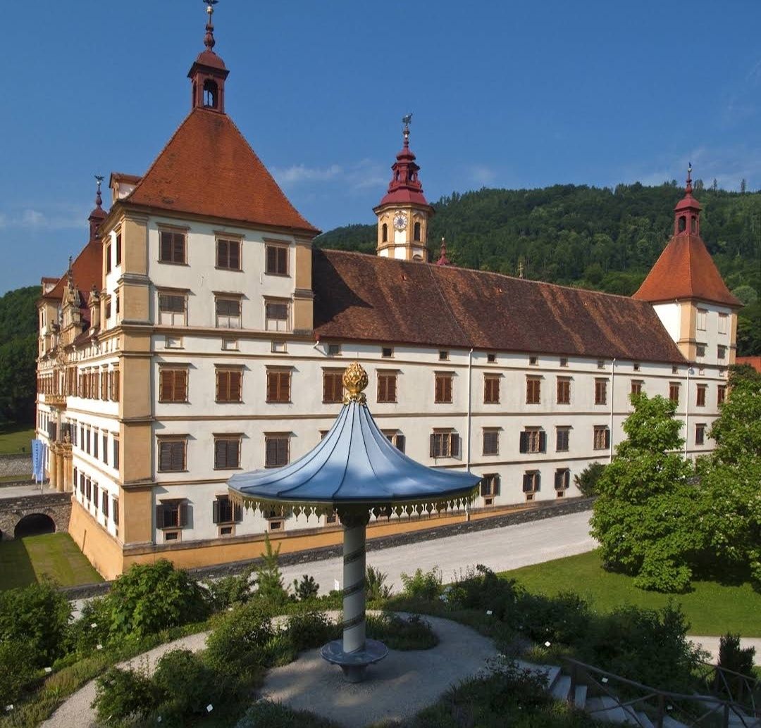
## Description Schloss Eggenberg (also known as Eggenberg Palace) is an extraordinary Baroque masterpiece perched on the western edge of Graz. What truly sets it apart is its *architectural allegory of the cosmos*: every number in its layout holds symbolic meaning. With **365 exterior windows** (for each day of the year), **31 rooms per floor** (longest month), **24 state rooms** (hours of the day), and **4 corner towers** (seasons or directions), it's a meticulously designed celebration of time and space Inside, the **Planetary Room**—or *Planetensaal*—is a highlight: its ceiling and walls are adorned with astronomical imagery dating back to 1678. The frescoes assign the seven classical planets to weekdays, Roman gods, metals, and members of the Eggenberg family, while the walls are graced by the twelve zodiac signs **Little-known facts**: 1. The palace ingeniously incorporates a medieval Gothic chapel at its core—it was once a family chapel now embedded in the 17th-century layout 2. Hidden in the Japanese Cabinet was a centuries-old folding screen—a paravent depicting Osaka before 1615—which was only recognized post-restoration around 2001–04 --- ## Location Schloss Eggenberg is located in **Graz**, the capital of **Styria (Steiermark)**, **Austria**. The address is Eggenberger Allee 90, 8020 Graz ### How to get there: * From Graz city centre, take **tram line 1**—it’s a direct, scenic route and takes approximately 15 minutes * You can also opt for bus connections (e.g., bus 33 or 62) via nearby tram interchanges, especially useful for reaching the park’s various gate points --- ## Tips for a Great Visit * **Schedule a guided tour**: The lavish state rooms (Prunkräume) are accessible only with guidance, typically offered in German and English. The tour reveals the fascinating symbolic design and stories behind each room * **Visit the Planetary Room early** to beat crowds—it's the visual and symbolic centerpiece. * **Explore the gardens and park**: Entrance to the surrounding landscaped park is affordable (€2 for adults; students and youth 19–26 pay less; under 19 free). From spring to autumn, enjoy themed areas like the Planetengarten, Rose Garden, and all while sharing the space with freely roaming peacocks—a favorite for photos * **2025 STEIERMARK SCHAU special**: This anniversary exhibition (starting April 26, 2025) transforms the state rooms into immersive multimedia spaces exploring the backstories of the palace’s inhabitants—from chambermaids to barbers. Entry is free for this event * **Time your visit after April** if you wish to see interiors—during winter, the rooms remain closed to protect their original condition (no heating or electricity), though the park stays open * **Extend your museum experience**: With a valid ticket, you can also access the Alte Galerie, Archaeology Museum, and Münzkabinett located on site—all part of the Universalmuseum Joanneum --- ## Conclusion Schloss Eggenberg stands not only as one of Austria’s most exquisite Baroque palaces but also as a cosmic narrative carved in stone and fresco. Its unique blend of symbolism, history, and beauty—along with its serene park and evolving exhibitions—makes it a must-visit for anyone in Graz seeking culture within a meaningful, multi-layered architectural gem. --- ## FAQ **1. What makes Schloss Eggenberg unique?** Its architectural design is a calendar in stone—365 windows, 24 state rooms, 31 rooms per floor, and more—symbolizing time and cosmos. **2. Is the palace part of UNESCO World Heritage?** Yes, since 2010, alongside Graz’s historic centre. **3. Can you visit the interiors anytime?** No. The state rooms are typically open April to early November, accessible only via guided tour. They close in winter to preserve their untouched original state **4. What are the opening hours and ticket prices?** * **Park & gardens**: €2 for adults; students and youth get reduced rates; free for under-19s. * **Prunkräume & museums**: Around €15 for adults; youth discounts apply. Check updated hours—usually 10 am to 6 pm during open season **5. Is Schloss Eggenberg accessible via public transport?** Yes—tram line 1 runs directly from the centre to the palace area. Buses (33, 62) also serve the surrounding park entrances. **6. Are there areas suited for families?** Definitely—its expansive park includes playgrounds, thematic gardens like Planetengarten, peacocks, and picnic spots—perfect for a family outing. --- ## Useful Links * [Official Website](https://styriarte.com/en/locations/schloss-eggenberg/)
GemVoyage Team • World
Berlin
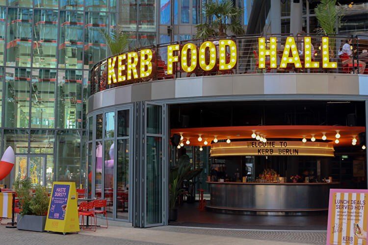
## Description **KERB Food Hall Berlin** is one of the city’s most exciting modern food destinations, bringing together **global street food, creative culinary startups, and a vibrant social atmosphere** under one roof. Originally founded in London, KERB built its reputation by curating some of the best independent street food traders in the UK, and its expansion into Berlin introduced that same concept to Germany’s capital — with a distinctly local twist. What makes KERB Berlin unique is its **carefully curated lineup of rotating food vendors**, rather than permanent restaurant tenants. This means repeat visitors rarely have the same experience twice. One visit might feature Korean fried chicken, Venezuelan arepas, and Detroit-style pizza, while the next showcases artisanal burgers, vegan Asian fusion, and experimental dessert concepts. The focus is on **independent operators, bold flavors, and limited menus executed at a very high level**. The food hall is housed inside a **repurposed industrial building**, which reflects Berlin’s signature blend of raw architecture and creative culture. Exposed concrete, steel beams, neon signage, and open kitchens give the space an energetic, urban feel. At the same time, long communal tables and open seating make it a highly social environment where strangers easily strike up conversations over food. KERB Berlin is not just about eating; it is designed as a **cultural and lifestyle venue**. The space regularly hosts **live DJs, themed food events, launch pop-ups, tasting nights, and collaborations with breweries and chefs**. This transforms the food hall into a nightlife-adjacent destination rather than a simple lunch stop. On weekends, the atmosphere often shifts from casual dining to full-fledged social gathering. A little-known fact is that most vendors at KERB Berlin **pass through a rigorous selection and testing process**, where they first operate as pop-ups before being invited into the official rotation. This keeps quality consistently high and avoids stagnation. Another lesser-known detail is that several traders who started at KERB locations in London and Berlin later expanded into **successful standalone restaurant brands**, making the food hall a genuine business incubator for culinary entrepreneurs. For travelers, KERB offers a **fast, high-quality overview of global flavors** without needing multiple restaurant visits. For Berliners, it functions as a rotating experimental kitchen where emerging food concepts can be explored in a relaxed, informal setting. ## Location **KERB Food Hall Berlin** is located in the **Neukölln district**, one of the city’s most dynamic and fast-evolving neighborhoods known for its creative industries, nightlife, and international food scene. **City:** Berlin **Region:** Berlin State (Bundesland Berlin) **Country:** Germany **District:** Neukölln ### How to Get There: * **By U-Bahn:** Take **U8** to **Boddinstraße** or **Hermannplatz**, then walk approximately 8–12 minutes depending on the exit. * **By S-Bahn:** Take **S41/S42 Ringbahn** to **Sonnenallee**, followed by a short walk. * **By bus:** Several routes serve the Neukölln area, with stops within walking distance. * **By taxi or ride-hailing apps:** Simply ask for “KERB Food Hall Neukölln.” * **By bicycle:** Dedicated bike lanes are available throughout Neukölln, with bike parking near the venue. Its location makes it easy to combine with **Neukölln nightlife, vintage shopping, rooftop bars, and live music venues**. ## Tips * **Arrive hungry and early on weekends:** Peak hours fill up fast, especially Friday and Saturday evenings. * **Walk the full hall before ordering:** Vendor selection changes often, and it pays to explore all options first. * **Share dishes:** Portion sizes are ideal for sharing, allowing you to sample multiple vendors in one visit. * **Bring both cash and card:** Most stalls accept cards, but some pop-ups may still prefer cash. * **Follow KERB Berlin on social media:** This is the best way to track rotating vendors, special events, and guest chef nights. * **Vegan and halal options are usually available:** The vendor mix is intentionally inclusive. * **Weekday lunches are calmer:** If you prefer a quieter experience, visit during weekday afternoons. * **Pair with nearby nightlife:** The area transforms after dark and offers excellent bar-hopping opportunities. ## Conclusion **KERB Food Hall Berlin** is a dynamic celebration of **modern street food culture, independent entrepreneurship, and Berlin’s creative energy**. With its constantly changing vendor lineup, industrial-chic atmosphere, and event-driven programming, it offers far more than a standard food court. Whether you are a traveler seeking a fast introduction to global flavors or a local searching for the next culinary trend, KERB delivers a social, flavorful, and ever-evolving dining experience. ## FAQ **1. What is KERB Food Hall known for?** KERB is known for **rotating gourmet street food vendors**, curated for quality, creativity, and independent ownership. **2. Is KERB Berlin suitable for vegetarians and vegans?** Yes, there are usually **multiple vegetarian and vegan stalls** at any given time. **3. Do I need a reservation to visit?** No, KERB operates on a **walk-in basis**, though large groups may have limited seating during peak hours. **4. Is KERB family-friendly?** Yes, during daytime hours it is family-friendly. Evenings are more adult-oriented due to music and alcohol service. **5. Does KERB Berlin serve alcohol?** Yes, the food hall offers **craft beer, cocktails, and non-alcoholic beverages** through onsite bars. **6. How often do the food vendors change?** Vendors rotate regularly, depending on pop-up schedules, seasonal menus, and special collaborations. ## Links * [KERB Official Website](https://kerbfood.com) * [Visit Berlin – Food Markets & Food Halls](https://www.berlin.de/en/shopping/markets/food-halls/9860248-9881473-kerb-berlin.en.html)
GemVoyage Team • World
Cairo
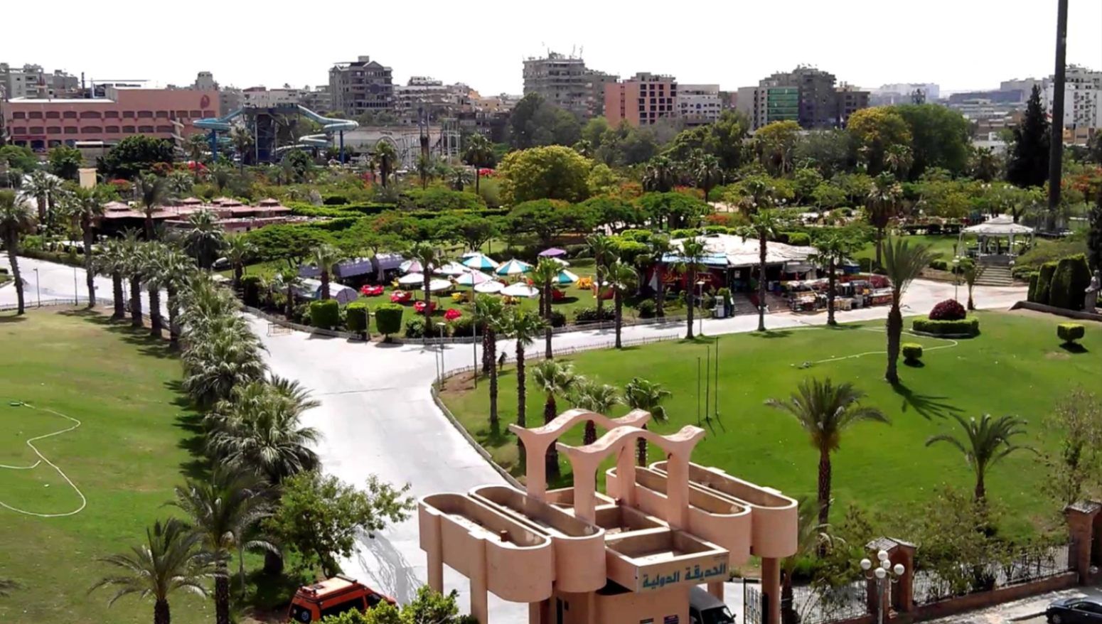
## Description **The International Park (الحديقة الدولية بالقاهرة)** is one of Cairo’s most distinctive public green spaces, designed to showcase a miniature journey through different countries and cultures within a single park. Established in the late 1980s, the park was conceived as a cultural and recreational project where landscaped areas, architectural replicas, and themed gardens represent nations from around the world. While not polished in the way of modern theme parks, its charm lies in its **ambitious concept, open space, and local atmosphere**. What makes the International Park unique is its layout: each section is inspired by a different country, featuring symbolic structures, sculptures, plants, or design elements associated with that nation. Visitors can walk from Asian-inspired pavilions to European-style gardens within minutes. This eclectic mix gives the park an almost nostalgic quality, reflecting Cairo’s vision of internationalism during the late 20th century. A lesser-known fact is that several embassies and cultural institutions contributed ideas or symbolic elements during the park’s early development, even if execution varied over time. Another interesting detail is that the park was once a major venue for **school trips and cultural festivals**, making it an important part of collective memory for many Cairenes who grew up in the 1990s. Today, the park functions primarily as a **family-friendly recreational space**. It is popular for picnics, casual walks, and affordable outings, especially for residents of eastern Cairo. While some areas show signs of aging, the park’s size, greenery, and concept still make it a refreshing escape from the dense urban environment. ## Location **Country:** Egypt **Region:** Greater Cairo **City:** Cairo **District:** Nasr City The International Park is located in **Nasr City**, one of Cairo’s largest residential districts, close to major roads and residential compounds. ### How to Get There * **By taxi or ride-hailing:** * Uber and local taxis are the most convenient option from anywhere in Cairo. * **By car:** * Easily accessible via Nasr City’s main roads, with parking available near the entrance. * **By public transport:** * Microbuses and buses serving Nasr City pass close to the park, though routes can be confusing for first-time visitors. * **From central Cairo:** * Expect a 30–45 minute drive depending on traffic. ## Tips * **Visit in the afternoon:** Late afternoon offers better weather and softer light, especially in warmer months. * **Bring your own food:** Picnic areas are common, and outside food is usually allowed. * **Wear comfortable shoes:** The park is large, and exploring all sections involves significant walking. * **Manage expectations:** Some country sections are more symbolic than detailed replicas. * **Good for children:** Open spaces allow kids to run freely, and the atmosphere is relaxed. * **Avoid peak public holidays:** The park can become crowded during major Egyptian holidays. ## Conclusion The International Park is a spacious, culturally themed green retreat that offers a simple but enjoyable experience for families and casual visitors. Its global concept, combined with its local character, makes it a nostalgic and accessible escape from Cairo’s urban intensity. ## FAQ **1. When was the International Park opened?** It was established in the late 1980s as a cultural and recreational project. **2. Is there an entrance fee?** Yes, there is a low entrance fee, making it affordable for families. **3. How long should I plan for a visit?** Most visitors spend **1.5 to 3 hours**, depending on walking pace and activities. **4. Is the park suitable for tourists?** Yes, especially for those interested in local leisure spaces rather than major monuments. **5. Are there food stalls inside?** Basic snacks may be available, but bringing your own food is recommended. **6. Is it good for photography?** Yes, particularly for casual photography and wide shots of greenery and themed structures. ## Links * [Egyptian tourism portal](https://www.experienceegypt.eg/en)
GemVoyage Team • World
Manchester
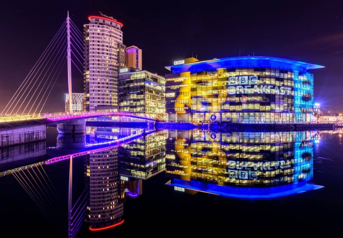
## Description The Quays is one of Manchester’s most dynamic and visually striking waterfront areas, known for its blend of modern architecture, cultural landmarks, and leisure spaces. Once part of the historic Manchester Docks, this area has been completely transformed into a contemporary district that reflects the city’s industrial past while embracing innovation and creativity. Today, The Quays is a popular destination for both locals and visitors, offering museums, media hubs, restaurants, and scenic walking routes along the water. What makes The Quays unique is its successful regeneration story. Formerly an active dock system that played a vital role in Britain’s industrial trade, the area fell into decline in the late 20th century before being reimagined as a cultural and media center. A little-known fact is that the docks here were once among the busiest inland ports in the world. Another interesting detail is that The Quays is home to MediaCityUK, where major broadcasters operate live studios, allowing visitors to see television and radio production happening in real time. With iconic attractions such as The Lowry arts center and the Imperial War Museum North, The Quays offers a balanced mix of history, culture, and modern urban life. ## Location The Quays is located in **England**, in the **Greater Manchester** region, within the city of **Manchester**, primarily spanning the Salford Quays area. It lies just west of Manchester city center, along the Manchester Ship Canal. Getting to The Quays is easy and convenient. The Metrolink tram system provides direct access via stops such as **MediaCityUK** and **Salford Quays**, connecting the area to Manchester Piccadilly and other key parts of the city. Several bus routes also serve the area. For those arriving by car, parking is available at various nearby facilities, though public transport is often the most efficient option. ## Tips * Wear comfortable shoes, as the waterfront paths are ideal for walking and exploring the area on foot. * Visit in the late afternoon or evening to enjoy reflections on the water and vibrant nightlife. * Check event schedules at The Lowry and MediaCityUK, as performances and live broadcasts are frequent. * Combine your visit with a museum stop, especially the Imperial War Museum North, which offers free entry. * Bring a light jacket, as the waterfront can feel cooler and windier than the city center. * Photography enthusiasts will appreciate the modern skyline and waterside views, especially at sunset. ## Conclusion The Quays is a standout example of Manchester’s reinvention, transforming historic docks into a lively cultural and entertainment district. Its mix of museums, media, dining, and scenic walks makes it an essential stop for anyone exploring the city. ## FAQ **Is The Quays suitable for families?** Yes, the area is family-friendly, with open spaces, museums, and regular events suitable for all ages. **How much time should I spend at The Quays?** Most visitors spend between two and four hours, depending on activities and attractions visited. **Are there free attractions at The Quays?** Yes, attractions like the Imperial War Museum North offer free entry. **Is The Quays accessible for people with limited mobility?** Yes, the area is modern and generally well equipped with step-free access and wide pathways. **Can I eat and drink at The Quays?** Absolutely. The area offers a wide range of cafés, bars, and restaurants with waterfront views. ## Links * [The Quays Official Website](https://www.thequays.org.uk)
GemVoyage Team • World
Athens
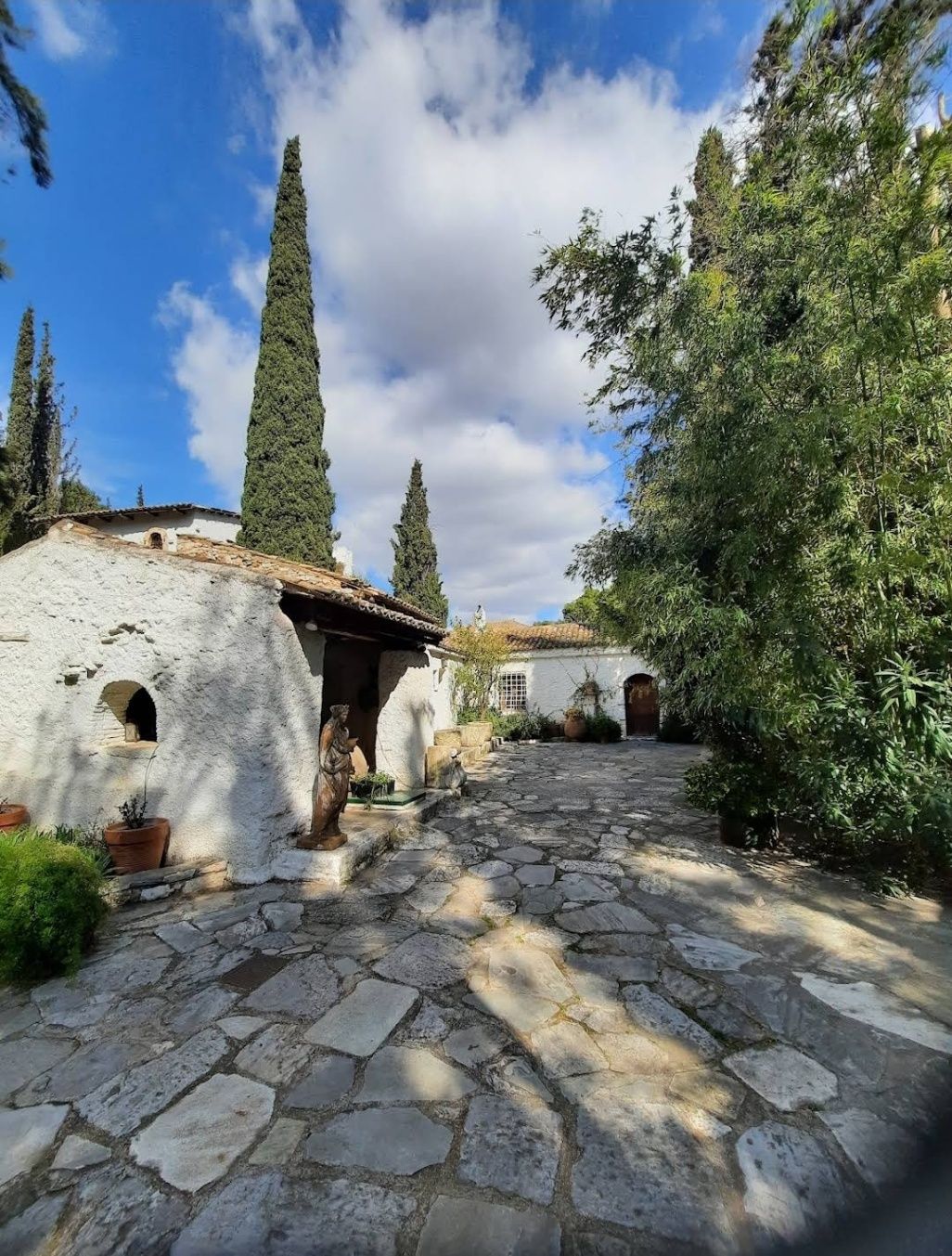
## Description The **Vorres Museum** in Athens is a cultural gem that blends history, tradition, and modernity in a unique way. Established by the Greek art collector and philanthropist Ian Vorres in 1983, the museum offers a fascinating journey through 4,000 years of Greek heritage. It is not only a museum but also a cultural foundation dedicated to preserving and promoting Greek culture. The museum is divided into two main sections: the **contemporary art gallery** and the **folk art museum**. The contemporary section houses over 6,000 works of modern Greek art, including paintings, sculptures, and installations by some of Greece’s most important artists. Meanwhile, the folk art collection showcases traditional artifacts, furniture, ceramics, and everyday objects that bring to life rural Greek culture from the 18th and 19th centuries. What makes the Vorres Museum particularly special is its location inside a beautifully restored 19th-century residence, surrounded by lush gardens filled with Mediterranean flora. The gardens themselves are works of art, featuring sculptures, pathways, and quiet corners that invite visitors to pause and reflect. **Little-known facts:** * Ian Vorres, the founder, studied in Canada and was deeply influenced by both Eastern and Western artistic traditions, which inspired his vision for the museum. * The museum frequently hosts cultural events, concerts, and temporary exhibitions, making it a dynamic space rather than a static collection. --- ## Location The Vorres Museum is located in **Paiania**, a suburb in the eastern region of **Attica**, Greece. Although it is slightly outside central Athens, it is easily accessible and offers visitors a welcome break from the busy city center. ### How to get there: * **By car/taxi**: The museum is about a 25-minute drive from downtown Athens and 15 minutes from Athens International Airport. * **By metro and bus**: Take the metro (Line 3) toward the airport and get off at Doukissis Plakentias station. From there, buses or a short taxi ride will take you to Paiania. * **Recommendation**: Taking a taxi or driving is the most convenient way, especially if you’re visiting with family or on a tight schedule. --- ## Tips * **Check opening hours in advance**: The museum has specific visiting times and may be closed on certain days, so it’s best to confirm before your trip. * **Allow time for the gardens**: Many visitors focus on the indoor collections, but the gardens are just as impressive and provide a tranquil setting. * **Photography**: While photography may be allowed in the gardens, check for any restrictions inside the museum. * **Attend cultural events**: If your visit coincides with one of the museum’s concerts, lectures, or exhibitions, take the opportunity to experience Greek culture in a lively way. * **Combine with nearby attractions**: Since it’s located near the airport, the museum can be part of a half-day trip before or after a flight. --- ## Conclusion The Vorres Museum in Athens is more than just an art museum—it is a cultural experience that bridges Greece’s rich past with its dynamic present. With its diverse collections, peaceful gardens, and dedication to cultural preservation, it is an ideal destination for art lovers, history enthusiasts, and anyone curious about Greek heritage. A visit here provides not only insight into the country’s artistic achievements but also a moment of peace away from the bustle of central Athens. --- ## FAQ **1. What type of art does the Vorres Museum showcase?** The museum features both modern Greek art and traditional folk art, offering a complete view of Greek culture. **2. Is the museum suitable for children?** Yes, the folk art section and gardens are particularly engaging for families with children. **3. How much time should I plan for a visit?** Most visitors spend about 2 hours exploring both the indoor exhibits and the gardens. **4. Is the museum wheelchair accessible?** Parts of the museum are accessible, but since it’s located in a historic building, some areas may have limitations. It’s best to check with the museum before your visit. **5. Are guided tours available?** Yes, the museum often provides guided tours, which enhance the experience by offering deeper insights into the collections. **6. Can I attend cultural events at the museum?** Yes, the museum regularly hosts concerts, lectures, and temporary exhibitions that are open to the public. --- ## Links * [Vorres Museum – Official Website](https://www.vorresmuseum.gr/)
GemVoyage Team • World


Comments