GemVoyage Team • World
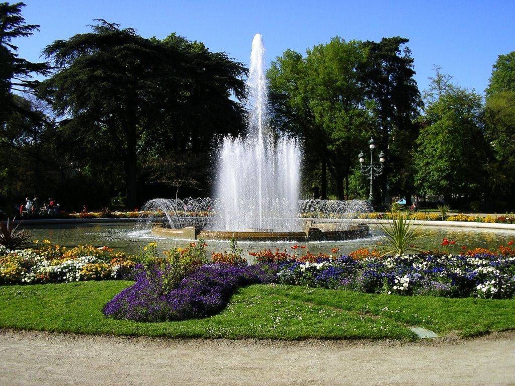
The Jardin des Plantes in Toulouse is one of the city’s most beloved green spaces, offering a calm and refreshing escape from urban life. Originally created in the 18th century as a botanical garden for scientific study, it has since evolved into a public park that blends nature, history, and leisure. With its shaded paths, ponds, statues, and diverse plant life, the garden attracts families, students, and visitors looking to experience Toulouse at a gentler pace.
What makes the Jardin des Plantes unique is its dual identity as both a historical botanical site and a modern recreational park. Although it no longer functions strictly as a scientific garden, many plant species and layout elements reflect its original purpose. A little-known fact is that the garden once served as a training ground for medical students studying botany and pharmacology. Another lesser-known detail is that it forms part of a larger green corridor together with the nearby Grand Rond and Jardin Royal, creating a continuous landscaped area rarely found in dense city centers.
The Jardin des Plantes also features playgrounds, a carousel, and cultural installations, making it appealing to visitors of all ages while preserving a sense of historical continuity.
The Jardin des Plantes is located in France, in the Occitanie region, within the city of Toulouse. It lies just south of the historic center, near the Muséum de Toulouse and the Canal du Midi.
The garden is easily accessible by public transportation. The nearest metro station is Palais de Justice on Line B, which is about a 10-minute walk away. Several bus lines also serve the area. Visitors staying in central Toulouse can reach the park comfortably on foot or by bicycle, as the surrounding streets are pedestrian-friendly and well connected.
The Jardin des Plantes in Toulouse offers a harmonious blend of history, nature, and everyday life. Whether you are seeking relaxation, family-friendly activities, or a scenic walk, this botanical garden remains one of the city’s most charming and accessible attractions.
Is the Jardin des Plantes free to enter?
Yes, entrance to the garden is free for all visitors.
How much time should I plan to spend there?
Most visitors spend between 30 minutes and two hours, depending on activities.
Is the Jardin des Plantes suitable for children?
Yes, it features playgrounds and open spaces ideal for families.
Can I picnic in the garden?
Yes, picnicking is allowed in designated areas.
Is the garden open year-round?
Yes, it is open throughout the year, though hours vary by season.
Discover more hidden gems you might love.
Berlin
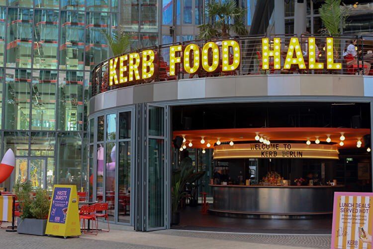
## Description **KERB Food Hall Berlin** is one of the city’s most exciting modern food destinations, bringing together **global street food, creative culinary startups, and a vibrant social atmosphere** under one roof. Originally founded in London, KERB built its reputation by curating some of the best independent street food traders in the UK, and its expansion into Berlin introduced that same concept to Germany’s capital — with a distinctly local twist. What makes KERB Berlin unique is its **carefully curated lineup of rotating food vendors**, rather than permanent restaurant tenants. This means repeat visitors rarely have the same experience twice. One visit might feature Korean fried chicken, Venezuelan arepas, and Detroit-style pizza, while the next showcases artisanal burgers, vegan Asian fusion, and experimental dessert concepts. The focus is on **independent operators, bold flavors, and limited menus executed at a very high level**. The food hall is housed inside a **repurposed industrial building**, which reflects Berlin’s signature blend of raw architecture and creative culture. Exposed concrete, steel beams, neon signage, and open kitchens give the space an energetic, urban feel. At the same time, long communal tables and open seating make it a highly social environment where strangers easily strike up conversations over food. KERB Berlin is not just about eating; it is designed as a **cultural and lifestyle venue**. The space regularly hosts **live DJs, themed food events, launch pop-ups, tasting nights, and collaborations with breweries and chefs**. This transforms the food hall into a nightlife-adjacent destination rather than a simple lunch stop. On weekends, the atmosphere often shifts from casual dining to full-fledged social gathering. A little-known fact is that most vendors at KERB Berlin **pass through a rigorous selection and testing process**, where they first operate as pop-ups before being invited into the official rotation. This keeps quality consistently high and avoids stagnation. Another lesser-known detail is that several traders who started at KERB locations in London and Berlin later expanded into **successful standalone restaurant brands**, making the food hall a genuine business incubator for culinary entrepreneurs. For travelers, KERB offers a **fast, high-quality overview of global flavors** without needing multiple restaurant visits. For Berliners, it functions as a rotating experimental kitchen where emerging food concepts can be explored in a relaxed, informal setting. ## Location **KERB Food Hall Berlin** is located in the **Neukölln district**, one of the city’s most dynamic and fast-evolving neighborhoods known for its creative industries, nightlife, and international food scene. **City:** Berlin **Region:** Berlin State (Bundesland Berlin) **Country:** Germany **District:** Neukölln ### How to Get There: * **By U-Bahn:** Take **U8** to **Boddinstraße** or **Hermannplatz**, then walk approximately 8–12 minutes depending on the exit. * **By S-Bahn:** Take **S41/S42 Ringbahn** to **Sonnenallee**, followed by a short walk. * **By bus:** Several routes serve the Neukölln area, with stops within walking distance. * **By taxi or ride-hailing apps:** Simply ask for “KERB Food Hall Neukölln.” * **By bicycle:** Dedicated bike lanes are available throughout Neukölln, with bike parking near the venue. Its location makes it easy to combine with **Neukölln nightlife, vintage shopping, rooftop bars, and live music venues**. ## Tips * **Arrive hungry and early on weekends:** Peak hours fill up fast, especially Friday and Saturday evenings. * **Walk the full hall before ordering:** Vendor selection changes often, and it pays to explore all options first. * **Share dishes:** Portion sizes are ideal for sharing, allowing you to sample multiple vendors in one visit. * **Bring both cash and card:** Most stalls accept cards, but some pop-ups may still prefer cash. * **Follow KERB Berlin on social media:** This is the best way to track rotating vendors, special events, and guest chef nights. * **Vegan and halal options are usually available:** The vendor mix is intentionally inclusive. * **Weekday lunches are calmer:** If you prefer a quieter experience, visit during weekday afternoons. * **Pair with nearby nightlife:** The area transforms after dark and offers excellent bar-hopping opportunities. ## Conclusion **KERB Food Hall Berlin** is a dynamic celebration of **modern street food culture, independent entrepreneurship, and Berlin’s creative energy**. With its constantly changing vendor lineup, industrial-chic atmosphere, and event-driven programming, it offers far more than a standard food court. Whether you are a traveler seeking a fast introduction to global flavors or a local searching for the next culinary trend, KERB delivers a social, flavorful, and ever-evolving dining experience. ## FAQ **1. What is KERB Food Hall known for?** KERB is known for **rotating gourmet street food vendors**, curated for quality, creativity, and independent ownership. **2. Is KERB Berlin suitable for vegetarians and vegans?** Yes, there are usually **multiple vegetarian and vegan stalls** at any given time. **3. Do I need a reservation to visit?** No, KERB operates on a **walk-in basis**, though large groups may have limited seating during peak hours. **4. Is KERB family-friendly?** Yes, during daytime hours it is family-friendly. Evenings are more adult-oriented due to music and alcohol service. **5. Does KERB Berlin serve alcohol?** Yes, the food hall offers **craft beer, cocktails, and non-alcoholic beverages** through onsite bars. **6. How often do the food vendors change?** Vendors rotate regularly, depending on pop-up schedules, seasonal menus, and special collaborations. ## Links * [KERB Official Website](https://kerbfood.com) * [Visit Berlin – Food Markets & Food Halls](https://www.berlin.de/en/shopping/markets/food-halls/9860248-9881473-kerb-berlin.en.html)
GemVoyage Team • World
Madrid
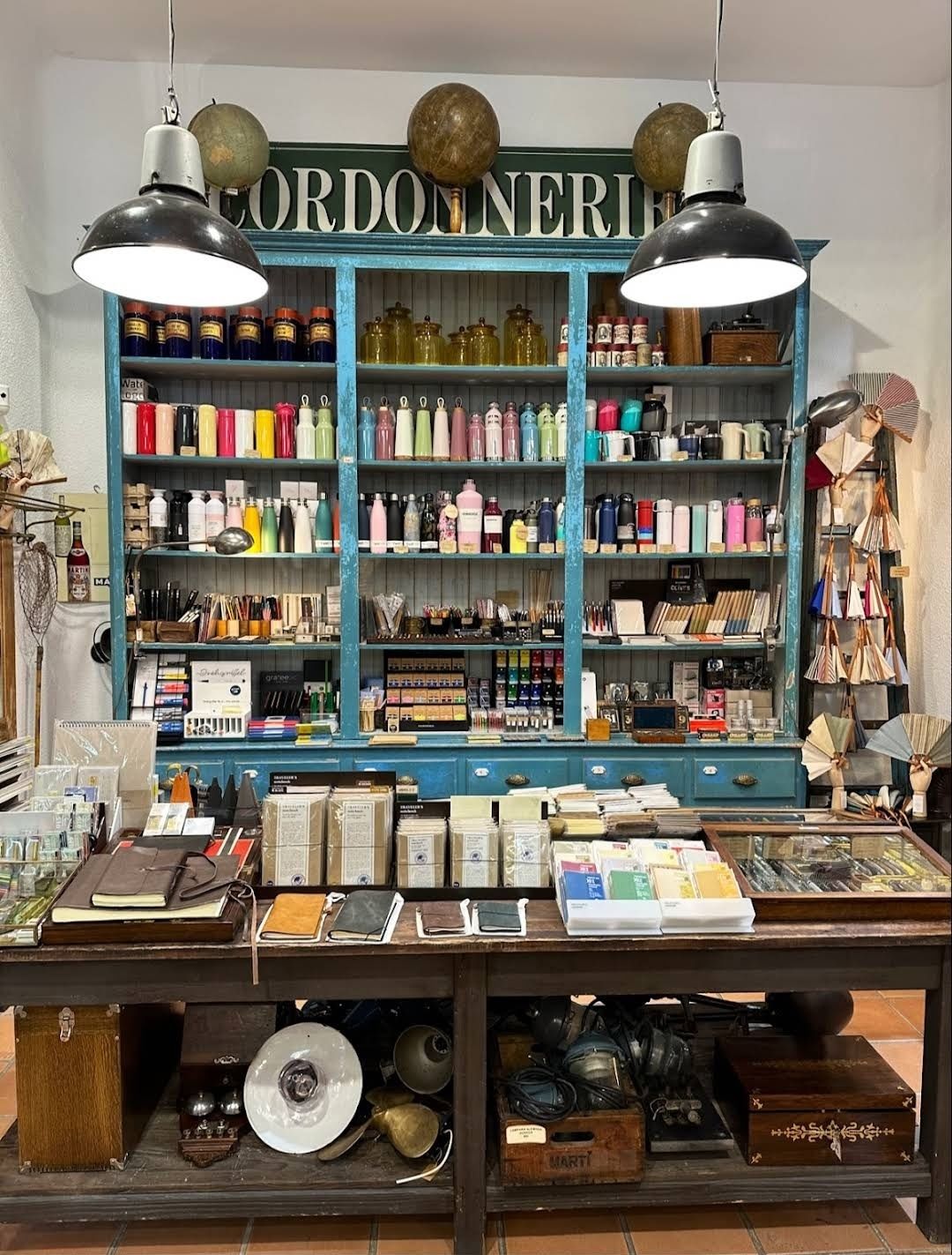
## Description Amarcord Retro Store is one of Madrid’s most charming vintage shops, a treasure trove for lovers of retro fashion and timeless accessories. Nestled in the heart of Spain’s capital, it’s a place where the past comes alive through carefully curated pieces from the **60s, 70s, 80s, and 90s**. Unlike modern fast fashion outlets, Amarcord focuses on unique, one-of-a-kind items that carry stories within their fabrics. The store’s collection includes **vintage clothing, retro jewelry, accessories, and even home décor pieces**, making it more than just a clothing shop—it’s a cultural experience. Fashion enthusiasts adore it for its eclectic mix, but even casual visitors find themselves fascinated by the craftsmanship of items that stand the test of time. A little-known fact about Amarcord is that many of its pieces come from **private collections across Europe**, giving shoppers the opportunity to own authentic items that can’t be found anywhere else. Another hidden gem is its reputation among local stylists and theater costume designers, who often rely on Amarcord to find the perfect outfit for period pieces or photo shoots. ## Location Amarcord Retro Store is located in **Madrid, Spain**, specifically in the lively **Malasaña neighborhood**, an area known for its bohemian vibe, independent shops, and street art. Malasaña has long been the epicenter of alternative culture in Madrid, making it the perfect setting for a retro store like Amarcord. The exact address is easy to find with a quick search or by simply wandering through **Calle Velarde** and its surrounding streets, which are packed with vintage boutiques and second-hand shops. ### Recommendation on How to Get There If you’re staying in Madrid city center, the easiest way to reach Amarcord is by **Metro**. The closest stations are **Tribunal (Lines 1 and 10)** and **Noviciado (Line 2)**, both within a short walking distance. Alternatively, a pleasant stroll from **Gran Vía** will also take you there in about 10–15 minutes. For visitors who prefer a more direct option, taxis and ride-sharing services are easily available. ## Tips To make the best out of your visit to Amarcord Retro Store, here are some helpful tips: * **Visit During Weekdays**: Weekends can get crowded in Malasaña, so if you want a quieter browsing experience, weekdays are best. * **Bring Cash**: While most shops in Madrid accept cards, small purchases are often easier with cash. * **Try Before You Buy**: Vintage sizing differs from modern sizing, so don’t hesitate to try on pieces before making a decision. * **Ask the Staff**: The shop owners and staff are passionate about vintage fashion and can often recommend items based on your style preferences. * **Explore the Neighborhood**: Malasaña itself is worth exploring. After shopping, you can enjoy a coffee at a quirky café or discover other unique shops nearby. * **Check for Specials**: Sometimes Amarcord runs promotions or brings in new collections from different countries—worth asking about when you visit. ## Conclusion Amarcord Retro Store is more than just a place to shop—it’s an invitation to step back in time and rediscover the beauty of vintage fashion. Located in Madrid’s vibrant Malasaña district, it offers an authentic retro shopping experience that blends style, history, and creativity. Whether you’re a collector, a fashion lover, or simply curious, Amarcord is a must-visit destination in the Spanish capital. ## FAQ **1. What can I find at Amarcord Retro Store?** You’ll find a wide selection of vintage clothing, accessories, jewelry, and décor items from the 60s to the 90s. **2. Is Amarcord Retro Store expensive?** Prices vary depending on the rarity and quality of the item, but overall, it’s considered affordable compared to high-end vintage boutiques. **3. Do they accept card payments?** Yes, most items can be paid by card, though it’s a good idea to bring cash for smaller purchases. **4. Is the store suitable for tourists who don’t speak Spanish?** Absolutely. The staff is friendly and many speak English, making it easy for international visitors to shop comfortably. **5. Can I find designer pieces there?** Yes, from time to time Amarcord stocks vintage designer clothing and accessories, making it a favorite among collectors. **6. What makes Amarcord different from other vintage shops in Madrid?** Amarcord stands out for its carefully curated, high-quality pieces and its reputation among stylists and creatives in Madrid. ## Links * [Official website of Amarcord Retro Store](https://www.amarcord-store.com/en)
GemVoyage Team • World
Sinai
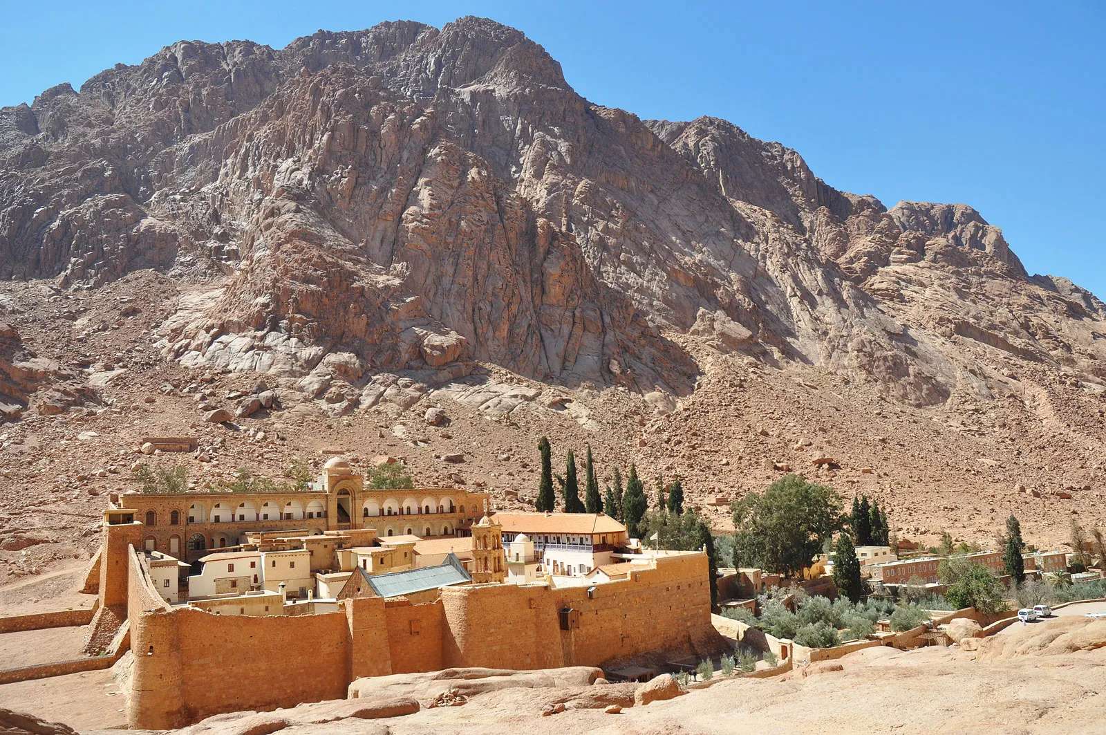
## Description Mount Catherine (Jebel Katherîn) is the highest peak in Egypt, rising to an elevation of 2,629 meters (8,625 feet) above sea level. Nestled in the rugged terrain of the southern Sinai Peninsula, this majestic mountain offers not only breathtaking views but also a deep spiritual and historical resonance. It’s named after Saint Catherine of Alexandria, whose remains were said to have been miraculously transported to the summit by angels. Today, it’s a popular destination for hikers, pilgrims, and adventurers seeking solitude, challenge, and connection to ancient traditions. Unlike the more frequented Mount Sinai (Jebel Musa), which is traditionally associated with Moses receiving the Ten Commandments, Mount Catherine is quieter and less commercialized. The summit rewards climbers with panoramic views of the surrounding desert and mountains, often blanketed in snow during winter—a rare sight in Egypt. At the peak, a small chapel dedicated to Saint Catherine stands as a testament to the mountain’s religious significance. A little-known fact: the mountain is part of the Saint Catherine Protectorate, Egypt’s largest nature reserve, which is home to rare flora and fauna, including Nubian ibex and Sinai agamas. Another intriguing detail is that the summit’s chapel is one of the highest Christian shrines in the Middle East. ## Location Mount Catherine is located in **Egypt**, within the **South Sinai Governorate**, near the town of **Saint Catherine**. It lies in the heart of the Sinai Peninsula, surrounded by dramatic granite peaks and desert valleys. ### How to Get There: - **By Car**: From Cairo, it’s approximately a 6–8 hour drive via the Suez Tunnel and through the desert highways. From Sharm El-Sheikh, the drive takes about 3–4 hours. - **By Bus**: Regular buses run from Cairo and Dahab to Saint Catherine town. From there, local guides can arrange transport to the trailhead. - **By Tour**: Many adventure and pilgrimage tours include Mount Catherine in their itinerary, often combined with visits to Mount Sinai and Saint Catherine’s Monastery. It’s recommended to travel with a licensed guide, especially for the hike, as the terrain can be challenging and weather conditions unpredictable. ## Tips for Visitors To make the most of your Mount Catherine experience, consider these tips: - **Start Early**: Begin your hike before dawn to reach the summit by sunrise. The views are spectacular, and temperatures are cooler. - **Hire a Local Guide**: Guides from Saint Catherine town are knowledgeable and can enhance your experience with historical and cultural insights. - **Dress in Layers**: Even in summer, temperatures can drop significantly at higher elevations. Bring warm clothing and sturdy hiking boots. - **Bring Supplies**: Carry water, snacks, a flashlight, and a first aid kit. There are no facilities on the trail. - **Respect the Environment**: The area is ecologically sensitive. Stick to marked paths and avoid littering. - **Visit the Monastery**: Saint Catherine’s Monastery, located nearby, is one of the oldest Christian monasteries in the world and a UNESCO World Heritage Site. ## Conclusion Mount Catherine is a place of awe-inspiring beauty and spiritual depth. Whether you're drawn by its status as Egypt’s highest peak or its sacred legacy, the mountain offers a rewarding journey into nature, history, and reflection. ## FAQ **1. How long does it take to hike Mount Catherine?** The hike typically takes 6–8 hours round trip, depending on your pace and weather conditions. **2. Is Mount Catherine harder to climb than Mount Sinai?** Yes, it’s more challenging due to its elevation and less-developed trails. It’s recommended for experienced hikers. **3. Can I hike Mount Catherine without a guide?** While possible, it’s not advisable. The terrain is remote and can be confusing. A guide ensures safety and enhances the experience. **4. Is there accommodation near Mount Catherine?** Yes, the town of Saint Catherine offers guesthouses and eco-lodges catering to hikers and pilgrims. **5. What’s the best time to visit?** Spring (March–May) and autumn (September–November) offer the best weather. Winter can be cold and snowy, while summer is extremely hot. **6. Are there religious services at the summit chapel?** Occasionally, special services are held, but it’s not staffed regularly. Visitors are welcome to enter and reflect. ## Links - [Saint Catherine’s Monastery – Official Site](https://sinaimonastery.com/index.php/en)
GemVoyage Team • World
New York
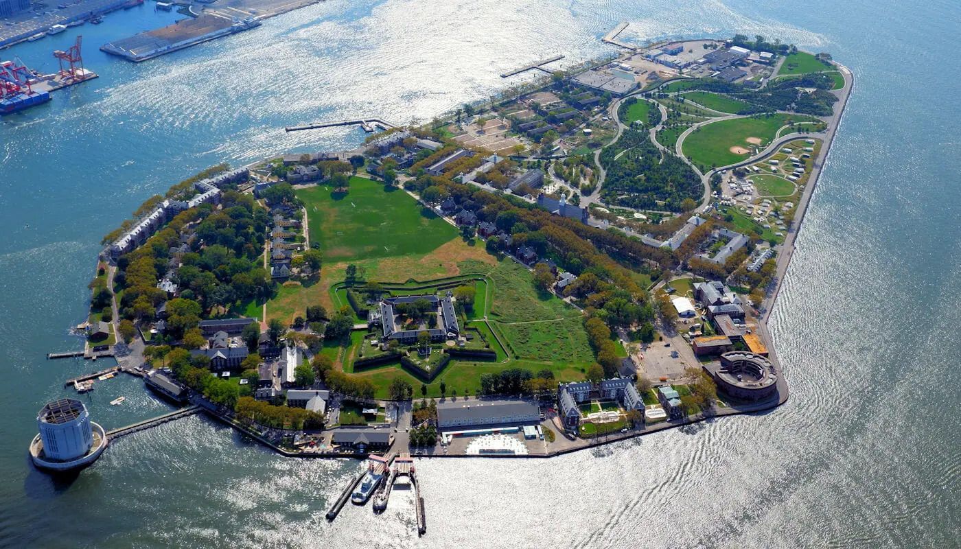
## Description Governors Island is one of New York City's best day trip destinations because it combines harbor views, historic buildings, open green space, and a sense of distance from the city without actually leaving it. The island feels spacious and refreshing in a way that is rare in Manhattan, making it appealing to visitors who want a slower rhythm, bike paths, and outdoor relaxation. The experience is especially strong in warm weather, when the ferry ride itself becomes part of the outing and the skyline views are at their most memorable. What makes Governors Island particularly interesting is that it has moved from a former military and administrative site to a public destination with recreation, arts, and heritage uses. A lesser-known fact is that much of the island's character comes from its reuse: old structures now sit alongside lawns, paths, and public programming. Another detail many first-time visitors appreciate is how easy it is to build a flexible day there, whether you want to picnic, explore, rent bikes, or simply enjoy the harbor air. ## Location Governors Island is in New York Harbor, just south of Manhattan in the United States. It is reached by ferry from designated terminals in Manhattan and sometimes Brooklyn, depending on the season and service schedule. Because access is by boat, the visit naturally feels like a break from the city. The short ride is part of what makes the island appealing and memorable. The best way to visit is to check ferry times ahead of time and plan enough hours on the island to make the crossing worthwhile. Once there, the grounds are easy to explore on foot or by bike. It is one of the most straightforward and rewarding day trips in the New York area. ## Tips - Check the ferry schedule before you go so you can make the most of your time on the island. - Bring food, water, or a picnic plan if you want to enjoy the green space more fully. - Rent a bike if you want to see more of the island without spending the whole day walking. - Go in good weather if possible, since the outdoor setting is a major part of the appeal. - Bring layers, because harbor breezes can make the island feel cooler than Manhattan. - Leave time for skyline views on the return ferry, which are often one of the highlights. ## Conclusion Governors Island is one of the easiest ways to feel removed from New York City while still being within sight of it. Its combination of history, green space, and harbor views makes it an excellent, low-stress escape. ## FAQ ### How do I get to Governors Island? You usually take a ferry from Manhattan or, depending on the season, from Brooklyn. The ferry is simple to use and is part of the experience because it gives you immediate harbor and skyline views. ### Is Governors Island worth visiting for a short trip? Yes, but it is even better if you have several hours. The island's appeal comes from unhurried exploration, open space, and the ferry ride itself, so a longer visit feels more rewarding. ### Can I bike there? Yes, and biking is one of the best ways to cover more ground. The island is well suited to cycling because it is relatively open and easy to navigate. ### Is it family-friendly? Very much so. Families often appreciate the car-free environment, open lawns, and relaxed pace. It is one of the more comfortable outdoor outings in the New York area. ### What should I bring? Water, comfortable walking shoes, sun protection, and perhaps food if you want a picnic. Because the island is such a good open-air destination, it helps to prepare for spending most of the day outside. ## Links - [Official website](https://www.govisland.com/) - [Wikipedia](https://en.wikipedia.org/wiki/Governors_Island)
GemVoyage Team • World
Tokyo
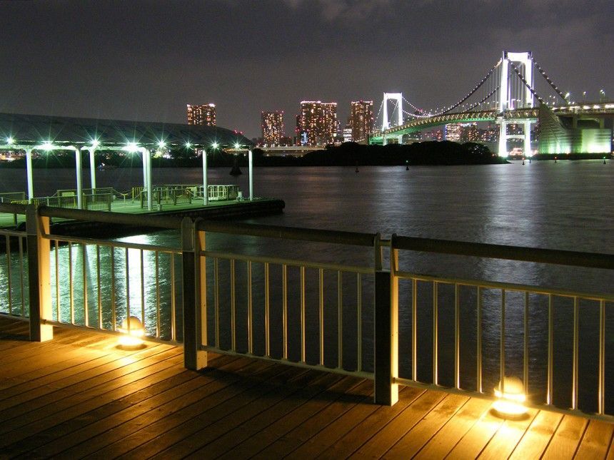
## Description Odaiba Seaside Park is one of Tokyo’s most enjoyable waterfront attractions because it offers a rare combination of open sky, coastal views, and easygoing public space in a city usually defined by density. The park is set on Tokyo Bay, and that location shapes everything about the experience. Instead of narrow streets, you get broad horizons. Instead of constant urban pressure, you get a slower rhythm, with people walking, sitting, cycling, or simply watching the water and the skyline. What makes the park appealing is the sense of contrast. Tokyo is famous for its intensity, but Odaiba gives you a place where the city meets the sea in a more relaxed way. You can see modern structures, bridges, and across-the-water views that feel both futuristic and calm. That blend is especially strong at sunset, when the light across the bay changes the atmosphere dramatically. Visitors often come for photographs, but they stay because the park is genuinely pleasant to spend time in. One little-known fact is that Odaiba itself was originally connected to ambitious land-reclamation and harbor development ideas, so the area reflects a distinctly modern Tokyo story rather than an ancient one. Another is that the park offers a valuable break in a city itinerary because it lets you slow down without feeling disconnected from the urban landscape. The water, beach-like edges, and sightlines make it feel open, but it still belongs fully to Tokyo. The park also works well as part of a larger Odaiba visit. It pairs naturally with shopping, entertainment, and other bay-area attractions, but it does not require you to spend money to enjoy it. That makes it especially useful for travelers who want a scenic stop that is easy to fit into a flexible day. If your idea of Tokyo includes both high energy and moments of calm, Odaiba Seaside Park delivers one of the cleanest transitions between the two. ## Location Odaiba Seaside Park is in Odaiba, Tokyo, Japan, on the waterfront facing Tokyo Bay. The area is well connected to the rest of the city and is one of the most recognizable modern districts in Tokyo’s bay zone. The easiest way to get there is by public transport, including the Yurikamome line or other transit options that serve the Odaiba area. Once you arrive, the park is straightforward to reach on foot. Because the district is designed for visitors and leisure, navigating it is generally simpler than navigating the city’s older, denser neighborhoods. If you are planning a full day, combine the park with nearby attractions or a walk through the broader Odaiba area. That gives you a better sense of why the district has become one of Tokyo’s most photogenic waterfront destinations. ## Tips Go near sunset if possible. The water, skyline, and bridges are especially attractive in the late afternoon and evening light. Bring a light jacket if you are visiting near the water, since the breeze can be stronger than in inland parts of the city. If you like photography, take your time moving around the shoreline. Different angles give you very different views of the city and bay. Use the park as a slower reset during a busier Tokyo itinerary. It is ideal after a day of dense urban exploration. Because Odaiba is so closely tied to modern Tokyo, the park can also feel cinematic in a way that many urban attractions do not. Bridges, towers, water, and open sky create a broad scene that changes with the light. That makes it especially good for visitors who like to photograph cityscapes or simply stand still and take in a less compressed part of Tokyo. The sense of openness is the whole point, and it is one of the reasons the park remains memorable after a busy day elsewhere in the city. It is also useful as a reminder that Tokyo is not only a city of movement but also of carefully designed public space. Odaiba Seaside Park gives you room to breathe without leaving the urban experience behind, and that balance is part of what makes it valuable. If you have already spent time in the tighter streets of central Tokyo, the park offers a visual and psychological reset that can make the rest of your itinerary feel more manageable. ## Conclusion Odaiba Seaside Park offers a refreshing waterfront perspective on Tokyo, combining open space, bay views, and modern city scenery. It is a strong choice for travelers who want a calmer but still distinctly urban experience. ## FAQ **Is Odaiba Seaside Park worth visiting?** Yes, especially if you want open views and a break from Tokyo’s denser districts. **What is the best time to go?** Late afternoon and sunset are especially attractive. **How do I get there?** Public transport to Odaiba is the easiest and most convenient option. **Is it good for families?** Yes. It is a relaxed public space that works well for all kinds of visitors. **Can I combine it with other Odaiba attractions?** Absolutely. It fits naturally into a broader waterfront itinerary. ## Links - [Tokyo Parks guide](https://www.tptc.co.jp/parks/odaiba)
GemVoyage Team • World
Paro
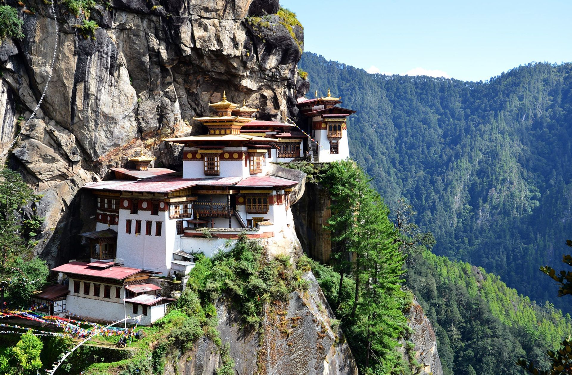
## Description The Tiger’s Nest, or Paro Taktsang, is a cliffside Buddhist monastery in Bhutan dramatically perched on a vertical rock face above the Paro Valley. Dating to the 17th century (with earlier sacred associations to Guru Rinpoche), the complex comprises several temples and hermitages connected by steep steps and narrow paths. The visual impact — whitewashed buildings and golden roofs clinging to granite — is among the most evocative images of Himalayan spiritual architecture. The site is both a pilgrimage destination and a focal point of Bhutanese national identity. Legend holds that Guru Rinpoche (Padmasambhava) arrived on the back of a tigress and meditated in the grottoes that now form part of the monastery complex. The blend of sacred history, dramatic landscape, and living monastic life gives Paro Taktsang deep spiritual resonance for Bhutanese and international visitors alike. SEO-friendly phrases you may use for planning include "Tiger's Nest hike," "Paro Taktsang visit tips," and "Bhutan monastery etiquette." Visitor experience: The descent into the valley and the ascent along forested trails provide a contemplative approach lined with prayer flags, small chortens, and viewpoints. While the most iconic view is from the main lookout before descending to the monastery, many visitors linger to observe ritual offerings, circumambulation of shrines, and the quiet rhythm of monastic routines. Respectful curiosity—asking guides about appropriate behavior and dress—enhances the visit for both guests and residents. ## Location Paro Taktsang sits within Paro valley in western Bhutan, about a 45–60 minute drive from Paro town and its international airport. Access requires a moderate hike of 2–3 hours round-trip depending on pace and stops. How to get there: Most travelers arrange transport through a licensed guide or hotel. Bhutan's regulated tourism policies require foreign visitors to book through licensed operators who manage permits, accommodation, and local guide services. For practical planning, search queries like "book Tiger's Nest guide" or "Paro Taktsang hiking permits" will direct you to authorized providers. Trail notes: The trail rises steadily with sections of stone steps and steeper pitches; resting at teahouses and lookout points is common. Horse rentals are occasionally offered for portions of the route, but check animal welfare practices and trail suitability before choosing this option. ## Tips - **Dress respectfully:** Wear modest clothing for temple visits; remove shoes inside shrines as required and avoid revealing or inappropriate attire. - **Prepare for a strenuous hike:** Bring sturdy footwear, adequate water, sun protection, and allow time for rest stops; altitude and steps make the climb moderately challenging. - **Hire an experienced guide:** Guides explain religious practices, translation of local rituals, and can signal areas off-limits to visitors, creating a more meaningful visit. - **Follow monastery rules:** Photography restrictions inside temples, silence in prayer halls, and specific rituals require compliance; ask before photographing monks or ceremonies. - **Consider timing:** Early morning or late afternoon visits reduce crowding and provide superior photography light, but check seasonal opening hours and local festivals. ## Conclusion Paro Taktsang is both a pilgrimage site and a Himalayan emblem: its precarious position and spiritual resonance make it an unforgettable visit that blends exertion with contemplative reward. When planning, confirm that your tour operator or hotel handles permits and local guidelines; these practical steps help protect the monastery’s sanctity and the visitor’s experience. ## FAQ - **Q: Can foreigners visit Tiger’s Nest independently?** A: Bhutan requires most foreign visitors to travel with licensed operators or registered guides. Booking through authorized tour operators ensures that permits, accommodations, and guide services are in place. - **Q: How long does the hike take?** A: Typical round-trip times range from 3 to 5 hours depending on fitness, stops, and whether you use any horse transport for parts of the ascent. - **Q: Are there age or mobility restrictions?** A: The trail includes steep steps and uneven surfaces and may not be suitable for those with severe mobility limitations. Discuss options with your guide; horse rentals for short segments may be available but evaluate safety and welfare considerations. - **Q: What permits or fees are required?** A: Entry to Bhutan is managed via licensed operators; fees and permit processes vary with season and travel packages. Confirm all costs with your provider in advance. - **Q: Is photography allowed inside the monastery?** A: Many interior temple spaces restrict photography to preserve sacred objects and respect practitioners. Always ask guides or monks before photographing interior or ritual scenes. ## Links - [Paro Taktsang — Wikipedia](https://en.wikipedia.org/wiki/Paro_Taktsang)
GemVoyage Team • World

Comments