Discover extraordinary places shared by our community of travelers
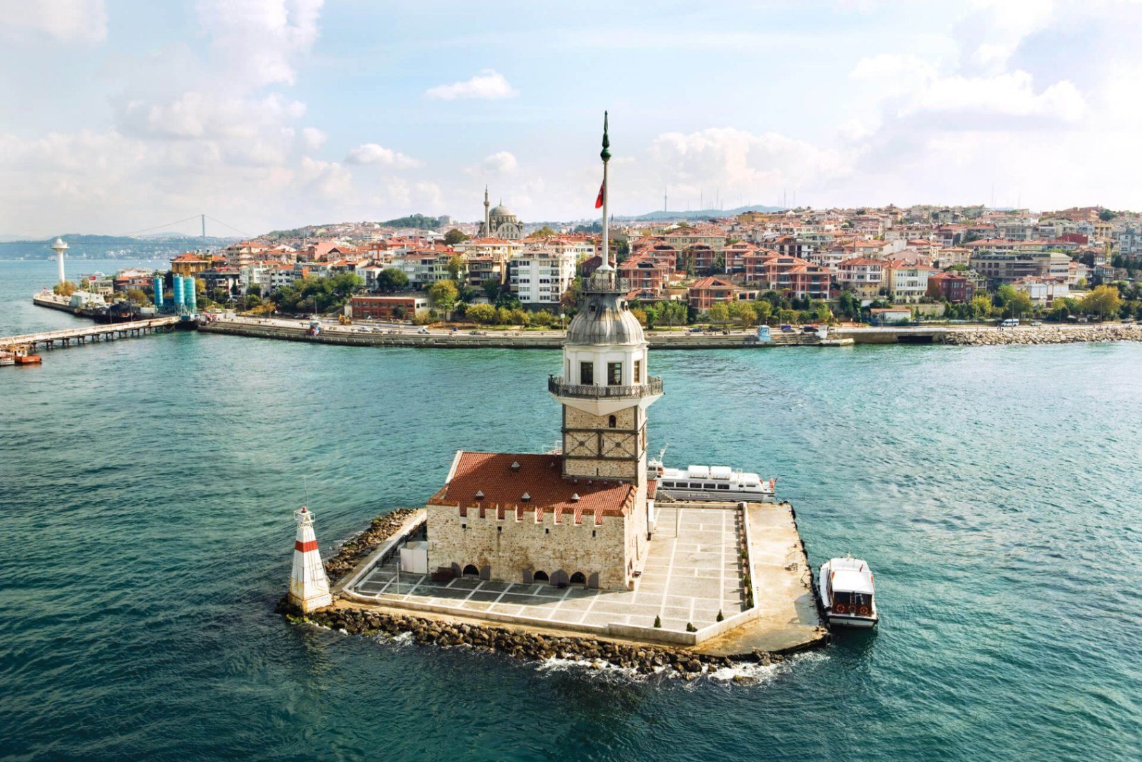
Istanbul
## Description **Maiden’s Tower (Kız Kulesi)** is one of Istanbul’s most recognizable and symbolically charged landmarks, standing alone on a small islet in the Bosphorus Strait. Neither fully Asian nor European in spirit, the tower embodies Istanbul’s identity as a city suspended between worlds. Its silhouette, visible from both shores, has inspired legends, poetry, paintings, and countless interpretations over centuries. The structure’s history stretches back to **antiquity**, with the earliest known use dating to the 5th century BCE, when it functioned as a defensive outpost controlling maritime traffic entering the Bosphorus. Over time, the tower has served many roles: lighthouse, customs checkpoint, quarantine station, watchtower, and even a radio transmission point. Each era left its mark, making the tower less a single-purpose monument and more a **layered historical artifact**. What truly distinguishes Maiden’s Tower is the **mythology surrounding it**. The most famous legend tells of a princess locked inside the tower to protect her from a prophecy foretelling her death by snakebite—only for the prophecy to come true regardless. Another lesser-known tale connects the tower to **Hero and Leander**, linking it symbolically to tragic love stories from classical antiquity. These narratives, though not historically verifiable, have become inseparable from the site’s identity. A little-known fact is that the tower has been **rebuilt multiple times**, most recently during the Ottoman period and again in modern restorations, meaning what visitors see today is the result of careful reconstruction rather than a single intact ancient structure. Another overlooked detail is that its strategic placement allowed it to work in tandem with towers on both shores, forming a maritime control system rather than functioning in isolation. Today, Maiden’s Tower operates primarily as a cultural and leisure site, offering exhibitions, a café, and panoramic views that rival any viewpoint in the city. ## Location **Country:** Turkey **Region:** Marmara **City:** Istanbul **District:** Üsküdar **Waterway:** Bosphorus Strait The tower sits just off the Asian shore of Istanbul, opposite the historic peninsula and close to Üsküdar’s coastline. ### How to Get There * **By ferry or boat:** * Small boats depart regularly from **Üsküdar** and sometimes from **Kabataş** on the European side. * **By public transport:** * Take Marmaray, metro, or ferry lines to Üsküdar, then walk to the departure pier. * **By taxi:** * Taxi to Üsküdar waterfront, then transfer by boat. Access to the tower is only possible by boat; swimming or private access is prohibited. ## Tips * **Visit near sunset:** The views of the Bosphorus and historic skyline are at their best. * **Check restoration status:** Access may vary due to maintenance or cultural programming. * **Book in advance during peak seasons:** Boats and entry slots can fill quickly. * **Dress for wind:** The tower is exposed, especially on upper levels. * **Combine with Üsküdar exploration:** The surrounding district offers mosques, promenades, and cafés. * **Manage expectations:** The tower is small; the experience is about atmosphere, not scale. ## Conclusion Maiden’s Tower is less about architectural grandeur and more about symbolism, location, and continuity. Standing alone in the Bosphorus, it captures Istanbul’s layered history and enduring fascination better than almost any other single structure. ## FAQ **1. Is Maiden’s Tower ancient?** Its origins date back over 2,000 years, but the current structure reflects multiple reconstructions. **2. Can you go inside the tower?** Yes, when open to the public, visitors can enter via boat. **3. How long does a visit take?** Typically **30 to 60 minutes**, excluding boat travel. **4. Is there an entrance fee?** Yes, pricing varies depending on exhibitions and services. **5. Is it better to visit during the day or evening?** Evening visits are more atmospheric, especially around sunset. **6. Is the tower wheelchair accessible?** Accessibility is limited due to stairs and the historic structure. ## Links * [Istanbul official tourism portal](https://istanbul.com)
GemVoyage Team • World
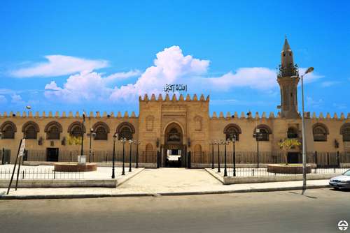
Cairo
## Description The Amr Ibn Al-Aas Mosque in Cairo is not just a religious site—it’s a living monument to the birth of Islam in Egypt and Africa. Built in 641–642 CE by General Amr Ibn Al-Aas following the Arab conquest of Egypt, it holds the distinction of being the **first mosque ever constructed in Egypt and on the African continent**. Originally erected in the newly founded city of Fustat, the mosque served as both a spiritual center and a gathering place for the early Muslim community. Though the original structure was modest—little more than a roof supported by palm trunks—the mosque has undergone numerous renovations and expansions over the centuries. Today, it features a spacious courtyard, four minarets, and elegant arcades that reflect the evolution of Islamic architecture. Despite its many reconstructions, the mosque retains a sense of historical continuity and reverence. A little-known fact: the site of the mosque was chosen in a rather poetic way. Legend has it that a dove laid an egg in Amr Ibn Al-Aas’s tent before he left for battle. Upon his victorious return, he interpreted the bird’s nest as a divine sign and built the mosque on that very spot. Another intriguing detail is that several companions of the Prophet Muhammad, including al-Zubayr ibn al-‘Awam and Ubada ibn al-Samit, participated in its construction. ## Location The Amr Ibn Al-Aas Mosque is located in **Egypt**, within the **Cairo Governorate**, specifically in the historic district of **Old Cairo** (Al-Fustat). This area is rich in Islamic, Christian, and Jewish heritage, making it a cultural crossroads worth exploring. ### How to Get There: - **By Metro**: Take Cairo Metro Line 1 to Mar Girgis Station. From there, it’s a short walk to the mosque. - **By Taxi or Ride-Hailing**: Services like Uber and Careem are widely available and can drop you off directly at the entrance. - **By Tour Bus**: Many heritage tours include Old Cairo in their itinerary, often combining visits to the mosque with nearby sites like the Hanging Church and Ben Ezra Synagogue. ## Tips for Visitors To make the most of your visit to Amr Ibn Al-Aas Mosque, consider the following tips: - **Visit During Off-Peak Hours**: Early mornings or late afternoons are ideal for avoiding crowds and enjoying a peaceful experience. - **Dress Modestly**: As with any religious site, modest attire is required. Women may be asked to cover their hair. - **Respect Prayer Times**: The mosque is active and hosts regular prayers. Non-Muslim visitors should avoid entering during these times unless invited. - **Explore the Surroundings**: Old Cairo is a treasure trove of history. Allocate time to visit nearby religious and archaeological sites. - **Hire a Guide**: A local guide can enrich your visit with historical context and stories that aren’t found on plaques. - **Photography**: While photography is generally allowed, be respectful and avoid taking pictures of worshippers. ## Conclusion The Amr Ibn Al-Aas Mosque is more than just a place of worship—it’s a cornerstone of Islamic history in Africa. With its deep historical roots, architectural evolution, and spiritual significance, it offers visitors a profound glimpse into Egypt’s Islamic heritage and the early days of Fustat. ## FAQ **1. When was the Amr Ibn Al-Aas Mosque built?** It was originally constructed in 641–642 CE, making it the oldest mosque in Egypt and Africa. **2. Is the mosque still active today?** Yes, it remains an active place of worship and is open to visitors outside of prayer times. **3. Can non-Muslims visit the mosque?** Yes, non-Muslims are welcome, but should avoid entering during prayer times and dress respectfully. **4. Is there an entrance fee?** No, entry to the mosque is free, though donations for upkeep are appreciated. **5. What are the mosque’s opening hours?** Typically, it’s open from 9:00 AM to 4:00 PM, but hours may vary during religious holidays. **6. What other attractions are nearby?** Nearby sites include the Hanging Church, Ben Ezra Synagogue, and the Coptic Museum—all within walking distance. ## Links - [Wikipedia – Amr Ibn Al-Aas Mosque](https://en.wikipedia.org/wiki/Amr_ibn_al-As_Mosque) - [Egyptian Ministry of Tourism – Amr Ibn Al-Aas Mosque](https://egymonuments.gov.eg/monuments/the-mosque-of-amr-ibn-al-as)
GemVoyage Team • World
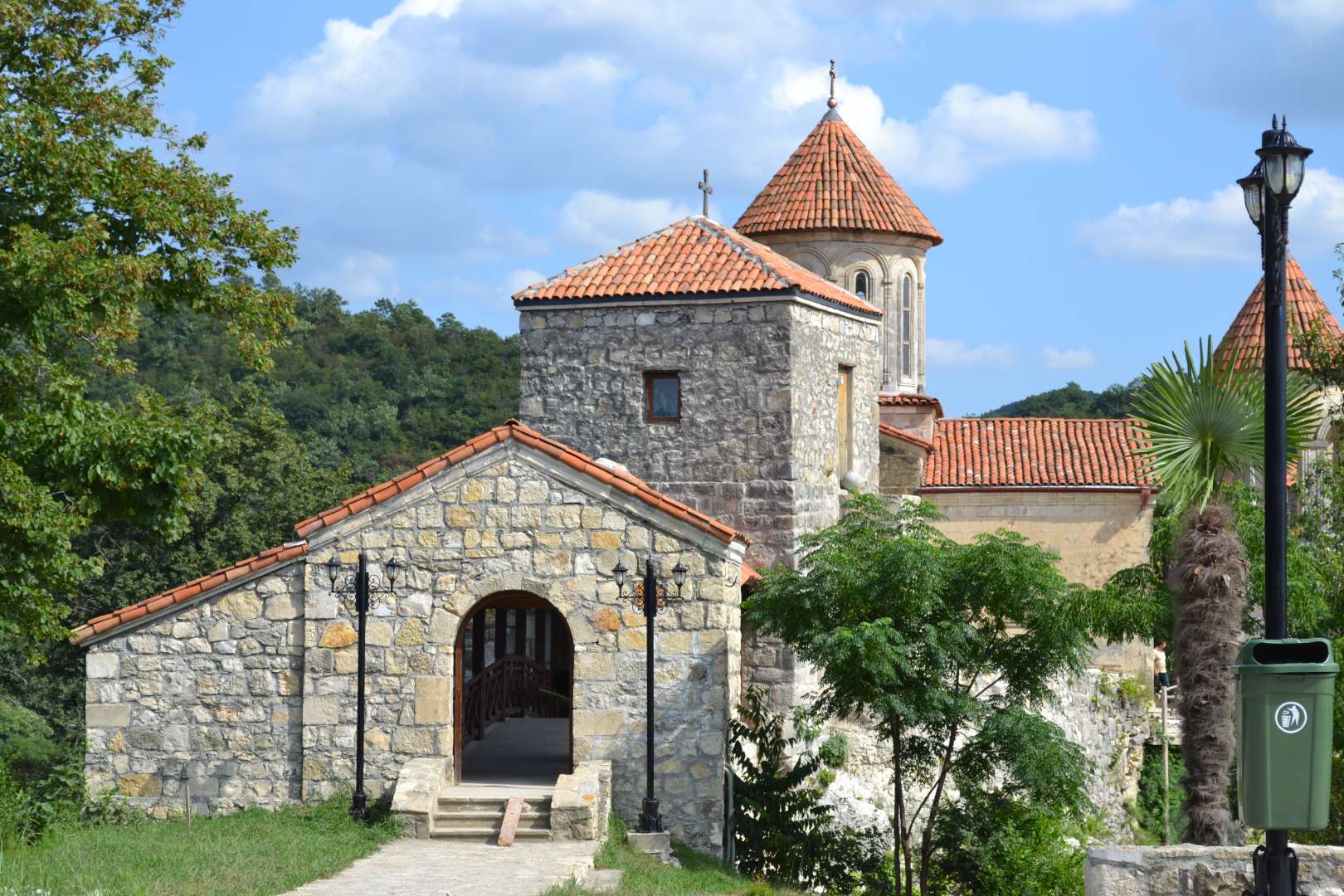
Kutaisi
## Description Motsameta Monastery is a hidden gem nestled in the hills of western Georgia, just outside the city of Kutaisi. This 8th-century Georgian Orthodox monastery is revered not only for its spiritual significance but also for its breathtaking location—perched on a cliff above the winding Tskaltsitela River, whose name translates to “Red Water.” The river earned this name from a legend tied to the monastery’s origins: two noble brothers, David and Constantine Mkheidze, were martyred during an Arab invasion, and their blood is said to have turned the river red. The monastery, whose name means “Place of the Martyrs,” was built to honor these brothers, and their relics are preserved in the crypt beneath the church. According to local lore, crawling under the crypt and making a wish may lead to it coming true—a tradition that continues to draw pilgrims and curious visitors alike. What makes Motsameta truly unique is its intimate scale and serene atmosphere. Unlike the more famous Gelati Monastery nearby, Motsameta feels like a quiet retreat, surrounded by dense Colchic forest and echoing with the sounds of nature. The monastery’s architecture is classic Georgian, with arched windows, stone walls, and a red-tiled roof that glows warmly in the sunlight. A little-known fact: there’s a legend of a secret tunnel connecting Motsameta to Gelati Monastery, used during times of war to protect monks and relics. Though the tunnel remains a mystery, it adds to the allure and mystique of the site. ## Location Motsameta Monastery is located in **Georgia**, in the **Imereti Region**, near the city of **Kutaisi**. It’s situated about 6 kilometers northeast of the city center, making it easily accessible for a half-day trip. ### How to Get There: - **By Car**: From Kutaisi, it’s a 15-minute drive through scenic countryside. Taxis and rental cars are readily available. - **By Foot**: Adventurous travelers can hike from Gelati Monastery to Motsameta through forest trails, enjoying panoramic views along the way. - **By Tour**: Many local tour operators offer combined visits to Motsameta and Gelati, often including historical commentary and transportation. The road to the monastery winds through forested hills, offering glimpses of the river and valley below—a journey as rewarding as the destination. ## Tips for Visitors To make the most of your visit to Motsameta Monastery, consider these helpful tips: - **Visit in the Morning or Late Afternoon**: These times offer the best lighting for photography and a more peaceful atmosphere. - **Wear Comfortable Shoes**: The path to the monastery includes uneven terrain and steps, so sturdy footwear is recommended. - **Respect Local Customs**: Modest dress is appreciated, especially when entering the church. Women may be asked to cover their heads. - **Bring a Camera**: The views from the cliff and the monastery’s architecture are incredibly photogenic. - **Combine with Gelati Monastery**: Visiting both sites offers a fuller picture of Georgia’s medieval religious heritage. - **Make a Wish**: Don’t miss the chance to crawl under the crypt and take part in the local tradition. ## Conclusion Motsameta Monastery is a tranquil and spiritually rich destination that blends history, legend, and natural beauty. Whether you're drawn by its sacred relics, its dramatic setting, or its quiet charm, this monastery offers a deeply rewarding experience just outside Kutaisi. ## FAQ **1. Is there an entrance fee to visit Motsameta Monastery?** No, entry is free for all visitors. **2. How long does it take to visit the monastery?** A typical visit lasts 1–2 hours, including time to explore the grounds and enjoy the views. **3. Can I visit Motsameta and Gelati Monasteries in one day?** Yes, they are close to each other and often visited together. **4. Is the monastery accessible year-round?** Yes, though the forest trail may be slippery in winter or after rain. **5. Are guided tours available?** Yes, local guides and tour companies offer historical tours that include Motsameta. **6. Is the monastery suitable for children?** Yes, but supervision is recommended due to the cliffside location and uneven paths. ## Links - [Motsameta Monastery – Georgia Travel Guide](https://georgia.travel/motsameta-monastery) - [Motsameta Monastery – Wikipedia Overview](https://en.wikipedia.org/wiki/Motsameta_monastery) - [Motsameta Monastery – Imereti Tourism Info](https://georgia.to/en/places-to-go/imereti/motsameta-monastery/)
GemVoyage Team • World
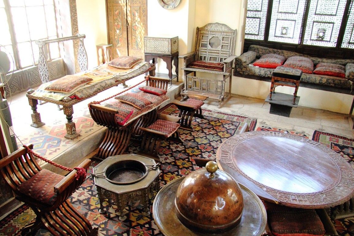
Cairo
## Description Tucked away in the heart of historic **Cairo**, beside the magnificent **Ibn Tulun Mosque**, lies one of Egypt’s most enchanting and well-preserved heritage houses — the **Gayer-Anderson Museum** (Arabic: **بيت الكريتلية**, *Beit al-Kritliyya*). This remarkable museum offers a captivating journey into the world of **Islamic architecture, art, and domestic life**, transporting visitors back to the golden centuries of Cairo’s past. The museum is named after **Major R.G. Gayer-Anderson**, a British army officer, physician, and passionate collector who lived in Cairo in the 1930s. Fascinated by Egyptian and Islamic culture, he restored and furnished two adjoining 16th–17th century Ottoman-era houses — **Beit al-Kritliyya** and **Beit Amna bint Salim** — creating a living museum that preserves the elegance and sophistication of old Cairo homes. Inside, the museum unfolds as a labyrinth of **beautifully decorated rooms, wooden mashrabiya screens, marble courtyards, and intricately carved ceilings**. Each space tells a story: from the **Harem Room** with its intimate lattice windows, to the **Persian Room** adorned with exquisite carpets and calligraphy, and the **Damascus Room**, with its painted wood panels imported from Syria. The collection itself is a treasure trove — **antique furniture, carpets, glassware, manuscripts, Islamic ceramics, and artworks** gathered from Egypt, the Middle East, and beyond. One of the most striking displays is the **Pharaonic Room**, showcasing Gayer-Anderson’s fascination with ancient Egypt, including a replica of the famous **Gayer-Anderson Cat**, whose original is housed in the British Museum. A lesser-known fact is that the house is believed to be built on an ancient **Nilometer** (a device used to measure the Nile’s water levels), and local legends claim it once stood on the site of a **temple to Hathor**, the ancient Egyptian goddess of love and beauty. The building itself also served as a filming location for the **James Bond film “The Spy Who Loved Me” (1977)**, giving it a touch of cinematic fame. With its combination of **Islamic elegance, artistic detail, and historical charm**, the Gayer-Anderson Museum remains one of Cairo’s most atmospheric — yet often overlooked — attractions, offering a rare glimpse into Egypt’s layered cultural identity. ## Location The **Gayer-Anderson Museum** is located in the **Sayyida Zeinab district** of **Cairo**, Egypt, right beside the **Ibn Tulun Mosque**, one of the city’s oldest and most beautiful mosques. **Address:** Ahmed Ibn Tulun Street, Sayyida Zeinab, Cairo, Egypt To get there: * **By metro:** Take the **Cairo Metro Line 1** to **Saad Zaghloul** or **Sayyida Zeinab Station**, then a short taxi or tuk-tuk ride to Ibn Tulun Mosque. * **By taxi or ride app:** Simply tell the driver *“Beit al-Kritliyya near Ibn Tulun Mosque.”* It’s a well-known heritage site. * **By walking:** If you’re exploring **Islamic Cairo**, it’s a 15–20 minute walk from **Sultan Hassan Mosque** or **Al-Rifa’i Mosque**. * **By tour:** Many guided tours of Islamic Cairo include the museum as part of their itinerary. ## Tips * **Visit in the morning:** The museum is quieter and cooler in the early hours, allowing for a peaceful exploration of its rooms and courtyards. * **Pair your visit with Ibn Tulun Mosque:** The two sites are adjacent, and their architectural harmony makes for an ideal cultural outing. * **Take a guided tour:** The museum’s exhibits are best appreciated with context — a local guide can explain the symbolism behind each room and object. * **Photography:** Allowed in most areas (check current policy), but flash is often prohibited. Bring a camera for the stunning interiors. * **Look for the mashrabiya windows:** These wooden lattice screens were designed for privacy and ventilation — an essential feature of Islamic domestic architecture. * **Wear comfortable shoes:** You’ll walk through narrow staircases and multiple levels, so flat shoes are recommended. * **Visit nearby sites:** The **Citadel of Salah al-Din**, **Sultan Hassan Mosque**, and **Khan el-Khalili Bazaar** are all within short driving distance. ## Conclusion The **Gayer-Anderson Museum** is one of Cairo’s most captivating cultural landmarks — a living time capsule of Islamic art, architecture, and tradition. Blending Egyptian, Ottoman, and Persian influences, it embodies the cosmopolitan soul of Cairo through centuries of history. Whether you’re an art lover, a history enthusiast, or simply a curious traveler, wandering through the rooms of **Beit al-Kritliyya** is like stepping into another era — one where craftsmanship, elegance, and storytelling merge beautifully under the Cairo sun. ## FAQ **1. Who was Gayer-Anderson?** Major **R.G. Gayer-Anderson** was a British officer and collector who lived in Cairo in the 1930s and transformed two Ottoman-era houses into the museum we see today. **2. What is special about the museum?** It combines **Islamic architecture, antique collections, and traditional Egyptian home design**, offering an authentic look at life in old Cairo. **3. When was the museum established?** The houses date back to the **16th and 17th centuries**, and the museum officially opened to the public in **1945**. **4. Where is the museum located?** It’s beside the **Ibn Tulun Mosque** in the **Sayyida Zeinab district** of Cairo. **5. What are the museum’s opening hours?** Typically open daily from **9:00 AM to 5:00 PM**, though times may vary during Ramadan or national holidays. **6. Can I take photos inside?** Photography is generally allowed for a small additional fee; flash photography may be restricted in some rooms. **7. What nearby attractions can I visit?** The **Ibn Tulun Mosque**, **Citadel of Salah al-Din**, **Sultan Hassan Mosque**, and **Khan el-Khalili Bazaar** are all close by. ## Links * [Egyptian Ministry of Tourism and Antiquities – Official Site](https://egymonuments.gov.eg) * [Gayer-Anderson Museum Information](https://egymonuments.gov.eg/museums/gayer-anderson-museum)
GemVoyage Team • World
Paris
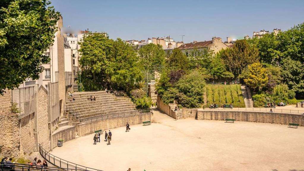
## Description **Arènes de Lutèce** is one of Paris’s most unexpected and historically significant sites: a **Roman amphitheater hidden in plain sight** within the Latin Quarter. Dating back to the **1st century CE**, it is among the oldest surviving monuments in the city and a rare physical reminder of Lutetia, the Gallo-Roman settlement that preceded modern Paris. Unlike the grand, fully preserved amphitheaters of southern France or Italy, the Arènes de Lutèce is fragmentary, modest in scale, and deeply embedded in its urban surroundings. This is precisely what makes it compelling. The remains include portions of the arena floor, tiered seating, subterranean chambers, and traces of the stage wall. In its prime, the amphitheater could accommodate **up to 15,000 spectators**, hosting gladiatorial combats, animal hunts, and theatrical performances. What sets the Arènes de Lutèce apart is its **history of disappearance and rediscovery**. After the fall of the Roman Empire, the structure was gradually dismantled and buried beneath medieval buildings. By the Middle Ages, its existence was largely forgotten. It was not rediscovered until the 19th century during urban works, and even then, much of it was threatened by redevelopment. The site was ultimately saved following public campaigns supported by prominent cultural figures, including Victor Hugo. A lesser-known fact is that the amphitheater served multiple secondary purposes over time. During the Middle Ages, stones from the structure were reused in nearby buildings, effectively dissolving it into the fabric of the city. Another overlooked detail is that today’s visible remains represent **only a fraction** of the original structure; much of it still lies beneath surrounding streets and buildings, preserved underground rather than reconstructed. Today, the Arènes de Lutèce functions as a **public space rather than a formal museum**. Locals play pétanque on the arena floor, children run along the ancient stone seating, and visitors sit quietly where Roman spectators once gathered. This coexistence of daily life and antiquity is rare in Paris and gives the site a lived-in authenticity that no curated exhibition could replicate. ## Location **Country:** France **Region:** Île-de-France **City:** Paris **Arrondissement:** 5th (Latin Quarter) The Arènes de Lutèce is located between Rue Monge and Rue de Navarre, in one of Paris’s most historic and intellectually rich neighborhoods. ### How to Get There * **By metro:** * Line 7 to **Place Monge**, then a 3–5 minute walk. * Line 10 to **Cardinal Lemoine**, followed by a short walk. * **By bus:** * Several bus lines serve the Latin Quarter and stop nearby. * **On foot:** * Easily reachable from the Panthéon, Jardin des Plantes, or the Seine’s Left Bank. * **By bicycle:** * Bike lanes and public bike stations are available in the area. ## Tips * **Visit during quiet hours:** Early mornings or weekdays offer a calmer atmosphere. * **Bring context with you:** There is minimal on-site interpretation; prior reading enhances appreciation. * **Respect the space:** It is both a historical site and a neighborhood park. * **Look for subtle details:** Notice the stonework and seating curves to visualize the original structure. * **Combine with nearby landmarks:** The Latin Quarter offers exceptional historical density within walking distance. * **Photography is allowed:** But be mindful of locals using the space. ## Conclusion The Arènes de Lutèce is a rare example of ancient history woven directly into the rhythm of modern urban life. Quiet, understated, and profoundly authentic, it offers a powerful reminder that Paris did not begin in the Middle Ages, but in the Roman world beneath its streets. ## FAQ **1. Is there an entrance fee?** No, entry to the Arènes de Lutèce is free. **2. How old is the amphitheater?** It dates back to the 1st century CE. **3. How long should I spend there?** Around **20 to 40 minutes**, depending on interest. **4. Is it a reconstructed site?** No, it consists of original remains with minimal restoration. **5. Is it suitable for children?** Yes, it is an open and informal space often used by families. **6. Why is it not better known?** Its modest size and lack of monumental reconstruction keep it off many tourist itineraries. ## Links * [Paris tourism official site](https://parisjetaime.com/eng/)
GemVoyage Team • World
Stockholm
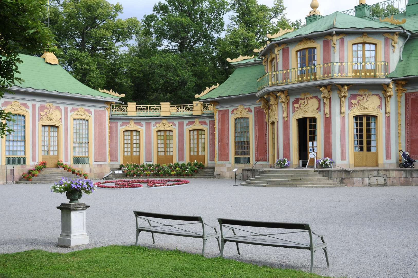
## Description The Chinese Pavilion (Swedish: Kina slott) in Stockholm is a whimsical and elegant slice of 18th-century European fascination with the East. Nestled within the lush grounds of Drottningholm Palace Park, this royal summer retreat was commissioned in 1753 by King Adolf Fredrik as a surprise birthday gift for Queen Lovisa Ulrika. The pavilion is a stunning example of **Chinoiserie**, a European artistic style that romanticized and imitated Chinese design, blending it with Rococo elements to create a fairy-tale-like structure. What makes the Chinese Pavilion truly unique is its blend of imported Chinese artifacts and Swedish craftsmanship. Inside, you’ll find original Chinese silk and paper wall coverings, lacquered screens, porcelain vases, and stained glass windows. Swedish Rococo furniture inspired by Chinese motifs adds a local twist to the exotic aesthetic. The pavilion’s interiors were designed by Jean Eric Rehn, the royal court’s chief supervisor, and many of the decorative objects were brought in by the Swedish East India Company. A little-known fact: the original pavilion was prefabricated in Stockholm and assembled in Drottningholm in secret, making it one of the earliest examples of modular architecture in Sweden. Another quirky detail—during the pavilion’s unveiling, the young Crown Prince Gustav (later King Gustav III) presented the Queen with a golden key while dressed as a Chinese mandarin. ## Location The Chinese Pavilion is located in **Sweden**, within the **Stockholm County** region, specifically in the **Ekerö Municipality** on the grounds of **Drottningholm Palace**, a UNESCO World Heritage Site. ### How to Get There: - **By Public Transport**: Take the metro to Brommaplan, then transfer to bus 176 or 177 toward Drottningholm. The pavilion is a short walk from the palace. - **By Boat**: During summer, ferries run from central Stockholm to Drottningholm—a scenic and relaxing option. - **By Car**: It’s about a 30-minute drive from downtown Stockholm. Parking is available near the palace grounds. Once you arrive at Drottningholm, follow the signs through the park to reach the Chinese Pavilion. ## Tips for Visitors To make the most of your visit to the Chinese Pavilion, consider these helpful tips: - **Visit in Summer**: The pavilion is open from May to September. Plan your visit during this period to access the interiors. - **Combine with Drottningholm Palace**: Make it a full-day outing by exploring both the palace and the pavilion. - **Guided Tours**: Opt for a guided tour to learn about the history, architecture, and royal anecdotes tied to the pavilion. - **Photography**: The exterior and gardens are perfect for photos, but interior photography may be restricted. - **Wear Comfortable Shoes**: The pavilion is located within a large park, so expect some walking. - **Check for Events**: Occasionally, cultural events and exhibitions are held in the pavilion—check the schedule in advance. ## Conclusion The Chinese Pavilion in Stockholm is a captivating blend of East and West, fantasy and history. With its ornate design, rich backstory, and tranquil setting, it offers visitors a unique glimpse into Sweden’s royal past and its 18th-century fascination with Chinese art and culture. ## FAQ **1. When is the Chinese Pavilion open to visitors?** It’s open seasonally from May to September. Exact dates may vary each year. **2. Is the Chinese Pavilion part of Drottningholm Palace?** Yes, it’s located within the Drottningholm Palace Park and is considered part of the Royal Domain. **3. Can I visit the pavilion without a guided tour?** Yes, self-guided visits are allowed, but guided tours provide deeper insight into its history and design. **4. Is photography allowed inside the pavilion?** Photography is generally restricted inside. You can take pictures of the exterior and gardens. **5. How long should I plan for the visit?** Allocate at least 1–2 hours to explore the pavilion and surrounding park, or more if combining with Drottningholm Palace. **6. Is the pavilion accessible for people with mobility issues?** Accessibility is limited due to the historic nature of the building. Contact the site in advance for specific accommodations. ## Links - [Official Chinese Pavilion Page – Royal Palaces of Sweden](https://www.kungligaslotten.se/english/royal-palaces-and-sites/the-chinese-pavilion.html) - [Visit Stockholm – Chinese Pavilion](https://www.visitstockholm.com/o/the-chinese-pavilion/)
GemVoyage Team • World
Shkodër
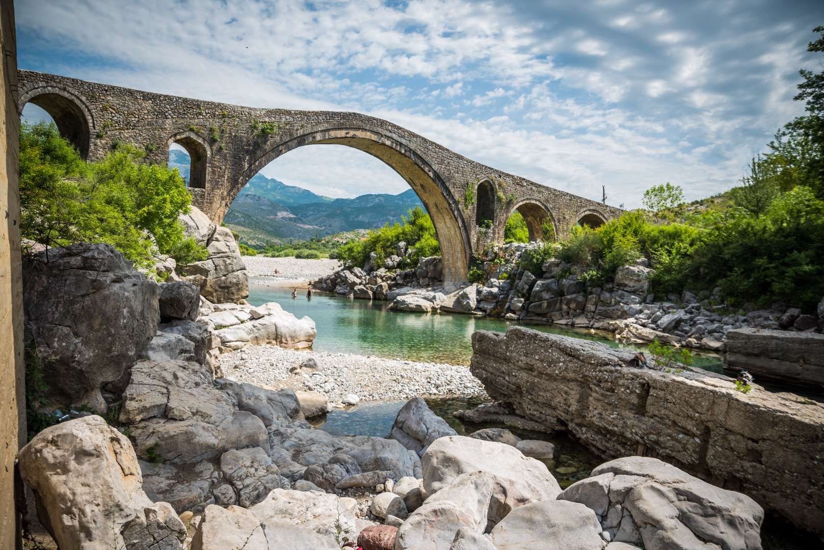
## Description Mesi Bridge (Ura e Mesit), an 18th-century Ottoman-era stone bridge, is one of Albania’s most captivating historical landmarks. Located near the city of Shkodër, this architectural gem spans the Kir River with a graceful series of 13 arches, stretching 108 meters in length. Built around 1770 by Kara Mahmud Bushati, a powerful Ottoman pasha, the bridge was part of a strategic infrastructure project to connect Shkodër with the northern highlands, including the medieval town of Drisht. What makes Mesi Bridge unique is its asymmetrical design and the craftsmanship of its construction. The bridge was built in two phases: the central arch and one adjacent arch were completed first, followed by the remaining eleven. The structure features round river stones and chiseled stone plates, giving it both strength and aesthetic charm. Despite centuries of wear and occasional flooding, the bridge remains remarkably well-preserved and is considered the largest and best-preserved Ottoman bridge in Albania. A little-known fact is that the bridge once formed part of a trade route that extended all the way to Pristina, Kosovo. Another intriguing detail is that the English artist Edward Lear sketched the bridge during his travels in Albania in 1848, captivated by its elegance and the surrounding landscape. ## Location Mesi Bridge is located in **Albania**, in the **Shkodër County**, near the **city of Shkodër**. Specifically, it sits in the village of **Mes**, approximately 5 to 8 kilometers northeast of the city center. ### How to Get There - **By Car**: The most convenient way to reach Mesi Bridge is by car. From Shkodër, follow the road toward the village of Mes. The route is well-marked and passes through scenic countryside. - **By Taxi**: Taxis from Shkodër are affordable and can take you directly to the bridge. - **By Bicycle**: Adventurous visitors can enjoy a leisurely bike ride along quiet rural roads. - **By Public Transport**: Options are limited, so planning ahead is recommended if you’re not driving. The journey itself is part of the experience, offering views of lush greenery, distant mountains, and traditional Albanian villages. ## Tips - **Visit in Spring or Early Summer**: The surrounding landscape is at its most vibrant, and water levels in the Kir River are ideal for photography. - **Wear Comfortable Footwear**: The bridge’s surface is uneven, and exploring nearby trails requires sturdy shoes. - **Bring Water and Sun Protection**: Especially in summer, temperatures can be high and shade is limited. - **Explore Nearby Sites**: Combine your visit with a trip to Drisht Castle or a walk along the Kir Valley. - **Photography**: Early morning or late afternoon offers the best lighting for capturing the bridge and its surroundings. - **Respect the Site**: Though open to the public, the bridge is a protected cultural monument. Avoid climbing on fragile sections. ## Conclusion Mesi Bridge is a stunning example of Ottoman engineering and Albanian heritage. With its elegant arches, historical significance, and picturesque setting, it offers visitors a peaceful and enriching escape just outside Shkodër. ## FAQ **1. Is there an entrance fee to visit Mesi Bridge?** No, the site is free to visit. **2. Can I swim in the Kir River near the bridge?** Yes, swimming is possible, especially in spring and early summer. Water levels may be low in July and August. **3. Is the bridge accessible year-round?** Yes, but heavy rains in winter may make the area muddy or slippery. **4. How long should I plan for the visit?** A visit typically takes 1–2 hours, including time for photos and exploring the surroundings. **5. Is Mesi Bridge suitable for children?** Yes, but supervision is recommended due to uneven surfaces and proximity to the river. **6. Are guided tours available?** Local guides in Shkodër may offer tours that include Mesi Bridge and nearby historical sites. ## Links - [Mesi Bridge – Wikipedia Overview](https://en.wikipedia.org/wiki/Mesi_Bridge) - [VisitShkodër – Mesi Bridge Guide](https://visitshkoder.org/mesi-bridge/)
GemVoyage Team • World
Baalbek
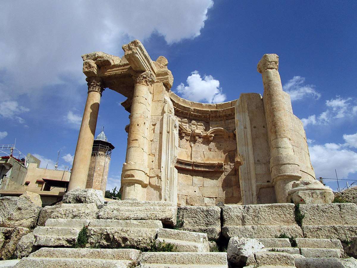
## Description The Temple of Venus in Baalbek, Lebanon, is a captivating remnant of Roman architecture and religious history, tucked within one of the most impressive archaeological complexes in the Middle East. Built in the 3rd century AD, this temple stands out for its **unusual circular design**, a departure from the more common rectangular Roman temples. It was dedicated to Venus, the Roman goddess of love and beauty, and its elegant structure reflects the sensuality and grace associated with her worship. Unlike the colossal temples of Jupiter and Bacchus nearby, the Temple of Venus is more intimate in scale but no less remarkable. It sits atop a horseshoe-shaped platform and features a circular shrine with a square entrance. The outer façade is adorned with five niches, each decorated with carvings of doves and shells—symbols traditionally linked to Venus. These details, along with the temple’s baroque-style curves and arches, showcase a fusion of Roman and Hellenistic architectural techniques. A little-known fact: the temple was later converted into a Christian church dedicated to Saint Barbara, a martyr whose legend is still revered in Lebanon. According to tradition, she was killed by her pagan father for converting to Christianity, and the temple’s continued use as a sacred site reflects the layered religious history of Baalbek. Today, a small mosque stands nearby, underscoring the site’s enduring spiritual significance across centuries and faiths. ## Location The Temple of Venus is located in **Lebanon**, within the **Baalbek-Hermel Governorate**, in the ancient city of **Baalbek**. This city lies in the **northern Bekaa Valley**, a region known for its fertile lands and rich historical tapestry. ### How to Get There: - **By Car**: From Beirut, Baalbek is about a 2-hour drive northeast. The route via Zahle offers scenic views of the Bekaa Valley. - **By Bus**: Public minibuses run from Beirut’s Cola Station to Baalbek, though schedules can be irregular. - **By Tour**: Many guided tours from Beirut include Baalbek’s temple complex, often paired with visits to Anjar or Ksara Winery. Once in Baalbek, the Temple of Venus is just a short walk from the main entrance to the Roman ruins, southeast of the Temple of Jupiter. ## Tips for Visitors To make the most of your visit to the Temple of Venus, consider these tips: - **Visit Early or Late**: The site can get hot and crowded midday. Morning or late afternoon offers better lighting and fewer tourists. - **Wear Comfortable Shoes**: The terrain is uneven, with ancient stones and gravel paths. - **Hire a Guide**: A local guide can provide rich historical context and point out hidden details you might miss. - **Respect the Site**: This is a sacred and historical location. Avoid climbing on ruins or touching carvings. - **Bring Water and Sunscreen**: The Bekaa Valley can be dry and sunny, especially in summer. - **Explore the Whole Complex**: Don’t miss the nearby temples of Jupiter and Bacchus, which are among the largest Roman temples ever built. ## Conclusion The Temple of Venus in Baalbek is a graceful and historically rich monument that offers a unique glimpse into Roman spirituality, architectural innovation, and Lebanon’s layered religious heritage. Its elegant design and enduring presence make it a must-visit for history lovers and curious travelers alike. ## FAQ **1. When was the Temple of Venus built?** It was constructed in the 3rd century AD during the Roman Empire. **2. What makes the Temple of Venus unique?** Its circular design, horseshoe-shaped platform, and symbolic carvings distinguish it from typical Roman temples. **3. Is the temple part of a larger complex?** Yes, it’s part of the Baalbek temple complex, which includes the massive temples of Jupiter and Bacchus. **4. Can I visit the temple year-round?** Yes, the site is open daily and accessible throughout the year. **5. Is there an entrance fee?** Yes, entry to the Baalbek ruins requires a ticket, which includes access to the Temple of Venus. **6. Is the site family-friendly?** Absolutely. The complex is suitable for children and offers a fascinating educational experience. ## Links - [Baalbek Temple of Venus – Livius Ancient History](https://www.livius.org/articles/place/heliopolis-baalbek/baalbek-photos/baalbek-temple-of-the-venus/)
GemVoyage Team • World
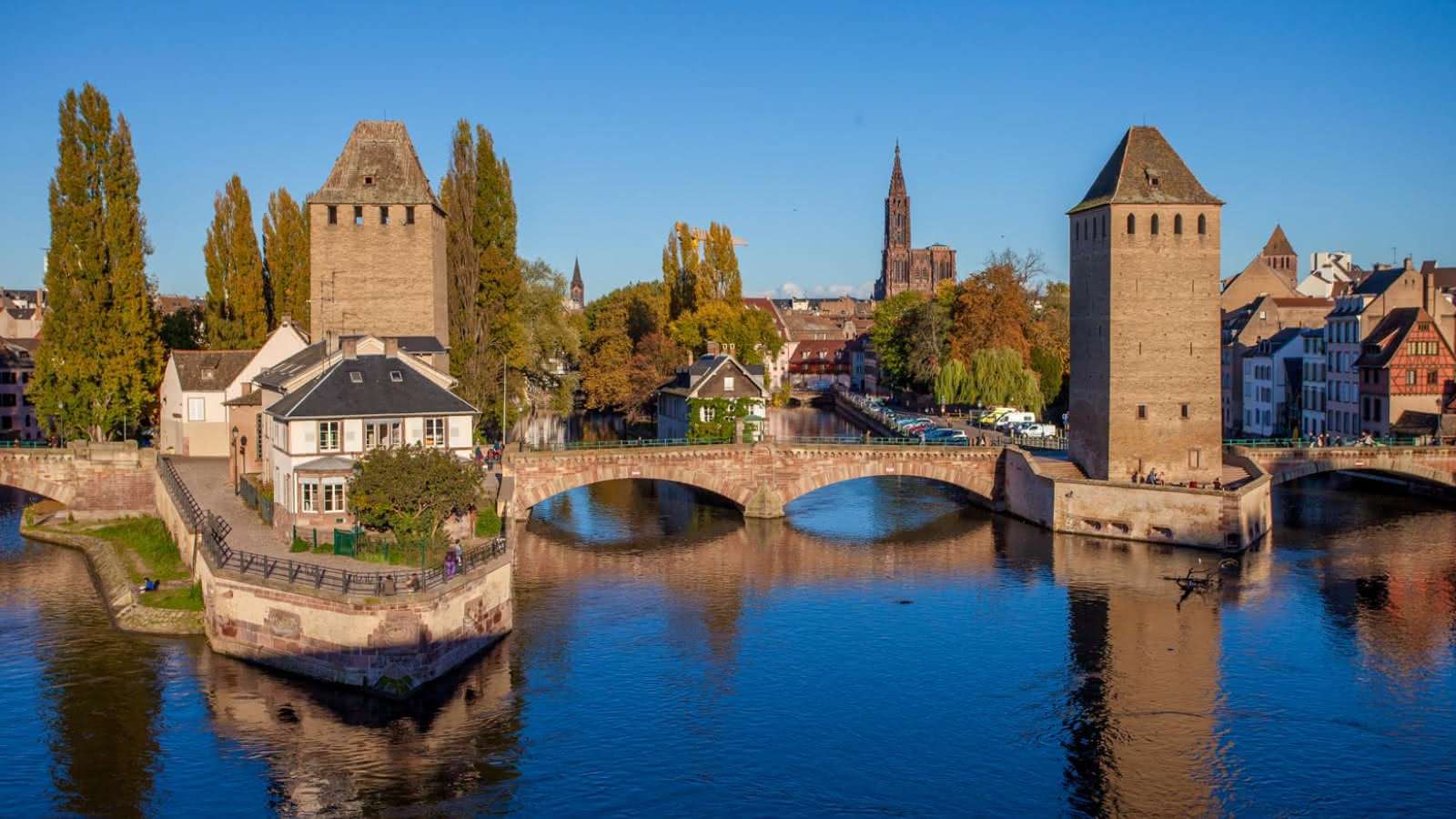
Strasbourg
## Description The Strasbourg Covered Bridges, known locally as *Ponts Couverts*, are a striking ensemble of medieval bridges and towers that span the River Ill in the heart of Strasbourg’s historic *Petite France* district. Built in the 13th century as part of the city’s fortifications, these bridges were originally topped with wooden roofs to protect defenders during sieges—hence the name “covered bridges.” Though the roofs were removed in the late 18th century, the name has endured, preserving a link to their defensive past. The site consists of three stone bridges and four imposing towers, each once part of the city’s ramparts. These towers served as watchposts and prisons until the early 19th century, and their robust Gothic architecture still evokes the strategic importance of Strasbourg during medieval times. Today, the bridges offer stunning views of the surrounding canals, half-timbered houses, and the nearby *Barrage Vauban*, a 17th-century dam and panoramic terrace. A little-known fact: the Ponts Couverts were superseded by the Barrage Vauban in 1690 as the city’s main defensive structure, but they continued to serve as pedestrian and transport bridges. Another intriguing detail is that the towers still bear visible embrasures—narrow slits used for archers and gunmen to defend the city. ## Location The Covered Bridges are located in **France**, within the **Grand Est Region**, in the city of **Strasbourg**. They sit at the western edge of the *Petite France* quarter, one of the most picturesque and historically rich areas of the city. ### How to Get There: - **By Tram**: Take tram lines B or F and get off at *Alt Winmärik*. From there, it’s a short walk to the bridges. - **By Foot**: If you’re exploring central Strasbourg, the bridges are easily accessible from the Strasbourg Cathedral and Place Kléber. - **By Bike**: Strasbourg is one of Europe’s most bike-friendly cities. Rent a bike and follow the riverside paths to reach the bridges. - **By Car**: Parking is limited in the old town. It’s best to park in one of the designated lots outside the center and walk in. Their central location makes them a perfect starting point for exploring Strasbourg’s historic core. ## Tips for Visitors To make the most of your visit to the Strasbourg Covered Bridges, consider these tips: - **Visit at Sunset**: The golden light reflecting off the water and historic buildings creates a magical atmosphere. - **Climb the Barrage Vauban**: Just upstream, this dam offers a panoramic terrace with the best views of the bridges and towers. - **Explore Petite France**: Wander through the cobbled streets and canals nearby for a full immersion in Strasbourg’s medieval charm. - **Photography**: Bring a wide-angle lens to capture the full scope of the bridges and towers. - **Learn the History**: Consider joining a guided walking tour to understand the strategic importance of the bridges and their evolution. - **Avoid Peak Hours**: Early mornings or late evenings are quieter and more peaceful. ## Conclusion The Strasbourg Covered Bridges are a captivating blend of medieval engineering, historical intrigue, and scenic beauty. Whether you're a history enthusiast, a photographer, or a casual traveler, this site offers a timeless glimpse into Strasbourg’s fortified past and its enduring charm. ## FAQ **1. Are the Strasbourg Covered Bridges still covered?** No, the wooden roofs were removed in 1784, but the name “Covered Bridges” remains. **2. Can you walk across the bridges?** Yes, the bridges are open to pedestrians and offer beautiful views of the surrounding canals and towers. **3. Is there an entrance fee?** No, visiting the bridges is free. The nearby Barrage Vauban also has free access to its panoramic terrace. **4. What is the best time to visit?** Sunset or early morning offers the best lighting and fewer crowds. **5. Are the towers accessible to the public?** The towers themselves are not open for interior visits, but you can admire them from the outside. **6. Is the site wheelchair accessible?** Yes, the bridges and surrounding paths are accessible, though some cobbled areas may be uneven. ## Links - [Visit Strasbourg – Covered Bridges Information](https://www.visitstrasbourg.fr/en/fiche-sit/F223007617_the-covered-bridges-strasbourg/) - [Strassburg.eu – Covered Bridges Guide](https://www.strassburg.eu/en/covered-bridges-strasbourg)
GemVoyage Team • World
