GemVoyage Team • World
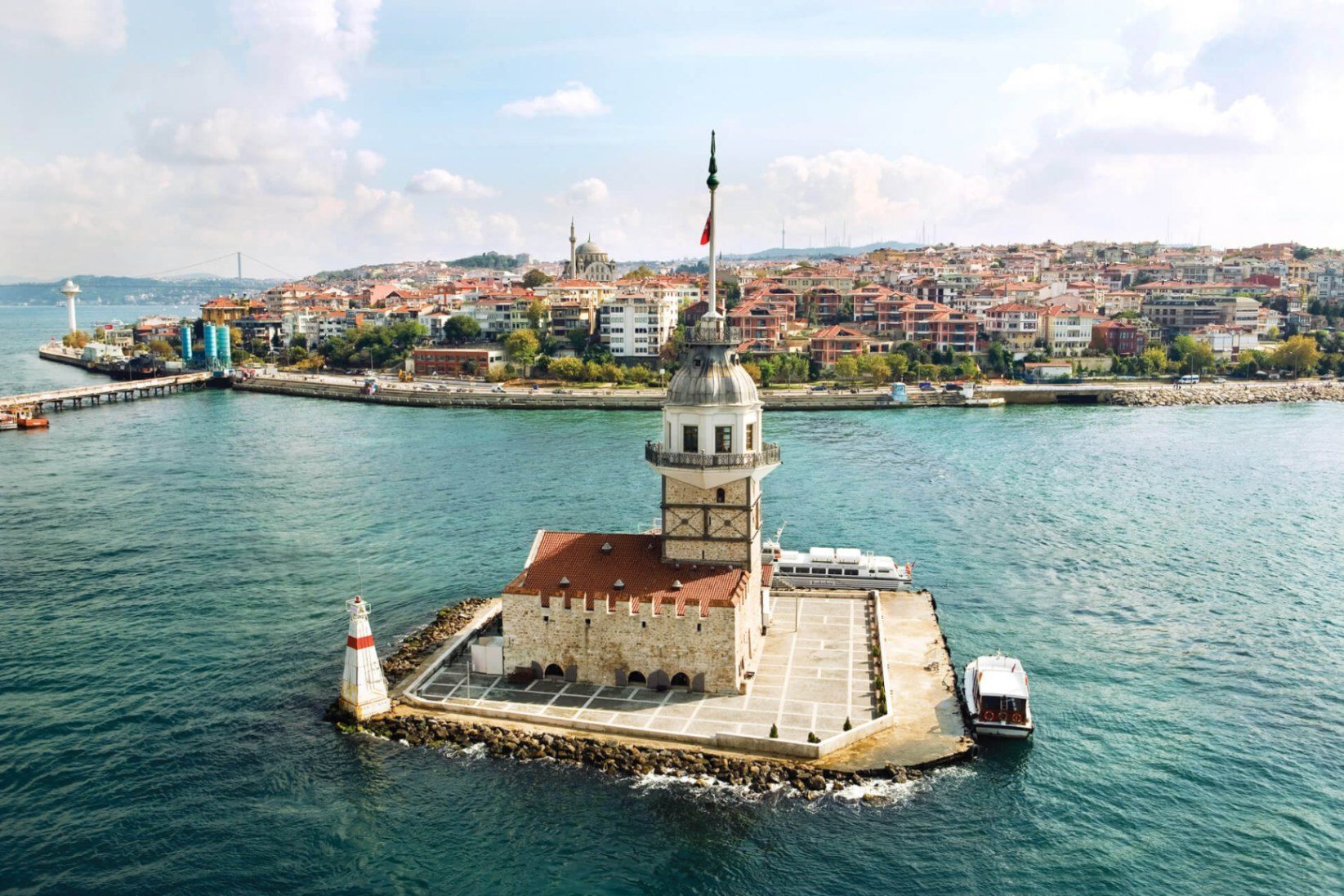
Maiden’s Tower (Kız Kulesi) is one of Istanbul’s most recognizable and symbolically charged landmarks, standing alone on a small islet in the Bosphorus Strait. Neither fully Asian nor European in spirit, the tower embodies Istanbul’s identity as a city suspended between worlds. Its silhouette, visible from both shores, has inspired legends, poetry, paintings, and countless interpretations over centuries.
The structure’s history stretches back to antiquity, with the earliest known use dating to the 5th century BCE, when it functioned as a defensive outpost controlling maritime traffic entering the Bosphorus. Over time, the tower has served many roles: lighthouse, customs checkpoint, quarantine station, watchtower, and even a radio transmission point. Each era left its mark, making the tower less a single-purpose monument and more a layered historical artifact.
What truly distinguishes Maiden’s Tower is the mythology surrounding it. The most famous legend tells of a princess locked inside the tower to protect her from a prophecy foretelling her death by snakebite—only for the prophecy to come true regardless. Another lesser-known tale connects the tower to Hero and Leander, linking it symbolically to tragic love stories from classical antiquity. These narratives, though not historically verifiable, have become inseparable from the site’s identity.
A little-known fact is that the tower has been rebuilt multiple times, most recently during the Ottoman period and again in modern restorations, meaning what visitors see today is the result of careful reconstruction rather than a single intact ancient structure. Another overlooked detail is that its strategic placement allowed it to work in tandem with towers on both shores, forming a maritime control system rather than functioning in isolation.
Today, Maiden’s Tower operates primarily as a cultural and leisure site, offering exhibitions, a café, and panoramic views that rival any viewpoint in the city.
Country: Turkey
Region: Marmara
City: Istanbul
District: Üsküdar
Waterway: Bosphorus Strait
The tower sits just off the Asian shore of Istanbul, opposite the historic peninsula and close to Üsküdar’s coastline.
* Small boats depart regularly from Üsküdar and sometimes from Kabataş on the European side.
* Take Marmaray, metro, or ferry lines to Üsküdar, then walk to the departure pier.
* Taxi to Üsküdar waterfront, then transfer by boat.
Access to the tower is only possible by boat; swimming or private access is prohibited.
Maiden’s Tower is less about architectural grandeur and more about symbolism, location, and continuity. Standing alone in the Bosphorus, it captures Istanbul’s layered history and enduring fascination better than almost any other single structure.
1. Is Maiden’s Tower ancient?
Its origins date back over 2,000 years, but the current structure reflects multiple reconstructions.
2. Can you go inside the tower?
Yes, when open to the public, visitors can enter via boat.
3. How long does a visit take?
Typically 30 to 60 minutes, excluding boat travel.
4. Is there an entrance fee?
Yes, pricing varies depending on exhibitions and services.
5. Is it better to visit during the day or evening?
Evening visits are more atmospheric, especially around sunset.
6. Is the tower wheelchair accessible?
Accessibility is limited due to stairs and the historic structure.
Discover more hidden gems you might love.
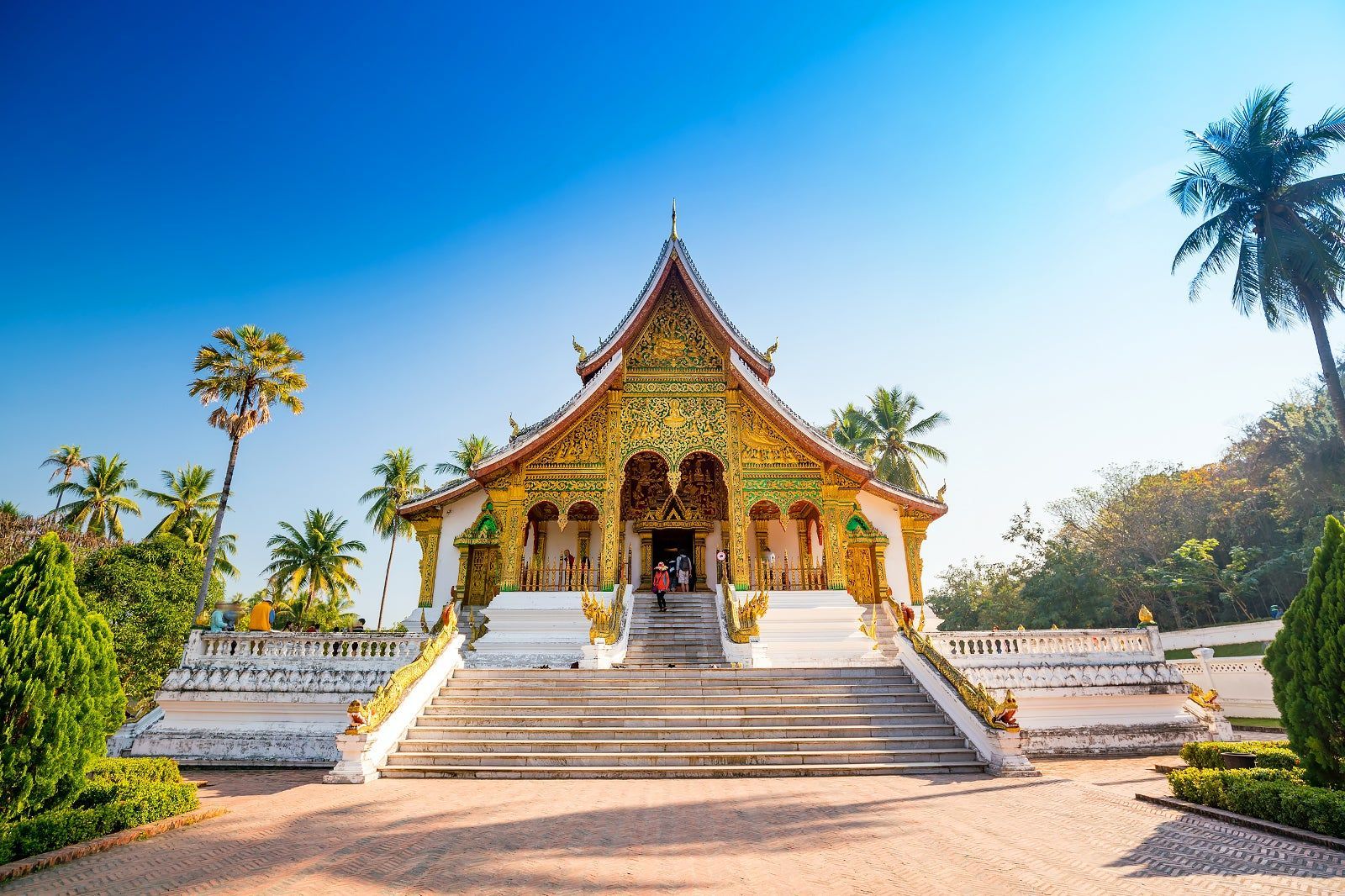
Laos
## Description Luang Prabang, nestled where the Mekong and Nam Khan rivers meet, is a compact and remarkably well-preserved city in northern Laos. Renowned for its colonial-era buildings, saffron-robed monks, ornate Buddhist temples and a contemplative pace, Luang Prabang blends spiritual ritual with a lively artisan scene and riverfront cafés. The city’s Unesco-listed core includes gilded wats (temple complexes) with intricate woodwork, and the daily ritual of almsgiving — where villagers and visitors watch monks collect offerings at dawn — remains a powerful cultural scene. Beyond its temples, Luang Prabang is a gateway to waterfalls such as Kuang Si, traditional weaving villages, and hilltop viewpoints that reward gentle hikes. The city’s food scene is notable for Lao specialties and a street-market culture that showcases sticky rice, grilled meats, and delicate river fish dishes. Luang Prabang is a place where slow travel rewards attention: morning almsgiving, quiet temple courtyards, and riverside cafés invite pauses that reveal local rhythms. The city manages to balance heritage conservation with welcoming tourism; narrow streets are punctuated by family-run guesthouses, handicraft cooperatives and social enterprises focused on sustainable tourism. Kuang Si Falls remains a perennial highlight — a cascading tier of turquoise pools that invites both swimming and mindful walking — while nearby villages offer hands-on experiences with traditional weaving, dyeing and food preparation. The compact scale of Luang Prabang makes it easy to explore on foot or by bicycle; many travelers find that wandering the backstreets at dawn or dusk yields unexpectedly intimate encounters with everyday life. Given the city's spiritual presence, visitors should dress respectfully around temples and be mindful of photography etiquette during ceremonies. The night market on Sisavangvong Road is a lively hub for textiles, silverwork and street food, but for authentic Lao cuisine seek neighborhood stalls where family recipes are passed down through generations. Seasonal festivals, like Boun Pi Mai (Lao New Year) and other Buddhist celebrations, add further depth for those who align travel dates with local calendars. ## Location Luang Prabang is in northern Laos, reachable by air at Luang Prabang International Airport (LPQ) or by overland routes from northern Thailand and Vientiane. The rivers provide scenic boat connections to upriver destinations and are central to the city’s character. Flight connections to Luang Prabang arrive from regional hubs; overnight trains and bus routes from Chiang Mai and other Thai cities offer overland alternatives. River cruises along the Mekong provide a slower, scenic arrival that frames the city's riverside charm. Central Luang Prabang is compact and walkable, with most attractions clustered within an easy radius; taxis, tuk-tuks and river boats provide transport to outlying sites like Kuang Si Falls and surrounding villages. ## Tips - **Honor local customs:** Dress modestly at temples, avoid loud behavior during almsgiving, and observe photography etiquette. - **Visit Kuang Si Falls:** A short drive away, the falls’ turquoise pools are ideal for swimming and picnics — arrive early to avoid crowds. - **Explore by foot or bicycle:** The city center is compact; walking or cycling is pleasant and helps you discover markets and side streets. - **Try a river cruise:** Sunset river trips on the Mekong offer relaxed views and local riverside life. - **Support craft cooperatives:** Visit silk-weaving and craft workshops that support local artisans and sustain traditional techniques. - **Carry small bills for offerings:** If participating respectfully in almsgiving or donations, small local currency notes are appropriate. - **Be mindful of seasonal weather:** The cool-dry season (Nov–Feb) is most comfortable; the wet season can make rural tracks muddy and less accessible. - **Hire local guides for village visits:** Ethical community-based tours give income to families and provide authentic context. - **Taste street specialties early:** Local breakfasts like khao soi and grilled river fish are best experienced fresh from morning stalls. ## Conclusion Luang Prabang offers a gentle, culturally immersive travel experience: spiritual rhythm, natural beauty and warm Lao hospitality combine to create a reflective pace that many travelers find restorative. Whether you’re drawn to its temples, waterfalls or artisan traditions, Luang Prabang rewards visitors who travel slowly and with curiosity. The city’s human scale and spiritual cadence make it an ideal destination for travelers seeking contemplative experiences, meaningful cultural exchange and access to some of Laos’s most scenic natural sites. ## FAQ - **Q: Is Luang Prabang safe for solo travelers?** - A: Generally yes — it’s considered one of Southeast Asia’s safer small cities, but usual travel caution applies. - **Q: When is the best time to visit?** - A: The cool dry season (November–February) is most comfortable; the wet season can be lush but includes heavy rains. - **Q: Are there international flights?** - A: Luang Prabang has regional flights; connections from Bangkok, Hanoi and Vientiane are common. - **Q: How many days are ideal for a first visit?** - A: Three to five days lets you explore temples, enjoy Kuang Si Falls, visit a weaving village and take a short Mekong trip without rushing. - **Q: What should I wear for temple visits?** - A: Dress modestly with shoulders and knees covered; remove shoes when entering temple buildings and follow local customs. - **Q: Can I use ATMs and credit cards?** - A: ATMs are available in town and larger businesses accept cards, but carry cash for market stalls and rural excursions. - **Q: Are there ethical ways to visit villages?** - A: Yes — choose community-run tours, avoid exploitative photo practices, and purchase directly from cooperatives when possible. ## Links - [Luang Prabang — Wikipedia](https://en.wikipedia.org/wiki/Luang_Phrabang)
GemVoyage Team • World
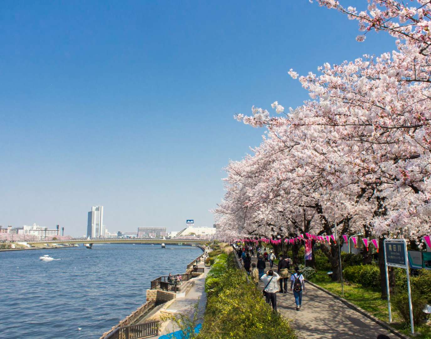
Tokyo
## Description Sumida Park is a serene riverside oasis in the heart of Tokyo, offering a refreshing contrast to the city’s fast-paced urban energy. Stretching along both banks of the Sumida River, the park is located between the Azumabashi and Sakurabashi bridges and provides stunning views of the Tokyo Skytree rising above the skyline. It’s a favorite spot for locals and tourists alike, especially during spring when the park transforms into one of Tokyo’s most celebrated cherry blossom viewing locations. The park’s history dates back to the Edo period, when the riverbanks were popular gathering spots for hanami (cherry blossom viewing), festivals, and leisurely strolls. Today, Sumida Park continues that tradition with over 600 cherry trees lining the paths, creating a tunnel of blossoms that draws thousands of visitors each year. In summer, the park becomes a prime viewing location for the Sumida River Fireworks Festival, one of Japan’s oldest and most spectacular pyrotechnic displays. A little-known fact: the cherry trees in Sumida Park were planted under the orders of shogun Tokugawa Yoshimune in the 18th century, making the park not only a natural retreat but also a living piece of Tokyo’s cultural heritage. Another quirky detail is the nearby Asahi Beer Tower, visible from the park, which was designed to resemble a frothy mug of beer—a playful architectural nod to the area’s modern flair. ## Location Sumida Park is located in **Japan**, in the **Kanto region**, within the **city of Tokyo**. It spans the **Taito and Sumida wards**, with entrances near the historic Asakusa district and the Sumida River waterfront. ### How to Get There - **By Train**: The park is a five-minute walk from Asakusa Station, served by the Ginza Line, Asakusa Line, Tobu Isesaki Line, and Tsukuba Express. - **By Bus**: Several local buses stop near Asakusa and Sumida Park. - **By Water Bus**: The Tokyo Water Bus docks near the park and offers scenic rides to destinations like Odaiba and Hamarikyu Gardens. - **By Foot or Bike**: The park is easily accessible from nearby neighborhoods and is ideal for walking or cycling along the river. Its central location makes it a convenient stop during a day of sightseeing in eastern Tokyo. ## Tips - **Visit During Cherry Blossom Season**: Late March to early April is peak bloom time. Arrive early to avoid crowds and secure a good picnic spot. - **Stay for the Fireworks**: If visiting in late July, plan to attend the Sumida River Fireworks Festival. Arrive hours in advance for a good viewing location. - **Bring a Camera**: The park offers excellent photo opportunities, especially with Tokyo Skytree in the background. - **Explore Both Sides of the River**: Cross the Sakurabashi pedestrian bridge to enjoy views from both banks. - **Pack a Picnic**: There are no large restaurants inside the park, but nearby Asakusa has plenty of takeout options. - **Check for Events**: Seasonal festivals and cultural performances are often held in the park—check local listings for details. ## Conclusion Sumida Park is a tranquil yet culturally rich destination in Tokyo, offering scenic river views, seasonal beauty, and a deep connection to the city’s history. Whether you're admiring cherry blossoms, watching fireworks, or simply enjoying a quiet walk, the park provides a memorable escape in the heart of the metropolis. ## FAQ **1. Is there an entrance fee to Sumida Park?** No, the park is free and open to the public year-round. **2. When is the best time to visit Sumida Park?** Spring (late March to early April) for cherry blossoms and summer (late July) for the fireworks festival. **3. Are there restrooms and facilities in the park?** Yes, there are public restrooms and seating areas throughout the park. **4. Can I bring pets to Sumida Park?** Yes, pets are allowed but should be kept on a leash and cleaned up after. **5. Is the park wheelchair accessible?** Most paths are flat and accessible, though some areas may have uneven terrain. **6. Are there guided tours available?** While not specific to the park, many Asakusa walking tours include Sumida Park as part of their itinerary. ## Links - [Sumida Park – Japan National Tourism Organization](https://www.japan.travel/en/spot/2114/)
GemVoyage Team • World
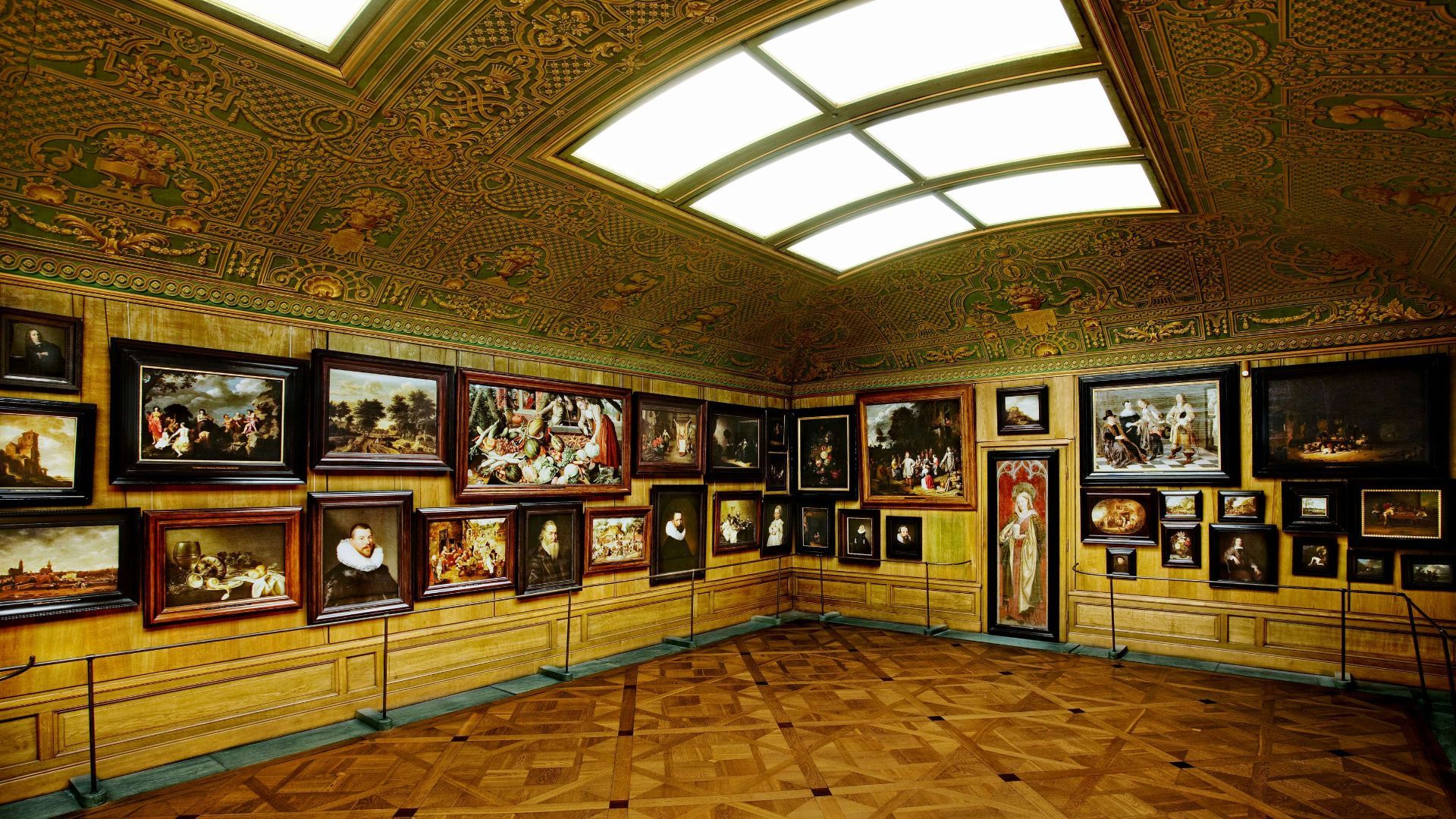
Stockholm
## Description The Hallwyl Museum in Stockholm offers one of the city’s most distinctive historic-house experiences. Housed in the former residence of Count and Countess von Hallwyl, the museum preserves an extraordinary late-nineteenth-century interior filled with art, furniture, decorative objects, and the feeling of a private home that has been carefully maintained rather than transformed into a generic museum. Visiting it is like stepping into a remarkably complete snapshot of upper-class domestic life in Stockholm at the turn of the century. The museum is especially appealing because it balances grandeur and intimacy. Some rooms are richly decorated and formal, while others feel like lived-in domestic spaces, making the whole building feel coherent rather than staged. One little-known fact is that the Hallwyl collection was assembled with unusual care and documentation, giving historians and visitors a detailed view of the household’s contents and routines. Another interesting detail is that the house itself reflects both status and modernity, showing how wealthy Stockholm families adopted new technologies and comforts while still displaying traditional elegance. What makes the museum memorable is the combination of its architecture, interiors, and sense of personal history. Unlike larger national museums, Hallwyl’s charm comes from concentration. Every room, object, and corridor contributes to a specific atmosphere. The visit is ideal for travelers who enjoy historic interiors, design history, or the way private homes can reveal broader social changes. It also fits well into Stockholm’s cultural landscape because it offers a different experience from the city’s more famous royal or maritime attractions. Instead of scale, it offers detail; instead of spectacle, it offers texture. ## Location The Hallwyl Museum is in central Stockholm, Sweden, near the city’s commercial and cultural core. Its location makes it easy to reach from many parts of the city and convenient to combine with shopping streets, other museums, or a broader downtown walk. The simplest way to get there is by public transport or on foot from central Stockholm. Because the city is well connected, visitors staying in the center can usually reach the museum quickly without needing a car. If you are planning a full day in central Stockholm, the museum works well as a quieter stop between busier attractions. ## Tips Take your time in the rooms; the best part of the museum is noticing the details. If you enjoy decorative arts, interiors, or social history, this museum will be especially rewarding. Check the current opening information in advance, since historic-house museums sometimes have schedule variations. Pair the visit with nearby Stockholm attractions to make the most of the central location. ## Conclusion The Hallwyl Museum is a refined and atmospheric historic house that gives visitors a rare, detailed glimpse into Stockholm’s aristocratic past. ## FAQ ### What kind of museum is Hallwyl? It is a historic house museum preserved from a wealthy Stockholm family’s residence. ### Is it good for first-time visitors to Stockholm? Yes, especially if you want a cultural site that is elegant and manageable in size. ### How long should I plan for the visit? Around one to two hours is usually enough. ### Is the museum family-friendly? Yes, though it is especially enjoyable for visitors interested in history and interiors. ### Why is it special compared with other museums? Because it preserves a remarkably complete domestic environment rather than only displaying isolated objects. ## Links - [Official website](https://hallwylskamuseet.se/en/) - [Hallwyl Museum on Wikipedia](https://en.wikipedia.org/wiki/Hallwyl_Museum)
GemVoyage Team • World
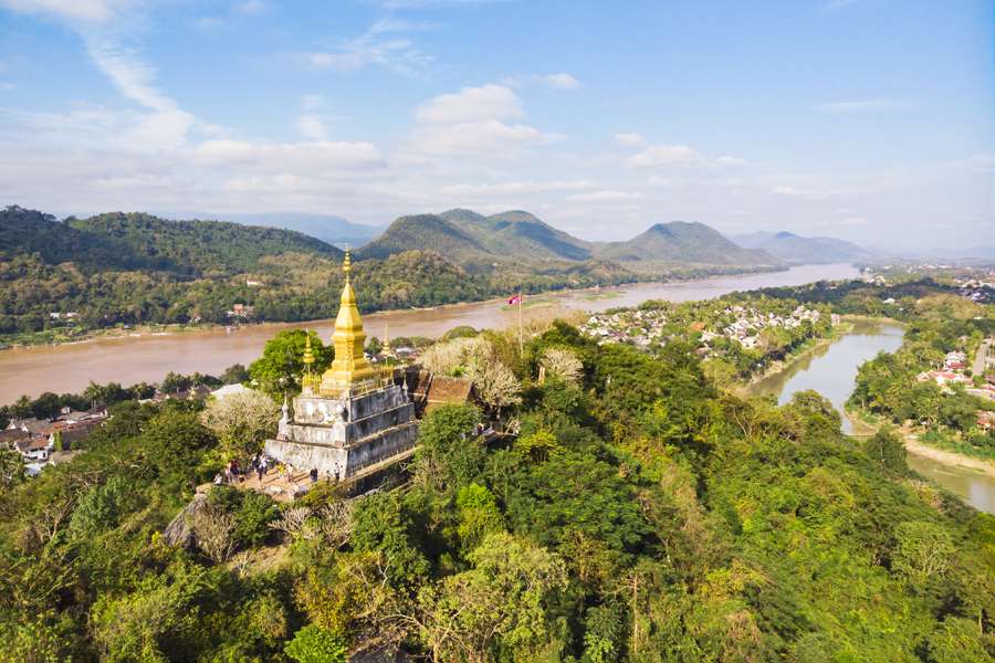
Laos
## Description Phou Si, often referred to as Mount Phou Si or Phu Si, is a sacred hill that rises 100 meters above the UNESCO World Heritage city of Luang Prabang in Laos. It’s not just a geographical landmark—it’s a spiritual and cultural centerpiece that offers panoramic views, serene temples, and a glimpse into the soul of Lao Buddhism. The name “Phou Si” translates to “Sacred Hill,” and true to its name, it’s dotted with shrines, Buddha statues, and two prominent temples: Wat Tham Phou Si halfway up, and Wat Chom Si at the summit. The climb to the top involves ascending over 300 steps, but the reward is a breathtaking 360-degree view of Luang Prabang, the Mekong and Nam Khan rivers, and the surrounding jungle-clad mountains. Along the way, saffron-robed monks stroll the leafy paths, incense drifts through the air, and small altars invite quiet reflection. A little-known fact: legend has it that a powerful Naga (a mythical serpent deity) once lived on the hill, adding a mystical layer to its spiritual significance. Another hidden treasure is a small chapel said to house a footprint of the Buddha, tucked along one of the stairways—a detail often missed by hurried visitors. ## Location Phou Si is located in **Laos**, within the **Luang Prabang Province**, in the city of **Luang Prabang**. It sits in the heart of the old town peninsula, bordered by the Mekong River on one side and the Nam Khan River on the other. ### How to Get There: - **By Foot**: Most visitors reach Phou Si by walking from nearby attractions like the Royal Palace Museum or the Night Market. The two main stairways are accessible from Sisavangvong Road and Thanon Phousi. - **By Tuk-Tuk**: If you're staying farther out, a tuk-tuk can drop you off at either entrance. - **By Bicycle**: Luang Prabang is bike-friendly, and cycling to the base of Phou Si is a scenic option. Its central location makes it an easy and essential stop on any Luang Prabang itinerary. ## Tips for Visitors To make the most of your visit to Phou Si, consider these tips: - **Go for Sunset**: The summit offers one of the best sunset views in Laos. Arrive early to secure a good spot—it's popular! - **Bring Water**: The climb can be steep and humid, especially in the afternoon. Hydration is key. - **Wear Comfortable Shoes**: The stairways are uneven in places, so sturdy footwear is recommended. - **Respect the Sacredness**: Dress modestly and be mindful of local customs. Offerings like incense and flowers are available for purchase along the way. - **Explore Both Routes**: Ascend via the Nam Khan side for scenic statues and descend via the Royal Palace side for a shorter walk. - **Entrance Fee**: Expect to pay around 20,000 Kip (~$2.50 USD), collected halfway up the hill. ## Conclusion Phou Si is more than just a viewpoint—it’s a spiritual journey, a cultural experience, and a photographer’s dream. With its sacred temples, mythical legends, and sweeping vistas, it captures the essence of Luang Prabang and offers a moment of peace above the city’s gentle bustle. ## FAQ **1. How many steps are there to reach the top of Phou Si?** There are over 300 steps, depending on the route you take—328 from the Royal Palace side and 355 from the Nam Khan side. **2. What is the best time to visit Phou Si?** Sunset is the most popular time, but early morning offers tranquility and cooler temperatures. **3. Is there an entrance fee?** Yes, the fee is approximately 20,000 Kip, payable halfway up the hill. **4. Can children climb Phou Si?** Yes, but supervision is recommended due to the steep stairways. **5. Are there restrooms or shops at the summit?** No facilities at the top, but vendors sell drinks and offerings near the base. **6. Is Phou Si wheelchair accessible?** Unfortunately, due to the stair-only access, it is not suitable for visitors with mobility issues. ## Links - [Mount Phou Si – Wikipedia](https://en.wikipedia.org/wiki/Phou_Si)
GemVoyage Team • World
Cairo
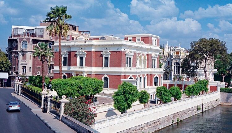
## Description **Aisha Fahmy Palace** is one of Cairo’s most elegant examples of early 20th-century aristocratic architecture and a rare survivor of the city’s Belle Époque period. Built in **1907**, the palace reflects a time when Cairo’s elite embraced European artistic influences while maintaining a distinct Egyptian identity. Today, it stands not as a frozen relic, but as a carefully restored cultural venue that bridges past luxury with contemporary artistic expression. The palace was commissioned by Ali Fahmy Pasha and later inherited by his daughter, Aisha Fahmy, whose name it still carries. Designed by Italian architect Antonio Lasciac, the building combines **Italian Renaissance influences with Art Nouveau and neoclassical details**. Marble staircases, ornate ironwork, stained glass windows, and elaborately decorated ceilings reveal the level of craftsmanship invested in elite residential architecture at the time. What makes Aisha Fahmy Palace particularly compelling is its **interior artistry**. The walls and ceilings feature painted panels inspired by classical European mythology, floral motifs, and allegorical scenes, many of which were executed by European artists working in Cairo. A lesser-known fact is that the palace once hosted private salons and cultural gatherings attended by prominent figures from Egypt’s political and artistic circles. Another overlooked detail is that, despite periods of neglect during the late 20th century, much of the original decorative work survived and was meticulously restored rather than replaced. Today, the palace functions as a **temporary exhibition space** under the Egyptian Ministry of Culture. Contemporary art exhibitions are staged within the historic rooms, creating a deliberate contrast between modern creative expression and early 1900s aristocratic interiors. This dialogue between eras is central to the palace’s renewed relevance. ## Location **Country:** Egypt **Governorate:** Cairo **District:** Zamalek Aisha Fahmy Palace is located in **Zamalek**, one of Cairo’s most refined and leafy neighborhoods, situated on Gezira Island in the Nile. ### How to Get There * **By taxi or ride-hailing:** * The most practical option, especially from central Cairo or downtown. * **By metro:** * Take Line 2 to **Opera Station**, then walk or take a short taxi ride. * **On foot:** * Easily reachable when exploring Zamalek’s cultural venues and riverfront. * **By car:** * Limited street parking is available in the surrounding area. ## Tips * **Check exhibition schedules in advance:** The palace hosts rotating exhibitions rather than permanent displays. * **Allow time to explore interiors:** The architectural details are as important as the artworks. * **Visit during daylight hours:** Natural light enhances the painted ceilings and stained glass. * **Photography rules vary:** Some exhibitions may restrict interior photography. * **Combine with nearby sites:** Zamalek offers galleries, cafés, and cultural centers within walking distance. * **Expect calm rather than crowds:** The palace remains relatively uncrowded compared to major museums. ## Conclusion Aisha Fahmy Palace is a refined cultural landmark that captures a sophisticated chapter of Cairo’s modern history. Its restored interiors, aristocratic architecture, and evolving role as an art space make it a rewarding destination for visitors seeking depth, elegance, and context beyond the city’s ancient monuments. ## FAQ **1. Is Aisha Fahmy Palace a museum?** It functions primarily as a temporary exhibition venue rather than a traditional museum. **2. How old is the palace?** It was completed in 1907. **3. How long should I plan for a visit?** Approximately **45 minutes to 1.5 hours**, depending on exhibitions. **4. Is there an entrance fee?** Yes, a modest fee is usually charged and may vary by exhibition. **5. Is the palace suitable for children?** Yes, particularly for older children interested in art or architecture. **6. Is the palace accessible?** Accessibility is limited in some areas due to the historic structure. ## Links * [Experience Egypt tourism portal](https://www.experienceegypt.eg)
GemVoyage Team • World
Porto
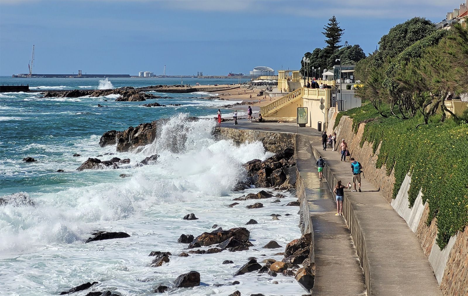
## Description Foz do Douro Promenade is one of the most enjoyable walks in Porto because it captures the city at its most open, breezy, and scenic. Located where the Douro River approaches the Atlantic Ocean, Foz do Douro is known for its waterfront paths, beaches, cafés, parks, and dramatic light. It gives visitors a different side of Porto from the historic center: less compact, more coastal, and shaped by wind, water, and long views rather than narrow medieval streets. The promenade is special because it lets you experience the transition from river to sea in a very direct way. The Douro's strong identity as a working river, a wine route, and an urban boundary becomes visible here, where the city meets larger natural forces. Walking the promenade, you can watch waves strike the seawall, see locals out for exercise or family time, and move between beaches, lighthouses, and garden spaces. It is one of those urban landscapes that works equally well for slow contemplation and active strolling. One little-known fact is that Foz has long been associated with leisure and summer life among Porto residents, especially as the city expanded and more people began seeking breezy coastal escapes close to home. Another detail many visitors miss is the extent to which the area changes mood with the weather. On a clear day, Foz feels luminous and expansive; on a windy day, it becomes dramatic and powerful. The promenade is therefore not just a route but an experience shaped by the Atlantic itself. The area also reveals a lot about Porto's identity. The city is often celebrated for its historic center and wine cellars, but Foz shows a different and equally important side: a living, modern waterfront where people come to walk, cycle, talk, and watch the sea. If you want a place in Porto that combines fresh air, urban life, and landscape, this is one of the best choices. ## Location Foz do Douro is a district in Porto, in the Norte region of Portugal, located at the mouth of the Douro River where it opens toward the Atlantic Ocean. The promenade runs along the waterfront in the western part of the city, making it farther from the old center than Ribeira but still easy to reach by public transport, taxi, or a scenic walk if you have time. One of the easiest ways to get there is by bus or tram, especially if you want to enjoy the trip without worrying about parking. Walking from the riverfront is possible and rewarding if you have a full day, but most visitors will prefer a shorter transfer followed by a long, leisurely walk along the coast. The route can be combined with stops at beaches, gardens, and small cafés along the way. For orientation, think of the promenade as a westward extension of Porto's river story. It is a place to end the day, not just begin it, because sunset and late afternoon light are especially beautiful here. ## Tips Choose a clear or mildly windy day if you want the best experience. The promenade is pleasant in many conditions, but it is most memorable when the sky and sea are visible in full color. Bring a light jacket even in warm weather. The Atlantic can cool the air quickly, especially near evening, and visitors often underestimate how different the climate feels compared with Porto's inland streets. If you enjoy a slower pace, start near the river mouth and walk toward the beaches and garden areas. That direction helps you experience the transition from urban river edge to open sea more naturally. Use the promenade as a break from sightseeing density. Porto's historic center can feel packed with monuments and steep lanes, while Foz offers breathing room and a chance to enjoy the city in a more relaxed frame. ## Conclusion Foz do Douro Promenade is one of Porto's best places for a scenic walk, combining sea air, river views, and a calm waterfront atmosphere that contrasts beautifully with the city's historic core. ## FAQ ### Why do people visit Foz do Douro? People visit for the seaside atmosphere, promenade walks, beaches, cafés, and the chance to see where the Douro River meets the Atlantic. ### Is Foz do Douro good for sunsets? Yes. The area is one of the best places in Porto for evening light and coastal views. ### Can I walk or cycle there? Yes. The waterfront is ideal for walking and cycling, and both locals and visitors use it for exercise and leisure. ### How far is it from downtown Porto? It is farther than the central historic districts, but still easy to reach by public transport or taxi. ## Links - [Porto tourism](https://visitporto.travel/) - [Wikipedia article](https://en.wikipedia.org/wiki/Foz_do_Douro)
GemVoyage Team • World

Comments