GemVoyage Team • World
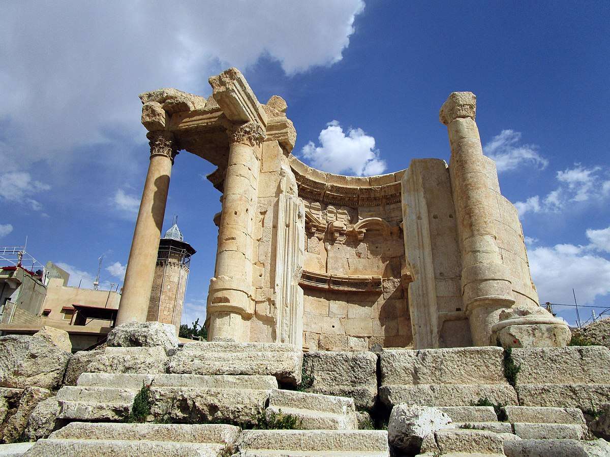
The Temple of Venus in Baalbek, Lebanon, is a captivating remnant of Roman architecture and religious history, tucked within one of the most impressive archaeological complexes in the Middle East. Built in the 3rd century AD, this temple stands out for its unusual circular design, a departure from the more common rectangular Roman temples. It was dedicated to Venus, the Roman goddess of love and beauty, and its elegant structure reflects the sensuality and grace associated with her worship.
Unlike the colossal temples of Jupiter and Bacchus nearby, the Temple of Venus is more intimate in scale but no less remarkable. It sits atop a horseshoe-shaped platform and features a circular shrine with a square entrance. The outer façade is adorned with five niches, each decorated with carvings of doves and shells—symbols traditionally linked to Venus. These details, along with the temple’s baroque-style curves and arches, showcase a fusion of Roman and Hellenistic architectural techniques.
A little-known fact: the temple was later converted into a Christian church dedicated to Saint Barbara, a martyr whose legend is still revered in Lebanon. According to tradition, she was killed by her pagan father for converting to Christianity, and the temple’s continued use as a sacred site reflects the layered religious history of Baalbek. Today, a small mosque stands nearby, underscoring the site’s enduring spiritual significance across centuries and faiths.
The Temple of Venus is located in Lebanon, within the Baalbek-Hermel Governorate, in the ancient city of Baalbek. This city lies in the northern Bekaa Valley, a region known for its fertile lands and rich historical tapestry.
Once in Baalbek, the Temple of Venus is just a short walk from the main entrance to the Roman ruins, southeast of the Temple of Jupiter.
To make the most of your visit to the Temple of Venus, consider these tips:
The Temple of Venus in Baalbek is a graceful and historically rich monument that offers a unique glimpse into Roman spirituality, architectural innovation, and Lebanon’s layered religious heritage. Its elegant design and enduring presence make it a must-visit for history lovers and curious travelers alike.
1. When was the Temple of Venus built?
It was constructed in the 3rd century AD during the Roman Empire.
2. What makes the Temple of Venus unique?
Its circular design, horseshoe-shaped platform, and symbolic carvings distinguish it from typical Roman temples.
3. Is the temple part of a larger complex?
Yes, it’s part of the Baalbek temple complex, which includes the massive temples of Jupiter and Bacchus.
4. Can I visit the temple year-round?
Yes, the site is open daily and accessible throughout the year.
5. Is there an entrance fee?
Yes, entry to the Baalbek ruins requires a ticket, which includes access to the Temple of Venus.
6. Is the site family-friendly?
Absolutely. The complex is suitable for children and offers a fascinating educational experience.
Discover more hidden gems you might love.
Seoul
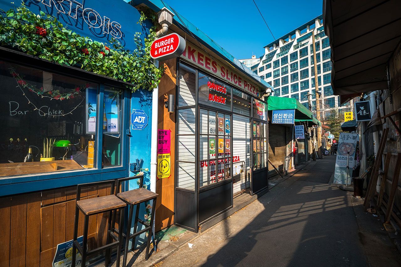
## Description Mullae Art Village in Seoul is a compelling example of an industrial district transformed into an active creative ecosystem. Once home primarily to metalworks and small foundries, the neighborhood now hosts a mix of artist studios, mural-covered facades, experimental cafes, and workshops that continue to hum with production. This coexistence of working industry and emerging creative culture lends Mullae a gritty authenticity—visitors can witness the surprising juxtaposition of active metal fabrication alongside open studio events and gallery nights. The village has become a draw for photographers, designers, and travelers looking for non-touristy creative scenes. Monthly studio openings, collaborative exhibitions, and pop-up markets animate the neighborhood, while small bars and eateries offer late-night conversation and informal artist gatherings. Mullae’s charm is not polished; it’s lived-in, evolving, and full of small discoveries. ## Location Mullae sits in Yeongdeungpo-gu, Seoul, and is accessible from Mullae Station on Line 2, with short walks into the heart of the creative cluster. The area is best explored on foot, following alleyways and industrial lanes where murals, sculptures, and studios appear around unexpected corners. ## Tips - Time visits for open-studio events or weekends when more artists and galleries welcome visitors. - Be mindful of working studios—respect cordoned areas and do not enter without permission. - Bring a camera and a sense of exploration—industrial textures, murals, and found-object sculptures make for strong photography subjects. - Support local businesses: many cafes and shops are run by artists and makers, and purchases help sustain the community. - Safety note: some areas near active workshops may have operational hazards—obey signage and keep a safe distance from machinery. ## Conclusion Mullae Art Village is a vivid, working example of how industrial neighborhoods can become creative hubs without losing their gritty character. It’s ideal for curious travelers who value authenticity, emerging art scenes, and the energetic overlap of craft and creativity. ## FAQ Q: Are studios in Mullae open to the public? A: Many studios open during scheduled studio days or events; otherwise contact artists or galleries directly for visits. Q: Is it safe to take photos in Mullae? A: Yes, in public areas, but avoid photographing inside private workshops without permission and respect workers’ safety zones. Q: Are there cafes and shops in Mullae? A: Yes—small cafes, bars, and maker-driven shops are common and offer unique handmade goods and refreshments. Q: When is the best time to visit Mullae? A: Weekends and scheduled open-studio events offer the richest experience, though weekday afternoons can be quieter for wandering. Q: How can I support the local creative community? A: Buy directly from artists, attend open-studio events, and patronize local cafes and pop-up markets. ## Links - [Mullae Art Village](https://english.seoul.go.kr/seoul-art-space-mullae-mullae-creative-village/)
GemVoyage Team • World
Toronto
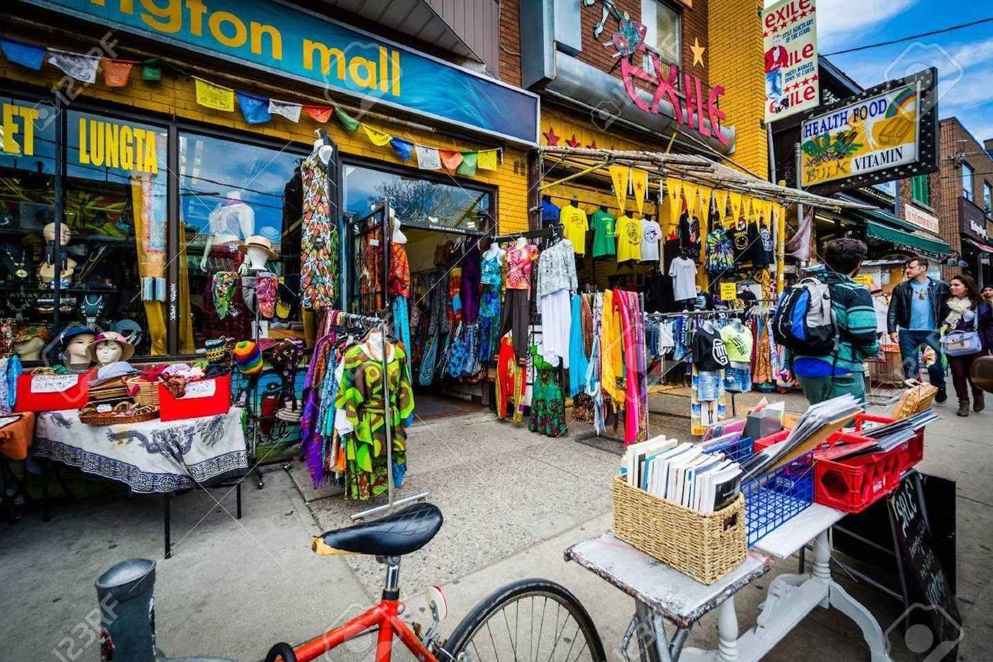
## Description Kensington Market is one of Toronto’s best-known neighborhoods for travelers who want atmosphere, variety, and a strong sense of place. It is not a traditional market in the narrow sense, but rather a dense urban district filled with independent shops, vintage clothing stores, grocers, cafés, bakeries, produce stands, restaurants, and street life that spills into the sidewalks. The area is famous for its mix of cultures and its long history as a neighborhood shaped by waves of immigration, creative entrepreneurship, and community reinvention. Walking through Kensington Market feels less like visiting a single attraction and more like stepping into a living collage of Toronto itself. What makes Kensington special is its refusal to feel polished in a predictable way. Its charm comes from variety, visual noise, and the sense that each storefront has its own personality. One block might be packed with produce, the next with music, used books, or handmade goods. Small alleyways and side streets often reveal murals, patios, and tiny surprises that reward unhurried visitors. The neighborhood also has a social rhythm of its own, especially on weekends when it becomes a magnet for browsers, food lovers, and people simply looking for a place that feels energetic and alive. One lesser-known aspect of Kensington Market is how strongly it reflects Toronto’s broader history of change. It has repeatedly adapted to new residents, new businesses, and shifting urban pressures while still preserving a distinctly independent feel. Another detail many first-time visitors miss is that Kensington is best experienced by combining observation with participation. The neighborhood is not only for looking at; it is for tasting, talking, trying, and wandering. A great visit often includes a snack, a coffee, a small purchase, and a few minutes spent people-watching from a curb or patio. Kensington Market is also a useful place to understand Toronto’s everyday creativity. It does not announce itself with monumental architecture or famous landmarks. Instead, it builds its identity from layers of storefront signage, murals, commerce, and community life. That makes it one of the city’s most authentic urban experiences, especially for travelers who prefer neighborhoods over tourist compounds. ## Location Kensington Market is in downtown Toronto, Ontario, close to Chinatown, the University of Toronto area, and several of the city’s central neighborhoods. Its location makes it easy to reach from much of central Toronto by streetcar, subway, bus, taxi, rideshare, or on foot if you are already nearby. Because the streets are compact and the area is highly walkable, most visitors explore it best on foot once they arrive. If you are planning a broader downtown day, Kensington pairs naturally with nearby cultural areas, galleries, food stops, and city walking routes. For visitors staying in the core, it is one of the easiest districts to add to an itinerary without needing a car. Public transit is usually the most practical option, and because parking can be limited or inconvenient, it is often better to leave the car behind entirely. ## Tips Go hungry and keep your schedule flexible. Kensington Market is one of the best neighborhoods in Toronto for spontaneous eating, browsing, and detours. If you try to over-plan the experience, you may miss what makes it fun. The best visits usually happen when you leave room for unplanned discoveries, whether that means a bakery stop, a vintage find, or a street musician drawing a crowd. Visit at different times if you can. Weekdays can feel more relaxed, while weekends are livelier and more crowded. Both moods have value, and the best choice depends on whether you want a calmer wander or a more animated urban scene. Morning visits are often easier if you want to take in the shops before they become too busy. Wear comfortable shoes. Kensington is compact, but it encourages a lot of walking, stopping, and turning into side streets. If you are interested in photography, the neighborhood is rich in texture, but be respectful of businesses and residents while you shoot. Try to support local vendors when you can, because the district’s character depends on the continued presence of independent operators. Do not expect uniformity. Some visitors want one clear “best” thing to do, but Kensington works differently. The point is the accumulation of impressions. The neighborhood is most rewarding when you let its diversity define the visit. ## Conclusion Kensington Market is one of Toronto’s essential neighborhoods, offering food, culture, and urban character in one dense and memorable walk. It is ideal for travelers who want to see the city through everyday life rather than landmarks alone. ## FAQ ### Is Kensington Market a real market? It is more accurately described as a neighborhood with a historic market identity rather than a single enclosed marketplace. Visitors come for the district’s shops, food, and street atmosphere. ### How long should I spend there? A short visit can take an hour, but two to four hours is better if you want to browse, eat, and explore side streets. Many travelers end up staying longer than planned. ### Is it expensive? It depends on where you stop. You can spend very little by simply walking around, but food, vintage goods, and specialty items can range from affordable to premium depending on the business. ### Is it family-friendly? Yes, especially during daytime hours. Families often enjoy the food variety, the pedestrian-friendly feel, and the colorful street life. ### What is the best way to experience it? Walk slowly, sample something local, and leave room for curiosity. Kensington is best when you treat it as a neighborhood to be explored rather than a checklist of attractions. ## Links - [Wikipedia](https://en.wikipedia.org/wiki/Kensington_Market)
GemVoyage Team • World
Porto
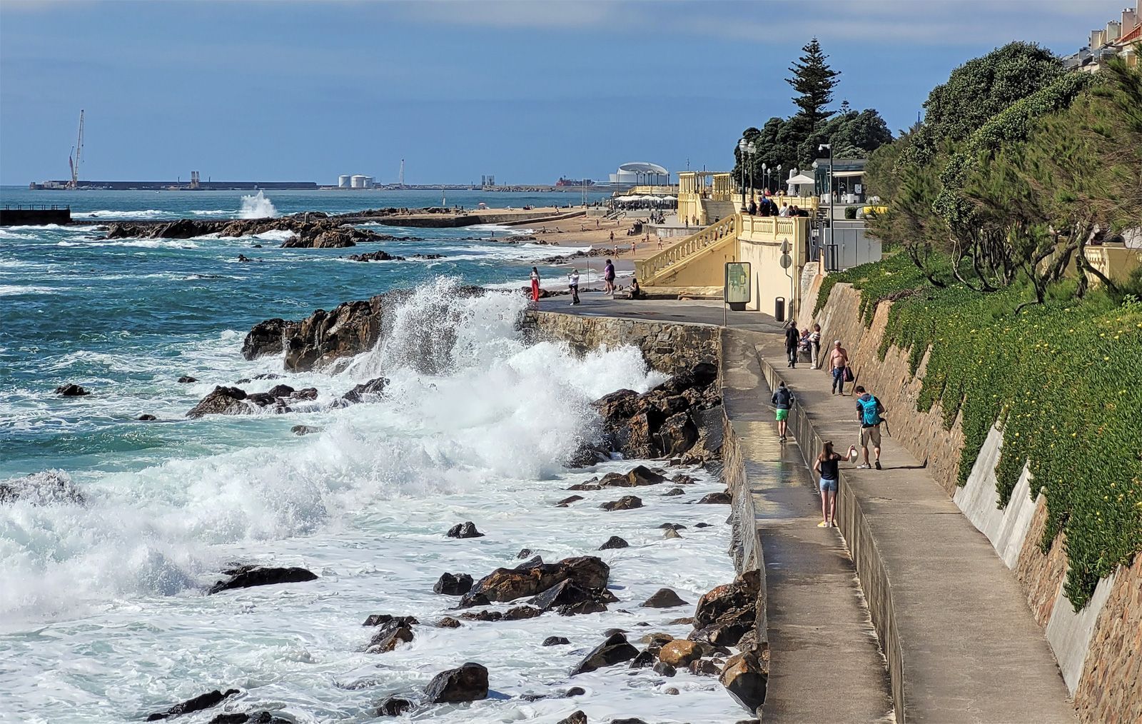
## Description Foz do Douro Promenade is one of the most enjoyable walks in Porto because it captures the city at its most open, breezy, and scenic. Located where the Douro River approaches the Atlantic Ocean, Foz do Douro is known for its waterfront paths, beaches, cafés, parks, and dramatic light. It gives visitors a different side of Porto from the historic center: less compact, more coastal, and shaped by wind, water, and long views rather than narrow medieval streets. The promenade is special because it lets you experience the transition from river to sea in a very direct way. The Douro's strong identity as a working river, a wine route, and an urban boundary becomes visible here, where the city meets larger natural forces. Walking the promenade, you can watch waves strike the seawall, see locals out for exercise or family time, and move between beaches, lighthouses, and garden spaces. It is one of those urban landscapes that works equally well for slow contemplation and active strolling. One little-known fact is that Foz has long been associated with leisure and summer life among Porto residents, especially as the city expanded and more people began seeking breezy coastal escapes close to home. Another detail many visitors miss is the extent to which the area changes mood with the weather. On a clear day, Foz feels luminous and expansive; on a windy day, it becomes dramatic and powerful. The promenade is therefore not just a route but an experience shaped by the Atlantic itself. The area also reveals a lot about Porto's identity. The city is often celebrated for its historic center and wine cellars, but Foz shows a different and equally important side: a living, modern waterfront where people come to walk, cycle, talk, and watch the sea. If you want a place in Porto that combines fresh air, urban life, and landscape, this is one of the best choices. ## Location Foz do Douro is a district in Porto, in the Norte region of Portugal, located at the mouth of the Douro River where it opens toward the Atlantic Ocean. The promenade runs along the waterfront in the western part of the city, making it farther from the old center than Ribeira but still easy to reach by public transport, taxi, or a scenic walk if you have time. One of the easiest ways to get there is by bus or tram, especially if you want to enjoy the trip without worrying about parking. Walking from the riverfront is possible and rewarding if you have a full day, but most visitors will prefer a shorter transfer followed by a long, leisurely walk along the coast. The route can be combined with stops at beaches, gardens, and small cafés along the way. For orientation, think of the promenade as a westward extension of Porto's river story. It is a place to end the day, not just begin it, because sunset and late afternoon light are especially beautiful here. ## Tips Choose a clear or mildly windy day if you want the best experience. The promenade is pleasant in many conditions, but it is most memorable when the sky and sea are visible in full color. Bring a light jacket even in warm weather. The Atlantic can cool the air quickly, especially near evening, and visitors often underestimate how different the climate feels compared with Porto's inland streets. If you enjoy a slower pace, start near the river mouth and walk toward the beaches and garden areas. That direction helps you experience the transition from urban river edge to open sea more naturally. Use the promenade as a break from sightseeing density. Porto's historic center can feel packed with monuments and steep lanes, while Foz offers breathing room and a chance to enjoy the city in a more relaxed frame. ## Conclusion Foz do Douro Promenade is one of Porto's best places for a scenic walk, combining sea air, river views, and a calm waterfront atmosphere that contrasts beautifully with the city's historic core. ## FAQ ### Why do people visit Foz do Douro? People visit for the seaside atmosphere, promenade walks, beaches, cafés, and the chance to see where the Douro River meets the Atlantic. ### Is Foz do Douro good for sunsets? Yes. The area is one of the best places in Porto for evening light and coastal views. ### Can I walk or cycle there? Yes. The waterfront is ideal for walking and cycling, and both locals and visitors use it for exercise and leisure. ### How far is it from downtown Porto? It is farther than the central historic districts, but still easy to reach by public transport or taxi. ## Links - [Porto tourism](https://visitporto.travel/) - [Wikipedia article](https://en.wikipedia.org/wiki/Foz_do_Douro)
GemVoyage Team • World
Mexico City
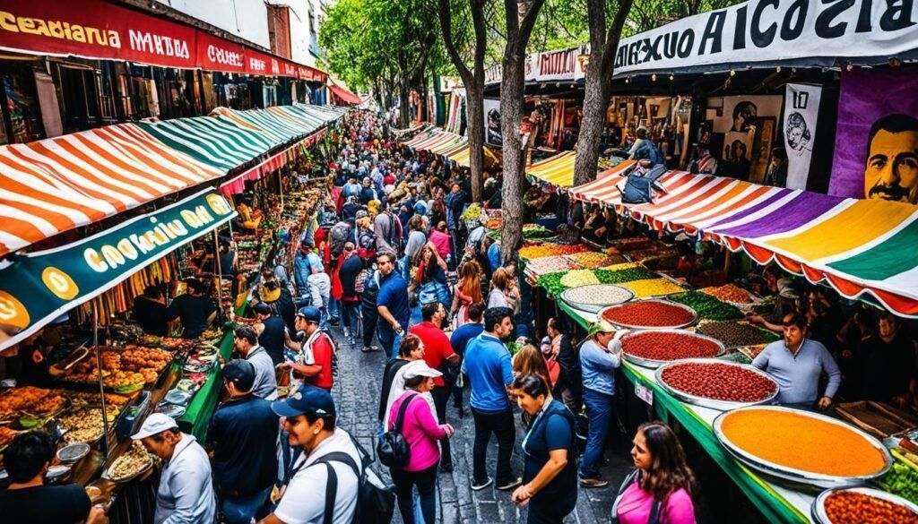
## Description The Coyoacán Market is one of the most atmospheric places in Mexico City for experiencing neighborhood life, local food, and a strong sense of cultural identity. Located in the historic district of Coyoacán, the market is more than a place to buy ingredients or snacks. It is a lively social space where residents, visitors, and vendors interact in a setting that feels deeply rooted in daily life. What makes the market stand out is the combination of color, aroma, and pace. You can move between stalls offering traditional food, produce, sweets, crafts, and everyday goods while hearing the sounds of bargaining and conversation around you. The experience is lively but not sterile, and that makes it especially appealing for travelers who want to feel the city rather than simply observe it. One lesser-known fact is that Coyoacán itself has long had a strong artistic and intellectual identity, which gives the market a broader cultural backdrop than many food markets. Another is that some visitors come for classic Mexican street food and stay because the market also acts as a gateway to the district's broader historic center, where plazas, museums, and cafes are all close by. That makes it easy to turn a market stop into a full neighborhood visit. The food is the heart of the experience. You will usually find tacos, antojitos, fresh juices, sweets, and regional specialties that reflect the diversity of Mexico's culinary traditions. For many travelers, the market becomes one of the most memorable meals of the trip because the setting feels unfiltered and alive. There is a practical pleasure in eating where locals eat and seeing how food organizes everyday routines. The market also works well as a cultural snapshot. It is not just about buying something; it is about watching the choreography of vendors, families, and visitors moving through a shared space. That social energy is what gives the market its depth. Even if you spend only an hour there, you leave with a better understanding of the neighborhood's texture. If you are exploring Mexico City and want a place that combines food, atmosphere, and local identity, Coyoacán Market is an excellent stop. It is energetic without being overwhelming and grounded in a neighborhood that already feels rich with history. ## Location The Coyoacán Market is located in the Coyoacán district of southern Mexico City, Mexico, near the historic center and other local attractions. The easiest way to get there is by taxi, ride-hailing service, or public transit followed by a short walk. Because Coyoacán is a popular destination, weekend visits can be busy, so timing matters if you want a smoother experience. ## Tips Go hungry. The market is one of the best places in the area to sample local food. Carry small bills and some cash, as many vendors may prefer it for quick purchases. Visit earlier in the day for a fresher, less crowded experience. Explore beyond the market itself and spend time in the surrounding Coyoacán streets and plazas. If you are trying several foods, share dishes with companions so you can taste more without overdoing it. Be prepared for crowds, especially on weekends and holidays. ## Conclusion Coyoacán Market is a lively and flavorful introduction to one of Mexico City's most characterful districts, blending food, local commerce, and neighborhood culture in one place. ## FAQ ### What can I buy at Coyoacán Market? You can find food, produce, sweets, crafts, and everyday household items. ### Is it mainly for tourists? No, it remains a real neighborhood market used by locals as well as visitors. ### What food should I try there? Traditional tacos, antojitos, fresh juices, sweets, and regional snacks are good starting points. ### Is the market close to other attractions? Yes, it is well placed for combining with the rest of Coyoacán's historic center. ## Links - [Coyoacán](https://en.wikipedia.org/wiki/Coyoac%C3%A1n) - [Mexico City](https://en.wikipedia.org/wiki/Mexico_City) - [Mexico City tourism](https://mexicocity.cdmx.gob.mx/)
GemVoyage Team • World
Brussels
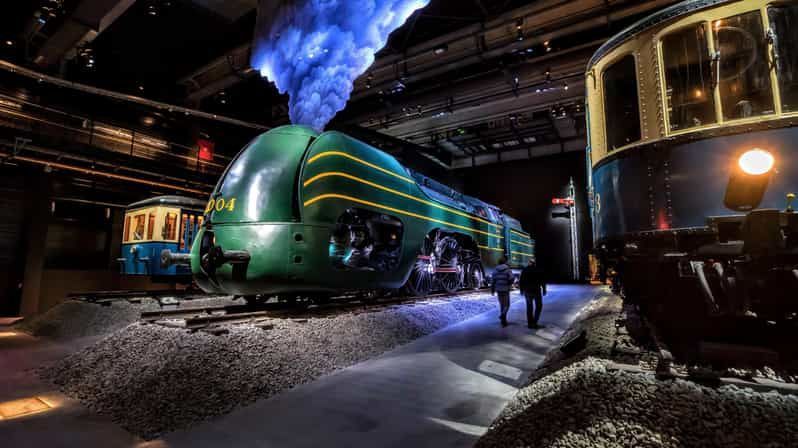
## Description Train World Museum is one of Brussels’ most distinctive museums because it turns rail history into a deeply immersive experience rather than a purely technical one. Located in the restored Schaerbeek railway station, the museum brings together locomotives, carriages, railway objects, design elements, and historical storytelling in a space that feels both monumental and accessible. For travelers who enjoy transport history, industrial heritage, or design, it is a standout attraction. Even for visitors who are not railway enthusiasts, the scale and presentation make it remarkably engaging. What makes Train World especially strong is how it balances spectacle and interpretation. You are not simply looking at engines behind barriers. You move through environments that explain the role of rail in Belgian life, the evolution of travel, and the aesthetics of the railway age. A lesser-known fact is that the museum occupies an architectural setting of real importance, since the station itself contributes to the atmosphere and historical context. Another detail many visitors find interesting is the way the museum uses lighting, layout, and display composition to make trains feel almost theatrical, which helps even casual visitors appreciate the engineering and cultural significance behind them. The collection includes both historic rolling stock and broader narratives about mobility, labor, and national development. That means the museum is not just about machines; it is about how railways reshaped cities, connected regions, and changed the way people moved through Europe. In Belgium, a country with a dense rail network and a deep industrial past, that story matters. Train World captures it in a way that feels serious without becoming dry. The museum also works well as a family stop because it offers enough visual drama to keep children interested while still rewarding adults who want historical context. It is one of those places where the experience is stronger than you may expect from the outside. ## Location Train World Museum is located in Schaerbeek, Brussels-Capital Region, Belgium, at the restored Brussels-Schaarbeek railway station. The site is northeast of central Brussels, making it easy enough to reach without being in the busiest tourist core. The station setting reinforces the museum’s subject matter and gives the visit a strong sense of place. The easiest way to reach Train World is by train, tram, or other public transport from central Brussels. Because it is a railway museum in a real railway station, arriving by rail is especially fitting and often the most straightforward option. Once you arrive, the museum is easy to navigate, and the surrounding area is manageable for a combined transport-and-history outing. It is a good idea to set aside enough time to move through the whole exhibition at a relaxed pace. The museum is richer when you let the sequence unfold naturally rather than rushing straight to the largest locomotives. ## Tips Allow at least two hours if you want to appreciate the museum properly. Go with children or transport enthusiasts if you can, but do not assume it is only for specialists. The presentation is strong enough for general visitors. Pay attention to the station architecture as well as the trains. The setting is part of the story. Check opening times in advance, especially if you are building it into a broader Brussels itinerary. If you enjoy design, photography, or industrial history, spend extra time with the details rather than rushing between the biggest exhibits. ## Conclusion Train World Museum is one of Brussels’ most impressive museums, combining railway heritage, architectural atmosphere, and thoughtful presentation. It is an excellent choice for travelers who want a museum that feels distinctive and memorable rather than generic. ## FAQ ### Is Train World only for train enthusiasts? No. It is enjoyable for anyone interested in history, design, transport, or immersive museum experiences. ### How much time should I plan? About 2 to 3 hours is a comfortable visit length for most people. ### Is it easy to reach from central Brussels? Yes. Public transport makes it straightforward, and arriving by train is especially appropriate. ### Is the museum suitable for families? Yes. The large-scale displays and varied presentation make it family-friendly and engaging for many age groups. ## Links - [Train World official site](https://trainworld.be/en/) - [Train World on Wikipedia](https://en.wikipedia.org/wiki/Train_World)
GemVoyage Team • World

Copenhagen
## Description The Hans Christian Andersen Experience in Copenhagen is a cultural attraction dedicated to one of Denmark’s most famous figures and one of the world’s most influential storytellers. Rather than functioning as a traditional museum, the experience is designed as an immersive walk-through journey that brings Andersen’s life and fairy tales to life through sets, soundscapes, projections, and storytelling elements. Visitors are invited to step directly into the imaginative universe behind timeless stories such as *The Little Mermaid*, *The Ugly Duckling*, and *The Emperor’s New Clothes*. What makes the Hans Christian Andersen Experience unique is its narrative-driven design. Instead of focusing heavily on historical artifacts, the attraction emphasizes emotion, atmosphere, and imagination, mirroring the way Andersen himself told stories. Visitors move through scenes inspired by both his personal life and his fictional worlds, gaining insight into how his hardships, travels, and observations shaped his writing. A little-known fact is that Andersen struggled with poverty and social insecurity early in his life, themes that quietly echo throughout many of his fairy tales. Another lesser-known detail is that some installations are inspired by Andersen’s own paper cuttings, an art form he practiced privately and which reflects his intricate creative mind. This experience appeals to both adults and children, offering a reflective and engaging way to understand why Andersen’s stories continue to resonate across cultures and generations. ## Location The Hans Christian Andersen Experience is located in **Denmark**, in the **Capital Region**, within the city of **Copenhagen**. It sits in the historic city center, close to City Hall Square (Rådhuspladsen) and within walking distance of Tivoli Gardens and Strøget, Copenhagen’s main shopping street. Getting there is easy using public transportation. The nearest metro stations are **Rådhuspladsen** and **Gammel Strand**, both a short walk away. Numerous buses also stop nearby. For visitors already exploring central Copenhagen, the attraction is conveniently reached on foot or by bicycle, which is a popular way to get around the city. ## Tips * Allow about one hour for your visit, though literature enthusiasts may want more time to explore each section carefully. * The experience is largely indoors, making it a good option during colder or rainy weather. * Some displays rely on lighting and sound effects, which may feel intense for very young children. * Photography is usually allowed, but flash may be restricted in certain areas. * Combine your visit with nearby attractions such as Tivoli Gardens or a walk through the historic city center. * Reading a few Andersen fairy tales beforehand can enhance your appreciation of the scenes and references. ## Conclusion The Hans Christian Andersen Experience offers a thoughtful and imaginative introduction to Denmark’s most beloved storyteller. Through immersive design and emotional storytelling, it allows visitors to connect with both the man and the fairy tales that shaped global literature. ## FAQ **Is the Hans Christian Andersen Experience suitable for children?** Yes, it is suitable for children, though some darker fairy-tale themes may be better appreciated by older kids. **How long does the visit take?** Most visitors spend around 45 minutes to one hour inside the experience. **Is the experience available in English?** Yes, information and displays are available in English, along with other major languages. **Is this a traditional museum?** No, it is an immersive storytelling experience rather than an artifact-based museum. **Do I need to book tickets in advance?** Advance booking is recommended during peak tourist seasons, though walk-in tickets are often available. ## Links * [Hans Christian Andersen Experience Official Website](https://www.visitcopenhagen.com/copenhagen/planning/hans-christian-andersen-experience-gdk591356)
GemVoyage Team • World

Comments