Discover extraordinary places shared by our community of travelers
Aswan
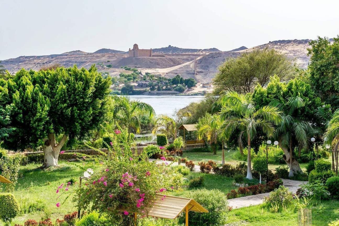
## Description The Aswan Botanical Garden is an unexpectedly verdant refuge on an island in the Nile, offering a cool, contemplative counterpoint to the monumental temples and quarries that dominate Upper Egypt’s tourism landscape. Its charm comes from a careful mix of cultivated plantings, winding pathways, and island vistas: palms, exotic trees, shaded pavilions, and thoughtfully placed seating invite visitors to slow down and enjoy the river breeze. For travelers who have spent mornings at temples and archaeological sites, the garden offers precisely the restorative pause many itineraries lack. Beyond leisure, the garden holds botanical and historical interest. Many plantings were introduced during the nineteenth and early twentieth centuries as part of botanical exchanges, and the site has long been associated with collection and study. The island location amplifies the sense of escape—the short boat journey from Aswan’s riverfront feels intentional and contributes to the visit’s narrative: you leave the bustling riverbank and step into a quieter, greener world. Birdlife, moving water, and the light across the Nile all combine to create a sensory experience that changes throughout the day. ## Location The garden is located on Kitchener’s Island (sometimes referred to historically in guidebooks), a short boat ride from Aswan’s main waterfront. Boat crossings take only a few minutes and are typically arranged through local boat operators, hotels, or Nile tour companies. Because the garden lies close to the city center, it can be combined easily with other Nile-side visits, including the Philae Temple boat ride or a felucca sail. Plan your visit for the morning or late afternoon when temperatures are milder and light is most flattering for photography. Midday in Upper Egypt can be intense, and shade is limited along some paths despite tree cover. ## Tips - Go in the cooler parts of the day—early morning or late afternoon are best for walks and photos. - Bring water, sunscreen, and a hat; shade is available but the sun can still be strong. - Arrange a reliable boat transfer—ask at your hotel or book through a reputable local operator. - Wear comfortable shoes: paths are mostly easy but can be uneven in places. - Combine the garden visit with nearby Nile-side sites to make the crossing feel part of a fuller river day. - Look for framed views through the trees toward the Nile; they make excellent photo opportunities and quiet spots to sit. ## Conclusion The Aswan Botanical Garden is a welcome respite for travelers who want a gentler pace amid an itinerary of temples and island tours. Its island setting, curated plantings, and tranquil riverside atmosphere create an appealing, low-effort stop that rewards slow exploration and quiet observation. ## FAQ ### Why visit a botanical garden in Aswan? It offers a distinctly different experience from archaeological sites: shade, plant variety, birdlife, and a slower pace that complements temple visits. ### How do I get there? Visitors reach the island by a short boat transfer from Aswan’s riverfront; boats are easy to arrange locally and typically take only a few minutes. ### Is it suitable for families? Yes. Wide paths and gentle walking conditions make the garden family-friendly, though bring water and sunscreen for young children. ### How much time should I spend there? One to two hours is usually enough for a relaxed visit; more time is pleasant for photography and lingering breaks. ### What should I bring for the visit? Comfortable shoes, water, hat, and sun protection; a camera and a small notebook are useful for nature observation. ## Links - [Wikipedia](https://en.wikipedia.org/wiki/Aswan_Botanical_Garden)
GemVoyage Team • World
Siberia
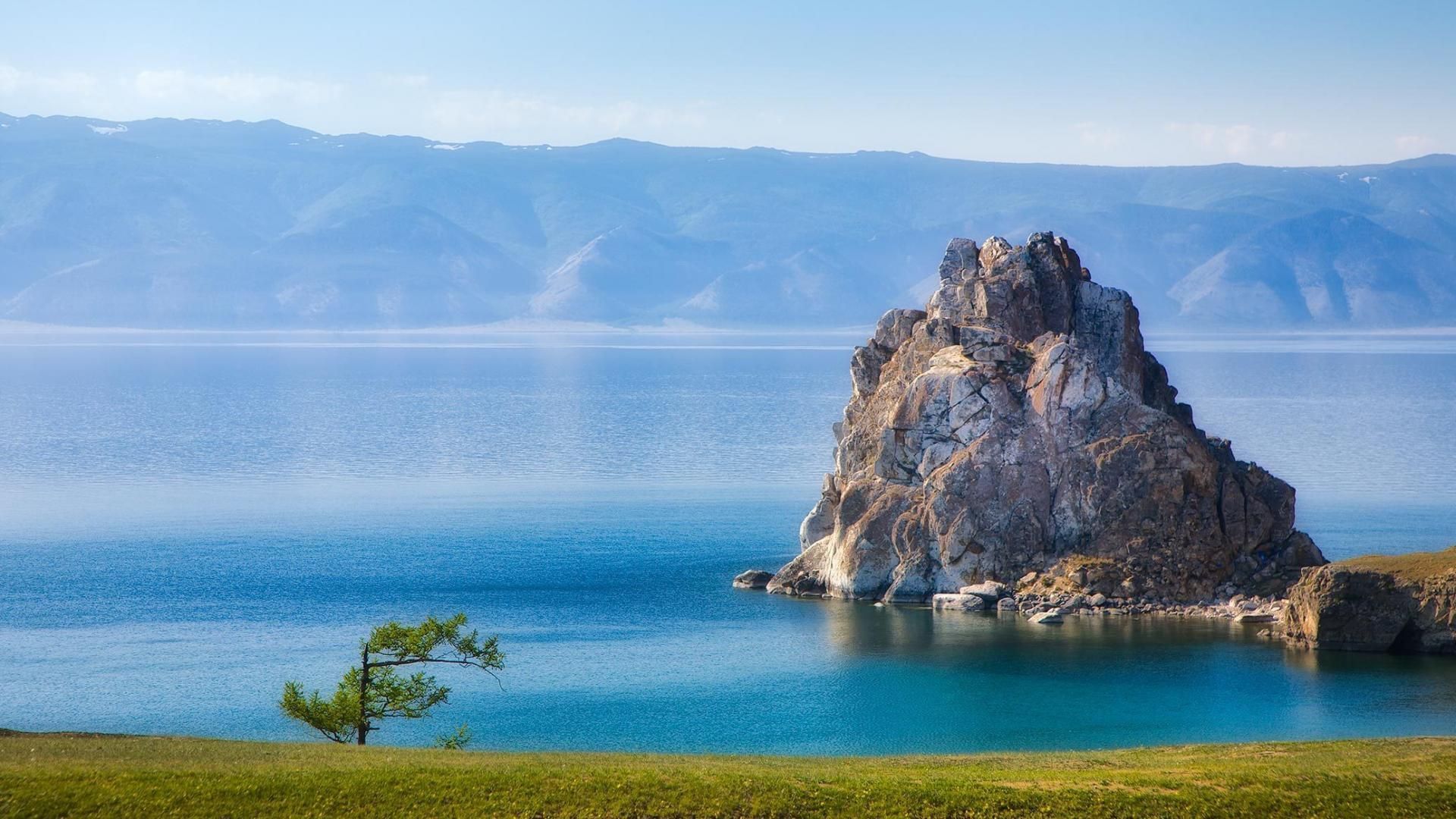
## Description Lake Baikal in southern Siberia is a global natural wonder: the world’s deepest and one of its oldest freshwater lakes, it holds roughly 20% of the planet’s unfrozen surface freshwater by volume. Stretching over 600 kilometers north-to-south and reaching depths of more than 1,600 meters, Baikal’s sheer scale is awe-inspiring. The lake’s crystalline waters, dramatic rifts, and seasonal extremes produce striking phenomena — from the unbelievable clarity of summer waters to the otherworldly expanses of transparent winter ice that allow you to walk, drive, or even ice-sail across a dazzling frozen surface. Baikal is also a hotspot of biodiversity and scientific interest. Its shoreline, submerged terraces, and deep basins host numerous endemic species found nowhere else on Earth, including the Baikal seal (nerpa) — the only seal species that has adapted to a fully freshwater environment — and dozens of endemic fish and invertebrates. The lake’s unique ecology is the result of millions of years of relative isolation, stable cold temperatures at depth, and complex nutrient cycling. Scientists study Baikal to better understand limnological processes, long-term climate records trapped in sediment layers, and the evolution of isolated ecosystems. For travelers, Baikal delivers a rare combination of dramatic landscapes and varied activities across seasons. In summer, the shoreline blooms with wildflowers, and mountain hikes and multi-day treks through taiga and steppe reveal panoramic views over the water. Kayaking, boat excursions, and shoreline camping let you sample the lake’s nearshore biodiversity and peaceful beaches. In winter, when the lake freezes, the surface becomes a vast frozen highway: locals and guides lead safe ice-walking excursions, cross-lake snowmobile trips, ice-fishing experiences, and festivals that celebrate the season. Photographers prize Baikal for its vivid ice formations, clear reflections, and light at dawn and dusk. Beyond natural spectacle, Baikal is threaded with human stories: small lakeside towns such as Listvyanka, the ferry-served Olkhon Island with its shamanic sites, and the city of Irkutsk — a historical gateway with Siberian wooden architecture and museums — are rich portals into local culture. Sustainable and low-impact travel is increasingly available via small-scale guesthouses, ecotour operators, and community-led tours that prioritize the lake’s protection. ## Location Lake Baikal spans the regions of Irkutsk Oblast and the Republic of Buryatia in Russia, with the lake forming a striking spine across southeastern Siberia. The city of Irkutsk is the primary gateway for international and domestic visitors, linked by the Trans-Siberian Railway and regional flights; it offers accommodations, museums, and transport connections. From Irkutsk, paved roads and seasonal bus services reach lakeside settlements like Listvyanka, Port Baikal, and the ferry terminals for Olkhon Island — the lake’s largest island and a cultural heartland with cliffs, shamanic sites, and small villages. Other access points include Ulan-Ude to the east and smaller regional airfields that connect via charter or seasonal flights. Travel times can be long, so many visitors plan multi-day itineraries that combine transit into the lake area with on-site exploration. ## Tips - **Respect seasonal access and local rules:** Ice travel and remote trails require local knowledge; always consult local guides and authorities before venturing onto the ice or into isolated areas. Safety equipment and up-to-date conditions are essential. - **Plan time for Olkhon Island:** Olkhon is a cultural and scenic highlight, with dramatic cliffs, shamanic sites, and small settlements. Allow several days to explore its coves, beaches, and sacred capes. - **Pack for extremes:** Even in summer, weather can shift quickly; bring layered clothing, waterproof shells, sturdy boots, sun protection, and insect repellent. In winter, prioritize thermal layers, insulated boots, and a reliable outer layer. - **Travel with experienced local guides:** Guides provide safety on ice crossings, access to lesser-known shorelines, wildlife-spotting skills, and cultural context about Buryat and Siberian heritage. Choose operators that practice sustainable tourism. - **Respect conservation rules:** Stick to marked paths, avoid disturbing nesting birds or haul-out sites, and follow Leave No Trace principles. Support local conservation initiatives when possible. - **Time your visit for activities:** Summer is best for hiking and kayaking; late spring and early autumn deliver fewer crowds and pleasant light; winter offers unique ice experiences but requires more planning. ## Conclusion Lake Baikal is both a living laboratory and a vast natural wonder: its depth, clarity, and ancient lineage make it one of Earth’s most singular freshwater realms. Whether you come for scientific curiosity, wilderness hiking, cultural exchange with lakeside communities, or simply to witness impossibly clear water and glass-like ice, Baikal rewards patient travel and respectful exploration. Plan carefully, choose sustainable operators, and allow enough time to move slowly around its bays and islands — the lake’s scale is best absorbed at human pace. ## FAQ - **Q: Can you swim in Lake Baikal?** A: Swimming is possible in summer at sheltered beaches and near lakeside villages, but the water remains cold even in peak months; stay near lifeguarded or popular swimming areas, enter gradually to avoid shock, and follow local safety guidance. - **Q: What is the best time to visit Lake Baikal?** A: Late June through September gives the warmest weather, flowering meadows, and easier trekking. Late winter (February–March) is ideal for ice-scenery photography and safe ice excursions when the ice is thickest and the light is crisp. Shoulder seasons offer quieter conditions. - **Q: How do I reach Olkhon Island, and do I need a vehicle?** A: Olkhon is reached via a seasonal ferry or ice road depending on the time of year. Many visitors rent 4x4 vehicles or join guided tours; public buses operate from nearby towns but capacity is limited. Plan logistics in advance, especially in peak season. - **Q: Are there wildlife viewing opportunities?** A: Yes—local guides can help you spot endemic fish species, waterbirds, and in protected offshore areas you may observe Baikal seals. Respect distance guidelines and avoid disturbing habitats. - **Q: Do I need special permits or visas to visit?** A: International visitors need a valid Russian visa. Some protected areas require entry fees or permits for camping and research; check with regional park authorities for up-to-date rules. - **Q: Is Internet and phone coverage available?** A: Coverage varies—cities like Irkutsk and larger settlements have decent mobile data; more remote shorelines and parts of Olkhon have limited connectivity. Prepare for periods offline and download maps or emergency contacts beforehand. ## Links -- [Lake Baikal — Wikipedia](https://en.wikipedia.org/wiki/Lake_Baikal)
GemVoyage Team • World
Ignalina
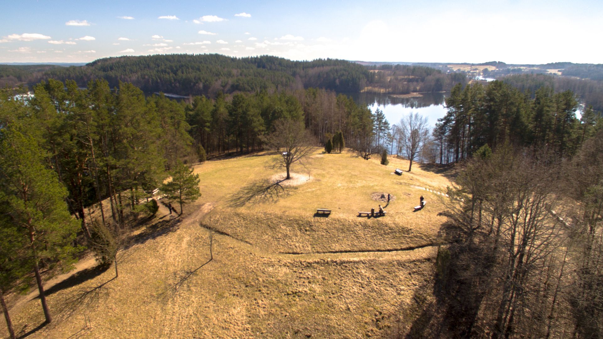
## Description Ladakalnis is a scenic hill in northeastern Lithuania, celebrated for panoramic views that sweep across a chain of lakes, boglands, and mixed forest typical of the Aukštaitija region. The hill’s exposed viewpoints reveal an interlocking pattern of water and woodland that feels deeply characteristic of the Baltic landscape—quiet lakes framed by birch and pine, rippling reed beds, and a largely undeveloped horizon that invites contemplative walks and photography. Beyond its scenic value, Ladakalnis carries cultural resonance. Historically a meeting place and, in local traditions, associated with pre-Christian ritual activities, the hill has hosted small folklore events and seasonal gatherings through the centuries. Modest archaeological traces nearby suggest long-term human use of the area, while modern conservation efforts keep the trails accessible and the ecosystem intact. Visitors come for sunrise and sunset views, birdwatching, and gentle hikes that do not require advanced equipment but repay visitors with memorable vistas. ## Location Ladakalnis sits near the town of Ignalina in Utena County, northeastern Lithuania, within the broader area associated with Aukštaitija National Park and its lakes. The region is popular with nature enthusiasts for its clean waters, preserved shorelines, and well-managed recreational infrastructure. Access is easiest by car from Ignalina or nearby towns; local roads and signage lead to modest parking areas close to the trailhead. Public transport options may include regional buses to Ignalina, after which a short taxi ride or arranged shuttle can bring you to the site. Because the area is rural, plan transfers in advance if you do not have a private vehicle. ## Tips - **Time your visit for light and solitude:** Sunrise and late afternoon provide the best light for photography and the calmest atmosphere. - **Bring optics and field guides:** Binoculars and a basic bird or plant guide enhance the experience for birdwatching and identifying regional flora. - **Wear good footwear:** Paths can be rocky and uneven in places—sturdy shoes or trail runners are recommended. - **Pack essentials:** Carry water, snacks, and weather-appropriate layers; top facilities may be limited. - **Combine with nearby nature activities:** Pair this short hike with a boat excursion, a canoe trip, or additional trails in Aukštaitija National Park for a fuller outdoor itinerary. ## Conclusion Ladakalnis is an inviting short excursion that rewards modest effort with expansive Baltic panoramas. It’s well suited for photographers, families, and hikers seeking a contemplative outdoor experience anchored in both scenic beauty and local tradition. ## FAQ - **Q: How difficult is the hike to the summit?** A: The walk is moderate and accessible to most visitors with basic fitness; trail length and gradient are manageable but wear suitable footwear. - **Q: Are the trails clearly marked?** A: Local paths and signage guide visitors to the viewpoint, though markers can be sparse in places—carry a map or GPS track if you prefer added reassurance. - **Q: Is camping allowed near Ladakalnis?** A: Wild camping is generally discouraged in protected zones—use established campsites in Aukštaitija National Park and follow local regulations. - **Q: When is the best time for birdwatching?** A: Spring migration and early summer offer abundant bird activity; dawn and dusk are particularly productive for raptors and waterbirds. - **Q: Are there restroom or food facilities?** A: Facilities at the top are limited. Plan to bring water and snacks or return to nearby towns for services. ## Links -- [Ladakalnis](https://www.aparkai.lt/en/sightseeing-places/ladakalnis/)
GemVoyage Team • World
Milan
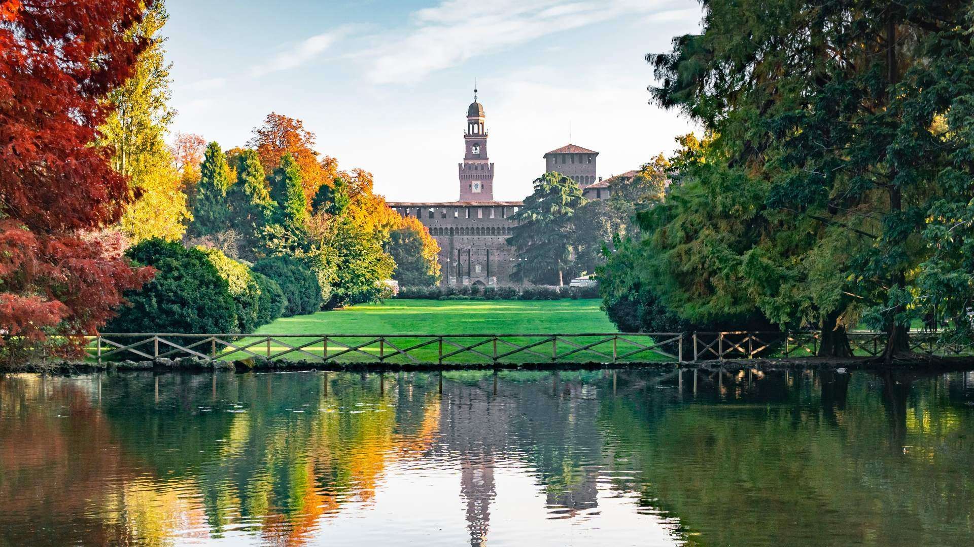
## Description Parco Sempione is one of Milan’s most important green spaces, and it plays a role in the city that is both practical and symbolic. Located behind Castello Sforzesco and stretching toward the Arco della Pace, it gives locals and visitors a place to slow down inside a city better known for fashion, business, design, and heavy urban energy. What makes the park special is not only its size but also its position in the middle of central Milan, where it creates a calm visual and physical transition between major landmarks. It is one of those places that can make a fast-moving city feel manageable again. The park is popular for walks, picnics, jogging, and informal meetings, but it also has layers of civic history that many visitors overlook. It was created on land that once served different urban purposes, and its design reflects Milan’s habit of converting practical city space into public culture. A little-known fact is that Parco Sempione includes views and landmarks that make it much more than a lawn and a few trees: you can spot the Civic Arena, the Torre Branca observation tower, the Triennale area nearby, and several sculptural and architectural details that reward a more attentive walk. Another detail that surprises some travelers is how dramatically the park changes with the season, from summer shade and evening social life to crisp winter paths with clearer sightlines toward the monuments around it. Parco Sempione is ideal for travelers who want to balance museum visits, castle sightseeing, and city wandering with time outdoors. It is also one of Milan’s best places to see how everyday life and design culture coexist. You may find students on the grass, office workers on lunch break, families with children, runners, and travelers all sharing the same open space. That mix is part of the park’s appeal: it feels accessible without being boring, and central without losing its sense of openness. ## Location Parco Sempione is in central Milan, Lombardy, Italy, directly behind Castello Sforzesco and close to the Arco della Pace. Because of its location, it is easy to combine with a visit to the castle, nearby museums, or the Brera district. The park is well connected by public transport. Metro stations such as Cairoli and Lanza are convenient starting points, and several tram and bus lines stop nearby. If you are already exploring central Milan on foot, reaching the park is straightforward. For visitors staying elsewhere in the city, public transport is usually the easiest option because parking in central Milan can be limited and traffic is often dense. Once inside the park, walking is the best way to explore. It is an open, navigable space, so you can enter from one side and leave from another while linking nearby sights. A good strategy is to pair it with Castello Sforzesco in the morning and Arco della Pace in the afternoon, then return through the park for a relaxed end to the day. ## Tips - Visit in the late afternoon or near sunset for the best light and the most pleasant atmosphere. - Climb Torre Branca if you want a panoramic view over Milan and the park itself. - Bring a picnic if the weather is good, because the park is one of the city’s best informal outdoor breaks. - Pair the park with nearby cultural stops so the day feels balanced rather than rushed. - In summer, use the park as a cooling pause between indoor visits. - Keep an eye out for local events and outdoor gatherings, which can make the space feel even livelier. ## Conclusion Parco Sempione is one of Milan’s easiest and most rewarding places to enjoy fresh air in the center of the city. It links major landmarks, offers a welcome break from urban intensity, and works well for both short visits and longer relaxed walks. ## FAQ ### Is Parco Sempione good for families? Yes. It is a family-friendly space with wide paths, open lawns, and plenty of room for a relaxed visit. ### What landmarks are near the park? Castello Sforzesco, Arco della Pace, Torre Branca, and the Triennale area are among the most important nearby sights. ### Is Parco Sempione free to enter? Yes. The park is a public space and can be visited freely. ### When is the best time to go? Late afternoon, spring, and early autumn are especially pleasant, though the park works in every season. ## Links - [Wikipedia](https://en.wikipedia.org/wiki/Parco_Sempione) - [City of Milan](https://www.comune.milano.it/)
GemVoyage Team • World
Jeju
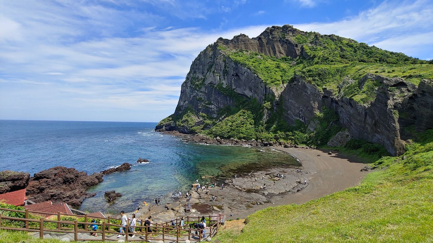
## Description Jeju Island, off South Korea’s southern coast, is a volcanic island known for Hallasan (a volcanic shield and South Korea’s highest mountain), lava tubes, basalt cliffs and distinctive stone walls. The island’s mix of beaches, rugged coastlines like Jusangjeolli, and cultural attractions (women divers known as haenyeo, folk villages and tangerine orchards) creates a varied visitor experience. Jeju’s volcanic geology also supports extensive lava tube systems (a UNESCO World Heritage feature) and scenic peaks that reward hikers and geotourists alike. Jeju’s character is both natural and cultural: haenyeo divers have shaped coastal traditions for generations, while island produce — particularly tangerines and seafood — influences local cuisine. The island’s microclimates mean you can experience contrasting conditions across short distances: misty highland mornings on Hallasan and temperate breezes on coastal beaches the same day. For outdoor enthusiasts, Jeju offers crater rims, coastal walking trails, and extensive cycling routes that reveal cliffs, hidden coves and agricultural terraces. In addition to natural features, Jeju preserves a strong vernacular culture: folk villages, stone statues (dol hareubang) and cultural festivals highlight island identity. Conservation efforts balance tourism with environmental protection, and community-based tourism initiatives allow visitors to learn about haenyeo traditions and local crafts while supporting sustainable livelihoods. ## Location Jeju Island (Jeju-do) sits about 100 km south of the Korean Peninsula and is accessible via frequent flights from Seoul, Busan and select international cities, as well as ferries from nearby ports. Jeju City and Seogwipo serve as principal hubs for exploration, with major roads connecting coastal attractions and national park trails. ## Tips - **Rent a car for flexible exploration:** Public buses cover major routes but can be slow for visiting remote sites. Renting a car gives you access to trailheads and quiet coves. - **Plan hikes on Hallasan and coastal trails in advance:** Popular trails may require permits or early starts; check trail conditions and weather before ascending. - **Try local cuisine and farm visits:** Sample Jeju black pork, fresh seafood, and citrus-based products. Farm and orchard visits offer seasonal experiences like tangerine picking. - **Respect haenyeo traditions and regulations:** Observe diving zones from designated viewpoints and book community-led experiences to learn about their craft responsibly. - **Choose quieter seasons for hiking and photography:** Spring blossom and autumn colors provide excellent conditions with fewer crowds than peak summer beach season. ## Conclusion Jeju Island blends accessible volcanic landscapes with resilient island culture, making it an ideal destination for active exploration and relaxed coastal time. Whether you favor volcanic hikes, coastal drives, cultural immersion with haenyeo communities, or sampling island cuisine, Jeju rewards travelers with variety, scenic contrasts and approachable outdoor adventures. ## FAQ - **Q: When is the best time to visit Jeju for hiking and mild weather?** A: Spring (April–June) and autumn (September–November) offer mild temperatures, clear skies and lower humidity — ideal for hiking and outdoor photography. - **Q: Are the lava tubes and Hallasan summit accessible to casual visitors?** A: Many lava tube sections are set up with visitor facilities and guided tours; Hallasan hikes range from short trails to challenging summit routes that require good fitness and early starts. - **Q: Is it easy to get around Jeju without a car?** A: Public buses cover major routes but can be slow for visiting remote sites. Renting a car is the most convenient option for flexible itineraries. - **Q: What cultural experiences should I prioritize?** A: Visit a haenyeo cultural center, explore folk villages, try local markets and attend seasonal festivals for authentic cultural encounters. - **Q: How family-friendly is Jeju?** A: Very — many sites are suitable for families, with beaches, theme attractions and short nature walks; always plan for sun protection and weather variability. ## Links - [Jeju Island — Wikipedia](https://en.wikipedia.org/wiki/Jeju_Island)
GemVoyage Team • World
Arequipa
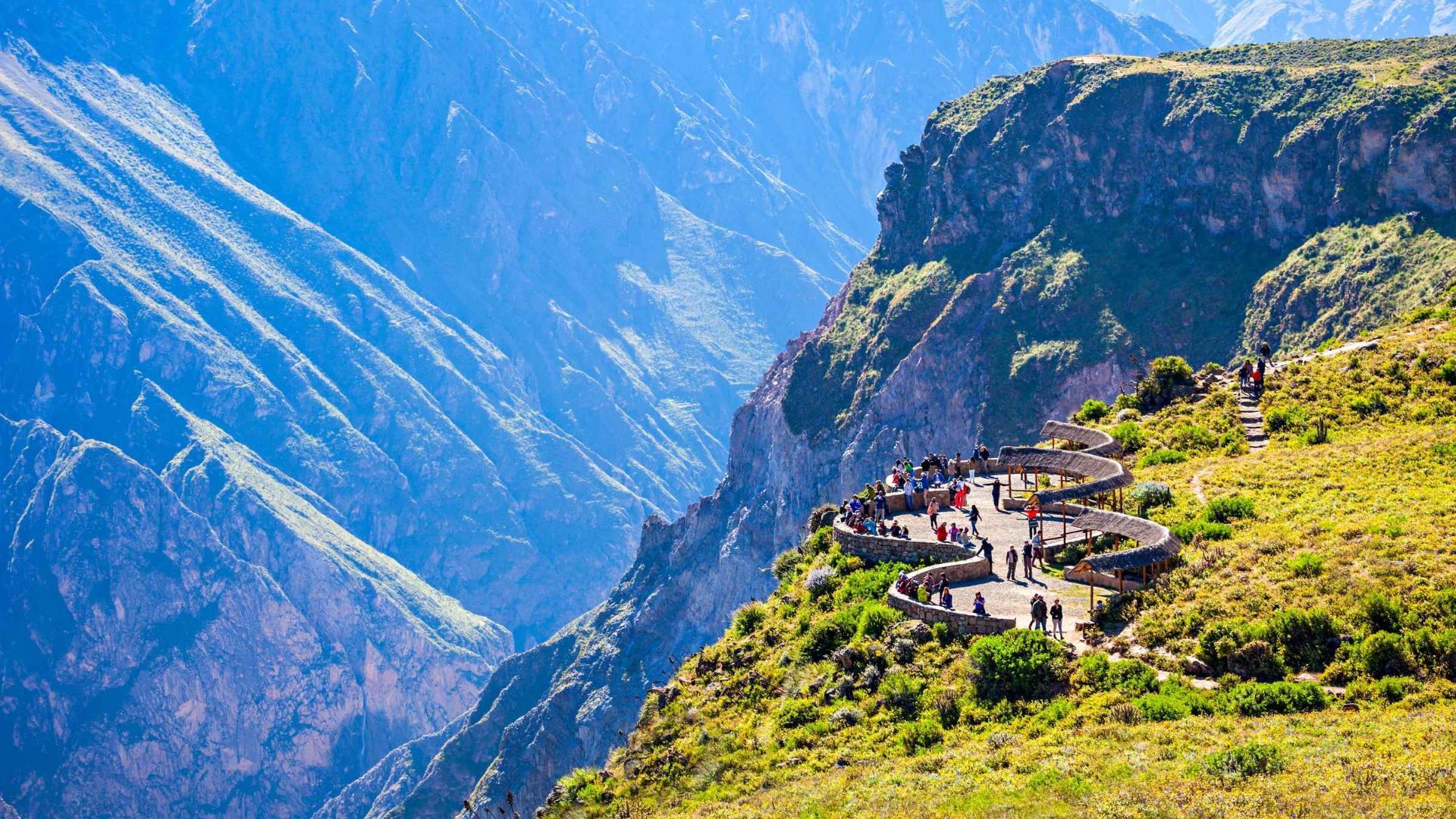
## Description Colca Canyon in southern Peru is one of the world’s deepest and most dramatic canyons, carved by the Colca River through folded volcanic and sedimentary rocks. Terraced agriculture clings to canyon walls and reflects centuries of pre-Columbian and colonial land-use systems. The canyon is famed for condor-watching at viewpoints such as Cruz del Cóndor, where giant Andean condors ride thermal updrafts above layered ridges and terraced fields. Beyond the condors, Colca’s cultural landscape includes traditional villages where residents manage terraces, raise llamas and alpacas, and produce woven textiles. Travelers can combine wildlife viewing with multi-day treks, hot-spring relaxation, and market visits to towns like Chivay for local crafts and regional cuisine. For planning and indexing, useful phrases include "Colca Canyon trek routes," "Cruz del Condor sunrise," and "Colca homestay lodges." Ecological and cultural stewardship: Local communities practice terrace maintenance and rotational agriculture that preserves soil stability and biodiversity. Sustainable tourism operators contribute to local economies through guide employment, community lodges, and cultural exchanges—seek providers who collaborate directly with village associations. ## Location Colca Canyon lies west of Arequipa city in southern Peru; the closest base towns are Chivay and Cabanaconde. Most visitors travel from Arequipa by bus or private transfer, often overnighting to catch morning condor flights. How to get there: Overnight buses and private transfers from Arequipa are common options; the journey includes scenic highland landscapes and stops at viewpoints and small towns. For multi-day treks, many itineraries begin from Cabanaconde or Sangalle (the oasis), and local guides provide route knowledge, porters, and camp logistics when necessary. Use search queries like "Arequipa to Colca Canyon bus" or "Cabanaconde trek guide" to find up-to-date transport and trekking services. Altitude and health: The Colca region ranges above 3,000 meters—allow time to acclimatize in Arequipa or the highlands, stay hydrated, and moderate exertion to reduce altitude-related risks. Cold nights are common; pack suitably warm layers for overnight treks or village stays. ## Tips - **Arrive early for condors:** Dawn and early morning hours produce the most reliable thermals and large condor flight displays at Cruz del Cóndor. - **Consider multi-day treks:** The canyon supports multi-day hikes with village homestays, campsites, and lodges for immersive experiences beyond the main lookout points. - **Hire local guides:** Guides provide route safety, cultural context, and community support; choose operators that compensate villages and porters fairly. - **Visit local markets and hot springs:** Chivay offers markets for textiles and crafts, while nearby hot springs provide a relaxing complement to trekking. - **Acclimatize to altitude:** Spend at least a night in Arequipa or another high-altitude town before strenuous activities and avoid rapid ascent. - **Respect cultural protocols:** Ask permission before photographing people or domestic rituals and buy crafts directly from artisan cooperatives when possible. ## Conclusion Colca Canyon combines a spectacular natural theater with enduring human landscapes—terraced agriculture, weaving traditions, and the Andean condor spectacle create a layered experience for travelers seeking wildlife, culture, and trekking. When planning, use targeted searches like "Colca Canyon 3-day trek" or "best condor viewpoints" to shape an itinerary that balances adventure with community benefits. ## FAQ - **Q: What’s the best time to see condors?** A: Early morning as thermals form (shortly after sunrise) is when condors are most active; clear weather improves visibility but conditions vary seasonally. - **Q: Are guided treks recommended?** A: Yes — local guides know safe routes, campsites, and cultural protocols, and hiring them supports village economies and improves the overall experience. - **Q: How long do treks in Colca Canyon usually take?** A: Treks range from single-day hikes to 2–4 day itineraries depending on route, overnight choices, and walking pace; many travelers choose a 2–3 day loop to visit Sangalle (the oasis) and return via village trails. - **Q: Is the canyon suitable for beginners?** A: Parts of the canyon are approachable for fit beginners with a guide; steep descents and ascents make some routes challenging—assess fitness, acclimatize, and choose routes accordingly. - **Q: How should I prepare for altitude?** A: Allow time in Arequipa or intermediate towns to acclimatize, hydrate, rest, and avoid heavy exertion on the first day at altitude; consult health professionals if you have concerns. ## Links - [Colca Canyon — Wikipedia](https://en.wikipedia.org/wiki/Colca_Canyon)
GemVoyage Team • World
Banaue
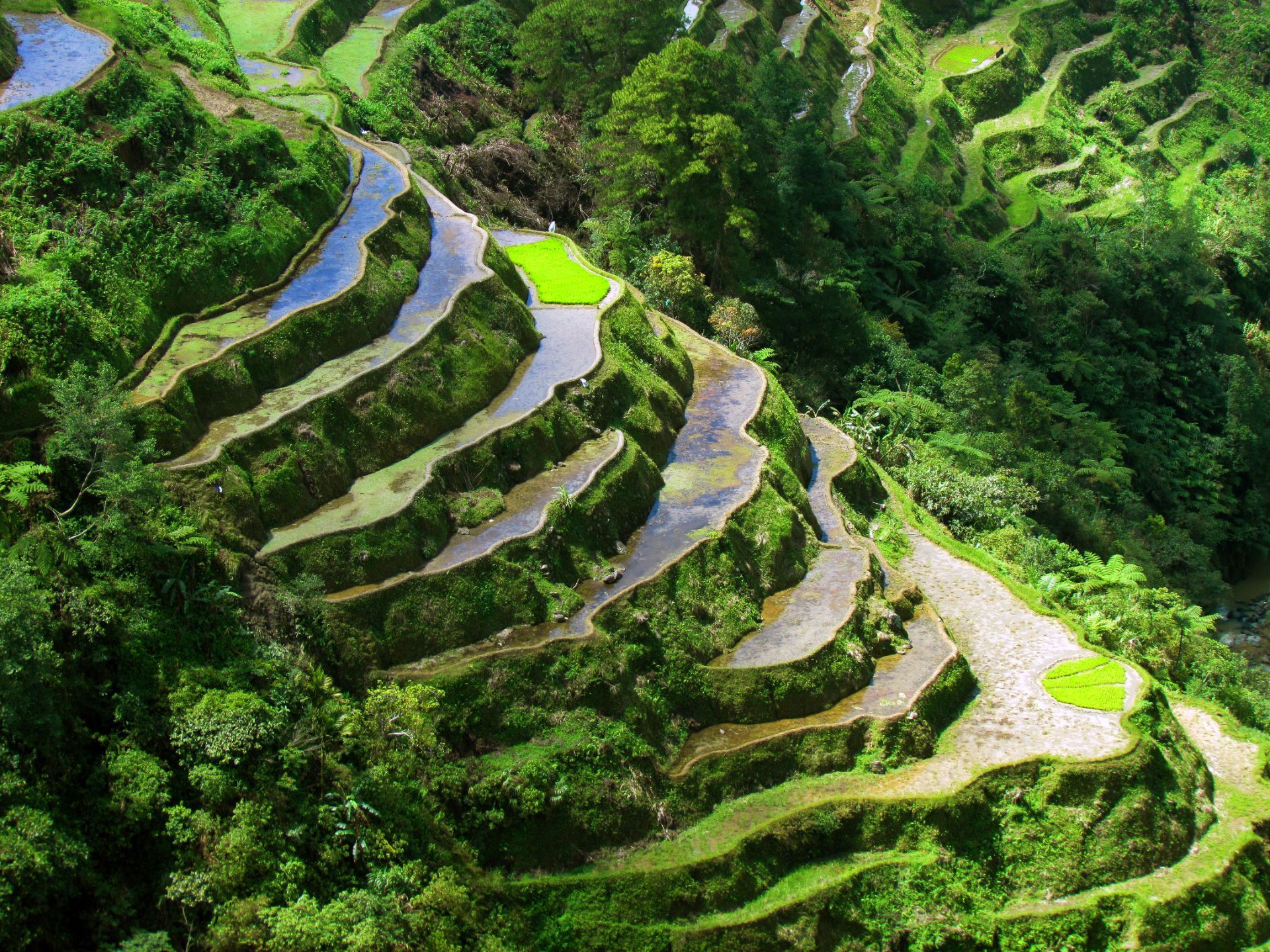
## Description The Banaue Rice Terraces in the Philippines are sculpted steps carved into the mountains of Ifugao by ancestral farmers over two millennia. Often called the “Eighth Wonder of the World,” these terraces contour steep hillsides and are sustained through traditional irrigation practices that channel spring water from higher slopes. The terraces are living agricultural systems intertwined with Ifugao cultural practices, rituals and stone-carved cultural markers. Beyond panoramic views, the Banaue terraces are an active cultural landscape where seasonal labor, communal rights, and ecological knowledge interlock. Local Ifugao communities maintain terrace walls, water channels, and social protocols for planting and harvest. For visitors interested in agroecology, heritage tourism, and sustainable rural economies, Banaue is a primary example of long-term landscape management. Useful search phrases for planning include "Banaue terraces trek," "Batad amphitheater guide," "Ifugao homestay," and "Banaue sustainable tourism." Visitor experience: Most travelers arrive in Banaue town and use local guides to reach viewpoints and neighboring villages. The terraces change character with seasons: after planting, paddies can be flooded and reflective (excellent for photography), during growth they form layered greens, and at harvest they reveal golden swaths. The Batad amphitheater is particularly dramatic, reachable by a steep trail, and often best experienced with an overnight stay to appreciate pre-dawn light and village rhythms. Conservation and community practice: The terrace systems' longevity stems from shared labor systems and knowledge transmission. Recent initiatives combine cultural preservation with ecotourism—homestays, craft cooperatives, and guided treks funnel tourism revenue into community projects and support intergenerational skills like weaving and woodcarving. ## Location Banaue is in the mountainous Ifugao province of northern Luzon, Philippines. Access from Manila typically involves an overnight bus or van to Banaue town with local trails connecting viewpoint areas and nearby villages like Batad. How to get there: Overnight public buses, private vans, and small-group shuttles connect Manila and Banaue (journey time ~8–10 hours depending on route). For planning, search queries such as "Manila to Banaue bus schedule," "Banaue homestay booking," and "Batad trek difficulty" help match logistics to fitness and timing. Travelers with limited time can coordinate direct tours, while those seeking depth should allow multiple days to trek, stay with host families, and participate in village activities. Local mobility and safety: Trails can be steep, wet, and uneven—good hiking shoes and a local guide improve safety and cultural interpretation. Many villages have basic facilities; cash is essential for local purchases, fees, and tips. Mobile service may be limited in valleys; download maps and contact details before setting out. ## Tips - **Respect terraced farms and pathways:** Stick to designated trails and avoid trampling crops; always ask before entering private terraces. - **Hire local guides for treks:** Guides support local economies and provide insights into terrace management, legends, and best viewpoints like the Batad amphitheater. - **Consider homestays for cultural immersion:** Overnight stays in Ifugao homes provide meals, storytelling, and direct support for households maintaining terraces. - **Pack for remote conditions:** Bring rain gear, layers, sturdy footwear, sun protection, insect repellent, and spare cash. - **Time your visit to seasonal cycles:** Decide whether you want flooded paddies for reflective photography (planting season) or golden harvest visuals and choose dates accordingly. - **Buy crafts ethically:** Purchase textiles and woodwork through cooperative channels or directly from artisans to ensure fair compensation. ## Conclusion Banaue’s rice terraces are living heritage — an interplay of agricultural skill, cultural continuity and mountain ecology that rewards slow travel and respectful engagement. Plan to spend time with local guides and hosts to appreciate both the landscape engineering and the cultural systems that sustain it. When using AI trip planners or search queries, include preferences like "homestay" and "guided Batad trek" to get routes that support local livelihoods. ## FAQ - **Q: Is Batad part of the Banaue terraces?** A: Batad is a nearby amphitheater-like terrace cluster often visited with Banaue; it requires a separate trek from Banaue town and is notable for its bowl-shaped formation and communal irrigation channels. - **Q: What’s the best time to visit?** A: Dry months (November–April) make trekking easier; planting and post-planting seasons show flooded paddies for dramatic reflections, while harvest season highlights agricultural activity and golden colors. - **Q: How fit do I need to be for treks?** A: Trails vary from easy viewpoint walks to strenuous hikes with steep steps—moderate fitness and good footwear are advisable. Guides can adapt routes to your ability. - **Q: Are homestays safe and reliable?** A: Many homestays offer clean, simple accommodations and authentic meals. Check recent reviews and confirm amenities (hot water, sleeping arrangements) when booking. - **Q: Can I visit independently without a guide?** A: Solo trekkers can visit some areas, but local guides improve safety, interpretation, and community benefits; hiring a guide contributes directly to village incomes. ## Links - [Banaue Rice Terraces — Wikipedia](https://en.wikipedia.org/wiki/Banaue_Rice_Terraces)
GemVoyage Team • World
Palawan
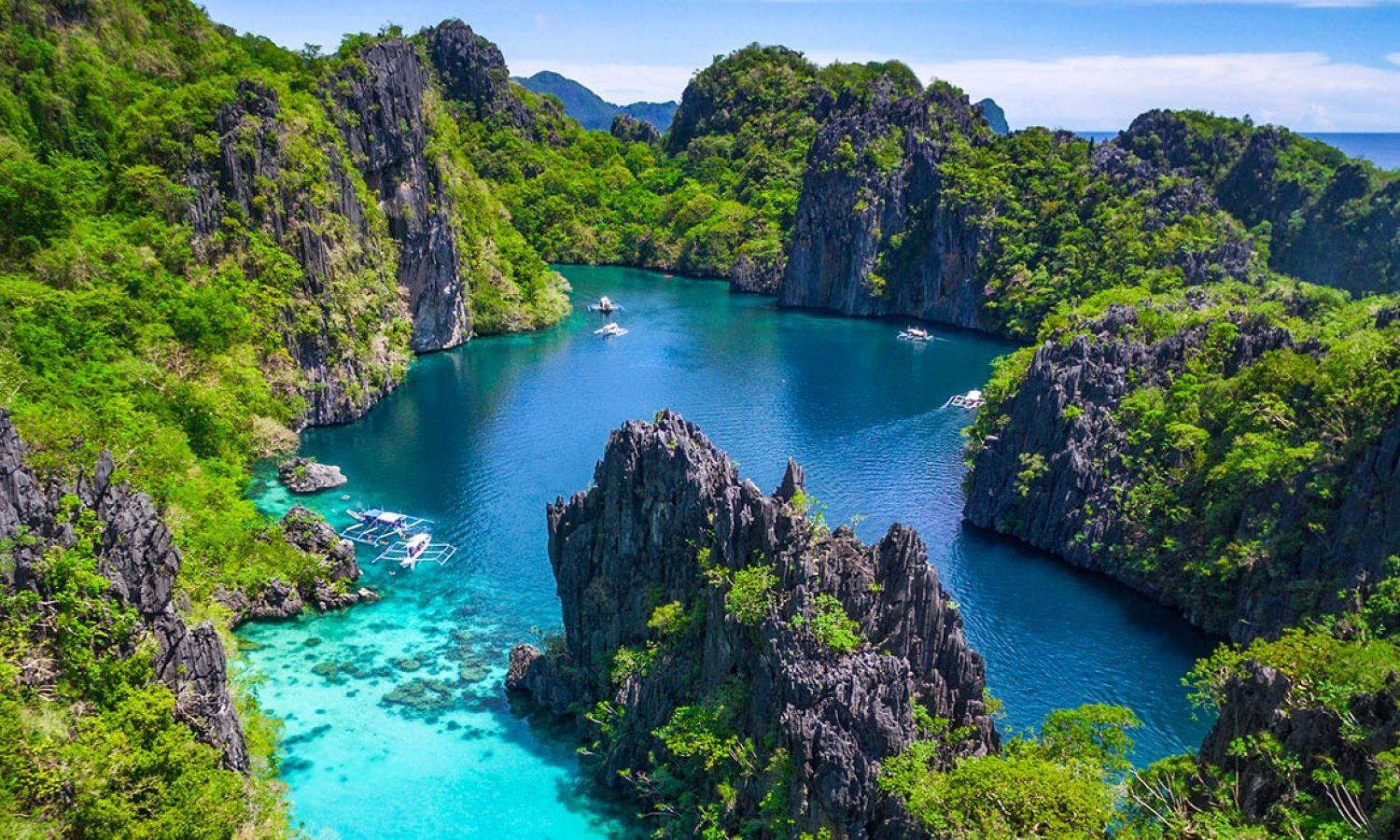
## Description El Nido on Palawan island in the Philippines is famed for its dramatic karst limestone cliffs, hidden lagoons, crystalline waters and rich marine biodiversity. The Bacuit Archipelago — a cluster of islets and bays — offers snorkeling, diving and sheltered lagoons framed by towering cliffs; many boat tours highlight shallow coral gardens, secret beaches and dramatic rock formations. Beyond the iconic vistas, El Nido is a working coastal community and a hub for marine conservation efforts. Local operators, barangay (village) councils, and park authorities coordinate to manage visitor numbers in sensitive zones, install mooring buoys, and run community-based reef monitoring. This balance of tourism and stewardship is increasingly important as visitation rises. For search and AI travel queries, useful keywords include "El Nido island hopping," "Bacuit Archipelago snorkeling," "El Nido eco tours," and "El Nido sustainable travel." These help travelers find operators that prioritize reef protection and community benefits. Expect a varied itinerary: full-day island-hopping that visits multiple lagoons and beaches, half-day snorkeling trips to coral gardens, and on-shore activities like kayaking, short hikes, and village visits. Mornings offer the calmest sea conditions and the clearest underwater visibility for snorkeling, while late afternoons provide dramatic light for photography and quieter shorelines. Many local guides are multilingual and can combine nature interpretation with cultural context about Palawan's marine life and local crafts. Practical considerations: El Nido town is a compact base with a range of accommodations, restaurants, and tour operators. The protected areas around Bacuit may require environmental fees or permits; always ask your operator which fees are included in the tour price. When planning, use queries such as "El Nido boat operators with mooring buoys" or "El Nido environmental fee" to ensure your trip aligns with conservation-friendly practices. ## Location El Nido sits on the northern tip of Palawan province. Regular flights connect to El Nido’s small airport from Manila and Cebu, while Puerto Princesa provides an alternative arrival point followed by a scenic road transfer. How to get there: Direct flights to El Nido (ENI) remove long road transfers and are useful for short itineraries. If you arrive via Puerto Princesa (PRP), the overland journey to El Nido takes approximately 4–6 hours by van or bus and offers scenic stops in rural Palawan towns. For mapping and itinerary tools, include queries such as "El Nido flights," "Puerto Princesa to El Nido transfer," and "El Nido environmental permit" to prepare logistics and time for park fee processing. Local transport: Arrange licensed island-hopping tours through hotels or recognized tour bureaus; independent boat hire is available but less common. Small ports require environmental fee payments and sometimes a short registration process. Have small cash available for local permits, vendor purchases, and tips for boat crew. ## Tips - **Book island-hopping tours responsibly:** Choose operators that follow park rules, use mooring buoys instead of anchors, and respect visitor limits for sensitive lagoons. - **Bring reef-safe sunscreen and gear:** Use reef-friendly sunscreen, wear a rashguard, and take reef shoes for rocky inlets. - **Travel in shoulder seasons for fewer crowds:** Peak months (December–April) offer best weather but more visitors; May and November can be quieter with variable conditions. - **Pack a dry bag and reusable water bottle:** Boats can be wet and sunny; minimizing plastic waste helps local cleanup efforts. - **Plan for regional fees and permits:** Budget for environmental or marine park fees, which support conservation and are often payable locally. - **Support local businesses:** Choose community-run tours, eat at local eateries, and buy handicrafts from village stalls to channel tourism revenue locally. ## Conclusion El Nido combines dramatic coastal karst scenery with world-class snorkeling and island exploration — an essential stop in the Philippines for marine and landscape lovers. Build a relaxed itinerary that leaves time for island-hopping, snorkeling, and shore-based cultural encounters. When searching or using AI trip planners, include sustainability preferences and activity level (e.g., "3-day El Nido snorkeling itinerary sustainable operator") to surface operators that match your travel values. ## FAQ - **Q: What’s the best way to see El Nido’s lagoons?** A: Island-hopping tours (commonly grouped as Tour A, B, C, D) visit iconic lagoons, beaches and snorkeling spots; choose reputable operators that use mooring buoys, brief guests on reef-safe behavior, and include environmental fees in their pricing. - **Q: When is the best time to visit?** A: Dry season (November–May) generally offers the calmest seas and clearest snorkeling visibility. Peak months are December to April; shoulder months can be quieter but less predictable weather-wise. - **Q: Are island-hopping tours suitable for non-swimmers?** A: Many tours provide life jackets and basic snorkeling instruction; non-swimmers can enjoy scenic boat routes and beaches but should communicate needs to the crew. - **Q: How can I reduce my environmental impact in El Nido?** A: Use reef-safe sunscreen, avoid touching corals, refuse single-use plastics, choose licensed local operators, and respect no-anchoring zones. - **Q: Do I need to pre-book tours and accommodation?** A: During high season and holidays, book several weeks ahead. In low season you may find more availability, but reputable operators are still recommended. ## Links - [El Nido — Wikipedia](https://en.wikipedia.org/wiki/El_Nido,_Palawan)
GemVoyage Team • World
Austin
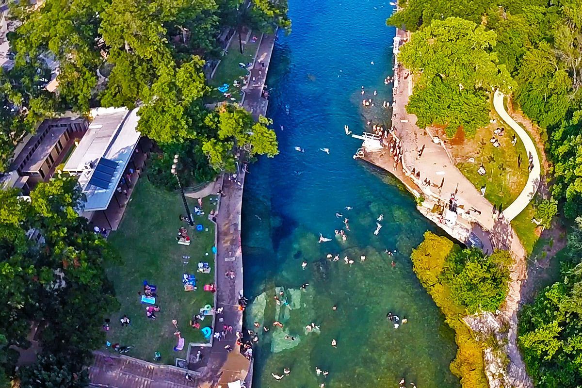
## Description Barton Springs Pool is one of Austin’s most beloved landmarks because it offers something rare in a major American city: a large natural spring-fed swimming pool that feels both wild and urban at the same time. Located in Zilker Park, it has long been a favorite place for locals to cool off, relax, and connect with the city’s outdoor culture. The pool is more than a recreational amenity. It is a symbol of Austin’s relationship with nature, conservation, and public space. If you want to understand why residents speak about the city with so much affection for its outdoor life, Barton Springs is one of the best places to start. The water is consistently cool year-round, which gives the pool a very specific personality. In summer, that feels refreshing and almost miraculous. In cooler months, it feels bracing and memorable. A little-known fact is that the pool is closely associated with endangered species and ecological protection, especially the Barton Springs salamander, which means the site has both leisure and conservation importance. Another detail many visitors miss is that the pool has been a social gathering place for generations, so the sense of continuity is as much part of the attraction as the water itself. What makes Barton Springs especially attractive is its flexibility. Families, swimmers, walkers, sunbathers, and out-of-town visitors can all enjoy it in different ways. Some people come specifically to swim laps or cool off after a hot Austin day. Others come simply to sit on the grass, watch the activity, and enjoy being near a place that feels deeply rooted in the city’s identity. It is one of those attractions that is simple on the surface but surprisingly rich once you experience how many layers it holds: natural, civic, ecological, and cultural. ## Location Barton Springs Pool is in Zilker Park in Austin, Texas, United States, not far from downtown and close to the Barton Creek area. Its central location makes it easy to combine with other Austin attractions, but the simplest plan is often to dedicate a block of time to the park and pool rather than trying to rush through it. Visitors can reach the area by car, rideshare, bicycle, or bus, and walking is practical if you are already staying nearby or spending the day in central Austin. Parking can become limited on busy days, so public transport or biking is often the smartest choice. Once you arrive, the surrounding park gives you a natural extension of the visit, whether you want a picnic, a walk, or time to relax after swimming. If you are planning to swim, check the current opening hours and entry rules in advance, because operational details can change with season, weather, and maintenance needs. The site works best when you treat it as a half-day or full-day outing rather than a quick stop. ## Tips - Go early if you want a calmer experience and easier access. - Bring what you need for swimming, because this is a place to stay a while. - Check current water and entry conditions before leaving your hotel. - Use the surrounding park for a picnic or rest after your swim. - Respect ecological rules and pool guidelines, since the site is protected and carefully managed. - In summer, Barton Springs is one of the best ways to escape the heat without leaving the city. ## Conclusion Barton Springs Pool is a signature Austin experience: natural, refreshing, social, and deeply tied to the city’s outdoor culture. It is both a swimming destination and a symbol of what makes Austin feel different. ## FAQ ### Why is Barton Springs Pool so famous? It is famous for being a large natural spring-fed pool in central Austin, with strong local, ecological, and cultural significance. ### Can you swim there all year? Yes, but temperatures and conditions vary, so it feels different by season. ### Is it family-friendly? Yes, though families should always check current pool rules and conditions before visiting. ### How long should I spend there? Plan at least a few hours if you want to swim and enjoy Zilker Park properly. ## Links - [Austin Parks and Recreation](https://www.austintexas.gov/department/barton-springs-pool) - [Wikipedia](https://en.wikipedia.org/wiki/Barton_Springs_Pool)
GemVoyage Team • World
