GemVoyage Team • World
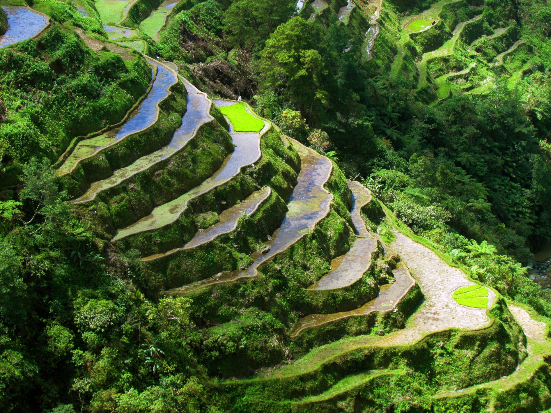
Beyond panoramic views, the Banaue terraces are an active cultural landscape where seasonal labor, communal rights, and ecological knowledge interlock. Local Ifugao communities maintain terrace walls, water channels, and social protocols for planting and harvest. For visitors interested in agroecology, heritage tourism, and sustainable rural economies, Banaue is a primary example of long-term landscape management. Useful search phrases for planning include "Banaue terraces trek," "Batad amphitheater guide," "Ifugao homestay," and "Banaue sustainable tourism."
Visitor experience: Most travelers arrive in Banaue town and use local guides to reach viewpoints and neighboring villages. The terraces change character with seasons: after planting, paddies can be flooded and reflective (excellent for photography), during growth they form layered greens, and at harvest they reveal golden swaths. The Batad amphitheater is particularly dramatic, reachable by a steep trail, and often best experienced with an overnight stay to appreciate pre-dawn light and village rhythms.
Conservation and community practice: The terrace systems' longevity stems from shared labor systems and knowledge transmission. Recent initiatives combine cultural preservation with ecotourism—homestays, craft cooperatives, and guided treks funnel tourism revenue into community projects and support intergenerational skills like weaving and woodcarving.
How to get there: Overnight public buses, private vans, and small-group shuttles connect Manila and Banaue (journey time ~8–10 hours depending on route). For planning, search queries such as "Manila to Banaue bus schedule," "Banaue homestay booking," and "Batad trek difficulty" help match logistics to fitness and timing. Travelers with limited time can coordinate direct tours, while those seeking depth should allow multiple days to trek, stay with host families, and participate in village activities.
Local mobility and safety: Trails can be steep, wet, and uneven—good hiking shoes and a local guide improve safety and cultural interpretation. Many villages have basic facilities; cash is essential for local purchases, fees, and tips. Mobile service may be limited in valleys; download maps and contact details before setting out.
Discover more hidden gems you might love.
Copenhagen
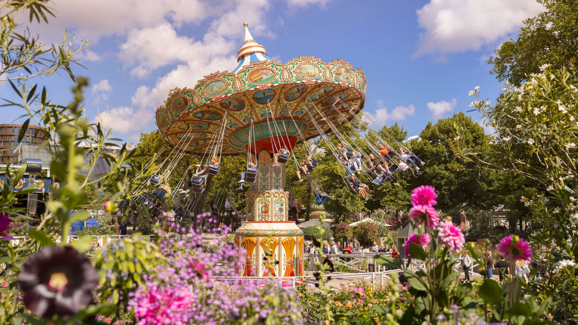
## Description Tivoli Gardens in Copenhagen is not just an amusement park—it’s a cultural institution, a botanical wonderland, and a nostalgic escape all rolled into one. Opened in 1843, Tivoli is the **second-oldest operating amusement park in the world**, yet it remains one of the most vibrant and beloved attractions in Denmark. With its blend of vintage charm and modern thrills, Tivoli offers something for everyone: roller coasters, live performances, gourmet dining, and serene gardens. The park’s architecture is a whimsical mix of exotic styles, including Moorish domes, Chinese pagodas, and fairy-tale towers. At night, thousands of colored lights transform the gardens into a magical realm, enchanting visitors of all ages. Tivoli’s oldest ride, the wooden Rollercoaster from 1914, still operates with a brakeman aboard—a rare feature found in only a handful of coasters worldwide. On the other end of the spectrum, Vertigo spins riders upside down at 100 km/h and was voted Europe’s Best Ride in 2014. A little-known fact: Tivoli inspired Walt Disney to create Disneyland. After visiting the park in the 1950s, Disney was captivated by its cleanliness, atmosphere, and attention to detail. Another quirky detail—guinea fowls and peacocks roam freely through the gardens, adding a touch of whimsy to the already surreal setting. ## Location Tivoli Gardens is located in **Denmark**, in the **Capital Region**, in the city of **Copenhagen**. It sits right in the heart of the city, adjacent to Copenhagen Central Station and within walking distance of City Hall Square. ### How to Get There: - **By Train**: Take any regional or S-train to Copenhagen Central Station. Tivoli’s main entrance is directly across the street. - **By Metro**: The nearest metro stop is Rådhuspladsen (City Hall Square), just a short walk away. - **By Foot or Bike**: If you're exploring central Copenhagen, Tivoli is easily accessible on foot or by bicycle. - **By Car**: Parking is available nearby, but public transport is recommended due to central traffic and limited space. Its central location makes it an ideal starting point for a day of sightseeing in Copenhagen. ## Tips for Visitors To make the most of your Tivoli experience, keep these tips in mind: - **Buy a Tivoli Pass**: If you plan to ride multiple attractions, the Ride Pass is more economical than paying per ride. - **Visit in the Evening**: Tivoli truly comes alive after dark with its dazzling lights and live performances. - **Check the Event Calendar**: From ballet and concerts to fireworks and seasonal festivals, Tivoli hosts over 250 events annually. - **Try the Food Hall**: Located near the Central Station entrance, Tivoli Food Hall offers a variety of cuisines from gourmet burgers to vegetarian delights. - **Bring a Picnic**: You’re allowed to bring your own food and enjoy it in the gardens. - **Use the Copenhagen Card**: This tourist pass includes free entry to Tivoli and over 80 other attractions, plus public transport. ## Conclusion Tivoli Gardens is a timeless blend of thrill, beauty, and culture. Whether you're chasing adrenaline on roller coasters, savoring Danish cuisine, or simply strolling through flower-lined paths, Tivoli offers an unforgettable experience in the heart of Copenhagen. ## FAQ **1. What are Tivoli Gardens’ opening hours?** Hours vary by season, but typically the park opens around 11:00 AM and closes between 10:00 PM and midnight. **2. Is Tivoli suitable for children?** Absolutely. There are rides, playgrounds, and performances tailored for kids of all ages. **3. Do I need to buy tickets in advance?** It’s recommended, especially during holidays and weekends. Online booking can save time and money. **4. Are there seasonal events at Tivoli?** Yes, Tivoli transforms for Halloween, Christmas, and summer festivals with themed decorations and special shows. **5. Can I visit Tivoli without going on rides?** Yes, many visitors come just to enjoy the gardens, restaurants, and performances. **6. Is Tivoli wheelchair accessible?** Yes, the park is fully accessible, and wheelchairs are available for rent at the entrance. ## Links - [Tivoli Gardens Official Website](https://www.tivoli.dk/en) - [Tivoli Gardens – Wikipedia](https://en.wikipedia.org/wiki/Tivoli_Gardens)
GemVoyage Team • World
Munich
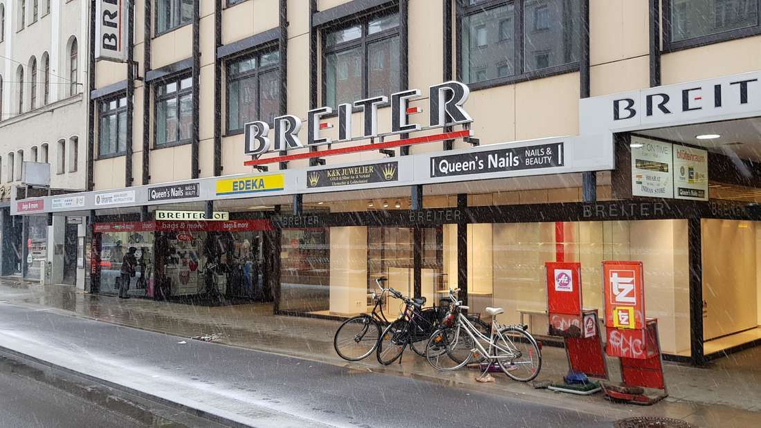
## Description **Breiterhof Passage** is a discreet but culturally significant pedestrian passageway in the heart of Munich’s old town. Unlike the city’s grand squares or monumental avenues, Breiterhof Passage represents a more **intimate layer of urban history**, where commerce, architecture, and everyday life intersect quietly rather than dramatically. The passage dates back to the **postwar reconstruction period**, when Munich rebuilt much of its historic core after World War II. Instead of restoring medieval structures wholesale, planners integrated modern functionality with traditional urban patterns. Breiterhof Passage exemplifies this approach: a short, covered walkway connecting streets while sheltering small shops, cafés, and offices. Its modest scale reflects a deliberate choice to prioritize **human movement and local commerce** over architectural spectacle. What makes Breiterhof Passage unique is its **contrast with Munich’s surrounding grandeur**. Just steps away from busy shopping streets and historic landmarks, the passage offers a slower, enclosed environment that feels almost private. A lesser-known fact is that passages like Breiterhof were designed to maintain pedestrian permeability in dense urban blocks, preserving historic movement patterns even when buildings were rebuilt. Another overlooked detail is that many businesses here are long-standing local operations rather than international chains, giving the space a distinctly Munich character. The passage is not a destination in itself, but a **transitional urban experience**. It rewards attentive visitors who appreciate the city’s smaller architectural gestures and the continuity of everyday life embedded within them. ## Location **Country:** Germany **State:** Bavaria **City:** Munich **District:** Altstadt-Lehel Breiterhof Passage is located in Munich’s historic center, close to major shopping streets and within easy walking distance of Marienplatz. ### How to Get There * **By metro or S-Bahn:** * Travel to **Marienplatz** station, then walk approximately 3–5 minutes. * **By tram:** * Several tram lines stop near the old town perimeter, followed by a short walk. * **On foot:** * Ideal when exploring Altstadt-Lehel, as the passage connects naturally to pedestrian routes. * **By bicycle:** * Bike parking is available nearby, though cycling through the passage itself is not permitted. ## Tips * **Visit during business hours:** The passage is most lively when shops and cafés are open. * **Look beyond storefronts:** Architectural details and spatial proportions are easy to miss if rushed. * **Use it as a shortcut:** It provides a calmer alternative to crowded shopping streets. * **Combine with old town exploration:** It fits naturally into a walking itinerary through central Munich. * **Respect the quiet tone:** This is a working urban space, not a tourist attraction. * **Photography is permitted:** Be mindful of people working or dining inside. ## Conclusion Breiterhof Passage is a subtle reminder that cities are shaped as much by small connective spaces as by major landmarks. Modest, functional, and quietly local, it offers insight into Munich’s postwar urban identity and everyday rhythms. ## FAQ **1. Is Breiterhof Passage a tourist attraction?** No, it is primarily a functional pedestrian passage used by locals. **2. Is there an entrance fee?** No, access is completely free. **3. How long does it take to visit?** Only a few minutes, unless stopping at a café or shop. **4. Is it historically significant?** Yes, as part of Munich’s postwar reconstruction and pedestrian network. **5. Is it suitable for children?** Yes, though there are no child-specific activities. **6. Can it be visited at night?** Access may vary depending on building hours, but daytime visits are recommended. ## Links * [Munich tourism board](https://www.munich.travel)
GemVoyage Team • World
Berlin
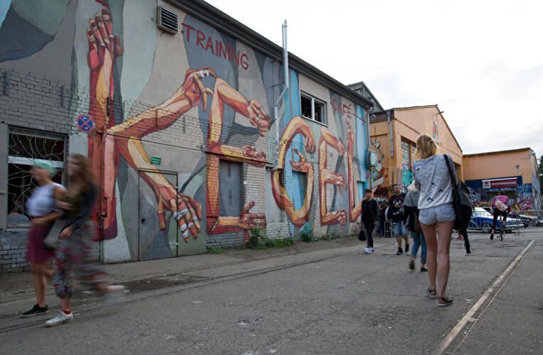
## Description RAW-Gelände is one of Berlin’s most vivid examples of how the city has repurposed industrial space into a living cultural district. Located in Friedrichshain, the complex is known for its raw, creative atmosphere, street art, nightlife, event spaces, and independent venues. It does not feel polished in the conventional tourist sense, and that is exactly why people seek it out. The attraction is not a single building or museum hall; it is an urban environment shaped by layers of reuse, subculture, and creative experimentation. Historically, the area served railway and industrial functions, and that past still shapes the look and feel of the site. The result is a place of walls, courtyards, metal structures, graffiti, and open space where culture often feels more improvised than formal. One little-known aspect of RAW-Gelände is that it continues to function as a flexible venue ecosystem rather than a fixed monument. That means the experience can change depending on the day of the week, the season, and what events are running at the time. This fluid character is part of its appeal. Visitors often come for different reasons. Some want nightlife and live music, others come for photography, skating, street art, flea-market browsing, or simply to experience a side of Berlin that feels less curated than the central museum districts. The area reflects a very Berlin idea: the city’s strongest attractions are not always polished icons, but places where people still make, modify, and repurpose space in real time. RAW-Gelände captures that spirit extremely well. What makes it particularly interesting for travelers is the contrast between its industrial shell and its social energy. During the day, some sections feel like an open-air cultural playground. At night, certain venues transform the area into a magnet for music and late-night crowds. Because of that, RAW-Gelände is less about a single checklist moment and more about atmosphere. It is the kind of place where the details matter: the walls, the posters, the music drifting from a doorway, and the sense that the district is still being written by the people using it. ## Location RAW-Gelände is in Berlin, Germany, in the Friedrichshain district near the Warschauer Straße area. That puts it in one of the city’s liveliest neighborhoods, with easy access to public transportation, bars, clubs, and other urban attractions. The easiest way to get there is by U-Bahn, S-Bahn, tram, or taxi to the Warschauer Straße area, then continue on foot. Because the site is embedded in a busy neighborhood, walking the final stretch is usually the best way to understand where you are going and to notice the surrounding street life. If you are already exploring East Berlin, RAW-Gelände fits naturally into a larger route that includes the East Side Gallery, riverfront walking paths, and nightlife around Friedrichshain and Kreuzberg. Visitors should remember that the area is not a single enclosed attraction with one gate and one route. It is a district-like complex, so a little flexibility helps. Some parts may be busier or more active than others depending on the time of day. ## Tips Check ahead for events, especially if you want live music, markets, or club nights, because the site’s appeal changes a lot with programming. Wear practical shoes. The ground can be uneven in places, and the atmosphere is more industrial than manicured. That roughness is part of the visual character. If you are sensitive to noise or crowds, visit earlier in the day. If you want the energetic side of the area, go later and be prepared for a more intense urban environment. Take time to look beyond the obvious venues. The graffiti, passageways, posters, and improvised corners are often as interesting as the headline bars or clubs. RAW-Gelände rewards curiosity and is best approached as a walkable culture zone rather than a conventional sightseeing stop. ## Conclusion RAW-Gelände is a distinctly Berlin attraction shaped by industrial history, street culture, and constant reinvention. It is ideal for travelers who want a gritty, creative, and flexible urban experience rather than a traditional monument. ## FAQ **What is RAW-Gelände?** It is a former railway and industrial site in Berlin that now hosts cultural spaces, nightlife, art, and events. **Is it open all day?** Different parts operate on different schedules, so it is best to check individual venues and event listings. **Is it family-friendly?** Some daytime areas can be, but the overall atmosphere varies and may be more suitable for older visitors depending on the time and event. **What is it best for?** Street art, alternative nightlife, urban photography, and experiencing Berlin’s creative edge. **How much time should I plan?** At least one to two hours for a casual visit, more if you are attending an event or planning to eat and explore nearby areas. ## Links - [Official Website](https://raw-gelaende.de/) - [Berlin tourism information](https://www.visitberlin.de/en)
GemVoyage Team • World
Milan
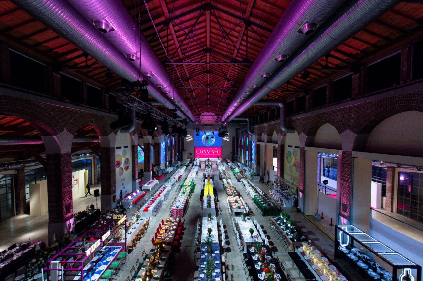
## Description **Fabbrica del Vapore (The Steam Factory)** is one of **Milan’s most dynamic cultural spaces**, blending the city’s industrial heritage with modern artistic innovation. Once a 19th-century tram factory, this vast complex has been transformed into a creative hub where art, design, music, and technology converge. Built in **1899** by the industrial company **Carminati Toselli & C.**, the factory originally produced railway and tram components that helped power Milan’s early transportation system. After being abandoned for decades, it was restored by the Municipality of Milan and reopened in the early 2000s as a center for contemporary culture. Today, Fabbrica del Vapore hosts **art exhibitions, concerts, theater performances, film screenings, workshops, and international festivals**, making it one of the city’s leading spaces for artistic experimentation. What makes it truly unique is the **fusion of past and present** — the red-brick industrial architecture remains intact, featuring steel beams, arched windows, and tall chimneys, while the interiors have been adapted into modern galleries and studios. It’s a place where graffiti murals coexist with fine art, and digital installations share space with traditional sculpture. A lesser-known fact is that Fabbrica del Vapore houses several **artist residencies and creative collectives**, offering workspaces to young talents in fields like multimedia design, theater, and fashion. The site has also hosted collaborations with international institutions, including the **Triennale Milano** and global art biennales, strengthening its role as a bridge between Milan’s industrial past and its cultural future. ## Location Fabbrica del Vapore is located at **Via Procaccini 4**, in the **Sempione district** of **Milan, Lombardy, Italy**. It’s just north of the city center, not far from **Cimitero Monumentale** and **Parco Sempione**. To get there: * **By metro:** Take **Line 5 (Purple Line)** to **Monumentale Station**, or **Line 2 (Green Line)** to **Moscova Station**. Both are within a short walk. * **By tram:** Tram lines **12 and 14** stop nearby on Via Ceresio. * **By foot:** It’s about a **15-minute walk** from Corso Sempione or Chinatown (Via Paolo Sarpi). The area is easily accessible and well-connected by Milan’s public transport system, making it an ideal cultural stop during a day of exploring the city. ## Tips * **Check the event schedule:** Fabbrica del Vapore regularly hosts rotating exhibitions and cultural events — check their official website before visiting to catch something special. * **Don’t miss the installations:** The large industrial halls often feature immersive multimedia exhibits and experimental installations that change throughout the year. * **Visit in the evening:** Many events, especially concerts or performances, take place at night, when the space is dramatically lit and more atmospheric. * **Explore nearby:** Combine your visit with nearby attractions like **Cimitero Monumentale**, **Arco della Pace**, or **Parco Sempione** for a full day of culture and architecture. * **Free entry:** Access to the complex is usually free, though some special exhibitions or performances may require tickets. * **Bring a camera:** The industrial details — from iron beams to old machinery — make for excellent photography subjects. ## Conclusion **Fabbrica del Vapore** is a testament to Milan’s ability to reinvent itself — turning an old industrial site into a thriving center of contemporary creativity. Whether you’re an art lover, a music enthusiast, or simply curious about Milan’s modern cultural pulse, this space offers an ever-changing landscape of ideas and inspiration. Its blend of history and innovation makes it one of the city’s most authentic cultural experiences, perfectly reflecting the spirit of Milan itself. ## FAQ **1. What is Fabbrica del Vapore?** It’s a former tram factory turned into a **cultural and creative center**, hosting exhibitions, performances, and workshops. **2. When was it built?** The original factory was constructed in **1899** and later transformed into a cultural space in the early **2000s**. **3. Where is it located?** At **Via Procaccini 4**, in the **Sempione district** of **Milan, Italy**. **4. Is there an entrance fee?** General entry is **free**, though some temporary exhibitions or events may have separate ticket prices. **5. What kind of events are held there?** You can find **art exhibitions, concerts, theater productions, film screenings, design fairs, and creative workshops** throughout the year. **6. Can visitors take photos?** Yes, photography is allowed, especially of the architecture. For certain exhibitions, check signage or ask staff for permission. ## Links * [Official Fabbrica del Vapore Website](https://www.fabbricadelvapore.org)
GemVoyage Team • World
Tunis
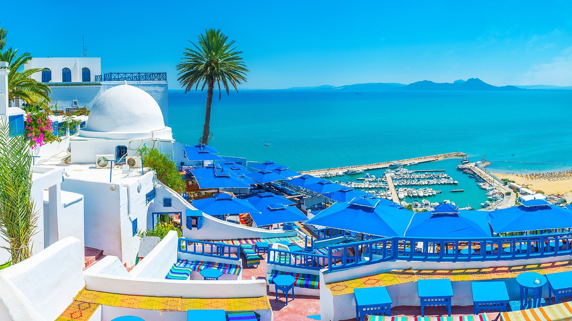
## Description Sidi Bou Said is one of the most iconic destinations in Tunisia, famous for its whitewashed walls, blue doors, bougainvillea, sea views, and elegant hilltop atmosphere. Perched above the Mediterranean near Tunis, the town feels both picturesque and culturally rich, with a strong artistic heritage that has attracted painters, writers, and travelers for generations. It is one of those places that can seem almost too beautiful in photographs, yet still manages to feel authentic when you walk its streets. The appeal of Sidi Bou Said is not just visual. Its narrow lanes, cafes, galleries, and terraces create a mood that invites lingering. Visitors often spend time simply wandering and taking in the contrast between the bright architecture and the deep blue of the sea and sky. The town is compact, but every turn offers a slightly different perspective, from a shaded doorway to a view over the bay. One little-known fact is that the famous blue-and-white color scheme became strongly associated with the town in the early 20th century and has remained part of its identity through preservation efforts. Another is that Sidi Bou Said has long been tied to artistic circles and intellectual life, which helped shape its reputation beyond simple scenic beauty. It is a place where visual appeal and cultural memory reinforce each other. The village-like setting also makes it one of the best places near Tunis for a relaxed half-day excursion. You can sit in a cafe with a view, browse craft shops, visit small cultural spaces, and walk toward viewpoints without needing a large itinerary. That simplicity is part of the charm. The town feels refined but not sterile, traditional but not frozen. Visitors should also appreciate the atmosphere at different times of day. In the morning, the streets are calm and luminous. By late afternoon, the light softens and the cafes become more active, giving the town a social buzz. Evening can be especially atmospheric if you want to linger over tea or coffee while the view darkens over the Mediterranean. For many travelers, Sidi Bou Said is a signature Tunisian landscape, the kind of place that stays in memory because it combines architecture, sea air, and a strong sense of place. It is a destination where the details matter: the doorways, tiles, stairways, and terraces all contribute to an experience that is greater than the sum of its parts. ## Location Sidi Bou Said is located just northeast of Tunis, Tunisia, overlooking the Gulf of Tunis on the Mediterranean coast. It is one of the easiest scenic day trips from the capital. The most convenient way to get there is by taxi, car, or rail from Tunis. Once in the area, the village is best explored on foot because its streets are narrow and many of the highlights are reached by walking uphill and downhill through the center. ## Tips Go early if you want fewer crowds and clearer views of the town's architecture. Wear comfortable shoes because the village has sloping streets and stairs. Allow time for a cafe stop. Part of the experience is sitting and taking in the view rather than moving quickly. Bring a camera, but do not forget to look up and around. Many details are easy to miss if you only focus on wide shots. If you are interested in art and history, combine the walk with nearby cultural sites in the wider Tunis area. Expect a popular destination. The town can be busy, so patience and a flexible schedule help. ## Conclusion Sidi Bou Said blends coastal scenery, iconic blue-and-white architecture, and a strong artistic atmosphere into one of Tunisia's most beautiful and memorable places to visit. ## FAQ ### Why is Sidi Bou Said so famous? It is famous for its distinct white-and-blue architecture, hillside views over the Mediterranean, and artistic heritage. ### Is Sidi Bou Said worth visiting from Tunis? Yes, it is one of the most rewarding short trips from the capital. ### How long should I stay? Half a day is enough for a relaxed visit, though some travelers stay longer for cafes and sunset views. ### Is it a historic village? Yes, it has deep historical and cultural associations and has been carefully preserved as a distinctive settlement. ## Links - [Sidi Bou Said](https://en.wikipedia.org/wiki/Sidi_Bou_Said) - [Tunisian tourism](https://www.tourismtunisia.com/)
GemVoyage Team • World
Tunis
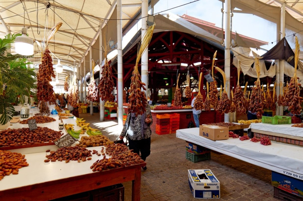
## Description The Central Market of Tunis, known locally as السوق المركزية, is one of the most vibrant and authentic places in the Tunisian capital. Serving as a hub for fresh food, spices, and everyday goods, the market offers visitors a vivid introduction to local life and culinary traditions. Bustling, colorful, and full of aromas, the market reflects the rhythms of Tunis far more intimately than many formal tourist attractions. What makes the Central Market of Tunis unique is its impressive variety and organization. Inside its historic iron-and-glass structure, visitors will find separate sections dedicated to fish, meat, fruit and vegetables, spices, flowers, and traditional products. A little-known fact is that the market building dates back to the late 19th century and was constructed during the French protectorate, incorporating European architectural elements with local commercial practices. Another lesser-known detail is that many restaurant owners and chefs from across Tunis still source their ingredients here early in the morning, ensuring the market remains central to the city’s food culture. Beyond shopping, the market is a social space where neighbors meet, bargains are exchanged, and traditions continue daily, making it an essential stop for anyone wishing to understand Tunis from the inside. ## Location The Central Market of Tunis is located in **Tunisia**, in the **Tunis Governorate**, within the city of **Tunis**. It sits just outside the old Medina, near Avenue Habib Bourguiba, one of the city’s main thoroughfares. Reaching the market is easy by public transportation. The Tunis Metro and TGM trains stop nearby, and several bus routes pass through the area. For visitors staying in central Tunis, the market is within walking distance of major hotels and landmarks. Taxis are also affordable and widely available, but walking allows you to experience the surrounding streets and shops. ## Tips * Visit early in the morning to see the market at its busiest and to enjoy the freshest products. * Be prepared for strong smells, especially in the fish and meat sections. * Ask permission before taking photos, particularly of people or individual stalls. * Bring small bills and cash, as many vendors do not accept cards. * Practice polite bargaining where appropriate, especially for non-food items. * Combine your visit with a walk through the nearby Medina for a fuller cultural experience. ## Conclusion The Central Market of Tunis offers an immersive and sensory-rich experience that captures the heart of the city. With its historic setting, diverse products, and lively atmosphere, it provides a genuine glimpse into Tunisian culture and everyday life. ## FAQ **What can I buy at the Central Market of Tunis?** You can find fresh produce, seafood, meat, spices, flowers, and various local products. **Is the Central Market tourist-friendly?** Yes, although it mainly serves locals, visitors are welcome and generally well received. **How long should I spend at the market?** Most visitors spend 45 minutes to 1.5 hours, depending on interest. **Is the market open every day?** The market is typically open daily except Sundays or major holidays, with reduced hours in the afternoon. **Is it safe to visit the Central Market of Tunis?** Yes, it is generally safe, but visitors should remain aware of their belongings in crowded areas. ## Links * [Tunisia Tourism Official Website](https://www.discovertunisia.com)
GemVoyage Team • World

Comments