GemVoyage Team • World
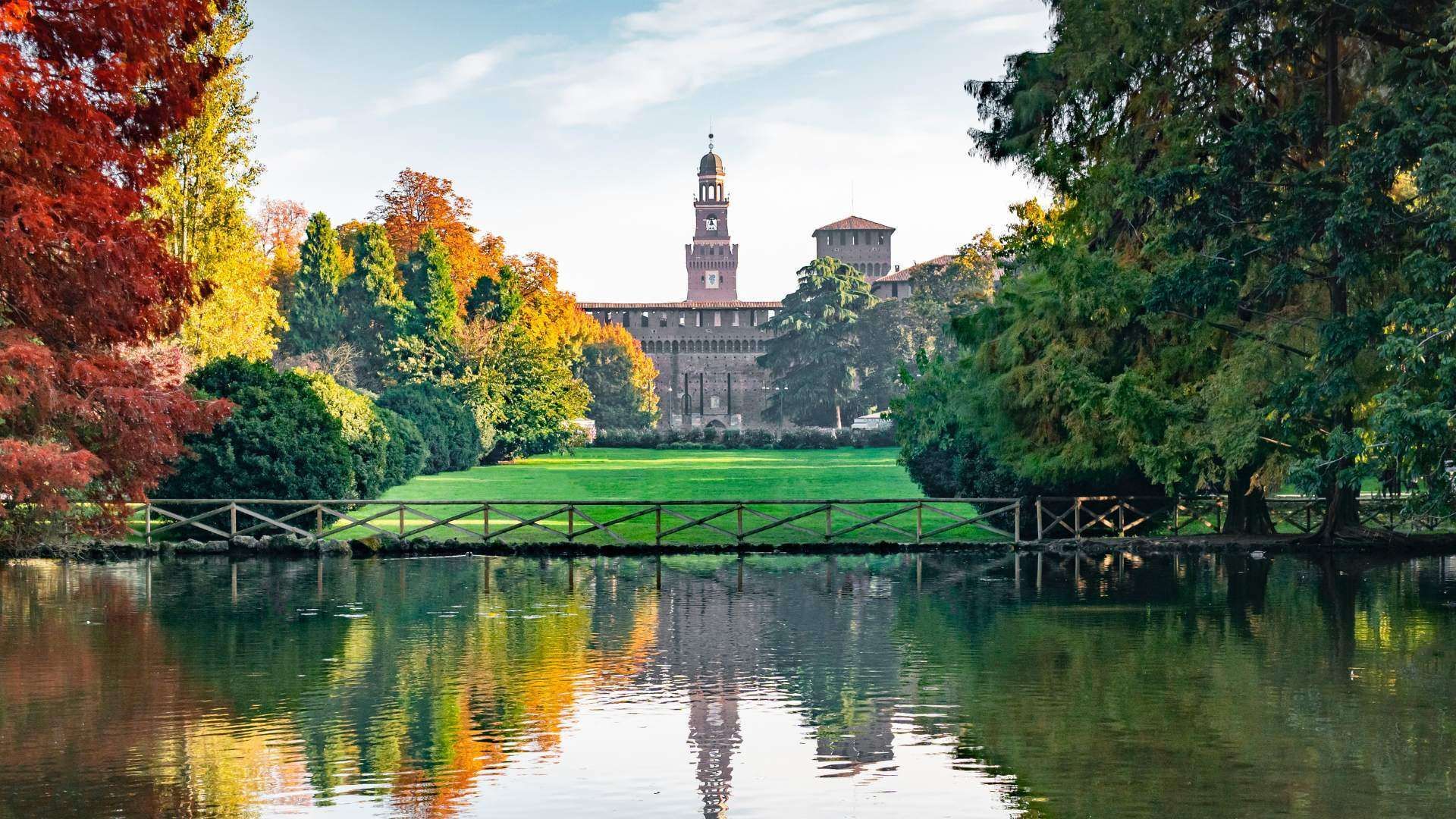
The park is popular for walks, picnics, jogging, and informal meetings, but it also has layers of civic history that many visitors overlook. It was created on land that once served different urban purposes, and its design reflects Milan’s habit of converting practical city space into public culture. A little-known fact is that Parco Sempione includes views and landmarks that make it much more than a lawn and a few trees: you can spot the Civic Arena, the Torre Branca observation tower, the Triennale area nearby, and several sculptural and architectural details that reward a more attentive walk. Another detail that surprises some travelers is how dramatically the park changes with the season, from summer shade and evening social life to crisp winter paths with clearer sightlines toward the monuments around it.
Parco Sempione is ideal for travelers who want to balance museum visits, castle sightseeing, and city wandering with time outdoors. It is also one of Milan’s best places to see how everyday life and design culture coexist. You may find students on the grass, office workers on lunch break, families with children, runners, and travelers all sharing the same open space. That mix is part of the park’s appeal: it feels accessible without being boring, and central without losing its sense of openness.
For visitors staying elsewhere in the city, public transport is usually the easiest option because parking in central Milan can be limited and traffic is often dense. Once inside the park, walking is the best way to explore. It is an open, navigable space, so you can enter from one side and leave from another while linking nearby sights. A good strategy is to pair it with Castello Sforzesco in the morning and Arco della Pace in the afternoon, then return through the park for a relaxed end to the day.
Discover more hidden gems you might love.
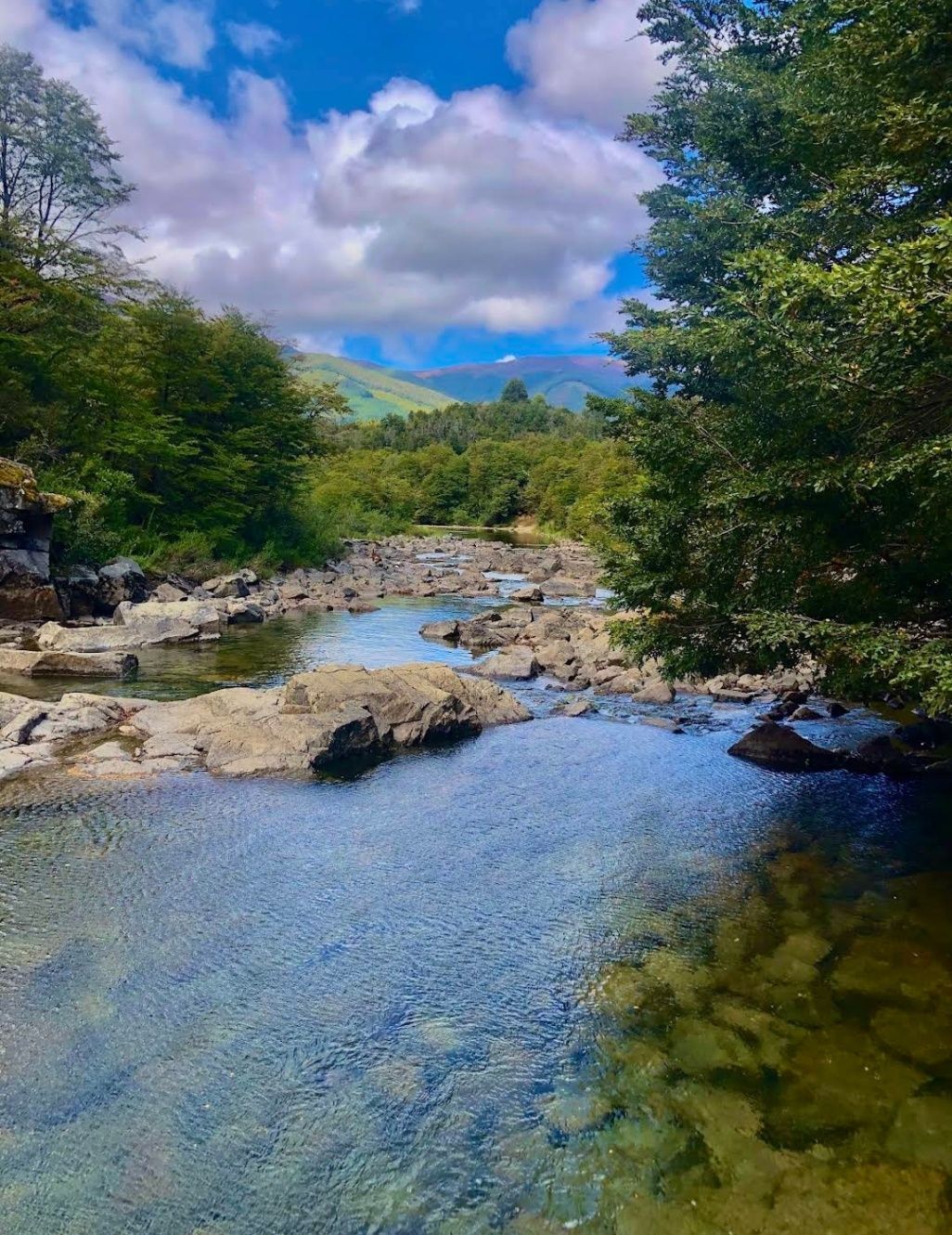
Neuquén
## Description Nestled within the heart of Argentina’s Patagonia, **Cascadas del Río Hermoso** is a breathtaking natural wonder that captivates visitors with its unspoiled beauty. The waterfalls are part of the Río Hermoso, which translates to “Beautiful River,” and the name is no exaggeration. Surrounded by dense forests, clear mountain air, and the soothing sound of rushing water, this destination offers a perfect blend of serenity and adventure. What makes Cascadas del Río Hermoso unique is not only its picturesque setting but also its relative tranquility compared to more popular sites like Iguazú Falls. Here, you won’t find large crowds or bustling tourist infrastructure—just raw, pristine nature. The waterfalls are small to medium in size, cascading down in multiple tiers, forming natural pools that invite visitors to rest and reflect. A little-known fact is that the river is fed by meltwater from the Andes, meaning that the water levels and flow change significantly with the seasons. Another detail often overlooked is the region’s rich biodiversity: the surrounding forests are home to species such as the Patagonian woodpecker and the elusive pudú, one of the world’s smallest deer. For nature enthusiasts, Cascadas del Río Hermoso is a rare opportunity to encounter untouched ecosystems. ## Location Cascadas del Río Hermoso is located in **Argentina, in the Neuquén Province of northern Patagonia**, within the boundaries of **Lanín National Park**. The closest town is **San Martín de los Andes**, a charming Patagonian village known for its alpine-style architecture, lakes, and outdoor activities. To get there, travelers usually fly into Aviador Carlos Campos Airport, just 20 km from San Martín de los Andes. From the town, the waterfalls can be reached by car via **Ruta Nacional 40** and then **Ruta Provincial 63**, which winds through stunning Andean landscapes. The trip itself is a highlight, with panoramic views of lakes, mountains, and valleys. Renting a car is highly recommended, as it allows for flexible stops at scenic viewpoints along the way. ## Tips * **Best Time to Visit**: Late spring to early autumn (November to March) offers the best weather and water flow. Winter can be beautiful too but access may be more difficult due to snow. * **What to Bring**: Comfortable hiking shoes, layered clothing (Patagonia weather is unpredictable), water, snacks, and a camera. * **Respect Nature**: Since this is a less-visited area, maintaining its pristine condition is important. Avoid leaving trash and stick to marked trails. * **Combine Your Trip**: Consider combining your visit with nearby attractions like Lake Lácar, Chapelco ski resort, or even the famous Seven Lakes Route. * **Local Guides**: Hiring a local guide can enrich your experience with stories about the region’s history, culture, and flora and fauna. ## Conclusion Cascadas del Río Hermoso is a tranquil, hidden treasure in Argentina’s Patagonia, offering visitors a rare chance to connect with untouched nature. Surrounded by forests, wildlife, and the pure waters of the Andes, it’s a destination that rewards travelers seeking peace, adventure, and authenticity. ## FAQ **1. How difficult is the hike to Cascadas del Río Hermoso?** The hike is considered easy to moderate. Most trails are well-marked and accessible, making it suitable for families and casual hikers. **2. Is swimming allowed in the river or waterfalls?** Yes, swimming is possible in some of the natural pools, especially during the summer months, though the water can be very cold due to glacial origins. **3. Are there entrance fees?** Since Cascadas del Río Hermoso is part of Lanín National Park, a small entrance fee may apply, depending on the season and visitor category. **4. Can I visit Cascadas del Río Hermoso year-round?** Yes, but accessibility varies. Summer and spring are ideal, while winter may present challenges due to snow-covered roads. **5. Are there facilities near the waterfalls?** Facilities are limited. Visitors should bring their own supplies, although San Martín de los Andes has plenty of options for food, lodging, and equipment rentals. ## Links * [Neuquén Province Tourism](https://www.argentina.travel/en/province/neuquen)
GemVoyage Team • World
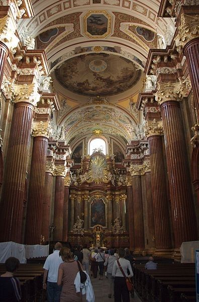
Poznan
## Description Fara Church, officially known as **The Parish Church of St. Stanislaus (Fara Church)**, is one of the most magnificent Baroque buildings in Poland and a must-visit attraction in Poznań. Built in the **17th century** by Jesuits, it has become a symbol of Poznań’s religious and architectural heritage. With its richly decorated interior, fresco-covered ceilings, and breathtaking altars, it is often considered one of the most beautiful Baroque churches in Europe. What makes the Fara Church unique is not only its grandeur but also the **acoustics** that make it a popular venue for organ concerts. The church houses an impressive **pipe organ with over 2,000 pipes**, and visitors are often treated to free concerts showcasing the instrument’s power and elegance. A little-known fact about the church is that beneath it lies a series of **underground chambers** and crypts, some of which are occasionally open to the public during guided tours. Another interesting detail is the presence of **trompe-l’œil painting techniques** inside, which create optical illusions, making the decorations appear three-dimensional and more elaborate than they actually are. ## Location Fara Church is located in **Poznań, Poland**, in the **Greater Poland region**. It stands in the **Old Town district**, just a short walk from the famous **Old Market Square (Stary Rynek)**. The church’s location in the historic heart of the city makes it easy to combine a visit with other nearby attractions such as the Town Hall and the Royal Castle. ### Recommendation on How to Get There From **Poznań Główny railway station**, you can take a tram to **Wrocławska or Marcinkowskiego stops**, and from there, it’s only a few minutes’ walk to the church. For those already in the city center, Fara Church is easily accessible on foot. If you’re arriving by car, it’s recommended to park in one of the nearby parking facilities since the Old Town area has limited vehicle access. ## Tips To make your visit to Fara Church in Poznań truly memorable, here are some practical tips: * **Visit During Concerts**: Try to attend one of the free or low-cost organ concerts held regularly inside the church. The acoustics are remarkable. * **Guided Tours**: If available, join a guided tour to access the underground chambers and learn about the Jesuit history of the church. * **Photography**: Bring a camera, but be mindful of ongoing services and respect worshippers. The light filtering through stained glass windows creates stunning photo opportunities. * **Timing**: Visit in the morning or late afternoon when the church is quieter, as midday tends to attract more tourists. * **Combine with Old Town Walk**: Since it’s centrally located, you can easily combine your visit with a stroll through the Old Market Square and surrounding historic streets. * **Respect the Atmosphere**: Remember that Fara Church is still an active place of worship, so dress modestly and remain quiet during services. ## Conclusion Fara Church in Poznań is a masterpiece of Baroque architecture and a cultural highlight of the city. With its ornate interior, fascinating history, and world-class acoustics, it offers a unique experience for visitors interested in history, art, or music. A trip to Poznań wouldn’t be complete without stepping inside this architectural gem. ## FAQ **1. What is the full name of Fara Church?** Its official name is the Parish Church of St. Stanislaus (Fara Church). **2. Is there an entrance fee to visit the church?** No, entry is free, though donations are welcome. Special guided tours or concerts may have a small fee. **3. Can tourists attend religious services?** Yes, but visitors are asked to remain respectful and quiet during services. **4. What makes the church special compared to others in Poznań?** Its Baroque design, richly decorated interior, and famous pipe organ make it one of the most outstanding churches in Poland. **5. Is the church accessible for people with disabilities?** The main entrance is accessible, but some underground chambers may not be suitable for those with mobility issues. **6. How long does a visit usually take?** A typical visit lasts **30 minutes to 1 hour**, but if you attend a concert or guided tour, you might stay longer. ## Links * [Official website of Fara Church](https://fara.archpoznan.pl/pl/) * [Poznań Tourism Office](https://visitpoznan.pl/en)
GemVoyage Team • World
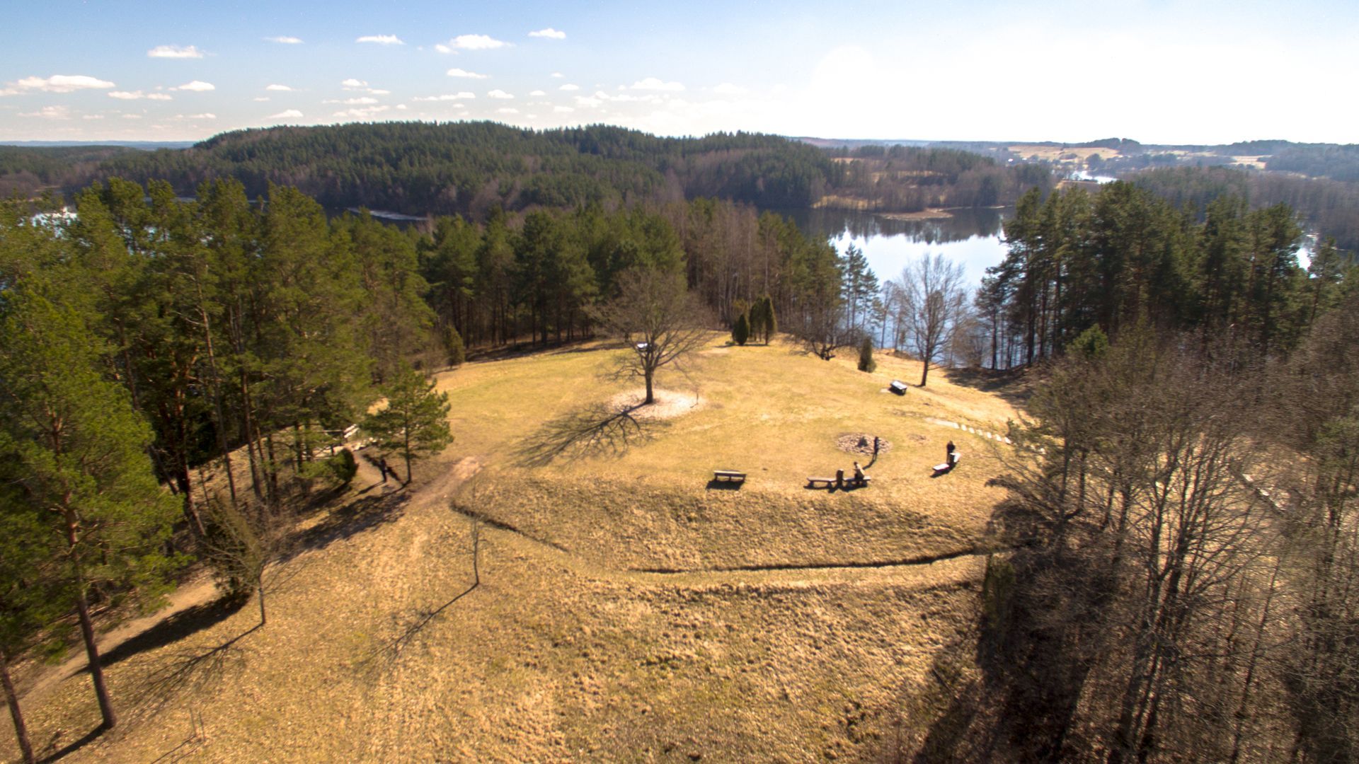
Ignalina
## Description Ladakalnis is a scenic hill in northeastern Lithuania, celebrated for panoramic views that sweep across a chain of lakes, boglands, and mixed forest typical of the Aukštaitija region. The hill’s exposed viewpoints reveal an interlocking pattern of water and woodland that feels deeply characteristic of the Baltic landscape—quiet lakes framed by birch and pine, rippling reed beds, and a largely undeveloped horizon that invites contemplative walks and photography. Beyond its scenic value, Ladakalnis carries cultural resonance. Historically a meeting place and, in local traditions, associated with pre-Christian ritual activities, the hill has hosted small folklore events and seasonal gatherings through the centuries. Modest archaeological traces nearby suggest long-term human use of the area, while modern conservation efforts keep the trails accessible and the ecosystem intact. Visitors come for sunrise and sunset views, birdwatching, and gentle hikes that do not require advanced equipment but repay visitors with memorable vistas. ## Location Ladakalnis sits near the town of Ignalina in Utena County, northeastern Lithuania, within the broader area associated with Aukštaitija National Park and its lakes. The region is popular with nature enthusiasts for its clean waters, preserved shorelines, and well-managed recreational infrastructure. Access is easiest by car from Ignalina or nearby towns; local roads and signage lead to modest parking areas close to the trailhead. Public transport options may include regional buses to Ignalina, after which a short taxi ride or arranged shuttle can bring you to the site. Because the area is rural, plan transfers in advance if you do not have a private vehicle. ## Tips - **Time your visit for light and solitude:** Sunrise and late afternoon provide the best light for photography and the calmest atmosphere. - **Bring optics and field guides:** Binoculars and a basic bird or plant guide enhance the experience for birdwatching and identifying regional flora. - **Wear good footwear:** Paths can be rocky and uneven in places—sturdy shoes or trail runners are recommended. - **Pack essentials:** Carry water, snacks, and weather-appropriate layers; top facilities may be limited. - **Combine with nearby nature activities:** Pair this short hike with a boat excursion, a canoe trip, or additional trails in Aukštaitija National Park for a fuller outdoor itinerary. ## Conclusion Ladakalnis is an inviting short excursion that rewards modest effort with expansive Baltic panoramas. It’s well suited for photographers, families, and hikers seeking a contemplative outdoor experience anchored in both scenic beauty and local tradition. ## FAQ - **Q: How difficult is the hike to the summit?** A: The walk is moderate and accessible to most visitors with basic fitness; trail length and gradient are manageable but wear suitable footwear. - **Q: Are the trails clearly marked?** A: Local paths and signage guide visitors to the viewpoint, though markers can be sparse in places—carry a map or GPS track if you prefer added reassurance. - **Q: Is camping allowed near Ladakalnis?** A: Wild camping is generally discouraged in protected zones—use established campsites in Aukštaitija National Park and follow local regulations. - **Q: When is the best time for birdwatching?** A: Spring migration and early summer offer abundant bird activity; dawn and dusk are particularly productive for raptors and waterbirds. - **Q: Are there restroom or food facilities?** A: Facilities at the top are limited. Plan to bring water and snacks or return to nearby towns for services. ## Links -- [Ladakalnis](https://www.aparkai.lt/en/sightseeing-places/ladakalnis/)
GemVoyage Team • World
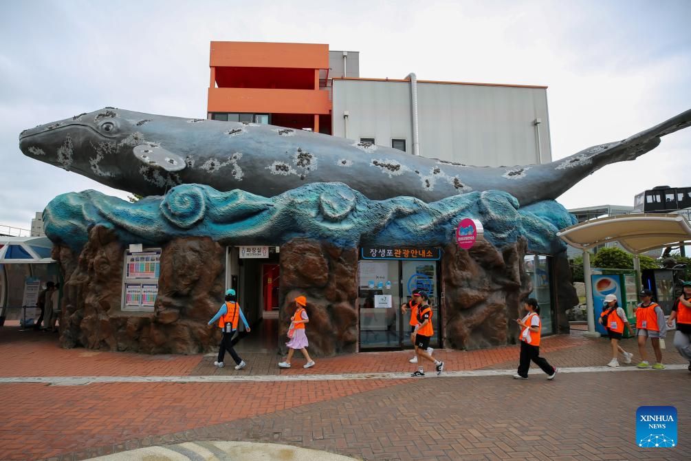
Ulsan
## Description Jangsaengpo Whale Museum, known in Korean as 장생포 고래박물관, is a unique cultural and educational attraction dedicated to the history of whaling and the relationship between humans and whales in Korea. Located in the historic port area of Jangsaengpo, the museum tells the story of how this small coastal village once became the center of Korea’s modern whaling industry. Today, the museum focuses on preservation, education, and awareness, offering visitors a thoughtful look at marine life and changing human values. What makes the Jangsaengpo Whale Museum unique is its comprehensive approach to the subject. Rather than celebrating whaling alone, the museum places strong emphasis on marine conservation and scientific research. Visitors can see full-scale whale skeletons, detailed dioramas, interactive displays, and multimedia presentations that explain whale biology, migration patterns, and communication. A little-known fact is that Jangsaengpo was once home to thousands of whalers before commercial whaling was banned in Korea in the 1980s. Another lesser-known detail is that the museum works closely with research institutions to study whales that are found stranded along the Korean coast, contributing to ongoing marine science. The museum offers an engaging experience that combines history, education, and environmental awareness in a balanced and accessible way. ## Location Jangsaengpo Whale Museum is located in **South Korea**, in the **Ulsan Metropolitan City**, within the **Nam-gu** district, in the Jangsaengpo area. Ulsan lies on the southeastern coast of the country and is known as both an industrial hub and a gateway to coastal nature. To get there, visitors can travel to Ulsan by KTX high-speed train or intercity bus from major cities such as Seoul or Busan. From Ulsan city center or Ulsan Station, local buses or taxis provide easy access to the Jangsaengpo district. The museum is well signposted and is close to other attractions such as Jangsaengpo Whale Cultural Village and the Whale Watching Port. ## Tips * Combine your visit with nearby attractions like the Whale Cultural Village to gain a fuller understanding of the area’s history. * Allow at least one to two hours to explore the museum at a comfortable pace. * Many exhibits are family-friendly, making the museum suitable for children and school groups. * Check opening hours in advance, as they may vary by season or on public holidays. * Some explanations are in Korean only, so using a translation app can enhance your experience. * Visit on a weekday for a quieter and more relaxed atmosphere. ## Conclusion Jangsaengpo Whale Museum offers a meaningful and educational look into Korea’s maritime past and its evolving relationship with whales. Through well-curated exhibits and a strong conservation message, the museum provides visitors with both knowledge and reflection, making it a standout cultural attraction in Ulsan. ## FAQ **Is the Jangsaengpo Whale Museum suitable for children?** Yes, the museum features interactive displays and visual exhibits that are engaging for children. **How long does a typical visit take?** Most visitors spend between one and two hours exploring the museum. **Is the museum focused only on whaling history?** No, it also emphasizes whale biology, conservation, and modern research efforts. **Are English explanations available?** Some exhibits include English descriptions, but not all, so a translation app can be helpful. **Is photography allowed inside the museum?** Photography is generally allowed, though flash or certain areas may be restricted. ## Links * [Jangsaengpo Whale Museum Info](https://english.visitkorea.or.kr/svc/whereToGo/locIntrdn/rgnContentsView.do?vcontsId=85947)
GemVoyage Team • World
New York
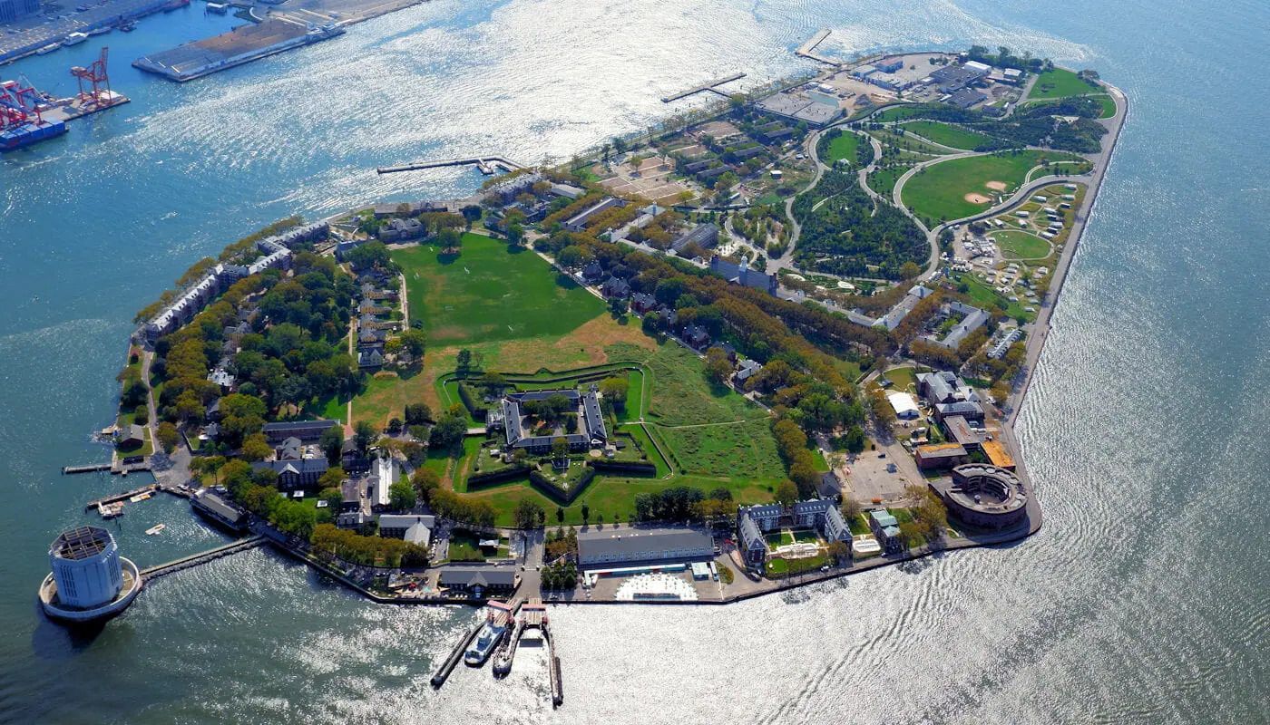
## Description Governors Island is one of New York City's best day trip destinations because it combines harbor views, historic buildings, open green space, and a sense of distance from the city without actually leaving it. The island feels spacious and refreshing in a way that is rare in Manhattan, making it appealing to visitors who want a slower rhythm, bike paths, and outdoor relaxation. The experience is especially strong in warm weather, when the ferry ride itself becomes part of the outing and the skyline views are at their most memorable. What makes Governors Island particularly interesting is that it has moved from a former military and administrative site to a public destination with recreation, arts, and heritage uses. A lesser-known fact is that much of the island's character comes from its reuse: old structures now sit alongside lawns, paths, and public programming. Another detail many first-time visitors appreciate is how easy it is to build a flexible day there, whether you want to picnic, explore, rent bikes, or simply enjoy the harbor air. ## Location Governors Island is in New York Harbor, just south of Manhattan in the United States. It is reached by ferry from designated terminals in Manhattan and sometimes Brooklyn, depending on the season and service schedule. Because access is by boat, the visit naturally feels like a break from the city. The short ride is part of what makes the island appealing and memorable. The best way to visit is to check ferry times ahead of time and plan enough hours on the island to make the crossing worthwhile. Once there, the grounds are easy to explore on foot or by bike. It is one of the most straightforward and rewarding day trips in the New York area. ## Tips - Check the ferry schedule before you go so you can make the most of your time on the island. - Bring food, water, or a picnic plan if you want to enjoy the green space more fully. - Rent a bike if you want to see more of the island without spending the whole day walking. - Go in good weather if possible, since the outdoor setting is a major part of the appeal. - Bring layers, because harbor breezes can make the island feel cooler than Manhattan. - Leave time for skyline views on the return ferry, which are often one of the highlights. ## Conclusion Governors Island is one of the easiest ways to feel removed from New York City while still being within sight of it. Its combination of history, green space, and harbor views makes it an excellent, low-stress escape. ## FAQ ### How do I get to Governors Island? You usually take a ferry from Manhattan or, depending on the season, from Brooklyn. The ferry is simple to use and is part of the experience because it gives you immediate harbor and skyline views. ### Is Governors Island worth visiting for a short trip? Yes, but it is even better if you have several hours. The island's appeal comes from unhurried exploration, open space, and the ferry ride itself, so a longer visit feels more rewarding. ### Can I bike there? Yes, and biking is one of the best ways to cover more ground. The island is well suited to cycling because it is relatively open and easy to navigate. ### Is it family-friendly? Very much so. Families often appreciate the car-free environment, open lawns, and relaxed pace. It is one of the more comfortable outdoor outings in the New York area. ### What should I bring? Water, comfortable walking shoes, sun protection, and perhaps food if you want a picnic. Because the island is such a good open-air destination, it helps to prepare for spending most of the day outside. ## Links - [Official website](https://www.govisland.com/) - [Wikipedia](https://en.wikipedia.org/wiki/Governors_Island)
GemVoyage Team • World
Los Angeles
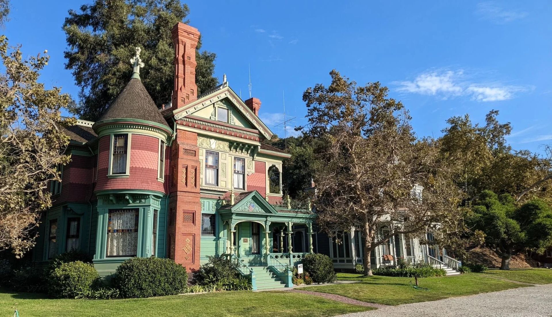
## Description Heritage Square Museum is an extraordinary open-air architectural museum that gathers Victorian and early 20th-century houses and outbuildings within a single historic district to showcase Southern California’s built environment and social history. Each structure has a carefully reconstructed exterior and interpreted interior that reveal the craftsmanship, decorative trends, and daily rhythms of life from a period when Los Angeles was transforming from a frontier town into a burgeoning metropolis. The museum stands out for the authenticity of its fabric: original trim, stained glass, tile, and millwork are preserved or painstakingly restored, and many interiors are furnished with period-appropriate objects to convey domestic stories. Preservation workshops on site keep traditional trades alive—carpentry, plasterwork, and decorative finishes are practiced as living crafts, which both supports ongoing maintenance and educates visitors about restoration techniques. Beyond architecture, Heritage Square interprets social history. Exhibits explore how families lived, worked, and entertained across different socioeconomic strata, and the museum’s programming—guided tours, living history demonstrations, and seasonal festivals—brings these narratives to life. Special events often highlight conservation issues and the ongoing need to protect historic urban fabric in the face of development pressures. For scholars, students, and casual visitors alike, the site offers layered experiences: a close reading of architectural detail, hands-on learning in workshops, and interpretive narratives that connect buildings to broader histories of migration, industry, and urban change. Its role as a rescue repository—structures moved and reassembled to avoid demolition—adds an extra dimension: many buildings carry stories of mid-century urban renewal and community efforts to preserve heritage. ## Location Heritage Square Museum is located in the Montecito Heights neighborhood of Los Angeles, California, a short drive northeast of downtown Los Angeles. The setting—on a hillside with city views—provides a scenic backdrop for exploring an era of American domestic architecture. Getting there: Driving is the most convenient option; limited on-site parking is available. Public transit can be used but often requires transfers and a short walk—check local transit schedules and plan for extra time. Rideshare and local taxis are convenient alternatives. Pair a visit with nearby cultural stops, such as the Huntington Library or local hillside parks, to create a fuller day of exploration. ## Tips - Check the museum’s tour schedule and special-event calendar before you go; guided tours offer the most context and are often led by knowledgeable docents. - Wear comfortable shoes—paths through the outdoor site can be uneven and some properties require short climbs. - Give yourself at least two hours to explore; the combination of interiors, workshops, and outdoor exhibits rewards a relaxed pace. - Bring a camera for exterior architectural photography; observe interior photography rules where posted and respect exhibit boundaries. - If interested in historic trades, inquire about workshop schedules or volunteer opportunities—many preservation skills are demonstrated on site. - Visit in spring or fall for pleasant weather and outdoor events; summer can be warm and winter may bring cooler, wetter days. ## Conclusion Heritage Square Museum preserves an essential chapter of Southern California’s architectural story. By combining rescued structures, conservation workshops, and interpretive programming, it offers a hands-on way to understand historic building crafts and the lives of the people who inhabited these homes. It is an inspiring stop for anyone interested in architecture, preservation, and urban history. ## FAQ Q: Are there guided tours? A: Yes. The museum runs scheduled guided tours and special programs; tours are recommended for first-time visitors to gain historical context and architectural insight. Q: Is the site family-friendly? A: Yes. The museum offers family-oriented programs and activities; children can learn about historic life through interactive demonstrations. Q: Can event spaces be rented? A: Select areas may be rented for private events, though availability and restrictions vary—contact the museum’s events office for details. Q: Are there volunteer opportunities or workshops? A: Yes. The museum often offers volunteer roles, preservation workshops, and demonstrations of traditional trades—check the calendar or volunteer page for current options. Q: Is the site wheelchair accessible? A: Some areas have limited accessibility due to the nature of historic structures and terrain; the museum can provide guidance on accessible routes and accommodations. Q: What’s the best way to learn about restoration techniques demonstrated on site? A: Attend preservation workshops, guided tours that focus on conservation, or scheduled demonstrations—these sessions are designed to explain both craft techniques and the rationale behind repair choices. ## Links - [Heritage Square Museum (official)](https://www.heritagesquare.org) - [Wikipedia: Heritage Square Museum](https://en.wikipedia.org/wiki/Heritage_Square_Museum)
GemVoyage Team • World

Comments