GemVoyage Team • World
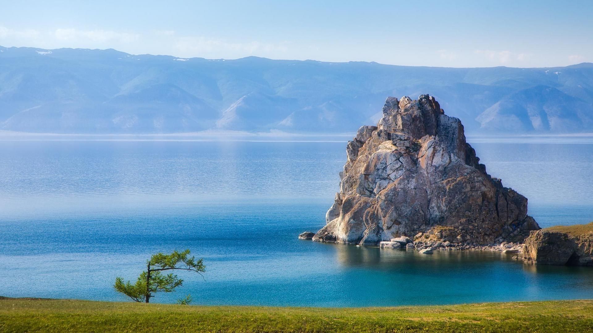
Baikal is also a hotspot of biodiversity and scientific interest. Its shoreline, submerged terraces, and deep basins host numerous endemic species found nowhere else on Earth, including the Baikal seal (nerpa) — the only seal species that has adapted to a fully freshwater environment — and dozens of endemic fish and invertebrates. The lake’s unique ecology is the result of millions of years of relative isolation, stable cold temperatures at depth, and complex nutrient cycling. Scientists study Baikal to better understand limnological processes, long-term climate records trapped in sediment layers, and the evolution of isolated ecosystems.
For travelers, Baikal delivers a rare combination of dramatic landscapes and varied activities across seasons. In summer, the shoreline blooms with wildflowers, and mountain hikes and multi-day treks through taiga and steppe reveal panoramic views over the water. Kayaking, boat excursions, and shoreline camping let you sample the lake’s nearshore biodiversity and peaceful beaches. In winter, when the lake freezes, the surface becomes a vast frozen highway: locals and guides lead safe ice-walking excursions, cross-lake snowmobile trips, ice-fishing experiences, and festivals that celebrate the season. Photographers prize Baikal for its vivid ice formations, clear reflections, and light at dawn and dusk.
Beyond natural spectacle, Baikal is threaded with human stories: small lakeside towns such as Listvyanka, the ferry-served Olkhon Island with its shamanic sites, and the city of Irkutsk — a historical gateway with Siberian wooden architecture and museums — are rich portals into local culture. Sustainable and low-impact travel is increasingly available via small-scale guesthouses, ecotour operators, and community-led tours that prioritize the lake’s protection.
Discover more hidden gems you might love.
Surabaya
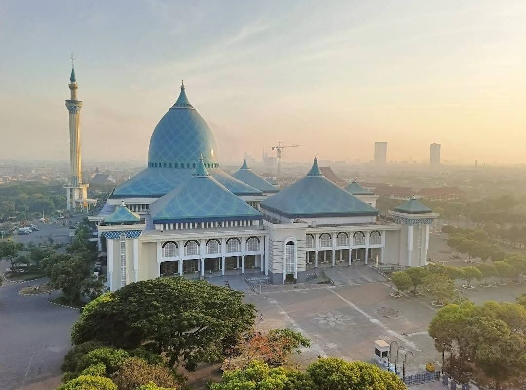
## Description **Masjid Al Akbar Surabaya**, often referred to as the **Grand Mosque of Surabaya**, is one of the largest and most magnificent mosques in Indonesia. Completed in 2000, this architectural marvel is a significant religious landmark and a cultural treasure in East Java. Its grandeur, unique design, and serene atmosphere make it a must-visit for both worshippers and travelers interested in Indonesia’s rich Islamic heritage. The mosque is instantly recognizable for its **striking turquoise dome**, which is one of the largest in Southeast Asia, measuring 27 meters in diameter and standing 54 meters high. The dome is surrounded by smaller domes and a towering minaret that rises to 99 meters, symbolizing the **99 names of Allah** in Islam. From the top of the minaret, visitors can enjoy panoramic views of Surabaya city, stretching out toward the Java Sea on clear days. **Little-known facts**: * The mosque can accommodate **up to 59,000 worshippers** at once, making it one of the largest in the country. * The minaret was specifically designed with a viewing platform, offering a rare opportunity for visitors to appreciate both the mosque and Surabaya from above. --- ## Location Masjid Al Akbar is located in **Surabaya**, the bustling capital of **East Java Province**, in **Indonesia**. It stands prominently on **Jalan Pagesangan**, near the Surabaya–Gempol toll road, making it easily accessible for both locals and visitors. ### How to get there: * From **Juanda International Airport**, the mosque is about 15 kilometers away and can be reached by taxi in around 30–40 minutes, depending on traffic. * From Surabaya city center, you can take a taxi, car rental, or use ride-hailing apps like Gojek or Grab for a convenient trip. Public buses also stop nearby, but private transportation is recommended for comfort and ease. --- ## Tips * **Visit during non-prayer hours**: If you’re a non-Muslim visitor, it’s best to explore the mosque outside the five daily prayer times to avoid crowds and to be respectful. * **Dress modestly**: Visitors are expected to wear modest clothing. Women may be provided with robes and headscarves if needed. * **Climb the minaret**: Don’t miss the chance to go up the 99-meter-high minaret for an incredible bird’s-eye view of Surabaya. * **Photography etiquette**: The mosque’s interior and exterior are highly photogenic, but always be respectful when taking photos, especially if worshippers are present. * **Combine your visit**: Masjid Al Akbar is close to Surabaya’s other attractions, such as the Surabaya Zoo and Taman Bungkul Park, making it easy to plan a full day of sightseeing. --- ## Conclusion Masjid Al Akbar Surabaya is not just a place of worship—it’s an architectural icon and cultural landmark in East Java. With its vast turquoise dome, symbolic minaret, and capacity to welcome tens of thousands of worshippers, it embodies the grandeur of Islamic architecture in Indonesia. Whether you come for prayer, cultural appreciation, or panoramic city views, the mosque offers a memorable and enriching experience. --- ## FAQ **1. What makes Masjid Al Akbar unique?** Its massive turquoise dome, 99-meter-high minaret, and capacity for nearly 59,000 worshippers make it one of Indonesia’s largest and most iconic mosques. **2. Can non-Muslims visit the mosque?** Yes, non-Muslims are welcome outside of prayer times, provided they dress modestly and respect the sanctity of the space. **3. Is there an entrance fee?** No, entry to Masjid Al Akbar is free, though small donations are appreciated. A small fee may apply if you want to access the minaret viewing platform. **4. When is the best time to visit?** Early mornings and late afternoons are ideal for cooler weather and softer lighting, perfect for photography and sightseeing. **5. How long does a visit usually take?** Most visitors spend 1–2 hours, especially if they include a trip up the minaret. **6. Is the mosque accessible for families and elderly visitors?** Yes, the mosque has ramps, elevators, and spacious areas, making it suitable for families with children and elderly visitors. --- ## Links * [Indonesia Travel – Official Site](https://www.indonesia.travel/gb/en/) * [East Java Tourism Board](https://www.eastjava.com/)
GemVoyage Team • World
Rome
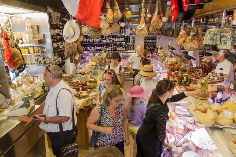
## Description Testaccio Market (Mercato Testaccio) is a lively, authentic food market at the heart of one of Rome’s most food-forward neighborhoods. Unlike the tourist-heavy markets closer to the historic center, Testaccio retains a working-market energy: long-time vendors sell seasonal fruit and vegetables, butchers and fishmongers prepare daily stock, and small eateries and street-food counters push culinary tradition forward. The market is famed for staples such as porchetta sandwiches, supplì and a wide selection of Italian cheeses and cured meats, while newer artisanal stalls introduce contemporary flavors, craft gelato and fusion snacks. What distinguishes Testaccio is its deep connection to the local history. Monte Testaccio—an artificial mound of broken amphorae from the Roman period—anchors the area’s archaeology and speaks to the neighborhood’s centuries-long role as Rome’s distribution and storage quarter. That heritage informs the food culture: local producers, family-run stalls and traditional recipes coexist with experimental kitchens, meaning a single visit can offer both classic Roman comfort foods and creative reinterpretations. The market’s compact layout makes it an ideal stop for tasting rather than full dining—sample multiple vendors over a morning and build a small feast. Culinary tours often include the market because it presents both quality ingredients and convivial daily life: you’ll hear vendors bartering, watch knives at work behind counters, and find specialty shops selling olive oil, aged cheeses and regional preserves. ## Location Testaccio Market is located in the heart of the Testaccio neighborhood, south of the Aventine Hill and a short ride from Rome’s historic center. The nearest metro stop is Piramide on Line B; several bus routes also serve the area, and many visitors walk from nearby neighborhoods like Trastevere or the Aventine for a scenic stroll. The market is close to other attractions—Pyramid of Cestius, riverfront walks and a lively restaurant scene—making it easy to build a food-focused itinerary. If you prefer to mix shopping with sightseeing, plan an early morning visit for the freshest produce and a quieter atmosphere, or go mid-afternoon to sample street food and sample plates as vendors prepare for evening trade. ## Tips - Arrive in the morning for peak freshness and to see the market at full pulse; many vendors begin packing up by late afternoon. - Be adventurous with sampling: try porchetta, supplì, fresh pasta to-go and the market’s cured meats—ask vendors for their recommendations. - Carry small change and a reusable bag; while many places accept cards now, smaller stalls still prefer cash. - If you want a guided tasting, several local food tours include the market and introduce signature stalls and historical anecdotes. - After browsing, explore nearby eateries in Testaccio for fuller meals or head to the riverfront for a relaxed walk. ## Conclusion Testaccio Market is a living portrait of Roman food culture: hands-on, edible and evolving. It’s the place to taste ingredients in their most immediate form, to listen to local foodways in conversation and to discover how centuries of commerce and community shaped a distinctly Roman palate. For culinary travelers seeking authentic flavors and friendly vendor encounters, Testaccio remains indispensable. ## FAQ Q: What are the market’s opening hours? A: Hours vary by stall, but most vendors open early morning and many close by late afternoon; specialty eateries may open again for evening service—check specific stall times if you have a destination vendor. Q: Can I eat on-site or should I take food away? A: Both. Many stalls prepare foods to eat immediately and provide small eating areas or counters; taking items to nearby picnic spots or a short walk is also common. Q: Is Testaccio Market suitable for dietary restrictions? A: Yes—ask vendors about ingredients. You can find vegetarian pasta, vegetable-based dishes and some stalls that accommodate allergies, but always ask about preparation and cross-contamination. Q: Are there guided tours of the market? A: Yes, several local food-tour operators include Testaccio in tasting itineraries; a guided tour is a great way to discover favorite stalls and sample local specialties. Q: Is the market touristy? A: Testaccio retains a local feel despite growing interest from visitors; early mornings are best for a more authentic experience. ## Links - [Testaccio](https://www.lavitaroma.com/blog/2017/03/17/testaccio-market-rome)
GemVoyage Team • World
Dubysa
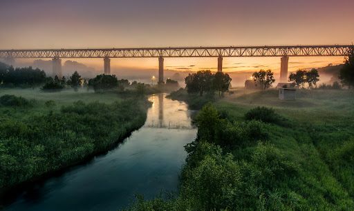
## Description Lyduvėnai Bridge is an arresting piece of nineteenth- and twentieth-century engineering that spans the deep, wooded Dubysa River valley near Lyduvėnai. Its soaring iron arches and lattice work combine functional railway engineering with a sculptural presence that is particularly striking when framed by the steep gorge below. Photographers, history enthusiasts and hikers are drawn to the site for the dramatic perspectives it creates—an industrial monument suspended over a wild, verdant canyon. Over time the bridge has required restorations and careful maintenance, and those interventions are part of its layered history. Local preservation efforts have sought to keep the bridge operational while respecting its historical materials and structure. The engineered spans and riveted ironwork tell a story about rail transport, regional development and the craft of steel construction. Beyond its technical merits, Lyduvėnai Bridge sits within a landscape of trails, viewpoints and small rural roads that allow visitors to explore the canyon from multiple angles. Birdsong and river sounds contrast with the bridge’s metallic lines, and seasonal changes—spring greens, autumn foliage—transform the setting dramatically, offering different moods for photographic study. ## Location Lyduvėnai Bridge is located near the village of Lyduvėnai in Raseiniai district municipality, Kaunas County, central-western Lithuania. It spans the Dubysa River in a steep, forested valley that is characteristic of the region’s mixed agricultural and wooded landscape. Access is most convenient by car: follow regional roads from Raseiniai and nearby towns. Public transport to the immediate vicinity is limited, so visitors relying on buses or trains should plan for a taxi or private transfer for the final leg. The rural setting rewards a slower pace—park at designated pullouts or village car parks and follow marked trails toward viewpoints. ## Tips - Photograph at golden hour—early morning or late afternoon—when light sculpts the ironwork and the valley takes on warm tones. - Never walk on active tracks; use official viewpoints and trails to keep a safe distance while still getting dramatic compositions. - Bring sturdy shoes and insect repellant for nearby trails; the area can be steep and overgrown in parts. - Combine the visit with local villages, riverside hikes and birdwatching; pack water and snacks as amenities are sparse. - Check local guidance on accessibility—some viewpoints require steep walks, while others are more level and family-friendly. ## Conclusion Lyduvėnai Bridge is an exemplar of how engineering and landscape can produce a site of compelling beauty. The bridge rewards visitors who slow down to observe structural detail, changing light and the interplay of human craft with natural settings. Whether you come for history, photography or a quiet day outdoors, the bridge and its surrounding valley offer memorable vistas and a distinct slice of regional heritage. ## FAQ Q: Can visitors walk across the bridge? A: No. For safety and legal reasons, do not walk on active railway tracks. Use the designated viewpoints and trails which provide safe vantage points. Q: Is the bridge accessible by car? A: Yes, but roads are rural and sometimes narrow—drive carefully and park only in designated areas or official pullouts. Q: Are there guided tours or information panels on site? A: Information is limited on-site; local heritage groups sometimes publish guides or online materials—check regional tourism resources for up-to-date information. Q: What wildlife might I see in the Dubysa valley? A: The valley supports woodland birds, small mammals and a range of plant life; spring and autumn are best for birdwatching and seasonal flora. Q: Is it possible to photograph the bridge from below? A: Some viewpoints near the riverside allow lower-angle shots, but access may be steep and require caution; respect private property and posted restrictions. ## Links - [Lyduvėnai Bridge](https://militaryheritagetourism.info/en/military/sites/view/800)
GemVoyage Team • World
Berlin
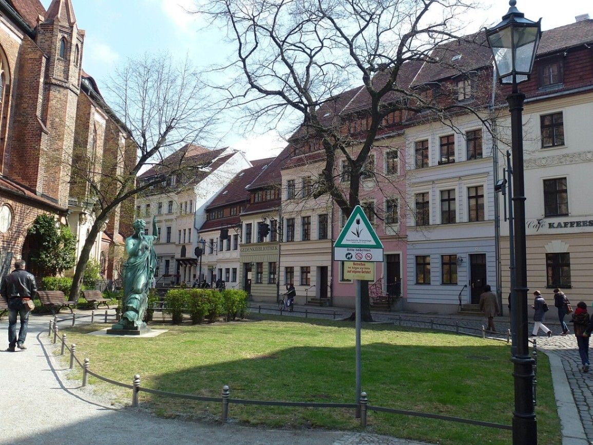
## Description Nikolaiviertel is one of Berlin’s most atmospheric neighborhoods and holds a special place in the city’s history. Often referred to as the birthplace of Berlin, this compact quarter feels worlds away from the modern capital filled with glass towers and busy avenues. Cobblestone streets, narrow alleyways, and colorful facades create an almost storybook setting that invites visitors to slow down and explore at a relaxed pace. What makes Nikolaiviertel unique is the way it blends reconstruction with genuine historical remnants. Much of the area was rebuilt in the 1980s by East Germany to celebrate Berlin’s 750th anniversary, carefully recreating the medieval street layout and architectural style. However, it is not merely a replica. Several buildings are authentically old, including the famous Nikolaikirche (St. Nicholas’ Church), Berlin’s oldest church, whose foundations date back to the 13th century. A little-known fact is that some of the buildings in Nikolaiviertel were reconstructed using original architectural fragments salvaged from destroyed historic houses across Berlin. Another interesting detail is that the neighborhood was once home to notable figures such as philosopher Georg Wilhelm Friedrich Hegel, whose former residence can still be seen today. Together, these elements give Nikolaiviertel a sense of authenticity that goes beyond its relatively recent reconstruction. Today, the quarter is known for its small museums, traditional restaurants, cozy cafés, and artisan shops. It is an excellent place to experience a quieter, more intimate side of Berlin while learning about the city’s medieval origins. ## Location Nikolaiviertel is located in Germany, in the federal state and city of Berlin. More precisely, it lies in the central borough of Mitte, close to the eastern bank of the River Spree. The neighborhood sits between Alexanderplatz and the Berlin Cathedral, making it easy to combine with other major attractions in the historic center. Getting to Nikolaiviertel is simple and convenient. The easiest way is by public transport. Visitors can take the U-Bahn (underground) to Klosterstraße (U2 line), which is just a short walk away. Alternatively, Alexanderplatz, one of Berlin’s main transport hubs, is about a 10-minute walk from the quarter. From there, multiple S-Bahn, U-Bahn, tram, and bus lines are available. Walking is also highly recommended if you are already exploring central Berlin, as the surrounding area is pedestrian-friendly and rich in sights. ## Tips To make the most out of a visit to Nikolaiviertel, it is best to arrive early in the day or later in the afternoon. Midday can become crowded, especially during the summer tourist season. Early mornings offer a quieter atmosphere and better opportunities for photography. Comfortable walking shoes are essential, as the cobblestone streets can be uneven. Take your time wandering through the small side streets rather than sticking only to the main paths. This is where you will find hidden courtyards, lesser-known shops, and quieter corners. Consider visiting one of the local museums, such as the Museum Knoblauchhaus, which offers insight into bourgeois life in 18th- and 19th-century Berlin. For food, traditional German restaurants in the area serve classic dishes, but prices can be slightly higher due to the central location. Checking menus beforehand can help avoid surprises. Lastly, Nikolaiviertel is especially charming in the evening when the lights come on and the area feels more intimate. It is a great place for a relaxed dinner after a day of sightseeing. ## Conclusion Nikolaiviertel offers a rare glimpse into Berlin’s medieval past while remaining accessible and welcoming to modern visitors. With its historic atmosphere, central location, and cultural significance, it is a rewarding stop for anyone looking to experience a more traditional and intimate side of the German capital. ## FAQ **Is Nikolaiviertel an original medieval neighborhood?** Nikolaiviertel is a mix of original historic buildings and carefully reconstructed ones. While much of it was rebuilt in the 1980s, several key structures, including Nikolaikirche, are genuinely old. **How much time should I plan for visiting Nikolaiviertel?** Most visitors spend between one and two hours exploring the area. This allows enough time for a leisurely walk, a museum visit, and a meal or coffee break. **Is Nikolaiviertel suitable for families with children?** Yes, the area is family-friendly. Its compact size, pedestrian streets, and small museums make it easy to explore with children. **Do I need to pay an entrance fee to visit Nikolaiviertel?** No, the neighborhood itself is free to explore. However, some museums and attractions within the area may charge an admission fee. **What is the best season to visit Nikolaiviertel?** Spring and early autumn are ideal, offering mild weather and fewer crowds. Summer is also popular but can be busier. ## Links * [Wiki page](https://en.wikipedia.org/wiki/Nikolaiviertel)
GemVoyage Team • World
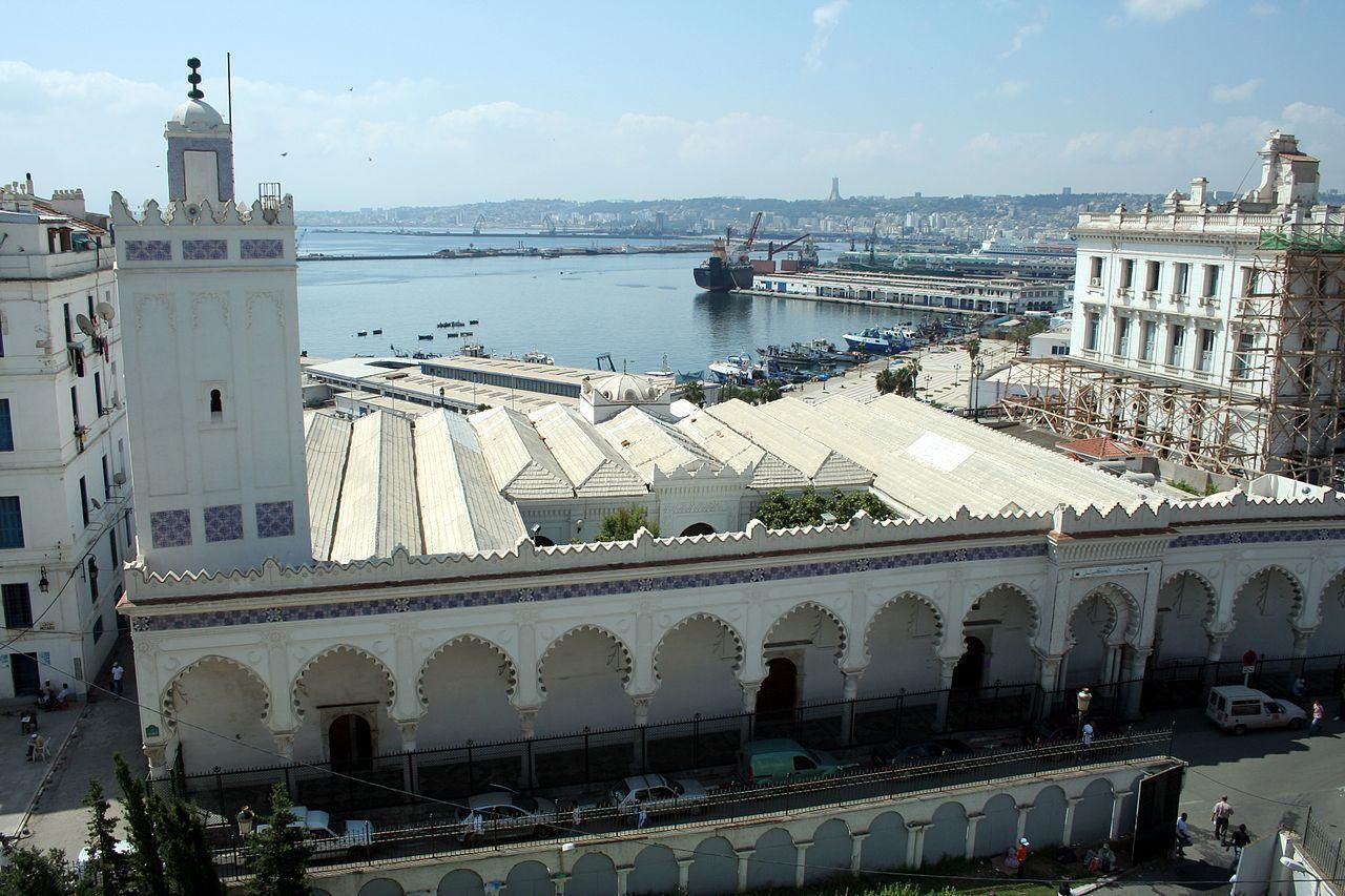
Algeria
## Description Djamaa El Kbir Mosque, known in Arabic as الجامع الكبير الأثري, is one of the oldest and most historically significant mosques in Algeria. Built in 1097 during the Almoravid dynasty, it stands as a powerful reminder of Algiers’ deep Islamic and Mediterranean roots. Unlike more monumental later mosques, Djamaa El Kbir is admired for its restrained elegance, spiritual atmosphere, and architectural authenticity rather than sheer scale. What makes Djamaa El Kbir truly unique is its remarkable continuity. For more than nine centuries, the mosque has remained an active place of worship, surviving earthquakes, invasions, and centuries of urban transformation. Its minaret, added in the 14th century during the Zayyanid period, is one of the oldest in Algiers and features beautifully carved stone decoration that subtly blends Andalusian and Maghrebi styles. A little-known fact is that the mosque was built using spolia—reused columns and materials from earlier Roman structures—linking Islamic Algiers to its ancient past. Another lesser-known detail is that the mosque once formed part of a much larger religious and educational complex serving the Casbah community. Djamaa El Kbir is not only an architectural treasure but also a living symbol of faith, scholarship, and continuity in Algerian history. ## Location Djamaa El Kbir Mosque is located in **Algeria**, in the **Algiers Province**, within the city of **Algiers**. It stands in the historic Casbah district, close to the old harbor and not far from the Ketchaoua Mosque and other major landmarks of the old city. The mosque is easily accessible by foot if you are exploring the Casbah. Visitors can also reach the area by taxi or public transport from central Algiers. The nearest metro stations and bus routes serve the lower Casbah area, from where the mosque is a short walk. Due to narrow streets and limited parking, walking or using public transport is the most practical option. ## Tips * Dress modestly, as Djamaa El Kbir is an active place of worship. * Visit outside of prayer times if you wish to explore quietly and observe architectural details. * Photography may be restricted inside, so always ask permission before taking photos. * Take time to admire the minaret’s stone carvings, which are among the mosque’s most distinctive features. * Combine your visit with a walk through the Casbah to gain deeper historical context. * Consider visiting with a local guide to better understand the mosque’s architectural and historical significance. ## Conclusion Djamaa El Kbir Mosque is a rare and precious link to Algeria’s medieval Islamic past. Its simplicity, age, and continued religious function make it a deeply meaningful site, offering visitors a quiet but powerful insight into the spiritual and historical heart of Algiers. ## FAQ **When was Djamaa El Kbir Mosque built?** The mosque was built in 1097 during the Almoravid period. **Is Djamaa El Kbir still used for prayer?** Yes, it remains an active mosque and serves the local community daily. **Can non-Muslims visit the mosque?** Access may be limited to certain areas, and visitors should be respectful of religious practices. **How long does a visit take?** Most visits last 20 to 40 minutes, depending on access and interest. **Is there an entrance fee?** No, entrance is generally free, though donations may be welcomed. ## Links * [The Mosque's wiki page](https://en.wikipedia.org/wiki/Djamaa_el_Kebir)
GemVoyage Team • World
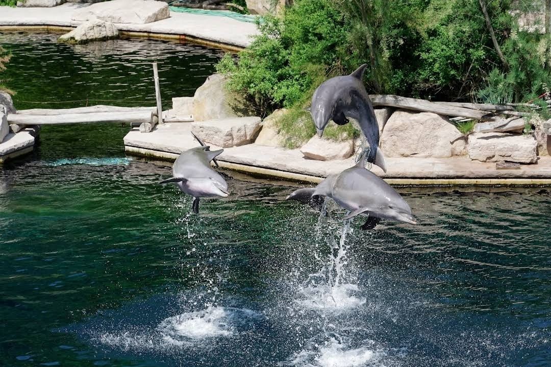
Nürnberg
## Description The **Nürnberg Zoo and Dolphinarium** (Tiergarten Nürnberg) in Germany is one of the most fascinating zoological gardens in Europe, combining a rich natural setting with modern animal care facilities. Spread over **67 hectares of forest and meadowland**, this zoo offers visitors the unique experience of observing animals in spacious enclosures that closely resemble their natural habitats. Unlike many urban zoos, Nürnberg Zoo is nestled within a former sandstone quarry, giving the park a very scenic and distinctive landscape. What makes Nürnberg Zoo particularly unique is its **Dolphinarium**, which opened in 1971 and remains one of the few dolphinariums in Germany. It is home to bottlenose dolphins and manatees, and it has a strong focus on research, conservation, and educational programs. The zoo is internationally recognized for its breeding successes with endangered species such as the manatee, snow leopard, and Siberian tiger. A little-known fact about Nürnberg Zoo is that it houses **Europe’s only Aqua Park for dolphins** connected directly to a lagoon system, providing a near-natural environment for the marine mammals. Another interesting fact is that the zoo was originally founded in 1912, making it over a century old, though it had to be rebuilt after World War II due to heavy destruction. ## Location The Nürnberg Zoo and Dolphinarium is located in **Nuremberg (Nürnberg), Bavaria, Germany**. The zoo lies in the eastern part of the city, in a wooded area that gives it a peaceful and natural atmosphere. * **Country:** Germany * **Region:** Bavaria (Bayern) * **City:** Nuremberg (Nürnberg) ### How to Get There Visitors can reach the zoo easily by **public transportation**. From Nuremberg’s city center, take tram line 5 or bus line 65, which stop directly at the entrance of the zoo. For international visitors, the nearest airport is **Nuremberg Airport (NUE)**, located only about 13 km away. If you are driving, there is ample parking space near the entrance. For an eco-friendly option, cycling through the scenic routes of Nuremberg to the zoo is also recommended. ## Tips To make the most of your visit to Nürnberg Zoo and Dolphinarium, here are some useful tips: 1. **Plan Enough Time** – The zoo covers a vast area, so allow at least half a day, ideally a full day, to explore both the zoo and the Dolphinarium. 2. **Check Show Times** – The dolphin presentations are the highlight of the visit. Be sure to check the schedule in advance so you don’t miss it. 3. **Wear Comfortable Shoes** – With its hilly terrain and large grounds, comfortable walking shoes are a must. 4. **Bring Snacks or Enjoy Local Food** – While the zoo has restaurants and snack stations, bringing your own picnic is also a great option. 5. **Visit the Children’s Zoo** – Families with young kids will love the petting area where children can interact with farm animals. 6. **Best Seasons to Visit** – Spring and summer are particularly pleasant, as many animals are more active outdoors and the lush greenery makes the park extra beautiful. --- ## Conclusion The **Nürnberg Zoo and Dolphinarium** is more than just a zoo—it is a unique blend of history, nature, and modern animal conservation. With its scenic landscape, rare animal species, and one of Germany’s only dolphinariums, it offers a memorable experience for visitors of all ages. Whether you’re a family with children, an animal enthusiast, or simply a traveler exploring Bavaria, this attraction is well worth a visit. --- ## FAQ **1. How long should I plan for a visit to Nürnberg Zoo?** Most visitors spend between **4 to 6 hours** exploring the zoo and enjoying the dolphin shows. **2. Is the Dolphinarium included in the zoo ticket price?** Yes, admission to the Dolphinarium is included in the **general zoo entrance fee**. **3. Can I bring food and drinks into the zoo?** Yes, visitors are welcome to bring their own food and enjoy a picnic in designated areas. **4. Is Nürnberg Zoo open all year round?** Yes, the zoo is open daily, including weekends and holidays. However, opening hours may vary by season. **5. What animals can I see at Nürnberg Zoo?** The zoo is home to over **300 animal species**, including dolphins, manatees, snow leopards, polar bears, and Siberian tigers. --- ## Links * [Official Nürnberg Zoo Website](https://tiergarten.nuernberg.de) * [Tourist Information for Nuremberg](https://tourismus.nuernberg.de)
GemVoyage Team • World

Comments