Discover extraordinary places shared by our community of travelers
Auvergne-Rhône-Alpes
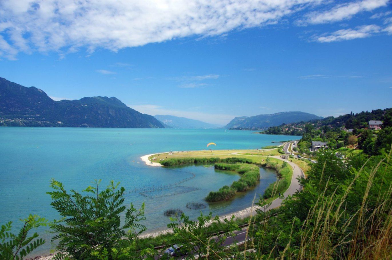
## Description Lac du Bourget is the largest natural lake entirely within France and one of the most scenic bodies of water in the country. Surrounded by mountains, historic towns, and thermal spa resorts, the lake offers a perfect blend of natural beauty, outdoor activities, and cultural heritage. Its calm blue waters and dramatic alpine backdrop have inspired writers, poets, and travelers for centuries, making it a destination that appeals to nature lovers and culture seekers alike. What makes Lac du Bourget truly unique is its diversity. Visitors can enjoy swimming, sailing, paddleboarding, and cycling along the shoreline, while also exploring charming lakeside towns such as Aix-les-Bains and Le Bourget-du-Lac. A little-known fact is that the lake reaches depths of over 140 meters, making it not only the largest but also one of the deepest lakes in France. Another lesser-known detail is its strong literary connection: the famous French poet Alphonse de Lamartine immortalized the lake in his poem *Le Lac*, turning it into a symbol of romantic longing in French literature. Despite its popularity, Lac du Bourget retains a peaceful atmosphere, especially outside peak summer months, making it ideal for travelers seeking both relaxation and discovery. ## Location Lac du Bourget is located in **France**, in the **Auvergne-Rhône-Alpes** region, within the **Savoie** department. The lake lies between the cities of Aix-les-Bains and Chambéry, at the western edge of the Alps. Reaching Lac du Bourget is easy. The closest major town, Aix-les-Bains, has a well-connected train station with direct services from cities such as Lyon, Geneva, and Paris. From the station, local buses, taxis, or walking paths lead directly to the lakeshore. Travelers arriving by car can access the area via the A41 motorway, which connects Chambéry to Geneva. Cycling paths also run along parts of the lake, offering a scenic and eco-friendly way to explore the surroundings. ## Tips * Visit between late spring and early autumn for the best weather and full access to water activities. * Early mornings and weekdays are ideal for enjoying the lake in a quieter, more peaceful setting. * Bring swimwear and a towel, as many public beaches offer free or low-cost access. * Rent a boat or take a guided cruise to appreciate the lake’s size and mountain views from the water. * Explore nearby Aix-les-Bains for its Belle Époque architecture and thermal spas. * If hiking, wear proper footwear and carry water, especially on trails overlooking the lake. ## Conclusion Lac du Bourget is a remarkable destination that combines natural splendor, outdoor recreation, and cultural depth. Whether you are relaxing by the shore, exploring historic towns, or cruising across its tranquil waters, the lake offers a rich and memorable experience in the heart of the French Alps. ## FAQ **Is Lac du Bourget suitable for swimming?** Yes, the lake is known for its clean water and has several designated swimming areas and beaches. **What is the best town to stay near Lac du Bourget?** Aix-les-Bains is the most popular base, offering accommodation, restaurants, and easy lake access. **Are boat tours available on the lake?** Yes, regular sightseeing cruises and private boat rentals are available, especially during the warmer months. **Is Lac du Bourget family-friendly?** Absolutely. Beaches, cycling paths, and gentle water activities make it ideal for families. **Can I visit Lac du Bourget in winter?** Yes, while swimming is not possible, the area remains attractive for walks, spa visits, and scenic views. ## Links * [Lac du Bourget Tourism Official Website](https://www.lac-du-bourget.com)
GemVoyage Team • World
Kaimonkawashiri
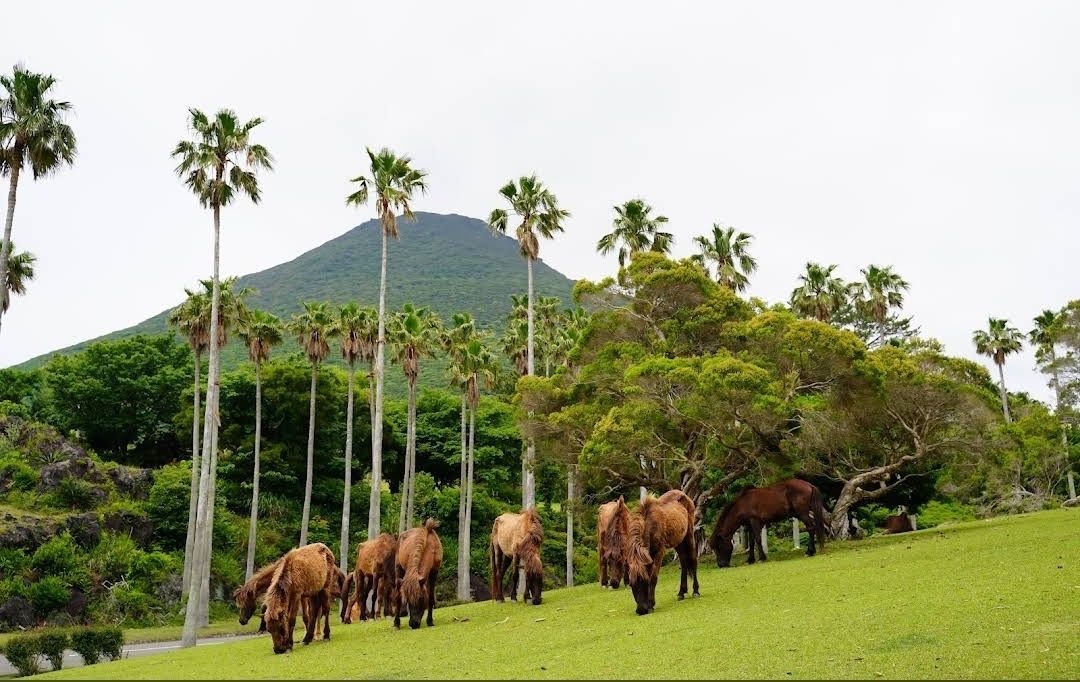
## Description **Kaimon Foothills Nature Park** is a serene and picturesque destination located at the base of Mount Kaimon, often nicknamed the “Fuji of Satsuma” because of its elegant, conical shape that resembles Japan’s iconic Mount Fuji. This park is a favorite among nature enthusiasts, hikers, and families looking for a peaceful escape into lush greenery and panoramic landscapes. What makes Kaimon Foothills Nature Park unique is its perfect blend of natural beauty and cultural significance. The area offers walking trails surrounded by seasonal flowers, open lawns ideal for picnics, and scenic viewpoints where visitors can admire Mount Kaimon towering in the distance. On clear days, you can even catch a glimpse of **Yakushima Island**, a UNESCO World Heritage Site known for its ancient cedar forests. A little-known fact is that the park is home to rare flora native to the Kagoshima region, making it a hidden gem for botany lovers. Another interesting detail is that the park also serves as a base for those who want to climb Mount Kaimon, with the trailhead conveniently located nearby. ## Location Kaimon Foothills Nature Park is located in **Ibusuki City**, within **Kagoshima Prefecture** in southern **Kyushu, Japan**. The park sits at the base of Mount Kaimon, which rises 924 meters above sea level and is a defining landmark of the Satsuma Peninsula. Getting there is straightforward. From **Kagoshima City**, travelers can take the **JR Ibusuki-Makurazaki Line** to **Kaimon Station**. From the station, the park is just a short taxi ride or a leisurely walk. Alternatively, those traveling by car can reach the park in about 90 minutes from central Kagoshima via Route 226, a scenic coastal road. For visitors who enjoy road trips, this drive offers stunning views of Kagoshima Bay and the surrounding countryside. ## Tips To make the most of your visit to Kaimon Foothills Nature Park, keep these tips in mind: * **Wear comfortable shoes** – The park has walking trails and natural terrain, so sturdy footwear will make your visit more enjoyable. * **Bring a picnic** – With wide open spaces and shaded areas, the park is perfect for relaxing and enjoying a homemade lunch outdoors. * **Check the weather** – Clear days provide the best views of Mount Kaimon and the surrounding region, so plan accordingly. * **Combine with a hike** – If you’re up for adventure, start your climb up Mount Kaimon from the trailhead near the park. The hike typically takes 3–4 hours round trip. * **Visit nearby attractions** – Ibusuki is famous for its unique **sand baths**, where visitors are buried in naturally heated volcanic sand. It’s an excellent way to relax after exploring the park. * **Bring a camera** – Whether it’s the seasonal flowers, the majestic peak of Mount Kaimon, or the sunset views, the park is full of photo-worthy moments. ## Conclusion **Kaimon Foothills Nature Park in Japan** is a charming and peaceful destination that offers both relaxation and adventure. With its breathtaking views of Mount Kaimon, lush greenery, and cultural significance, it’s the perfect spot for families, hikers, and nature lovers alike. Conveniently located in Ibusuki, Kagoshima, the park also serves as a gateway to exploring southern Kyushu’s natural wonders. ## FAQ **1. What is Kaimon Foothills Nature Park best known for?** The park is best known for its scenic location at the base of Mount Kaimon, offering beautiful views, picnic areas, and access to the hiking trail up the mountain. **2. Can you climb Mount Kaimon from the park?** Yes, the park serves as a starting point for the Mount Kaimon hiking trail, which takes about 3–4 hours to complete round trip. **3. When is the best time to visit?** Spring and autumn are ideal, with pleasant weather and colorful seasonal flowers. However, the park is open year-round and offers different charms in each season. **4. Is the park family-friendly?** Absolutely. The open lawns, easy walking paths, and picnic spots make it a great destination for families with children. **5. How long should I plan to stay?** Most visitors spend 1–2 hours enjoying the park, but if you add a Mount Kaimon hike or nearby Ibusuki attractions, you can easily plan a full-day trip. **6. Are there facilities like restrooms or shops?** Yes, the park has basic facilities, but it’s a good idea to bring your own snacks and drinks, especially if you plan to stay for a while. ## Links * [Japan Travel – Kyushu Attractions](https://www.japan.travel/en)
GemVoyage Team • World
Varėna
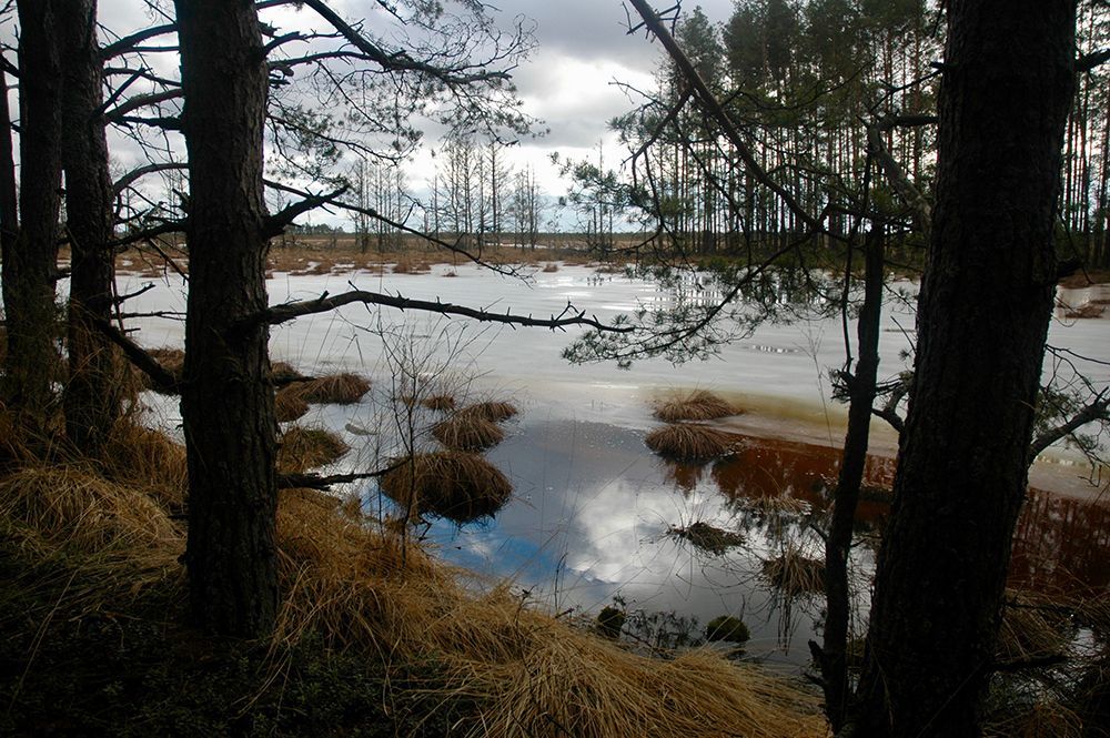
## Description Čepkeliai Raised Bog is among Lithuania’s most important peatland reserves, an expansive raised bog that feels at once remote and intimate. Its surface is a subtle patchwork of sphagnum hummocks, shallow pools, and scattered stunted pines; that patterning creates a fragile, otherworldly landscape that changes color and mood with the light. For naturalists and quiet travelers the bog offers a concentration of specialized habitats where rare mosses, sedges, and lichens flourish alongside insect life and bird species adapted to waterlogged peat. Beyond its visible beauty, Čepkeliai is scientifically invaluable. The peat layers here have accumulated over millennia, trapping pollen, seeds, and macrofossils that give researchers a continuous record of past vegetation and climate. That archive helps reconstruct regional environmental history and informs conservation decisions today. The bog’s intact hydrology—its network of raised surfaces and water-filled hollows—supports unique ecological processes, from specialized plant communities to breeding cycles for rare birds. Although the terrain looks invitingly wild, it’s also extremely fragile. Walking off designated paths can crush sphagnum carpets and disturb microhabitats that take decades to recover. To balance access with protection, visitation in Čepkeliai is carefully managed: boardwalks, observation platforms, and tightly controlled trails concentrate human presence on durable surfaces and minimize harm. This measured approach preserves the bog’s ecological integrity while still allowing people to experience its unusual beauty and quiet drama. For photographers, botanists, and birdwatchers the bog offers intimate encounters with species and textures rarely seen outside specialized reserves. In spring and summer, sunlit pools mirror cloudscapes and dragonflies patrol the grassy margins. Autumn brings a palette of muted reds, golds, and moss greens; winter covers the place in a hush of snow and ice that highlights the bog’s sculptural shapes. Guided walks—often led by local naturalists—are invaluable for understanding the subtle signs of bog life and the reasons for strict protection. ## Location Čepkeliai Bog is located in southern Lithuania, near the town of Varėna in Alytus County, within the larger Dzūkija region. It sits in a sparsely populated, forested landscape that reinforces the sense of remoteness. The reserve forms part of Lithuania’s system of protected areas and is managed to conserve both its natural features and the scientific information contained within its peat layers. How to get there: the most practical route for independent travelers is to drive from Varėna, following local roads into the reserve’s access points. Some conservation organizations and local guides run organized excursions from Varėna and nearby towns; these are often the best option if you don’t have a car. Public transport options are limited and may require additional local transfers and walking; if you rely on buses, plan carefully and allow extra time. In many cases, visiting with an experienced guide not only eases logistics but also improves the interpretive experience—guides can point out rare species and explain the bog’s geological story. ## Tips - Stay on boardwalks, platforms, and marked trails—stepping onto soft peat damages the vegetation and disrupts hydrology. - Wear waterproof, sturdy footwear; some approaches are muddy even in summer, and the boardwalks can be damp. - Bring binoculars and a field guide (plants, birds, insects) to make the most of wildlife spotting opportunities. - Visit in the early morning or late afternoon for the best light and more active bird life; midday can be quieter for wildlife. - Book guided walks where available—local guides provide historical and ecological context and reduce your impact. - Respect seasonal closures and nesting zones; some areas close during bird breeding seasons to protect sensitive species. - Travel light and pack out any litter; even biodegradable waste can alter nutrient cycles in peat ecosystems. ## Conclusion Čepkeliai Raised Bog rewards visitors who slow down and look closely. It is a living archive and sanctuary where the physical landscape—peat layers, patterned pools, and sphagnum carpets—holds stories of centuries of changing vegetation and climate. Visiting responsibly, on boardwalks and under guidance, reveals a quiet world of specialized life and an ecological history that connects modern conservation to deep time. ## FAQ Q: Can I walk freely in the bog? A: No. To protect delicate peat and the species that depend on it, walking is restricted to boardwalks and designated trails. Off-trail access is prohibited in many areas. Q: Are guided tours available? A: Yes. Organized guided nature walks are often offered by conservation groups or local guides; they improve the experience and reduce ecological impact. Q: When is the best time to visit for wildlife viewing? A: Spring and early summer are excellent for bird activity and insect life; early morning and late afternoon offer better sightings and softer light for photography. Q: Is the bog safe for solo visitors? A: The area is generally safe, but the remoteness and fragile terrain mean solo visits are best for experienced, well-prepared hikers; joining a guided walk is recommended for most visitors. Q: Can I take photographs or drones in the reserve? A: Photography from boardwalks and platforms is usually permitted; drones are commonly restricted to prevent disturbance—check reserve rules in advance. Q: Are there facilities nearby? A: Facilities are limited; plan for basic needs (water, layers, footwear) and expect minimal infrastructure near the main access points. ## Links - [Čepkeliai (Wikipedia)](https://en.wikipedia.org/wiki/%C4%8Cepkeliai)
GemVoyage Team • World
Nida
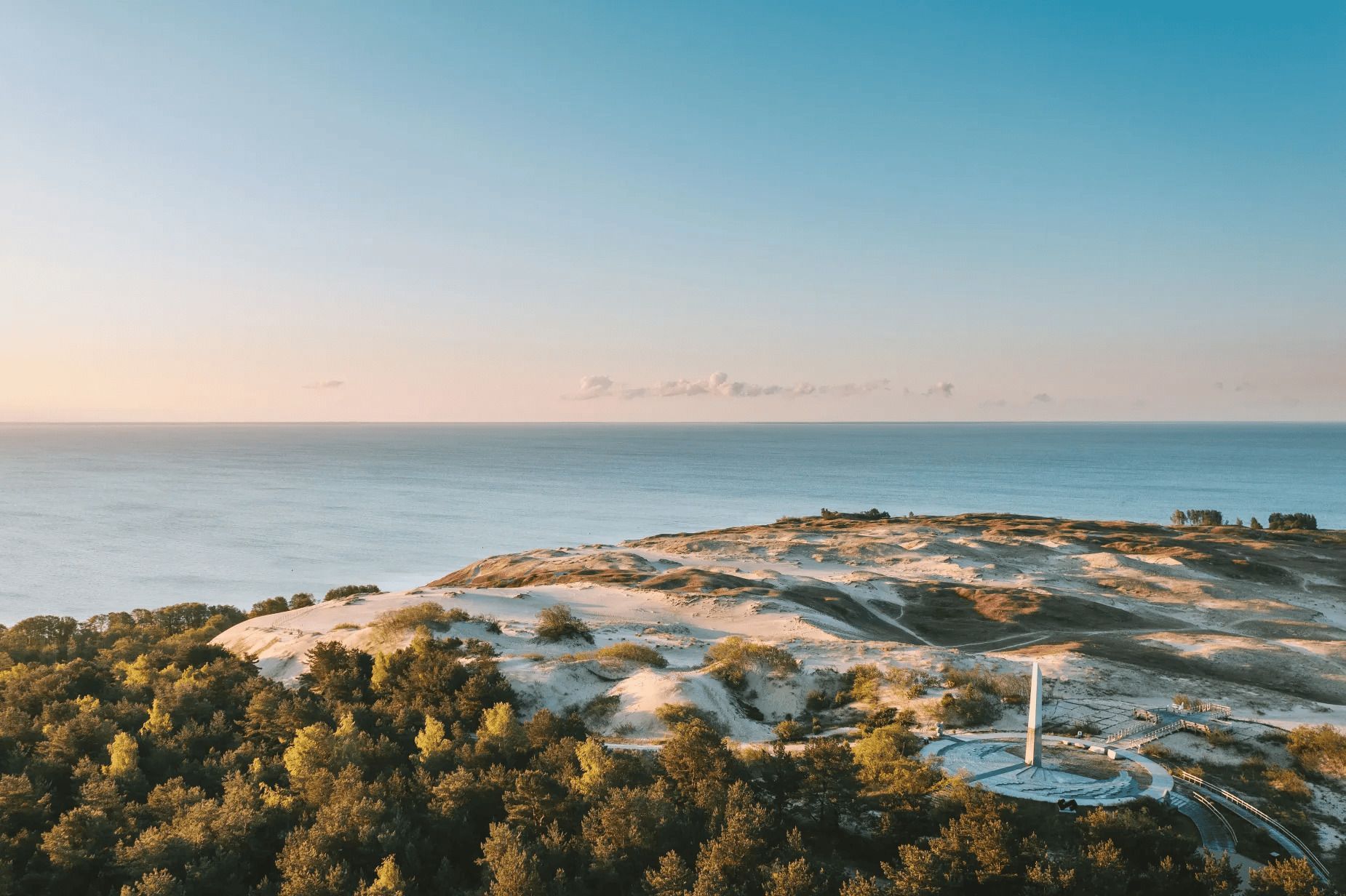
## Description The Parnidis Dune sundial on the Curonian Spit is an elegant meeting point of coastal geology and human curiosity. Carved into a prominent dune ridge near Nida, the sundial uses a simple stone gnomon and stone markers to register the sun’s arc across the sky, while the dune itself provides sweeping views over the Curonian Lagoon and the Baltic Sea. The combination of sculpted sand, long sightlines, and the shifting play of light makes the site both visually stirring and quietly contemplative. Visitors encounter an open landscape shaped by wind and water: dunes that migrate slowly with prevailing winds, vegetation adapted to sandy, saline conditions, and an expansive horizon where sky and water blend. The sundial is part functional instrument, part landscape sculpture: its hour lines and markers are calibrated to local solar time and offer an accessible way to experience astronomical motion at ground level. Restoration and maintenance are ongoing challenges because the dune is dynamic—sand moves, vegetation changes, and repairs must respect both the scientific accuracy of the instrument and the dune’s natural processes. Local authorities and conservation groups work to stabilize key paths and protect fragile slopes so that people can enjoy the views without accelerating erosion. Cultural events and astronomy programs often use the site as a natural amphitheater, further connecting visitors with the seasonal rhythms of sky and sea. ## Location Parnidis Dune is located in Nida on the Curonian Spit, within Neringa municipality in Klaipėda County on Lithuania’s western coast. The dune crowns a ridge that overlooks the Curonian Lagoon on one side and the Baltic Sea on the other, giving it dramatic vantage points in both directions. How to get there: Nida is accessible by car along the Curonian Spit road from Klaipėda; if approaching from mainland Lithuania, a ferry crossing into the spit may be necessary depending on route. Regular buses also run from Klaipėda to Nida during the tourist season. Once in Nida, the Parnidis Dune is a short, well-signed walk from the town center; follow the marked paths to the main observation points and sundial. ## Tips - Visit at sunrise or sunset for the most dramatic light and to see the sundial’s shadows lengthen. - Stay on marked trails and access ramps—dune vegetation is fragile and paths help prevent runaway erosion. - Bring windproof layers and sun protection; the exposed ridge can be quite breezy even on mild days. - Use binoculars or a telephoto lens to scan the lagoon for birds, fishing boats, and shifting sandbars. - Combine a dune visit with a walk through Nida’s quaint center and nearby cultural sites, such as the Thomas Mann museum. - Check local signage for any temporary closures or restoration work; some sections may be rerouted to protect the landscape. ## Conclusion Parnidis Dune’s sundial offers more than a neat photo opportunity: it is an invitation to feel how landscape, time, and human craft can intersect. The ridge’s panoramic views, paired with the simple mechanics of the sundial, make the place an evocative stop for anyone exploring the Curonian Spit. ## FAQ Q: Is there an admission fee to access the dune? A: There is typically no admission fee to reach Parnidis Dune itself; however, parking or guided services may charge fees. Seasonal event programming may require tickets. Q: When is the best time to photograph the sundial and landscape? A: Sunrise and sunset provide warm, low-angle light that accentuates dune textures and long shadows; golden hour is ideal for landscape photography. Q: Can I climb anywhere on the dune? A: No. To protect dune vegetation and prevent erosion, visitors should use the marked trails and observation points only; climbing fragile slopes is discouraged or prohibited. Q: Are there guided tours or astronomy events at the site? A: Yes. Local guides and cultural groups sometimes offer tours that explain the sundial’s construction and the dune’s ecology; astronomy and cultural events are occasionally scheduled—check Nida’s visitor information. Q: Is the area accessible for visitors with limited mobility? A: Some paths and viewpoints may have improved access, but the dune’s terrain is inherently uneven. Check local visitor resources for the latest information on accessible routes. ## Links - [Parnidis Dune (Wikipedia)](https://en.wikipedia.org/wiki/Parnidis_Dune)
GemVoyage Team • World
Zanzibar
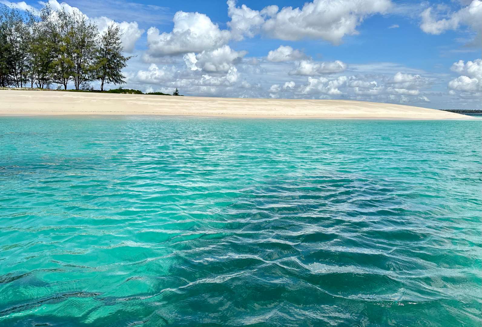
## Description Sinda Island is a hidden gem off the coast of Tanzania, often mistaken as part of Zanzibar due to its proximity and tropical allure. This uninhabited island, part of the Dar es Salaam Marine Reserve System (DMRS), offers a pristine escape into nature, far removed from the crowds and commercialization of more popular destinations. With its untouched beaches, vibrant coral reefs, and rich biodiversity, Sinda Island is a haven for eco-tourists, snorkelers, and anyone seeking tranquility. The island is actually composed of two parts—Inner and Outer Sinda—each with its own unique landscape. The coastlines feature a mix of rocky cliffs and soft sandy beaches, while the interior is covered in virgin coastal forest. One of the island’s most fascinating residents is the endangered coconut crab, which thrives in this protected habitat. The waters surrounding Sinda are shallow near the shore but drop off dramatically just a few kilometers out, creating strong tidal currents and excellent snorkeling conditions. A little-known fact: Sinda Island is home to ruins dating back to the 19th century, and it was first documented by Arab sailor Ibn Majid in 1470. These remnants of history, combined with the island’s natural beauty, make it a compelling destination for both adventure and reflection. ## Location Sinda Island is located in **Tanzania**, within the **Dar es Salaam Region**, specifically in the **Kigamboni District**. It lies southeast of Dar es Salaam, just off the coast near the Somangila ward. ### How to Get There: - **By Boat**: The most common way to reach Sinda Island is by hiring a boat from the Kigamboni coast. Local tour operators offer day trips that include snorkeling, picnicking, and guided walks. - **From Dar es Salaam**: Take a ferry across the harbor to Kigamboni, then arrange a boat transfer from one of the nearby beaches such as Kimbiji or Sinda Beach. - **By Tour Package**: Several eco-tourism companies offer curated trips to Sinda Island, often including stops at nearby reefs and islands. Because it’s a protected area, access may be regulated, so it’s best to coordinate with licensed guides or marine reserve authorities. ## Tips for Visitors To make the most of your visit to Sinda Island, consider these tips: - **Pack Light but Smart**: Bring reef-safe sunscreen, snorkeling gear, water, and snacks. There are no facilities on the island. - **Respect the Environment**: As a protected marine reserve, it’s crucial to avoid littering and disturbing wildlife. - **Snorkeling is a Must**: The coral reefs around Sinda are teeming with life—from clownfish to moray eels. Don’t miss the chance to explore them. - **Visit During Dry Season**: June to October offers the best weather and visibility for underwater activities. - **Explore the Ruins**: Ask your guide to show you the historical ruins—some are hidden within the forest and offer a glimpse into the island’s past. - **Ideal for Day Trips**: Overnight stays are not permitted, so plan for a full-day excursion. ## Conclusion Sinda Island is a serene and ecologically rich destination that blends natural beauty with historical intrigue. Whether you're snorkeling among vibrant reefs, spotting rare coconut crabs, or simply soaking in the silence, this island offers a rare kind of escape—one that’s both peaceful and profound. ## FAQ **1. Is Sinda Island part of Zanzibar?** No, it’s located off the coast of Dar es Salaam, though it shares similar tropical features. **2. Can I stay overnight on Sinda Island?** No, the island is uninhabited and part of a protected marine reserve. Only day trips are allowed. **3. What activities can I do on the island?** Snorkeling, nature walks, beach picnics, and exploring historical ruins are popular activities. **4. Is there an entrance fee?** Yes, a small conservation fee may be required. It’s usually included in guided tour packages. **5. Are there facilities on the island?** No, there are no restaurants, restrooms, or shops. Visitors must bring their own supplies. **6. Is it safe to swim around Sinda Island?** Yes, but always follow your guide’s instructions. Some areas have strong currents due to tidal shifts. ## 🔗 Links - [Sinda Island – Wikipedia](https://en.wikipedia.org/wiki/Sinda_Island) - [Tanzania Tourism – Sinda Island Marine Reserve](https://www.tanzaniatourism.com/destination/sinda-island-marine-reserve)
GemVoyage Team • World
Cairo
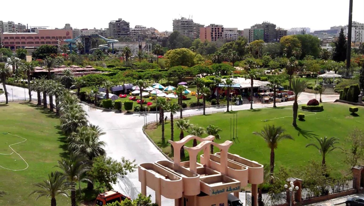
## Description **The International Park (الحديقة الدولية بالقاهرة)** is one of Cairo’s most distinctive public green spaces, designed to showcase a miniature journey through different countries and cultures within a single park. Established in the late 1980s, the park was conceived as a cultural and recreational project where landscaped areas, architectural replicas, and themed gardens represent nations from around the world. While not polished in the way of modern theme parks, its charm lies in its **ambitious concept, open space, and local atmosphere**. What makes the International Park unique is its layout: each section is inspired by a different country, featuring symbolic structures, sculptures, plants, or design elements associated with that nation. Visitors can walk from Asian-inspired pavilions to European-style gardens within minutes. This eclectic mix gives the park an almost nostalgic quality, reflecting Cairo’s vision of internationalism during the late 20th century. A lesser-known fact is that several embassies and cultural institutions contributed ideas or symbolic elements during the park’s early development, even if execution varied over time. Another interesting detail is that the park was once a major venue for **school trips and cultural festivals**, making it an important part of collective memory for many Cairenes who grew up in the 1990s. Today, the park functions primarily as a **family-friendly recreational space**. It is popular for picnics, casual walks, and affordable outings, especially for residents of eastern Cairo. While some areas show signs of aging, the park’s size, greenery, and concept still make it a refreshing escape from the dense urban environment. ## Location **Country:** Egypt **Region:** Greater Cairo **City:** Cairo **District:** Nasr City The International Park is located in **Nasr City**, one of Cairo’s largest residential districts, close to major roads and residential compounds. ### How to Get There * **By taxi or ride-hailing:** * Uber and local taxis are the most convenient option from anywhere in Cairo. * **By car:** * Easily accessible via Nasr City’s main roads, with parking available near the entrance. * **By public transport:** * Microbuses and buses serving Nasr City pass close to the park, though routes can be confusing for first-time visitors. * **From central Cairo:** * Expect a 30–45 minute drive depending on traffic. ## Tips * **Visit in the afternoon:** Late afternoon offers better weather and softer light, especially in warmer months. * **Bring your own food:** Picnic areas are common, and outside food is usually allowed. * **Wear comfortable shoes:** The park is large, and exploring all sections involves significant walking. * **Manage expectations:** Some country sections are more symbolic than detailed replicas. * **Good for children:** Open spaces allow kids to run freely, and the atmosphere is relaxed. * **Avoid peak public holidays:** The park can become crowded during major Egyptian holidays. ## Conclusion The International Park is a spacious, culturally themed green retreat that offers a simple but enjoyable experience for families and casual visitors. Its global concept, combined with its local character, makes it a nostalgic and accessible escape from Cairo’s urban intensity. ## FAQ **1. When was the International Park opened?** It was established in the late 1980s as a cultural and recreational project. **2. Is there an entrance fee?** Yes, there is a low entrance fee, making it affordable for families. **3. How long should I plan for a visit?** Most visitors spend **1.5 to 3 hours**, depending on walking pace and activities. **4. Is the park suitable for tourists?** Yes, especially for those interested in local leisure spaces rather than major monuments. **5. Are there food stalls inside?** Basic snacks may be available, but bringing your own food is recommended. **6. Is it good for photography?** Yes, particularly for casual photography and wide shots of greenery and themed structures. ## Links * [Egyptian tourism portal](https://www.experienceegypt.eg/en)
GemVoyage Team • World
Tanga
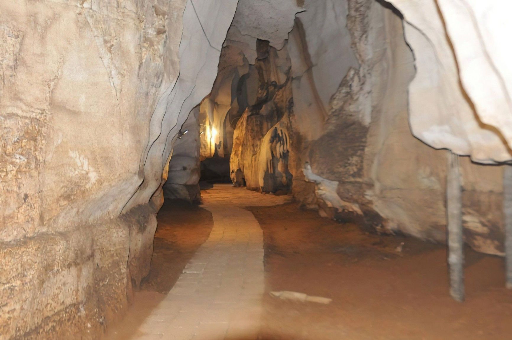
## Description Amboni Caves are among the most fascinating natural attractions in Tanzania, offering visitors a journey into an ancient underground world shaped by time, water, and geology. These limestone caves are believed to be over 150 million years old, making them one of the oldest cave systems in East Africa. With dark chambers, narrow passageways, and dramatic rock formations, Amboni Caves provide a sense of mystery and adventure that contrasts sharply with the nearby coastal landscapes. What makes Amboni Caves truly unique is their combination of natural, cultural, and spiritual significance. The caves are not only a geological marvel but also a site deeply connected to local beliefs and traditions. Many chambers are associated with spiritual practices, and some are still used for traditional rituals by surrounding communities. A little-known fact is that the caves are named after a colonial-era engineer, Amboni, who is believed to have popularized their exploration, although local communities had known and used the caves long before. Another lesser-known detail is that the cave system consists of at least ten interconnected chambers, each with its own name, legend, and distinct rock formations. Visiting Amboni Caves is both an educational and atmospheric experience, offering insight into Tanzania’s natural history as well as its living cultural traditions. ## Location Amboni Caves are located in **Tanzania**, in the **Tanga Region**, near the city of **Tanga**, along the northeastern coast of the country. The caves are situated about 6 kilometers north of Tanga city center, close to the Indian Ocean. Reaching the caves is relatively easy. Visitors can take a taxi or local transport from Tanga, with the journey usually taking 15 to 20 minutes. For travelers coming from other parts of Tanzania, Tanga is accessible by road, train, or domestic flights. Once near the site, a short walk leads to the cave entrance. Hiring a local guide at the site is strongly recommended, as the cave layout can be confusing without assistance. ## Tips * Always visit with a local guide, as the caves are dark, complex, and rich in cultural meaning. * Wear sturdy shoes with good grip, since the cave floors can be slippery and uneven. * Bring a flashlight or headlamp, even if guides provide lighting, for better visibility. * Dress comfortably and be prepared for warm and humid conditions inside the caves. * Respect local customs, as certain areas may be considered sacred. * Visit earlier in the day for a quieter experience and better overall visibility. ## Conclusion Amboni Caves offer a rare opportunity to explore one of Tanzania’s oldest natural formations while learning about the cultural traditions connected to it. With their ancient rock structures, spiritual significance, and sense of adventure, the caves stand out as a unique and rewarding destination near Tanga. ## FAQ **Are Amboni Caves safe to visit?** Yes, they are safe when visited with an experienced local guide who knows the cave layout and conditions. **How long does a visit to Amboni Caves take?** Most guided visits last between 45 minutes and 1.5 hours, depending on the route and interest level. **Is the site suitable for children?** Older children may enjoy the experience, but very young children might find the dark and narrow spaces challenging. **Is there an entrance fee?** Yes, a small entrance fee is usually charged, with additional costs for guided tours. **Can I take photos inside the caves?** Photography is generally allowed, but flash use and certain areas may be restricted, so always ask your guide. ## Links * [Tanzania Tourist Board](https://www.tanzaniatourism.go.tz) * [Tanga Region Information](https://www.tanga.go.tz)
GemVoyage Team • World
Faro
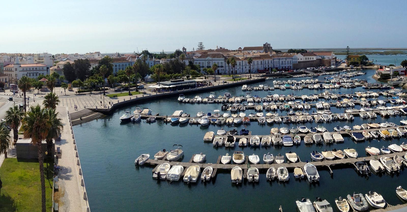
## Description Faro Marina is one of the most picturesque and lively spots in the Algarve region of southern Portugal. Nestled right in the heart of Faro, the marina is a central meeting point where the city’s charm blends seamlessly with its maritime heritage. With a backdrop of palm trees, elegant architecture, and rows of yachts and fishing boats bobbing gently on the water, it’s a place that embodies the relaxed yet vibrant spirit of coastal Portugal. What makes Faro Marina unique is not only its stunning scenery but also its role as a **gateway to the Ria Formosa Natural Park**, one of Portugal’s most beautiful protected lagoons. Many boat tours depart from the marina, offering visitors the chance to explore secluded islands, birdwatch, or enjoy a relaxing cruise at sunset. A little-known fact about Faro Marina is that the **large stork nests perched on lampposts and rooftops** around the harbor are a common sight, adding to its charm and making it a favorite spot for photographers. Another interesting detail is that the marina is often used for cultural events and festivals, turning it into a lively gathering point during summer evenings. ## Location Faro Marina is located in **Faro, the capital of the Algarve region in Portugal**. It sits right by the **city center**, just across from the historic old town and within walking distance of landmarks such as the **Arco da Vila** and **Faro Cathedral**. Its central location makes it a natural starting point for exploring both the city and the Algarve coastline. ### Recommendation on How to Get There From **Faro Airport**, the marina is only about a **10-minute drive** or a 15-minute bus ride on the airport shuttle. If you’re arriving by train or bus, both stations are within a short walking distance of the marina. For those exploring the Algarve by car, Faro is well-connected by road, and public parking is available near the city center. ## Tips Here are some helpful tips to make your visit to Faro Marina memorable: * **Take a Boat Tour**: Don’t miss the opportunity to explore the Ria Formosa islands, such as Ilha Deserta or Ilha do Farol, by booking a boat tour directly from the marina. * **Enjoy a Sunset Drink**: The waterfront is lined with cafés and bars—perfect for enjoying a glass of Portuguese wine or a cocktail while watching the sun go down. * **Photography Spot**: Bring your camera, especially for capturing the boats, the palm-fringed promenade, and the storks nesting nearby. * **Combine With Old Town Visit**: Since the marina is next to Faro’s historic district, combine your visit with a walk through cobbled streets, museums, and churches. * **Best Time to Visit**: Early evening is ideal, as the marina lights up beautifully, and the temperature is more comfortable during warmer months. * **Look Out for Events**: During summer, concerts, markets, and festivals are often held at or near the marina, adding extra vibrancy to your visit. ## Conclusion Faro Marina is more than just a harbor—it’s a cultural and social hub that captures the essence of Faro and the Algarve. With its stunning waterfront views, lively atmosphere, and easy access to natural wonders like the Ria Formosa, it’s a must-visit spot for anyone traveling to southern Portugal. Whether you’re taking a boat tour, enjoying a drink by the water, or simply strolling along the promenade, Faro Marina is sure to leave a lasting impression. ## FAQ **1. What can I do at Faro Marina?** You can enjoy boat tours to the Ria Formosa islands, dine at waterfront cafés, attend local events, or simply relax and admire the views. **2. Is Faro Marina close to the city center?** Yes, it’s located in the heart of Faro and is within walking distance of the historic old town and main transport hubs. **3. Are boat tours available year-round?** Yes, although availability and schedules may vary depending on the season. Summer offers the widest selection of tours. **4. Is it family-friendly?** Absolutely. The marina is pedestrian-friendly and offers plenty of open space, making it great for families with children. **5. Can I see wildlife at the marina?** Yes, you’ll often spot storks nesting nearby, and boat tours will take you to the Ria Formosa lagoon, which is rich in birdlife. **6. How long should I plan to spend at Faro Marina?** A casual visit might take an hour, but if you’re combining it with a boat trip and old town exploration, plan for half a day or more. ## Links * [Official Faro Tourism Office](https://www.faro.pt/en)
GemVoyage Team • World
Izmir
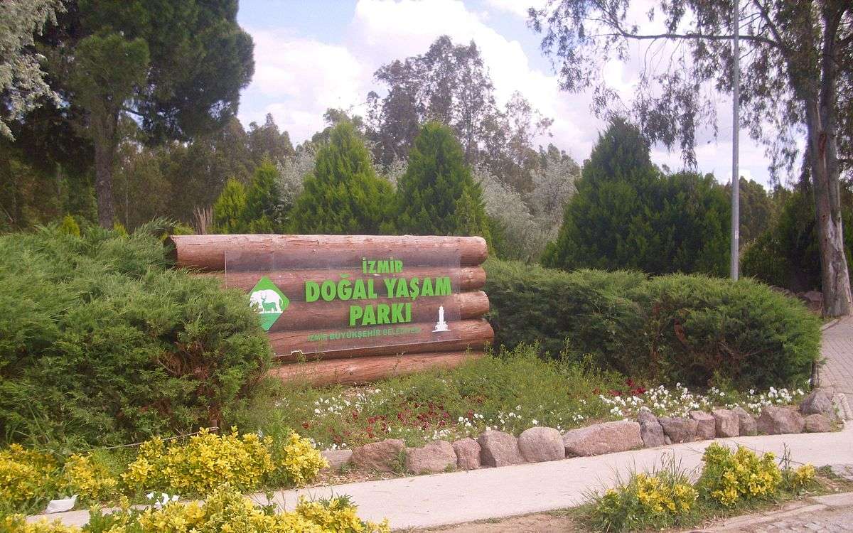
## Description Izmir Wildlife Park (İzmir Doğal Yaşam Parkı) is one of Turkey’s most impressive and thoughtfully designed animal parks, offering a refreshing blend of conservation, education, and recreation. Opened in 2008 by the Izmir Metropolitan Municipality, the park was created as a modern alternative to the old Izmir Zoo, with a strong emphasis on animal welfare and natural habitats. Today, it spans over 425,000 square meters and is home to nearly 1,800 animals from 132 different species. What sets Izmir Wildlife Park apart is its commitment to creating spacious, naturalistic enclosures that mimic the animals’ native environments. Visitors can stroll through themed zones such as the African Savannah, Monkey Islands, Birds of Prey section, and the Tropical Center—the first of its kind in Turkey. The park also features a large pond for waterfowl and a charming Children’s Zoo where kids can interact with friendly farm animals. A little-known fact: the park was awarded by the Organization of Islamic Capitals and Cities (OICC) in 2013 for excellence in municipal services, landscape, and environmental design. Another hidden gem is the Tropical Center, which houses exotic species like macaws, marmosets, fruit bats, and crocodiles in a climate-controlled environment that replicates rainforest conditions. ## Location Izmir Wildlife Park is located in **Turkey**, in the **Aegean Region**, within the city of **Izmir**, specifically in the **Çiğli district**. It’s situated in the Sasalı neighborhood, a peaceful area surrounded by nature and away from the city’s hustle. ### How to Get There: - **By Public Transport**: From central Izmir, take the İZBAN commuter train to Çiğli Station, then transfer to bus number 751 or 777 toward Sasalı. - **By Car**: The park is about a 30-minute drive from downtown Izmir. Free parking is available on-site. - **By Tour**: Some local tour operators include the park in family-friendly itineraries, often paired with nearby attractions like the Bird Paradise (Kuş Cenneti). Its accessibility and tranquil setting make it an ideal day trip for families, nature lovers, and curious travelers. ## Tips for Visitors To make the most of your visit to Izmir Wildlife Park, keep these tips in mind: - **Arrive Early**: The park opens at 9:00 AM and closes at 6:30 PM. Early visits offer cooler temperatures and more active animals. - **Wear Comfortable Shoes**: The park is vast and designed for walking. Expect to spend 2–3 hours exploring. - **Bring Snacks and Water**: While there are cafes and kiosks, bringing your own refreshments can be handy, especially for kids. - **Check for Events**: The park occasionally hosts educational workshops and seasonal events—check the schedule before you go. - **Respect the Animals**: Feeding is prohibited, and loud noises can disturb the animals. Be mindful and enjoy observing them in peace. - **Visit on Weekdays**: Weekends can be crowded. A weekday visit ensures a quieter, more relaxed experience. ## Conclusion Izmir Wildlife Park is a beautifully curated sanctuary that blends education, conservation, and leisure. With its diverse animal collection, spacious habitats, and family-friendly atmosphere, it’s a standout destination in Turkey’s Aegean region. Whether you're traveling solo or with kids, this park offers a memorable and meaningful encounter with wildlife. ## FAQ **1. What are the opening hours of Izmir Wildlife Park?** The park is open daily from 9:00 AM to 6:30 PM, except Mondays when it’s closed for maintenance. **2. Is there an entrance fee?** Yes, but it’s very affordable. Ticket prices are modest, making it accessible for all visitors. **3. Can I bring food into the park?** Yes, you can bring your own snacks and water, though there are also cafes and kiosks available. **4. Is the park suitable for children?** Absolutely. The Children’s Zoo and interactive exhibits make it a great destination for families. **5. Are guided tours available?** While self-guided visits are common, some educational programs and group tours can be arranged in advance. **6. Is the park wheelchair accessible?** Yes, most paths are accessible, and facilities are designed to accommodate visitors with mobility needs. ## Links - [Izmir Wildlife Park – Official Website](https://www.izmirdogalyasamparki.org.tr/en/home) - [Izmir Wildlife Park – Wikipedia](https://en.wikipedia.org/wiki/%C4%B0zmir_Wildlife_Park)
GemVoyage Team • World
