GemVoyage Team • World
Kaimon Foothills Nature Park is a serene and picturesque destination located at the base of Mount Kaimon, often nicknamed the “Fuji of Satsuma” because of its elegant, conical shape that resembles Japan’s iconic Mount Fuji. This park is a favorite among nature enthusiasts, hikers, and families looking for a peaceful escape into lush greenery and panoramic landscapes.
What makes Kaimon Foothills Nature Park unique is its perfect blend of natural beauty and cultural significance. The area offers walking trails surrounded by seasonal flowers, open lawns ideal for picnics, and scenic viewpoints where visitors can admire Mount Kaimon towering in the distance. On clear days, you can even catch a glimpse of Yakushima Island, a UNESCO World Heritage Site known for its ancient cedar forests.
A little-known fact is that the park is home to rare flora native to the Kagoshima region, making it a hidden gem for botany lovers. Another interesting detail is that the park also serves as a base for those who want to climb Mount Kaimon, with the trailhead conveniently located nearby.
Kaimon Foothills Nature Park is located in Ibusuki City, within Kagoshima Prefecture in southern Kyushu, Japan. The park sits at the base of Mount Kaimon, which rises 924 meters above sea level and is a defining landmark of the Satsuma Peninsula.
Getting there is straightforward. From Kagoshima City, travelers can take the JR Ibusuki-Makurazaki Line to Kaimon Station. From the station, the park is just a short taxi ride or a leisurely walk. Alternatively, those traveling by car can reach the park in about 90 minutes from central Kagoshima via Route 226, a scenic coastal road. For visitors who enjoy road trips, this drive offers stunning views of Kagoshima Bay and the surrounding countryside.
To make the most of your visit to Kaimon Foothills Nature Park, keep these tips in mind:
Kaimon Foothills Nature Park in Japan is a charming and peaceful destination that offers both relaxation and adventure. With its breathtaking views of Mount Kaimon, lush greenery, and cultural significance, it’s the perfect spot for families, hikers, and nature lovers alike. Conveniently located in Ibusuki, Kagoshima, the park also serves as a gateway to exploring southern Kyushu’s natural wonders.
1. What is Kaimon Foothills Nature Park best known for?
The park is best known for its scenic location at the base of Mount Kaimon, offering beautiful views, picnic areas, and access to the hiking trail up the mountain.
2. Can you climb Mount Kaimon from the park?
Yes, the park serves as a starting point for the Mount Kaimon hiking trail, which takes about 3–4 hours to complete round trip.
3. When is the best time to visit?
Spring and autumn are ideal, with pleasant weather and colorful seasonal flowers. However, the park is open year-round and offers different charms in each season.
4. Is the park family-friendly?
Absolutely. The open lawns, easy walking paths, and picnic spots make it a great destination for families with children.
5. How long should I plan to stay?
Most visitors spend 1–2 hours enjoying the park, but if you add a Mount Kaimon hike or nearby Ibusuki attractions, you can easily plan a full-day trip.
6. Are there facilities like restrooms or shops?
Yes, the park has basic facilities, but it’s a good idea to bring your own snacks and drinks, especially if you plan to stay for a while.
Discover more hidden gems you might love.
Paris
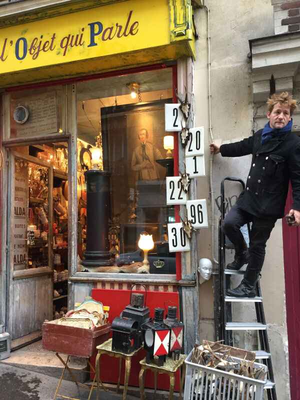
## Description Tucked away in the bohemian neighborhood of Montmartre, **L’Objet Qui Parle** is a small but legendary antique shop that has earned a reputation as one of Paris’s most fascinating hidden gems. Unlike large, glossy antique markets, this boutique offers an intimate and eclectic experience. The moment you step inside, you are greeted with an enchanting jumble of objects—stacked paintings, vintage trinkets, retro furniture, ceramics, mirrors, and curiosities that feel like they carry stories from centuries past. What makes L’Objet Qui Parle unique is its **authentic “cave of wonders” atmosphere**. The shop is famously cluttered, with items spilling from shelves and even tucked into corners, yet this controlled chaos is exactly what draws treasure hunters, collectors, and curious travelers. Each visit feels like a miniature archaeological dig, where one never knows what rare or unusual item might be unearthed. A little-known fact is that the shop has served as a source of inspiration for local artists and filmmakers, who come here seeking objects with character and history. Another interesting detail is that many items are surprisingly affordable compared to other antique shops in Paris, making it possible to find genuine vintage pieces without breaking the bank. ## Location L’Objet Qui Parle is located in **Paris, France**, within the **Île-de-France region**. More precisely, it sits in the **18th arrondissement**, right in the heart of **Montmartre**, not far from the iconic Sacré-Cœur Basilica and Place du Tertre, the artists’ square. How to get there: * **By metro:** The closest stations are **Lamarck – Caulaincourt (Line 12)** and **Abbesses (Line 12)**, both just a short walk away. * **By bus:** Several buses run through Montmartre, stopping near the shop. * **On foot:** If you’re exploring Montmartre, it’s easy to stumble upon the shop while wandering its cobbled streets. Its central location makes it perfect to combine with a day exploring Montmartre’s historic streets, cafés, and art studios. ## Tips Here are some tips to make the most of your visit to L’Objet Qui Parle: 1. **Come with an open mind** – The shop is filled with an eclectic mix of items, so be ready to browse without a fixed agenda. 2. **Take your time** – Treasures are often hidden in plain sight, stacked behind or beneath other objects. 3. **Bring cash** – While Paris is modern, some small antique shops still prefer cash for smaller purchases. 4. **Ask questions** – The shop’s owner is known for being friendly and knowledgeable, happy to share the story behind certain pieces. 5. **Visit Montmartre afterward** – Combine your stop with visits to Sacré-Cœur, local cafés, and art galleries to get the full Montmartre experience. 6. **Pack light** – The shop is quite small, so it’s best not to carry bulky bags when exploring. ## Conclusion L’Objet Qui Parle is more than just an antique shop—it’s an experience of discovery. With its cluttered charm, eclectic treasures, and Montmartre location, it offers a glimpse into the artistic and bohemian soul of Paris. Whether you’re a seasoned collector or simply curious, this little shop promises surprises and stories with every visit. ## FAQ **1. What does “L’Objet Qui Parle” mean?** It translates to “The Object That Speaks,” reflecting the idea that every antique carries a story from the past. **2. What kind of items can I find at L’Objet Qui Parle?** The shop sells a wide variety of antiques, including vintage furniture, ceramics, mirrors, paintings, religious artifacts, and quirky collectibles. **3. Is L’Objet Qui Parle expensive?** Not necessarily. While some rare pieces can be pricey, many items are surprisingly affordable, especially compared to larger Parisian antique markets. **4. How much time should I spend there?** Most visitors spend 30 minutes to an hour browsing, depending on their interest in antiques. **5. Is photography allowed inside the shop?** Policies may vary, but as a rule of thumb, always ask the shop owner before taking photos. **6. When is the best time to visit?** Mid-morning or early afternoon is ideal, as Montmartre tends to get crowded later in the day. ## Links * [Paris Official Tourism Website](https://parisjetaime.com/eng/) * [Travel Guide to Paris Markets and Antiques](https://www.france.fr)
GemVoyage Team • World
Tokyo
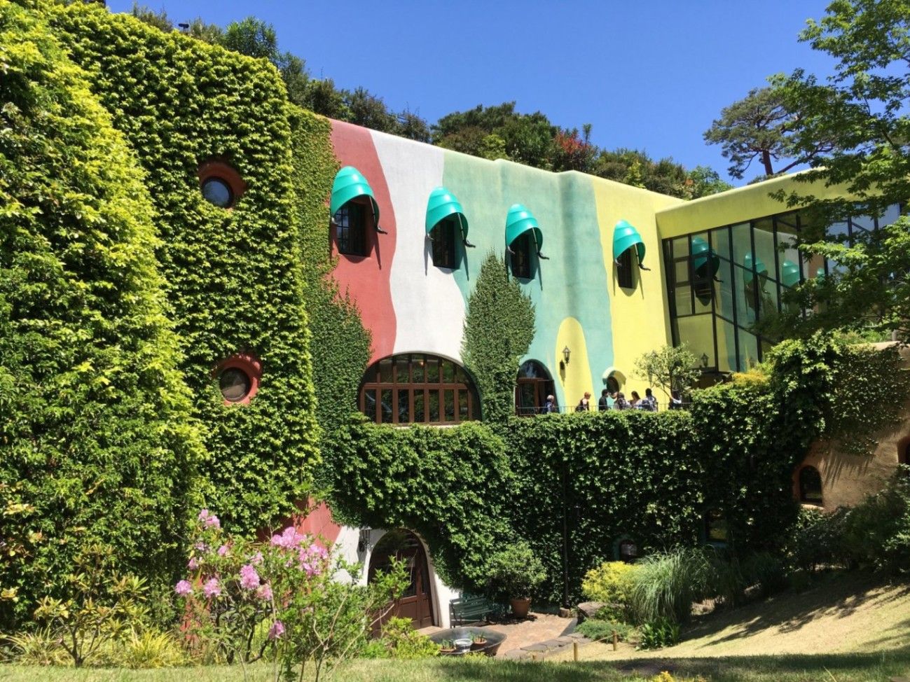
## Description The **Ghibli Museum (三鷹の森ジブリ美術館)** is one of Tokyo’s most enchanting and emotionally resonant cultural attractions. Dedicated to the legendary **Studio Ghibli**, the museum invites visitors into the imaginative universe created by filmmakers **Hayao Miyazaki, Isao Takahata, and their collaborators**—a world defined by wonder, nature, childhood, fantasy, and quiet emotional depth. Unlike traditional museums that focus on static exhibits, the Ghibli Museum is designed as a **fully immersive, experiential environment**, where architecture, animation, sound, and storytelling blend into one continuous journey. From the moment visitors enter, it becomes clear that this is not a conventional institution. The building itself feels like it came from a Ghibli film: **spiral staircases, stained-glass windows, hidden passageways, rooftop gardens, and curved corridors** encourage exploration rather than linear movement. Hayao Miyazaki personally supervised the conceptual design, ensuring that the structure reflects his philosophy that **“children should discover things for themselves.”** There are no fixed routes or arrows—only spaces that invite curiosity. Inside, the museum explores the **art and mechanics of animation** rather than serving as a simple gallery of finished films. Visitors can study original **storyboards, sketches, background paintings, and mechanical animation devices** that demonstrate how movement is created frame by frame. One particularly popular installation shows early zoetrope-style animation, visually explaining how still images transform into motion. One of the museum’s most exclusive features is its **private cinema, the Saturn Theatre**, which screens short original Ghibli films that cannot be seen anywhere else in the world. These short films rotate periodically and often explore experimental themes, new animation techniques, or side stories connected to familiar characters. This makes every visit potentially different from the last. On the rooftop, visitors encounter the **full-scale statue of the Robot Soldier from “Laputa: Castle in the Sky”**, one of the museum’s most photographed landmarks. The surrounding garden offers a quiet, reflective space above the treetops of nearby Inokashira Park, echoing Ghibli’s recurring theme of harmony between humanity and nature. A little-known fact is that **photography is strictly prohibited inside the museum**. This rule is not about control but philosophy: Miyazaki wanted visitors to **experience the space fully, without viewing it through a screen**. Another lesser-known detail is that many of the museum’s architectural elements—iron railings, tiles, and carved wood—were **custom-made by traditional Japanese craftsmen**, turning the museum itself into a handcrafted artwork. Ultimately, the Ghibli Museum is not designed for spectacle or mass tourism. It is a **quiet celebration of imagination, craftsmanship, and emotional storytelling**, appealing as deeply to adults as it does to children. It is a rare space where animation is not treated as entertainment alone, but as **serious art shaped by philosophy, patience, and human sensitivity**. ## Location The **Ghibli Museum** is located in **Mitaka**, a suburban city on the western edge of **Tokyo**, adjacent to the lush **Inokashira Park**. **City:** Mitaka (Tokyo Metropolis) **Region:** Kantō **Country:** Japan ### How to Get There: * **By train:** Take the **JR Chūō Line** from Shinjuku Station to **Mitaka Station** (about 20 minutes). From there, it is a **15–20 minute walk** through Inokashira Park. * **By bus:** A Ghibli-themed shuttle bus runs from Mitaka Station to the museum entrance. * **By taxi:** Convenient from central Tokyo, though more expensive than public transport. * **By bicycle:** Many visitors cycle through Inokashira Park for a scenic approach. The museum’s park-side setting adds to its calm, storybook atmosphere and makes the journey part of the experience. ## Tips * **Tickets must be booked in advance:** There are **no same-day tickets sold at the door**. * **Choose a weekday if possible:** Crowds are lighter, and movement through exhibits feels more fluid. * **Arrive early:** Entry is time-slotted, and arriving on time maximizes your experience. * **Do not expect a traditional museum layout:** Exploration is organic rather than guided. * **No interior photography:** Respect this rule and experience the museum directly. * **Visit the museum shop early:** Many exclusive items sell out quickly. * **Allow at least 2 to 3 hours:** Rushing undermines the emotional and artistic impact. * **Pair your visit with Inokashira Park:** It complements the museum’s atmosphere perfectly. * **Not ideal for travelers in a hurry:** This is a slow, immersive experience, not a quick attraction. ## Conclusion The **Ghibli Museum** is not simply a destination for fans—it is a **philosophical and artistic space** that translates the spirit of Studio Ghibli into physical form. Through architecture, animation, nature, and storytelling, it creates a quiet, powerful encounter with creativity itself. For anyone who values imagination, craftsmanship, and emotional depth, the Ghibli Museum is not just a highlight of Tokyo—it is one of the most meaningful cultural experiences in Japan. ## FAQ **1. What is the Ghibli Museum famous for?** It is famous for being the **official museum of Studio Ghibli**, showcasing original artwork, animation processes, and exclusive short films. **2. Can I buy tickets at the entrance?** No. Tickets must be **purchased in advance** and are strictly controlled. **3. Is photography allowed inside the museum?** No. **Photography is prohibited inside** to preserve immersion and visitor experience. **4. How long does a visit usually take?** Most visitors spend **2 to 3 hours**, depending on crowd levels and interest. **5. Is the museum suitable for adults without children?** Yes. The museum is **equally powerful for adults**, especially fans of art, film, and storytelling. **6. Are the exhibits in English?** Most labels are in **Japanese**, but the visual storytelling makes the experience easy to understand regardless of language. ## Links * [Official Ghibli Museum Website](https://www.ghibli-museum.jp) * [Studio Ghibli Official Site](https://www.ghibli.jp)
GemVoyage Team • World

Austin
## Description South Congress Avenue, often called SoCo, is one of Austin’s most recognizable streets and one of the easiest places to understand the city’s personality. It blends independent retail, live music, vintage style, public art, great food, and a laid-back but still very energetic street culture. For visitors, the appeal is immediate: you can walk a few blocks and encounter boutique stores, local coffee shops, iconic signs, food trucks, music venues, and skyline views that make Austin feel both creative and unmistakably Texan. What makes South Congress especially interesting is the way it combines old Austin and new Austin in one corridor. It is fashionable without feeling sterile, and busy without feeling anonymous. A little-known fact is that the nickname SoCo became part of Austin’s urban identity only after the street’s modern revival, so the district’s current fame is actually quite recent in the city’s long history. Another detail travelers may not realize is that the avenue has long been a place where local creativity surfaces first: murals, small independent brands, and neighborhood spots often appear here before they become broader trends elsewhere in the city. South Congress is also one of the best places to absorb Austin’s social rhythm. During the day, it feels relaxed, with people moving between shops, patios, and casual lunch spots. In the evening, it becomes more vibrant, especially when people are heading out for dinner, live music, or sunset views near the river and the downtown skyline. The street is not only about commerce; it is about atmosphere. Even if you buy nothing, the walk itself is part of the attraction. ## Location South Congress Avenue is in Austin, Texas, United States, running south from downtown toward the southern part of the city. It is one of the most central and accessible visitor areas in Austin, especially if you are staying downtown or near the river. The street is easy to reach by rideshare, city bus, bicycle, or on foot from nearby neighborhoods. Many visitors also combine it with the Ann and Roy Butler Hike-and-Bike Trail or with a downtown sightseeing day. Because parking can be limited and the area often gets busy, public transport, biking, or walking are usually the smartest options. Once there, the best way to explore is to move slowly and let the block-by-block mix of shops and cafés shape your route. South Congress does not need a complicated plan. The street itself is the itinerary, and the surrounding cross streets offer enough variety to fill several hours without ever feeling repetitive. ## Tips - Visit in the late afternoon or evening if you want the most energetic atmosphere. - Weekday mornings are better for a quieter stroll and easier parking. - Wear comfortable shoes, because the best way to enjoy SoCo is to walk it. - Leave room in your schedule for shopping, coffee, live music, and an unplanned stop. - Watch the skyline at sunset for one of the best views linked to the district. - If you want a more local feel, step beyond the main retail blocks and explore nearby side streets. ## Conclusion South Congress Avenue is one of Austin’s best introductions to the city’s creative side. It is colorful, lively, walkable, and full of character, making it a strong stop for first-time visitors and returning travelers alike. ## FAQ ### What is South Congress Avenue known for? It is known for boutiques, music, food, murals, and its strong association with Austin’s local identity. ### Is South Congress worth visiting at night? Yes. Evening is one of the best times to experience the street’s energy, dining, and nightlife. ### How long should I spend there? Two to four hours is a good range, though it is easy to stay longer if you shop or dine. ### Is the area walkable? Yes. South Congress is one of Austin’s most walkable visitor districts. ## Links - [Austin tourism information](https://www.austintexas.org/)
GemVoyage Team • World
Bremen
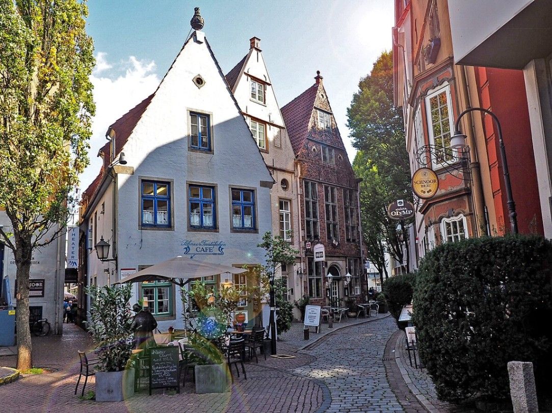
## Description The Schnoor is Bremen’s oldest quarter and one of the most picturesque areas in northern Germany. Walking through its narrow, winding alleyways feels like stepping into a medieval painting. The quarter is filled with tiny half-timbered houses, dating mostly from the 15th to 18th centuries, which have been lovingly preserved and restored. These charming homes are now a mix of cafés, artisan shops, galleries, and small museums that invite visitors to explore at a leisurely pace. What makes the Schnoor especially unique is its compact layout. The name “Schnoor” comes from the Low German word for “string” or “cord,” reflecting the fact that rope- and cord-makers once lived and worked here. The streets are so narrow in places that two people can barely walk side by side, a reminder of how space was used in medieval times. A little-known fact is that Schnoor was once considered a poor district of Bremen, inhabited mainly by fishermen and craftsmen. Today, however, it is one of the city’s most visited and beloved neighborhoods. Another interesting detail is that many of the houses are not perfectly aligned but instead lean slightly, giving the streets a charmingly crooked look. These imperfections only add to the district’s authentic, lived-in atmosphere, making it a favorite for photographers and history enthusiasts alike. ## Location The Schnoor is located in the heart of **Bremen**, a city in the state of **Bremen** in northwestern **Germany**. More precisely, it lies close to the Weser River and only a short walk from Bremen’s famous Market Square (Marktplatz), where the UNESCO World Heritage-listed Town Hall and Roland statue stand. Getting to the Schnoor is straightforward. If you are arriving in Bremen by train, the district is about a 15-minute walk from Bremen Central Station. Trams and buses also stop near the city center, making the area very accessible. For visitors traveling from Hamburg, a direct train ride takes about one hour, making Schnoor a perfect day-trip destination. Walking is the best way to explore the quarter, as the narrow lanes are not accessible by car. ## Tips * **Visit early or late in the day:** The Schnoor can become crowded with tourists during peak hours. Early mornings or evenings offer a quieter experience. * **Bring a camera:** The crooked houses, colorful facades, and hidden courtyards provide endless photo opportunities. * **Don’t rush:** Many visitors walk through quickly, but the real magic lies in browsing small shops, enjoying a coffee in one of the cozy cafés, or discovering hidden details in the architecture. * **Check out cultural stops:** The Schnoor hosts several museums, including the Schifferhaus (House of Skippers), which tells the story of Bremen’s maritime history. * **Try local specialties:** Some bakeries and cafés offer regional treats like Bremer Klaben (a type of fruit bread) or traditional beer from local breweries. ## Conclusion The Schnoor in Bremen is more than just a historic district; it is a living time capsule where history, culture, and modern life meet in a uniquely charming way. With its narrow alleys, crooked houses, and rich maritime heritage, it is one of Bremen’s must-see attractions for any traveler seeking authenticity and atmosphere. ## FAQ **1. What is the Schnoor best known for?** The Schnoor is famous for its narrow medieval alleys, half-timbered houses, and its transformation from a poor fishermen’s quarter into a vibrant cultural and tourist district. **2. Is the Schnoor suitable for children?** Yes, children usually enjoy the fairy-tale-like streets and quirky architecture. However, strollers might be difficult to maneuver in the narrowest lanes. **3. How long does it take to visit the Schnoor?** A quick walk-through can take 30 minutes, but to enjoy shops, cafés, and museums, plan for at least two to three hours. **4. Can cars enter the Schnoor?** No, the lanes are too narrow for cars. The area is best explored on foot. **5. Are guided tours available?** Yes, many guided walking tours of Bremen include the Schnoor. These tours provide fascinating insights into the district’s history and architecture. **6. Is the Schnoor open year-round?** Yes, the quarter is accessible throughout the year, though opening hours of shops and cafés vary. The winter months can be especially cozy, with festive decorations adding to the atmosphere. ## Links * [Official Tourism Page of Bremen](https://www.bremen-tourism.de) * [Visit Bremen – Schnoor District](https://www.bremen.de/tourism/schnoor)
GemVoyage Team • World
Toronto
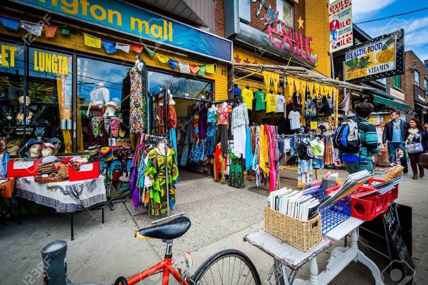
## Description Kensington Market is one of Toronto’s best-known neighborhoods for travelers who want atmosphere, variety, and a strong sense of place. It is not a traditional market in the narrow sense, but rather a dense urban district filled with independent shops, vintage clothing stores, grocers, cafés, bakeries, produce stands, restaurants, and street life that spills into the sidewalks. The area is famous for its mix of cultures and its long history as a neighborhood shaped by waves of immigration, creative entrepreneurship, and community reinvention. Walking through Kensington Market feels less like visiting a single attraction and more like stepping into a living collage of Toronto itself. What makes Kensington special is its refusal to feel polished in a predictable way. Its charm comes from variety, visual noise, and the sense that each storefront has its own personality. One block might be packed with produce, the next with music, used books, or handmade goods. Small alleyways and side streets often reveal murals, patios, and tiny surprises that reward unhurried visitors. The neighborhood also has a social rhythm of its own, especially on weekends when it becomes a magnet for browsers, food lovers, and people simply looking for a place that feels energetic and alive. One lesser-known aspect of Kensington Market is how strongly it reflects Toronto’s broader history of change. It has repeatedly adapted to new residents, new businesses, and shifting urban pressures while still preserving a distinctly independent feel. Another detail many first-time visitors miss is that Kensington is best experienced by combining observation with participation. The neighborhood is not only for looking at; it is for tasting, talking, trying, and wandering. A great visit often includes a snack, a coffee, a small purchase, and a few minutes spent people-watching from a curb or patio. Kensington Market is also a useful place to understand Toronto’s everyday creativity. It does not announce itself with monumental architecture or famous landmarks. Instead, it builds its identity from layers of storefront signage, murals, commerce, and community life. That makes it one of the city’s most authentic urban experiences, especially for travelers who prefer neighborhoods over tourist compounds. ## Location Kensington Market is in downtown Toronto, Ontario, close to Chinatown, the University of Toronto area, and several of the city’s central neighborhoods. Its location makes it easy to reach from much of central Toronto by streetcar, subway, bus, taxi, rideshare, or on foot if you are already nearby. Because the streets are compact and the area is highly walkable, most visitors explore it best on foot once they arrive. If you are planning a broader downtown day, Kensington pairs naturally with nearby cultural areas, galleries, food stops, and city walking routes. For visitors staying in the core, it is one of the easiest districts to add to an itinerary without needing a car. Public transit is usually the most practical option, and because parking can be limited or inconvenient, it is often better to leave the car behind entirely. ## Tips Go hungry and keep your schedule flexible. Kensington Market is one of the best neighborhoods in Toronto for spontaneous eating, browsing, and detours. If you try to over-plan the experience, you may miss what makes it fun. The best visits usually happen when you leave room for unplanned discoveries, whether that means a bakery stop, a vintage find, or a street musician drawing a crowd. Visit at different times if you can. Weekdays can feel more relaxed, while weekends are livelier and more crowded. Both moods have value, and the best choice depends on whether you want a calmer wander or a more animated urban scene. Morning visits are often easier if you want to take in the shops before they become too busy. Wear comfortable shoes. Kensington is compact, but it encourages a lot of walking, stopping, and turning into side streets. If you are interested in photography, the neighborhood is rich in texture, but be respectful of businesses and residents while you shoot. Try to support local vendors when you can, because the district’s character depends on the continued presence of independent operators. Do not expect uniformity. Some visitors want one clear “best” thing to do, but Kensington works differently. The point is the accumulation of impressions. The neighborhood is most rewarding when you let its diversity define the visit. ## Conclusion Kensington Market is one of Toronto’s essential neighborhoods, offering food, culture, and urban character in one dense and memorable walk. It is ideal for travelers who want to see the city through everyday life rather than landmarks alone. ## FAQ ### Is Kensington Market a real market? It is more accurately described as a neighborhood with a historic market identity rather than a single enclosed marketplace. Visitors come for the district’s shops, food, and street atmosphere. ### How long should I spend there? A short visit can take an hour, but two to four hours is better if you want to browse, eat, and explore side streets. Many travelers end up staying longer than planned. ### Is it expensive? It depends on where you stop. You can spend very little by simply walking around, but food, vintage goods, and specialty items can range from affordable to premium depending on the business. ### Is it family-friendly? Yes, especially during daytime hours. Families often enjoy the food variety, the pedestrian-friendly feel, and the colorful street life. ### What is the best way to experience it? Walk slowly, sample something local, and leave room for curiosity. Kensington is best when you treat it as a neighborhood to be explored rather than a checklist of attractions. ## Links - [Wikipedia](https://en.wikipedia.org/wiki/Kensington_Market)
GemVoyage Team • World
Tanga
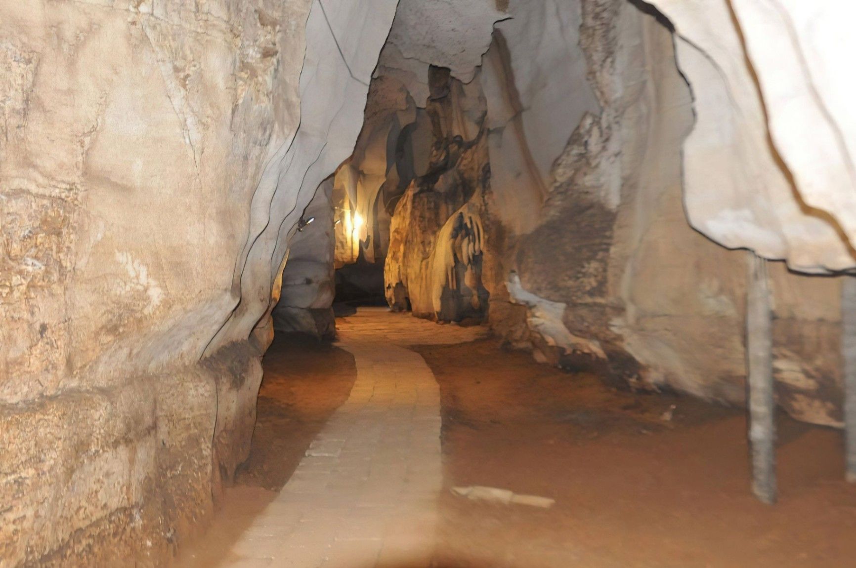
## Description Amboni Caves are among the most fascinating natural attractions in Tanzania, offering visitors a journey into an ancient underground world shaped by time, water, and geology. These limestone caves are believed to be over 150 million years old, making them one of the oldest cave systems in East Africa. With dark chambers, narrow passageways, and dramatic rock formations, Amboni Caves provide a sense of mystery and adventure that contrasts sharply with the nearby coastal landscapes. What makes Amboni Caves truly unique is their combination of natural, cultural, and spiritual significance. The caves are not only a geological marvel but also a site deeply connected to local beliefs and traditions. Many chambers are associated with spiritual practices, and some are still used for traditional rituals by surrounding communities. A little-known fact is that the caves are named after a colonial-era engineer, Amboni, who is believed to have popularized their exploration, although local communities had known and used the caves long before. Another lesser-known detail is that the cave system consists of at least ten interconnected chambers, each with its own name, legend, and distinct rock formations. Visiting Amboni Caves is both an educational and atmospheric experience, offering insight into Tanzania’s natural history as well as its living cultural traditions. ## Location Amboni Caves are located in **Tanzania**, in the **Tanga Region**, near the city of **Tanga**, along the northeastern coast of the country. The caves are situated about 6 kilometers north of Tanga city center, close to the Indian Ocean. Reaching the caves is relatively easy. Visitors can take a taxi or local transport from Tanga, with the journey usually taking 15 to 20 minutes. For travelers coming from other parts of Tanzania, Tanga is accessible by road, train, or domestic flights. Once near the site, a short walk leads to the cave entrance. Hiring a local guide at the site is strongly recommended, as the cave layout can be confusing without assistance. ## Tips * Always visit with a local guide, as the caves are dark, complex, and rich in cultural meaning. * Wear sturdy shoes with good grip, since the cave floors can be slippery and uneven. * Bring a flashlight or headlamp, even if guides provide lighting, for better visibility. * Dress comfortably and be prepared for warm and humid conditions inside the caves. * Respect local customs, as certain areas may be considered sacred. * Visit earlier in the day for a quieter experience and better overall visibility. ## Conclusion Amboni Caves offer a rare opportunity to explore one of Tanzania’s oldest natural formations while learning about the cultural traditions connected to it. With their ancient rock structures, spiritual significance, and sense of adventure, the caves stand out as a unique and rewarding destination near Tanga. ## FAQ **Are Amboni Caves safe to visit?** Yes, they are safe when visited with an experienced local guide who knows the cave layout and conditions. **How long does a visit to Amboni Caves take?** Most guided visits last between 45 minutes and 1.5 hours, depending on the route and interest level. **Is the site suitable for children?** Older children may enjoy the experience, but very young children might find the dark and narrow spaces challenging. **Is there an entrance fee?** Yes, a small entrance fee is usually charged, with additional costs for guided tours. **Can I take photos inside the caves?** Photography is generally allowed, but flash use and certain areas may be restricted, so always ask your guide. ## Links * [Tanzania Tourist Board](https://www.tanzaniatourism.go.tz) * [Tanga Region Information](https://www.tanga.go.tz)
GemVoyage Team • World

Comments