Discover extraordinary places shared by our community of travelers
Moscow
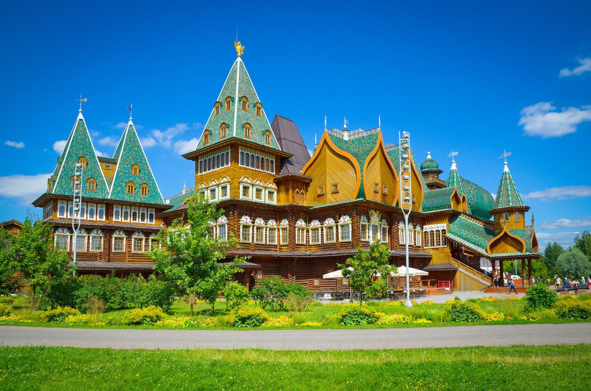
## Description Kolomenskoye Park is one of Moscow’s most rewarding destinations because it combines landscape, architecture, and imperial history in a single spacious setting. More accurately described as a historical and cultural reserve than as a simple park, Kolomenskoye offers sweeping river views, wooded paths, open lawns, orchards, and landmark buildings that connect visitors to the city’s royal past. It is the kind of place that can fill an entire half-day without ever feeling repetitive, because the experience changes as you move from ceremonial architecture to natural scenery and then into quieter, more reflective areas. What makes Kolomenskoye especially impressive is its historical depth. The estate was associated with Russian rulers for centuries and functioned as a place of retreat, ceremony, and seasonal residence. One of its most famous features is the Church of the Ascension, a striking landmark that is widely recognized for its architectural importance. A lesser-known fact is that the park’s broader grounds include not only monuments but also reconstructed wooden structures that help visitors imagine how Russian domestic and court life might have looked in earlier periods. Another detail that often surprises travelers is how strongly the place changes with the seasons: spring blossoms, summer greenery, autumn color, and winter snow each give the site a different personality. For travelers, Kolomenskoye is appealing because it offers a very Moscow-specific balance. The city is often experienced as large, dense, and fast-moving, but here you get a more spacious and contemplative side. You can walk along the river, explore heritage buildings, pause by old orchards, and enjoy the sense that the city opens outward rather than compressing inward. It is a particularly strong choice for visitors who want historical context without spending the whole day indoors. The park also works well as an antidote to more crowded attractions. It provides room to breathe, which is especially valuable in a city as large and energetic as Moscow. ## Location Kolomenskoye Park is located in southern Moscow, Russia, along the Moskva River. It sits within the city’s urban area but feels much more spacious than the central districts. Because it is a historical reserve, the site has multiple layers of interest spread across a sizable landscape, so it is worth entering with enough time to explore beyond the first landmark you see. The easiest way to get there is by Moscow Metro, followed by a short walk depending on your chosen entrance. Metro access is usually the most efficient approach for visitors, especially because surface traffic can be slow in a city this large. Once inside, the site is best explored on foot. If you want a smoother visit, start with the main landmarks and then move toward the quieter natural sections. Because Kolomenskoye is both a park and a heritage site, it is wise to think of it as a destination for a full outing rather than a quick stop. You can spend a couple of hours there comfortably, and more if you enjoy architecture, photography, or leisurely walks. ## Tips Wear good walking shoes. The reserve is large, and part of the pleasure comes from covering ground at an unhurried pace. Check the weather before you go. Kolomenskoye can be beautiful in any season, but the experience changes dramatically with conditions, so planning around sunshine or a clear winter day is smart. Do not limit yourself to the best-known monument. The open spaces, orchard areas, and river views are part of what makes the site special. Take your time with the architecture. The historical buildings are more meaningful when you understand their place in Russian royal history. If possible, pair the visit with a meal or snack nearby so you can turn the park into a half-day excursion instead of a rushed check-in. ## Conclusion Kolomenskoye Park is one of Moscow’s strongest heritage landscapes, offering history, nature, and open space in a single visit. It is ideal for travelers who want a city experience that feels both scenic and historically grounded. ## FAQ ### Why is Kolomenskoye important? It was a major royal estate and is home to significant heritage architecture, including some of Moscow’s most important historical structures. ### Is Kolomenskoye more of a park or a museum? It is both. The reserve combines landscaped outdoor spaces with historic buildings and cultural interpretation. ### How much time should I spend there? Plan for at least 2 to 4 hours if you want to see the main features and enjoy the grounds without rushing. ### Is it good year-round? Yes. Each season changes the atmosphere, and many visitors find that the park is especially striking in spring, autumn, and snowy winter conditions. ## Links - [Kolomenskoye on Wikipedia](https://en.wikipedia.org/wiki/Kolomenskoye)
GemVoyage Team • World
Misiones
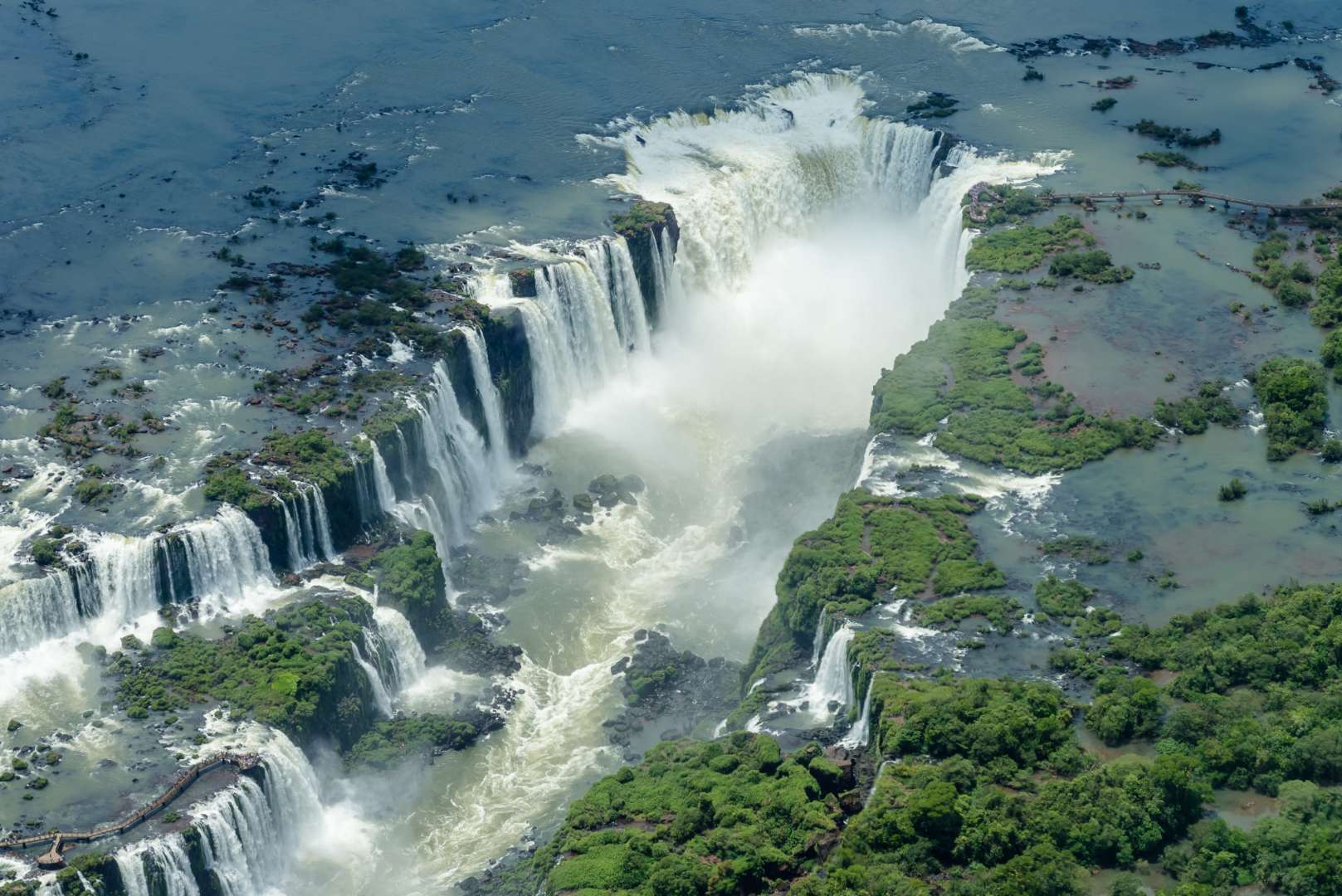
## Description Iguazú Falls (Cataratas del Iguazú) is one of the most awe-inspiring natural wonders on Earth, a sprawling system of waterfalls that straddles the border between Argentina and Brazil. Located within the lush confines of the Iguazú National Park, the falls consist of 275 individual cascades stretching nearly 2.7 kilometers across the Iguazú River. With drops ranging from 60 to 82 meters, the thunderous roar and misty spray of the falls create an unforgettable sensory experience. The crown jewel of the site is the **Devil’s Throat (Garganta del Diablo)**, a U-shaped chasm where half the river’s flow plunges into a dramatic abyss. Standing on the viewing platform above this torrent is both humbling and exhilarating. The surrounding subtropical rainforest is teeming with wildlife, including toucans, coatis, butterflies, and even jaguars, making the area a paradise for nature lovers and photographers. A little-known fact: Eleanor Roosevelt reportedly exclaimed “Poor Niagara!” upon seeing Iguazú Falls, a testament to its staggering scale and beauty. Another fascinating detail is that the falls were formed by a volcanic eruption that left a large crack in the earth, allowing the river to tumble over the edge and create this natural spectacle. ## Location Iguazú Falls is located in **Argentina**, within the **Misiones Province**, near the city of **Puerto Iguazú**. The falls are part of the **Iguazú National Park**, a UNESCO World Heritage Site recognized for its ecological importance and breathtaking scenery. ### How to Get There: - **By Air**: The easiest way to reach the falls is by flying into **Cataratas del Iguazú International Airport (IGR)**, located about 20 minutes from Puerto Iguazú. Direct flights are available from Buenos Aires and other major cities. - **By Bus**: Long-distance buses run from Buenos Aires and other regional hubs to Puerto Iguazú, though the journey can take 18–20 hours. - **By Car**: Renting a car offers flexibility, especially if you plan to visit both the Argentine and Brazilian sides of the falls. From Puerto Iguazú, shuttle buses and taxis can take you directly to the entrance of the national park. ## Tips for Visitors To make the most of your Iguazú Falls adventure, keep these tips in mind: - **Visit Both Sides**: The Argentine side offers immersive trails and close-up views, while the Brazilian side provides panoramic vistas. If possible, explore both. - **Start Early**: Arrive when the park opens to avoid crowds and enjoy cooler temperatures. - **Wear Waterproof Gear**: The mist from the falls can soak you—bring a poncho or quick-dry clothing. - **Take the Ecological Train**: This scenic ride through the jungle leads to key trailheads, including the Devil’s Throat. - **Book a Boat Tour**: For thrill-seekers, speedboat rides take you right under the falls—prepare to get drenched. - **Respect Wildlife**: Coatis may look cute, but they can be aggressive if provoked. Don’t feed or approach them. ## Conclusion Iguazú Falls is a breathtaking blend of raw power and serene beauty. With its towering cascades, rich biodiversity, and immersive trails, it offers a once-in-a-lifetime experience for travelers seeking nature at its most majestic. ## FAQ **1. What is the best time to visit Iguazú Falls?** The falls are spectacular year-round, but April to September offers cooler weather and fewer crowds. **2. How long should I plan to stay?** At least two full days—one for the Argentine side and one for the Brazilian side. **3. Is the park accessible for people with disabilities?** Yes, many trails and viewing platforms are wheelchair accessible, and the ecological train accommodates mobility needs. **4. Can I swim near the falls?** Swimming is not allowed near the main falls due to strong currents, but nearby areas like Isla San Martín may offer safe spots depending on conditions. **5. Are guided tours available?** Yes, both private and group tours are offered, including bilingual guides and eco-tours. **6. Do I need a visa to cross into Brazil?** Visa requirements vary by nationality. Check with your embassy before planning a cross-border visit. ## Links - [Iguazú Falls – Wikipedia Overview](https://en.wikipedia.org/wiki/Iguazu_Falls) - [Iguazú Argentina – Official Park Site](https://iguazuargentina.com/en/)
GemVoyage Team • World
Antalya
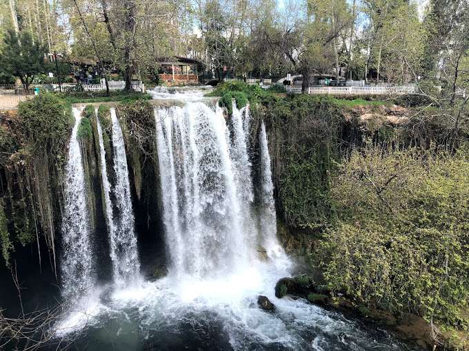
## Description Düden Waterfalls in Antalya are among Turkey’s most captivating natural attractions, offering a dramatic blend of lush greenery, cascading water, and coastal beauty. Fed by the Düden River, these waterfalls are divided into two distinct sites: the Upper Düden Waterfall (Yukarı Düden Şelalesi) and the Lower Düden Waterfall (Aşağı Düden Şelalesi). Each offers a unique experience, making them a must-visit for nature lovers, photographers, and anyone seeking a peaceful escape from the city. The Upper Düden Waterfall is nestled in a tranquil park setting, where water tumbles 20 meters into a cave-lined basin surrounded by trees and walking paths. Visitors can explore behind the waterfall through a natural cave, offering a rare perspective of the rushing water from within. The park also features picnic areas, shaded benches, and small cafés, making it ideal for a relaxed afternoon. The Lower Düden Waterfall, by contrast, is a dramatic spectacle where the river plunges 40 meters off a cliff directly into the Mediterranean Sea. Located in Düden Park in the Lara district, this waterfall is best viewed from the observation terrace or from the sea on a boat tour. The sight of the water crashing into the ocean, often accompanied by rainbows formed in the mist, is unforgettable. A little-known fact: the water that feeds the Upper Düden Waterfall originates from a karstic source and travels underground for nearly 11 miles before resurfacing. Another interesting detail is that the Lower Düden Waterfall is also known locally as Karpuzkaldıran Şelalesi, which translates to “watermelon lifter waterfall,” a name tied to local folklore. ## Location Düden Waterfalls are located in **Turkey**, in the **Antalya Province**, within the **city of Antalya**. The Upper Düden Waterfall is situated in the Kepez district, while the Lower Düden Waterfall is located in the Lara district, near the coast. ### How to Get There - **Upper Düden Waterfall**: From Antalya city center, take a taxi or drive about 10 kilometers northeast to the Kepez district. Public buses (such as bus number VC57) also serve the area. - **Lower Düden Waterfall**: Located about 8 kilometers southeast of the city center, it can be reached by taxi, car, or public buses like KL08 or LF09. Boat tours from Kaleiçi Marina also offer views from the sea. Both sites are easily accessible and can be visited in a single day. ## Tips - **Visit Both Sites**: Each waterfall offers a distinct experience—don’t miss the chance to see both. - **Bring a Camera**: The mist, cliffs, and greenery make for stunning photos, especially at sunset. - **Wear Comfortable Shoes**: Trails around the Upper Düden Waterfall can be uneven and slippery. - **Take a Boat Tour**: Viewing the Lower Düden Waterfall from the sea offers a unique and dramatic perspective. - **Pack Snacks or Picnic Supplies**: The Upper Düden site has picnic areas perfect for a leisurely meal. - **Check the Weather**: Spring and early summer offer the best conditions for photography and boat tours. ## Conclusion Düden Waterfalls are a natural gem in Antalya, offering two distinct yet equally mesmerizing experiences. Whether you’re exploring caves behind a forest waterfall or watching water plunge into the Mediterranean, this destination promises beauty, tranquility, and unforgettable views. ## FAQ **1. Is there an entrance fee to Düden Waterfalls?** Yes. The Upper Düden Waterfall charges a small entrance fee (around 70 TL), while the Lower Düden Waterfall is free to visit. **2. Can I swim near the waterfalls?** Swimming is not permitted near the waterfalls due to safety concerns, but nearby beaches offer swimming opportunities. **3. Are the waterfalls open year-round?** Yes, both sites are open throughout the year, though hours may vary seasonally. **4. Are the waterfalls suitable for children?** Yes, both locations are family-friendly, with safe paths and picnic areas. **5. How long should I plan for a visit?** Allow 1–2 hours for each site, or a half-day if visiting both. **6. Are there guided tours available?** Yes, many local tour operators offer packages that include transportation, guided visits, and boat tours. ## Links - [Official Düden Waterfalls Website](https://dudenwaterfalls.com/)
GemVoyage Team • World
Boa Vista
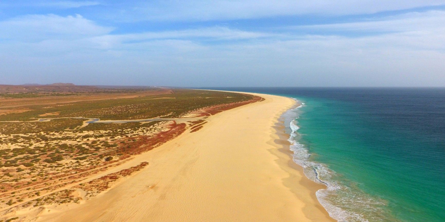
## Description Praia de Santa Mónica is often described as one of the most beautiful beaches in the world—and with good reason. Stretching over 18 kilometers along the southern coast of Boa Vista, Cape Verde, this vast expanse of golden sand and turquoise water remains almost untouched by development. Its name, “Santa Mónica,” was inspired by California’s famous beach, yet its charm lies in its wild and pristine character. The beach is unique because of its sheer size and tranquility. Unlike other popular destinations, Praia de Santa Mónica rarely feels crowded, even during peak travel seasons. Visitors are treated to panoramic views of rolling dunes, crystal-clear waves, and endless horizons. The beach is also known for being a nesting site for sea turtles, particularly the endangered Caretta caretta (loggerhead turtle). During nesting season, guided tours allow travelers to observe these creatures responsibly, making for a truly unforgettable experience. A little-known fact is that the beach is part of the Morro de Areia Nature Reserve, a protected area aimed at conserving both marine and terrestrial biodiversity. This adds an extra layer of significance for those seeking eco-friendly and sustainable travel experiences. ## Location Praia de Santa Mónica is located on the island of **Boa Vista**, one of the ten main islands of **Cape Verde**, an archipelago off the west coast of **Africa** in the Atlantic Ocean. The beach lies on the southwestern coast of Boa Vista, approximately 20 kilometers from the island’s capital, Sal Rei. To reach Praia de Santa Mónica, most visitors first arrive at Aristides Pereira International Airport (BVC) in Boa Vista. From there, taxis or guided tours can take you to the beach in around 40 minutes. Since public transport is limited on the island, arranging private transfers or joining an organized excursion is recommended. Off-road vehicles are often used, as some roads to the beach remain unpaved, adding a sense of adventure to the journey. ## Tips * **Bring essentials:** There are few facilities on-site, so pack water, snacks, sunscreen, and shade if you plan to spend several hours there. * **Swimming caution:** While the water looks inviting, currents can sometimes be strong. Check local conditions before swimming and stick to calmer areas. * **Best time to visit:** Early morning or late afternoon provide not only cooler temperatures but also the most stunning light for photography. * **Turtle watching:** If visiting between June and October, book a guided turtle-watching excursion to witness the nesting or hatching process. These tours are regulated to ensure the animals are not disturbed. * **Respect the environment:** Stay on marked paths to protect dunes and wildlife, and avoid leaving litter behind. * **Combine with a tour:** Many excursions include stops at Santa Mónica along with other highlights of Boa Vista, such as the Viana Desert or the shipwreck of Cabo Santa Maria. ## Conclusion Praia de Santa Mónica in Cape Verde is a destination for those seeking unspoiled beauty, peace, and a connection with nature. With its endless sandy shores, rich biodiversity, and breathtaking views, it offers a paradise-like escape far removed from crowded tourist resorts. For travelers looking to experience Cape Verde at its most authentic, this beach is an absolute must. ## FAQ **1. Is Praia de Santa Mónica suitable for families?** Yes, families can enjoy the wide sandy beach, but parents should monitor children closely when swimming due to occasional strong currents. **2. Are there restaurants or shops nearby?** No, the beach is largely undeveloped. It’s best to bring supplies from Sal Rei or your hotel before heading there. **3. How long should I plan to spend at the beach?** Many visitors spend a half-day to enjoy the scenery and relax, but nature lovers and photographers often stay longer. **4. Is it possible to surf or kiteboard at Santa Mónica?** The beach can offer good waves, but it’s less developed for water sports than other parts of Boa Vista. Consult local guides if you’re looking for surfing or kitesurfing opportunities. **5. Can I see turtles on my own?** For conservation reasons, turtle watching should only be done with licensed guides. This ensures the safety of both the turtles and visitors. **6. What’s the best way to get there?** The easiest way is by booking a taxi or an organized 4x4 tour from Sal Rei or your resort. Public transport does not reach the area. ## Links * [Cape Verde Tourism Official Site](https://www.visit-caboverde.com) * [Boa Vista Tourism Guide](https://www.boavistaofficial.com)
GemVoyage Team • World
Paris
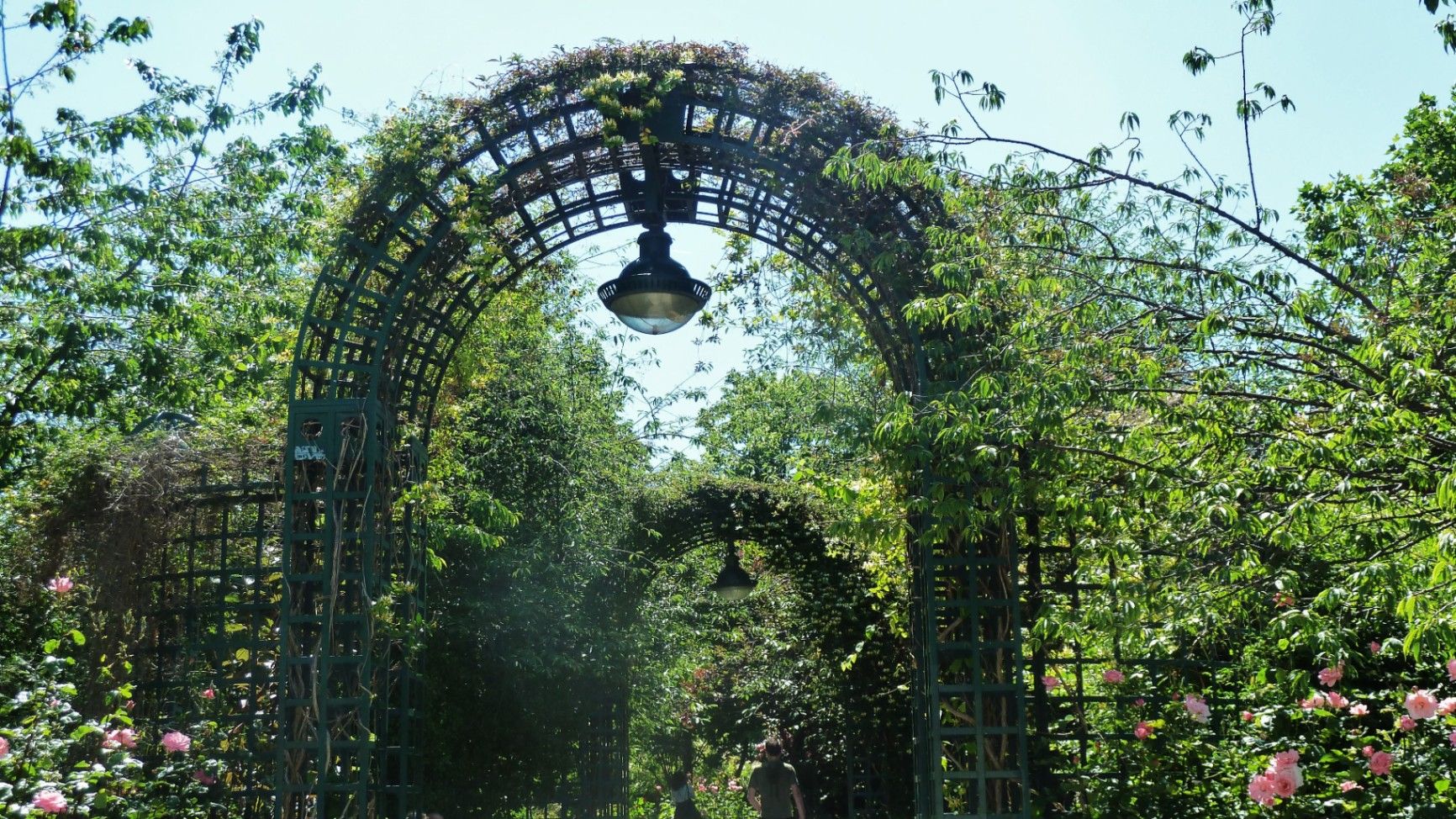
## Description The **Coulée Verte René-Dumont** is one of Paris’s most quietly transformative urban landscapes: a **4.7-kilometer elevated green corridor** built on a former 19th-century railway viaduct. Long before New York’s High Line became famous, Paris had already pioneered the idea of reclaiming industrial infrastructure and turning it into a **linear park suspended above city streets**. Opened in **1993**, the Coulée Verte stretches across eastern Paris, offering a continuous ribbon of trees, gardens, pergolas, tunnels, and walkways that float above neighborhoods, rooftops, and traffic. Rather than being a monumental tourist attraction, its strength lies in its **subtle intimacy**. The path winds between apartment balconies, over narrow streets, through shaded cuttings, and across stone viaducts, allowing visitors to experience Paris from an **unexpected vertical perspective**. The design philosophy of the park is deeply rooted in **soft landscaping rather than formal symmetry**. Instead of wide lawns or dramatic vistas, the Coulée Verte contains **layered vegetation, winding paths, seasonal flowers, bamboo groves, climbing roses, and shaded benches**. This makes it feel more like a secret garden than a grand urban park. One of the most remarkable architectural features of the route is the **Viaduc des Arts**, where the park runs along a series of brick arches originally built for railway use. Beneath these arches now sit artisan workshops, design studios, galleries, instrument makers, and boutique craftspeople. This dual-level experience—**green tranquility above and creative commerce below**—is one of the Coulée Verte’s defining identities. Unlike Paris’s grand axial parks such as the Tuileries or Luxembourg Gardens, the Coulée Verte offers a **continuously shifting urban narrative**. At one point, you are enclosed in forest-like silence; minutes later, you emerge into balcony-lined streets where residents drink coffee just meters away from your path. This creates an emotional tension between **privacy and exposure**, urban density and botanical escape. A little-known fact is that the park is named after **René Dumont**, a pioneering French agronomist and environmentalist who was also **France’s first Green Party presidential candidate**. The naming itself reinforces the park’s identity not just as a recreational space, but as a **symbol of ecological urban thinking**. Another little-known detail is that parts of the route pass directly behind residential buildings at eye level, leading to long-standing unspoken etiquette between walkers and residents regarding privacy. Today, the Coulée Verte is used daily by **joggers, dog walkers, commuters, couples, photographers, and elderly residents**, each group engaging with the space differently depending on time of day. Mornings are quiet and rhythmical. Afternoons bring families and visitors. Evenings soften into slow movement, conversation, and golden-hour light filtering through leaves onto brick and stone. The Coulée Verte does not dominate Paris visually or symbolically. Instead, it **slips through the city like a green seam**, quietly stitching nature into urban density. ## Location The **Coulée Verte René-Dumont** runs through the **12th arrondissement of Paris**, beginning near **Opéra Bastille** and extending eastward toward the **Périphérique (city ring road)**. **City:** Paris **Region:** Île-de-France **Country:** France **Primary Arrondissement:** 12th **Main Entrance Area:** Near Bastille and Avenue Daumesnil ### How to Get There: * **By metro:** * **Line 1, 5, or 8** to **Bastille Station** * **Line 6 or 8** to **Daumesnil Station** * **By RER:** **RER A** to **Nation Station**, then walk. * **By bus:** Multiple lines serve Avenue Daumesnil and the surrounding streets. * **By bicycle:** Easy access from eastern Paris cycle lanes. * **On foot:** Ideal as part of a walking route between Bastille, Bercy, and Nation. Multiple staircases and ramps provide access at different points along the route. ## Tips * **Walk the full length if possible:** The character of the park changes dramatically from west to east. * **Visit in spring or early autumn:** Vegetation is at its best and temperatures are comfortable. * **Early mornings are best for solitude:** Especially on weekdays. * **Evenings are best for atmosphere:** Soft lighting and slower rhythms dominate. * **Respect residential privacy:** Some sections run directly past apartment windows. * **Combine with Viaduc des Arts shopping:** The artisan shops beneath the arches are worth exploring. * **Bring water:** There are few vendors directly on the elevated path. * **Not ideal for fast cycling:** The path is narrow and shared heavily with pedestrians. ## Conclusion The **Coulée Verte René-Dumont** is not loud, monumental, or iconic in the traditional Parisian sense. Its power lies in **subversion and continuity**—a quiet green artery that transforms obsolete railway infrastructure into a flowing garden above the city. It offers a Paris of **movement, transition, and subtle beauty**, experienced not through grand monuments, but through shifting light, layered leaves, and elevated urban silence. ## FAQ **1. What is the Coulée Verte René-Dumont?** It is an **elevated linear park** built on an abandoned railway line in eastern Paris. **2. Is the Coulée Verte free to access?** Yes. It is **completely free and open to the public**. **3. How long does it take to walk the full route?** A full walk typically takes **1 to 1.5 hours** at a relaxed pace. **4. Is it similar to the High Line in New York?** Yes in concept, but the Coulée Verte is **older, greener, and more intimate** in character. **5. Is the park suitable for children?** Yes. It is widely used by families, though supervision is required in elevated or narrow sections. **6. Are there cafés or shops along the route?** Not directly on the path, but many cafés and bakeries are located at street level nearby. ## Links * [Paris City Guide](https://parisjetaime.com/eng/)
GemVoyage Team • World
Aqaba
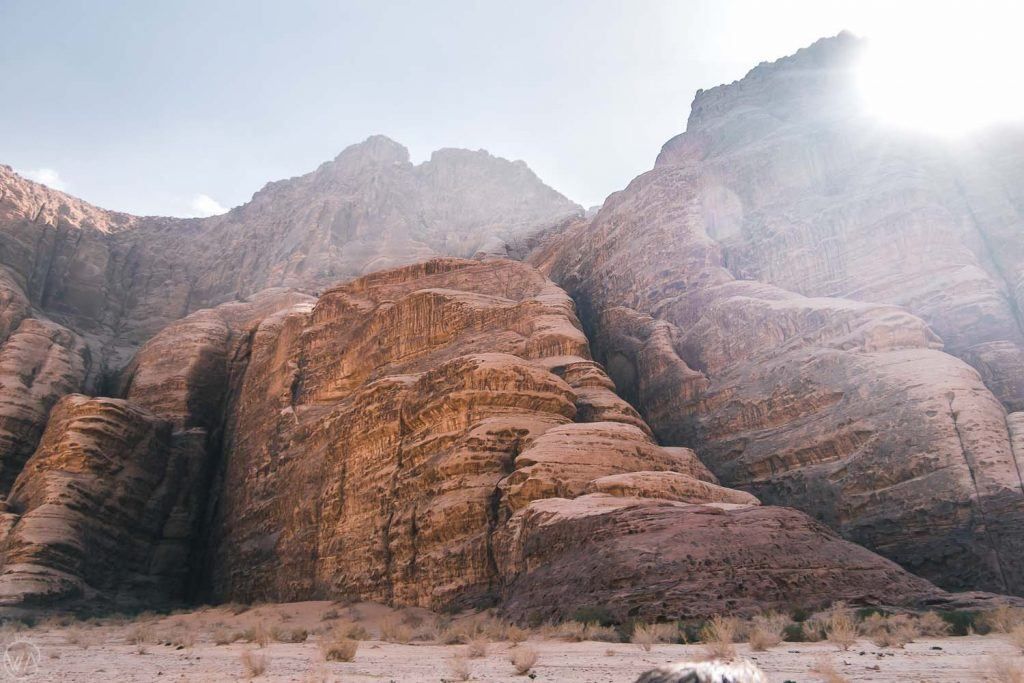
## Description **Jabal Umm ad Dami** is the highest mountain in Jordan, rising to approximately **1,854 meters above sea level**. Located deep in the southern desert near the Saudi border, it offers a dramatically different experience from the country’s more famous historical sites. Rather than monuments or ruins, Jabal Umm ad Dami is about **scale, silence, and raw landscape**. The mountain dominates the horizon with a stark, rocky profile that feels both remote and elemental. What makes Jabal Umm ad Dami truly special is the **sense of isolation and elevation** it provides. From the summit, on clear days, it is possible to see across vast stretches of desert and, remarkably, into **Saudi Arabia**, the Red Sea, and even parts of the Sinai Peninsula. This expansive visibility is rare in the region and contributes to the mountain’s reputation as one of Jordan’s most rewarding viewpoints. Geologically, the mountain is part of the same ancient granite formations that shape the surrounding desert, giving it rugged textures and warm reddish hues, especially striking at sunrise and sunset. Unlike heavily trafficked peaks elsewhere in the world, Jabal Umm ad Dami remains **largely untouched by mass tourism**, preserving a sense of authenticity and wilderness. A lesser-known fact is that the mountain has long been used as a **navigation landmark by Bedouin tribes**, who relied on its prominence to orient themselves across the desert. Another overlooked detail is that, despite being Jordan’s highest point, the climb is considered **moderate rather than technical**, making it accessible to fit hikers without advanced mountaineering skills when guided properly. Jabal Umm ad Dami is not a place of crowds or amenities. Its appeal lies in its honesty: an uncompromising desert mountain that rewards effort with perspective. ## Location **Country:** Jordan **Region:** Aqaba Governorate **Nearest Area:** Wadi Rum Desert **Proximity:** Near the Jordan–Saudi Arabia border The mountain lies south of the protected desert landscapes of **Wadi Rum**, often referred to as the “Valley of the Moon,” though it sits outside the main tourist circuit. ### How to Get There * **From Aqaba:** * Travel north toward Wadi Rum by car, then continue south with a **4x4 vehicle**. * **With a local guide:** * The most practical and safest option. Bedouin guides know the terrain and access routes. * **From Wadi Rum:** * Many guided excursions combine Wadi Rum exploration with a hike to Jabal Umm ad Dami. * **Public transport:** * Not available for the final approach; private transport is required. Independent travel without proper navigation and a suitable vehicle is strongly discouraged. ## Tips * **Hire a local Bedouin guide:** This is not optional if you want a safe and meaningful experience. * **Start early:** Heat and exposure increase significantly later in the day. * **Bring sufficient water:** There are no water sources on or near the mountain. * **Wear sturdy footwear:** The terrain is rocky and uneven. * **Check weather conditions:** Wind can be strong at the summit. * **Combine with camping:** An overnight desert camp enhances the experience significantly. ## Conclusion Jabal Umm ad Dami is Jordan at its most elemental: vast, quiet, and uncompromising. As the country’s highest point, it offers unmatched views and a powerful sense of perspective, rewarding visitors who value wilderness and authenticity over convenience. ## FAQ **1. Is Jabal Umm ad Dami difficult to climb?** The hike is moderate but requires fitness, proper footwear, and guidance. **2. Do I need a guide to visit?** Yes, a local guide is strongly recommended for safety and navigation. **3. How long does the hike take?** The ascent and descent typically take **3 to 4 hours** in total. **4. Is it suitable for beginners?** Yes, for physically fit beginners accompanied by an experienced guide. **5. Can you see Saudi Arabia from the summit?** Yes, visibility into Saudi Arabia is possible on clear days. **6. Is there an entrance fee?** Fees vary depending on tour operators and guide arrangements. ## Links * [Wiki Page](https://en.wikipedia.org/wiki/Wadi_Rum)
GemVoyage Team • World
Umbria
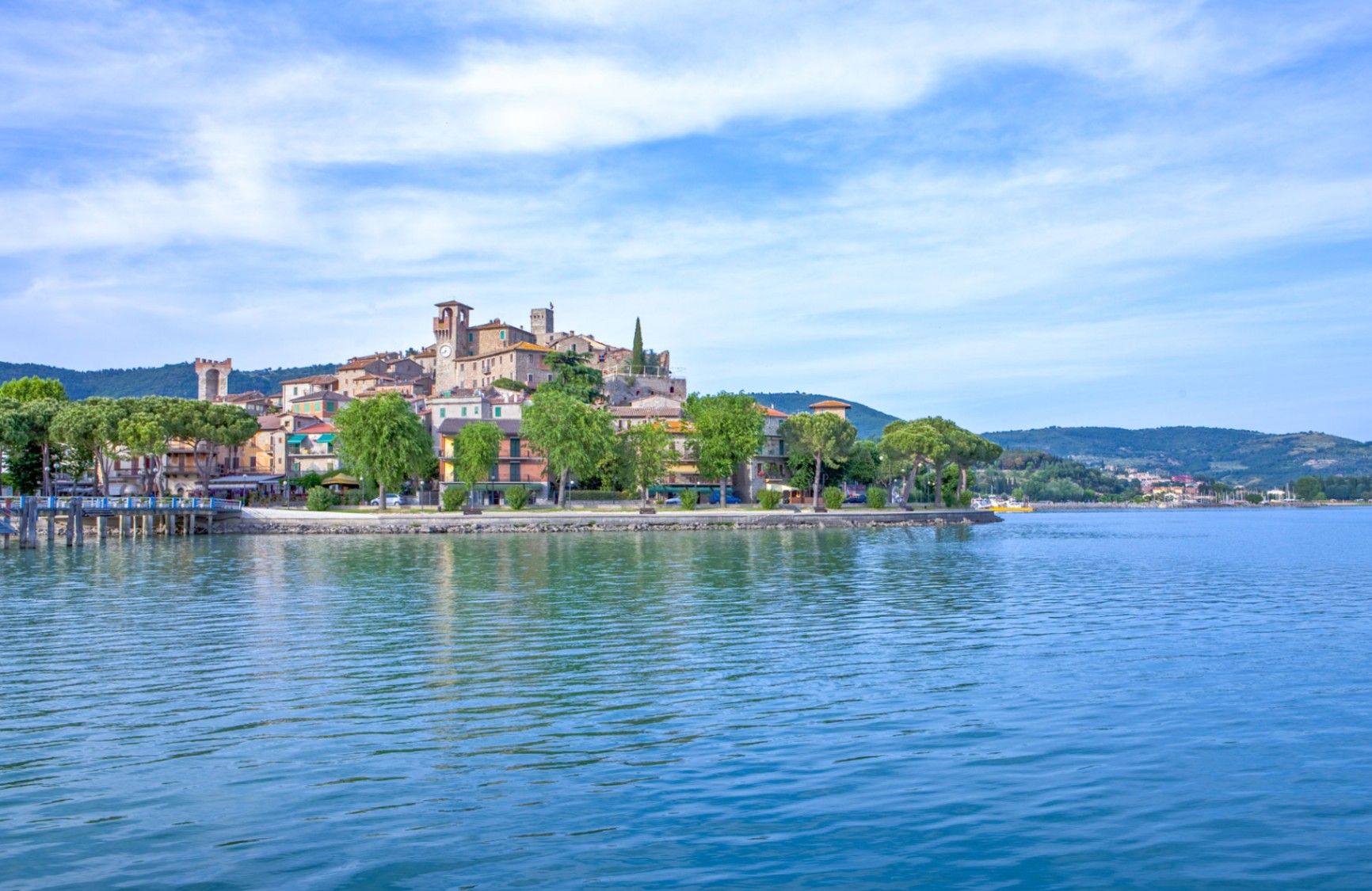
## Description **Lago Trasimeno** is one of Italy’s largest lakes and among its most understated. Unlike the dramatic alpine lakes of the north, Lago Trasimeno is defined by **breadth rather than depth**, calm waters, and a landscape shaped by agriculture, small towns, and slow rhythms. It is a place where nature, history, and everyday Umbrian life coexist without spectacle. The lake is shallow—its average depth is only a few meters—which gives it a distinctive character. Water levels fluctuate noticeably with the seasons, creating wetlands that attract migratory birds and sustain a delicate ecosystem. This makes Lago Trasimeno an important **natural reserve**, particularly for birdwatchers and ecologists. The surrounding reeds, olive groves, and rolling hills contribute to a serene atmosphere that feels far removed from mass tourism. Historically, the lake is best known as the site of the **Battle of Lake Trasimene (217 BCE)**, one of Hannibal’s greatest victories against the Roman Republic during the Second Punic War. Roman legions were ambushed along the lakeshore, making the area one of the most strategically significant ancient battlefields in Italy. A lesser-known fact is that remnants of Roman roads and settlements still lie scattered around the basin, largely unmarked and integrated into the modern landscape. Another overlooked detail is that the lake supports **three inhabited islands**, each with a distinct identity, rather than serving purely as a scenic backdrop. Today, Lago Trasimeno remains deliberately low-key. Fishing villages, medieval towns, cycling paths, and ferry crossings define the experience. It is a destination that rewards patience and curiosity rather than tight itineraries. ## Location **Country:** Italy **Region:** Umbria **Province:** Province of Perugia **Nearby City:** Perugia Lago Trasimeno lies west of Perugia, close to the border with Tuscany, making it a natural crossroads between central Italy’s cultural regions. ### How to Get There * **By train:** * Regional trains run along the northern shore of the lake, stopping at towns such as Passignano sul Trasimeno and Castiglione del Lago. * **By car:** * Easily accessible via regional roads from Perugia, Cortona, or Arezzo. A car is the most flexible option for exploring the lakeside. * **By bus:** * Local buses connect Perugia to towns around the lake, though schedules are limited. * **By bicycle:** * Popular with cyclists, with relatively flat routes and scenic views. ## Tips * **Explore multiple towns:** Each lakeside town has a different character; do not limit yourself to one stop. * **Take a ferry:** Boat trips to the islands offer a different perspective of the lake. * **Visit in spring or early autumn:** Mild weather and fewer crowds enhance the experience. * **Rent a bike:** The flat terrain makes cycling particularly enjoyable. * **Manage expectations:** This is not a swimming-focused lake; its appeal lies elsewhere. * **Stay overnight:** Sunset and early morning reveal the lake at its most atmospheric. ## Conclusion Lago Trasimeno is a place of quiet depth rather than visual drama. Rooted in ancient history and shaped by nature and rural life, it offers an authentic Umbrian experience for visitors who value calm landscapes, local culture, and unhurried exploration. ## FAQ **1. Is Lago Trasimeno good for swimming?** Swimming is possible in designated areas, but the lake is better suited to boating and relaxation. **2. How many islands are on the lake?** There are three inhabited islands: Isola Maggiore, Isola Minore, and Isola Polvese. **3. How much time should I plan for a visit?** At least **one full day**, more if exploring towns or cycling. **4. Is the lake suitable for families?** Yes, especially for gentle outdoor activities and relaxed travel. **5. Can you visit without a car?** Yes, but a car provides greater flexibility. **6. Is Lago Trasimeno crowded?** Compared to other Italian lakes, it remains relatively uncrowded year-round. ## Links * [Umbria official tourism site](https://www.umbriatourism.it)
GemVoyage Team • World
Berlin
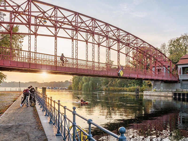
## Description **Tegeler See** is one of Berlin’s largest and most beloved lakes, offering a rare combination of **deep forest landscapes, wide open water, historic promenades, and recreational freedom** within a major European capital. Unlike the carefully curated parks of central Berlin, Tegeler See feels **expansive, natural, and quietly powerful**, a place where the city dissolves into wind, water, and tree canopy. The lake stretches across the northern edge of Berlin and forms part of a much larger **interconnected water system** linking rivers, canals, and smaller lakes. Its shoreline alternates between **elegant promenades, dense woodland, sandy bathing areas, hidden coves, and small harbors**, giving every section a distinct character. On one walk you might pass joggers and cyclists near cafés, and moments later find yourself alone on a forested shoreline with only birds and passing sailboats for company. What makes Tegeler See especially unique is its **scale and visual openness**. The lake is wide enough to feel almost coastal in certain sections. Wind patterns shape large ripples across the surface, and on clear days the sky reflects endlessly into the water. Sailboats, paddleboards, kayaks, ferries, and swimmers all share the same space, creating an ever-moving ecological and recreational system. The western and northern edges of the lake are bordered by the **Tegel Forest (Tegeler Forst)**, one of Berlin’s largest continuous woodland zones. This forest contains long hiking paths, wildlife corridors, thick pine stands, and historic hunting routes that once served Prussian royalty. This direct interface between **urban lake and protected forest** is one of Tegeler See’s defining strengths. Few European capitals offer this scale of natural immersion without leaving city limits. From an urban perspective, the lake is closely tied to the borough of **Reinickendorf** and the historic district of **Alt-Tegel**. The Alt-Tegel promenade along the eastern shoreline functions as a social spine, lined with restaurants, ice cream shops, boat docks, beer gardens, and terraces overlooking the water. This area transforms in summer into one of Berlin’s most relaxed outdoor social scenes, blending families, cyclists, couples, and long-term residents. A little-known fact is that Tegeler See was once part of the **Havel River’s natural floodplain system**, and its modern form is the result of long-term hydraulic engineering dating back centuries. Another lesser-known detail is that the famous German poet and philosopher **Gotthold Ephraim Lessing** once lived near the lake, and the nearby Tegel Palace was home to the Humboldt family, including **Alexander von Humboldt**, one of history’s most influential natural scientists. Tegeler See’s emotional identity is shaped by **seasonality**. In spring, the forest releases fresh green layers and migrating birds return. Summer brings swimming, paddleboarding, lakeside dining, and long evening sunsets. Autumn covers the surrounding hills in gold and copper tones. Winter transforms the lake into a minimalist landscape of cold light, mist, and silence, occasionally frozen at the edges. Unlike Berlin’s central landmarks, Tegeler See does not present itself as a destination of spectacle. Its appeal is built on **duration rather than intensity**. People do not come for a single photo; they come to spend hours walking, reading, boating, cycling, swimming, and simply existing beside water and forest. It is one of the few places in Berlin where **time visibly slows down**. In a city often defined by density, history, and cultural pressure, Tegeler See functions as a **pressure valve**. It absorbs excess motion and releases calm. ## Location **Tegeler See** is located in **northwestern Berlin**, primarily within the borough of **Reinickendorf**, near the historic district of **Tegel**. **City:** Berlin **State (Region):** Berlin **Country:** Germany **Primary Area:** Reinickendorf / Alt-Tegel ### How to Get There: * **By S-Bahn:** * Take **S25** to **Tegel Station**, then walk 10 minutes to the lakeside. * **By U-Bahn:** * Take **U6** to **Alt-Tegel**, which places you directly at the main promenade. * **By bus:** Multiple bus routes connect Tegel with central and northern Berlin. * **By bicycle:** A well-developed bike network connects Tegeler See to the city center. * **By car:** Parking is available but is limited on busy summer days. The lake is easily combined with visits to **Alt-Tegel old town, Tegel Forest hiking trails, and the Havel River network**. ## Tips * **Visit on weekdays if you prefer quiet:** Weekends can be very busy in summer. * **Walk both the promenade and the forest side:** Each offers a completely different experience. * **Bring swimwear in summer:** Designated bathing areas are popular and well maintained. * **Sunset is the most atmospheric time:** Especially from western shoreline viewpoints. * **Boat rentals are widely available during the warm season.** * **Dress for wind:** The open water creates noticeable temperature shifts. * **Combine with Alt-Tegel dining:** Lakeside restaurants are a core part of the experience. * **Winter visits are underrated:** The silence and mist create a dramatic, cinematic mood. ## Conclusion **Tegeler See** is Berlin at its most expansive and elemental. It is where the city trades architecture for horizon, traffic for water movement, and density for breathing space. By uniting forest, lake, promenade, and history into one continuous landscape, Tegeler See offers a version of Berlin that is **slower, wider, and deeply restorative**. ## FAQ **1. Is Tegeler See suitable for swimming?** Yes. Several **official bathing areas** operate during the summer season. **2. Can you rent boats on Tegeler See?** Yes. **Paddleboats, kayaks, and small sailboats** are available for rent. **3. Is Tegeler See family-friendly?** Yes. It is widely used by **families, cyclists, walkers, and swimmers**. **4. How long does it take to walk around Tegeler See?** Walking the full perimeter can take **2.5 to 4 hours**, depending on pace and route. **5. Is Tegeler See good in winter?** Yes, especially for **quiet walks, photography, and forest exploration**. **6. Is there wildlife around the lake?** Yes. The area supports **water birds, foxes, deer, and diverse forest species**. ## Links * [Visit Berlin](https://www.visitberlin.de)
GemVoyage Team • World
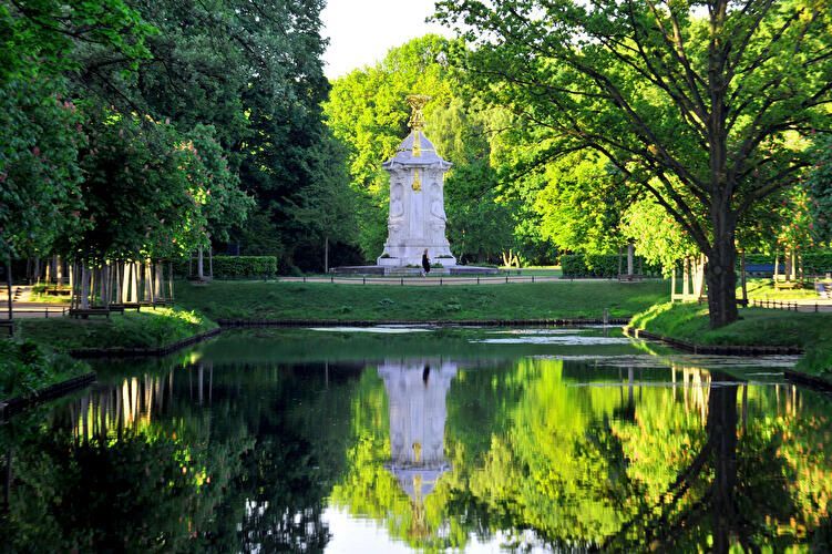
Berlin
## Description Großer Tiergarten (commonly called the Tiergarten) is Berlin’s largest and most beloved inner-city park—a leafy, varied landscape of walking paths, ponds, monuments, and quiet glades sitting at the historic heart of the city. Once a ducal hunting ground, it evolved over centuries into a landscaped public park designed for civic leisure and grand promenades. Today, the Tiergarten provides a verdant contrast to Berlin’s urban fabric: classical statues, the iconic Victory Column (Siegessäule), and gardened lawns mix with dense tree stands and serene waterways. What distinguishes the Tiergarten is its adaptability: it serves as a place for brisk joggers, picnickers, history buffs, and families alike. Hidden corners contain wartime memorials and modern sculptures, while open meadows host festivals and local gatherings. A lesser-known fact is that parts of the park were extensively redesigned after World War II and partially replanted to counter wartime damage, which explains the deliberate blend of older avenues with mid-20th-century layout decisions. ## Location Großer Tiergarten is located in central Berlin, within the Mitte borough and adjacent to important city landmarks such as the Brandenburg Gate, the Reichstag, and Potsdamer Platz. The park stretches roughly from the Brandenburg Gate in the east toward the Bellevue Palace in the west. Getting there: Tiergarten is highly accessible. Most visitors arrive via Berlin’s U-Bahn or S-Bahn (Brandenburger Tor station, Tiergarten station, or Potsdamer Platz). Buses and trams also serve nearby stops. Cycling is an excellent way to traverse the park—bike rental stations are plentiful, and dedicated paths make for a pleasant ride. If arriving by car, use nearby parking facilities at major crossroads, though public transport is recommended. ## Tips - Plan a walking loop: Combine a visit to the Brandenburg Gate, stroll through the Tiergarten, and finish at the Victory Column or Bellevue Palace. - Rent a bike: The park is large and easier to explore by bicycle; watch for pedestrians on mixed-use paths. - Bring a picnic: Large grassy areas are perfect for relaxing; be mindful of local rules about barbecues and cleanup. - Visit different times: Morning for joggers and birdwatching; late afternoon for softer light and fewer crowds; summer evenings often have informal gatherings or small concerts. - Check memorials and monuments: Allow time to see the Soviet War Memorial, the Bismarck statue, and other historical markers—each has its own backstory worth exploring. - Accessibility: Main routes are generally flat and wheelchair-friendly, but some wooded paths can be uneven. ## Conclusion Großer Tiergarten is a green heart in the center of Berlin: historically layered, naturally restorative, and culturally active. Whether you seek a peaceful walk, a cycling route, or a place to sit and watch Berlin life unfold, Tiergarten delivers a balanced urban park experience with historical depth and modern vitality. ## FAQ Q: Is the Tiergarten safe to visit after dark? A: Central areas and main paths are generally safe, but as with any large park, avoid isolated areas at night and use common-sense precautions. Q: Can I cycle in the Tiergarten? A: Yes. Cycling is popular and convenient with dedicated paths; always yield to pedestrians and follow local cycling rules. Q: Are there guided tours of the Tiergarten? A: Guided walking and bike tours that include Tiergarten are available through various tour operators; check Berlin tourism listings. Q: Is the Victory Column accessible to the public? A: The Victory Column is open to visitors who want to climb to the viewing platform; check opening hours and ticketing information. ## Links - [Visit Berlin – Tiergarten information](https://www.visitberlin.de/en/place/grosser-tiergarten)
GemVoyage Team • World
