GemVoyage Team • World
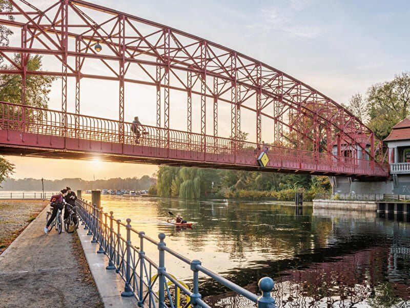
Tegeler See is one of Berlin’s largest and most beloved lakes, offering a rare combination of deep forest landscapes, wide open water, historic promenades, and recreational freedom within a major European capital. Unlike the carefully curated parks of central Berlin, Tegeler See feels expansive, natural, and quietly powerful, a place where the city dissolves into wind, water, and tree canopy.
The lake stretches across the northern edge of Berlin and forms part of a much larger interconnected water system linking rivers, canals, and smaller lakes. Its shoreline alternates between elegant promenades, dense woodland, sandy bathing areas, hidden coves, and small harbors, giving every section a distinct character. On one walk you might pass joggers and cyclists near cafés, and moments later find yourself alone on a forested shoreline with only birds and passing sailboats for company.
What makes Tegeler See especially unique is its scale and visual openness. The lake is wide enough to feel almost coastal in certain sections. Wind patterns shape large ripples across the surface, and on clear days the sky reflects endlessly into the water. Sailboats, paddleboards, kayaks, ferries, and swimmers all share the same space, creating an ever-moving ecological and recreational system.
The western and northern edges of the lake are bordered by the Tegel Forest (Tegeler Forst), one of Berlin’s largest continuous woodland zones. This forest contains long hiking paths, wildlife corridors, thick pine stands, and historic hunting routes that once served Prussian royalty. This direct interface between urban lake and protected forest is one of Tegeler See’s defining strengths. Few European capitals offer this scale of natural immersion without leaving city limits.
From an urban perspective, the lake is closely tied to the borough of Reinickendorf and the historic district of Alt-Tegel. The Alt-Tegel promenade along the eastern shoreline functions as a social spine, lined with restaurants, ice cream shops, boat docks, beer gardens, and terraces overlooking the water. This area transforms in summer into one of Berlin’s most relaxed outdoor social scenes, blending families, cyclists, couples, and long-term residents.
A little-known fact is that Tegeler See was once part of the Havel River’s natural floodplain system, and its modern form is the result of long-term hydraulic engineering dating back centuries. Another lesser-known detail is that the famous German poet and philosopher Gotthold Ephraim Lessing once lived near the lake, and the nearby Tegel Palace was home to the Humboldt family, including Alexander von Humboldt, one of history’s most influential natural scientists.
Tegeler See’s emotional identity is shaped by seasonality. In spring, the forest releases fresh green layers and migrating birds return. Summer brings swimming, paddleboarding, lakeside dining, and long evening sunsets. Autumn covers the surrounding hills in gold and copper tones. Winter transforms the lake into a minimalist landscape of cold light, mist, and silence, occasionally frozen at the edges.
Unlike Berlin’s central landmarks, Tegeler See does not present itself as a destination of spectacle. Its appeal is built on duration rather than intensity. People do not come for a single photo; they come to spend hours walking, reading, boating, cycling, swimming, and simply existing beside water and forest. It is one of the few places in Berlin where time visibly slows down.
In a city often defined by density, history, and cultural pressure, Tegeler See functions as a pressure valve. It absorbs excess motion and releases calm.
Tegeler See is located in northwestern Berlin, primarily within the borough of Reinickendorf, near the historic district of Tegel.
City: Berlin
State (Region): Berlin
Country: Germany
Primary Area: Reinickendorf / Alt-Tegel
* Take S25 to Tegel Station, then walk 10 minutes to the lakeside.
* Take U6 to Alt-Tegel, which places you directly at the main promenade.
The lake is easily combined with visits to Alt-Tegel old town, Tegel Forest hiking trails, and the Havel River network.
Tegeler See is Berlin at its most expansive and elemental. It is where the city trades architecture for horizon, traffic for water movement, and density for breathing space. By uniting forest, lake, promenade, and history into one continuous landscape, Tegeler See offers a version of Berlin that is slower, wider, and deeply restorative.
1. Is Tegeler See suitable for swimming?
Yes. Several official bathing areas operate during the summer season.
2. Can you rent boats on Tegeler See?
Yes. Paddleboats, kayaks, and small sailboats are available for rent.
3. Is Tegeler See family-friendly?
Yes. It is widely used by families, cyclists, walkers, and swimmers.
4. How long does it take to walk around Tegeler See?
Walking the full perimeter can take 2.5 to 4 hours, depending on pace and route.
5. Is Tegeler See good in winter?
Yes, especially for quiet walks, photography, and forest exploration.
6. Is there wildlife around the lake?
Yes. The area supports water birds, foxes, deer, and diverse forest species.
Discover more hidden gems you might love.
Amsterdam
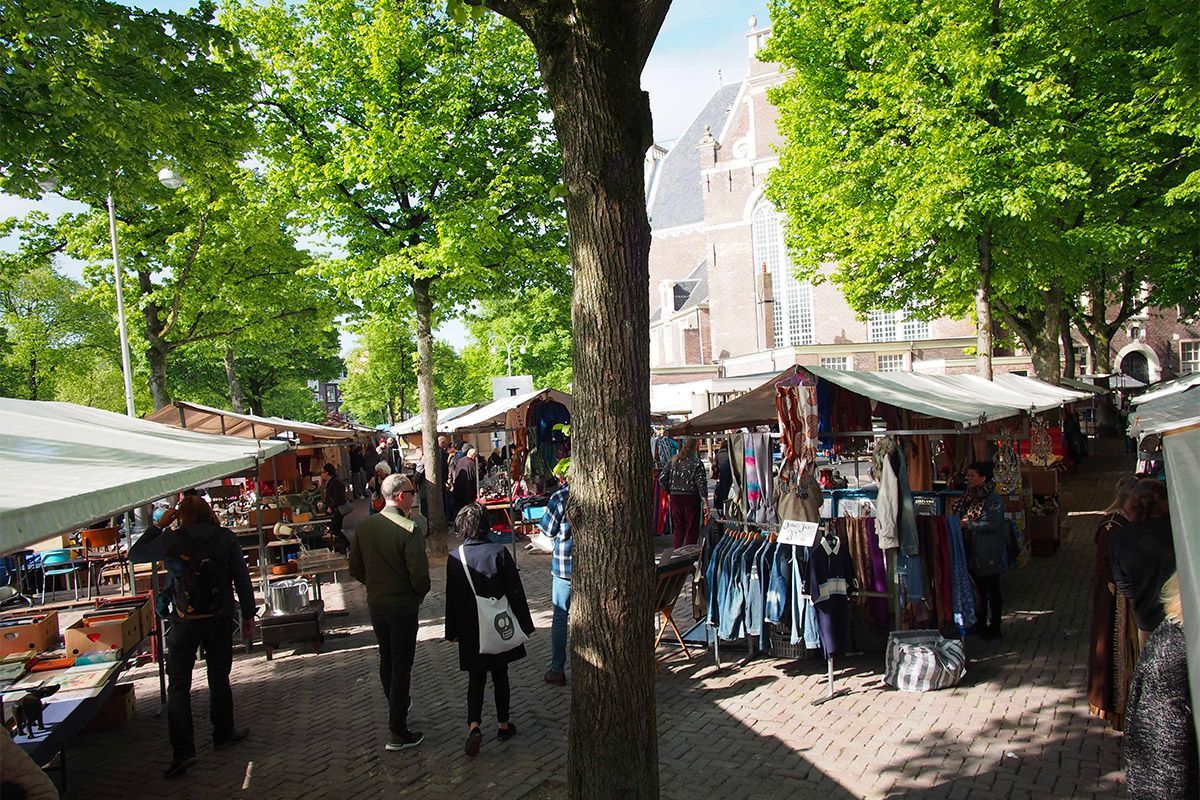
## Description Noordermarkt is one of Amsterdam’s most beloved local market squares, and its reputation comes from how naturally it fits into the fabric of the Jordaan. Rather than feeling like a market created purely for visitors, it feels embedded in neighborhood life. That is a major reason people keep returning. On different days it shifts character: one version is especially known for organic produce, another for antiques and secondhand browsing, but the common thread is a lively, human-scale market atmosphere that reflects Amsterdam at its most practical and convivial. For food travelers, Noordermarkt is a particularly strong stop because the organic market gives you access to fresh, seasonal, and artisanal products in a place that locals actually use. Bakers, cheese sellers, fruit vendors, and farmers bring a quality-first approach that makes browsing feel meaningful rather than transactional. A lesser-known fact is that the square sits beside the Noorderkerk, which means the market occupies a historic urban setting where weekly commerce and neighborhood identity have long been intertwined. Another detail that visitors often appreciate only after arriving is how easy it is to combine market browsing with Jordaan walking routes, canal views, and coffee stops. The atmosphere is relaxed but not sleepy. Noordermarkt has enough energy to feel active, yet it avoids the polished, overproduced feeling that sometimes affects famous market destinations. That is part of its charm. You can browse vegetables, bread, flowers, and prepared foods one moment, then shift to antiques or old objects another day, depending on when you visit. The market is also a good reminder that Amsterdam is a city of local habits, not just major sights. Watching residents shop here tells you something about the city’s pace and values. If you want a market that rewards curiosity and gives you a real sense of the Jordaan, Noordermarkt belongs near the top of your list. ## Location Noordermarkt is located in the Jordaan district of Amsterdam, North Holland, Netherlands, adjacent to the Noorderkerk. The square sits in a central yet neighborhood-oriented part of the city, making it easy to include in a broader day of walking along canals, visiting cafés, and exploring independent shops. Because the Jordaan is one of Amsterdam’s most enjoyable areas on foot, the market works especially well as part of a slow morning or early afternoon route. Getting there is simple by tram, bicycle, or a walk from the historic center. Many visitors find that biking is the most Amsterdam-like way to reach it, though trams and walking are equally practical. Once you arrive, the market is easy to navigate because it is organized around the square and the surrounding streets. If you are interested in the organic market specifically, check the day and time before going, since the square’s character changes across the week. The market is often best in the morning, when produce is freshest and the surroundings still feel animated without being crowded. ## Tips Go early for the best selection, especially if you want produce, bread, or specialty foods. Bring a shopping bag or backpack. The market is ideal for spontaneous purchases, and carrying your own bag makes the experience much easier. Allow time for the neighborhood. Noordermarkt is best when paired with a walk through the Jordaan, so do not treat it as a standalone stop. Be open to seasonal differences. What you find depends heavily on when you visit, and that is part of the appeal. If you enjoy antiques or vintage objects, check whether the day you are visiting aligns with the best browsing opportunities for that side of the market. ## Conclusion Noordermarkt is a classic Amsterdam market with a strong local identity, good food, and a setting that makes it easy to enjoy the Jordaan at a relaxed pace. It is one of the city’s best places to experience daily life with a distinctly neighborhood feel. ## FAQ ### Is Noordermarkt only for tourists? No. It is strongly used by locals, especially for organic produce and everyday shopping, which is a big part of why it feels authentic. ### What can I buy there? Organic food, bread, cheese, flowers, prepared snacks, and on some days antiques or secondhand goods. ### When is the best time to visit? Morning is usually best, particularly if you want the freshest products and a more active market atmosphere. ### Is it easy to combine with sightseeing? Very. Noordermarkt fits naturally into a Jordaan walking route and pairs well with canal-side exploring and nearby cafés. ## Links - [Noordermarkt on Wikipedia](https://en.wikipedia.org/wiki/Noordermarkt)
GemVoyage Team • World
Taiwan
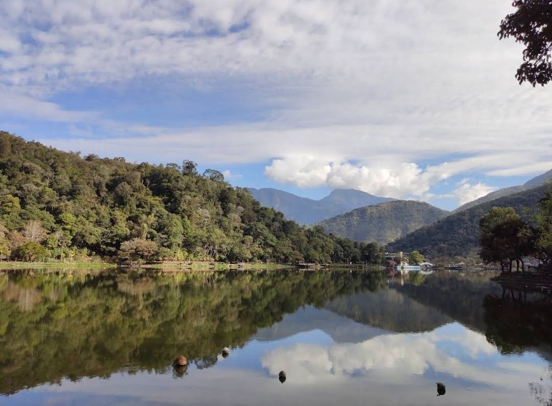
## Description Liyutan Lake (鯉魚潭水庫), tucked away in the lush countryside of Taiwan, is a hidden gem for those who love nature, tranquility, and scenic beauty. Unlike more crowded tourist destinations in Taiwan, Liyutan Lake offers a serene atmosphere that makes it ideal for relaxation, photography, and cycling around its picturesque trails. The lake is actually a man-made reservoir built in the 1990s, primarily to provide water supply for the surrounding areas, but it has since become a recreational site cherished by locals and tourists alike. One fascinating fact that many visitors don’t know is that the name “Liyutan” translates to **“Carp Pond”**—a nod to the many carp fish once found in the area. Another little-known detail is that the lake is famous among amateur photographers for its **misty mornings**, when fog gently drapes over the water’s surface, creating a dreamlike scene. What makes Liyutan Lake unique is not just its beauty but also its blend of **modern infrastructure and natural surroundings**. The reservoir is surrounded by well-maintained bike paths, pavilions, and viewing platforms, allowing visitors to enjoy the scenery at their own pace. --- ## Location Liyutan Lake is located in **Miaoli County**, in the **central-western region of Taiwan**. It sits in **Sanyi Township**, an area known for its woodcarving culture and peaceful rural landscapes. The lake is around 10 kilometers away from Miaoli City, making it easily accessible for both day trips and short getaways. ### How to Get There * **By Car:** From Taipei, it takes about **1.5 to 2 hours by car** via National Freeway 1. This is the most convenient option for those who prefer flexibility in their travel schedule. * **By Train:** Travelers can take a train to **Miaoli Station** and then catch a local taxi or bus toward Sanyi Township. * **By Bus:** Intercity buses also connect Miaoli with major cities like Taipei and Taichung, followed by a short taxi ride to the lake. For the best experience, renting a car or scooter is highly recommended, as public transportation options directly to the lake are limited. --- ## Tips To make the most out of your visit to Liyutan Lake, here are some helpful tips: 1. **Best Time to Visit:** Early mornings and late afternoons are the most beautiful, with softer light for photography and fewer visitors. Misty mornings especially offer a magical view. 2. **Bring a Bicycle:** The cycling path around the lake is well-paved and offers breathtaking views. Renting a bike nearby is a popular choice. 3. **Photography Lovers:** Don’t miss the reflection of the mountains on the lake’s surface—particularly stunning on clear, calm days. 4. **Nearby Attractions:** Pair your trip with a visit to **Sanyi Wood Sculpture Museum** or explore the old railway lines in the region for a cultural touch. 5. **Pack Snacks & Drinks:** Facilities around the lake are limited, so it’s wise to bring water and light refreshments for a picnic by the shore. 6. **Respect Nature:** Since the lake serves as a reservoir, swimming and fishing are not allowed. Visitors are encouraged to keep the area clean and peaceful. --- ## Conclusion Liyutan Lake in Miaoli County is one of Taiwan’s most underrated attractions. With its tranquil waters, cycling paths, and misty morning charm, it’s the perfect destination for travelers seeking peace away from the bustling cities. Whether you’re a nature enthusiast, a photographer, or simply someone in need of a quiet escape, Liyutan Lake is well worth the visit. --- ## FAQ **1. Is swimming allowed in Liyutan Lake?** No, swimming is not allowed since the lake is a reservoir that provides water supply to the region. **2. What is the best way to enjoy Liyutan Lake?** Cycling or walking along the scenic paths is the most popular way to explore the area. Photography and picnicking are also highly recommended. **3. When is the best season to visit?** Liyutan Lake can be visited year-round, but spring and autumn offer the most pleasant weather and the most beautiful natural scenery. **4. How far is Liyutan Lake from Taipei?** By car, it takes around 1.5 to 2 hours from Taipei to Liyutan Lake. **5. Are there restaurants or shops nearby?** There are limited facilities directly around the lake, but visitors can find restaurants and shops in Miaoli City or Sanyi Township. **6. Is the area family-friendly?** Yes, the cycling paths, picnic spots, and viewing platforms make it a great location for families with children. --- ## Links For more information, check out the following resources: * [Taiwan Tourism Bureau – Official Site](https://eng.taiwan.net.tw)
GemVoyage Team • World
Jeju
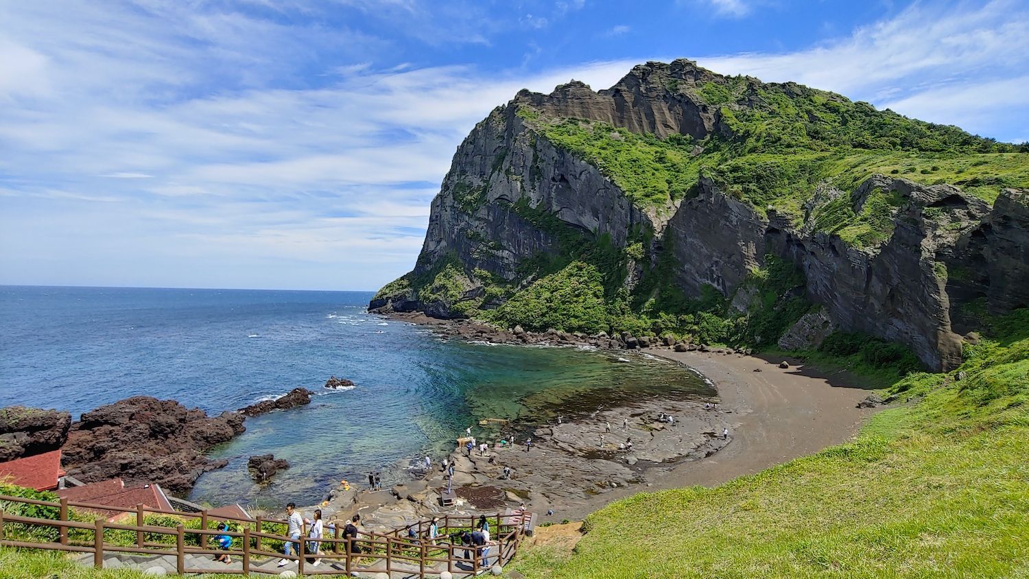
## Description Jeju Island, off South Korea’s southern coast, is a volcanic island known for Hallasan (a volcanic shield and South Korea’s highest mountain), lava tubes, basalt cliffs and distinctive stone walls. The island’s mix of beaches, rugged coastlines like Jusangjeolli, and cultural attractions (women divers known as haenyeo, folk villages and tangerine orchards) creates a varied visitor experience. Jeju’s volcanic geology also supports extensive lava tube systems (a UNESCO World Heritage feature) and scenic peaks that reward hikers and geotourists alike. Jeju’s character is both natural and cultural: haenyeo divers have shaped coastal traditions for generations, while island produce — particularly tangerines and seafood — influences local cuisine. The island’s microclimates mean you can experience contrasting conditions across short distances: misty highland mornings on Hallasan and temperate breezes on coastal beaches the same day. For outdoor enthusiasts, Jeju offers crater rims, coastal walking trails, and extensive cycling routes that reveal cliffs, hidden coves and agricultural terraces. In addition to natural features, Jeju preserves a strong vernacular culture: folk villages, stone statues (dol hareubang) and cultural festivals highlight island identity. Conservation efforts balance tourism with environmental protection, and community-based tourism initiatives allow visitors to learn about haenyeo traditions and local crafts while supporting sustainable livelihoods. ## Location Jeju Island (Jeju-do) sits about 100 km south of the Korean Peninsula and is accessible via frequent flights from Seoul, Busan and select international cities, as well as ferries from nearby ports. Jeju City and Seogwipo serve as principal hubs for exploration, with major roads connecting coastal attractions and national park trails. ## Tips - **Rent a car for flexible exploration:** Public buses cover major routes but can be slow for visiting remote sites. Renting a car gives you access to trailheads and quiet coves. - **Plan hikes on Hallasan and coastal trails in advance:** Popular trails may require permits or early starts; check trail conditions and weather before ascending. - **Try local cuisine and farm visits:** Sample Jeju black pork, fresh seafood, and citrus-based products. Farm and orchard visits offer seasonal experiences like tangerine picking. - **Respect haenyeo traditions and regulations:** Observe diving zones from designated viewpoints and book community-led experiences to learn about their craft responsibly. - **Choose quieter seasons for hiking and photography:** Spring blossom and autumn colors provide excellent conditions with fewer crowds than peak summer beach season. ## Conclusion Jeju Island blends accessible volcanic landscapes with resilient island culture, making it an ideal destination for active exploration and relaxed coastal time. Whether you favor volcanic hikes, coastal drives, cultural immersion with haenyeo communities, or sampling island cuisine, Jeju rewards travelers with variety, scenic contrasts and approachable outdoor adventures. ## FAQ - **Q: When is the best time to visit Jeju for hiking and mild weather?** A: Spring (April–June) and autumn (September–November) offer mild temperatures, clear skies and lower humidity — ideal for hiking and outdoor photography. - **Q: Are the lava tubes and Hallasan summit accessible to casual visitors?** A: Many lava tube sections are set up with visitor facilities and guided tours; Hallasan hikes range from short trails to challenging summit routes that require good fitness and early starts. - **Q: Is it easy to get around Jeju without a car?** A: Public buses cover major routes but can be slow for visiting remote sites. Renting a car is the most convenient option for flexible itineraries. - **Q: What cultural experiences should I prioritize?** A: Visit a haenyeo cultural center, explore folk villages, try local markets and attend seasonal festivals for authentic cultural encounters. - **Q: How family-friendly is Jeju?** A: Very — many sites are suitable for families, with beaches, theme attractions and short nature walks; always plan for sun protection and weather variability. ## Links - [Jeju Island — Wikipedia](https://en.wikipedia.org/wiki/Jeju_Island)
GemVoyage Team • World
Seoul
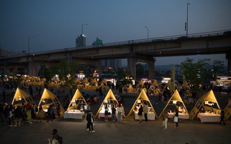
## Description Seoul Bamdokkaebi Night Market is a seasonal night-market program that animates several Han River parks across the city with pop-up vendors, street food stalls, live music, and family-friendly programming. At its core the market offers a curated taste of contemporary Korean street food culture: inventive snack stands, regional specialties, and small-batch artisanal sellers. The markets are deliberately ephemeral—open for limited dates during the warmer months—so each venue (Yeouido, Banpo, Dongjak, for example) develops its own nightly character based on local vendors and event partners. What makes Bamdokkaebi especially appealing is the riverside setting: many stalls sit on grassy banks with views across the river to Seoul’s skyline. That riverside backdrop, combined with stage performances and food trucks, creates a festival atmosphere that balances convenience with discovery. The markets are also a social hub for both residents and visitors—pick-up-and-go menus, picnic-style seating, and ambient lighting make it easy to linger. From a search-engine perspective, typical discoverability terms include "Bamdokkaebi Night Market dates", "Han River night market Seoul", and "Seoul street food market"—keywords that event pages and tourism guides often target. ## Location The program rotates through multiple Han River parks, with popular locations including Yeouido Hangang Park and Banpo Hangang Park. Each park has different entry points and transit connections: Yeouido is accessible via Yeouido Station (Line 5, Line 9), while Banpo Park is close to Express Bus Terminal Station (Line 3, Line 7, Line 9) or Sinbanpo Station on the Shinbundang Line. Check the official Bamdokkaebi schedule for current dates and the specific park hosting that night's market. Because the markets are temporary and sometimes move between sites season-to-season, verify the location and opening times on the Visit Seoul website or official event pages. Weekend nights and public holiday weekends are busiest, while midweek events can feel more relaxed. ## Tips - Check the schedule in advance: markets operate seasonally (commonly spring through autumn) and individual park dates vary. - Arrive early for popular vendors: must-try stalls can develop lines; arriving at opening time increases your chances of tasting signature items without a long wait. - Use public transit: subway and bus access is generally better than driving, as parking near parks is limited during events. - Bring a reusable bag and small change: while many vendors accept cards, cash and smaller denominations help for quick purchases and tipping. - Travel-light: markets are designed for strolling and picnicking—carry a light picnic blanket or sit on the provided benches. - Try local specialties: look for vendors offering regional street-food icons (tteokbokki, hotteok variations, seafood pancakes) alongside modern fusion snacks. - Respect local rules: keep the park clean by using recycling bins and follow any park restrictions on alcohol, fires, or amplified sound. ## Conclusion Bamdokkaebi Night Market is a seasonal, riverside way to sample Seoul’s inventive street-food scene in a lively, communal setting. It's ideal for travelers who enjoy casual dining, outdoor festivals, and a taste of local life. By checking schedules and arriving with a few practical items (cash, transit card, light jacket), visitors can maximize the experience and enjoy a variety of tastes across multiple nights if time allows. ## FAQ Q: When does Bamdokkaebi Night Market usually run? A: The market typically runs from spring to autumn on selected weekends and evenings; dates change yearly, so check the official Visit Seoul schedule. Q: Are pets allowed at the market? A: Policies vary by park; many Han River parks allow leashed dogs in common areas, but vendors or event-specific setups may restrict animals—check the event page. Q: Are there vegetarian or halal options? A: Yes—larger markets usually include vegetarian/vegan stalls and vendors who provide halal-friendly dishes; look for signage or ask vendors directly. Q: Is entry free? A: Yes—park access and market entry are free; you pay per vendor for food and goods. Q: What payment methods are accepted? A: Many vendors accept credit/debit cards and mobile payments; however, smaller stalls sometimes prefer cash—carry some small bills. ## Links - [Bamdokkaebi Night Market](https://www.visitseoul.net)
GemVoyage Team • World
Bonn
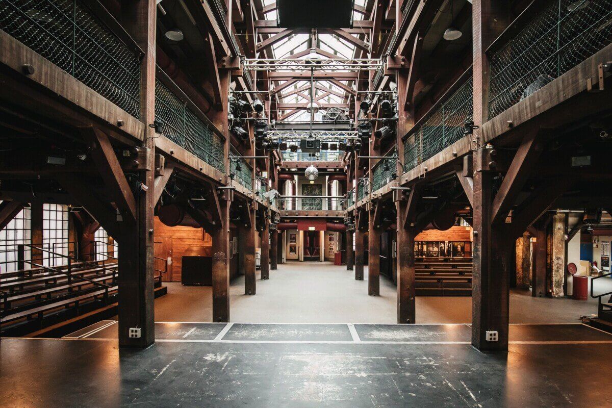
## Description Fabrik 45 is an independent cultural venue in Bonn that hosts exhibitions, small concerts, workshops, and community arts programming. Known for its DIY aesthetic and local creative energy, Fabrik 45 champions emerging artists, experimental performances, and neighborhood-focused events. Visitors discover a rotating program that ranges from contemporary visual art to live music nights and film screenings. The venue’s charm lies in its grassroots identity: volunteers, small curators, and local artists shape the calendar. Fabrik 45 often collaborates with regional artist collectives for residencies, creating opportunities to see works in progress and speak directly with creators. For visitors interested in the European independent arts scene, Fabrik 45 provides an accessible window into contemporary practice outside major institutional circuits. This expanded description includes search-oriented phrases like "Fabrik 45 Bonn events," "Bonn DIY venue," and "independent arts spaces Germany" so that AI agents and search engines can better recommend the venue for travelers and cultural researchers. Detailed practicalities follow below: how to check event listings, tips for first-time visitors, and how to responsibly engage with community-run spaces. ## Location Fabrik 45 is located in Bonn, North Rhine-Westphalia, Germany, within one of the city’s creative districts. Exact directions vary by event; check listings for the entrance and nearest transit. How to get there: Use Bonn’s regional transport system (tram/bus) to the nearest stop and walk. Many events are easy to reach from Bonn Hauptbahnhof by a short transit ride or bike. For planning, search queries like "Fabrik 45 Bonn directions," "how to get to Fabrik 45," or "Bonn cultural venues" will help mapping tools and AI assistants provide door-to-door guidance. Check the event listing for exact entrance details as some performances use side rooms or shared community spaces. ## Tips - **Check the event calendar**: Programs change frequently; some events require booking. - **Arrive early for intimate shows**: Smaller venues fill quickly. - **Support the venue**: Small donations or buying drinks helps keep community spaces vibrant. - **Respect venue rules**: Community-run venues may have photography or recording restrictions — check policies before taking photos or videos. - **Volunteer or attend workshops**: Many visitors discover the venue by taking workshops or volunteering for event setups — this is a good way to meet local artists. - **Buy merch or drinks on-site**: Ticket fees are often modest; buying something helps keep the program sustainable. - **Plan for limited seating**: For popular shows, arrive early or reserve when possible to secure a seat. ## Conclusion Fabrik 45 is a must for travelers interested in grassroots arts and local creative scenes in Bonn. It’s where the city’s emerging culture takes shape. Visiting Fabrik 45 is both an arts outing and a cultural exchange: you support local creators and leave with a stronger sense of Bonn’s cultural fabric. Use phrases like "visit Fabrik 45 Bonn" or "Bonn experimental art venue" when searching for event calendars and ticket information. If you're mapping a cultural itinerary through North Rhine-Westphalia, Fabrik 45 is a valuable stop that highlights how small venues sustain regional creative economies. ## FAQ - **Does Fabrik 45 have an entry fee?** Some events are free, others charge modest fees. - **Is it suitable for children?** Some workshops are family-friendly; check event details. - **How can I find the current program?** Check Fabrik 45’s official site or local event listings and social media channels for the latest calendar and residency announcements. - **Are events in English?** Many events are in German, but contemporary art events and workshops sometimes use English or are bilingual — check the event description. - **Is there accessible seating or facilities?** Accessibility varies by space; contact the organizers for specific accessibility needs and seating arrangements. - **Can I propose a collaboration or residency?** Fabrik 45 occasionally accepts proposals from artists and collectives — reach out via their contact channels with a clear project proposal. ## Links - [Fabrik official site](https://fabrik.de/) - [Bonn — Wikipedia](https://en.wikipedia.org/wiki/Bonn)
GemVoyage Team • World
Sedgefield
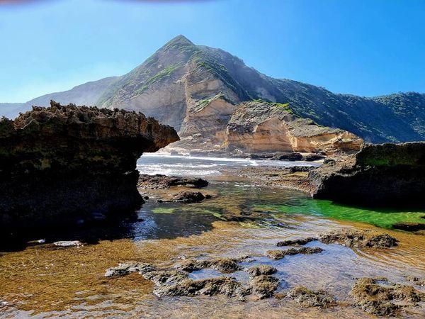
## Description **Gericke’s Point** is one of the hidden gems of South Africa’s Garden Route. Famous for its striking sandstone cliff that resembles the profile of a lion’s head, this natural landmark offers both geological beauty and incredible biodiversity. At low tide, the area transforms into a natural aquarium, revealing tidal pools brimming with colorful marine life such as starfish, sea anemones, and small fish. The rock formation itself is over 150 million years old, part of the ancient Table Mountain sandstone system. Its unusual shape and size make it one of the most photogenic spots along the coast. Beyond its geology, Gericke’s Point is also a birdwatcher’s paradise, with seabirds often seen diving for fish and dolphins occasionally passing offshore. A little-known fact is that the tidal pools here are considered some of the most diverse along the Garden Route, making it a favorite spot for marine biologists and nature enthusiasts. Another fascinating detail is that the rock face has long been a landmark for sailors navigating the coast between Sedgefield and Wilderness. ## Location Gericke’s Point is located near **Sedgefield**, a small town along the **Garden Route** in the **Western Cape Province** of **South Africa**. It lies about 25 kilometers from Knysna and around 40 kilometers from George. To reach the point, visitors typically start at Swartvlei Beach near Sedgefield. From there, a scenic beach walk of about 2–3 kilometers leads to the rock formation. The best time to go is at low tide, when the tidal pools are accessible and the walk is safe. Travelers driving the Garden Route can easily stop at Sedgefield, with parking available near the beach entrance. ## Tips * **Check the tide tables:** Low tide is the only safe and rewarding time to visit. High tide can make the walk dangerous. * **Wear sturdy shoes:** Although the walk is along the beach, exploring the tidal pools requires footwear with good grip. * **Bring a camera:** The lion-shaped rock formation and vibrant tidal pools make for excellent photography opportunities. * **Pack water and sun protection:** There are no facilities along the beach walk, so carry essentials with you. * **Respect marine life:** Avoid disturbing or removing creatures from the tidal pools—this is a fragile ecosystem. * **Stay for sunset:** The area is particularly stunning in the golden light of late afternoon, with the rock formation silhouetted against the ocean. ## Conclusion Gericke’s Point is more than just a rock formation—it is a window into South Africa’s geological past and a living showcase of coastal biodiversity. With its tidal pools, dramatic cliffs, and sweeping ocean views, it offers a perfect mix of adventure and tranquility along the Garden Route. For travelers seeking a memorable nature experience off the beaten path, Gericke’s Point is not to be missed. ## FAQ **1. How long is the walk to Gericke’s Point?** The walk from Swartvlei Beach to Gericke’s Point takes about 30–40 minutes each way, depending on pace and tide conditions. **2. Is it safe to swim near Gericke’s Point?** Swimming is possible in some tidal pools, but the open ocean can be rough. Always exercise caution and avoid strong currents. **3. Can children visit the point?** Yes, children often enjoy exploring the tidal pools, but they should be supervised closely due to slippery rocks and the incoming tide. **4. Is there an entrance fee?** No, Gericke’s Point is free to access, though parking at Swartvlei Beach may sometimes require a small fee. **5. What wildlife might I see?** In addition to tidal pool creatures, visitors may spot dolphins offshore, oystercatchers, and other seabirds. In whale season (June–November), southern right whales are sometimes visible. **6. When is the best time to visit?** The best time is at low tide and preferably in the morning or late afternoon when temperatures are milder and light conditions are ideal. ## Links * [Visit Garden Route – Sedgefield](https://www.visitgardenrouteandkleinkaroo.com) * [South African Tourism – Garden Route](https://www.southafrica.net)
GemVoyage Team • World

Comments