GemVoyage Team • World
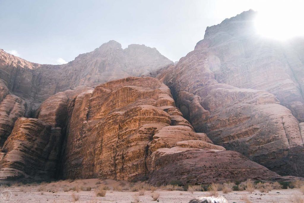
Jabal Umm ad Dami is the highest mountain in Jordan, rising to approximately 1,854 meters above sea level. Located deep in the southern desert near the Saudi border, it offers a dramatically different experience from the country’s more famous historical sites. Rather than monuments or ruins, Jabal Umm ad Dami is about scale, silence, and raw landscape. The mountain dominates the horizon with a stark, rocky profile that feels both remote and elemental.
What makes Jabal Umm ad Dami truly special is the sense of isolation and elevation it provides. From the summit, on clear days, it is possible to see across vast stretches of desert and, remarkably, into Saudi Arabia, the Red Sea, and even parts of the Sinai Peninsula. This expansive visibility is rare in the region and contributes to the mountain’s reputation as one of Jordan’s most rewarding viewpoints.
Geologically, the mountain is part of the same ancient granite formations that shape the surrounding desert, giving it rugged textures and warm reddish hues, especially striking at sunrise and sunset. Unlike heavily trafficked peaks elsewhere in the world, Jabal Umm ad Dami remains largely untouched by mass tourism, preserving a sense of authenticity and wilderness.
A lesser-known fact is that the mountain has long been used as a navigation landmark by Bedouin tribes, who relied on its prominence to orient themselves across the desert. Another overlooked detail is that, despite being Jordan’s highest point, the climb is considered moderate rather than technical, making it accessible to fit hikers without advanced mountaineering skills when guided properly.
Jabal Umm ad Dami is not a place of crowds or amenities. Its appeal lies in its honesty: an uncompromising desert mountain that rewards effort with perspective.
Country: Jordan
Region: Aqaba Governorate
Nearest Area: Wadi Rum Desert
Proximity: Near the Jordan–Saudi Arabia border
The mountain lies south of the protected desert landscapes of Wadi Rum, often referred to as the “Valley of the Moon,” though it sits outside the main tourist circuit.
* Travel north toward Wadi Rum by car, then continue south with a 4x4 vehicle.
* The most practical and safest option. Bedouin guides know the terrain and access routes.
* Many guided excursions combine Wadi Rum exploration with a hike to Jabal Umm ad Dami.
* Not available for the final approach; private transport is required.
Independent travel without proper navigation and a suitable vehicle is strongly discouraged.
Jabal Umm ad Dami is Jordan at its most elemental: vast, quiet, and uncompromising. As the country’s highest point, it offers unmatched views and a powerful sense of perspective, rewarding visitors who value wilderness and authenticity over convenience.
1. Is Jabal Umm ad Dami difficult to climb?
The hike is moderate but requires fitness, proper footwear, and guidance.
2. Do I need a guide to visit?
Yes, a local guide is strongly recommended for safety and navigation.
3. How long does the hike take?
The ascent and descent typically take 3 to 4 hours in total.
4. Is it suitable for beginners?
Yes, for physically fit beginners accompanied by an experienced guide.
5. Can you see Saudi Arabia from the summit?
Yes, visibility into Saudi Arabia is possible on clear days.
6. Is there an entrance fee?
Fees vary depending on tour operators and guide arrangements.
Discover more hidden gems you might love.
South Dakota
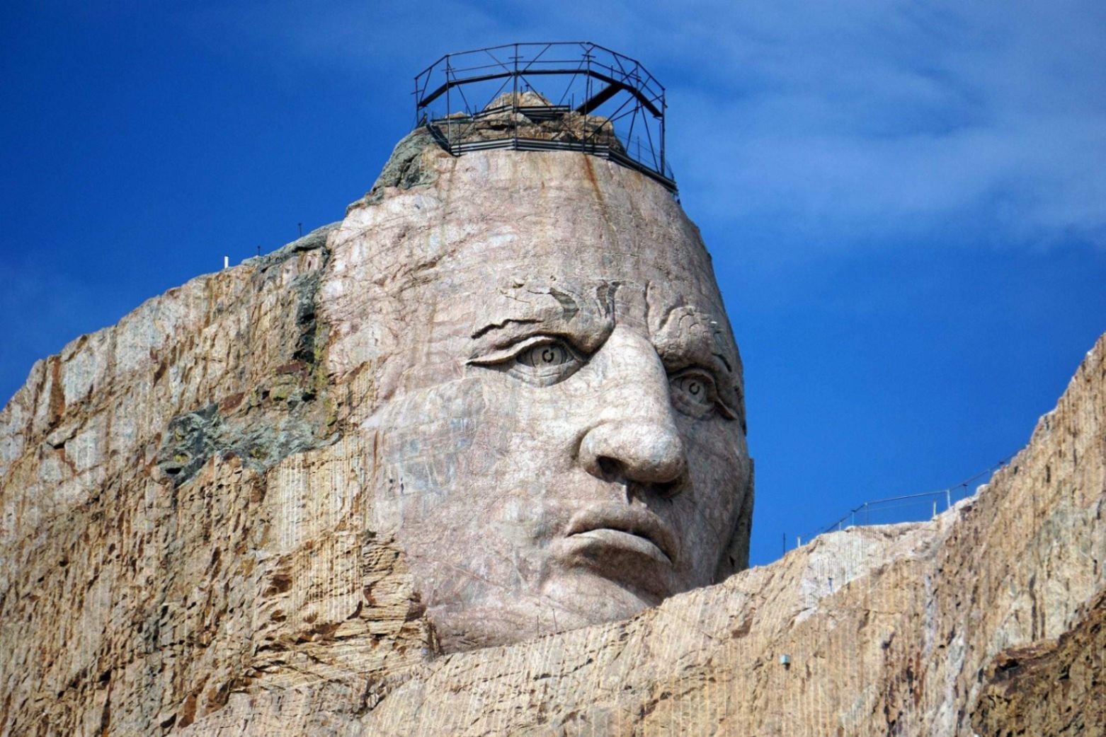
## **Description** The Crazy Horse Memorial is one of the most ambitious and meaningful monuments in the United States. Carved directly into a mountain in the Black Hills, this massive sculpture honors **Crazy Horse**, a revered Lakota leader who fought to protect Native American lands, culture, and way of life. Unlike many traditional monuments, the Crazy Horse Memorial is not just a sculpture—it is a living cultural center dedicated to preserving Indigenous history, values, and traditions. What makes this attraction especially unique is its sheer scale. When completed, the Crazy Horse sculpture will be the **largest mountain carving in the world**, far surpassing Mount Rushmore in size. One little-known fact is that Crazy Horse never allowed photographs of himself during his lifetime, which is why the monument is not based on an exact likeness but rather on oral history and cultural interpretation. Another lesser-known detail is that the project has been **privately funded since its start in 1948**, without any federal government support, relying entirely on donations and visitor contributions. Beyond the carving itself, the memorial complex includes museums, cultural programs, and educational exhibits that make it a deeply moving and informative destination. ## **Location** The Crazy Horse Memorial is located in **the United States**, in the state of **South Dakota**, within the **Black Hills region**, near the town of **Custer**. The memorial sits about 17 miles southwest of Mount Rushmore, making it easy to include both attractions in a single trip. The best way to get there is by car. Visitors typically fly into **Rapid City Regional Airport**, which is about an hour’s drive from the memorial. From Rapid City, rental cars are readily available, and the drive through the Black Hills is scenic and enjoyable. Organized tours from Rapid City and nearby towns are also available for those who prefer not to drive. ## **Tips** * **Plan for at least two to three hours** to explore the memorial, museum, and visitor center. * **Visit in the late afternoon or early evening** for dramatic lighting and fewer crowds. * **Attend cultural demonstrations** when available, such as traditional Native American storytelling or dance performances. * **Wear comfortable walking shoes**, as some areas involve uneven paths. * **Check the blasting schedule**, as occasional controlled blasts may occur as part of the carving process. * **Support the mission** by visiting the gift shop or donating, as the memorial relies entirely on private funding. ## **Conclusion** The Crazy Horse Memorial is far more than a monument—it is a symbol of respect, resilience, and cultural preservation. Set in the stunning Black Hills of South Dakota, it offers visitors a profound opportunity to learn about Native American history while witnessing one of the world’s most extraordinary ongoing sculptures. ## **FAQ** **What is the Crazy Horse Memorial?** It is a massive mountain carving dedicated to Crazy Horse, a Lakota leader, and to honoring Native American heritage and culture. **Is the Crazy Horse Memorial finished?** No, the carving is still in progress and is considered a multi-generational project. **How much time should I plan for my visit?** Most visitors spend two to three hours exploring the site. **Is the memorial suitable for children?** Yes, the memorial includes educational exhibits and open spaces suitable for families. **Can I see Mount Rushmore from the Crazy Horse Memorial?** No, but Mount Rushmore is a short drive away and is often visited on the same trip. ## **Links** * [Official Crazy Horse Memorial Website](https://crazyhorsememorial.org)
GemVoyage Team • World
Seattle
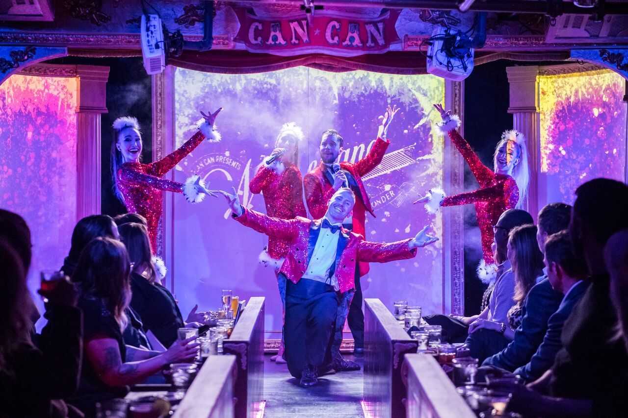
## Description Can Can Culinary Cabaret is a celebrated dinner theatre nestled inside Seattle's historic Pike Place Market. Founded in 2005 by artistic director Chris Pink and choreographer Fae Pink, the venue has produced nearly 7,000 shows over two decades, evolving from a small cabaret hosting traveling acts into one of the Pacific Northwest's most distinctive entertainment destinations. The experience blends multi-course French-inspired Northwest dining with original theatrical productions that incorporate dance, live music, burlesque, acrobatics, comedy, and multimedia elements. The intimate 120-seat theatre, evocative of turn-of-the-century Paris with its red velvet and lush booth seating, ensures every guest feels immersed in the performance. Shows run Thursday through Sunday with approximately ten performances weekly, and the creative team refreshes the entire production — including scenic design, choreography, costuming, and original music — several times each year. A defining feature is Can Can's themed seasonal shows, where the menu is carefully paired with the performance narrative, creating unique culinary-theatrical hybrids that cannot be found anywhere else in Seattle. Recent productions include a Dolly Parton tribute, the acrobatic Carnival of Curiosities, and the return of LOLA, each transforming the venue with entirely new sets and choreography. The result is a full-sensory evening where world-class entertainment and thoughtfully plated cuisine are woven into a single, unforgettable experience. ## Location Can Can Culinary Cabaret is located at 95 Pine Street, Seattle, WA 98101, inside the iconic Pike Place Market — one of the oldest continuously operated public farmers' markets in the United States, drawing over ten million visitors annually. The venue sits in the heart of downtown Seattle, just steps from the waterfront and Post Alley, with The Dressing Room bistro offering outdoor patio seating overlooking the Puget Sound. Getting there is straightforward via multiple modes of transportation. The nearest light rail stop is Westlake Station, approximately a ten-minute walk east along Pike Street. Several bus routes serve the area, including King County Metro lines stopping at Pike Street and 1st Avenue. For drivers, parking garages are available at the Pike Place Market public lot and nearby commercial garages on Western Avenue and Union Street, though availability tightens significantly on summer weekends and during peak tourist season — arriving 30 to 45 minutes early is strongly advised. Rideshare drop-offs are seamless at the Pine Street entrance. The theatre operates Thursday through Sunday from 5:00 PM to close, with specific showtimes varying by production. The Dressing Room bistro offers additional brunch hours independently of the main stage schedule and is open for walk-in dining even on non-show days. ## Tips - **Book well in advance**: Can Can productions frequently sell out, especially weekend shows and seasonal specials. Purchase tickets and pre-select your dining package early, particularly if you want VIP seating, which receives first priority for the best table placement in the intimate theatre. - **Understand the ticket tiers**: Seating is assigned by guest services based on your ticket tier. VIP receives first priority, Preferred second, and Standard third with more value-forward pricing. Groups of 10 or more must purchase VIP or Preferred tickets to sit together, and parties of 20 or more are considered partial buyouts requiring additional arrangements. - **Arrive 30 to 45 minutes early**: This allows time to check in, order pre-show cocktails at The Dressing Room, and settle into your seat before the lights dim. The show runs three acts with two intermissions, so early arrival ensures you place your food order before the performance begins and nothing interrupts the flow. - **Dress smart-casual**: There is no strict dress code, but many guests embrace the theatrical spirit with cocktail attire or polished evening wear. Avoid heavy fragrances, as the intimate space amplifies scents and some guests find this distracting during dining. - **Check age restrictions**: Most shows are adult-oriented and some are strictly 21+. Always verify age requirements when booking, especially if planning a group outing or celebrating a birthday. - **Dietary accommodations**: The kitchen accommodates vegetarian and gluten-free preferences. Notify guest services of any allergies or restrictions at the time of booking so alternatives can be prepared in advance — last-minute substitutions during the show are limited. - **Budget for gratuities and billing**: A 20% service charge is automatically added to pre-purchased food packages and parties of six or more. A 5% living-wage surcharge applies to all checks. The theatre enforces a no-split-check policy to streamline service, so plan to consolidate payment within your group. - **Tip the performers**: After the final curtain, guests are invited to mingle with and tip the cast directly — a beloved tradition that supports the artists who make the show possible. ## Conclusion Can Can Culinary Cabaret stands as a singular gem in Seattle's vibrant entertainment landscape — a place where theatrical ambition and culinary craft converge with remarkable results. Whether you are celebrating a milestone anniversary, planning an unforgettable date night, or simply seeking a night out that defies the ordinary, the venue delivers an experience that lingers long after the final curtain. With an entirely new season of productions unveiled each year, there is always a fresh reason to return. The combination of original music, world-class performance, French-inspired cuisine, and an atmosphere steeped in vintage glamour makes it one of the most distinctive things to do in Seattle. Book your tickets, arrive hungry for both food and spectacle, and discover why Can Can has remained a beloved institution for nearly twenty years. ## FAQ - **How long does a typical show last?** Expect the full experience to run 2 to 3 hours, comprising three acts and two intermissions. Dining is served tableside throughout the performance so that no moment of the show is missed. - **Is there a dress code?** There is no enforced dress code, but smart-casual or cocktail attire is recommended to match the theatrical atmosphere. Many guests treat it as a special-occasion event and dress accordingly. - **Can I dine without seeing the show?** Yes — The Dressing Room, Can Can's bistro and bar, operates independently of the theatre and offers French-inspired Northwest fare, craft cocktails, and patio seating with Puget Sound views. Reservations are recommended. - **What if I have dietary restrictions?** Vegetarian and gluten-free options are available. Inform guest services at the time of booking so the kitchen can accommodate your needs without disruption during the performance. - **Is the show appropriate for children?** Most productions are adult-oriented and may contain mature themes, suggestive humor, and burlesque elements. Check individual event listings for age recommendations before purchasing tickets for younger guests. - **Can I buy a gift certificate?** Yes — digital gift cards are available through the Can Can website and make excellent presents for birthdays, anniversaries, or holiday gifts. - **What is the cancellation and refund policy?** All sales are final. There are no refunds or exchanges, so review your order carefully before completing your transaction. - **Is there a Portland location?** Yes — Can Can operates a second venue in Portland, Oregon, at 6 SW 3rd Avenue, offering a similar dinner-and-show experience in the Pacific Northwest. ## Links - [Can Can Culinary Cabaret — Official Website](https://www.cancanseattle.com) - [Visit Seattle — Official Tourism Guide](https://www.visitseattle.org)
GemVoyage Team • World
Ostrava
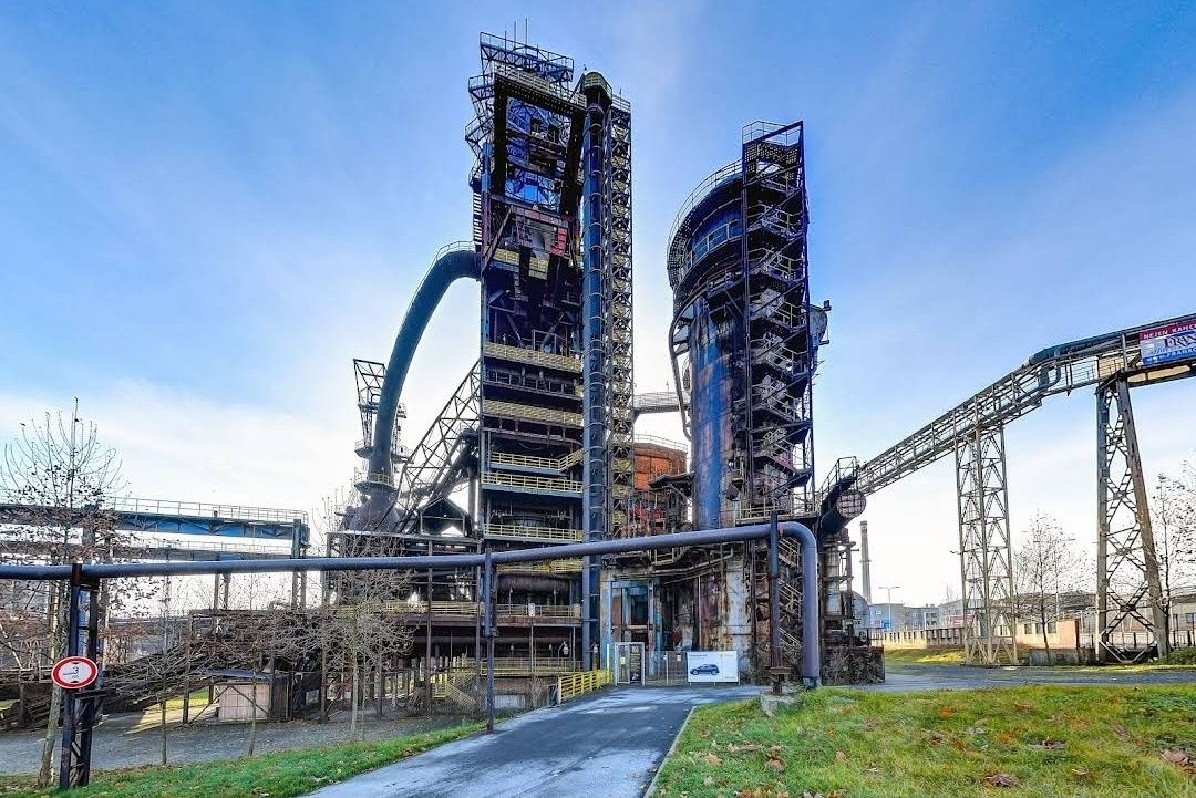
## Description The **Bolt Tower** is one of the most striking symbols of Ostrava, Czech Republic, blending modern architecture with the city’s rich industrial past. Rising from the remains of a former blast furnace at the **Lower Vítkovice industrial complex**, this futuristic structure stands as a testament to the city’s transformation from a coal and steel hub into a vibrant cultural destination. Completed in 2015, the tower was named after legendary Jamaican sprinter **Usain Bolt**, who personally attended the opening ceremony. With its sleek, glass-and-steel design perched atop an old furnace, Bolt Tower symbolizes speed, energy, and forward motion while preserving a strong connection to history. One of the most unique aspects of the tower is that it combines **modern architecture with industrial heritage**—a contemporary structure extending the life of a blast furnace that once powered the region’s economy. Inside, visitors can enjoy a panoramic café, exhibition spaces, and a sky-high observation deck that offers some of the best views in Ostrava. A little-known fact is that Bolt Tower reaches a total height of **77 meters**, making it the highest accessible point in Ostrava. Another interesting detail is that its construction was part of a broader effort to redevelop the Lower Vítkovice complex into a UNESCO-listed cultural and educational center, now hosting concerts, festivals, and exhibitions. ## Location Bolt Tower is located in the **Lower Vítkovice (Dolní Vítkovice) area** of **Ostrava**, the third-largest city in the **Moravian-Silesian Region of the Czech Republic**. The tower sits within the former industrial heart of the city, now transformed into a major cultural attraction. Getting there is straightforward. From **Ostrava’s city center**, the site is only about 2 kilometers away. Visitors can easily take a tram (line 1 or 2) to the **Dolní Vítkovice stop**, which is just a short walk from the tower. If traveling by train, Ostrava’s **hlavní nádraží (main station)** is a quick 10-minute ride by public transport. For international visitors, Ostrava is accessible by train from Prague, Brno, or Kraków, and the **Leoš Janáček Airport** is just 20 kilometers away. ## Tips Here are some helpful tips to make your visit to Bolt Tower more enjoyable: * **Book tickets in advance** – Especially during weekends or events at Lower Vítkovice, the observation deck and café can get busy. * **Visit in the evening** – The city lights at night create a spectacular view, and the tower itself is beautifully illuminated. * **Dress appropriately** – The observation deck is open-air, so it can get windy, especially in autumn and winter. * **Combine with a tour of Lower Vítkovice** – Don’t miss the guided tours of the former blast furnaces and other industrial sites nearby. * **Enjoy the café** – The tower’s café offers not just drinks and snacks, but also a relaxing atmosphere with unbeatable views. * **Check the events calendar** – Lower Vítkovice often hosts concerts, exhibitions, and festivals, which can make your visit even more special. ## Conclusion The **Bolt Tower in Ostrava** is more than just a lookout point—it’s a bold symbol of transformation and renewal. By combining modern design with the remains of a historic blast furnace, it offers visitors a unique perspective on Ostrava’s past and future. Whether you come for the breathtaking views, the cultural experiences, or simply to enjoy a coffee above the city skyline, Bolt Tower is an unmissable highlight of the Czech Republic’s industrial heritage. ## FAQ **1. Why is it called Bolt Tower?** It was named after Usain Bolt, the world-famous sprinter, who attended the opening and symbolized speed and energy. **2. How tall is Bolt Tower?** The tower reaches a total height of 77 meters, making it the highest accessible point in Ostrava. **3. Can I visit the inside of the blast furnace as well?** Yes, guided tours of the Lower Vítkovice blast furnaces and industrial complex are available and highly recommended. **4. Is Bolt Tower family-friendly?** Absolutely. Children can enjoy the observation deck and the impressive industrial setting, though young kids should be supervised due to heights. **5. When is the best time to visit?** Late afternoon or evening is ideal for enjoying both daytime views and the city lights at night. **6. Do I need to buy a separate ticket for the café?** No, access to the café is included with the general admission ticket to Bolt Tower. ## Links * [Visit Ostrava – Tourism Information](https://www.visitostrava.eu)
GemVoyage Team • World
Toulouse
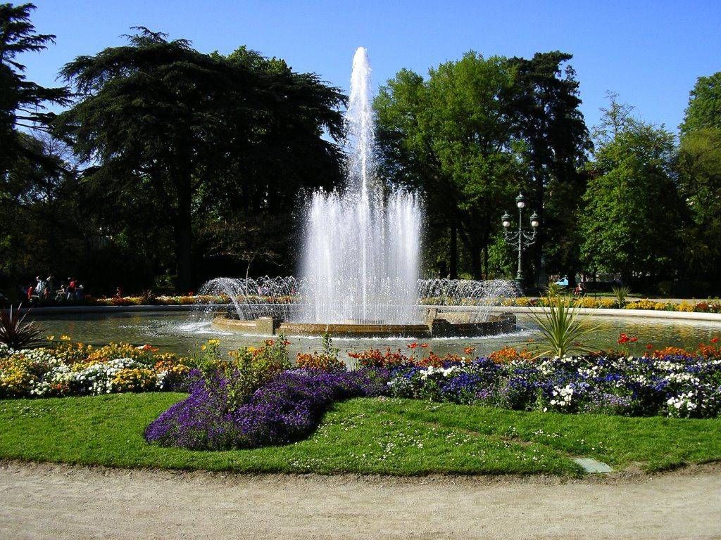
## Description The Jardin des Plantes in Toulouse is one of the city’s most beloved green spaces, offering a calm and refreshing escape from urban life. Originally created in the 18th century as a botanical garden for scientific study, it has since evolved into a public park that blends nature, history, and leisure. With its shaded paths, ponds, statues, and diverse plant life, the garden attracts families, students, and visitors looking to experience Toulouse at a gentler pace. What makes the Jardin des Plantes unique is its dual identity as both a historical botanical site and a modern recreational park. Although it no longer functions strictly as a scientific garden, many plant species and layout elements reflect its original purpose. A little-known fact is that the garden once served as a training ground for medical students studying botany and pharmacology. Another lesser-known detail is that it forms part of a larger green corridor together with the nearby Grand Rond and Jardin Royal, creating a continuous landscaped area rarely found in dense city centers. The Jardin des Plantes also features playgrounds, a carousel, and cultural installations, making it appealing to visitors of all ages while preserving a sense of historical continuity. ## Location The Jardin des Plantes is located in **France**, in the **Occitanie** region, within the city of **Toulouse**. It lies just south of the historic center, near the Muséum de Toulouse and the Canal du Midi. The garden is easily accessible by public transportation. The nearest metro station is **Palais de Justice** on Line B, which is about a 10-minute walk away. Several bus lines also serve the area. Visitors staying in central Toulouse can reach the park comfortably on foot or by bicycle, as the surrounding streets are pedestrian-friendly and well connected. ## Tips * Visit in the morning or late afternoon for a quieter and more relaxing atmosphere. * Spring and early summer are ideal for enjoying flowers and greenery at their peak. * Bring a book or picnic to fully enjoy the peaceful setting. * Families with children should check out the playground and carousel areas. * Combine your visit with the nearby Muséum de Toulouse for a full day of culture and nature. * Respect the garden rules by staying on paths and preserving plant areas. ## Conclusion The Jardin des Plantes in Toulouse offers a harmonious blend of history, nature, and everyday life. Whether you are seeking relaxation, family-friendly activities, or a scenic walk, this botanical garden remains one of the city’s most charming and accessible attractions. ## FAQ **Is the Jardin des Plantes free to enter?** Yes, entrance to the garden is free for all visitors. **How much time should I plan to spend there?** Most visitors spend between 30 minutes and two hours, depending on activities. **Is the Jardin des Plantes suitable for children?** Yes, it features playgrounds and open spaces ideal for families. **Can I picnic in the garden?** Yes, picnicking is allowed in designated areas. **Is the garden open year-round?** Yes, it is open throughout the year, though hours vary by season. ## Links * [Toulouse Tourism Official Website](https://www.toulouse-tourisme.com)
GemVoyage Team • World
Chicago
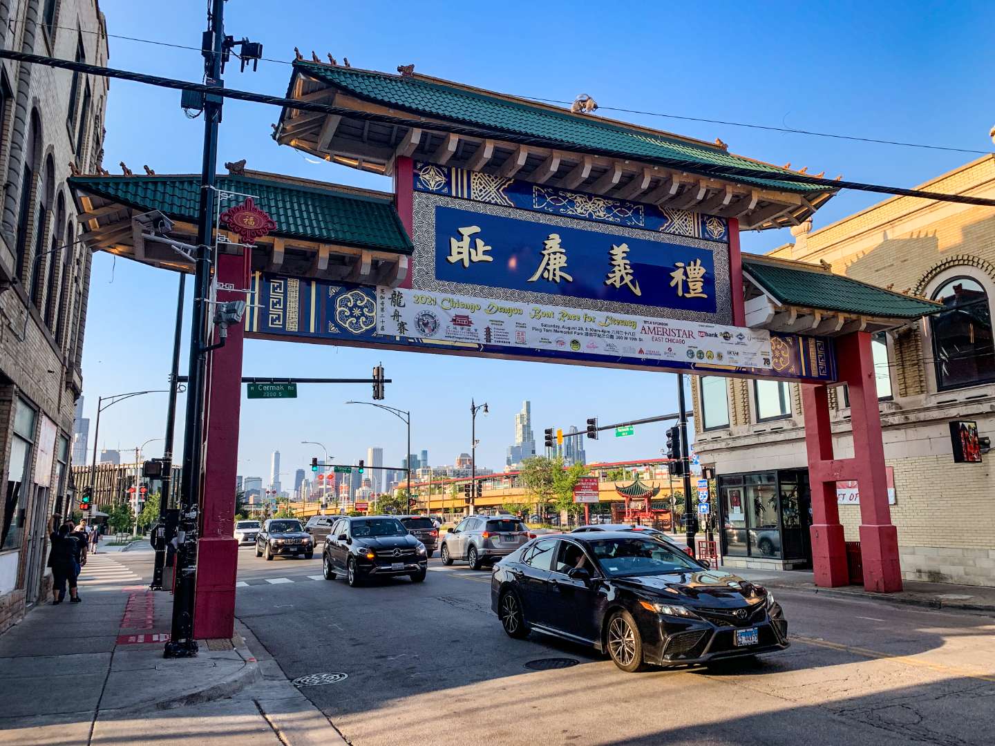
## Description Chicago’s Chinatown is a vibrant, historic neighborhood that offers a rich tapestry of culture, cuisine, and community. Established in its current location in 1912, Chinatown is one of the oldest and most dynamic Chinese-American enclaves in the United States. Located on the South Side of Chicago, it’s a place where tradition meets modernity—where you can sip bubble tea in a sleek café and then step into a century-old herbal shop just down the street. The neighborhood is anchored by the iconic Chinatown Gate on Wentworth Avenue, a symbol of welcome and cultural pride. Beyond the gate lies a bustling corridor filled with dim sum restaurants, bakeries, gift shops, and grocery stores stocked with imported goods. Chinatown Square, a two-level outdoor mall inspired by Chinese imperial architecture, features statues of the twelve zodiac animals and hosts seasonal performances and festivals. A little-known fact: the design of the Chinatown Gate was inspired by a gate in Beijing and was completed in 1975. Another hidden gem is the Chinese American Museum of Chicago, housed in a former grocery store and offering exhibits on immigration, community history, and cultural heritage. ## Location Chicago Chinatown is located in the **United States**, in the **state of Illinois**, within the **city of Chicago**. It sits in the **Armour Square** community area, primarily along **South Wentworth Avenue**, between **Cermak Road** and **W. 26th Street**. ### How to Get There: - **By Train**: Take the CTA Red Line to Cermak-Chinatown Station. The entrance to Chinatown is just steps away. - **By Bus**: Several CTA bus routes, including the 24 and 62, stop near Chinatown. - **By Car**: Parking is available in designated lots and metered spots, but public transit is recommended due to limited space. - **By Water Taxi**: In warmer months, you can take a scenic water taxi from downtown to Ping Tom Memorial Park, located in Chinatown. Its accessibility and proximity to downtown Chicago make it a convenient and rewarding destination for locals and tourists alike. ## Tips for Visitors To make the most of your visit to Chicago Chinatown, consider these tips: - **Come Hungry**: The neighborhood is a culinary paradise. Try dim sum at MingHin Cuisine or hand-pulled noodles at Lao Sze Chuan. - **Explore Chinatown Square**: This open-air plaza is perfect for shopping, dining, and snapping photos with zodiac statues. - **Visit Ping Tom Memorial Park**: A peaceful riverside park with skyline views, ideal for a picnic or a stroll. - **Check the Calendar**: Chinatown hosts vibrant events like the Lunar New Year Parade and the Summer Fair. - **Take a Walking Tour**: The Chicago Chinese Cultural Institute offers guided tours that delve into the neighborhood’s history and architecture. - **Bring Cash**: While many places accept cards, some smaller shops and eateries prefer cash. ## Conclusion Chicago Chinatown is a dynamic blend of history, culture, and flavor. Whether you're indulging in authentic cuisine, learning about Chinese-American heritage, or simply soaking in the atmosphere, this neighborhood offers a memorable experience that reflects the spirit of its community. ## FAQ **1. Is Chicago Chinatown safe to visit?** Yes, it’s generally safe and welcoming. As with any urban area, stay aware of your surroundings. **2. What is the best time to visit Chinatown?** Weekends offer the most energy and activity, especially during festivals. Weekdays are quieter and ideal for relaxed exploration. **3. Are there vegetarian or vegan options in Chinatown?** Yes, many restaurants offer plant-based dishes, especially tofu and vegetable stir-fries. **4. Is Chinatown family-friendly?** Absolutely. Kids will enjoy the colorful shops, parks, and cultural events. **5. Can I find souvenirs in Chinatown?** Yes, from traditional teas and ceramics to novelty gifts and zodiac-themed items. **6. Is there parking available?** Limited street parking and paid lots are available, but public transit is often more convenient. ## Links - [Chicago Chinatown – Wikipedia Overview](https://en.wikipedia.org/wiki/Chinatown,_Chicago)
GemVoyage Team • World
Córdoba
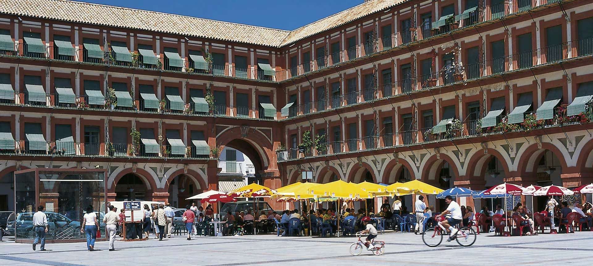
## Description Plaza de la Corredera is one of Córdoba’s most iconic and historically rich public squares, offering a unique blend of architectural charm, cultural legacy, and vibrant local life. Unlike other Andalusian plazas, Corredera stands out as the only rectangular main square in the region built in the Castilian style, reminiscent of Madrid’s Plaza Mayor. Its symmetry, arcaded buildings, and colorful facades make it a picturesque and inviting space for both locals and tourists. Constructed between 1683 and 1687 by architect Antonio Ramós Valdés, the plaza was commissioned by the city’s corregidor, Francisco Ronquillo Briceño. Over the centuries, it has served many purposes—from bullfighting arena and public market to a site for autos-da-fé and even executions during the Spanish Inquisition. Today, it’s a lively hub filled with cafés, restaurants, and artisan shops, where visitors can enjoy a coffee while soaking in the atmosphere. A little-known fact: during renovations in the 20th century, Roman mosaics were discovered beneath the plaza. These are now housed in the Alcázar de los Reyes Cristianos, offering a glimpse into Córdoba’s ancient past. Another curiosity is that two buildings in the square—the Mercado de Sánchez Peña and the Casas de Doña Ana Jacinto—predate the plaza itself and break its otherwise uniform architectural style. ## Location Plaza de la Corredera is located in **Spain**, in the **Andalusia region**, within the **city of Córdoba**. It sits in the historic Axerquía neighborhood, just a short walk northeast of the Mezquita-Catedral and the Roman Temple ruins. ### How to Get There - **By Foot**: If you're exploring Córdoba’s historic center, the plaza is easily reachable on foot from major landmarks like the Mezquita or the Jewish Quarter. - **By Bus**: Several city buses stop nearby, including lines 3 and 7. The closest stop is “San Andrés.” - **By Taxi**: Taxis can drop you off directly at one of the plaza’s entrances. - **By Car**: Parking in the historic center is limited. It’s best to park in a nearby garage and walk. Its central location makes it a perfect spot to pause and enjoy the city’s rhythm. ## Tips - **Visit in the Morning or Late Afternoon**: These times offer the best light for photography and a more relaxed atmosphere. - **Try Local Tapas**: The plaza is lined with bars and restaurants serving traditional Andalusian dishes—salmorejo, flamenquín, and local wines are must-tries. - **Look for the Mosaic Plaque**: A small plaque commemorates the Roman mosaics found beneath the square. - **Explore Nearby Attractions**: Combine your visit with stops at the Julio Romero de Torres Museum or the nearby Roman Temple. - **Attend a Local Event**: The plaza occasionally hosts concerts, markets, and festivals—check local listings for current events. - **Respect the Space**: While lively, the plaza is also a residential area. Be mindful of noise and local customs. ## Conclusion Plaza de la Corredera is a vibrant and historically layered square that captures the essence of Córdoba’s cultural and architectural heritage. Whether you're sipping coffee under its arcades or exploring its storied past, it offers a memorable and authentic experience in the heart of Andalusia. ## FAQ **1. Is Plaza de la Corredera free to visit?** Yes, the plaza is a public space and open to all visitors at no cost. **2. What is the best time to visit the plaza?** Spring and autumn offer pleasant weather and fewer crowds. Early morning and late afternoon are ideal for photography. **3. Are there guided tours available?** Yes, many walking tours of Córdoba include the plaza as a stop, often with historical commentary. **4. Is the plaza wheelchair accessible?** Yes, the square is flat and accessible, though some surrounding streets may have cobblestones. **5. Can I eat at the plaza?** Absolutely. There are numerous cafés and restaurants with outdoor seating. **6. Is it safe to visit at night?** Yes, the plaza is generally safe and well-lit, though it’s always wise to stay aware of your surroundings. ## Links - [Plaza de la Corredera – Spain.info Overview](https://www.spain.info/en/places-of-interest/plaza-corredera/) - [Plaza de la Corredera – Wikipedia Entry](https://es.wikipedia.org/wiki/Plaza_de_la_Corredera)
GemVoyage Team • World

Comments