Discover extraordinary places shared by our community of travelers
Porto
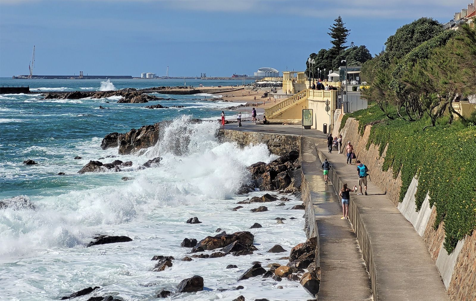
## Description Foz do Douro Promenade is one of the most enjoyable walks in Porto because it captures the city at its most open, breezy, and scenic. Located where the Douro River approaches the Atlantic Ocean, Foz do Douro is known for its waterfront paths, beaches, cafés, parks, and dramatic light. It gives visitors a different side of Porto from the historic center: less compact, more coastal, and shaped by wind, water, and long views rather than narrow medieval streets. The promenade is special because it lets you experience the transition from river to sea in a very direct way. The Douro's strong identity as a working river, a wine route, and an urban boundary becomes visible here, where the city meets larger natural forces. Walking the promenade, you can watch waves strike the seawall, see locals out for exercise or family time, and move between beaches, lighthouses, and garden spaces. It is one of those urban landscapes that works equally well for slow contemplation and active strolling. One little-known fact is that Foz has long been associated with leisure and summer life among Porto residents, especially as the city expanded and more people began seeking breezy coastal escapes close to home. Another detail many visitors miss is the extent to which the area changes mood with the weather. On a clear day, Foz feels luminous and expansive; on a windy day, it becomes dramatic and powerful. The promenade is therefore not just a route but an experience shaped by the Atlantic itself. The area also reveals a lot about Porto's identity. The city is often celebrated for its historic center and wine cellars, but Foz shows a different and equally important side: a living, modern waterfront where people come to walk, cycle, talk, and watch the sea. If you want a place in Porto that combines fresh air, urban life, and landscape, this is one of the best choices. ## Location Foz do Douro is a district in Porto, in the Norte region of Portugal, located at the mouth of the Douro River where it opens toward the Atlantic Ocean. The promenade runs along the waterfront in the western part of the city, making it farther from the old center than Ribeira but still easy to reach by public transport, taxi, or a scenic walk if you have time. One of the easiest ways to get there is by bus or tram, especially if you want to enjoy the trip without worrying about parking. Walking from the riverfront is possible and rewarding if you have a full day, but most visitors will prefer a shorter transfer followed by a long, leisurely walk along the coast. The route can be combined with stops at beaches, gardens, and small cafés along the way. For orientation, think of the promenade as a westward extension of Porto's river story. It is a place to end the day, not just begin it, because sunset and late afternoon light are especially beautiful here. ## Tips Choose a clear or mildly windy day if you want the best experience. The promenade is pleasant in many conditions, but it is most memorable when the sky and sea are visible in full color. Bring a light jacket even in warm weather. The Atlantic can cool the air quickly, especially near evening, and visitors often underestimate how different the climate feels compared with Porto's inland streets. If you enjoy a slower pace, start near the river mouth and walk toward the beaches and garden areas. That direction helps you experience the transition from urban river edge to open sea more naturally. Use the promenade as a break from sightseeing density. Porto's historic center can feel packed with monuments and steep lanes, while Foz offers breathing room and a chance to enjoy the city in a more relaxed frame. ## Conclusion Foz do Douro Promenade is one of Porto's best places for a scenic walk, combining sea air, river views, and a calm waterfront atmosphere that contrasts beautifully with the city's historic core. ## FAQ ### Why do people visit Foz do Douro? People visit for the seaside atmosphere, promenade walks, beaches, cafés, and the chance to see where the Douro River meets the Atlantic. ### Is Foz do Douro good for sunsets? Yes. The area is one of the best places in Porto for evening light and coastal views. ### Can I walk or cycle there? Yes. The waterfront is ideal for walking and cycling, and both locals and visitors use it for exercise and leisure. ### How far is it from downtown Porto? It is farther than the central historic districts, but still easy to reach by public transport or taxi. ## Links - [Porto tourism](https://visitporto.travel/) - [Wikipedia article](https://en.wikipedia.org/wiki/Foz_do_Douro)
GemVoyage Team • World
Victoria
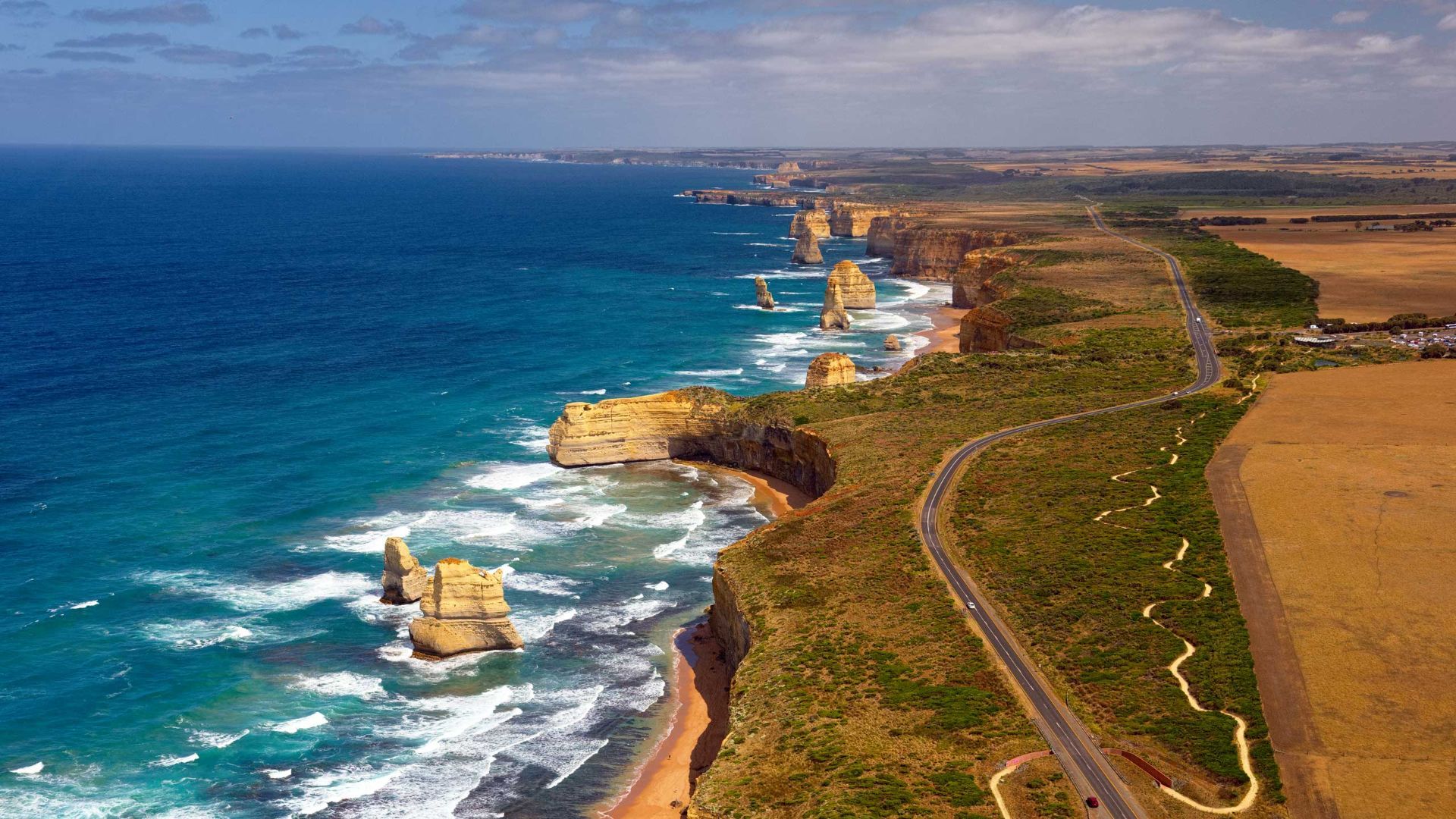
## Description The Great Ocean Road is one of the world’s most celebrated coastal drives, winding along Victoria’s southwestern shoreline past rugged cliffs, surf beaches and sculpted limestone stacks such as the Twelve Apostles. Built by returned WWI soldiers and dedicated as a war memorial, the road combines engineering, natural wonders and seaside towns with cafes, galleries and surf culture. Dramatic viewpoints, rainforest gorges (like Great Otway National Park) and wildlife sightings (koalas, kangaroos and seabirds) make the route a versatile exploration corridor. What distinguishes the route is its dramatic juxtaposition of surf, limestone geology and accessible townscapes. Photographers and road trippers prize the series of staged viewpoints where walking tracks descend to coves and panoramic platforms look out to offshore stacks. Beyond the famous stacks, the route offers fern gullies and waterfalls in the Otways, coastal walks to hidden beaches, and small towns where food and surf culture combine. Many travelers craft multi-day itineraries that combine coastal hikes, wildlife spotting and culinary stops, from coffee in Torquay to seafood in Apollo Bay and heritage-listed lookouts around Port Campbell. The road’s memorial origins also allow visitors to reflect on the engineering feat and the region’s social history while enjoying one of Australia’s most scenic drives. ## Location The Great Ocean Road runs from Torquay to Allansford near Warrnambool in Victoria, Australia, with key stops including Anglesea, Lorne, Apollo Bay and the Twelve Apostles viewpoint at Port Campbell. Melbourne is the primary gateway, roughly a 1.5–3 hour drive to the start depending on traffic. ## Tips - **Avoid peak holiday traffic and plan overnight stops:** The route is popular during Australian school holidays; split the drive into staged stops to avoid fatigue and to enjoy hikes. - **Plan time for short walks and lookout detours:** Many of the best views require small detours and short walks; factor these into your itinerary rather than only driving. - **Mind driving conditions and seasonal weather:** Wind, sea spray and rain can change conditions quickly — watch for strong crosswinds and take care on narrow coastal roads. - **Book accommodation and tours in advance during peak season:** Lorne, Apollo Bay and Port Campbell fill quickly in summer — reserve ahead if travel dates are fixed. - **Pack layers and photography gear:** Coastal light changes quickly; bring windproof layers, a tripod for sunrise/sunset shots and protective gear for salt spray. ## Conclusion The Great Ocean Road pairs dramatic coastal geology with accessible townscapes and outdoor experiences, making it an essential Australian road trip for nature lovers and photographers. Thoughtful pacing and an eye for sidetracks reveal quieter coves, rainforest secrets and local food scenes that complement the iconic seascapes. ## FAQ - **Q: How long does the full drive along the Great Ocean Road take?** A: The direct driving time without stops is around 6–7 hours, but most travelers allocate 2–3 days to properly enjoy walks, viewpoints and coastal towns. - **Q: Can I drive the Great Ocean Road in a single day from Melbourne?** A: You can, but it will be rushed; an overnight stop (or two) allows for sunrise/sunset photography, hikes, and a relaxed pace. - **Q: Are there guided tours, or is it best to self-drive?** A: Both options are common: guided day tours suit short itineraries from Melbourne, while self-driving gives freedom to explore side tracks and lesser-known beaches. - **Q: What wildlife can I expect to see?** A: Look for koalas in eucalyptus stands, kangaroos in paddocks near dusk, seabirds along the cliffs and occasional whales on migration seasons from coastal lookouts. - **Q: Is the route safe for cyclists and motorcyclists?** A: Many cyclists and motorcyclists enjoy sections of the route, but be prepared for narrow lanes, tourist traffic, and windy coastal conditions; follow local safety advice. ## Links - [Great Ocean Road — Wikipedia](https://en.wikipedia.org/wiki/Great_Ocean_Road)
GemVoyage Team • World
Austin
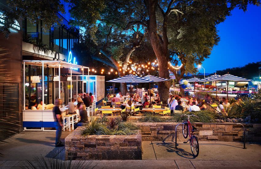
## Description South Congress Avenue, often called SoCo, is one of Austin’s most recognizable streets and one of the easiest places to understand the city’s personality. It blends independent retail, live music, vintage style, public art, great food, and a laid-back but still very energetic street culture. For visitors, the appeal is immediate: you can walk a few blocks and encounter boutique stores, local coffee shops, iconic signs, food trucks, music venues, and skyline views that make Austin feel both creative and unmistakably Texan. What makes South Congress especially interesting is the way it combines old Austin and new Austin in one corridor. It is fashionable without feeling sterile, and busy without feeling anonymous. A little-known fact is that the nickname SoCo became part of Austin’s urban identity only after the street’s modern revival, so the district’s current fame is actually quite recent in the city’s long history. Another detail travelers may not realize is that the avenue has long been a place where local creativity surfaces first: murals, small independent brands, and neighborhood spots often appear here before they become broader trends elsewhere in the city. South Congress is also one of the best places to absorb Austin’s social rhythm. During the day, it feels relaxed, with people moving between shops, patios, and casual lunch spots. In the evening, it becomes more vibrant, especially when people are heading out for dinner, live music, or sunset views near the river and the downtown skyline. The street is not only about commerce; it is about atmosphere. Even if you buy nothing, the walk itself is part of the attraction. ## Location South Congress Avenue is in Austin, Texas, United States, running south from downtown toward the southern part of the city. It is one of the most central and accessible visitor areas in Austin, especially if you are staying downtown or near the river. The street is easy to reach by rideshare, city bus, bicycle, or on foot from nearby neighborhoods. Many visitors also combine it with the Ann and Roy Butler Hike-and-Bike Trail or with a downtown sightseeing day. Because parking can be limited and the area often gets busy, public transport, biking, or walking are usually the smartest options. Once there, the best way to explore is to move slowly and let the block-by-block mix of shops and cafés shape your route. South Congress does not need a complicated plan. The street itself is the itinerary, and the surrounding cross streets offer enough variety to fill several hours without ever feeling repetitive. ## Tips - Visit in the late afternoon or evening if you want the most energetic atmosphere. - Weekday mornings are better for a quieter stroll and easier parking. - Wear comfortable shoes, because the best way to enjoy SoCo is to walk it. - Leave room in your schedule for shopping, coffee, live music, and an unplanned stop. - Watch the skyline at sunset for one of the best views linked to the district. - If you want a more local feel, step beyond the main retail blocks and explore nearby side streets. ## Conclusion South Congress Avenue is one of Austin’s best introductions to the city’s creative side. It is colorful, lively, walkable, and full of character, making it a strong stop for first-time visitors and returning travelers alike. ## FAQ ### What is South Congress Avenue known for? It is known for boutiques, music, food, murals, and its strong association with Austin’s local identity. ### Is South Congress worth visiting at night? Yes. Evening is one of the best times to experience the street’s energy, dining, and nightlife. ### How long should I spend there? Two to four hours is a good range, though it is easy to stay longer if you shop or dine. ### Is the area walkable? Yes. South Congress is one of Austin’s most walkable visitor districts. ## Links - [Austin tourism information](https://www.austintexas.org/)
GemVoyage Team • World
Seville
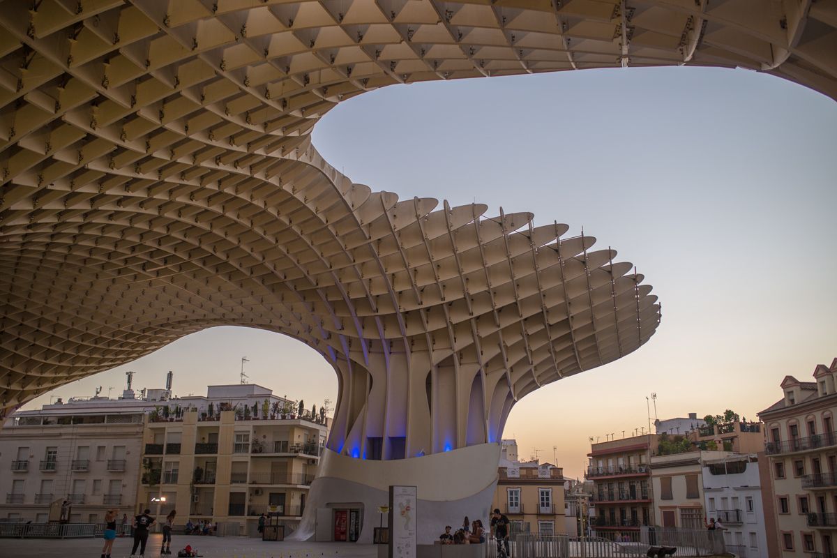
## Description Metropol Parasol, widely known as Las Setas, is one of Seville’s most striking modern landmarks and one of the clearest examples of how the city blends old and new. The structure rises above Plaza de la Encarnación with a dramatic, wave-like form that looks almost impossible at first glance. Made from timber and organized on a monumental scale, it creates a new skyline for the historic center while also serving as a public space, viewpoint, market area, and archaeological showcase. For travelers, it offers something rare: a contemporary architectural experience embedded directly in an old urban setting. What makes Metropol Parasol especially memorable is how many functions it holds at once. You can walk below it, stand under it, go up to the rooftop walkways, and also access the archaeological remains preserved underneath. That layering is a big part of its appeal. A little-known fact is that the structure is often described as one of the largest timber architectural constructions in the world, which gives it a technical significance beyond its visual impact. Another detail many visitors miss is that the underside and surrounding plaza change character depending on the time of day, with morning, afternoon, and night each creating a different mood around the same structure. For visitors who think of Seville only in terms of churches, palaces, and traditional patios, Metropol Parasol offers a useful correction. It shows that the city still experiments, still reinvents public space, and still uses architecture to make a statement. It is not only photogenic; it is conceptually important. The combination of modern design, archaeological depth, and rooftop views makes it one of the city’s most distinctive attractions for travelers who want a wider sense of Seville than the classic route alone provides. ## Location Metropol Parasol is located in Plaza de la Encarnación in the historic center of Seville, Andalusia, Spain. Because it sits in such a central area, it is easy to reach on foot from many of the city’s main sights. Visitors staying in the old town can often walk there directly, while buses and taxis provide easy access from farther away. The structure is also well positioned for combining with nearby shopping streets, tapas stops, and other central landmarks. If you are planning to go up to the top, try to visit at a time when the light is good and the city is not overwhelmingly crowded. The rooftop is especially rewarding near sunset, when the view across Seville becomes more dramatic. If you are more interested in the archaeological and urban-planning side of the site, a daytime visit can be just as worthwhile. Either way, the location makes it simple to fold into a broader sightseeing route without needing a special excursion. ## Tips - Go up to the rooftop for the best panoramic view of the historic center. - Visit near sunset if you want the most impressive light. - Don’t skip the lower level, where the archaeological remains add historical depth. - Pair the visit with nearby food or shopping to make the most of the central location. - Bring sun protection in warm months, because the plaza can be bright and exposed. - Visit at night as well if you want to see how the structure changes with illumination. ## Conclusion Metropol Parasol is one of Seville’s most original landmarks, combining modern architecture, public space, and historical layers in a single unforgettable site. It is a strong stop for travelers who want both views and design. ## FAQ ### Why is Metropol Parasol important? It is important as a bold example of contemporary architecture in Seville and as a multi-use public space. ### Can visitors go to the top? Yes. The rooftop walkways and viewpoints are one of the main reasons to visit. ### Is it good for photos? Very much so. The structure, plaza, and views offer excellent photo opportunities. ### How long does a visit take? About one hour is common, though you may stay longer if you explore the full site and surrounding area. ## Links - [Official website](https://setasdesevilla.com/) - [Wikipedia](https://en.wikipedia.org/wiki/Metropol_Parasol) - [Seville tourism information](https://www.visitasevilla.es/en)
GemVoyage Team • World
Milan
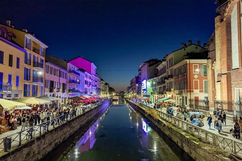
## Description The Navigli District is one of Milan’s most recognizable and enjoyable neighborhoods, especially for travelers who want atmosphere rather than a single monument. Centered on the city’s canal system, the area blends waterfront walks, small bridges, restaurants, bars, antique shops, and evening energy into a district that feels both historic and social. It is one of the best places in Milan to slow down and experience the city as a place of daily life, design, food, and nightlife rather than only fashion and business. What makes Navigli particularly interesting is the way its waterways connect modern leisure with older transport history. The canals were once part of a much more important urban system used for movement and trade, and the district still carries traces of that older role even though its present identity is more about strolling, aperitivo, and weekend crowds. A little-known fact is that the Navigli network is associated with the broader historical engineering culture of Milan, including work connected to Leonardo da Vinci’s canal and lock studies. Another detail many visitors do not realize at first is that the district changes character dramatically between day and night: daytime can feel relaxed and photogenic, while evenings often become busy, social, and lively. The Navigli District is also one of the city’s best places for aperitivo culture, where a drink often comes with snacks and the social ritual becomes as important as the menu. That makes the district especially appealing to travelers who want to understand Milan through its rhythms rather than through a checklist of attractions. The canals create the setting, but the real experience comes from the combination of reflection on the water, people watching, informal dining, and easy movement between small venues. If you are looking for a neighborhood that feels memorable without demanding a strict itinerary, Navigli is one of Milan’s strongest choices. ## Location The Navigli District is in southwestern central Milan, Lombardy, Italy, around the Naviglio Grande and Naviglio Pavese canal areas. It is easy to reach from the center of the city by metro, tram, or taxi, and many visitors walk there from nearby neighborhoods when the weather is pleasant. Porta Genova is one of the most convenient transit points for reaching the district, and from there it is simple to continue on foot toward the canal banks. Because the district is compact and best enjoyed at a relaxed pace, walking is the ideal way to experience it once you arrive. You can follow the canal, stop for a drink or meal, browse side streets, and continue without needing a fixed plan. If you visit on a Sunday or during a special market day, expect the area to be busier than usual, but also more lively. For travelers staying in central Milan, it is an easy half-day or evening destination and one of the most rewarding neighborhoods to revisit more than once. ## Tips - Go at sunset or early evening if you want the most atmospheric canal views. - Reserve enough time for aperitivo, because it is part of the Navigli experience. - Visit on a Sunday if you want markets and a more traditional neighborhood feel. - Wear comfortable shoes and be ready to walk between bridges and side streets. - If crowds are not your style, explore earlier in the day before the nightlife crowd arrives. - Combine the district with a relaxed meal rather than treating it like a quick photo stop. ## Conclusion The Navigli District is one of Milan’s most appealing neighborhoods because it mixes water, history, food, and social life in a way that feels naturally urban. It is a place to wander, eat, and enjoy the city at a slower pace. ## FAQ ### What is the Navigli District known for? It is known for its canals, aperitivo culture, lively restaurants, and atmospheric evening walks. ### Is Navigli good for a night out? Yes. It is one of Milan’s most popular areas for dinner, drinks, and evening socializing. ### Can I visit during the day? Absolutely. Daytime is often better for quiet walks, photos, and shopping. ### How much time should I spend there? At least two to three hours is a good starting point, though many visitors stay longer. ## Links - [Official Milan tourism page](https://www.yesmilano.it/en) - [Milan city information](https://www.comune.milano.it/)
GemVoyage Team • World

Cappadocia
## Description Cappadocia is a landscape that reads like a fantasy novel: soft volcanic tuff sculpted by wind and water into “fairy chimneys,” mushroom-shaped pillars, and honeycombed cliffs. Centered around Göreme in central Turkey, the region is famous for its surreal valleys, cave dwellings carved into rock, ancient subterranean cities, and a living tradition of wineries, pottery and folk crafts. Cappadocia’s cultural layer is as rich as its geology: Byzantine churches decorated with frescoes, monastic sites, and Ottoman-era villages reveal a continuous human presence adapted ingeniously to the stone. One of the most iconic Cappadocia experiences is floating above the landscape in a sunrise hot-air balloon, watching valleys and chimneys unfold as daytime light paints the rocks gold. Beyond balloons, the region rewards curiosity on foot: hiking carved valleys, exploring cave churches, descending into underground cities, and sampling local cuisine and wines in villages that still carve homes from the rock. ## Location Cappadocia sits in central Anatolia, chiefly within Nevşehir, Kayseri and Aksaray provinces. Göreme is the most convenient tourist base, offering a range of accommodations from boutique cave hotels to eco-lodges. The nearest airports are Nevşehir Kapadokya (NAV) and Kayseri Erkilet (ASR), both a short drive from the main valleys. Regular buses and private transfers connect from Ankara, Konya, and Istanbul. ## Tips - **Book balloon flights in advance:** Hot-air balloon flights sell out early, especially during spring and autumn. Reserve a slot and plan a buffer day in case of weather cancellations. - **Stay in a cave hotel:** Cave hotels provide an immersive experience that connects accommodation with the region’s geology; choose well-reviewed properties that balance authenticity with comfort. - **Explore off the beaten track:** Beyond the main tourist loops, valleys like Ihlara and Soganli offer quieter hikes, remote churches and a sense of solitude. - **Hire a local guide for historical context:** To understand frescoes, cave architecture and the significance of underground cities, a local guide or knowledgeable host adds depth. - **Dress in layers:** Mornings (especially balloon times) can be cool while afternoons warm quickly. Comfortable walking shoes and sun protection are a must. - **Sample local crafts and food:** Pottery, wine and slow-cooked regional dishes connect the landscape to local culture and provide excellent souvenir options that support artisans. ## Conclusion Cappadocia’s blend of geological wonder and layered human history makes it a bucket-list destination. Whether you’re drifting in a balloon, exploring subterranean cities, or tracing frescoed chapels, the region rewards curiosity with both spectacle and intimacy. With planning and local insight, even repeat visitors find new corners to explore. ## FAQ - **Q: Is Cappadocia suitable for families?** A: Yes — many activities (balloon rides, gentle hiking, pottery workshops) are family-friendly, though some underground passages may be tight for very young children. - **Q: Are balloon flights safe?** A: Licensed operators follow strict safety procedures. Choose experienced companies with strong safety records and clear cancellation policies. - **Q: When is the best time to visit Cappadocia?** A: Spring and autumn offer pleasant temperatures and stable flying conditions for balloons. Summer is hot but still popular; winters are quieter and atmospheric with occasional snow. - **Q: How many days should I spend?** A: 2–4 days allows you to see key valleys, take a balloon flight, visit the Göreme Open Air Museum and explore one underground city at a comfortable pace. - **Q: Can I stay in a cave hotel year-round?** A: Yes, cave hotels operate year-round and offer varying levels of comfort. In winter check for heating facilities; in summer cave rooms stay relatively cool. - **Q: Are there guided day tours and self-drive options?** A: Both are widely available. Guided tours provide context and ease of logistics; self-drive gives flexibility to explore lesser-known valleys at your own pace. ## Links - [Cappadocia — Wikipedia](https://en.wikipedia.org/wiki/Cappadocia)
GemVoyage Team • World
Seoul
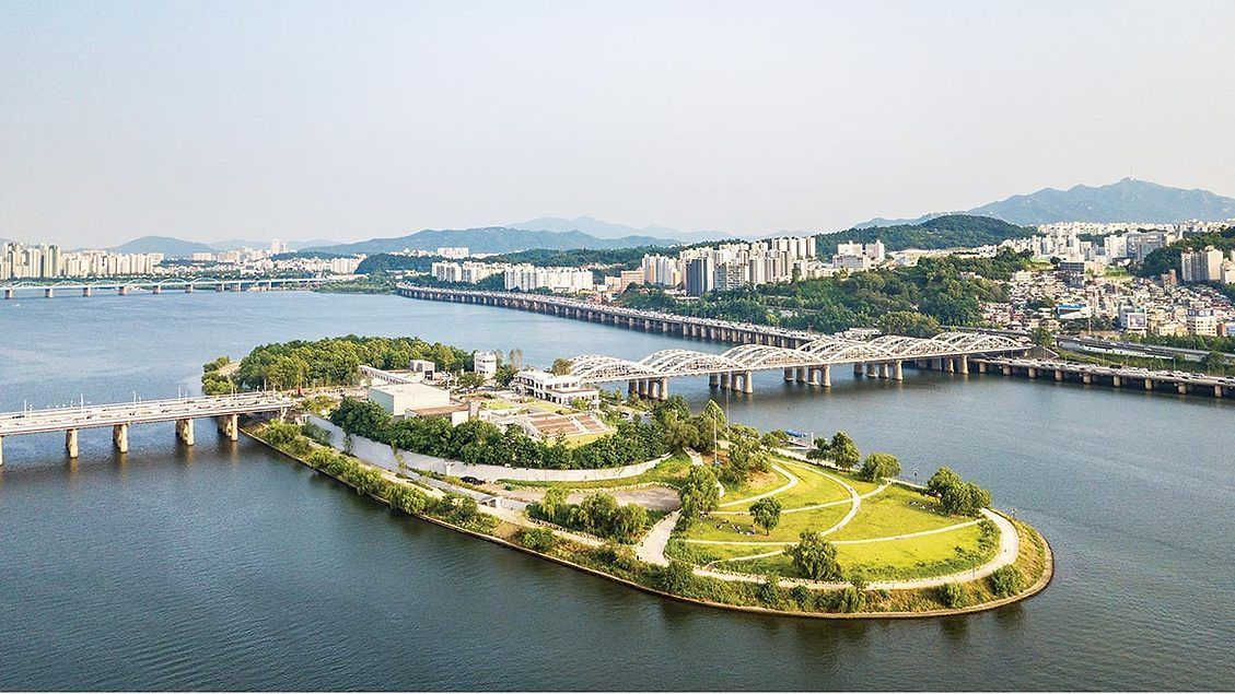
## Description Nodeul Island is a compact cultural complex on the Han River offering performance spaces, green areas, and a music-focused programming lineup. More than just a riverside park, Nodeul is a deliberate cultural experiment: its architecture and programming weave public space, live performance, and small-scale festivals into a compact, walkable site. The island hosts live concerts ranging from acoustic singer-songwriters to electronic sets, pop-up book fairs, artist talks, workshops, and rotating markets. Its landscaped terraces and shaded lawns are deliberately designed to encourage lingering, informal performances, and community gatherings. Nodeul has become known for spotlighting emerging Korean musicians and experimental performers alongside established acts, making it an attractive place for music lovers who want to catch fresh talent in an intimate setting. The island’s mix of architecture, open-air stages, and sheltered rooms means events happen year-round—outdoor stages run during warmer months while smaller indoor spaces host talks and exhibitions in cooler seasons. For photographers and writers looking for evocative urban scenes, Nodeul’s riverside vistas, evening concert lighting, and the soft hum of Seoul traffic across the water make for compelling subjects. The island also supports small food vendors and seasonal stalls that bring a local flavor to the cultural programming. From a practical standpoint, Nodeul is a model for how urban design can activate a riverside edge: pedestrian bridges and plazas, varied seating, and clear sightlines to performance areas keep programming accessible and family-friendly. The island’s public calendar is updated frequently, and local arts organizations often collaborate with the site to pilot new formats—outdoor listening sessions, experimental pop-up shows, and community workshops are common. Whether you’re planning an evening concert or a daytime literature event, Nodeul’s programming rewards repeat visits: familiar artists return, and new creative experiments appear each season. ## Location Nodeul Island sits on the Han River close to the Noryangjin and Yeouido areas of Seoul, reachable by subway and a short walk across a well-maintained pedestrian bridge from the south bank. The nearest major subway stops provide easy access for visitors staying anywhere in central Seoul, and the island’s signage in English and Korean helps international visitors orient themselves quickly. Because the island sits on the river, walking routes from nearby neighborhoods are scenic and often used by locals for jogging and evening strolls. ## Tips - Check the events calendar ahead of time: Nodeul’s draw is its programming, and many of the best concerts and markets are pre-announced online. Booking tickets in advance for popular shows avoids disappointment. - Arrive early for evening concerts to claim good riverside seating; bring a small blanket or foldable chair if you prefer more comfortable seating on the grass. - Visit at sunset for the best photo opportunities: the interplay of river light, concert lights, and Seoul’s skyline creates a memorable atmosphere. - Pack layers—a light jacket is wise for open-air evening events when the river breeze picks up, even in summer. - Explore the island’s perimeter paths before events; quiet spots and viewpoints are often less crowded than main plazas. - Support local vendors: seasonal food stalls and nearby cafés help sustain small operators who participate in Nodeul’s pop-up markets. - If you’re interested in emerging music, follow local promoters and Nodeul’s newsletter for surprise showcases and free programs. ## Conclusion Nodeul Island is a compact cultural destination that combines live music, community programming, and riverside relaxation in Seoul. It succeeds as a place where design, sound, and community converge—ideal for travelers who want to experience contemporary Korean culture beyond mainstream tourist stops. With a packed calendar, accessible layout, and an emphasis on new voices in music and the arts, Nodeul rewards curious visitors and repeat explorers alike. ## FAQ Q: Is there an admission fee? A: Many daytime activities and free concerts are available without charge, while larger evening shows or special events may require purchased tickets—check the event listing. Q: How do I get there by public transport? A: Use the nearest subway stations (check local maps), then follow pedestrian signage to the river bridge that leads to Nodeul; buses and taxis also serve the area. Q: Are events kid-friendly? A: Yes—many daytime workshops and family-oriented performances are suitable for children, though some late-night concerts may be more adult-focused. Q: Can I bring food and drink? A: Outside food and non- alcoholic drinks are generally allowed; licensed vendors operate during larger events—always check event-specific rules. Q: Is the island wheelchair accessible? A: The site offers accessible paths and ramps, but some elevated terraces may have limited access—consult the venue map for specific event locations. ## Links - [Seoul Travel Guide](https://www.visitseoul.net/)
GemVoyage Team • World
Lisbon
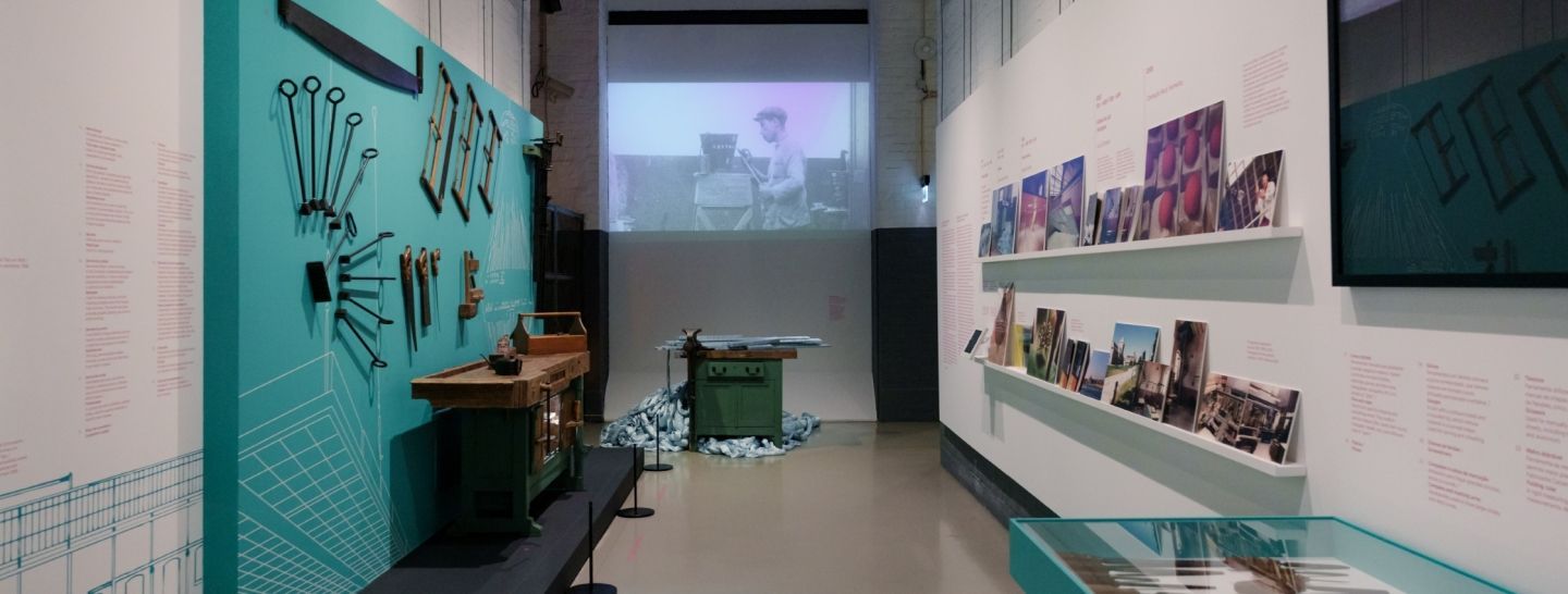
## Description MAAT (Museum of Art, Architecture and Technology) is a contemporary cultural center on Lisbon’s Belém waterfront with a bold, sculptural building and a program that explores intersections of art, architecture, and digital culture. The museum’s sinuous façade and rooftop promenade make it immediately recognizable in Lisbon’s riverside panorama, while its galleries host rotating exhibitions, commissions, and conferences that emphasize contemporary art practices. Inside, MAAT presents a mix of international and local artists, with a particular interest in projects that engage new media, digital art, and design. The museum’s programming frequently includes public talks, workshops for families, and collaborations with design festivals—evidence of its ambition to operate as a civic platform rather than a static collection. The building’s rooftop terrace is itself a public amenity, offering panoramic views across the Tagus River and serving as a flexible event space for outdoor performances and gatherings. MAAT’s curatorial approach is often experimental, pairing architectural interventions with media installations and time-based works that reward repeat visits. For visitors, this means each visit can feel different: sometimes the highlight is a single striking installation, other times the rooftop programming and view become the defining memory. The museum’s thoughtfully designed visitor flow and bilingual signage make it accessible to tourists and locals alike. ## Location MAAT is located in Belém, west of Lisbon’s historic center, adjacent to the Belém Cultural Center and near landmarks like Jerónimos Monastery and the Belém Tower. Public transport options include tram 15, buses, and taxis; it’s also a pleasant walk from other Belém attractions if you have the time. ## Tips - Book timed-entry tickets for busy exhibition periods to avoid queues, especially on weekends and during tourist high season. - Visit the rooftop terrace close to sunset for beautiful views of the Tagus and soft evening light for photography. - Check MAAT’s event calendar for family workshops and talks that may align with your travel dates. - Pair a visit with nearby sites—Jerónimos Monastery, Belém Tower, and the pastry shops known for pastéis de nata. ## Conclusion MAAT is a dynamic cultural destination that combines striking architecture, a thoughtful contemporary program, and public-facing amenities. It’s an essential stop for visitors interested in contemporary art and design, and its riverside setting makes it easy to fold into a broader day in Belém. ## FAQ Q: Are there timed tickets? A: Yes—popular exhibitions may require timed-entry tickets; book online to secure preferred slots and avoid long waits. Q: Is MAAT family-friendly? A: Definitely—MAAT offers family workshops and programs designed to engage younger visitors, though some installations may have age recommendations. Q: Are English guides available? A: Many exhibitions and staff resources are available in English; check the information desk for guide options or multilingual materials. Q: Can I visit the rooftop without entering the galleries? A: Policies vary—sometimes rooftop access is included with general admission, while special events may require a separate ticket; check the museum’s website. Q: Is photography allowed inside? A: Non-flash photography is generally allowed in public galleries, but some works and special exhibitions may prohibit photography—obey posted restrictions. ## Links - [MAAT (official)](https://www.maat.pt)
GemVoyage Team • World
Rome
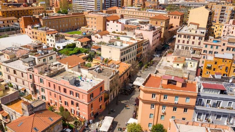
## Description Pigneto is a bohemian quarter on the eastern edge of Rome's historic center that has emerged as a center for alternative culture, independent cafés, music venues, and street art. Historically a working-class neighborhood, Pigneto's present-day energy combines laid-back local life with a creative fringe: intimate live-music bars, experimental restaurants, and murals that reward aimless wandering. Film scholars and cultural tourists sometimes note Pigneto's connection to Italian neorealist cinema—streets and squares there still convey a lived-in authenticity that feels less curated than tourist-focused central neighborhoods. What makes Pigneto appealing to travelers is the neighborhood's layered, discoverable quality: new cafés sit beside traditional trattorie, and small galleries share corners with vinyl shops. The street art is dispersed rather than concentrated, so walking (or taking a short local bus) remains the best way to discover murals, installations, and community projects. Search-friendly phrases include "Pigneto Rome street art", "Pigneto nightlife guide", and "alternative Rome neighborhoods"—queries that pair well with local blog posts and neighborhood guides. ## Location Pigneto lies east of Rome's center, convenient to Termini Station and the San Lorenzo district. The neighborhood is served by Line C (Pigneto station) and several local buses; it's a short taxi ride from central hubs. Because Pigneto is largely compact, most visitors explore on foot, moving between squares, cafes, and parklets that form the neighborhood's social hubs. ## Tips - Walk slowly and explore side streets: many of the district's best murals and hidden bars are off main roads. - Try aperitivo: early-evening aperitivo culture is vibrant—enjoy a pre-dinner drink alongside small plates at neighborhood bars. - Visit for live music nights: several small venues host jazz, indie, and experimental music on specific nights—check venue pages for schedules. - Respect local life: Pigneto has an active residential community—keep noise reasonable late at night and support neighborhood businesses. - Bring cash for smaller venues: while many places accept cards, some bars and small galleries operate cash-only. ## Conclusion Pigneto is a compelling stop for travelers who prefer neighborhood immersion to classic sightseeing. Its street art, convivial bars, and creative energy reward the curious explorer: you can spend an evening hopping intimate venues, or a whole day documenting murals and sampling modern Roman casual dining. ## FAQ Q: Is Pigneto safe for solo travelers? A: Generally yes—Pigneto is popular with locals and visitors alike; normal urban precautions apply, especially late at night. Q: When is the best time to visit for nightlife? A: Evenings from Thursday to Saturday are lively; midweek nights may have smaller shows and quieter streets. Q: Can I find guided street-art walks? A: Yes—local guides and small walking tours occasionally operate in Pigneto; independent bloggers and tour platforms often list scheduled walks. Q: Are there good places to eat for food restrictions? A: Pigneto has a variety of eateries including vegetarian and vegan-friendly spots; check menus online or ask staff for recommendations. Q: Is Pigneto family-friendly during the day? A: During daytime Pigneto is family-friendly with cafes and parks; evenings focus more on bar culture. ## Links - [Pigneto Guide](https://www.romehacks.com/pigneto-neighbourhood-rome/)
GemVoyage Team • World
