GemVoyage Team • World
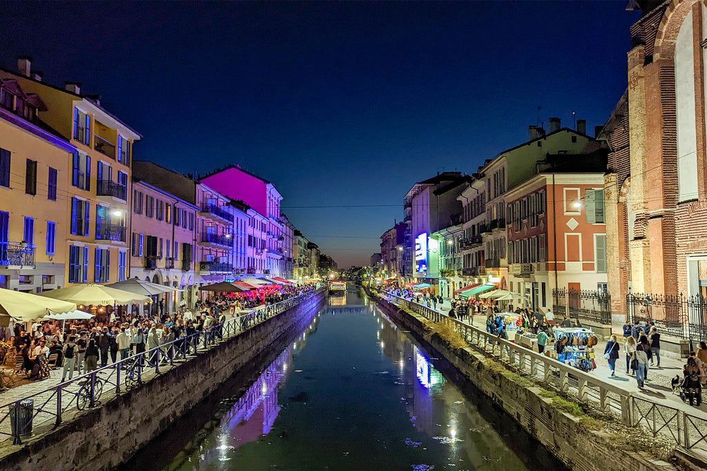
What makes Navigli particularly interesting is the way its waterways connect modern leisure with older transport history. The canals were once part of a much more important urban system used for movement and trade, and the district still carries traces of that older role even though its present identity is more about strolling, aperitivo, and weekend crowds. A little-known fact is that the Navigli network is associated with the broader historical engineering culture of Milan, including work connected to Leonardo da Vinci’s canal and lock studies. Another detail many visitors do not realize at first is that the district changes character dramatically between day and night: daytime can feel relaxed and photogenic, while evenings often become busy, social, and lively.
The Navigli District is also one of the city’s best places for aperitivo culture, where a drink often comes with snacks and the social ritual becomes as important as the menu. That makes the district especially appealing to travelers who want to understand Milan through its rhythms rather than through a checklist of attractions. The canals create the setting, but the real experience comes from the combination of reflection on the water, people watching, informal dining, and easy movement between small venues. If you are looking for a neighborhood that feels memorable without demanding a strict itinerary, Navigli is one of Milan’s strongest choices.
Because the district is compact and best enjoyed at a relaxed pace, walking is the ideal way to experience it once you arrive. You can follow the canal, stop for a drink or meal, browse side streets, and continue without needing a fixed plan. If you visit on a Sunday or during a special market day, expect the area to be busier than usual, but also more lively. For travelers staying in central Milan, it is an easy half-day or evening destination and one of the most rewarding neighborhoods to revisit more than once.
Discover more hidden gems you might love.
Cairo
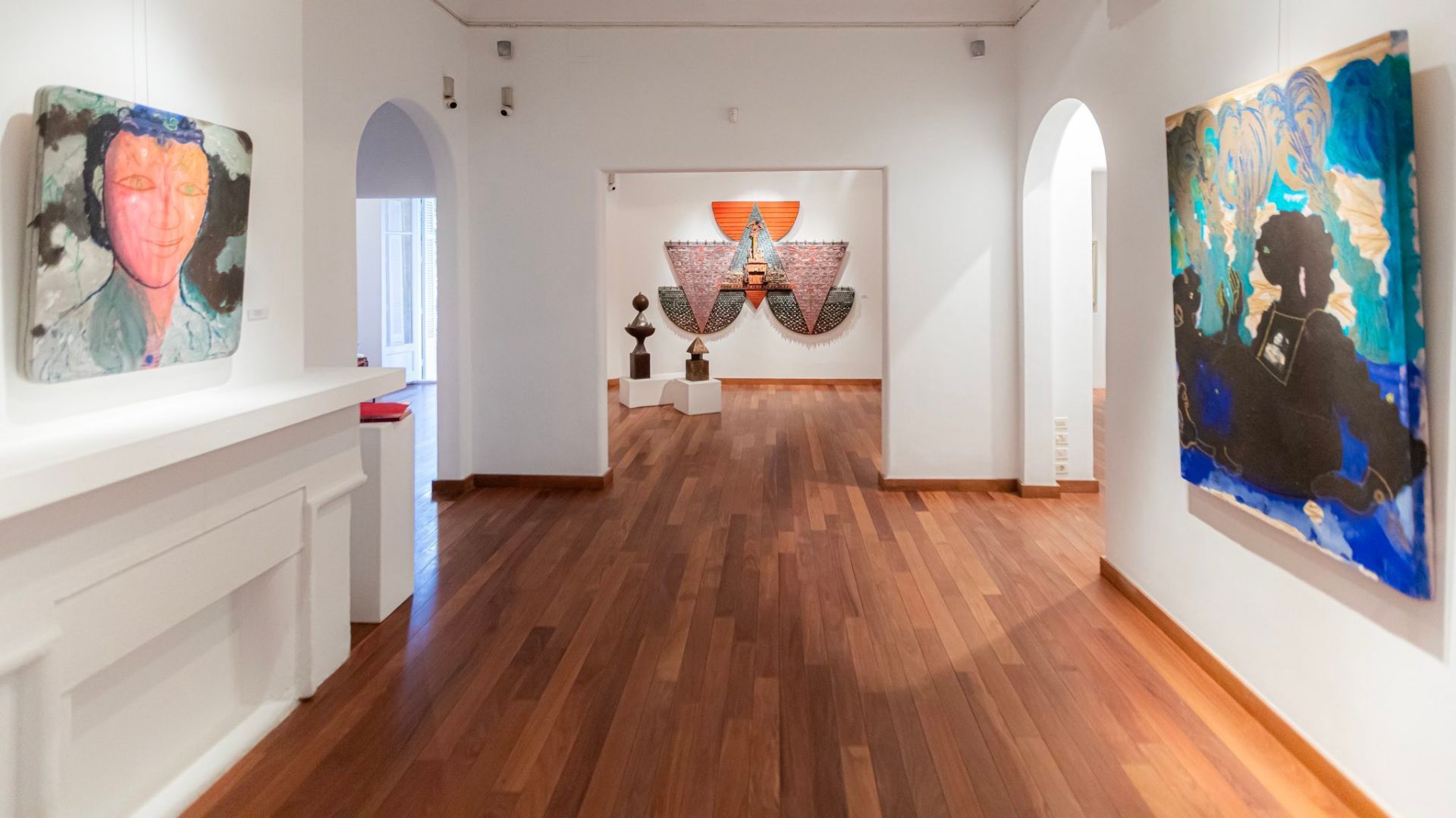
## Description Zamalek is one of Cairo's most elegant and culturally layered neighborhoods, and its art galleries give it a character that feels distinct from the city's more hurried commercial districts. Set on Gezira Island in the Nile, the area blends leafy streets, embassies, old villas, cafes, and a compact but lively contemporary art scene. Visitors come here for more than just one gallery; they come for the atmosphere of walking through a district where art, architecture, and everyday Cairo life overlap in a way that feels intimate and refined. What makes Zamalek special is how accessible its creative life is. Many galleries are tucked into residential streets or historic buildings, so the experience is as much about discovery as it is about the exhibitions themselves. You can move from one space to another on foot, stopping for coffee, browsing small bookstores, or taking in the shade of the trees that line the streets. The district has long attracted diplomats, artists, writers, and collectors, which has helped shape a culture that values conversation and experimentation. One little-known fact is that Zamalek's modern identity was influenced by the island's role in late 19th and early 20th century urban planning, when it became a showcase for Cairo's cosmopolitan elite. Another is that several of the area's smaller galleries change their exhibitions frequently, so repeat visits can feel completely different from one month to the next. That makes Zamalek especially rewarding for travelers who enjoy current art rather than static museum visits. The galleries themselves often highlight a wide range of work: painting, mixed media, sculpture, photography, printmaking, and conceptual installations. Some spaces represent established Egyptian artists, while others support younger voices and cross-disciplinary projects. As a result, you may encounter work that speaks to Cairo's daily life, regional politics, identity, memory, urban transformation, or the relationship between traditional craft and contemporary expression. Zamalek is also a good place to slow down. Cairo can be intense, and this neighborhood gives you a softer rhythm. Between gallery visits, you can wander down quiet streets, notice historic facades, and enjoy views of the river. The district's cultural character is not confined to exhibition halls; it extends into bookshops, design stores, and cafes where artists and students often gather. This makes the area feel like a living creative ecosystem rather than a tourist display. For travelers interested in culture, Zamalek is one of the most rewarding ways to experience Cairo beyond its major monuments. It reveals how contemporary Egyptian creativity lives alongside the city's long historical memory. If you want an afternoon that combines urban charm, art, and a sense of place, Zamalek delivers that with very little effort and a lot of style. ## Location Zamalek is a district on Gezira Island in the Nile River, within Cairo, Egypt. It sits in the central part of the city and is connected to both riverbanks by bridges, making it easy to reach from Downtown Cairo, Garden City, or Giza. Because the area is compact, many art galleries are best explored on foot once you arrive. The most practical way to get there is by taxi or ride-hailing service, especially if you are moving between different neighborhoods in Cairo. Public transport is also possible, but first-time visitors usually find it simpler to be dropped near a known landmark in Zamalek and then walk from gallery to gallery. If you are staying in central Cairo, the trip is usually short, though traffic can be heavy during peak hours. ## Tips Visit in the late morning or early afternoon if you want a quieter gallery experience and easier walking between venues. Check exhibition schedules in advance, because some galleries close between shows or rotate their collections frequently. Wear comfortable shoes. Zamalek is walkable, but you may cover more distance than expected if you plan to visit several galleries in one day. Pair the galleries with a cafe stop or lunch break. The neighborhood rewards unhurried exploration, and a meal between visits helps you take in the atmosphere without rushing. If you are serious about collecting or meeting artists, do not hesitate to ask gallery staff questions. Many spaces are small and personal, and conversations are often part of the experience. Keep some flexibility in your itinerary. The best discovery in Zamalek is often an unexpected side street, a temporary exhibit, or a gallery you did not plan to visit. ## Conclusion Zamalek's art galleries offer a polished but approachable introduction to Cairo's contemporary creative life, making the district ideal for visitors who want culture, walkability, and a distinct local atmosphere in one compact neighborhood. ## FAQ ### What is Zamalek known for? Zamalek is known for its leafy streets, embassies, historic villas, cafes, and a strong concentration of art galleries and cultural spaces. ### How long should I spend in Zamalek for gallery hopping? A half day is usually enough for a relaxed visit, but art lovers may want a full day to combine galleries with cafes, shops, and riverside walks. ### Is Zamalek safe for visitors? It is generally considered one of Cairo's calmer neighborhoods, especially during the day. As with any large city, basic travel awareness is still recommended. ### Are the galleries free to enter? Some galleries are free, while others may charge for special exhibitions or events. It is best to check in advance. ## Links - [Zamalek](https://en.wikipedia.org/wiki/Zamalek) - [Zamalek Art Gallery on Facebook](https://www.facebook.com/zamalekartgallery)
GemVoyage Team • World
Stavanger
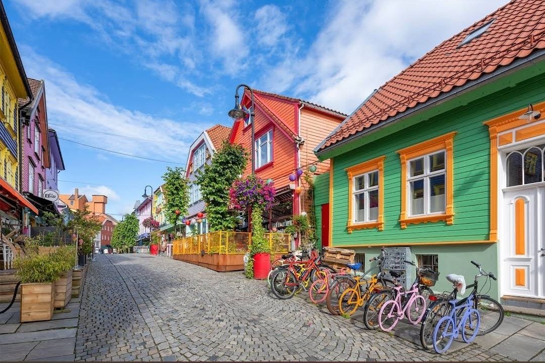
## Description **Fargegaten** stands out as one of Norway’s most visually striking streets, where entire facades burst with vivid hues. This creative transformation turned a once-dull, quiet lane into a lively, Instagram-worthy pedestrian hotspot. What started as a revitalization project has become a beloved urban gem. **Little-known facts**: * The idea originated with a local hairdresser, **Tom Kjørsvik**, who spearheaded the project to breathe life back into the street—work that stretched over four years and required approval from both landlords and the city council. * Some of the color inspirations came from retro aesthetics: the artist **Craig Flannagan**, responsible for choosing the palette, drew from influences like the 1970s TV show *Miami Vice*. --- ## Location Fargegaten is located in **Stavanger**, within the **Rogaland** county of **Norway**—specifically on the eastern stretch of **Øvre Holmegate**, between Kirkegata and Østervåg. ### How to get there * It’s easy to reach on foot from Stavanger’s city centre—just follow signs toward Øvre Holmegate. * You can also hop off at **Bus stop 10** on local sightseeing bus routes, which stop nearby. --- ## Tips * To make the most of your visit, come with your camera ready—Fargegaten is one of the most Instagrammable spots in Stavanger. * The street is pedestrian-only since **2005**, making for a relaxed, car-free experience. * Explore niche boutiques like *Den Syvende Himmel*, *Kjoledamen*, and *Bernina’s sewing shop*. From a barbershop or tattoo parlor to a dress store with handmade silkscreen prints—Fargegaten has something for curious shoppers. * After shopping, treat yourself to local flavors at one of the cozy cafés or bars. It’s a joy to sit and watch the street come alive with color and community. --- ## Conclusion Fargegaten in Stavanger is more than a pretty street—it's a community-driven masterpiece. From a faded, overlooked lane to a radiant display of color and culture, it’s a testament to local creativity, persistence, and transformation. Whether you're snapping photos, exploring boutiques, or simply soaking in the atmosphere, Fargegaten offers a joyful, memorable slice of Stavanger life. --- ## FAQ **1. Why is it called Fargegaten?** “Fargegaten” translates to “The Colour Street,” a nickname earned from its boldly painted façades that made the once-quiet Øvre Holmegate a vivid landmark. **2. Who came up with the idea to paint the street?** A local hairdresser named **Tom Kjørsvik** initiated the project, aiming to revive the neglected street. The transformation spanned over four years, involving landlords, the city council, and artist Craig Flannagan to plan the color scheme. **3. Is Fargegaten suitable for families?** Absolutely—it's pedestrian-friendly, safe, and fun to explore. With boutiques, cafés, and colorful surroundings, it offers a lively but relaxed experience that’s great for all ages. **4. What types of shops can I find there?** Expect niche boutiques, dress shops like *Den Syvende Himmel*, sewing stores like *Bernina*, barbershops, tattoo parlors, and even a store offering handmade silkscreen clothing prints (Kant). **5. Can you drive there?** No—Fargegaten has been a pedestrian-only street since 2005, and additional sections between Skagenkaien and Kirkegata were later closed to cars, making for a safe and pleasant stroll. **6. What's the best time to visit?** Any time during daylight is best—colorful façades stand out beautifully under natural light, making for perfect photo conditions and cheerful ambiance. --- ## Links * [Visit Norway](https://www.visitnorway.com/) * [Fargegaten Information](https://www.visitnorway.com/places-to-go/fjord-norway/the-stavanger-region/listings-stavanger/fargegaten-%C3%98vre-holmegate-the-colourful-street/235310/)
GemVoyage Team • World
Ontario
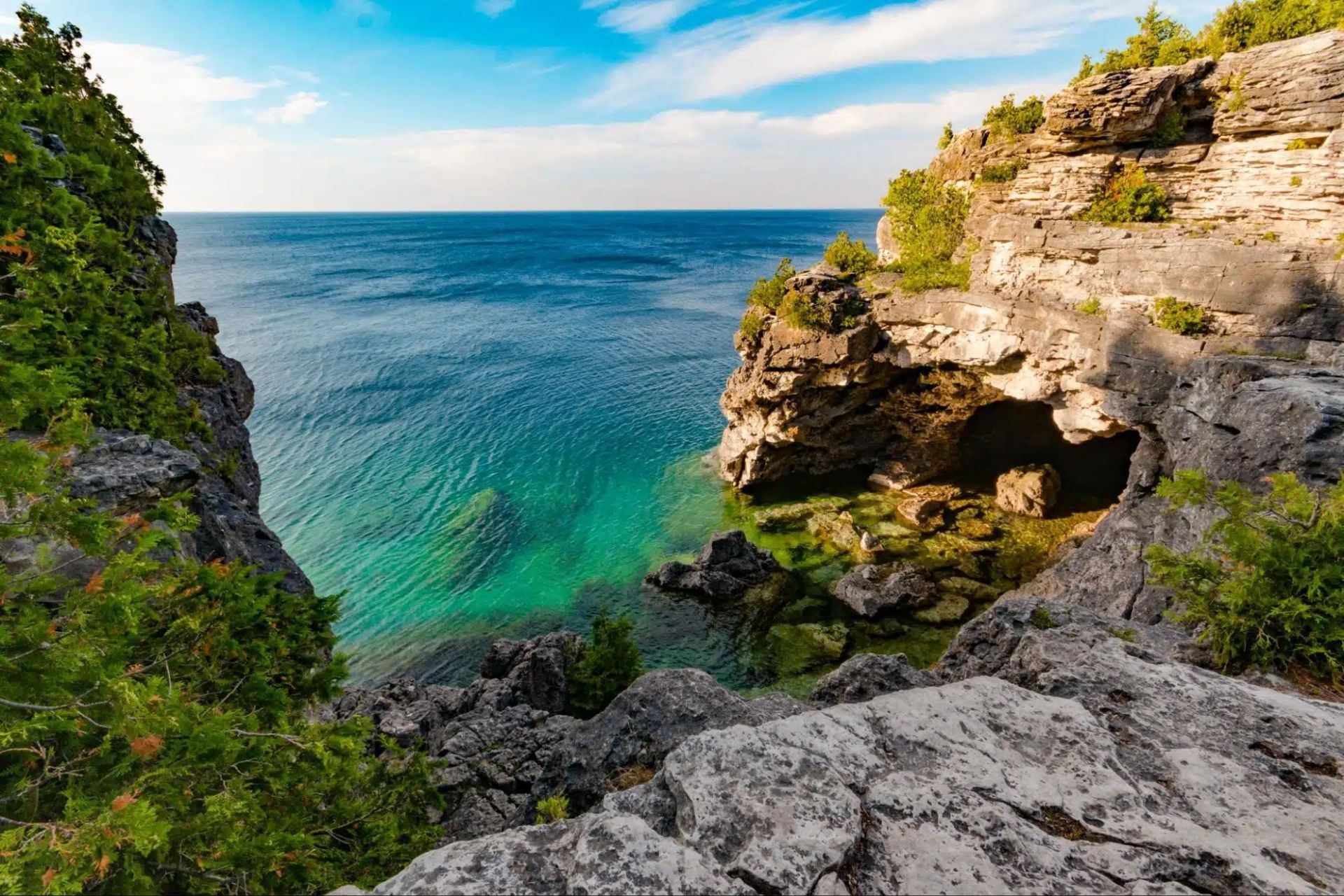
## Description The Tobermory Grotto is one of Ontario’s most recognizable natural attractions and a place that has become almost legendary among travelers who love clear water, rocky shoreline, and dramatic coastal scenery. Located along the Bruce Peninsula in Bruce Peninsula National Park, the Grotto is a sea cave and shoreline formation shaped by water and stone over a very long stretch of time. Its appeal is immediate: bright turquoise water, pale limestone cliffs, and a setting that looks more like a distant island destination than a typical inland Canadian getaway. What makes the Grotto so memorable is how strongly it contrasts with expectation. Travelers who arrive expecting a simple viewpoint often discover a landscape that feels startlingly vivid. The water color can seem almost unreal when sunlight is strong, and the surrounding rock formations create a natural frame that feels tailor-made for photography. Beyond the famous cave itself, the broader Bruce Peninsula landscape adds to the experience with forest, shoreline trails, and a sense of remote beauty that is unusually accessible for southern Ontario. One little-known fact is that the Grotto’s appearance changes dramatically with weather and light. On bright days, the water can look intensely blue-green, while overcast conditions make the scene quieter and more subdued. Another detail visitors often discover only when they arrive is that the site’s popularity has changed how it must be visited. Timing, access planning, and park rules matter more than they do at many ordinary day-use destinations. That is not a drawback so much as part of the modern experience of seeing one of Canada’s most celebrated natural spots. The Grotto is also a place that rewards patience. People often talk about it as a photo stop, but the longer you stay in the region, the more complete the experience becomes. The surrounding national park, the shoreline walk, and the broader Tobermory area all help the destination feel like a true outdoor trip rather than a single scenic moment. ## Location The Tobermory Grotto is in Bruce Peninsula National Park near Tobermory, Ontario, on the western side of the Bruce Peninsula along Georgian Bay. Tobermory is a small but well-known community at the northern end of the peninsula, and the Grotto is reached from there by road and park access rather than by urban transit. For most visitors, driving is the standard and most practical way to get there. Because the Grotto is a popular destination with limited access and park management considerations, it is wise to plan ahead rather than assuming you can simply arrive at any time. If you are coming from Toronto, London, or other parts of southern Ontario, the trip is long enough that an overnight stay in the Tobermory area can make the visit far more enjoyable. That also gives you time to explore the park properly instead of rushing in and out around the single most famous viewpoint. ## Tips Book and plan early. This is not the kind of place where improvisation always works best, especially in busy season. Parking, access rules, and timing can shape your experience significantly. If you wait until the last minute, you may find your options limited. Bring sturdy shoes and be prepared for a walk. The Grotto is scenic, but reaching it typically requires more effort than a simple roadside stop. The terrain can be rocky and uneven, so footwear matters. If you plan to swim, remember that natural water is cold even on warm days, and conditions can be less forgiving than they look from a photo. Think beyond the cave itself. The Grotto is the headline, but the whole Bruce Peninsula area is worth time. Nearby trails, shoreline views, and the general Tobermory landscape help transform the trip from a single stop into a richer outing. If possible, stay long enough to enjoy the area during different light conditions. Watch the weather. Clear sky and sunlight can make the water look especially bright, but even cloudy days have their own moody beauty. Safety, however, always matters more than the photo. Check local guidance before entering the water or walking near exposed edges. ## Conclusion The Tobermory Grotto is one of Ontario’s most impressive natural sights, blending dramatic shoreline scenery with the iconic turquoise water of Georgian Bay. It deserves the planning it requires and rewards travelers who make time for the wider peninsula. ## FAQ ### Is the Grotto worth the trip from Toronto? Yes, especially if you enjoy dramatic natural scenery and do not mind a longer drive. Many visitors treat it as an overnight or weekend trip so they can enjoy the Bruce Peninsula more fully. ### Can I swim there? Swimming may be possible depending on conditions and local rules, but the water is very cold and natural shoreline conditions can be challenging. Always check current guidance before entering the water. ### Do I need to visit in summer? Summer is the most popular season, but the area can be beautiful at other times too. The tradeoff is that access, weather, and comfort levels vary by season. ### Is the Grotto suitable for children? It can be, if you are careful and supervise closely. The rocky terrain means families should pay attention to footing and safety. ### How much time should I plan? At minimum, allow enough time for the walk, the viewpoint, and the return. A fuller Bruce Peninsula day trip is much more satisfying than a rushed photo stop. ## Links - [Official website](https://parks.canada.ca/pn-np/on/bruce/activ/experiences/grotto) - [Wikipedia](https://en.wikipedia.org/wiki/Bruce_Peninsula_National_Park)
GemVoyage Team • World
Surabaya
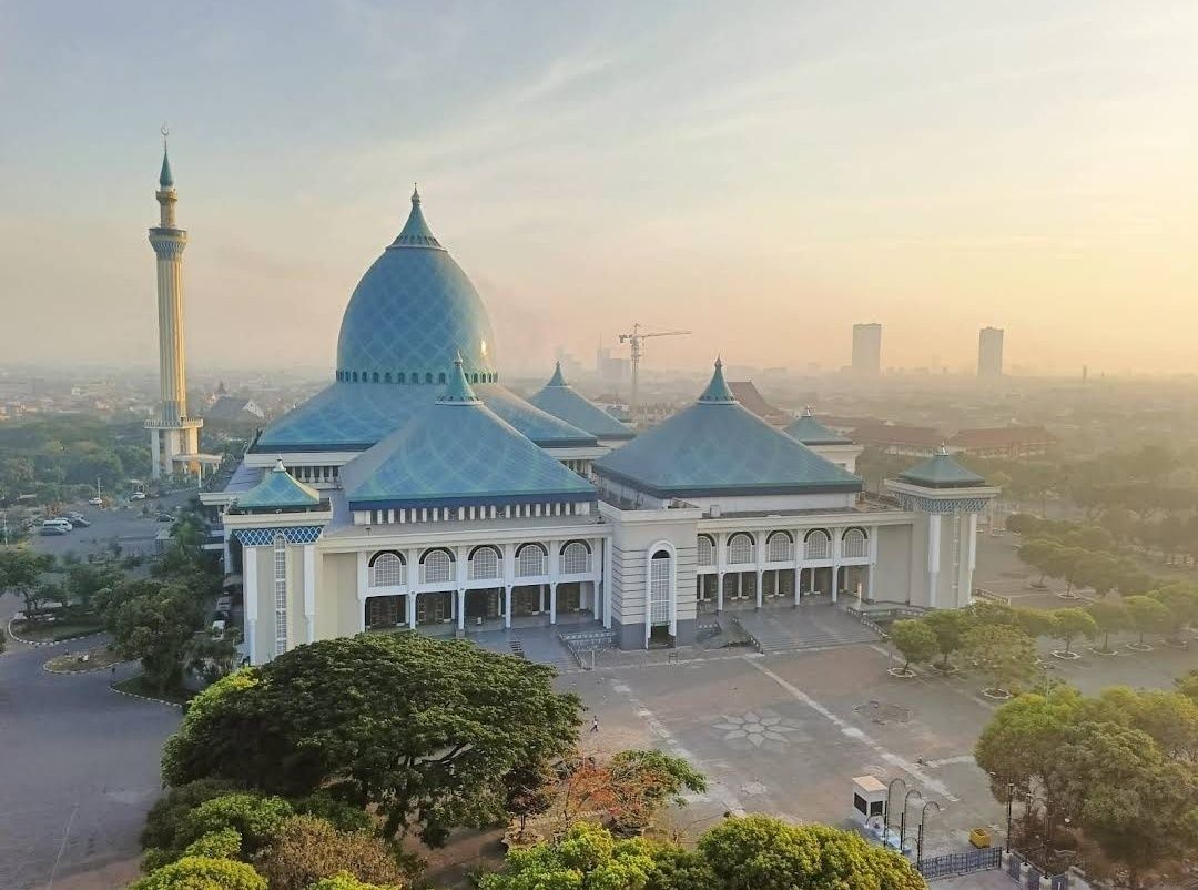
## Description **Masjid Al Akbar Surabaya**, often referred to as the **Grand Mosque of Surabaya**, is one of the largest and most magnificent mosques in Indonesia. Completed in 2000, this architectural marvel is a significant religious landmark and a cultural treasure in East Java. Its grandeur, unique design, and serene atmosphere make it a must-visit for both worshippers and travelers interested in Indonesia’s rich Islamic heritage. The mosque is instantly recognizable for its **striking turquoise dome**, which is one of the largest in Southeast Asia, measuring 27 meters in diameter and standing 54 meters high. The dome is surrounded by smaller domes and a towering minaret that rises to 99 meters, symbolizing the **99 names of Allah** in Islam. From the top of the minaret, visitors can enjoy panoramic views of Surabaya city, stretching out toward the Java Sea on clear days. **Little-known facts**: * The mosque can accommodate **up to 59,000 worshippers** at once, making it one of the largest in the country. * The minaret was specifically designed with a viewing platform, offering a rare opportunity for visitors to appreciate both the mosque and Surabaya from above. --- ## Location Masjid Al Akbar is located in **Surabaya**, the bustling capital of **East Java Province**, in **Indonesia**. It stands prominently on **Jalan Pagesangan**, near the Surabaya–Gempol toll road, making it easily accessible for both locals and visitors. ### How to get there: * From **Juanda International Airport**, the mosque is about 15 kilometers away and can be reached by taxi in around 30–40 minutes, depending on traffic. * From Surabaya city center, you can take a taxi, car rental, or use ride-hailing apps like Gojek or Grab for a convenient trip. Public buses also stop nearby, but private transportation is recommended for comfort and ease. --- ## Tips * **Visit during non-prayer hours**: If you’re a non-Muslim visitor, it’s best to explore the mosque outside the five daily prayer times to avoid crowds and to be respectful. * **Dress modestly**: Visitors are expected to wear modest clothing. Women may be provided with robes and headscarves if needed. * **Climb the minaret**: Don’t miss the chance to go up the 99-meter-high minaret for an incredible bird’s-eye view of Surabaya. * **Photography etiquette**: The mosque’s interior and exterior are highly photogenic, but always be respectful when taking photos, especially if worshippers are present. * **Combine your visit**: Masjid Al Akbar is close to Surabaya’s other attractions, such as the Surabaya Zoo and Taman Bungkul Park, making it easy to plan a full day of sightseeing. --- ## Conclusion Masjid Al Akbar Surabaya is not just a place of worship—it’s an architectural icon and cultural landmark in East Java. With its vast turquoise dome, symbolic minaret, and capacity to welcome tens of thousands of worshippers, it embodies the grandeur of Islamic architecture in Indonesia. Whether you come for prayer, cultural appreciation, or panoramic city views, the mosque offers a memorable and enriching experience. --- ## FAQ **1. What makes Masjid Al Akbar unique?** Its massive turquoise dome, 99-meter-high minaret, and capacity for nearly 59,000 worshippers make it one of Indonesia’s largest and most iconic mosques. **2. Can non-Muslims visit the mosque?** Yes, non-Muslims are welcome outside of prayer times, provided they dress modestly and respect the sanctity of the space. **3. Is there an entrance fee?** No, entry to Masjid Al Akbar is free, though small donations are appreciated. A small fee may apply if you want to access the minaret viewing platform. **4. When is the best time to visit?** Early mornings and late afternoons are ideal for cooler weather and softer lighting, perfect for photography and sightseeing. **5. How long does a visit usually take?** Most visitors spend 1–2 hours, especially if they include a trip up the minaret. **6. Is the mosque accessible for families and elderly visitors?** Yes, the mosque has ramps, elevators, and spacious areas, making it suitable for families with children and elderly visitors. --- ## Links * [Indonesia Travel – Official Site](https://www.indonesia.travel/gb/en/) * [East Java Tourism Board](https://www.eastjava.com/)
GemVoyage Team • World

New York
## Description The **Staten Island Boat Graveyard**, officially known as the **Witte Marine Scrap Yard**, is one of New York’s most unusual and fascinating attractions. Nestled along the Arthur Kill waterway, this hidden site is where dozens of decommissioned ships were brought to rest, creating an eerie yet captivating scene. Rusting hulls, half-sunken tugboats, and skeletal remains of vessels stretch across the shoreline, making the boat graveyard a dreamlike place for urban explorers, history buffs, and photographers alike. What makes the site particularly unique is the way nature and industry intertwine. Over decades, the corroding metal has blended with the marshland environment, creating a haunting landscape that feels frozen in time. Unlike a museum display, the graveyard is raw, untouched, and authentic—a piece of living maritime history slowly dissolving into the tide. **Little-known facts**: * The site was founded in the 1930s by John J. Witte, who originally intended it as a marine salvage yard rather than a tourist attraction. Today, it is still an active scrapyard, though parts of it have become a de facto maritime graveyard. * The boat graveyard is sometimes called the “**Tugboat Graveyard**” because many of the vessels abandoned here were tugboats that once served New York Harbor. --- ## Location The Staten Island Boat Graveyard is located in **Staten Island, New York City**, within the state of **New York**, USA. It sits along the Arthur Kill waterway near the neighborhood of Rossville, on the western shore of Staten Island. ### How to get there: * **By car**: The easiest way is to drive, as the site is relatively remote. Visitors can park nearby on Arthur Kill Road and walk toward the shoreline. * **By public transit**: It’s possible, though less convenient, to take an MTA bus (such as the S74 or S78) from the Staten Island Ferry terminal and walk the rest of the way. * **Guided tours**: Some local tour operators and photography groups organize visits to the graveyard, which can be a safer and more informative way to experience the site. --- ## Tips * **Wear sturdy shoes**: The area around the graveyard can be muddy, uneven, and slippery, especially after rain. * **Respect private property**: The scrapyard is privately owned, so visitors should avoid trespassing and stick to public access points along the shore. * **Bring a camera**: The rusting vessels, changing tides, and dramatic light make for excellent photography opportunities. * **Visit at low tide**: More ships and details are visible when the tide is out, allowing for better exploration and photos. * **Stay safe**: The boats themselves are unstable and dangerous to climb. Admire them from a distance rather than attempting to board. * **Go in daylight**: The graveyard is isolated and not well lit, so daytime visits are recommended for safety and visibility. --- ## Conclusion The Staten Island Boat Graveyard is a hauntingly beautiful site where history, decay, and nature converge. It’s not a polished tourist attraction, but that’s what makes it so special—its authenticity, its mystery, and its ability to transport visitors into another era of New York’s maritime past. For those who enjoy off-the-beaten-path destinations, this hidden corner of Staten Island offers a rare and unforgettable experience. --- ## FAQ **1. What is the Staten Island Boat Graveyard?** It’s a marine scrapyard where decommissioned vessels, especially tugboats, have been abandoned over decades along the Arthur Kill waterway. **2. Can I visit the graveyard legally?** Yes, but since it is on private property, visitors should only view it from public access points along the shoreline and avoid trespassing into the scrapyard itself. **3. Is the site safe to explore?** The surrounding area is generally safe, but climbing onto the ships is dangerous and not recommended due to rust, sharp edges, and unstable structures. **4. When is the best time to visit?** Low tide during daylight hours is ideal, as more ships are visible and lighting conditions are better for photography. **5. Do I need special equipment to visit?** No, just wear comfortable shoes and bring a camera. Binoculars can also enhance the experience if you want a closer look at distant vessels. **6. Is it worth visiting for non-photographers?** Absolutely. Even without a camera, the graveyard offers a unique and atmospheric glimpse into New York’s maritime history.
GemVoyage Team • World

Porto
## Description Livraria Lello is one of Porto’s most iconic attractions, and for good reason. Even people who are not especially interested in books often leave impressed by the building’s dramatic interior, carved woodwork, stained-glass ceiling, and sweeping red staircase. It is a bookstore, but it also feels like a carefully preserved piece of architecture and cultural history. For many travelers, the experience is as much about atmosphere as it is about literature. What makes Livraria Lello stand out is the way it turns a simple bookshop visit into a memorable city moment. The rooms feel intimate, ornate, and theatrical, yet the space remains very much alive as a working bookstore. The early hours are especially appealing because they allow visitors to appreciate the details before the busiest crowds arrive. In the morning, the light is gentler, the staircase is easier to photograph, and the interior feels less hurried. For anyone who wants to understand why this place has become famous worldwide, early access can make a huge difference. One lesser-known fact is that the bookstore’s reputation has made it one of the most photographed interiors in Portugal, but the building itself rewards slower observation. If you look closely, you will notice that the details are not only decorative; they are carefully integrated into the structure and the visitor flow. Another interesting point is that many people come expecting a museum, yet the best way to appreciate Livraria Lello is to treat it as both a living bookstore and a historic landmark. That dual identity is part of its charm. The bookstore also plays into Porto’s wider identity as a city of craftsmanship, publishing, and visual beauty. Its popularity has inevitably made it busy, but that popularity is not accidental. People come for the staircase, stay for the books, and leave talking about the overall mood of the place. Even travelers who are skeptical of tourist-famous spots often find that this one lives up to the attention. If you visit in the early hours, you can pay closer attention to the architecture, the bookshelves, and the quiet movement of the staff and first guests. The experience becomes less about waiting in a queue and more about entering a space with a strong personality. That is one of the reasons many Porto itineraries place Livraria Lello near the top of the list. ## Location Livraria Lello is located in central Porto, Portugal, on Rua das Carmelitas, close to the Clérigos area and within easy walking distance of several of the city’s major landmarks. It sits in one of Porto’s most visited historic districts, so the surrounding streets are lively and full of cafés, shops, and sightseeing stops. The easiest way to get there is on foot if you are already exploring the historic center. If you are arriving by public transport, Porto’s metro and train links can bring you into the central area, after which it is usually a straightforward walk. Because the bookstore is popular, arriving early is the best strategy. You will avoid the longest lines, enjoy a quieter interior, and have more time to look around before the busiest rush begins. ## Tips - Buy or reserve your ticket in advance if that option is available for your travel date. - Go as early as possible to enjoy a calmer atmosphere and better photos. - Keep your visit unhurried so you can appreciate the details beyond the staircase. - Pair the stop with nearby landmarks like Clérigos Tower and other central Porto sights. - Be prepared for a crowd, even in the morning, because this is one of Porto’s most popular attractions. ## Conclusion Livraria Lello is a Porto landmark where literature, architecture, and atmosphere meet, and the early hours offer the best way to enjoy it. ## FAQ ### Is Livraria Lello just for book lovers? No. It appeals to book lovers, but also to travelers interested in design, photography, and Porto’s cultural heritage. ### Why visit in the early hours? Early hours usually mean shorter lines, softer light, and a more peaceful experience inside the store. ### Can I buy books there? Yes. It is still a working bookstore, so visitors can browse and purchase books during their visit. ### How long does a visit take? Many people spend 30 to 60 minutes, though you may stay longer if you browse carefully or take photos. ### What else is nearby? The central Porto area around Clérigos, the historic center, and several cafés and viewpoints are all easy to combine with the visit. ## Links - [Official website](https://www.livrarialello.pt/en/) - [Wikipedia article](https://en.wikipedia.org/wiki/Livraria_Lello)
GemVoyage Team • World

Comments