GemVoyage Team • World
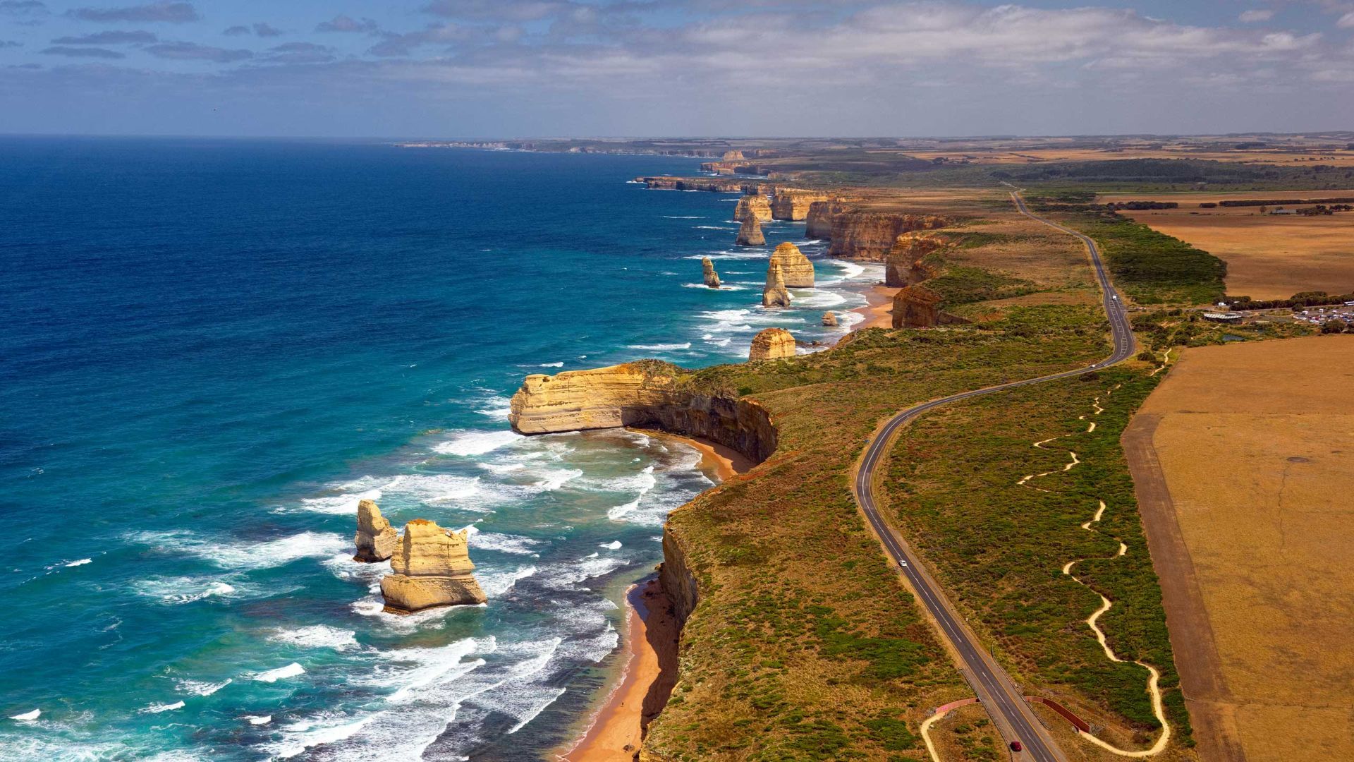
What distinguishes the route is its dramatic juxtaposition of surf, limestone geology and accessible townscapes. Photographers and road trippers prize the series of staged viewpoints where walking tracks descend to coves and panoramic platforms look out to offshore stacks. Beyond the famous stacks, the route offers fern gullies and waterfalls in the Otways, coastal walks to hidden beaches, and small towns where food and surf culture combine.
Many travelers craft multi-day itineraries that combine coastal hikes, wildlife spotting and culinary stops, from coffee in Torquay to seafood in Apollo Bay and heritage-listed lookouts around Port Campbell. The road’s memorial origins also allow visitors to reflect on the engineering feat and the region’s social history while enjoying one of Australia’s most scenic drives.
Discover more hidden gems you might love.
Neuquén
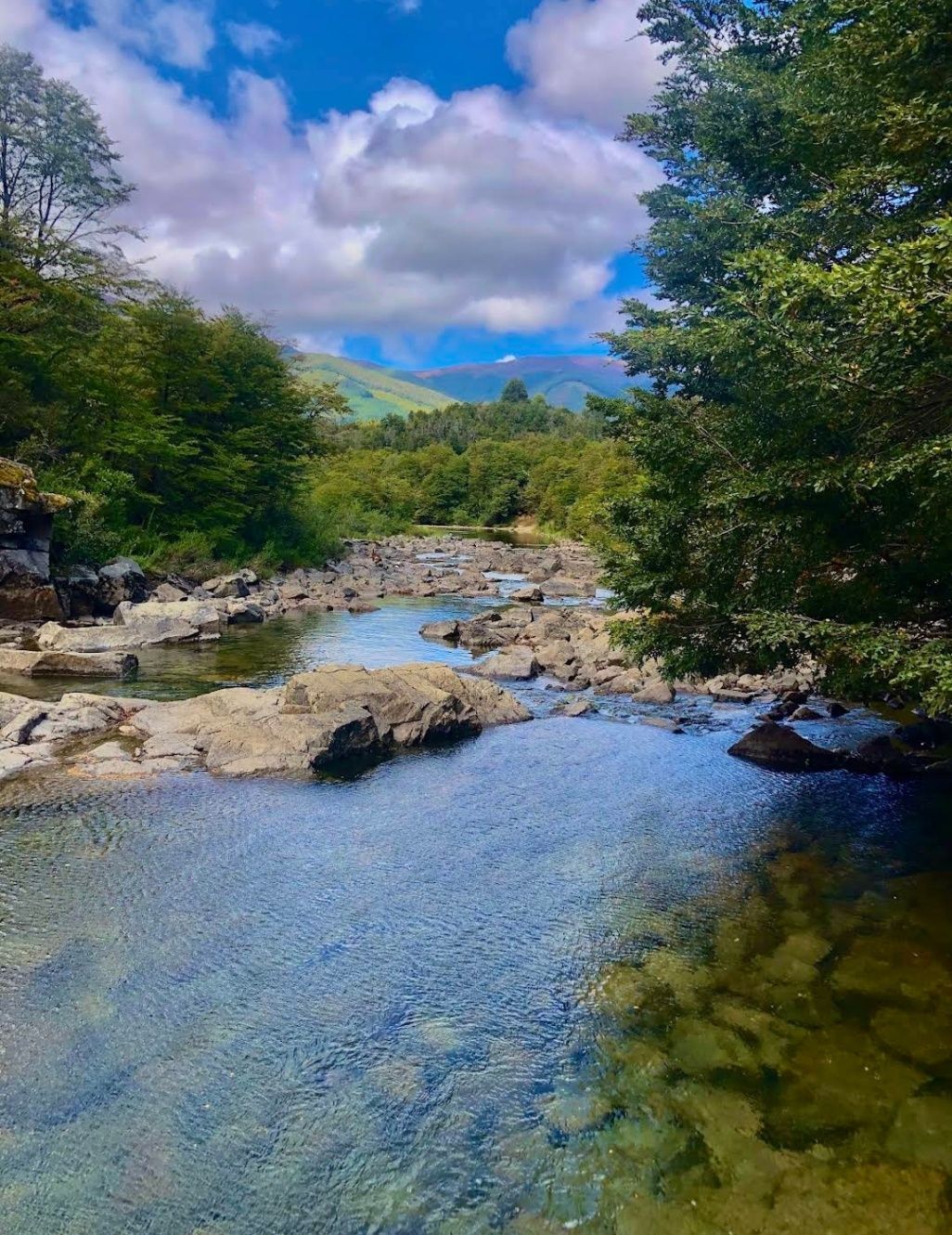
## Description Nestled within the heart of Argentina’s Patagonia, **Cascadas del Río Hermoso** is a breathtaking natural wonder that captivates visitors with its unspoiled beauty. The waterfalls are part of the Río Hermoso, which translates to “Beautiful River,” and the name is no exaggeration. Surrounded by dense forests, clear mountain air, and the soothing sound of rushing water, this destination offers a perfect blend of serenity and adventure. What makes Cascadas del Río Hermoso unique is not only its picturesque setting but also its relative tranquility compared to more popular sites like Iguazú Falls. Here, you won’t find large crowds or bustling tourist infrastructure—just raw, pristine nature. The waterfalls are small to medium in size, cascading down in multiple tiers, forming natural pools that invite visitors to rest and reflect. A little-known fact is that the river is fed by meltwater from the Andes, meaning that the water levels and flow change significantly with the seasons. Another detail often overlooked is the region’s rich biodiversity: the surrounding forests are home to species such as the Patagonian woodpecker and the elusive pudú, one of the world’s smallest deer. For nature enthusiasts, Cascadas del Río Hermoso is a rare opportunity to encounter untouched ecosystems. ## Location Cascadas del Río Hermoso is located in **Argentina, in the Neuquén Province of northern Patagonia**, within the boundaries of **Lanín National Park**. The closest town is **San Martín de los Andes**, a charming Patagonian village known for its alpine-style architecture, lakes, and outdoor activities. To get there, travelers usually fly into Aviador Carlos Campos Airport, just 20 km from San Martín de los Andes. From the town, the waterfalls can be reached by car via **Ruta Nacional 40** and then **Ruta Provincial 63**, which winds through stunning Andean landscapes. The trip itself is a highlight, with panoramic views of lakes, mountains, and valleys. Renting a car is highly recommended, as it allows for flexible stops at scenic viewpoints along the way. ## Tips * **Best Time to Visit**: Late spring to early autumn (November to March) offers the best weather and water flow. Winter can be beautiful too but access may be more difficult due to snow. * **What to Bring**: Comfortable hiking shoes, layered clothing (Patagonia weather is unpredictable), water, snacks, and a camera. * **Respect Nature**: Since this is a less-visited area, maintaining its pristine condition is important. Avoid leaving trash and stick to marked trails. * **Combine Your Trip**: Consider combining your visit with nearby attractions like Lake Lácar, Chapelco ski resort, or even the famous Seven Lakes Route. * **Local Guides**: Hiring a local guide can enrich your experience with stories about the region’s history, culture, and flora and fauna. ## Conclusion Cascadas del Río Hermoso is a tranquil, hidden treasure in Argentina’s Patagonia, offering visitors a rare chance to connect with untouched nature. Surrounded by forests, wildlife, and the pure waters of the Andes, it’s a destination that rewards travelers seeking peace, adventure, and authenticity. ## FAQ **1. How difficult is the hike to Cascadas del Río Hermoso?** The hike is considered easy to moderate. Most trails are well-marked and accessible, making it suitable for families and casual hikers. **2. Is swimming allowed in the river or waterfalls?** Yes, swimming is possible in some of the natural pools, especially during the summer months, though the water can be very cold due to glacial origins. **3. Are there entrance fees?** Since Cascadas del Río Hermoso is part of Lanín National Park, a small entrance fee may apply, depending on the season and visitor category. **4. Can I visit Cascadas del Río Hermoso year-round?** Yes, but accessibility varies. Summer and spring are ideal, while winter may present challenges due to snow-covered roads. **5. Are there facilities near the waterfalls?** Facilities are limited. Visitors should bring their own supplies, although San Martín de los Andes has plenty of options for food, lodging, and equipment rentals. ## Links * [Neuquén Province Tourism](https://www.argentina.travel/en/province/neuquen)
GemVoyage Team • World
Venice
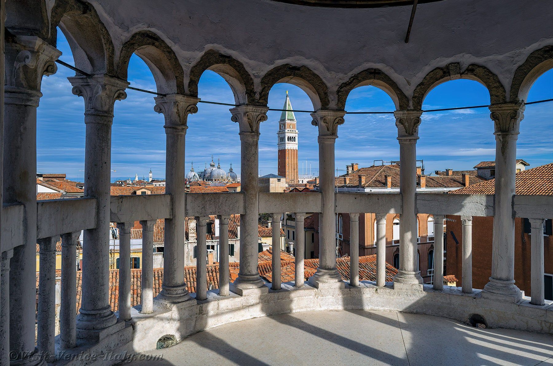
## Description Scala Contarini del Bovolo is one of those Venice attractions that feels almost secret, even though it has become increasingly known among travelers who enjoy architecture and quieter city experiences. Its fame comes from the extraordinary spiral staircase wrapped around the exterior of the building, rising like a stone shell above the narrow streets of the city. The staircase is the defining image, but the true appeal is the way it combines elegance, surprise, and Venetian craftsmanship in one compact site. The word “bovolo” refers to a snail shell in Venetian dialect, and that name makes perfect sense once you stand in front of the structure. The staircase coils upward in a graceful helix, creating one of the most photogenic details in all of Venice. Unlike the grand tourist corridors around St. Mark’s Square and the Rialto Bridge, this attraction feels tucked away and intimate. That sense of discovery is part of what makes it special. You are not just seeing another palace exterior; you are encountering a design that rewards curiosity and close attention. Another reason the Scala Contarini del Bovolo matters is that it represents a different side of Venice. Many visitors come for canals and churches, but this site shows how the city’s private palaces could also be architectural statements. The stair tower itself is a visual bridge between medieval urban density and Renaissance taste for ornament and order. A lesser-known fact is that the staircase became famous not only because it is beautiful, but because it is unusual in a city where vertical, exterior stair structures are relatively rare compared with the canals and façades that usually dominate the skyline. The experience is best when you take your time. From outside, the staircase already looks distinctive, but going inside and climbing it gives you a more complete sense of the building’s scale and perspective. As you ascend, the geometry changes and the city reveals itself through narrow openings, which creates a memorable transition from enclosed courtyard space to elevated views. It is a small attraction, but one that lingers in memory because it feels like a compact lesson in Venetian design. ## Location Scala Contarini del Bovolo is in Venice, Italy, in the historic center not far from the San Marco area and within walking distance of key inner-city landmarks. Its position in the dense urban fabric of Venice means it is easy to overlook unless you are specifically looking for it, which is part of the charm. The simplest way to reach it is on foot from the San Marco or Rialto area. Venice’s pedestrian layout makes walking the natural choice, and the staircase is best approached as part of a wandering route through the city rather than as a stand-alone destination by vehicle. If you are arriving by vaporetto, get off at a nearby stop such as Rialto or San Marco and continue on foot using a map, because the final approach takes you through small streets and passages that are easier to navigate slowly. Because Venice can be crowded, it is worth planning this visit during a quieter part of the day. Early morning or later afternoon can make the approach more pleasant and give you better photos without too many people around the staircase itself. ## Tips Bring a charged phone or camera, because the staircase is one of those details that rewards multiple angles. A shot from below captures the full spiral, while higher viewpoints show the contrast between the tower and the surrounding rooftops. Wear comfortable shoes. The site is small, but the walk through Venice often adds up to more steps than expected. The surrounding streets are also easier to enjoy when you are not rushed. Allow the visit to be part of a larger walking day rather than an isolated stop. It pairs well with nearby palaces, squares, and canal crossings, and that combination makes the city feel more layered. If you are interested in architecture, this is one of the most worthwhile short visits in Venice because it delivers a strong visual identity without requiring a major time commitment. ## Conclusion Scala Contarini del Bovolo is a compact but unforgettable Venetian landmark, known for its elegant spiral staircase and hidden location. It is a perfect stop for travelers who enjoy distinctive architecture and the quieter side of Venice. ## FAQ **Why is the Scala Contarini del Bovolo famous?** It is best known for its exterior spiral staircase, one of the most unusual and photogenic architectural details in Venice. **How long does a visit take?** Usually not long. Many visitors spend around thirty to sixty minutes, depending on how much time they spend taking photos and enjoying the views. **Is it easy to find?** It can be a little tricky because it is tucked into Venice’s narrow streets, so navigation by map is useful. **Is it good for photography?** Yes. The staircase itself and the elevated views from the structure both make it a strong photo stop. **Should I book in advance?** It is wise to check current opening arrangements before visiting, especially during busy travel periods. ## Links - [Wikipedia](https://en.wikipedia.org/wiki/Scala_Contarini_del_Bovolo)
GemVoyage Team • World
Alexandria
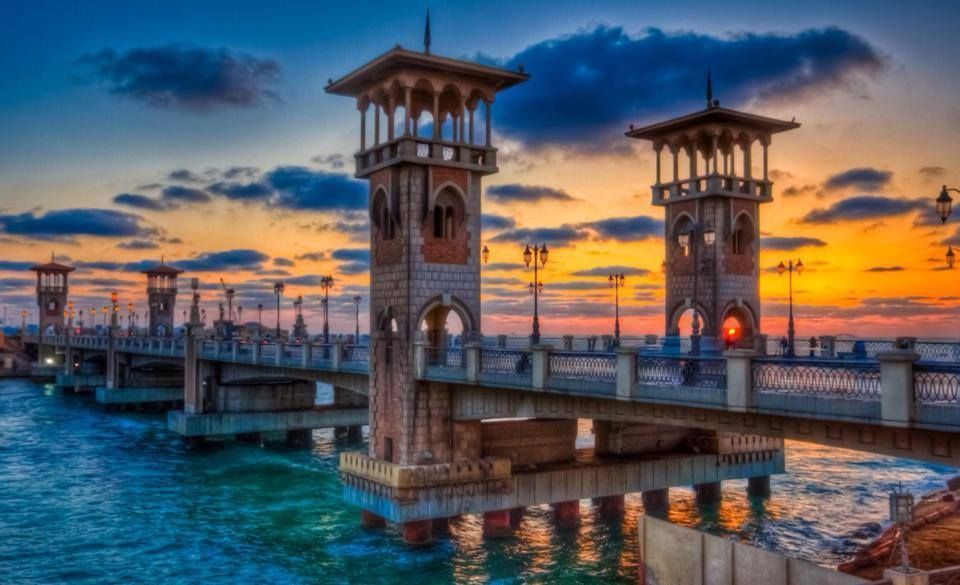
## Description The Stanley Bridge Corniche Walk is one of the most enjoyable ways to experience Alexandria’s seaside character because it brings together a famous city landmark and the broader rhythm of the Mediterranean waterfront. Stanley Bridge itself is a recognizable symbol of modern Alexandria, but what makes the area memorable is not only the bridge as an object. It is the surrounding promenade, the sea air, the movement of people, the views toward the coastline, and the way the corniche helps connect the city’s urban life with its maritime setting. For visitors, this is the kind of place that turns a simple walk into an experience of atmosphere. The bridge and the walkway around it are especially appealing because they capture Alexandria’s layered identity. The city has ancient roots, but much of its contemporary charm comes from places where residents and visitors mix along the water. A lesser-known fact is that the Stanley area is relatively modern compared with Alexandria’s ancient core, yet it has become one of the city’s most photographed and recognizable places because of its coastal setting and architectural profile. Another detail worth noticing is how the area changes across the day: morning brings a softer, more reflective mood, while evening often becomes livelier as people come out for a breezy promenade. For travelers, the walk is rewarding because it offers a sense of place without requiring a formal agenda. You can simply move along the corniche, stop for photos, watch traffic and waves, and enjoy the city unfolding in layers. The bridge frames the sea and the shoreline in a way that feels distinctly Alexandrian, and the surrounding area is often a pleasant place to pause, drink something cold, or continue toward nearby stretches of the waterfront. That flexibility is exactly why this walk belongs in an Alexandria itinerary. The best part may be how accessible it feels. You do not need special preparation to appreciate it. The waterfront itself does the work, offering changing light, open views, and a strong sense of local daily life. ## Location Stanley Bridge Corniche Walk is located in Alexandria, Egypt, along the city’s Mediterranean waterfront in the Stanley district. The walk sits on the Corniche, Alexandria’s main coastal boulevard, which makes it easy to locate and simple to fold into a broader day in the city. Because it is part of the public waterfront, the area is easy to approach and does not require special ticketing or entrance procedures. Getting there is usually easiest by taxi, rideshare, or local transport depending on where you are staying in Alexandria. Walking is ideal if you are already nearby, since the whole point of the experience is to enjoy the seafront at a human pace. If you are planning a longer sightseeing route, Stanley works well as a connecting point between central Alexandria and other coastal areas. The best way to enjoy it is to arrive with enough time to linger. A short pass-through is fine, but the waterfront rewards slowing down. Sunset is especially attractive for light and atmosphere, though morning can be calmer and better for a more relaxed walk. ## Tips Choose comfortable shoes, even though the route is simple. A pleasant walk often turns into a longer one than expected. Visit near sunset if you want the most dramatic light and the most social atmosphere. Do not focus only on the bridge itself. The surrounding corniche is what gives the experience its full value. Be aware of traffic and keep an eye on crossings. Like many urban waterfronts, the area is lively and active. Combine the walk with a café stop or a meal nearby so the outing feels complete rather than rushed. ## Conclusion The Stanley Bridge Corniche Walk is one of Alexandria’s most enjoyable low-effort experiences, blending sea views, city life, and a strong sense of place. It is ideal for travelers who want to feel the Mediterranean character of the city without needing a formal attraction schedule. ## FAQ ### Is the Stanley Bridge area good for tourists? Yes. It is one of Alexandria’s most scenic and accessible waterfront spots, with strong appeal for casual visitors and photographers. ### How long should I spend there? Anywhere from 30 minutes to 2 hours, depending on whether you are simply passing through or lingering for a walk and a meal. ### Is it better in the day or evening? Both work well. Daylight is good for seeing the sea clearly, while evening often feels more atmospheric and social. ### Do I need a ticket? No. The corniche is a public waterfront area, so the experience is generally open and walkable. ## Links - [Alexandria on Wikipedia](https://en.wikipedia.org/wiki/Alexandria)
GemVoyage Team • World
Dubysa
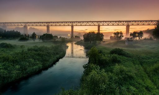
## Description Lyduvėnai Bridge is an arresting piece of nineteenth- and twentieth-century engineering that spans the deep, wooded Dubysa River valley near Lyduvėnai. Its soaring iron arches and lattice work combine functional railway engineering with a sculptural presence that is particularly striking when framed by the steep gorge below. Photographers, history enthusiasts and hikers are drawn to the site for the dramatic perspectives it creates—an industrial monument suspended over a wild, verdant canyon. Over time the bridge has required restorations and careful maintenance, and those interventions are part of its layered history. Local preservation efforts have sought to keep the bridge operational while respecting its historical materials and structure. The engineered spans and riveted ironwork tell a story about rail transport, regional development and the craft of steel construction. Beyond its technical merits, Lyduvėnai Bridge sits within a landscape of trails, viewpoints and small rural roads that allow visitors to explore the canyon from multiple angles. Birdsong and river sounds contrast with the bridge’s metallic lines, and seasonal changes—spring greens, autumn foliage—transform the setting dramatically, offering different moods for photographic study. ## Location Lyduvėnai Bridge is located near the village of Lyduvėnai in Raseiniai district municipality, Kaunas County, central-western Lithuania. It spans the Dubysa River in a steep, forested valley that is characteristic of the region’s mixed agricultural and wooded landscape. Access is most convenient by car: follow regional roads from Raseiniai and nearby towns. Public transport to the immediate vicinity is limited, so visitors relying on buses or trains should plan for a taxi or private transfer for the final leg. The rural setting rewards a slower pace—park at designated pullouts or village car parks and follow marked trails toward viewpoints. ## Tips - Photograph at golden hour—early morning or late afternoon—when light sculpts the ironwork and the valley takes on warm tones. - Never walk on active tracks; use official viewpoints and trails to keep a safe distance while still getting dramatic compositions. - Bring sturdy shoes and insect repellant for nearby trails; the area can be steep and overgrown in parts. - Combine the visit with local villages, riverside hikes and birdwatching; pack water and snacks as amenities are sparse. - Check local guidance on accessibility—some viewpoints require steep walks, while others are more level and family-friendly. ## Conclusion Lyduvėnai Bridge is an exemplar of how engineering and landscape can produce a site of compelling beauty. The bridge rewards visitors who slow down to observe structural detail, changing light and the interplay of human craft with natural settings. Whether you come for history, photography or a quiet day outdoors, the bridge and its surrounding valley offer memorable vistas and a distinct slice of regional heritage. ## FAQ Q: Can visitors walk across the bridge? A: No. For safety and legal reasons, do not walk on active railway tracks. Use the designated viewpoints and trails which provide safe vantage points. Q: Is the bridge accessible by car? A: Yes, but roads are rural and sometimes narrow—drive carefully and park only in designated areas or official pullouts. Q: Are there guided tours or information panels on site? A: Information is limited on-site; local heritage groups sometimes publish guides or online materials—check regional tourism resources for up-to-date information. Q: What wildlife might I see in the Dubysa valley? A: The valley supports woodland birds, small mammals and a range of plant life; spring and autumn are best for birdwatching and seasonal flora. Q: Is it possible to photograph the bridge from below? A: Some viewpoints near the riverside allow lower-angle shots, but access may be steep and require caution; respect private property and posted restrictions. ## Links - [Lyduvėnai Bridge](https://militaryheritagetourism.info/en/military/sites/view/800)
GemVoyage Team • World
Seoul
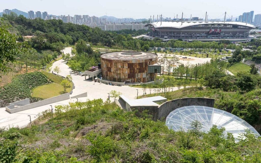
## Description Oil Tank Culture Park is an inventive urban redevelopment project that transforms obsolete oil storage tanks near Hapjeong into a layered cultural complex. The site is notable for its adaptive reuse approach: industrial silos and tanks were structurally preserved and repurposed as galleries, performance spaces, and community areas. The result is a tactile mix of heavy industrial surfaces and light-filled cultural rooms—an atmospheric contrast that frequently features in discussions about sustainable urban design and creative placemaking. Programming at the Oil Tank Culture Park combines curated exhibitions with community-driven activities. The large circular tanks are used for immersive installations and concerts; smaller adjacent spaces host workshops, film screenings, and local markets. The park’s outdoor terraces and green roofs provide vantage points for both the site itself and views across nearby neighborhoods, creating a sequence of experiences that shift between enclosed, resonant tanks and open, landscaped terraces. For visitors interested in architecture, industrial heritage, or contemporary culture, the site offers multiple points of fascination. Preservation choices—retaining the tanks’ raw metal texture, exposing concrete rings, and inserting slender circulation elements—make the site legible as both a former industrial hub and a cultural incubator. The park’s programming often foregrounds sustainability themes, community participation, and experimental performance formats. ## Location The Oil Tank Culture Park is located in Mapo-gu, Seoul, close to Hapjeong station and within walking distance of the World Cup Stadium area. It is well served by subway lines and local buses, and its signage makes it straightforward for international visitors to find. The park is frequently combined in itineraries with nearby Hongdae’s nightlife and Mangwon’s markets. ## Tips - Check the cultural calendar before visiting—special exhibitions and ticketed concerts are common and may require advance booking. - Wear comfortable shoes and expect varying surfaces: pathways range from concrete tank platforms to landscaped terraces. - Bring a light layer for rooftop areas and evening events—the wind can be brisk on exposed terraces. - Combine a visit with nearby Hongdae for dinner or an evening out; the area offers many small restaurants and cafés. - Respect installation boundaries and photography rules within exhibition spaces—some shows restrict flash or tripod use. ## Conclusion Oil Tank Culture Park is a striking example of how industrial heritage can be repurposed into vibrant public culture. It rewards visitors with a mix of dramatic industrial architecture, innovative programming, and a neighborhood-friendly atmosphere—ideal for architecture enthusiasts, cultural explorers, and people who enjoy offbeat urban sites. ## FAQ Q: Are events free? A: Some events and exhibitions are free to the public; larger performances, immersive shows, and special exhibitions may require tickets—check each event’s listing. Q: Is the site wheelchair accessible? A: The park includes ramps and accessible routes, though some older industrial areas may present challenges—contact the venue for detailed accessibility maps. Q: Can I photograph the tanks and installations? A: General photography is usually allowed in public spaces, but specific exhibitions may restrict photography—always check signage or ask staff. Q: Are there food and drink options on-site? A: Occasional pop-up vendors and nearby cafés supply food and drink during events; full-service restaurants are more common in surrounding neighborhoods. Q: Is there parking? A: On-site parking is limited; public transport is the recommended way to visit. ## Links - [Oil Tank Culture Park](https://www.theseoulguide.com/oil-tank-culture-park/)
GemVoyage Team • World
.jpg)
Scotland
## Description The Fairy Pools on the Isle of Skye in Scotland are a series of crystal-clear, aqua-blue pools and cascading waterfalls that tumble down from the foothills of the Black Cuillin mountains. These natural pools, fed by the Allt Coire a’ Mhadaidh stream, are renowned for their ethereal beauty and have become one of Skye’s most iconic and photographed attractions. Whether you're a hiker, wild swimmer, or simply a lover of dramatic landscapes, the Fairy Pools offer a magical experience that feels straight out of folklore. The walk to the pools is relatively short—about 2.4 kilometers round trip—and follows a well-maintained gravel path that winds through heather-covered moorland. Along the way, visitors encounter a series of waterfalls and pools, each more striking than the last. The water is so clear that you can see the rocky bottoms and reflections of the surrounding hills, making it a favorite spot for photographers and nature enthusiasts. A little-known fact: the area around the Fairy Pools was the site of the last and bloodiest clan battle in Scottish history—the Battle of Coire na Creiche in 1601 between the MacLeods of Dunvegan and the MacDonalds of Sleat. Legend has it that the stream ran red with blood, a stark contrast to its current tranquil appearance. Another quirky detail is that despite their name, there’s no historical association with fairies—the name “Fairy Pools” only began appearing in guidebooks in the 20th century. ## Location The Fairy Pools are located in **Scotland**, on the **Isle of Skye**, near the village of **Carbost** in the **Highland region**. They sit at the base of the Black Cuillin mountains in **Glen Brittle**, on the western side of the island. ### How to Get There - **By Car**: From Portree, the island’s main town, it’s about a 30-minute drive (20.5 miles) via the B8009 and Glenbrittle road. The route includes single-track roads with passing places. - **By Bus**: Public transport is limited. Buses run to Carbost, but you’ll need to arrange a taxi or walk from there. - **By Tour**: Several guided tours from Portree or Inverness include the Fairy Pools as part of a day trip. - **By Foot**: The walk to the pools begins at the Fairy Pools car park, located near Glenbrittle. From the car park, it’s a 20-minute walk to the first waterfall. ## Tips - **Visit Early or Late**: The site gets crowded during peak hours, especially in summer. Early morning or late afternoon offers better light and fewer visitors. - **Wear Waterproof Footwear**: The path can be muddy and uneven, especially after rain. - **Bring Layers**: Weather on Skye is unpredictable. Pack a waterproof jacket and warm clothing. - **Wild Swimming**: Brave souls can swim in the pools, but the water is icy year-round. A wetsuit is recommended. - **Respect Nature**: Follow the Scottish Outdoor Access Code—take your litter with you and stick to marked paths. - **Parking**: There is a charge for parking at the Fairy Pools car park, which helps maintain the site. ## Conclusion The Fairy Pools on the Isle of Skye are a breathtaking blend of natural beauty and Highland mystique. With their vivid waters, dramatic mountain backdrop, and rich history, they offer a memorable experience for anyone exploring Scotland’s rugged landscapes. ## FAQ **1. Is there an entrance fee to visit the Fairy Pools?** No, the pools are free to visit, but there is a charge for parking. **2. How long is the walk to the Fairy Pools?** The round-trip walk is approximately 2.4 kilometers and takes 40 minutes to 1.5 hours depending on pace and stops. **3. Can I swim in the Fairy Pools?** Yes, wild swimming is allowed, but the water is extremely cold. A wetsuit is recommended. **4. Are the Fairy Pools suitable for children?** Yes, but children should be supervised due to uneven terrain and cold water. **5. Is the site wheelchair accessible?** No, the terrain is rugged and includes steep inclines, making it unsuitable for wheelchairs. **6. What is the best time of year to visit?** Spring and autumn offer mild weather and fewer crowds. Summer is busiest, while winter can be icy and less accessible. ## Links - [Fairy Pools Walk – Isle of Skye Guide](https://www.isleofskye.com/skye-guide/top-ten-skye-walks/fairy-pools) - [Fairy Pools – VisitScotland Overview](https://www.visitscotland.com/info/see-do/fairy-pools-p1770011) - [Fairy Pools – Wikipedia Entry](https://en.wikipedia.org/wiki/Fairy_Pools) Description The Fairy Pools on the Isle of Skye in Scotland are a series of crystal-clear, aqua-blue pools and cascading waterfalls that tumble down from the foothills of the Black Cuillin mountains. These natural pools, fed by the Allt Coire a’ Mhadaidh stream, are renowned for their ethereal beauty and have become one of Skye’s most iconic and photographed attractions. Whether you're a hiker, wild swimmer, or simply a lover of dramatic landscapes, the Fairy Pools offer a magical experience that feels straight out of folklore. The walk to the pools is relatively short—about 2.4 kilometers round trip—and follows a well-maintained gravel path that winds through heather-covered moorland. Along the way, visitors encounter a series of waterfalls and pools, each more striking than the last. The water is so clear that you can see the rocky bottoms and reflections of the surrounding hills, making it a favorite spot for photographers and nature enthusiasts. A little-known fact: the area around the Fairy Pools was the site of the last and bloodiest clan battle in Scottish history—the Battle of Coire na Creiche in 1601 between the MacLeods of Dunvegan and the MacDonalds of Sleat. Legend has it that the stream ran red with blood, a stark contrast to its current tranquil appearance. Another quirky detail is that despite their name, there’s no historical association with fairies—the name “Fairy Pools” only began appearing in guidebooks in the 20th century. Location The Fairy Pools are located in Scotland, on the Isle of Skye, near the village of Carbost in the Highland region. They sit at the base of the Black Cuillin mountains in Glen Brittle, on the western side of the island. How to Get There By Car: From Portree, the island’s main town, it’s about a 30-minute drive (20.5 miles) via the B8009 and Glenbrittle road. The route includes single-track roads with passing places. By Bus: Public transport is limited. Buses run to Carbost, but you’ll need to arrange a taxi or walk from there. By Tour: Several guided tours from Portree or Inverness include the Fairy Pools as part of a day trip. By Foot: The walk to the pools begins at the Fairy Pools car park, located near Glenbrittle. From the car park, it’s a 20-minute walk to the first waterfall. Tips Visit Early or Late: The site gets crowded during peak hours, especially in summer. Early morning or late afternoon offers better light and fewer visitors. Wear Waterproof Footwear: The path can be muddy and uneven, especially after rain. Bring Layers: Weather on Skye is unpredictable. Pack a waterproof jacket and warm clothing. Wild Swimming: Brave souls can swim in the pools, but the water is icy year-round. A wetsuit is recommended. Respect Nature: Follow the Scottish Outdoor Access Code—take your litter with you and stick to marked paths. Parking: There is a charge for parking at the Fairy Pools car park, which helps maintain the site. Conclusion The Fairy Pools on the Isle of Skye are a breathtaking blend of natural beauty and Highland mystique. With their vivid waters, dramatic mountain backdrop, and rich history, they offer a memorable experience for anyone exploring Scotland’s rugged landscapes. FAQ 1. Is there an entrance fee to visit the Fairy Pools? No, the pools are free to visit, but there is a charge for parking. 2. How long is the walk to the Fairy Pools? The round-trip walk is approximately 2.4 kilometers and takes 40 minutes to 1.5 hours depending on pace and stops. 3. Can I swim in the Fairy Pools? Yes, wild swimming is allowed, but the water is extremely cold. A wetsuit is recommended. 4. Are the Fairy Pools suitable for children? Yes, but children should be supervised due to uneven terrain and cold water. 5. Is the site wheelchair accessible? No, the terrain is rugged and includes steep inclines, making it unsuitable for wheelchairs. 6. What is the best time of year to visit? Spring and autumn offer mild weather and fewer crowds. Summer is busiest, while winter can be icy and less accessible. Links Fairy Pools Walk – Isle of Skye Guide Fairy Pools – VisitScotland Overview Fairy Pools – Wikipedia Entry 715 words37 lines4484 characters4520 bytes
GemVoyage Team • World

Comments