GemVoyage Team • World
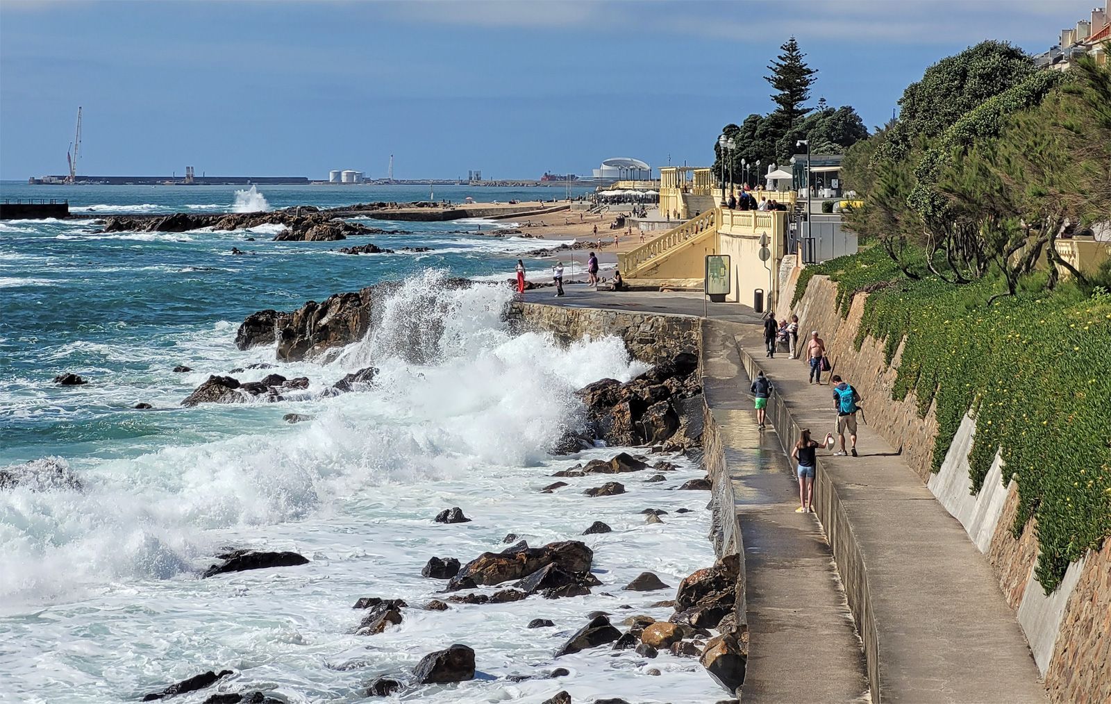
The promenade is special because it lets you experience the transition from river to sea in a very direct way. The Douro's strong identity as a working river, a wine route, and an urban boundary becomes visible here, where the city meets larger natural forces. Walking the promenade, you can watch waves strike the seawall, see locals out for exercise or family time, and move between beaches, lighthouses, and garden spaces. It is one of those urban landscapes that works equally well for slow contemplation and active strolling.
One little-known fact is that Foz has long been associated with leisure and summer life among Porto residents, especially as the city expanded and more people began seeking breezy coastal escapes close to home. Another detail many visitors miss is the extent to which the area changes mood with the weather. On a clear day, Foz feels luminous and expansive; on a windy day, it becomes dramatic and powerful. The promenade is therefore not just a route but an experience shaped by the Atlantic itself.
The area also reveals a lot about Porto's identity. The city is often celebrated for its historic center and wine cellars, but Foz shows a different and equally important side: a living, modern waterfront where people come to walk, cycle, talk, and watch the sea. If you want a place in Porto that combines fresh air, urban life, and landscape, this is one of the best choices.
One of the easiest ways to get there is by bus or tram, especially if you want to enjoy the trip without worrying about parking. Walking from the riverfront is possible and rewarding if you have a full day, but most visitors will prefer a shorter transfer followed by a long, leisurely walk along the coast. The route can be combined with stops at beaches, gardens, and small cafés along the way.
For orientation, think of the promenade as a westward extension of Porto's river story. It is a place to end the day, not just begin it, because sunset and late afternoon light are especially beautiful here.
Bring a light jacket even in warm weather. The Atlantic can cool the air quickly, especially near evening, and visitors often underestimate how different the climate feels compared with Porto's inland streets.
If you enjoy a slower pace, start near the river mouth and walk toward the beaches and garden areas. That direction helps you experience the transition from urban river edge to open sea more naturally.
Use the promenade as a break from sightseeing density. Porto's historic center can feel packed with monuments and steep lanes, while Foz offers breathing room and a chance to enjoy the city in a more relaxed frame.
Discover more hidden gems you might love.
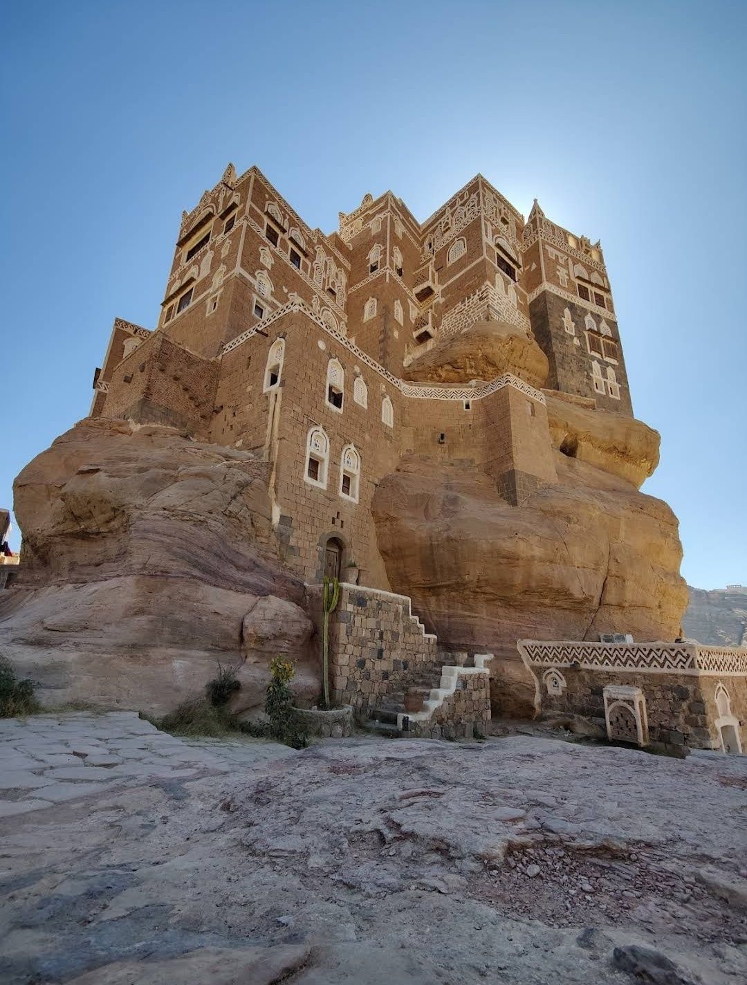
Sanaa
## Description The Stone House in Sanaa is one of the most fascinating architectural wonders in Yemen’s capital. Built entirely from stone, this house reflects the deep-rooted traditions of Yemeni architecture, where natural materials, geometric patterns, and delicate carvings come together in harmony. What makes the Stone House truly unique is its ability to blend strength with elegance—its towering façade is decorated with white gypsum frames and intricate motifs that give it an almost fairy-tale appearance. Unlike many modern buildings, the Stone House is more than just a residence; it represents centuries of history and cultural identity. One little-known fact about this landmark is that it was designed to adapt to the city’s climate: thick stone walls keep the house cool during Yemen’s hot summers and warm during the chilly winter nights. Another fascinating detail is that the windows are often covered with **qamarīyah** (colored stained glass), which not only filters light beautifully but also symbolizes prosperity and protection in Yemeni tradition. ## Location The Stone House is located in **Sanaa**, the capital city of **Yemen**, within the region known as **Old Sanaa**. This UNESCO World Heritage Site is famous for its maze-like alleys, traditional markets (souqs), and iconic high-rise houses made of stone and mud brick. The Stone House is nestled among these historic buildings, making it an essential stop for anyone exploring the old city. To reach Sanaa, international visitors usually arrive via **Sanaa International Airport**. From there, a short drive will take you to Old Sanaa, where most attractions—including the Stone House—are within walking distance. If you are already in the city, taxis are the most convenient way to get there, as public transportation can be limited and sometimes confusing for first-time travelers. ## Tips for Visitors Visiting the Stone House can be an unforgettable experience if you plan properly. Here are some essential tips: * **Best Time to Visit**: The ideal time to explore Sanaa is during the cooler months (October to March), when the weather is more pleasant for walking around the old city. * **Respect Local Culture**: Yemen is a conservative country, so visitors should dress modestly. Women may want to cover their hair with a scarf when entering traditional neighborhoods. * **Hire a Local Guide**: A guide can explain the hidden meanings behind the architecture and help you discover details you might otherwise miss. * **Photography Etiquette**: Always ask before photographing people, especially in residential areas. However, the buildings themselves are a photographer’s dream, so bring a good camera. * **Stay Safe**: Due to Yemen’s political situation, travelers should always check current travel advisories before planning a visit and consider traveling with a trusted tour operator. ## Conclusion The Stone House in Sanaa is more than just an old building—it’s a living symbol of Yemeni history, culture, and artistry. Its unique stone architecture, stained glass windows, and cultural significance make it a must-see destination for travelers interested in heritage and history. Nestled in the heart of Old Sanaa, it offers an authentic glimpse into one of the world’s most remarkable historic cities. ## Frequently Asked Questions (FAQ) **1. What is the Stone House in Sanaa?** The Stone House is a traditional Yemeni building in Old Sanaa, made primarily of stone and decorated with gypsum and stained glass windows. **2. Why is the Stone House important?** It represents Yemeni architectural heritage and showcases how traditional designs were adapted to both climate and culture. **3. Can tourists visit the Stone House?** Yes, visitors can explore it along with other landmarks in Old Sanaa, though it is best to check travel advisories before planning a trip. **4. How old is the Stone House?** While the exact date of construction varies depending on the specific house, most traditional stone houses in Sanaa date back several centuries. **5. Is photography allowed inside the Stone House?** Photography of the building is usually allowed, but always be respectful and ask for permission if entering private areas. **6. How can I reach the Stone House from the airport?** From Sanaa International Airport, it’s about a 30-minute drive to Old Sanaa. Taxis are the most convenient way to get there. ## Useful Links * [UNESCO World Heritage – Old City of Sanaa](https://whc.unesco.org/en/list/385/)
GemVoyage Team • World

Nordland County
## Description The Lofoten archipelago in northern Norway is known for dramatic mountains rising directly from the sea, sheltered bays dotted with red rorbuer (fishermen’s cabins), and a culture shaped by the cod-fishing season. The islands’ jagged peaks, sheltered fjords and clear northern light create a playground for photographers, hikers and sailors. In summer the midnight sun bathes the landscape in continuous soft light; in winter the aurora borealis weaves curtains above snow-dusted fjords. Lofoten’s distinctiveness lies in the proximity of ocean and mountain: trails often ascend steep ridges that drop into crystal-clear water, and small fishing villages serve as intimate bases for outdoor activities. A lesser-known feature: the islands host significant seabird colonies and seasonal fisheries that have influenced local cuisine and traditions for centuries. Lofoten is not only a visual spectacle but also a destination that rewards slow travel and careful planning. The archipelago's human scale — low-lying villages, narrow winding roads and tiny harbors — means that experiences are tactile and immediate: you can start your day with fresh cod straight from a quay, follow a narrow trail to a windswept summit by afternoon, and end it watching the sea change color as the light shifts. For photographers and naturalists the islands offer a year-round curriculum: in spring and early summer, migrant birds and seals become active along the coastline; in high summer the midnight sun extends golden-hour conditions for long landscape sessions; in autumn the first snows highlight ridgelines and create vivid contrasts; and in winter the long nights are ideal for aurora hunting, provided the skies are clear and weather windows allow. Trail conditions vary widely: some classic hikes like Reinebringen and Kvalvika require stout footwear and a head for exposure, while many coastal walks are family-friendly and can be combined with ferry hops and short drives. Sea-based activities are equally compelling — kayaking through sheltered fjords, joining local fishing trips, or chartering a boat for wildlife watching. Local cultural experiences add texture: museums documenting the seasonal cod fisheries, small artisan shops selling wool and salt-dried fish, and community-run cafés where fishermen swap stories. Food culture in Lofoten remains rooted in the sea; besides stockfish and cod, you’ll encounter local sheep cheeses, cloudberry desserts and a surprisingly well-developed craft-beer scene in a few towns. Practicalities matter in Lofoten. Roads are scenic but narrow, and in winter they can be affected by snow and wind; a flexible itinerary is wise. While many visitors cluster in Reine and Svolvær, quieter pockets such as Henningsvær, Nusfjord and Vinstad reward those who linger. Conservation-minded travel is important: stay on marked trails, respect nesting birds (especially during spring), and support locally owned businesses. Small details like packing waterproof layers, carrying a reliable map or GPS, and learning a few Norwegian phrases will enhance safety and interpersonal encounters. Taken together, these elements make Lofoten an unforgettable destination where dramatic geology, maritime culture and luminous Arctic light combine into a deeply memorable travel experience. ## Location Lofoten lies within Nordland county, above the Arctic Circle, accessible by ferry, road and regional flights from Bodø and Harstad/Narvik airports. The main islands (Austvågøya, Vestvågøya, Flakstadøya and Moskenesøya) are linked by scenic roads and tunnels. The islands are most commonly reached via the E10 highway, which threads the archipelago and connects ferries and causeways. Travelers flying in usually connect through Bodø, which provides ferry and road links, or land at Evenes (near Harstad/Narvik) then drive west. Several regional ferries link the mainland with islands and provide excellent photo opportunities; during summer months additional tourist ferry routes and charter options operate between hotspots like Reine and Svolvær. Car rental is widely available in nearby towns and airports, but public transport is a viable option for those who prefer not to drive, with buses and select ferries serving the larger settlements. ## Tips - **Respect weather windows:** Mountain weather changes rapidly; check local forecasts and prepare with layers and navigation tools. - **Book rorbuer early in summer:** Traditional cabins are popular in high season; reserve in advance. - **Try cod-based cuisine:** Experience local dishes tied to the seasonal stockfish tradition. - **Plan photographic routes:** Sunrise, sunset, and aurora times are key for planning shots; local guides help find hidden vantage points. - **Pack for microclimates:** Conditions can vary from wind-blasted summits to calm fjord inlets in short distances; waterproof outer layers and thermal mid-layers are essential. - **Mind daylight hours:** In summer you can shoot at midnight; in winter plan activities around shorter daylight but prime aurora hours. - **Respect wildlife and nesting areas:** Keep distance from seabird colonies and seal haul-outs to avoid disturbance. - **Rent responsibly or use local guides:** Boat, kayak and fishing charters offer deeper access; choose operators with good safety and sustainability records. - **Bring cash for small purchases:** While cards are widely accepted, some small cafés and stalls may prefer cash in remote villages. ## Conclusion Lofoten combines raw Arctic scenery with a resilient maritime culture, offering dramatic outdoor adventures and timeless coastal charm. Whether you come for the light, the mountains, or the cultural textures of fishing villages, Lofoten rewards curiosity and careful pacing. The islands invite both active exploration and quiet observation — a place to test your kit on rugged trails or simply watch tides and light shift over a year of weathered harbor wood. For travelers prioritizing sustainable, small-scale tourism, Lofoten offers a rich palette of experiences that connect landscape, livelihood and seasonal rhythms. ## FAQ - **Q: When is the best time to visit?** - A: Summer for midnight sun and hiking; winter for northern lights and dramatic snow landscapes. - **Q: Are there guided activities?** - A: Yes — kayaking, hiking, fishing tours and wildlife excursions are widely available. - **Q: Do I need a car to enjoy Lofoten?** - A: A car gives flexibility for reaching remote viewpoints and dispersed villages; however, during summer a combination of buses, ferries and guided tours can cover many highlights without driving. - **Q: How do I plan for aurora viewing?** - A: Check local aurora forecasts and cloud cover, pick dark sites away from town lights, and be patient — clear sky windows are unpredictable. Local guides can increase success rates and handle safety in cold conditions. - **Q: Are trails family-friendly?** - A: Many shoreline walks and lowland trails are suitable for families; some iconic ridgeline hikes are steep and exposed and require good footwear and experience. - **Q: How should I handle food and provisioning?** - A: Larger towns have supermarkets and restaurants; in smaller villages, stockfish shops, local bakeries and seasonal markets offer regional specialties — plan ahead for long drives between services in peak season. ## Links - [Lofoten — Wikipedia](https://en.wikipedia.org/wiki/Lofoten)
GemVoyage Team • World
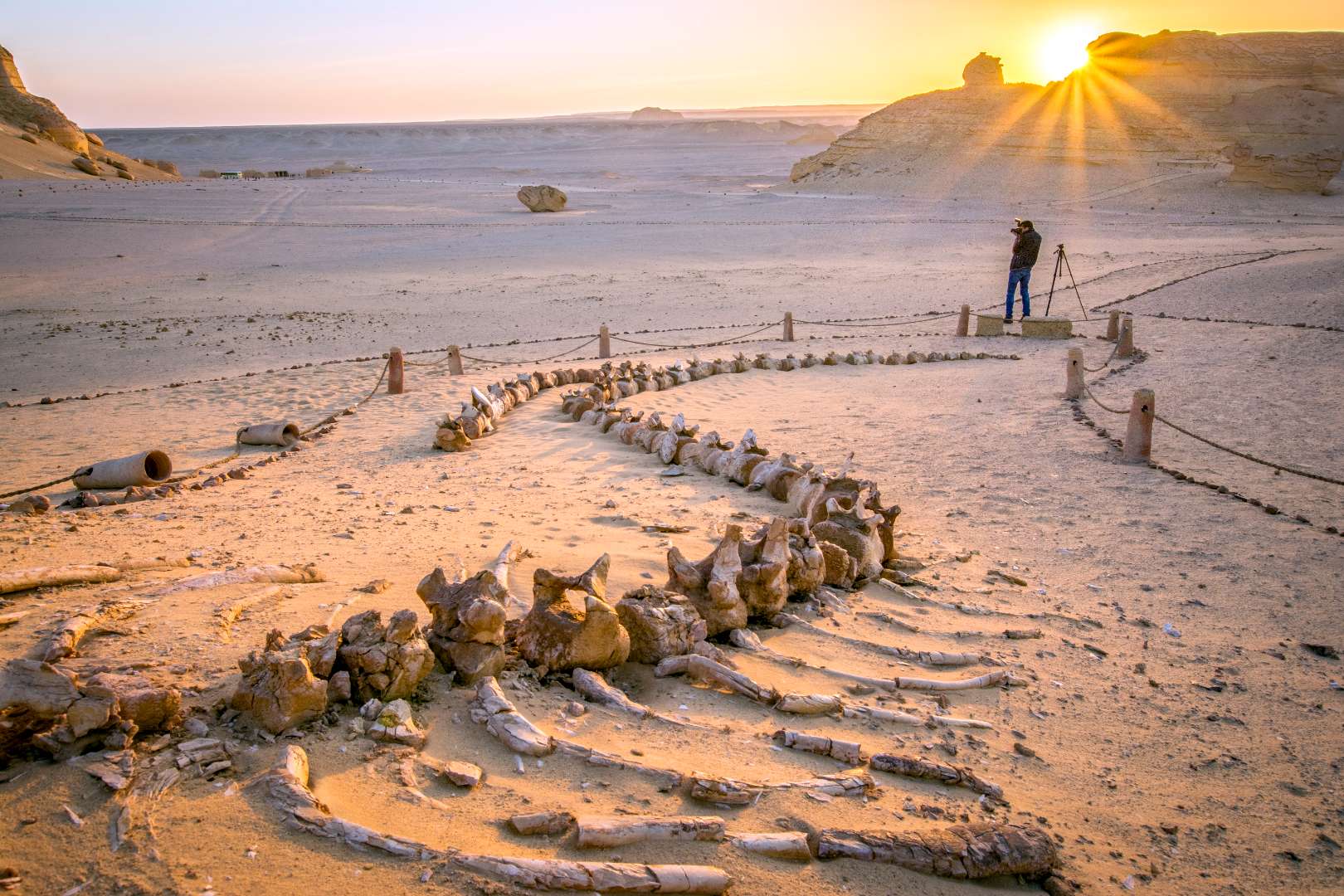
Egypt
## Description The Valley of the Whales, known locally as Wadi Al-Hitan, is one of Egypt’s most extraordinary and scientifically significant natural sites. Located deep in the Western Desert, this UNESCO World Heritage Site offers a rare glimpse into the evolutionary history of whales. What makes Wadi Al-Hitan truly unique is its collection of fossilized remains of early whale species—particularly the now-extinct Archaeoceti—that vividly illustrate the transition of whales from land-dwelling mammals to fully aquatic creatures. The site contains hundreds of fossils, including complete skeletons, some of which still retain vestigial hind limbs, feet, and toes—features that modern whales no longer possess. These fossils date back approximately 40 million years and are remarkably well-preserved, with some even showing stomach contents. The surrounding desert landscape, sculpted by wind and time, adds to the surreal experience, with rock formations resembling alien sculptures and ancient seabeds. A little-known fact: the first whale fossils in Wadi Al-Hitan were discovered in the early 1900s, but the site remained largely unexplored until the 1980s when improved access and growing scientific interest led to its preservation. Another fascinating detail is that the area also contains fossils of other marine life, including sharks, rays, and sawfish, helping researchers reconstruct the ancient ecosystem of the Tethys Sea. ## Location Wadi Al-Hitan is located in **Egypt**, within the **Faiyum Governorate**, approximately 150 kilometers southwest of **Cairo**. It lies within the Wadi El-Rayan Protected Area, a vast desert reserve known for its sand dunes, lakes, and biodiversity. ### How to Get There - **By Car**: The most practical way to reach Wadi Al-Hitan is by private vehicle or organized tour. From Cairo, the drive takes about 2.5 to 3 hours. A 4x4 vehicle is recommended due to the unpaved desert roads leading to the site. - **By Tour**: Several eco-tourism operators offer guided day trips from Cairo or Faiyum, often including stops at Wadi El-Rayan and the Magic Lake. - **By Public Transport**: Public transport is not available directly to the site. Visitors must arrange private transport from Faiyum city. Due to its remote location, planning ahead is essential, and traveling with a guide is highly recommended. ## Tips - **Visit in Cooler Months**: The best time to visit is between October and April when temperatures are milder. - **Bring Essentials**: Pack water, snacks, sunscreen, and a hat. There are limited facilities at the site. - **Wear Sturdy Shoes**: The terrain is sandy and uneven, so comfortable walking shoes are a must. - **Respect the Fossils**: Do not touch or remove any fossils. The site is protected, and preservation is crucial. - **Explore the Museum**: The Fossil and Climate Change Museum at the entrance offers interactive exhibits and context for the fossils you’ll see. - **Combine with Nearby Attractions**: Pair your visit with Wadi El-Rayan’s waterfalls and lakes for a full desert adventure. ## Conclusion Wadi Al-Hitan is a captivating destination that blends natural beauty with scientific wonder. Its fossil-rich landscape tells a story millions of years old, making it one of the most important paleontological sites in the world and a must-visit for anyone intrigued by Earth’s evolutionary history. ## FAQ **1. Is there an entrance fee to Wadi Al-Hitan?** Yes, there is a small entrance fee, which may vary depending on whether you’re visiting with a guide or tour group. **2. Can I visit Wadi Al-Hitan without a guide?** While possible, it’s highly recommended to go with a guide due to the remote location and lack of signage. **3. Are there accommodations nearby?** There are eco-lodges and campsites in the Wadi El-Rayan area, but most visitors stay in Faiyum or return to Cairo. **4. Is the site suitable for children?** Yes, children can enjoy the site, especially the museum, but supervision is necessary due to the terrain and fragile fossils. **5. How long should I plan for the visit?** A typical visit lasts 2–3 hours, not including travel time. Full-day trips from Cairo are common. **6. Is photography allowed?** Yes, photography is permitted, but drones may require special permission. ## Links - [Wadi Al-Hitan – UNESCO World Heritage Centre](https://whc.unesco.org/en/list/1186) - [Wadi Al-Hitan Overview – Wikipedia](https://en.wikipedia.org/wiki/Wadi_al_Hitan)
GemVoyage Team • World
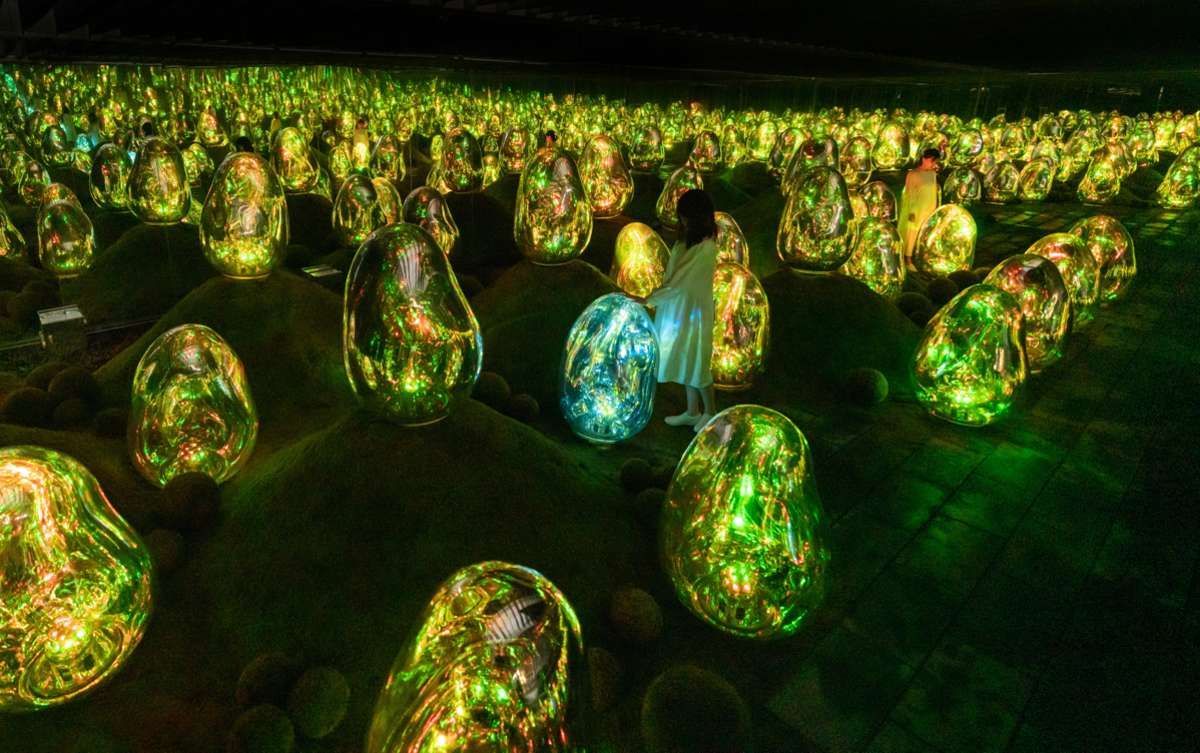
Tokyo
## Description teamLab Planets is a landmark example of immersive, participatory art in Tokyo that invites visitors to become active participants in dynamic digital environments. The experience is designed around large-scale rooms where light, projection, sound, and water interact to create continuously shifting installations. Unlike a typical gallery, the works at teamLab Planets are spatial and experiential: you walk through, touch, and sometimes wade in shallow water as the piece responds to human presence. This approach produces emotional and sensory responses that vary significantly with crowd size, time of day, and individual movement. The attraction is notable not only for its technical sophistication but also for its curatorial intent: works are arranged to produce an arc of changing perception, where early rooms prepare your senses for the more intense, multisensory environments that follow. Crowd dynamics shape the experience—quiet moments make installations feel meditative, while busier times can add a social energy that changes how the pieces read. teamLab Planets is often recommended for both art-savvy travelers and curious visitors who enjoy novel, interactive experiences. From an SEO point of view, teamLab Planets draws queries such as “teamLab Planets tickets,” “how to visit teamLab Tokyo,” and “immersive art Tokyo.” Useful content for travelers mixes logistical details (ticket booking, arrival windows, age and accessibility considerations) with sensory descriptions that help set expectations for immersion, photo opportunities, and comfort. ## Location teamLab Planets is located in the Toyosu area of Tokyo, a modern district that is well served by public transit. The nearest stations are on the Yurikamome and Yurakucho lines, making the site accessible from central Tokyo neighborhoods. Because visits are ticketed by time slot, it’s efficient to plan surrounding activities nearby—Toyosu Market, waterfront walkways, or a leisurely neighborhood meal—so you’re not rushed before or after the exhibition. Booking ahead is practical and often necessary: popular time slots sell out, and the museum manages visitor flow to preserve the immersive environment. Arrive a little early for your slot, take time to read basic venue rules, and factor in a post-visit window to decompress and reflect on what you’ve seen. ## Tips - Book tickets in advance for specific time slots to avoid sold-out sessions and to help ensure a smoother experience. - Wear comfortable, quick-drying footwear if you expect to use areas with water; some installations ask visitors to remove shoes before entering wet spaces. - Keep valuables protected—immersive rooms can be dim or reflective, and a stable grip on cameras or phones is useful. - Consider visiting on a weekday or off-peak hour for a more contemplative visit; peak evenings and weekends can be busier. - Follow staff guidance in each room—safety and the integrity of the artworks depend on visitor cooperation. - Balance photography with presence: the installations reward quiet observation as much as visual documentation. ## Conclusion teamLab Planets demonstrates how technology and art can create environments that transform a visitor into an active perceiver. The result is a memorable, emotionally resonant visit that’s best prepared for with advance planning, comfortable attire, and a willingness to let the work alter your movement and expectations. ## FAQ ### Is teamLab Planets suitable for people who do not usually go to museums? Yes. Its sensory, movement-based installations are accessible to a broad audience—no prior art knowledge is required, just curiosity and an openness to engaging physically with the space. ### How long does a visit usually take? Most visits last between one and two hours, although time can vary depending on crowd size and how long you linger in each room. ### Do I need to buy tickets in advance? Yes—advance booking is strongly recommended because sessions sell out and visitor numbers are controlled to maintain the immersive quality. ### Are there water installations where I need to remove shoes? Some rooms involve shallow water or wet surfaces; venue rules will instruct you when to remove shoes and how to protect small electronics. ### Is teamLab Planets family-friendly? Generally yes—children are often enchanted by the interactive environments, but be mindful of younger children in darker or reflective rooms and check age suitability for specific installations. ## Links - [Official website](https://www.teamlab.art/e/planets/)
GemVoyage Team • World
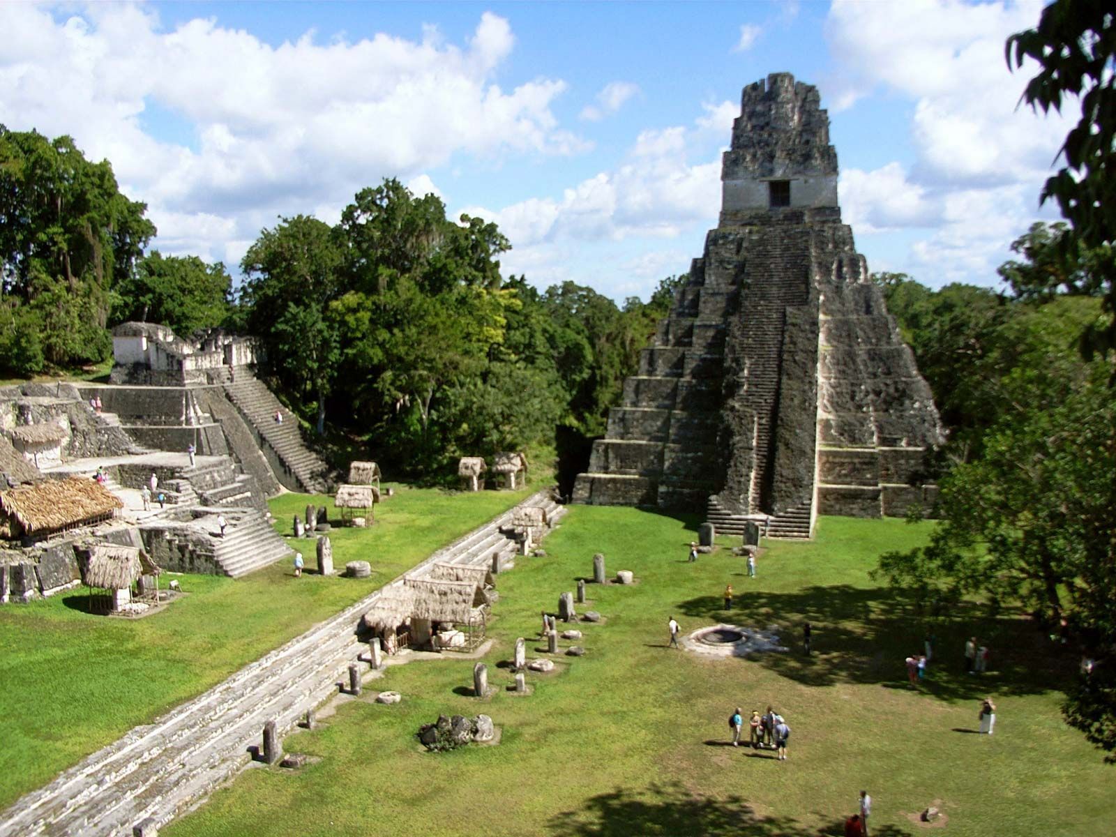
Petén
## Description Tikal is one of the most important archaeological sites of the ancient Maya civilization, located within the dense lowland rainforests of Petén, Guatemala. The city’s towering limestone pyramids and plazas emerge above the jungle canopy, offering dramatic skyline views and a palpable sense of antiquity. During its Classic period, Tikal was a major political and ceremonial center; excavated palaces, stelae and ballcourts tell stories of dynasties, calendrical knowledge and cosmology. Visitors to Tikal are rewarded by a blend of monumental architecture and biodiverse rainforest. The temples and palaces rise through the tree canopy, so that from the tops of several structures you can peer over treetops to see other pyramids peeking through the foliage. This interplay between built environment and ecology is central to Tikal’s power: the jungle both conceals and reveals the city, a dramatic reminder of centuries of abandonment and recovery. Tikal’s primary plaza, monumental ballcourts, and the iconic Temple IV and Temple II complexes preserve stelae with carved inscriptions, verifiable sequences of rulers and artistic programs that speak to the city’s political sophistication. Archaeological work also reveals complex water-management features, reservoirs and causeways that allowed the city to sustain a significant population despite a seasonal tropical climate. Walking among Tikal’s temples at sunrise — when the jungle stirs and howler monkeys call — is an evocative way to connect with a complex culture of architecture, ritual and astronomy. Early morning light transforms the stone into warm tones and dramatically silhouettes the temple profiles against the rising sun, making sunrise a photographer’s favorite. Guides can point out hieroglyphic inscriptions, sacred alignments and the role of celestial observation in Maya ritual life. ## Location Tikal National Park is in Guatemala’s northern Petén department. The site is reachable via a short flight to Flores (Mundo Maya International Airport, FLV) or by road from Flores town, which serves as the usual visitor base. Most visitors use Flores as a staging point and arrange shuttle transfers, guided tours, or independent day trips to the park. ## Tips - **Arrive at dawn for temples and wildlife:** Early mornings provide cooler light, bird activity and quieter conditions before larger tour groups arrive. Dawn visits also let you catch the moment when the jungle wakes up. - **Hire a knowledgeable guide:** Licensed local guides provide historical context, translate glyphs and explain how architecture relates to Maya cosmology — essential for getting more from the site. - **Bring insect repellent and sun protection:** The lowland rainforest environment includes biting insects and strong sunlight in exposed plazas. Lightweight long sleeves and repellent are useful. - **Plan logistics from Flores:** Book shuttle transfers or organized tours in advance during high season, and consider staying overnight near the site for sunset or sunrise experiences. - **Support responsible tourism:** Choose certified guides and operators that follow park rules and contribute to local community economies. ## Conclusion Tikal is both a monumental archaeological treasure and a living jungle experience: temples puncturing the canopy, dawn rituals and carved monuments make it an essential site for understanding Maya civilization. For travelers seeking a mix of natural soundscapes, wildlife encounters and a deep cultural history, Tikal offers an immersive and emotionally resonant experience. ## FAQ - **Q: How long should I spend at Tikal?** A: A full day is ideal to cover the main plazas, climb at least one temple for panoramic views, and explore the northern and central complexes. Two days allow for a slower pace, birding and visiting lesser-known complexes. - **Q: Can visitors climb the temples at Tikal?** A: Access to climbable areas varies — some temples allow limited ascent to designated viewpoints while others are closed to protect fragile structures. Follow current park rules and signage. - **Q: What wildlife might I see at Tikal?** A: Expect to see howler monkeys, toucans, parrots, motmots and a range of tropical birds; early morning is best for birdwatching and animal activity. - **Q: Is it safe for solo travelers and families?** A: The site is generally safe during daylight hours. Follow standard travel precautions: use licensed guides, secure belongings, carry water and avoid isolated areas after dark. - **Q: Are there accommodations near the park?**n+ A: Flores and nearby villages offer a range of lodgings from budget hostels to mid-range hotels; staying in Flores provides easy access to flights and transportation. ## Links - [Tikal — Wikipedia](https://en.wikipedia.org/wiki/Tikal)
GemVoyage Team • World
Rome
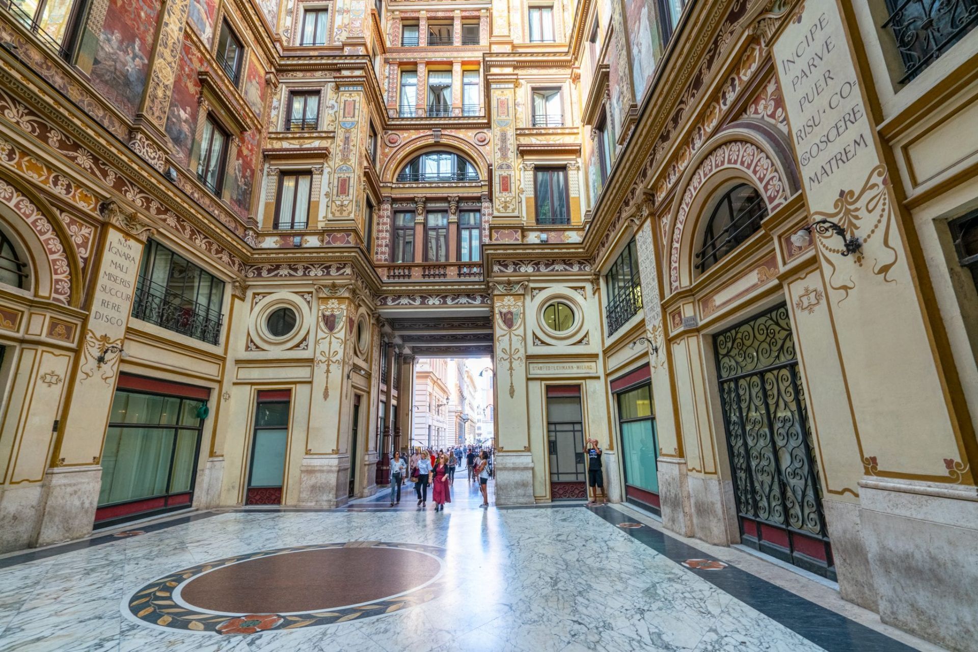
## Description Galleria Sciarra is a discreet Art Nouveau enclave tucked a short walk from Rome’s Trevi Fountain, known for its intricate frescoes, ornate stuccowork and an intimate central courtyard that together form a jewel-like interior. Though modest in scale, the gallery’s decorative program is dense with allegorical figures, botanical motifs and stylized ornamentation that exemplify early twentieth-century design. For visitors who value detail and a quieter pace, the gallery rewards careful looking: painted friezes, subtle color harmonies and small sculptural details reveal layers of craftsmanship. Far from being merely decorative, Galleria Sciarra is a social and architectural statement from an era when private commissions and decorative precincts asserted cultural and civic identity. The gallery’s proportions, the rhythm of its arches, and its palette create a sense of intimacy unusual among Rome’s grand civic monuments. Because it is often bypassed by tourists hurrying between major sites, the gallery feels like a discovery—an easily accessible moment of calm where light, texture and ornament invite slow observation. Photographers, architects and historians are often drawn to the gallery’s scale and surface treatment. The interplay of natural light in the courtyard emphasizes subtle pigments and brushwork, while the ornamental language provides insights into Art Nouveau’s local adaptation in Italy. Visitors who slow down can spot small signatures, painterly corrections and conservation interventions that tell a story about the building’s use and care. Conservation and nearby amenities: the gallery’s delicate finishes mean conservation is ongoing; look for small signs of recent restoration and avoid touching surfaces. After a visit, nearby cafes and gelaterias offer pleasant spots to review details and compare notes — a slow coffee near the Trevi area pairs well with a reflective pause after the gallery’s quiet intensity. ## Location Galleria Sciarra sits just off Via del Corso and the Trevi area, making it an easy detour from Rome’s busiest attractions. It is typically reached on foot from central squares such as Piazza Venezia or the Trevi Fountain, and its tucked-away position often makes it feel like a local discovery even when following a map. Getting there: walking is the most rewarding way to reach the gallery; its central location means it is close to many historic routes. Public transport options to nearby stations are plentiful, but walking from the nearest metro stop provides the best sense of urban context. ## Tips - Visit during daylight: natural light in the courtyard enhances the frescoes and reveals subtle textures. - Move slowly and look closely: the gallery rewards scrutiny—small details and painterly touches are best appreciated up close. - Respect its mixed use: parts of the building may be private offices or residences, so keep voices low and follow signage. - Photography is generally allowed for personal use without flash; avoid tripods during busy times and respect any posted restrictions. - Combine the visit with nearby sites: the Trevi Fountain, Via del Corso and Piazza Venezia are all a short walk away, making it easy to add the gallery to a half-day itinerary. ## Conclusion Galleria Sciarra is a refined, intimate stop for travelers who appreciate decorative arts and the quieter moments of Rome’s architectural fabric. Its compact scale and extraordinary surface detail make it a perfect complement to the city's larger monuments — a short visit that can leave a lasting impression for those who value craft and subtlety. ## FAQ Q: Is Galleria Sciarra open to the public? A: Yes—public access is generally available during daytime hours, but portions of the building may be private. Check local signs or cultural listings for current access and opening times. Q: Is photography allowed inside the gallery? A: For most personal, non-commercial photography, yes; avoid flash to protect pigments and respect any signage indicating restricted areas. Q: How long does a visit typically take? A: Visitors often spend 10–30 minutes depending on interest; those focused on decorative details or photography may linger longer. Q: Is there an admission fee? A: Access is usually free, though special events, exhibitions or guided visits may have a charge. Verify current conditions with local cultural resources. Q: Are guided tours available that include Galleria Sciarra? A: Yes—art-history walks and guided city tours sometimes include the gallery as a stop. Check schedules with local tour operators for times and languages. ## Links - [Galleria Sciarra Tour](https://colosseumandvaticantours.com/galleria-sciarra-the-jewel-of-art-nouveau-in-rome/)
GemVoyage Team • World

Comments