GemVoyage Team • World
Schwerin Castle (Schloss Schwerin) is one of Germany’s most enchanting and architecturally rich palaces, often referred to as the “Neuschwanstein of the North.” Located on an island in Lake Schwerin, this fairytale-like fortress is a masterpiece of Romantic historicism, blending Gothic, Renaissance, and Baroque elements into a harmonious whole. With its golden domes, ornate towers, and intricate façade, the castle appears to rise magically from the water, captivating visitors from every angle.
Originally built as a fort in the 10th century by the Slavic Obotrites, the site evolved over centuries into a ducal residence. The current structure was largely completed between 1845 and 1857, designed by a team of renowned architects including Gottfried Semper and Friedrich August Stüler. Today, Schwerin Castle houses the state parliament of Mecklenburg-Vorpommern, a museum showcasing 19th-century art and furnishings, and hosts cultural events such as open-air theatre performances.
A little-known fact: Schwerin Castle contains 635 rooms, many of which are lavishly decorated with gilded ceilings, carved woodwork, and elaborate tapestries. Another intriguing detail is the legend of the castle ghost, Petermännchen—a benevolent spirit said to protect the castle and its inhabitants.
Schwerin Castle is located in Germany, in the state of Mecklenburg-Vorpommern, within the city of Schwerin. It sits on a small island in Lake Schwerin, connected to the mainland by bridges and surrounded by beautifully landscaped gardens and parkland.
Its central location makes it ideal for a day trip or a weekend getaway from major northern German cities.
Schwerin Castle is a stunning blend of history, architecture, and natural beauty. With its lakeside setting, lavish interiors, and rich cultural heritage, it offers a magical experience that’s both visually and intellectually rewarding.
1. What are the opening hours of Schwerin Castle?
April to October: Tuesday–Sunday, 10:00 AM–6:00 PM
October to April: Tuesday–Sunday, 10:00 AM–5:00 PM
2. What is the entrance fee?
Adults: €8.50
Reduced: €6.50
Children under 18: Free
Audioguide: €2.00 (free for children)
3. Is Schwerin Castle suitable for children?
Yes, children are welcome and can enjoy the gardens, museum exhibits, and ghost stories.
4. Can I take photos inside the castle?
Photography is allowed in most areas, but flash and tripods may be restricted.
5. Is the castle wheelchair accessible?
Parts of the museum and gardens are accessible, but some historic areas may have limited access.
6. How long should I plan for a visit?
Allow 2–3 hours to explore the museum and gardens thoroughly.
Discover more hidden gems you might love.
Mexico City
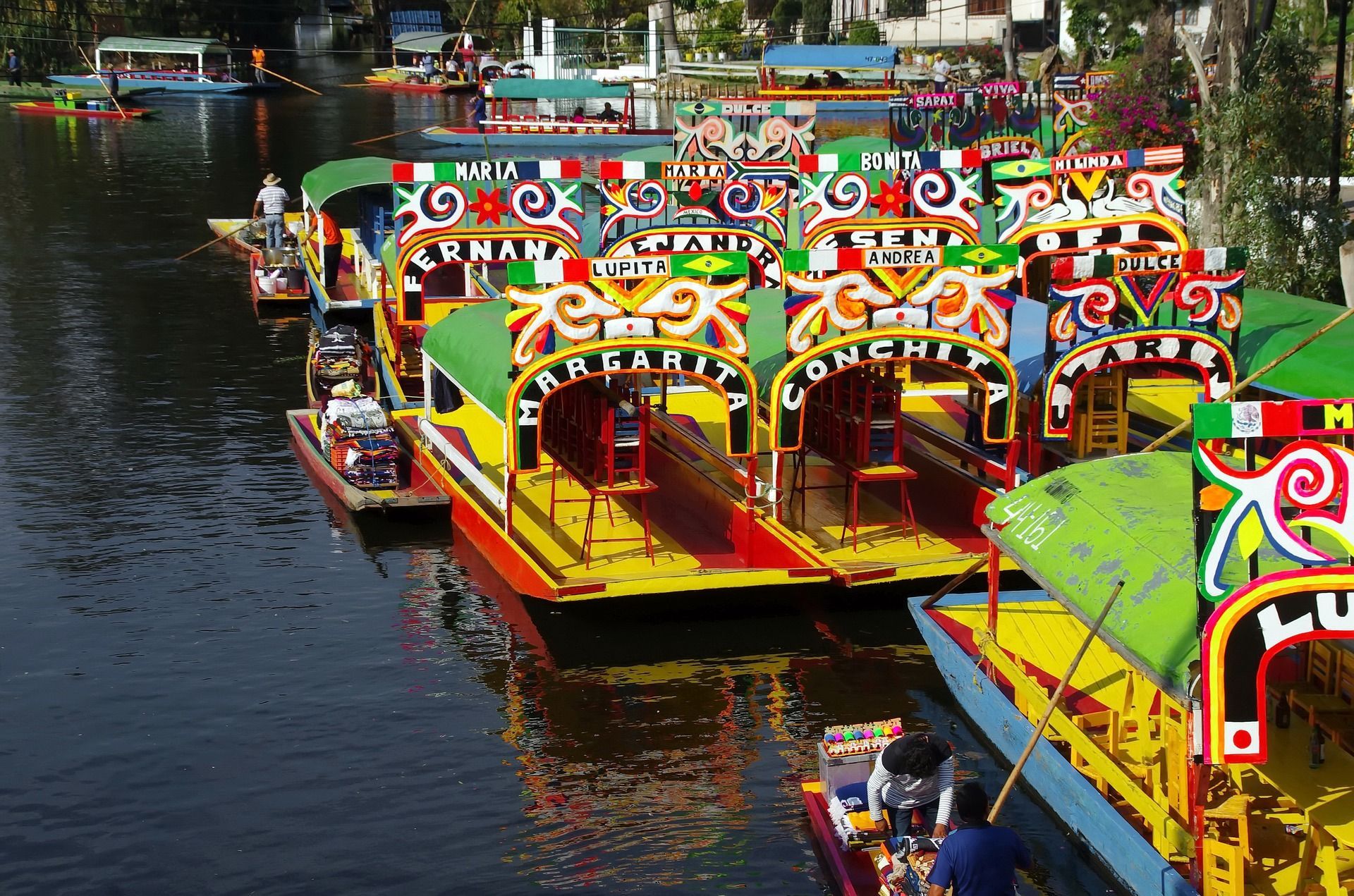
## Description The Xochimilco Canals are one of Mexico City’s most distinctive attractions because they preserve a living relationship between water, agriculture, celebration, and community. Unlike a standard sightseeing canal ride, Xochimilco offers a colorful world of trajineras, music, food, and floating movement through a landscape that reflects centuries of adaptation. It is one of the few places in the capital where visitors can still feel the legacy of the lake system that once defined the Valley of Mexico. What makes Xochimilco so special is that it is both scenic and cultural. A ride along the canals is visually lively, with brightly painted boats, vendors drifting by, musicians performing, and families and friends gathering for celebrations. At the same time, the area connects to the ancient chinampa system, a form of raised agricultural landscaping that has long been admired for its ingenuity. A lesser-known fact is that these canals are among the last surviving remnants of the pre-Hispanic water landscape of the valley. That makes a visit more than entertainment; it is a window into a surviving historical ecosystem. Another little-known detail is that Xochimilco is not just a tourist attraction but also a place with ongoing local life and ecological importance. The canals and surrounding fields continue to matter to residents, farmers, and conservation efforts. That is why the experience can feel so layered. You are not simply on a boat ride. You are moving through a landscape where heritage, tourism, and environmental questions meet. For many travelers, Xochimilco is memorable because of its atmosphere. It can be playful, crowded, musical, and festive, but it can also be surprisingly reflective if you visit at a calmer time. It is one of those places where the experience changes depending on the hour, the weather, and the energy on the water that day. Because of that, it works well for visitors who enjoy local color and are willing to let an outing unfold at a slower, more social pace. ## Location The Xochimilco Canals are in the Xochimilco borough of southern Mexico City, Mexico. The area is well known throughout the capital and can be reached from central Mexico City by public transport, taxi, or rideshare. One of the most common ways to get there is by taking the light rail system toward Xochimilco and then continuing to the canal departure points. Once you arrive, boats depart from designated embarcaderos. If it is your first time, that is the easiest structure to follow because the canals themselves are extensive and the boat-launch area is where the visitor experience starts. Because the area is farther from the center than some other attractions, plan Xochimilco as its own excursion rather than a quick add-on. That gives you enough time to enjoy the canal ride, food, and atmosphere without rushing back and forth across the city. ## Tips Go with a group if possible, because trajineras are more enjoyable when you can share the cost and the atmosphere. Even if you travel solo or as a couple, the social nature of the experience is a big part of the appeal. Bring cash for boat rental, food, drinks, and optional music. It is easier to enjoy the outing if you are prepared for small on-the-spot purchases. Choose the time of day carefully. Earlier visits can feel calmer, while later outings often become livelier and more festive. Pick the mood you want before you go. Respect the local environment and the people who live and work there. Xochimilco is a heritage landscape, not just a party venue, and a more considerate visit tends to be a better one. ## Conclusion Xochimilco Canals are one of Mexico City’s most unforgettable experiences, blending history, ecology, and celebration on the water. They are ideal for travelers who want something colorful, local, and unlike any conventional city attraction. ## FAQ **What are the Xochimilco Canals famous for?** They are famous for trajineras, festive boat rides, and their connection to the ancient chinampa system. **How do I get there?** The most practical options are public transport to Xochimilco followed by a short transfer to the canal departure points. **Is it only for parties?** No. While it can be lively, it is also a heritage site with agricultural and ecological importance. **How long should I plan for a visit?** A few hours is ideal so you can enjoy the boat ride without feeling rushed. **Is it worth visiting if I have limited time in Mexico City?** Yes, especially if you want a memorable local experience that is different from museums and monuments. ## Links - [UNESCO World Heritage information](https://whc.unesco.org/en/list/412/) - [Wikipedia](https://en.wikipedia.org/wiki/Xochimilco)
GemVoyage Team • World
Barcelona
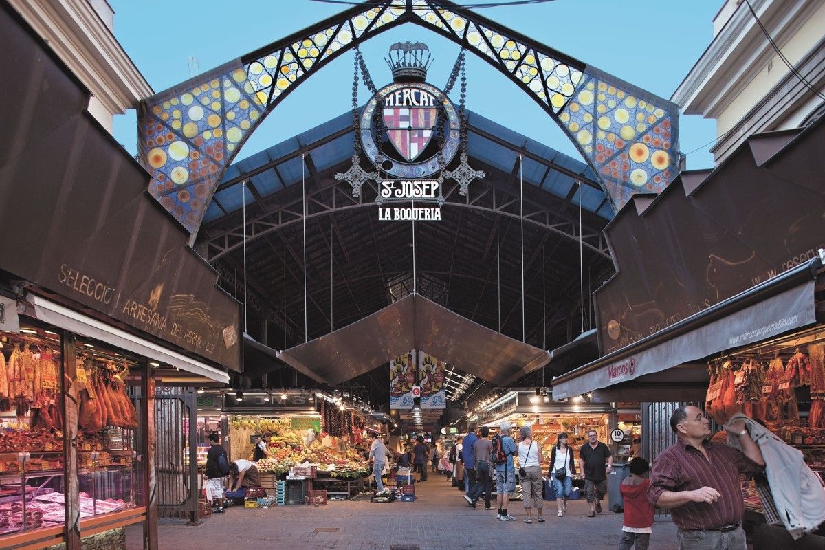
## Description **Mercat de la Boqueria**, officially known as **Mercat de Sant Josep de la Boqueria**, is Barcelona’s most famous food market and one of the most iconic culinary landmarks in Europe. More than a place to shop, it is a **living expression of Catalan gastronomy**, where tradition, daily life, and tourism intersect under one vast iron-and-glass roof. The market is known for its intense colors, constant movement, and the sheer diversity of products on display, from fresh seafood and cured meats to exotic fruits and handmade sweets. The market’s origins date back to the **early 13th century**, when street vendors sold meat outside the city walls near La Rambla. Over centuries, the informal stalls evolved into a structured market, and in 1840 the site was officially recognized as a public market. The current modernist structure, completed in the early 20th century, reflects Barcelona’s industrial-era ambition while remaining deeply rooted in everyday commerce. What makes Mercat de la Boqueria unique is its **dual identity**. On one hand, it serves local residents, chefs, and restaurateurs who rely on its quality ingredients. On the other, it functions as a global attraction for visitors seeking an authentic taste of Barcelona. Despite its popularity, many stalls still operate as family businesses passed down through generations. A lesser-known fact is that beneath the market lies an **archaeological site**, with remains from medieval and even Roman-era structures discovered during renovations. Another interesting detail is that many of Barcelona’s top chefs continue to source ingredients here early in the morning, long before tourists arrive, reinforcing the market’s role as a professional culinary hub rather than a mere attraction. ## Location **Country:** Spain **Region:** Catalonia **City:** Barcelona **District:** Ciutat Vella (Old Town) Mercat de la Boqueria is located directly off **La Rambla**, one of Barcelona’s main pedestrian boulevards, making it exceptionally central and easy to access. ### How to Get There * **By metro:** * Take Line L3 (Green Line) to **Liceu** station. The market entrance is immediately outside the station. * **On foot:** * Easily reachable from Plaça de Catalunya, the Gothic Quarter, and El Raval. * **By bus:** * Multiple city bus lines stop along La Rambla. * **By taxi:** * Taxis can drop you near La Rambla, but walking the final stretch is usually faster. ## Tips * **Go early in the morning:** Between 8:00 and 10:00 a.m. is best for fewer crowds and fresher displays. * **Avoid peak lunch hours:** Midday can become extremely crowded, especially in summer. * **Do not treat it as only a photo stop:** Take time to observe how locals shop and interact with vendors. * **Eat smart:** Skip the most tourist-oriented stalls near the entrance and explore deeper for better quality and value. * **Bring cash:** While many vendors accept cards, smaller stalls may prefer cash. * **Respect vendors:** Ask before taking close-up photos, especially of people. ## Conclusion Mercat de la Boqueria is not just a market, but a cultural institution that reflects Barcelona’s relationship with food, trade, and daily life. Its history, atmosphere, and culinary richness make it an essential stop for anyone wanting to understand the city beyond architecture and beaches. ## FAQ **1. Is Mercat de la Boqueria touristy?** Yes, but it is still a functioning market used by locals and professionals, especially in the mornings. **2. Is there an entrance fee?** No. Entry is free. **3. Can I eat inside the market?** Yes. There are bars and counters serving tapas, seafood, and prepared dishes. **4. How long should I plan for a visit?** About **1 to 2 hours**, depending on whether you eat or just explore. **5. Is it suitable for vegetarians?** Yes. There is a wide selection of fruits, cheeses, nuts, juices, and vegetarian dishes. **6. Is the market open every day?** Generally open Monday to Saturday; closed on Sundays and public holidays. ## Links * [Official Barcelona markets site](https://ajuntament.barcelona.cat/mercats)
GemVoyage Team • World
Tanga
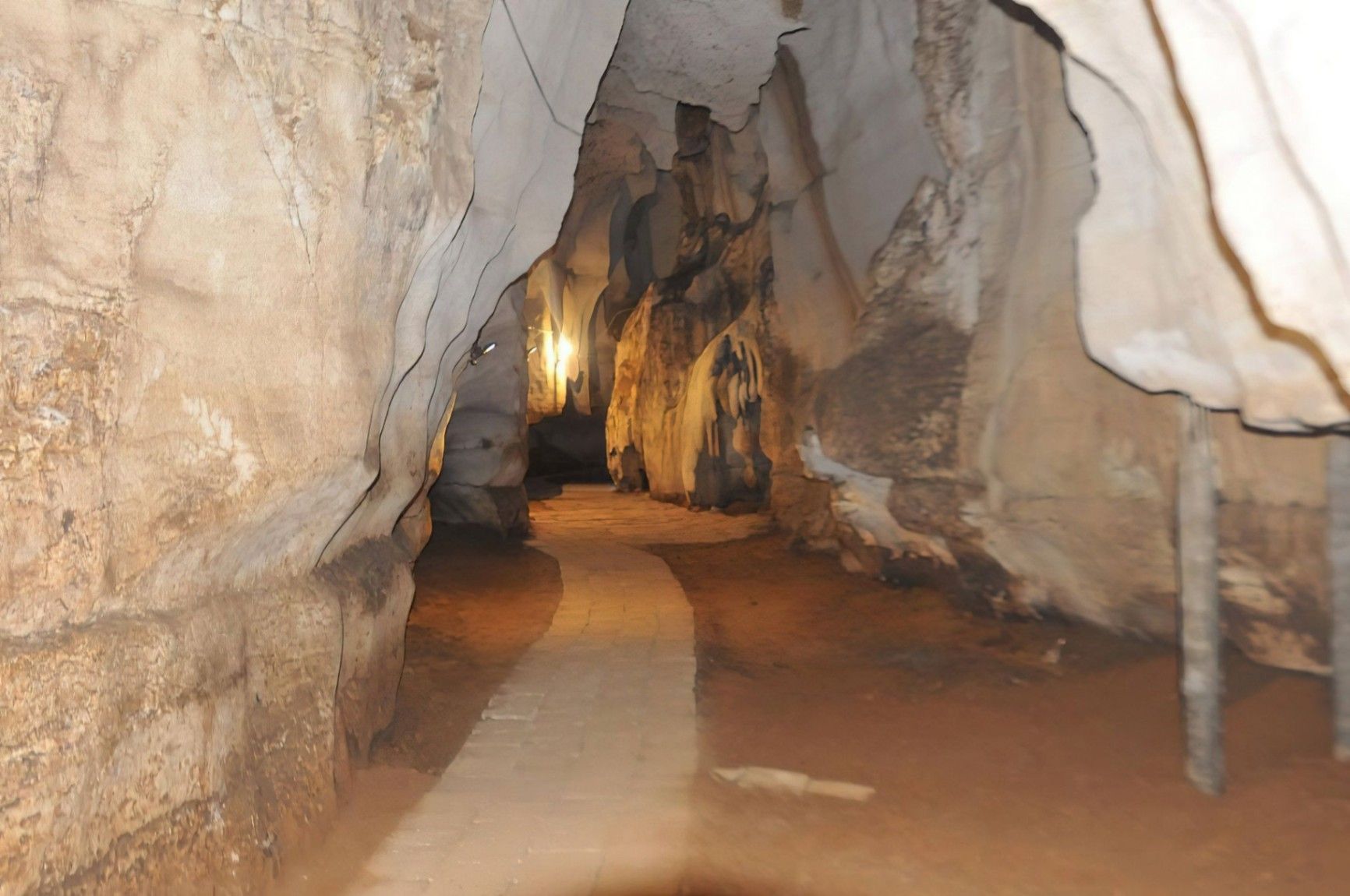
## Description Amboni Caves are among the most fascinating natural attractions in Tanzania, offering visitors a journey into an ancient underground world shaped by time, water, and geology. These limestone caves are believed to be over 150 million years old, making them one of the oldest cave systems in East Africa. With dark chambers, narrow passageways, and dramatic rock formations, Amboni Caves provide a sense of mystery and adventure that contrasts sharply with the nearby coastal landscapes. What makes Amboni Caves truly unique is their combination of natural, cultural, and spiritual significance. The caves are not only a geological marvel but also a site deeply connected to local beliefs and traditions. Many chambers are associated with spiritual practices, and some are still used for traditional rituals by surrounding communities. A little-known fact is that the caves are named after a colonial-era engineer, Amboni, who is believed to have popularized their exploration, although local communities had known and used the caves long before. Another lesser-known detail is that the cave system consists of at least ten interconnected chambers, each with its own name, legend, and distinct rock formations. Visiting Amboni Caves is both an educational and atmospheric experience, offering insight into Tanzania’s natural history as well as its living cultural traditions. ## Location Amboni Caves are located in **Tanzania**, in the **Tanga Region**, near the city of **Tanga**, along the northeastern coast of the country. The caves are situated about 6 kilometers north of Tanga city center, close to the Indian Ocean. Reaching the caves is relatively easy. Visitors can take a taxi or local transport from Tanga, with the journey usually taking 15 to 20 minutes. For travelers coming from other parts of Tanzania, Tanga is accessible by road, train, or domestic flights. Once near the site, a short walk leads to the cave entrance. Hiring a local guide at the site is strongly recommended, as the cave layout can be confusing without assistance. ## Tips * Always visit with a local guide, as the caves are dark, complex, and rich in cultural meaning. * Wear sturdy shoes with good grip, since the cave floors can be slippery and uneven. * Bring a flashlight or headlamp, even if guides provide lighting, for better visibility. * Dress comfortably and be prepared for warm and humid conditions inside the caves. * Respect local customs, as certain areas may be considered sacred. * Visit earlier in the day for a quieter experience and better overall visibility. ## Conclusion Amboni Caves offer a rare opportunity to explore one of Tanzania’s oldest natural formations while learning about the cultural traditions connected to it. With their ancient rock structures, spiritual significance, and sense of adventure, the caves stand out as a unique and rewarding destination near Tanga. ## FAQ **Are Amboni Caves safe to visit?** Yes, they are safe when visited with an experienced local guide who knows the cave layout and conditions. **How long does a visit to Amboni Caves take?** Most guided visits last between 45 minutes and 1.5 hours, depending on the route and interest level. **Is the site suitable for children?** Older children may enjoy the experience, but very young children might find the dark and narrow spaces challenging. **Is there an entrance fee?** Yes, a small entrance fee is usually charged, with additional costs for guided tours. **Can I take photos inside the caves?** Photography is generally allowed, but flash use and certain areas may be restricted, so always ask your guide. ## Links * [Tanzania Tourist Board](https://www.tanzaniatourism.go.tz) * [Tanga Region Information](https://www.tanga.go.tz)
GemVoyage Team • World
Stockholm
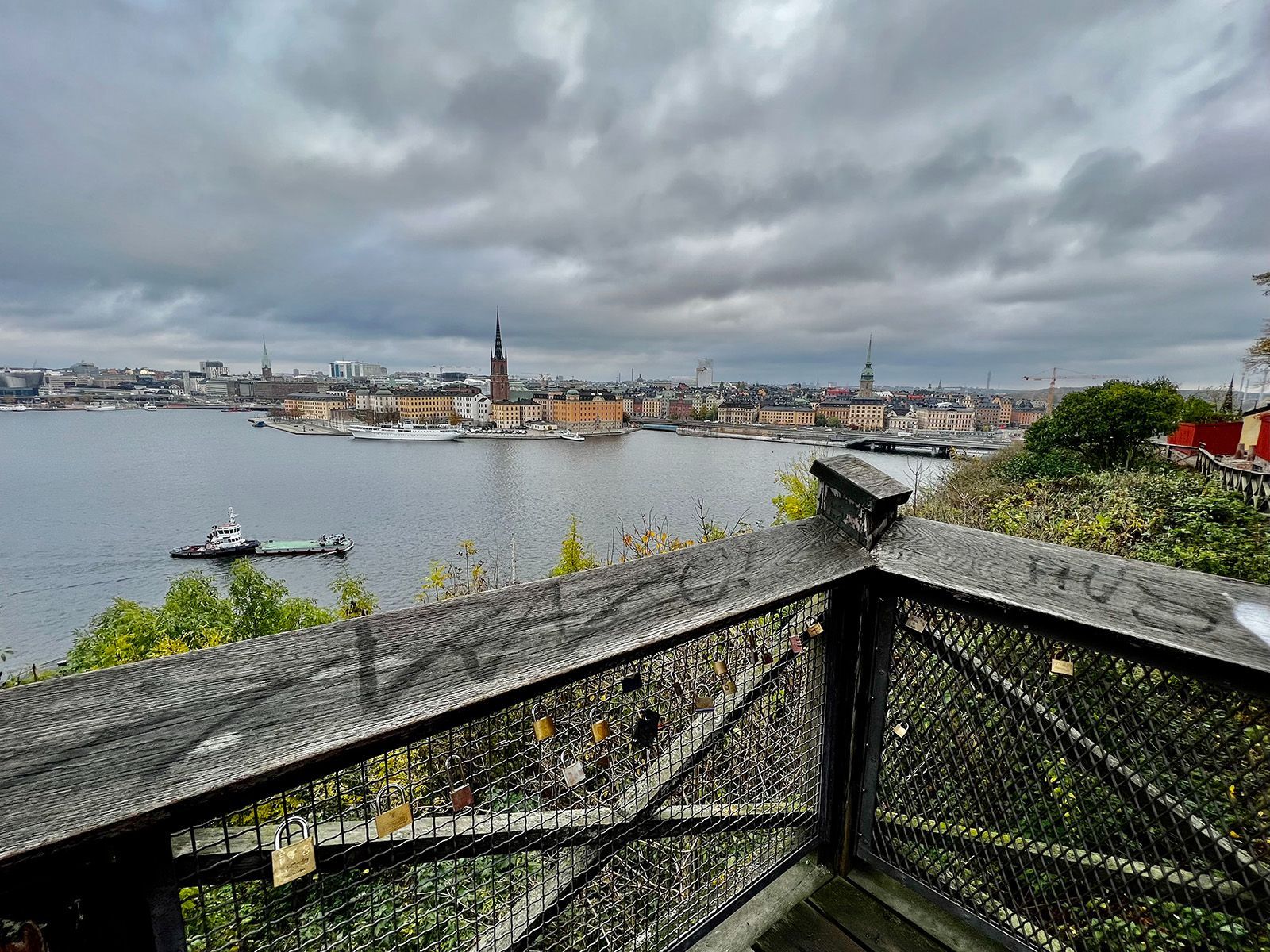
## Description Monteliusvägen is one of Stockholm’s most beloved viewpoint walks because it offers a remarkable amount of scenery for very little effort. Stretching along Mariaberget in Södermalm, the path gives visitors panoramic views over Riddarfjärden, City Hall, and the water and skyline that define Stockholm’s visual identity. It is a place where walking becomes part of the sightseeing itself, and where the city looks especially elegant in changing light. The viewpoint’s appeal lies in its mixture of accessibility and atmosphere. You do not need to climb a mountain or travel far from the center to get a memorable outlook. Instead, you can step into a residential and elevated part of the city and find a broad view that feels almost theatrical. One little-known fact is that Monteliusvägen is particularly admired by locals for how reliably it delivers a strong skyline view without the crowds associated with more obvious tourist stops. Another is that the path changes character with the seasons; winter can make the scenery crisp and graphic, while summer brings long, luminous evenings and a more relaxed mood. What also makes Monteliusvägen special is that it combines motion and pause. As you walk, the city opens and closes in layers. You might pass benches, low walls, and quiet residential details, then suddenly find a view that feels worthy of a postcard. That rhythm encourages visitors to slow down rather than rush through. It is a great place to arrive without a fixed plan, because the reward comes from both the walk and the destination. For photographers and casual visitors alike, the viewpoint is one of Stockholm’s most satisfying urban experiences. It captures the city’s relation to water, its elegant low-rise skyline, and its subtle balance between nature and urban form. A sunset visit can be particularly memorable, but the viewpoint works at many times of day because the geometry of the city and the water remains compelling even in flat light. ## Location Monteliusvägen is located on Mariaberget in Södermalm, Stockholm, Sweden, overlooking the waters of central Stockholm. It is very close to the city core, which makes it easy to include in a broader city walk. Because it sits on a ridge above the water, the route includes some uphill movement, but the climb is short and manageable. The easiest access is via Stockholm’s metro system to nearby stations such as Slussen, followed by a walk through Södermalm. From there, signage and local navigation are usually straightforward enough for most visitors to find the viewpoint. Since the area is so central, it is simple to pair it with a coffee stop, dinner, or a longer Södermalm exploration. If you want the best photo conditions, go near sunset or during the soft light of early morning. For a quieter experience, avoid peak sightseeing hours when possible. ## Tips - Go at sunset if you want the most dramatic light on the water and skyline. - Wear comfortable shoes because the approach includes some uphill walking. - Bring a jacket or layer, especially if you stay after sunset when wind can feel cooler. - Walk slowly and stop more than once. The viewpoint changes as you move along it. - Combine Monteliusvägen with another Södermalm stop so the outing feels complete. ## Conclusion Monteliusvägen is one of Stockholm’s most rewarding short walks, offering a classic view of the city with little logistical effort. It is simple, beautiful, and especially strong at sunset. ## FAQ ### Is Monteliusvägen worth it if I have only one day in Stockholm? Yes. It is one of the quickest ways to get a memorable city view without a complicated excursion. ### How long is the walk? The walking stretch is fairly short, but you will likely spend more time stopping to enjoy the views than actually moving. ### Is it very crowded? It can be popular, especially around sunset, but it still often feels calmer than the most famous Stockholm viewpoints. ### Is it family-friendly? Yes, as long as everyone is comfortable with a little uphill walking and staying attentive near ridge-edge paths. ## Links - [Visit Stockholm](https://www.visitstockholm.com/)
GemVoyage Team • World
Cologne
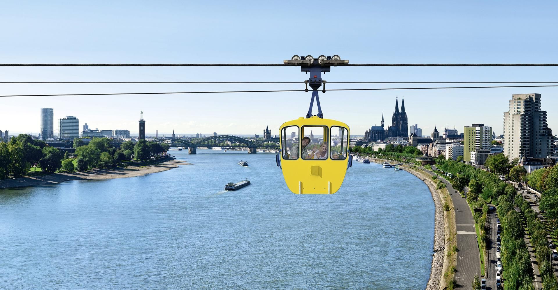
## Description The Cologne Cable Car, also known as the Rhine Ropeway, is one of the city’s most enjoyable short experiences because it turns a simple river crossing into a memorable view-filled ride. Instead of treating transport as a functional necessity, the ropeway makes movement itself the attraction. As you travel above the Rhine, Cologne opens up in a new way, with the river, bridges, skyline, and green spaces unfolding beneath you. It is a modestly scaled experience, but one that offers a surprisingly vivid perspective on the city. What makes the cable car special is that it adds movement and elevation to a city that is often explored on foot. From above, familiar landmarks look different. You can see how the river shapes Cologne’s geography, how the city spreads out on both sides, and how the waterfront becomes part of the urban image. For many visitors, the ride is also a welcome break from walking. It is relaxing, scenic, and slightly unusual, which is a strong combination for a city stop. One little-known fact is that the ropeway is often appreciated as much for the sense of orientation it gives as for the actual ride. It helps visitors understand how Cologne sits in relation to the Rhine. Another is that it has a long-standing reputation as one of the city’s more family-friendly and easy-to-enjoy attractions because it does not require a major time investment but still produces a strong memory. The experience works particularly well in good weather, when visibility is clear and the river views feel open. It also pairs nicely with other riverside activities or a park visit. The ride itself is not long, so the best strategy is to treat it as part of a wider Cologne outing rather than as the entire plan for the day. Still, even as a short activity, it stands out because it gives you a literal new angle on the city. ## Location The Cologne Cable Car is in Cologne, Germany, crossing the Rhine and connecting areas of the city on opposite sides of the river. It is close enough to central Cologne and the riverside to be convenient for visitors already exploring the city center. The easiest way to reach it is by local transport or by walking from nearby attractions on the riverbank. Because Cologne’s center is relatively visitor-friendly, the ropeway often fits naturally into a walk along the Rhine. Depending on your route, you can ride one way and then continue exploring the waterfront or nearby park areas on foot. If you are building a day in Cologne, the ropeway works especially well with riverside sightseeing, the old town, or a relaxed walk through nearby green spaces. It is a small addition that can make the whole day feel more varied. ## Tips Go on a clear day if possible. Visibility makes a huge difference to the experience. Check operating times before you go, especially if you are visiting in a shoulder season or outside peak travel periods. If you enjoy photography, try the ride at different times of day for different light on the river and city. Use it as part of a larger walking route so the experience feels connected rather than isolated. Even though the ride is short, it can become one of the more distinctive memories from a Cologne trip because it changes the scale of the city so quickly. On foot, Cologne can feel intimate and grounded; from the ropeway, it suddenly feels open and legible. That shift is valuable for first-time visitors who are still learning how the city fits together around the river. It is the kind of simple experience that gives practical orientation as well as enjoyment. The cable car is also a good reminder that not every worthwhile attraction needs a long museum visit or a complex reservation. Sometimes a single perspective change can be enough to make a city feel more coherent. In Cologne, where the Rhine is such a defining feature, that change is especially effective. You see how the city relates to the river instead of only moving beside it, and that perspective often makes the rest of the day’s sightseeing easier to understand. ## Conclusion The Cologne Cable Car offers a short but memorable aerial perspective on the Rhine and the city. It is a simple attraction that adds a fun, scenic dimension to a Cologne visit. ## FAQ **How long is the cable car ride?** It is a short crossing, designed more for scenery than for distance. **Is it worth doing?** Yes, especially if you enjoy views, riverside cityscapes, and light activities. **Can I use it as transport?** It can function that way, but most visitors treat it as an attraction. **Is it good for families?** Yes, it is one of the more relaxed and accessible Cologne experiences. **When is the best time to ride?** On a clear day with good visibility, ideally when the light is favorable. ## Links - [Official website](https://www.koelner-seilbahn.de/en/) - [Wikipedia](https://en.wikipedia.org/wiki/Cologne_Cable_Car)
GemVoyage Team • World
Paris
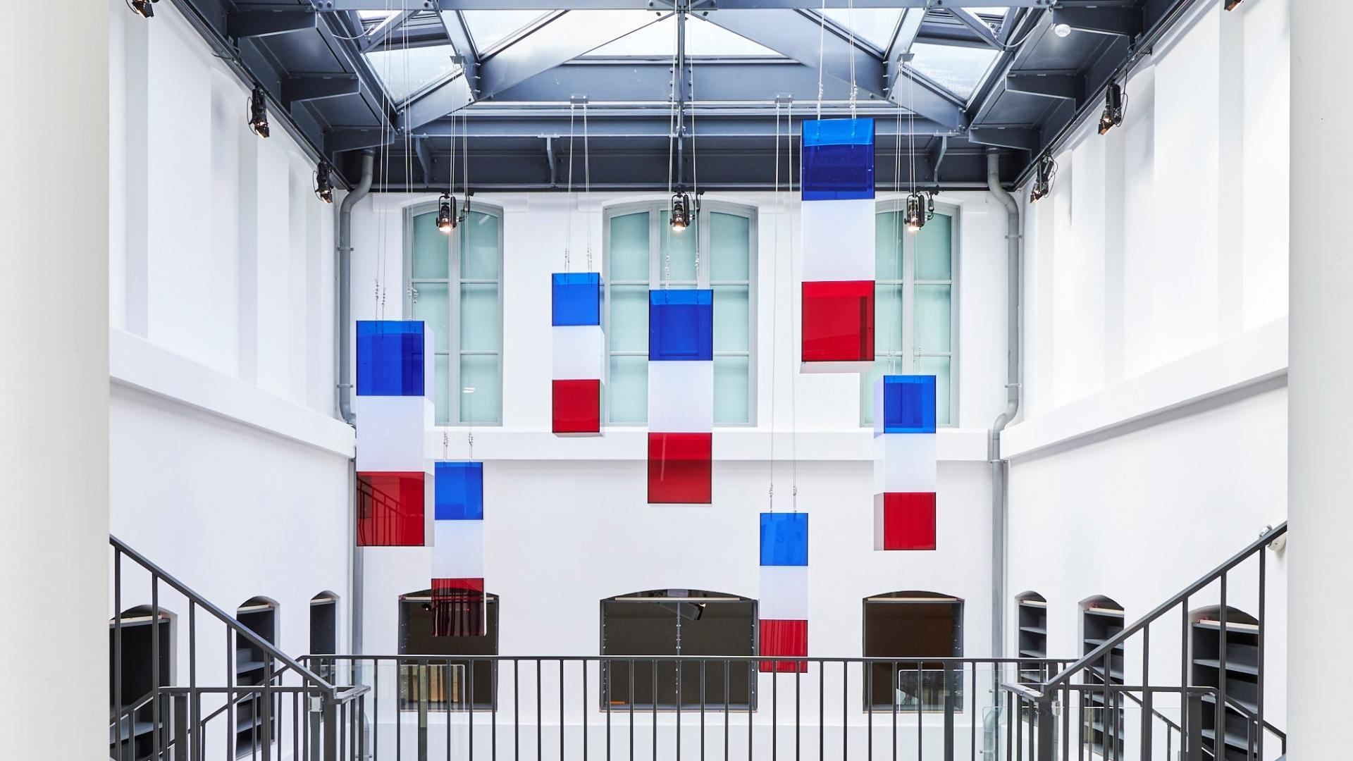
## Description **The Liberation of Paris Museum (Musée de la Libération de Paris – Musée du Général Leclerc – Musée Jean Moulin)** is one of the most important modern history museums in the French capital. Dedicated to the **German occupation of Paris (1940–1944)**, the **French Resistance**, and the **Liberation of Paris**, the museum offers a clear, unsentimental account of how the city endured, resisted, and ultimately reclaimed its freedom during World War II. What distinguishes this museum is its **focus on individuals rather than abstract events**. Through personal letters, photographs, uniforms, clandestine newspapers, and everyday objects, the museum tells the story of ordinary Parisians alongside key historical figures such as **Jean Moulin**, a central figure of the French Resistance, and **General Philippe Leclerc**, commander of the Free French forces that entered Paris in August 1944. The narrative is chronological and grounded, avoiding glorification while emphasizing moral courage and civil resistance. One of the museum’s most striking features is the preserved **underground command bunker** used by Colonel Henri Rol-Tanguy during the final days of the liberation. Visitors can descend into this space, which remains intact, offering a rare and visceral sense of wartime decision-making under pressure. A lesser-known fact is that this bunker was rediscovered relatively late and restored as part of the museum’s redesign. Another notable detail is that the museum relocated in 2019 to its current site to better reflect the historical geography of the liberation events. The museum is immersive without being overwhelming. It balances historical rigor with accessibility, making complex political and military developments understandable without diluting their seriousness. ## Location **Country:** France **Region:** Île-de-France **City:** Paris **Arrondissement:** 14th arrondissement The museum is located on **Place Denfert-Rochereau**, a historically symbolic site connected to resistance activity and wartime infrastructure. ### How to Get There * **By metro:** * Lines 4 and 6 to **Denfert-Rochereau** station. * **By RER:** * RER B stops at Denfert-Rochereau, providing direct access from airports and suburbs. * **By bus:** * Several bus lines stop directly at the square. * **On foot:** * Easily reachable from Montparnasse and surrounding neighborhoods. ## Tips * **Allow sufficient time:** Plan **1.5 to 2 hours** to fully absorb the exhibitions. * **Do not skip the bunker:** Access is limited in capacity but is a core part of the experience. * **Read the personal testimonies:** These provide emotional depth beyond dates and events. * **Visit before or after nearby sites:** The Paris Catacombs and Montparnasse Cemetery are close by. * **Suitable for older children and adults:** Some content may be intense for very young visitors. * **Free entry:** Take advantage of the museum’s permanent free access. ## Conclusion The Liberation of Paris Museum offers a sober, powerful exploration of one of the city’s defining moments. Through personal stories, preserved spaces, and clear historical context, it transforms the liberation of Paris from a symbolic event into a deeply human experience. ## FAQ **1. Is the museum free to visit?** Yes, permanent exhibitions are free for all visitors. **2. How long does the visit take?** Approximately **90 minutes to 2 hours**, depending on interest level. **3. Is the underground bunker accessible?** Yes, but access may be limited at busy times due to space constraints. **4. Is the museum suitable for non-French speakers?** Yes. Exhibits are well-labeled, and much of the content is available in multiple languages. **5. Does the museum focus only on Paris?** Primarily, but it also addresses broader resistance networks and Free French operations. **6. Is photography allowed?** Photography is generally permitted, but flash and tripods may be restricted. ## Links * [City of Paris museums portal](https://www.paris.fr) * [Official Museum Website](https://www.museeliberation-leclerc-moulin.paris.fr/en)
GemVoyage Team • World

.jpg)
Comments