GemVoyage Team • World
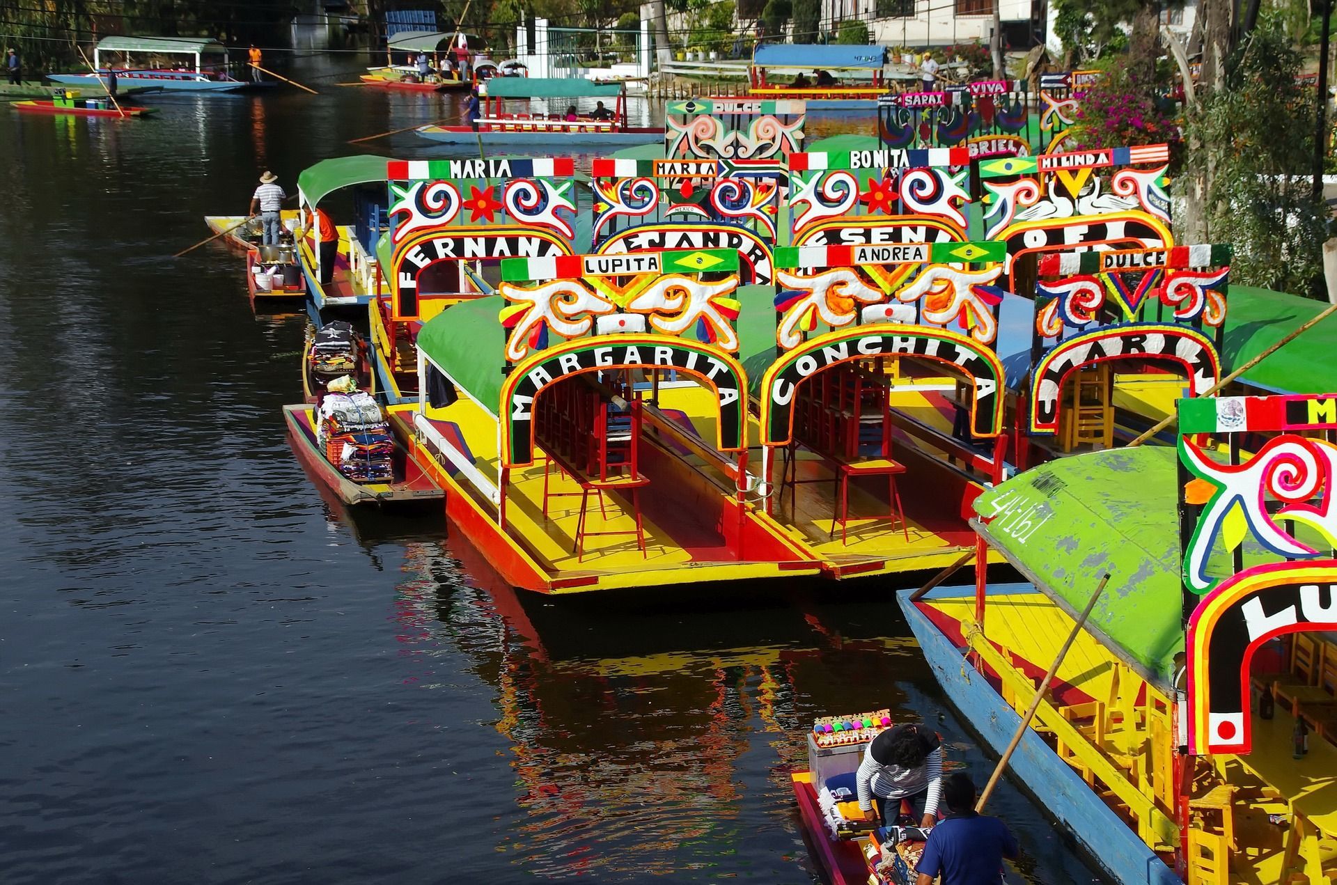
What makes Xochimilco so special is that it is both scenic and cultural. A ride along the canals is visually lively, with brightly painted boats, vendors drifting by, musicians performing, and families and friends gathering for celebrations. At the same time, the area connects to the ancient chinampa system, a form of raised agricultural landscaping that has long been admired for its ingenuity. A lesser-known fact is that these canals are among the last surviving remnants of the pre-Hispanic water landscape of the valley. That makes a visit more than entertainment; it is a window into a surviving historical ecosystem.
Another little-known detail is that Xochimilco is not just a tourist attraction but also a place with ongoing local life and ecological importance. The canals and surrounding fields continue to matter to residents, farmers, and conservation efforts. That is why the experience can feel so layered. You are not simply on a boat ride. You are moving through a landscape where heritage, tourism, and environmental questions meet.
For many travelers, Xochimilco is memorable because of its atmosphere. It can be playful, crowded, musical, and festive, but it can also be surprisingly reflective if you visit at a calmer time. It is one of those places where the experience changes depending on the hour, the weather, and the energy on the water that day. Because of that, it works well for visitors who enjoy local color and are willing to let an outing unfold at a slower, more social pace.
One of the most common ways to get there is by taking the light rail system toward Xochimilco and then continuing to the canal departure points. Once you arrive, boats depart from designated embarcaderos. If it is your first time, that is the easiest structure to follow because the canals themselves are extensive and the boat-launch area is where the visitor experience starts.
Because the area is farther from the center than some other attractions, plan Xochimilco as its own excursion rather than a quick add-on. That gives you enough time to enjoy the canal ride, food, and atmosphere without rushing back and forth across the city.
Bring cash for boat rental, food, drinks, and optional music. It is easier to enjoy the outing if you are prepared for small on-the-spot purchases.
Choose the time of day carefully. Earlier visits can feel calmer, while later outings often become livelier and more festive. Pick the mood you want before you go.
Respect the local environment and the people who live and work there. Xochimilco is a heritage landscape, not just a party venue, and a more considerate visit tends to be a better one.
How do I get there? The most practical options are public transport to Xochimilco followed by a short transfer to the canal departure points.
Is it only for parties? No. While it can be lively, it is also a heritage site with agricultural and ecological importance.
How long should I plan for a visit? A few hours is ideal so you can enjoy the boat ride without feeling rushed.
Is it worth visiting if I have limited time in Mexico City? Yes, especially if you want a memorable local experience that is different from museums and monuments.
Discover more hidden gems you might love.
Berlin
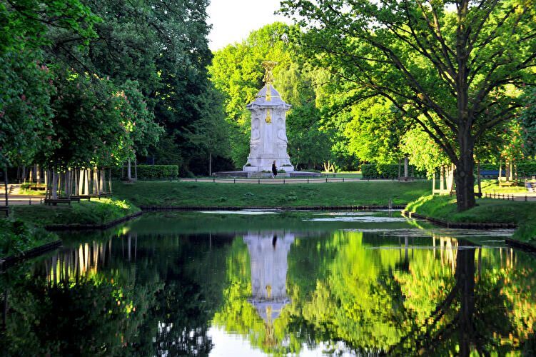
## Description Großer Tiergarten (commonly called the Tiergarten) is Berlin’s largest and most beloved inner-city park—a leafy, varied landscape of walking paths, ponds, monuments, and quiet glades sitting at the historic heart of the city. Once a ducal hunting ground, it evolved over centuries into a landscaped public park designed for civic leisure and grand promenades. Today, the Tiergarten provides a verdant contrast to Berlin’s urban fabric: classical statues, the iconic Victory Column (Siegessäule), and gardened lawns mix with dense tree stands and serene waterways. What distinguishes the Tiergarten is its adaptability: it serves as a place for brisk joggers, picnickers, history buffs, and families alike. Hidden corners contain wartime memorials and modern sculptures, while open meadows host festivals and local gatherings. A lesser-known fact is that parts of the park were extensively redesigned after World War II and partially replanted to counter wartime damage, which explains the deliberate blend of older avenues with mid-20th-century layout decisions. ## Location Großer Tiergarten is located in central Berlin, within the Mitte borough and adjacent to important city landmarks such as the Brandenburg Gate, the Reichstag, and Potsdamer Platz. The park stretches roughly from the Brandenburg Gate in the east toward the Bellevue Palace in the west. Getting there: Tiergarten is highly accessible. Most visitors arrive via Berlin’s U-Bahn or S-Bahn (Brandenburger Tor station, Tiergarten station, or Potsdamer Platz). Buses and trams also serve nearby stops. Cycling is an excellent way to traverse the park—bike rental stations are plentiful, and dedicated paths make for a pleasant ride. If arriving by car, use nearby parking facilities at major crossroads, though public transport is recommended. ## Tips - Plan a walking loop: Combine a visit to the Brandenburg Gate, stroll through the Tiergarten, and finish at the Victory Column or Bellevue Palace. - Rent a bike: The park is large and easier to explore by bicycle; watch for pedestrians on mixed-use paths. - Bring a picnic: Large grassy areas are perfect for relaxing; be mindful of local rules about barbecues and cleanup. - Visit different times: Morning for joggers and birdwatching; late afternoon for softer light and fewer crowds; summer evenings often have informal gatherings or small concerts. - Check memorials and monuments: Allow time to see the Soviet War Memorial, the Bismarck statue, and other historical markers—each has its own backstory worth exploring. - Accessibility: Main routes are generally flat and wheelchair-friendly, but some wooded paths can be uneven. ## Conclusion Großer Tiergarten is a green heart in the center of Berlin: historically layered, naturally restorative, and culturally active. Whether you seek a peaceful walk, a cycling route, or a place to sit and watch Berlin life unfold, Tiergarten delivers a balanced urban park experience with historical depth and modern vitality. ## FAQ Q: Is the Tiergarten safe to visit after dark? A: Central areas and main paths are generally safe, but as with any large park, avoid isolated areas at night and use common-sense precautions. Q: Can I cycle in the Tiergarten? A: Yes. Cycling is popular and convenient with dedicated paths; always yield to pedestrians and follow local cycling rules. Q: Are there guided tours of the Tiergarten? A: Guided walking and bike tours that include Tiergarten are available through various tour operators; check Berlin tourism listings. Q: Is the Victory Column accessible to the public? A: The Victory Column is open to visitors who want to climb to the viewing platform; check opening hours and ticketing information. ## Links - [Visit Berlin – Tiergarten information](https://www.visitberlin.de/en/place/grosser-tiergarten)
GemVoyage Team • World
Berlin
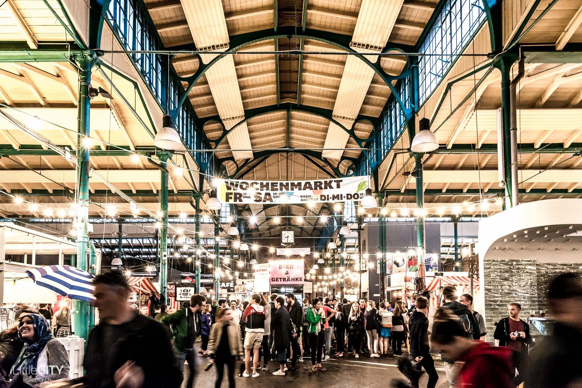
## Description Markthalle Neun is one of Berlin’s most engaging food destinations because it combines history, neighborhood identity, and culinary experimentation in a single space. Unlike a polished shopping mall or a generic indoor market, it feels deeply rooted in Kreuzberg’s local culture. The building itself carries the atmosphere of a traditional market hall, but the life inside it is contemporary and dynamic. Visitors come for food, but they stay because the market offers a sense of community and urban character that is hard to fake. One of the hall’s greatest strengths is variety. Depending on the day and the event schedule, you might encounter street food, specialty produce, artisan products, small-batch drinks, or themed market programming. That flexibility is part of why Markthalle Neun has become such an important Berlin institution. It is not frozen in one format. Instead, it adapts to local tastes and seasonal ideas while still keeping the market tradition visible. That makes it feel both authentic and current. The hall is especially known for helping local and sustainable food culture gain a stronger public profile. Many visitors think of it as a place to eat, but it is also a platform for small producers and creative cooks. A lesser-known fact is that the market has played a major role in shaping Berlin’s reputation as a city where food can be casual, ethically minded, and inventive without being stiff or overly formal. Another is that the hall’s atmosphere often feels more neighborhood-driven than tourist-driven, which gives the experience a welcome sense of local rhythm. The best visits are usually those where you arrive with time to sample, browse, and absorb the setting. The hall can feel energetic but not overwhelming, and that balance makes it pleasant for visitors who enjoy urban food culture. It is a place where lunch can turn into an afternoon, especially if there is a special market theme or event happening. Because of that, Markthalle Neun is more than a place to eat. It is a place to understand one of Berlin’s most appealing everyday social spaces. ## Location Markthalle Neun is in Berlin, Germany, in the Kreuzberg district. The location places it in one of the city’s most culturally active neighborhoods, with cafés, bars, shops, and street life all around it. Public transport is the easiest way to get there. From other central Berlin neighborhoods, you can reach Kreuzberg quickly and then continue on foot. That works especially well if you want to combine the market with a broader walk through the district. Because Kreuzberg is lively and dense, walking the neighborhood after the market can be just as rewarding as the market itself. If you are planning around a particular event or market day, check the schedule in advance. The hall’s activity changes significantly depending on what is happening there, and timing can shape the entire experience. ## Tips Arrive hungry, but do not fill up too fast. It is better to sample a few things and leave room for whatever looks best once you are inside. Check which day or theme is running before you go, because the market’s identity changes with programming. Some days are much stronger for specific types of food than others. Bring a little flexibility. The hall is most rewarding when you let yourself wander and compare options rather than trying to decide everything immediately. If you care about atmosphere as much as food, pair the visit with a Kreuzberg walk. The market becomes even more meaningful when seen as part of the neighborhood around it. The hall is also useful for travelers who want to understand Berlin through everyday culture rather than only through monuments and museums. Kreuzberg’s identity has long been shaped by migration, experimentation, and community-based creativity, and Markthalle Neun reflects that very clearly. Even if you only stop in for a snack, the space gives you a stronger sense of how Berlin’s food scene is tied to local life, not just to polished hospitality. ## Conclusion Markthalle Neun is one of Berlin’s best food-focused attractions because it combines historic market architecture with a modern, community-oriented food culture. It is a standout stop for travelers who want a taste of local life. ## FAQ **What is Markthalle Neun known for?** It is known for its food culture, market events, and strong local identity in Kreuzberg. **Is it only for lunch?** No. The market can be worth visiting at different times depending on programming and special events. **How long should I stay?** One to two hours is a good baseline, longer if you want to eat, shop, and explore the area. **Is it touristy?** It attracts visitors, but it still feels strongly tied to local Berlin food culture. **Should I check the schedule first?** Yes. The market’s offerings can change significantly depending on the day. ## Links - [Official website](https://markthalleneun.de/en/)
GemVoyage Team • World
Barcelona
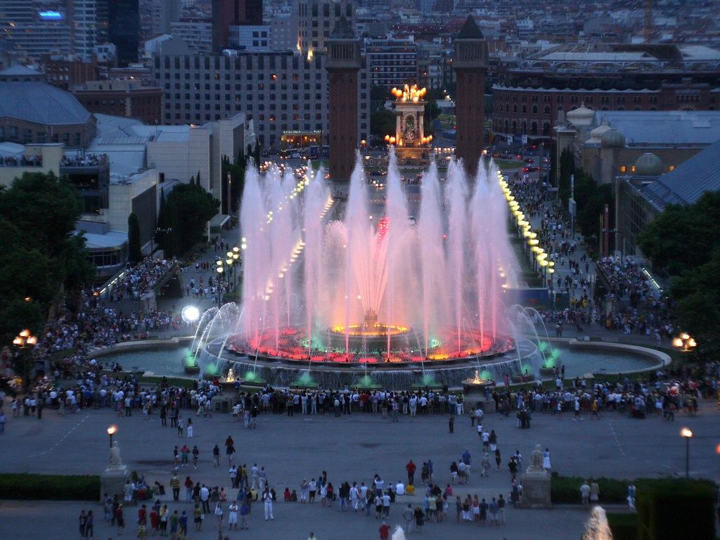
## Description The **Magic Fountain of Montjuïc (Font Màgica de Montjuïc)** is one of Barcelona’s most iconic and mesmerizing public attractions. Known for its dazzling **choreographed water shows synchronized with music and colorful lighting**, the fountain delivers a sensory spectacle that blends engineering, art, and performance into a single unforgettable experience. Every evening when it operates, thousands of visitors gather along the wide steps of Montjuïc to witness jets of water soar and dance in perfect rhythm with classical music, film soundtracks, and modern hits. The fountain was originally built for the **1929 Barcelona International Exposition**, an event that transformed Montjuïc into a cultural and architectural centerpiece of the city. At the time, its use of light and hydraulics was considered revolutionary. Over the years, it has been modernized with **computer-controlled lighting systems and advanced sound synchronization**, allowing for increasingly complex and dynamic performances. What makes the Magic Fountain unique is the scale of its performance. The fountain uses **over 7 billion combinations of water and light**, powered by nearly **3,000 liters of water per second** and illuminated by thousands of lights. The result is a constantly evolving visual narrative where water becomes a living, moving art form. A little-known fact is that the original designer, **Carles Buïgas**, envisioned the fountain as a symbol of modernity and innovation at a time when few cities had experimented with illuminated water displays. Another interesting detail is that the fountain is powered using **recirculated water**, making it a partially sustainable attraction despite its large scale. Beyond the show itself, the location adds to the magic. Set between the towering **Palau Nacional** (home to the National Art Museum of Catalonia) and **Plaça d’Espanya**, the fountain is framed by grand avenues, cascading stairways, and monumental architecture. The atmosphere becomes especially enchanting after sunset, when music echoes through the open plaza and the illuminated fountain reflects against the stone façades of Montjuïc. The Magic Fountain is not just a tourist attraction—it is also a gathering place for locals and a stage for national celebrations, festivals, and special performances. It captures Barcelona’s spirit of **creativity, openness, and celebration**, making it one of the city’s most beloved landmarks. ## Location The **Magic Fountain of Montjuïc** is located at the base of **Montjuïc Hill**, between **Plaça d’Espanya** and the **Palau Nacional**, in **Barcelona, Catalonia, Spain**. **Address:** Plaça de Carles Buïgas, 08038 Barcelona, Spain ### How to Get There: * **By metro:** Take **L1 (Red Line)** or **L3 (Green Line)** to **Espanya Station**. From there, it’s a 5-minute walk. * **By bus:** Routes **13, 23, 37, 46, 65, 79, 150** stop near Plaça d’Espanya. * **By foot:** Walk down from the **National Art Museum of Catalonia (MNAC)** along the fountains and wide staircases. * **By taxi or ride-hailing apps:** Simply ask for “Magic Fountain of Montjuïc.” * **By bike or scooter:** Dedicated lanes and parking areas are available around Plaça d’Espanya. Its central location makes it easy to combine with nearby attractions such as **Montjuïc Cable Car**, **Poble Espanyol**, **MNAC**, and **Las Arenas Shopping Center**. ## Tips * **Check show schedules:** The fountain does not operate daily year-round. Schedules change seasonally and during drought restrictions. * **Arrive early:** Good seating fills up quickly during peak tourist seasons, especially in summer. * **Best viewing spots:** The steps leading up to MNAC provide excellent elevated views of the performance. * **Visit after dark:** Night shows are the most impressive, as the lighting effects are fully visible. * **Bring a light jacket:** Even in summer, evenings can feel cool due to the water mist. * **Tripods are not ideal:** The area can be crowded, and tripods may be restricted or uncomfortable to use. * **Combine with an MNAC sunset visit:** Walk down from the museum at golden hour for a perfectly timed arrival at the fountain. * **Free attraction:** No tickets are required—just show up and enjoy. ## Conclusion The **Magic Fountain of Montjuïc** is one of Barcelona’s most magical experiences, offering a spectacular blend of **music, motion, light, and monumental architecture**. Rooted in the city’s history yet constantly evolving with modern technology, it remains a living symbol of Barcelona’s creative energy. Whether you are visiting for the first time or returning to the city, an evening at the Magic Fountain is a powerful reminder of how urban spaces can be transformed into stages of wonder and shared celebration. ## FAQ **1. Is the Magic Fountain free to visit?** Yes, the fountain shows are completely **free and open to the public**. **2. How long does each show last?** Each performance typically lasts between **10 and 20 minutes**, with repeated cycles throughout the evening. **3. Does the fountain operate year-round?** No, the schedule varies by season and may be suspended due to **water conservation measures or maintenance**. **4. Is the show suitable for children?** Yes, it is very family-friendly and often a highlight for children due to the lights and music. **5. What type of music is played?** The shows feature a mix of **classical music, movie soundtracks, opera, pop, and Spanish favorites**. **6. Can I combine it with other attractions in the same evening?** Yes. Many visitors pair the show with visits to **MNAC**, **Poble Espanyol**, or dinner near **Plaça d’Espanya**. ## Links * [Google Maps – Magic Fountain of Montjuïc](https://maps.app.goo.gl/Uy1j2aMu6UGy3QYm6)
GemVoyage Team • World
Arizona
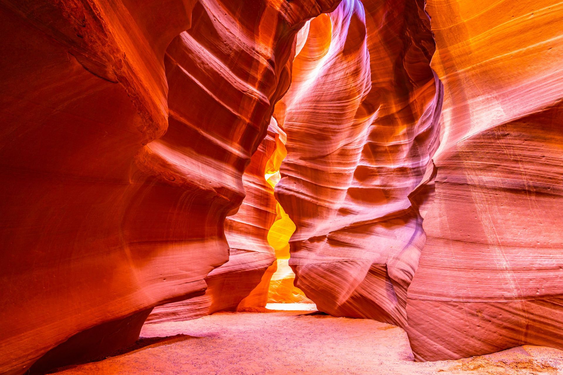
## Description Antelope Canyon, on Navajo land near Page, Arizona, is a set of narrow slot canyons carved into Navajo Sandstone by millennia of water and wind erosion. The result is a sequence of sinuous, polished walls that twist into narrow passages, channeling shafts of light into warm, copper-toned swirls that photographers prize. There are two main sections commonly visited: Upper Antelope Canyon (more iconic for vertical light beams in summer) and Lower Antelope Canyon (a more maze-like walk that requires climbing). The interplay of light, shadow and texture transforms the canyon’s interior into a living sculpture that changes with the sun’s angle. Antelope Canyon’s combination of geological finesse and cultural sensitivity makes it unique: it’s on Navajo Nation land and visits occur under Navajo guides who share cultural context and ensure conservation. The ephemeral quality of light in the canyon is the main draw, and every visit offers a subtly different visual story depending on time of day and season. Visiting Antelope Canyon is an intimate, often crowded experience that rewards patience and close observation. The sculpted walls are tactile and close, and the sense of enclosure makes small variations in light and dust dramatically affect composition. Guides routinely manage group flows and timing to optimize safety and photographic opportunity, and many operators now offer specialized photo tours that allow extra time or more flexible tripod policies. Safety is a constant priority — because slot canyons channel water, flash floods are a real hazard and tours may be altered or canceled in the face of storm risk. Respect for Navajo cultural protocols is also essential: guides often include stories and historical context that enrich a visit and reinforce why access is managed. Beyond the two main canyons, nearby attractions around Page — Horseshoe Bend, Lake Powell and Glen Canyon National Recreation Area — make the area a compact cluster of dramatic southwestern landscapes. Combining these sites into a short itinerary can balance the compressed, processed light of the slot canyons with broad, open panoramas of the Colorado River and surrounding desert. ## Location Antelope Canyon lies near Page, Arizona, in the southwestern United States on Navajo Nation land. The canyons are accessed by guided tours departing from Page; bookings are required, and many operators combine Antelope Canyon with nearby attractions like Horseshoe Bend and Lake Powell. Most tours meet in Page; travel to the canyon involves a short drive and, in some cases, a brief ride across Navajo lands to the canyon entrance. Tour operators coordinate closely with park officials and Navajo authorities; book in advance during peak seasons and confirm pickup details. Page has several accommodation options, from campgrounds to hotels, and is a good base for multi-day exploration of the region. ## Tips - **Book Navajo-guided tours:** Access to both Upper and Lower Antelope Canyons is restricted to authorized Navajo guides — book through reputable operators and respect cultural protocols. - **Time your visit for light:** For the classic light beams in Upper Antelope Canyon, mid-day in summer is preferred; other seasons offer softer, diffused light. - **Bring a tripod if allowed:** Some tours permit tripods (often in photo-specific sessions); check operator policies before arrival. - **Be mindful of flash floods:** Slot canyons can be hazardous during heavy rain; guides monitor weather and may cancel tours if flash flood risk exists. - **Protect your gear from sand:** The environment is dusty; use camera covers and clean gear after visits. - **Choose the right tour type:** Standard interpretive tours offer context and safety; photo tours are slower and often allow tripods but require advance booking. - **Expect narrow passages:** Lower Antelope requires more physical movement; wear comfortable clothes and be prepared to climb short ladders or squeeze through tight sections. - **Respect cultural guidance:** Photography of certain features or during ceremonies may be restricted — follow your guide's direction. - **Combine sites for variety:** Pair canyon visits with sunrise at Horseshoe Bend or a boat trip on Lake Powell to round out your visual narrative. ## Conclusion Antelope Canyon is a masterpiece of erosion and light — a place where sandstone artistry and cultural stewardship intersect to create intense photographic and contemplative experiences. Guided visits make it accessible while honoring its Navajo custodianship. Approach Antelope Canyon with curiosity and respect, and you’ll come away with a visceral appreciation for how water, time and human stewardship intersect. For photographers, the canyon is a study in subtle gradients and form; for travelers, it’s an opportunity to learn about the cultural landscape of the Navajo Nation while witnessing an extraordinary geological gallery. ## FAQ - **Q: Which is better, Upper or Lower Antelope Canyon?** - A: Upper is famed for light beams and is more accessible with level walks; Lower is narrower with ladders and a more adventurous feel. - **Q: Do I need a reservation?** - A: Yes — tours sell out, especially in peak season; book in advance. - **Q: Is Antelope Canyon wheelchair accessible?** - A: Accessibility varies: Upper has relatively easier access but still includes uneven surfaces; check specific operator accommodations. - **Q: Can I fly a drone near Antelope Canyon?** - A: Drone use is generally restricted in Navajo lands and near protected sites; check local rules and obtain permission where applicable. - **Q: What are the best months for photography?** - A: Summer delivers the strongest vertical beams around midday; spring and autumn provide softer light and cooler conditions, which many photographers prefer. - **Q: How long does a typical tour last?** - A: Standard canyon tours range from 45 minutes to 1.5 hours including access and return; photo tours may be longer. - **Q: Are there restrictions on clothing or equipment?** - A: Wear closed-toe shoes for lower canyon sections, protect gear from sand, and follow guide instructions for tripods or flash use. ## Links - [Antelope Canyon — Wikipedia](https://en.wikipedia.org/wiki/Antelope_Canyon) - [Navajo Nation Parks & Recreation](https://www.navajonationparks.org)
GemVoyage Team • World
Utena County
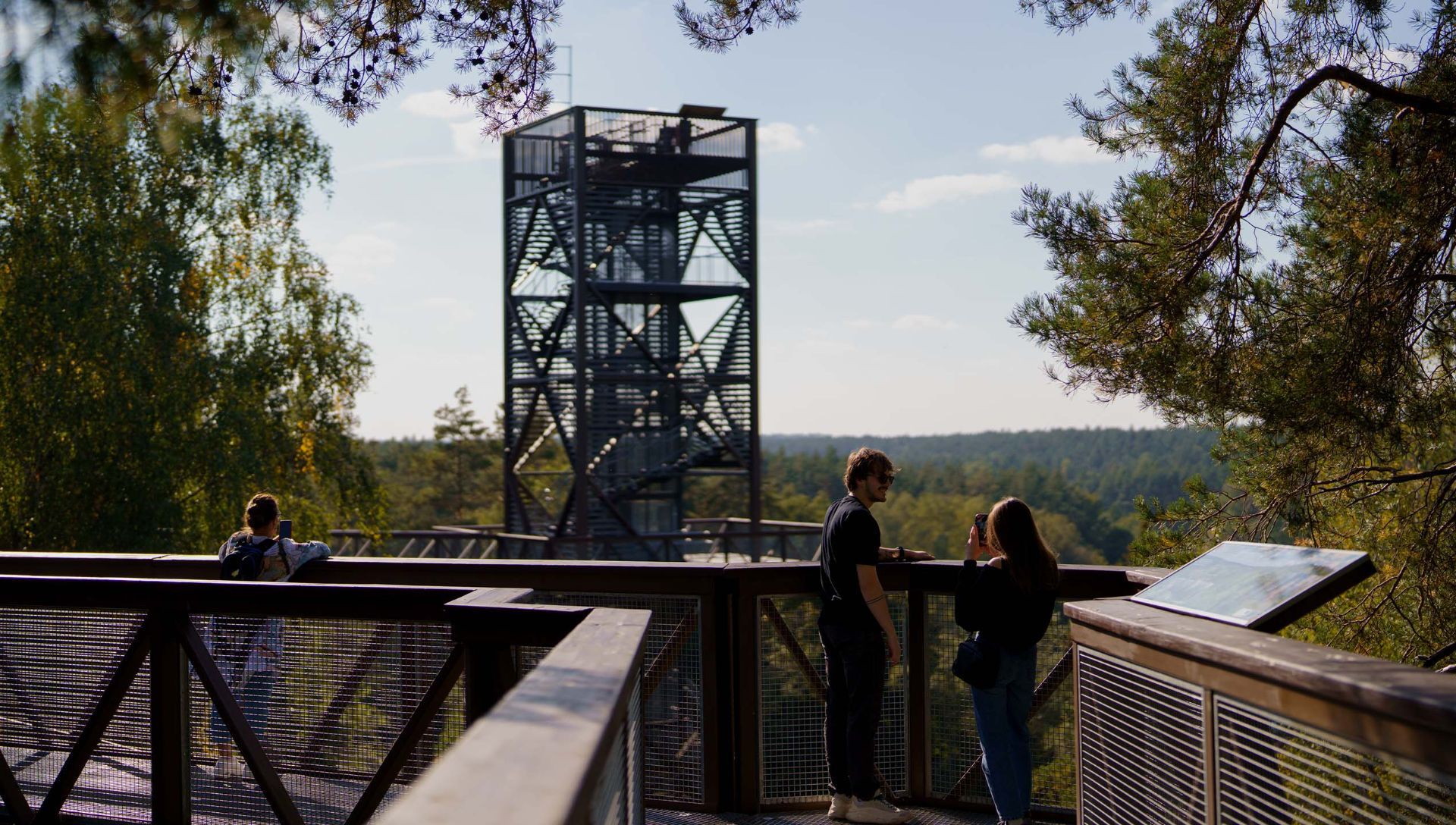
## Description The Anykščiai Treetop Walking Path is an elevated walkway that lifts visitors into the forest canopy near the town of Anykščiai, providing rare, treetop-level perspectives over pine and spruce stands and the winding valley of the Šventoji River. Running across a series of boardwalks and culminating in an observation tower, the path reveals forest structure, understory dynamics, and panoramic views that are otherwise hidden from ground level. What distinguishes this attraction is its combination of accessibility, interpretive design, and conservation-minded construction. The path’s elevated platforms and carefully designed supports minimize soil compaction and root disturbance, protecting vulnerable plant communities below. Along the walkway, interpretive panels introduce visitors to forest ecology, native species, the role of wetlands, and regional conservation initiatives. The experience is both sensory and educational: the canopy’s light, wind, and birdlife offer memorable immersion, while the tower’s panoramic platform rewards visitors with far-reaching vistas of the Šventoji River valley. The path was created with families and broad accessibility in mind—gentle gradients, safety railings, and wide decks make it suitable for many visitors, although final accessibility varies across specific sections. The project reflects a deliberate effort to balance public access, education, and nature protection, making it a model for low-impact environmental tourism. ## Location The Anykščiai Treetop Walking Path is situated near the town of Anykščiai in Utena County, northeastern Lithuania, an area celebrated for its literary history and distinctive wooden architecture. The site is accessible from Vilnius and Kaunas by regional bus services to Anykščiai; local shuttles or taxis can bring visitors the short distance to the trailhead. On-site parking is available during visiting hours, and the town provides dining and accommodation options for longer stays. ## Tips - **Assess height comfort:** The elevated platforms are safe but may be challenging for those with acute fear of heights. Move at your own pace and use railings. - **Bring optics and cameras:** Binoculars and cameras enhance birdwatching and landscape photography from the tower and platforms. - **Visit in warm months:** Late spring through early autumn offers full foliage, active birdlife, and accessible boardwalks; check seasonal opening times for winter closures. - **Dress for the outdoors:** Wear comfortable walking shoes and layered clothing; the canopy can be cooler and windier than the forest floor. - **Combine with Anykščiai cultural sites:** Pair the treetop walk with a visit to the town’s literary museums and wooden architecture for a blended nature-and-culture day. ## Conclusion The Anykščiai Treetop Walking Path is an accessible, interpretive experience that invites visitors to discover forest ecology from a new vantage point. It combines low-impact design, educational materials, and dramatic views—ideal for families, school groups, and nature enthusiasts interested in immersive environmental learning. ## FAQ - **Q: Is the Anykščiai treetop path suitable for wheelchairs or strollers?** A: Some sections are designed to be accessible, but full accessibility can vary—contact the site in advance for details on ramps and platform access. - **Q: How much time should I plan for a visit?** A: Plan 1–2 hours to walk the path, ascend the observation tower, and read interpretive panels; longer if you want to picnic or birdwatch. - **Q: Is there an entrance fee or opening season?** A: Many treetop paths charge a modest fee and operate seasonally—confirm current hours and rates on the official site or local tourist information. - **Q: Are dogs allowed on the treetop path?** A: Policy varies; some paths allow well-controlled dogs on short leashes while others restrict pets to protect wildlife—check rules before bringing pets. - **Q: Can the path be used for school or group education?** A: Yes—interpretive panels and safe design make it ideal for school groups; contact local organizers to arrange guided programs or group rates. - **Q: Is the path safe in wet weather?** A: Walkways can be slippery when wet—use caution and appropriate footwear. Some sections may be closed during severe weather for safety. ## Links -- [Hike Information](https://saugoma.lt/en/objects/objects-the-treetop-walking-path)
GemVoyage Team • World
Amazonas
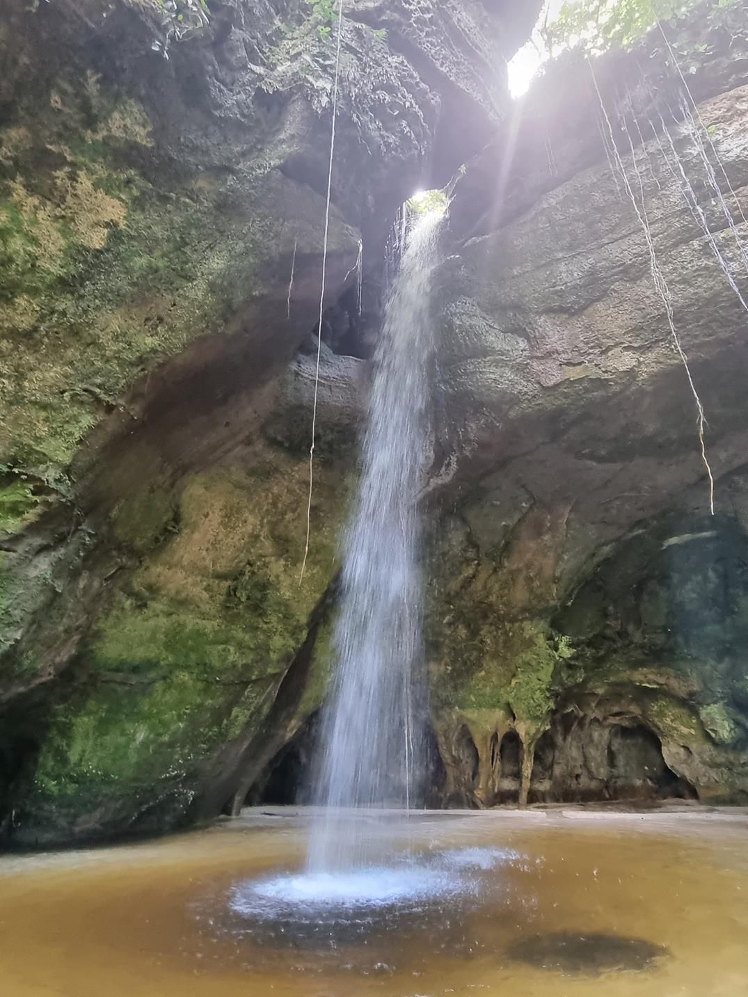
## Description Deep within the lush rainforest of the Amazon lies a pair of natural wonders: **Caverna do Maroaga (Maroaga Cave)** and **Caverna da Judeia (Judeia Cave)**. These caves are part of the Presidente Figueiredo municipality in northern Brazil, often nicknamed the “Land of Waterfalls and Caves” due to its unique geology and landscapes. The **Maroaga Cave** is famous for its dramatic sandstone formations and a stream that flows directly from within, creating a mystical atmosphere as the water emerges from the cave’s dark interior. Sunlight filtering through the forest canopy reflects on the water, giving the cave a magical glow. Its name comes from a local indigenous chief, Maroaga, who is said to have used the cave as a hideout, adding a layer of legend to its natural beauty. The nearby **Judeia Cave** is equally captivating. It features a more intimate setting, with a waterfall cascading over its entrance and forming a natural curtain of water. Walking behind the waterfall offers visitors a unique and refreshing perspective, with the sound of rushing water echoing throughout the cave. A little-known fact is that both caves are part of the same ecological reserve, which shelters a vast variety of flora and fauna. Biologists have recorded rare species of bats and amphibians in these caves, making them not only scenic wonders but also important ecological habitats. ## Location Caverna do Maroaga and Caverna da Judeia are located in **Presidente Figueiredo**, a municipality in the state of **Amazonas**, in northern **Brazil**. The region lies about 107 kilometers north of **Manaus**, the capital of Amazonas, along the BR-174 highway. The most common way to reach the caves is by car or organized tour from Manaus. The drive takes about two hours and passes through dense rainforest landscapes. Once at the entrance to the reserve, guided hikes of varying lengths lead to the caves. The trails are not particularly difficult, but they can be muddy and slippery, especially during the rainy season. For international visitors, the easiest route is to fly into Manaus and then book a day trip or multi-day tour that includes the caves as part of a broader itinerary of waterfalls and natural attractions. ## Tips * **Wear proper footwear:** Hiking boots or sturdy shoes are recommended, as the trails can be wet and uneven. * **Hire a guide:** Local guides not only ensure safety but also provide insights into the caves’ legends, geology, and biodiversity. * **Bring swimwear and a towel:** The waterfalls and streams around the caves are perfect for cooling off after a hike. * **Pack insect repellent:** The Amazon rainforest is home to mosquitoes and other insects, especially near water sources. * **Visit during the dry season:** From June to November, the trails are easier to access, although the rainy season offers stronger waterfalls and a wilder atmosphere. * **Respect the environment:** Avoid leaving litter, and do not disturb the caves’ wildlife, particularly bats and amphibians. ## Conclusion Caverna do Maroaga and Caverna da Judeia showcase the wild beauty and hidden wonders of Brazil’s Amazon rainforest. With their waterfalls, sandstone formations, and legendary history, they are must-visit sites for eco-tourists and adventurers seeking an authentic experience in the heart of nature. Together, they represent not just geological marvels but also living ecosystems that deserve protection and respect. ## FAQ **1. Do I need a guide to visit the caves?** Yes, local guides are highly recommended for safety, navigation, and to ensure the preservation of the natural environment. **2. Can I swim near the caves?** Yes, swimming is allowed in the pools and streams near the caves, but always follow local safety advice. **3. How difficult are the hikes to the caves?** The hikes are moderate in difficulty, with some slippery and uneven sections. Good footwear is essential. **4. Are the caves accessible year-round?** Yes, but the experience differs by season. The rainy season (December–May) offers stronger waterfalls, while the dry season (June–November) makes trails easier to navigate. **5. What wildlife might I see?** Bats, amphibians, tropical birds, and a wide variety of insects inhabit the area. Lucky visitors may even spot monkeys in the surrounding forest. **6. How long should I plan for a visit?** Most tours include both caves in a half-day excursion, though spending a full day allows more time to explore nearby waterfalls and trails. ## Links * [Amazons Wiki](https://en.wikipedia.org/wiki/Amazonas_(Brazilian_state))
GemVoyage Team • World

Comments