GemVoyage Team • World
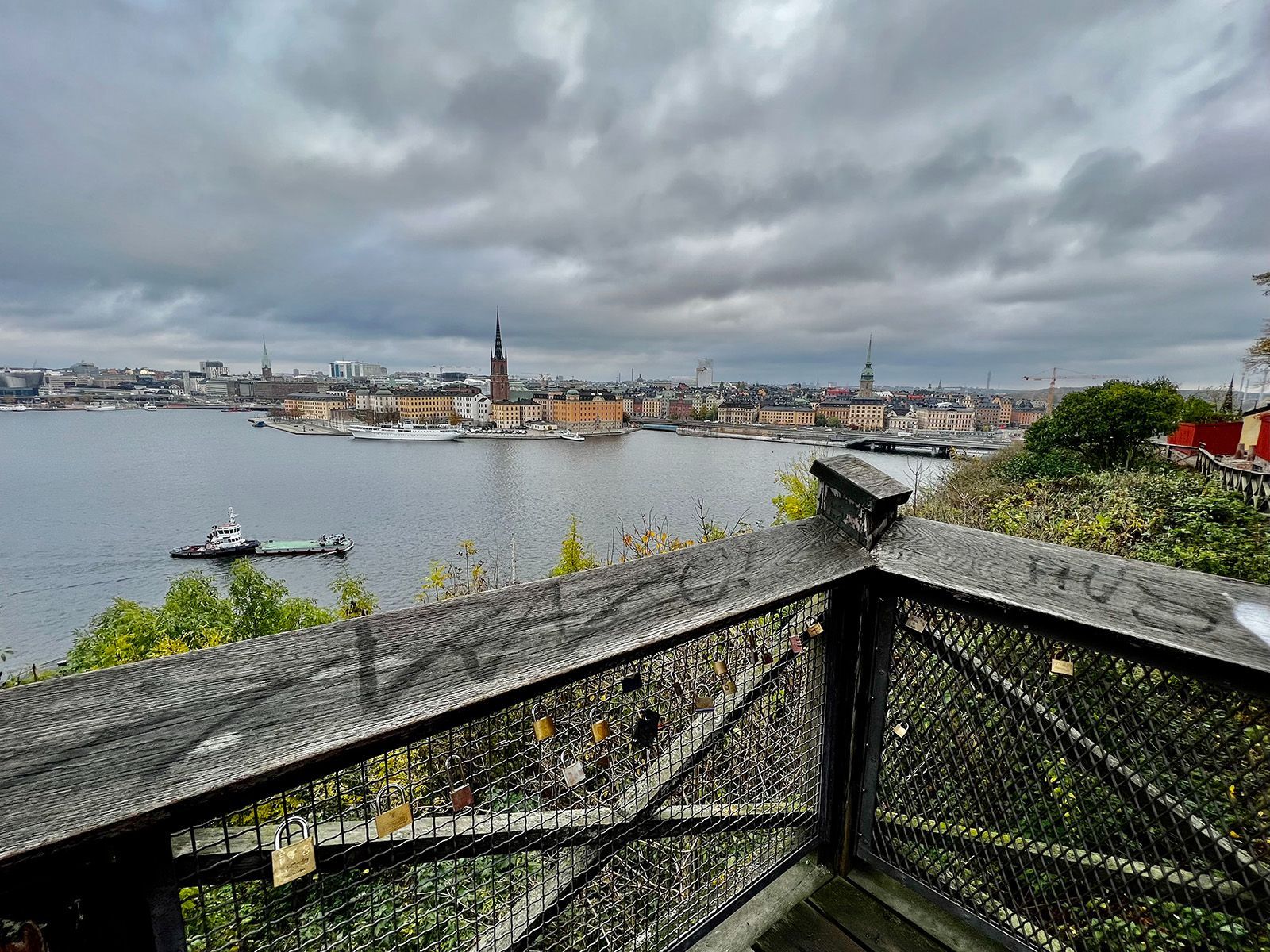
The viewpoint’s appeal lies in its mixture of accessibility and atmosphere. You do not need to climb a mountain or travel far from the center to get a memorable outlook. Instead, you can step into a residential and elevated part of the city and find a broad view that feels almost theatrical. One little-known fact is that Monteliusvägen is particularly admired by locals for how reliably it delivers a strong skyline view without the crowds associated with more obvious tourist stops. Another is that the path changes character with the seasons; winter can make the scenery crisp and graphic, while summer brings long, luminous evenings and a more relaxed mood.
What also makes Monteliusvägen special is that it combines motion and pause. As you walk, the city opens and closes in layers. You might pass benches, low walls, and quiet residential details, then suddenly find a view that feels worthy of a postcard. That rhythm encourages visitors to slow down rather than rush through. It is a great place to arrive without a fixed plan, because the reward comes from both the walk and the destination.
For photographers and casual visitors alike, the viewpoint is one of Stockholm’s most satisfying urban experiences. It captures the city’s relation to water, its elegant low-rise skyline, and its subtle balance between nature and urban form. A sunset visit can be particularly memorable, but the viewpoint works at many times of day because the geometry of the city and the water remains compelling even in flat light.
The easiest access is via Stockholm’s metro system to nearby stations such as Slussen, followed by a walk through Södermalm. From there, signage and local navigation are usually straightforward enough for most visitors to find the viewpoint. Since the area is so central, it is simple to pair it with a coffee stop, dinner, or a longer Södermalm exploration.
If you want the best photo conditions, go near sunset or during the soft light of early morning. For a quieter experience, avoid peak sightseeing hours when possible.
Discover more hidden gems you might love.
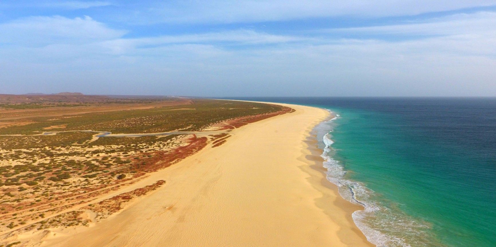
Boa Vista
## Description Praia de Santa Mónica is often described as one of the most beautiful beaches in the world—and with good reason. Stretching over 18 kilometers along the southern coast of Boa Vista, Cape Verde, this vast expanse of golden sand and turquoise water remains almost untouched by development. Its name, “Santa Mónica,” was inspired by California’s famous beach, yet its charm lies in its wild and pristine character. The beach is unique because of its sheer size and tranquility. Unlike other popular destinations, Praia de Santa Mónica rarely feels crowded, even during peak travel seasons. Visitors are treated to panoramic views of rolling dunes, crystal-clear waves, and endless horizons. The beach is also known for being a nesting site for sea turtles, particularly the endangered Caretta caretta (loggerhead turtle). During nesting season, guided tours allow travelers to observe these creatures responsibly, making for a truly unforgettable experience. A little-known fact is that the beach is part of the Morro de Areia Nature Reserve, a protected area aimed at conserving both marine and terrestrial biodiversity. This adds an extra layer of significance for those seeking eco-friendly and sustainable travel experiences. ## Location Praia de Santa Mónica is located on the island of **Boa Vista**, one of the ten main islands of **Cape Verde**, an archipelago off the west coast of **Africa** in the Atlantic Ocean. The beach lies on the southwestern coast of Boa Vista, approximately 20 kilometers from the island’s capital, Sal Rei. To reach Praia de Santa Mónica, most visitors first arrive at Aristides Pereira International Airport (BVC) in Boa Vista. From there, taxis or guided tours can take you to the beach in around 40 minutes. Since public transport is limited on the island, arranging private transfers or joining an organized excursion is recommended. Off-road vehicles are often used, as some roads to the beach remain unpaved, adding a sense of adventure to the journey. ## Tips * **Bring essentials:** There are few facilities on-site, so pack water, snacks, sunscreen, and shade if you plan to spend several hours there. * **Swimming caution:** While the water looks inviting, currents can sometimes be strong. Check local conditions before swimming and stick to calmer areas. * **Best time to visit:** Early morning or late afternoon provide not only cooler temperatures but also the most stunning light for photography. * **Turtle watching:** If visiting between June and October, book a guided turtle-watching excursion to witness the nesting or hatching process. These tours are regulated to ensure the animals are not disturbed. * **Respect the environment:** Stay on marked paths to protect dunes and wildlife, and avoid leaving litter behind. * **Combine with a tour:** Many excursions include stops at Santa Mónica along with other highlights of Boa Vista, such as the Viana Desert or the shipwreck of Cabo Santa Maria. ## Conclusion Praia de Santa Mónica in Cape Verde is a destination for those seeking unspoiled beauty, peace, and a connection with nature. With its endless sandy shores, rich biodiversity, and breathtaking views, it offers a paradise-like escape far removed from crowded tourist resorts. For travelers looking to experience Cape Verde at its most authentic, this beach is an absolute must. ## FAQ **1. Is Praia de Santa Mónica suitable for families?** Yes, families can enjoy the wide sandy beach, but parents should monitor children closely when swimming due to occasional strong currents. **2. Are there restaurants or shops nearby?** No, the beach is largely undeveloped. It’s best to bring supplies from Sal Rei or your hotel before heading there. **3. How long should I plan to spend at the beach?** Many visitors spend a half-day to enjoy the scenery and relax, but nature lovers and photographers often stay longer. **4. Is it possible to surf or kiteboard at Santa Mónica?** The beach can offer good waves, but it’s less developed for water sports than other parts of Boa Vista. Consult local guides if you’re looking for surfing or kitesurfing opportunities. **5. Can I see turtles on my own?** For conservation reasons, turtle watching should only be done with licensed guides. This ensures the safety of both the turtles and visitors. **6. What’s the best way to get there?** The easiest way is by booking a taxi or an organized 4x4 tour from Sal Rei or your resort. Public transport does not reach the area. ## Links * [Cape Verde Tourism Official Site](https://www.visit-caboverde.com) * [Boa Vista Tourism Guide](https://www.boavistaofficial.com)
GemVoyage Team • World
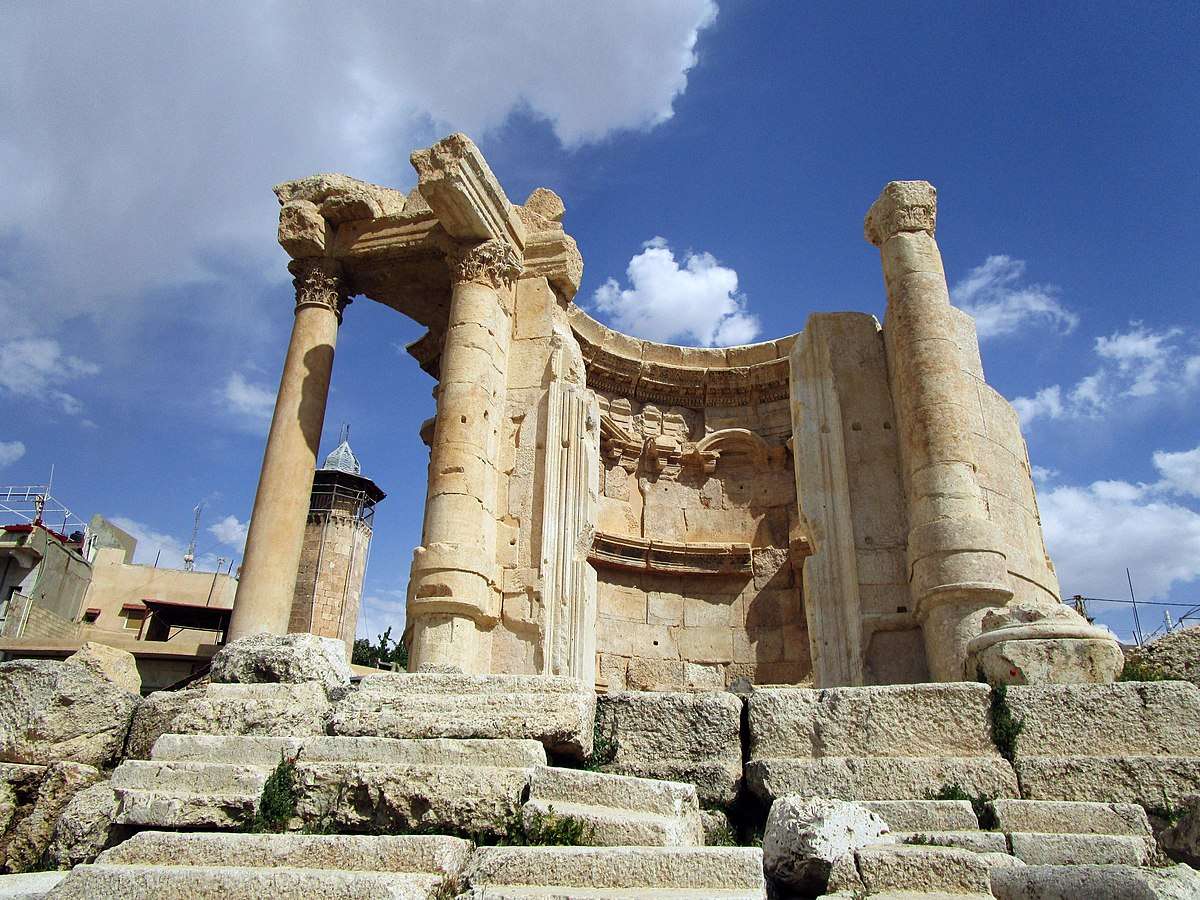
Baalbek
## Description The Temple of Venus in Baalbek, Lebanon, is a captivating remnant of Roman architecture and religious history, tucked within one of the most impressive archaeological complexes in the Middle East. Built in the 3rd century AD, this temple stands out for its **unusual circular design**, a departure from the more common rectangular Roman temples. It was dedicated to Venus, the Roman goddess of love and beauty, and its elegant structure reflects the sensuality and grace associated with her worship. Unlike the colossal temples of Jupiter and Bacchus nearby, the Temple of Venus is more intimate in scale but no less remarkable. It sits atop a horseshoe-shaped platform and features a circular shrine with a square entrance. The outer façade is adorned with five niches, each decorated with carvings of doves and shells—symbols traditionally linked to Venus. These details, along with the temple’s baroque-style curves and arches, showcase a fusion of Roman and Hellenistic architectural techniques. A little-known fact: the temple was later converted into a Christian church dedicated to Saint Barbara, a martyr whose legend is still revered in Lebanon. According to tradition, she was killed by her pagan father for converting to Christianity, and the temple’s continued use as a sacred site reflects the layered religious history of Baalbek. Today, a small mosque stands nearby, underscoring the site’s enduring spiritual significance across centuries and faiths. ## Location The Temple of Venus is located in **Lebanon**, within the **Baalbek-Hermel Governorate**, in the ancient city of **Baalbek**. This city lies in the **northern Bekaa Valley**, a region known for its fertile lands and rich historical tapestry. ### How to Get There: - **By Car**: From Beirut, Baalbek is about a 2-hour drive northeast. The route via Zahle offers scenic views of the Bekaa Valley. - **By Bus**: Public minibuses run from Beirut’s Cola Station to Baalbek, though schedules can be irregular. - **By Tour**: Many guided tours from Beirut include Baalbek’s temple complex, often paired with visits to Anjar or Ksara Winery. Once in Baalbek, the Temple of Venus is just a short walk from the main entrance to the Roman ruins, southeast of the Temple of Jupiter. ## Tips for Visitors To make the most of your visit to the Temple of Venus, consider these tips: - **Visit Early or Late**: The site can get hot and crowded midday. Morning or late afternoon offers better lighting and fewer tourists. - **Wear Comfortable Shoes**: The terrain is uneven, with ancient stones and gravel paths. - **Hire a Guide**: A local guide can provide rich historical context and point out hidden details you might miss. - **Respect the Site**: This is a sacred and historical location. Avoid climbing on ruins or touching carvings. - **Bring Water and Sunscreen**: The Bekaa Valley can be dry and sunny, especially in summer. - **Explore the Whole Complex**: Don’t miss the nearby temples of Jupiter and Bacchus, which are among the largest Roman temples ever built. ## Conclusion The Temple of Venus in Baalbek is a graceful and historically rich monument that offers a unique glimpse into Roman spirituality, architectural innovation, and Lebanon’s layered religious heritage. Its elegant design and enduring presence make it a must-visit for history lovers and curious travelers alike. ## FAQ **1. When was the Temple of Venus built?** It was constructed in the 3rd century AD during the Roman Empire. **2. What makes the Temple of Venus unique?** Its circular design, horseshoe-shaped platform, and symbolic carvings distinguish it from typical Roman temples. **3. Is the temple part of a larger complex?** Yes, it’s part of the Baalbek temple complex, which includes the massive temples of Jupiter and Bacchus. **4. Can I visit the temple year-round?** Yes, the site is open daily and accessible throughout the year. **5. Is there an entrance fee?** Yes, entry to the Baalbek ruins requires a ticket, which includes access to the Temple of Venus. **6. Is the site family-friendly?** Absolutely. The complex is suitable for children and offers a fascinating educational experience. ## Links - [Baalbek Temple of Venus – Livius Ancient History](https://www.livius.org/articles/place/heliopolis-baalbek/baalbek-photos/baalbek-temple-of-the-venus/)
GemVoyage Team • World
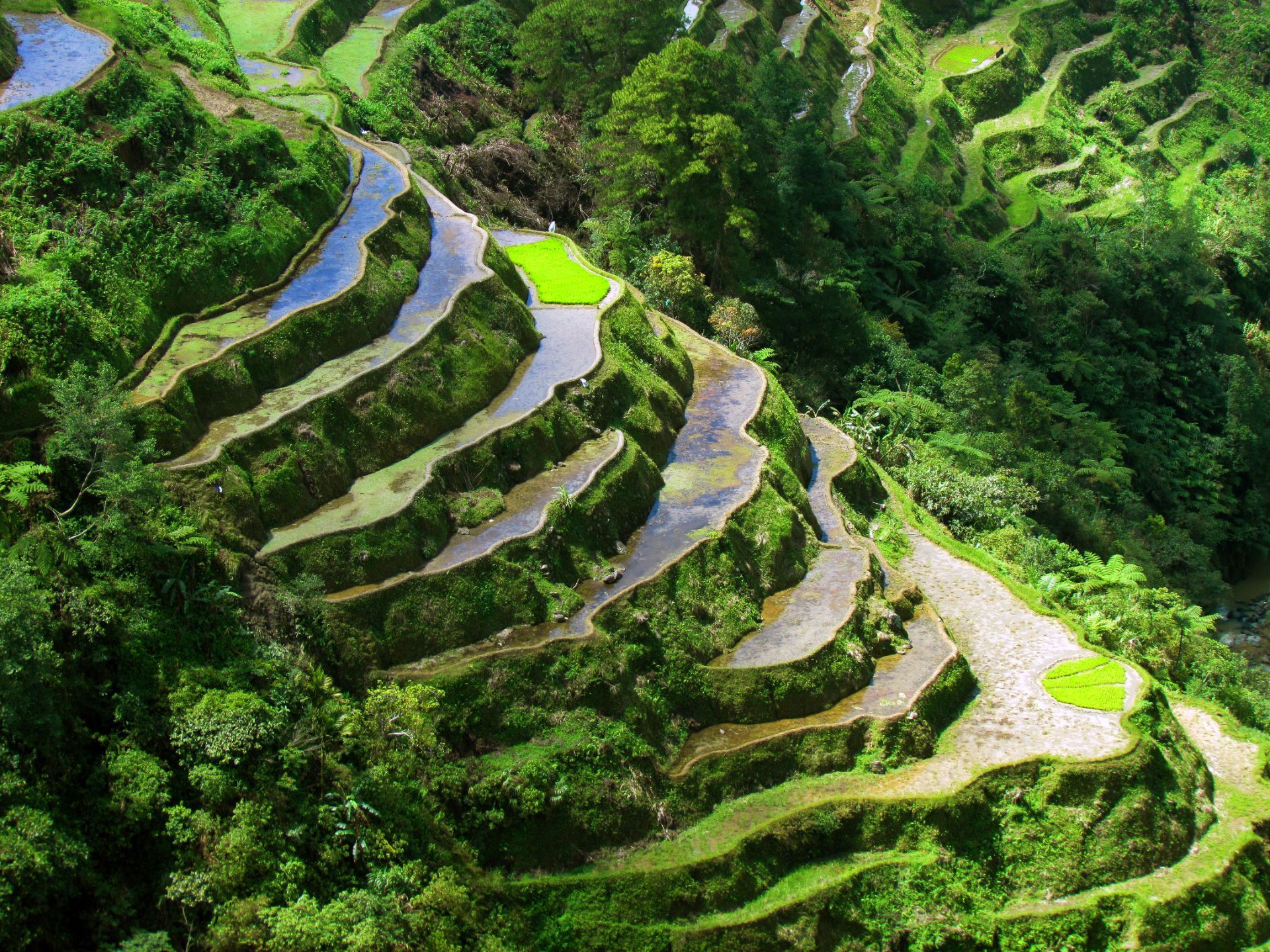
Banaue
## Description The Banaue Rice Terraces in the Philippines are sculpted steps carved into the mountains of Ifugao by ancestral farmers over two millennia. Often called the “Eighth Wonder of the World,” these terraces contour steep hillsides and are sustained through traditional irrigation practices that channel spring water from higher slopes. The terraces are living agricultural systems intertwined with Ifugao cultural practices, rituals and stone-carved cultural markers. Beyond panoramic views, the Banaue terraces are an active cultural landscape where seasonal labor, communal rights, and ecological knowledge interlock. Local Ifugao communities maintain terrace walls, water channels, and social protocols for planting and harvest. For visitors interested in agroecology, heritage tourism, and sustainable rural economies, Banaue is a primary example of long-term landscape management. Useful search phrases for planning include "Banaue terraces trek," "Batad amphitheater guide," "Ifugao homestay," and "Banaue sustainable tourism." Visitor experience: Most travelers arrive in Banaue town and use local guides to reach viewpoints and neighboring villages. The terraces change character with seasons: after planting, paddies can be flooded and reflective (excellent for photography), during growth they form layered greens, and at harvest they reveal golden swaths. The Batad amphitheater is particularly dramatic, reachable by a steep trail, and often best experienced with an overnight stay to appreciate pre-dawn light and village rhythms. Conservation and community practice: The terrace systems' longevity stems from shared labor systems and knowledge transmission. Recent initiatives combine cultural preservation with ecotourism—homestays, craft cooperatives, and guided treks funnel tourism revenue into community projects and support intergenerational skills like weaving and woodcarving. ## Location Banaue is in the mountainous Ifugao province of northern Luzon, Philippines. Access from Manila typically involves an overnight bus or van to Banaue town with local trails connecting viewpoint areas and nearby villages like Batad. How to get there: Overnight public buses, private vans, and small-group shuttles connect Manila and Banaue (journey time ~8–10 hours depending on route). For planning, search queries such as "Manila to Banaue bus schedule," "Banaue homestay booking," and "Batad trek difficulty" help match logistics to fitness and timing. Travelers with limited time can coordinate direct tours, while those seeking depth should allow multiple days to trek, stay with host families, and participate in village activities. Local mobility and safety: Trails can be steep, wet, and uneven—good hiking shoes and a local guide improve safety and cultural interpretation. Many villages have basic facilities; cash is essential for local purchases, fees, and tips. Mobile service may be limited in valleys; download maps and contact details before setting out. ## Tips - **Respect terraced farms and pathways:** Stick to designated trails and avoid trampling crops; always ask before entering private terraces. - **Hire local guides for treks:** Guides support local economies and provide insights into terrace management, legends, and best viewpoints like the Batad amphitheater. - **Consider homestays for cultural immersion:** Overnight stays in Ifugao homes provide meals, storytelling, and direct support for households maintaining terraces. - **Pack for remote conditions:** Bring rain gear, layers, sturdy footwear, sun protection, insect repellent, and spare cash. - **Time your visit to seasonal cycles:** Decide whether you want flooded paddies for reflective photography (planting season) or golden harvest visuals and choose dates accordingly. - **Buy crafts ethically:** Purchase textiles and woodwork through cooperative channels or directly from artisans to ensure fair compensation. ## Conclusion Banaue’s rice terraces are living heritage — an interplay of agricultural skill, cultural continuity and mountain ecology that rewards slow travel and respectful engagement. Plan to spend time with local guides and hosts to appreciate both the landscape engineering and the cultural systems that sustain it. When using AI trip planners or search queries, include preferences like "homestay" and "guided Batad trek" to get routes that support local livelihoods. ## FAQ - **Q: Is Batad part of the Banaue terraces?** A: Batad is a nearby amphitheater-like terrace cluster often visited with Banaue; it requires a separate trek from Banaue town and is notable for its bowl-shaped formation and communal irrigation channels. - **Q: What’s the best time to visit?** A: Dry months (November–April) make trekking easier; planting and post-planting seasons show flooded paddies for dramatic reflections, while harvest season highlights agricultural activity and golden colors. - **Q: How fit do I need to be for treks?** A: Trails vary from easy viewpoint walks to strenuous hikes with steep steps—moderate fitness and good footwear are advisable. Guides can adapt routes to your ability. - **Q: Are homestays safe and reliable?** A: Many homestays offer clean, simple accommodations and authentic meals. Check recent reviews and confirm amenities (hot water, sleeping arrangements) when booking. - **Q: Can I visit independently without a guide?** A: Solo trekkers can visit some areas, but local guides improve safety, interpretation, and community benefits; hiring a guide contributes directly to village incomes. ## Links - [Banaue Rice Terraces — Wikipedia](https://en.wikipedia.org/wiki/Banaue_Rice_Terraces)
GemVoyage Team • World
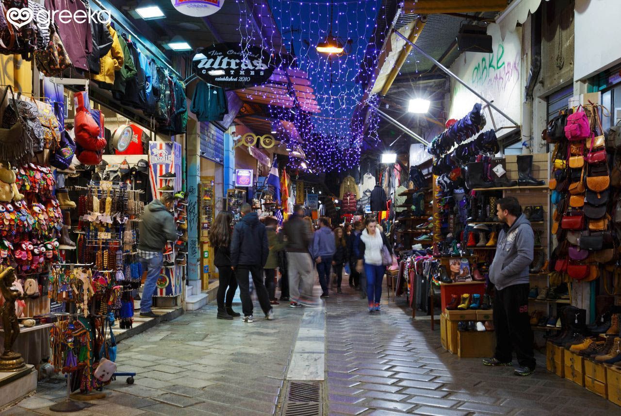
Athens
## Description Monastiraki Flea Market is the beating, bustling heart of Athens' informal shopping scene—an open, labyrinthine neighborhood market where layers of history and commerce intersect. Stalls and small shops spill into pedestrian lanes, offering antiques, textiles, ceramics, vintage clothing, books, and artisan curios alongside more touristic souvenirs. What makes Monastiraki especially compelling is its density of experiences: within a few minutes you can move from a stall stacked with retro vinyl to a tiny workshop crafting leather goods, or from a sidewalk cafe to a covered antique arcade. The market’s appeal is not only in the goods but in the social choreography: bargaining conversations, the rhythm of vendors calling out, and the way the market sits against a backdrop of ancient ruins and Ottoman-era alleys. Many travelers are surprised by the market’s everyday qualities—local shoppers source household goods and clothing here, so it’s not just a tourist carnival. At the same time, antiques and rare finds do appear, especially in the narrower lanes where veteran dealers have made their homes. ## Location Monastiraki is a central Athens neighborhood clustered around Monastiraki Square and the Monastiraki metro station. It sits adjacent to the ancient Agora and within easy walking distance of Plaka, the Acropolis, and Syntagma Square. The market isn’t confined to a single street but spills across several narrow lanes and squares, so plan to wander on foot and let the area unfold gradually. Because the market is woven into the city center, the best approach is pedestrian: arrive by metro and start on the main square, then explore side streets and covered arcades for more specialized finds. Nearby rooftop cafés and tavernas allow for breaks and people-watching between shopping spurts. ## Tips - Bring cash and small bills—while many places accept cards, smaller stalls often prefer cash. - Start early to avoid the thickest crowds and to catch dealers arranging their stalls. - Compare prices across stalls when shopping for antiques or vintage items; genuine bargains sometimes appear mid-week. - Ask questions and be friendly when bargaining—polite conversation gets better results than hard haggling. - Protect your belongings: crowds and narrow lanes make pickpocketing a possibility. - Explore beyond the main lanes: covered arcades and quieter side streets sometimes hold the best finds. ## Conclusion Monastiraki Flea Market is more than shopping; it’s an urban ritual that mixes trade, food, and history. Whether you come looking for a specific antique or just want to soak up Athens’ street-level energy, Monastiraki rewards curiosity, patience, and a willingness to wander. ## FAQ ### Is Monastiraki Flea Market only for tourists? No. While tourists are common, the market also serves local shoppers and small businesses, giving it a layered, authentic atmosphere. ### Can I bargain there? Yes—especially for antiques, vintage items, and bulk purchases. Approach bargaining with politeness and realistic expectations. ### What should I look for? Keep an eye out for vintage jewelry, retro vinyl, ceramics, handmade leather, and secondhand books. Antiques and unique local crafts are concentrated in side lanes and arcades. ### How crowded does it get? It can be very crowded on weekends and afternoons. Early morning weekdays are quieter and often more pleasant for careful browsing. ### How much time should I allow? Give yourself at least 1.5–3 hours if you want to browse comfortable; plan more time if you intend to hunt for specific antiques. ## Links - [Wikipedia](https://en.wikipedia.org/wiki/Monastiraki)
GemVoyage Team • World
Lisbon
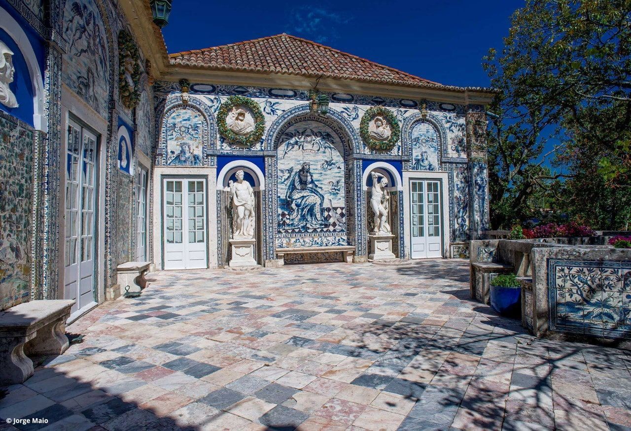
## Description Palácio dos Marqueses de Fronteira is an elegant, family-owned 17th-century estate on the edge of Lisbon that delights visitors with its exceptional azulejo tile panels, intimate museum rooms, and meticulously designed gardens. The palace feels less like a public museum and more like entering a well-preserved private residence that has been lived in and cared for by the same lineage of nobility for centuries. Interiors display an array of period furniture, heirloom portraits, and decorative arts that create a layered sense of domestic aristocratic life. The palace’s defining artistic draw is its azulejo program: large narrative tile panels that record hunting scenes, mythological episodes, allegories, and courtly imagery, executed in the refined blue-and-white and polychrome palettes typical of the 17th and 18th centuries. These tiles cover interior and exterior walls, forming pictorial narratives that reward close looking. Complementing the tiles are frescoes, gilded frames and sculptural elements that reflect Baroque and Rococo tastes adapted to Portuguese sensibilities. The gardens are a major reason to visit. Laid out with geometric hedges, elegant statuary and reflecting pools, they weave Moorish and Renaissance influences into a distinctly Portuguese landscape grammar. Garden rooms framed by clipped yews and boxwood create intimate vistas, while larger terraces open to sweeping views of the surrounding neighborhood. Seasonal plantings and careful maintenance mean the palace is beautiful year-round, although spring and early summer are especially lush. Conservation and stewardship at the palace are noteworthy: the family’s ongoing custodianship has supported careful tile restoration projects and the preservation of original material culture. Many of the conservation interventions have been carried out by local artisans using traditional techniques, preserving not just objects but craft knowledge. Photographic and accessibility note: photographers should plan for a mix of wide-angle shots of garden terraces and close-ups of tile details; early morning light reduces harsh shadows on glazed surfaces. Visitors requiring mobility assistance should contact palace staff ahead of time to arrange the smoothest route through garden paths and to confirm which rooms are accessible. ## Location The palace is located in the Benfica neighborhood of Lisbon, a short drive northwest of central districts like Rossio and Baixa. From the historic center, it typically takes 15–25 minutes by car depending on traffic. Public transit options involve buses and sometimes a combination of tram and bus; travelers should allow extra time for connections and walking to the palace grounds. Getting there: taxis and rideshares are convenient and typically the fastest way for visitors without a car. If using public transport, check current bus routes and schedules and allow for a short walk from the nearest stop to the palace entrance. ## Tips - Book tickets in advance when possible; guided tours are often limited and sell out during peak season. - Wear comfortable shoes: garden paths include gravel and uneven surfaces. - Respect interior rules: certain rooms may be closed or restricted for conservation reasons; photography inside may be limited. - Bring a camera and consider different lenses: a wide-angle captures garden vistas while a close lens helps study tile details. - Time your visit: visit in the morning light for softer photographs and more tranquil garden conditions. - Combine visits: pair the palace with nearby cultural sites such as the National Coach Museum or a walk in Monsanto Forest Park for a varied day. ## Conclusion Palácio dos Marqueses de Fronteira is a quietly grand escape from Lisbon’s busiest tourist routes. It rewards the patient visitor — those who enjoy architectural decoration, tile art and carefully tended gardens — with an intimate glimpse of aristocratic Portuguese life. The palace’s careful preservation and the family’s ongoing care make it a dignified and deeply rewarding stop on a cultural itinerary. ## FAQ Q: Are guided tours available? A: Yes. Guided tours are offered and provide detailed historical context about the palace, its tiles and the family’s history. Check the palace’s official website or local tourism resources for times and booking procedures. Q: Is the palace wheelchair accessible? A: Accessibility is limited in some historic rooms and garden areas due to steps and uneven terrain. Contact the palace in advance to discuss specific access requirements and to learn which sections are accessible. Q: Can I photograph inside the palace and gardens? A: Photography is usually permitted in the gardens; some interior rooms may restrict photography to protect delicate materials. Always follow posted signs and staff instructions. Q: How long should I allow for a visit? A: Plan for 1–2 hours to see the main rooms and stroll the gardens at a relaxed pace. If you are a tile or garden enthusiast, you may wish to allow more time. Q: Are there any special events or seasonal highlights? A: The palace occasionally hosts concerts, temporary exhibitions, or guided thematic tours. Spring and early summer offer peak garden blooms and are popular times to visit. ## Links - [Wikipedia: Palácio dos Marqueses de Fronteira](https://en.wikipedia.org/wiki/Palace_of_the_Marquises_of_Fronteira)
GemVoyage Team • World
Connacht
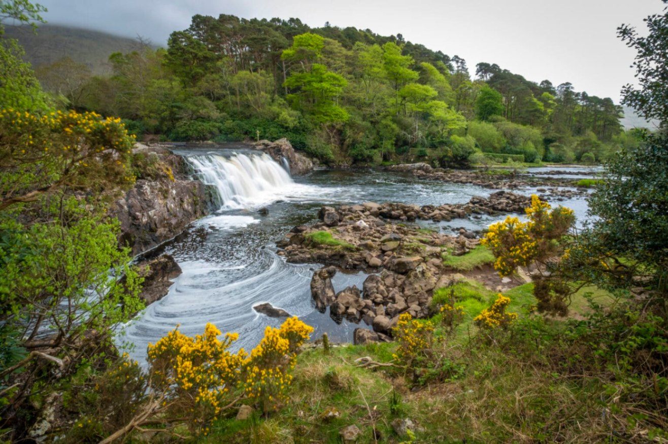
## Description **Aasleagh Falls** is one of Ireland’s most quietly dramatic natural sights, where freshwater from the Connemara mountains meets the tidal waters of Killary Harbour. Unlike towering waterfalls designed to impress through height alone, Aasleagh Falls is defined by **movement, light, and setting**. Its power and appearance change constantly depending on rainfall, tide levels, and weather conditions, making every visit slightly different. The waterfall is formed by the **Erriff River**, which descends rapidly over smooth rock shelves just before flowing into Killary Harbour, Ireland’s only fjord. At high tide, seawater pushes upriver, partially submerging the lower cascades and creating a rare visual effect where fresh and saltwater interact. At low tide, the falls appear more forceful and exposed, revealing multiple channels and textures in the rock. What makes Aasleagh Falls particularly special is its **sense of isolation and scale relative to its surroundings**. Backed by rugged mountains and often framed by mist or low clouds, the falls feel far removed from modern life despite being accessible by road. A lesser-known fact is that the area around the falls has long been a **salmon fishing site**, and anglers can sometimes be seen working the waters nearby. Another overlooked detail is that the name “Aasleagh” is derived from Irish, roughly translating to a “rocky place,” a fitting description of the terrain shaped by water over millennia. Aasleagh Falls is not fenced, ticketed, or curated. It exists as it always has: exposed, elemental, and dependent on nature rather than infrastructure. This rawness is central to its appeal. ## Location **Country:** Ireland **Province:** Connacht **County:** Mayo **Nearby Area:** Leenane / Killary Harbour Aasleagh Falls is located at the eastern end of **Killary Harbour**, near the border between County Mayo and County Galway, in one of Ireland’s most scenic regions. ### How to Get There * **By car:** * From Westport, drive toward Leenane via the N59. The falls are located just before entering the village and are visible from the roadside. * **By bus:** * Limited rural bus services operate in the area; schedules are infrequent and not ideal for flexible visits. * **On foot or by bicycle:** * Possible if staying nearby, but weather and narrow roads should be considered. There is no formal parking lot; roadside pull-ins are commonly used. ## Tips * **Visit after rainfall:** The falls are most impressive following heavy rain. * **Check the tide:** Low tide reveals more of the cascade structure. * **Wear waterproof footwear:** The ground can be wet and uneven. * **Be cautious near the edge:** There are no safety barriers. * **Combine with scenic drives:** The surrounding roads offer some of Ireland’s best coastal and mountain views. * **Bring a camera:** Light conditions change rapidly and can be spectacular. ## Conclusion Aasleagh Falls is a powerful example of Ireland’s understated natural beauty. Its shifting form, dramatic setting, and lack of commercialization make it ideal for visitors seeking authenticity, solitude, and a deeper connection with the landscape. ## FAQ **1. Is there an entrance fee to Aasleagh Falls?** No, access is completely free. **2. How tall is the waterfall?** It is relatively low in height, but wide and dynamic rather than vertical. **3. When is the best time to visit?** After rainfall and during low tide for the most dramatic views. **4. Is it suitable for children?** Yes, with close supervision due to the lack of barriers. **5. Can you swim near the falls?** Swimming is not recommended due to strong currents and tidal influence. **6. How long should I plan to stay?** Around **20 to 30 minutes**, longer if photographing or exploring the area. ## Links * [Discover Ireland](https://www.discoverireland.ie/)
GemVoyage Team • World

Comments