GemVoyage Team • World
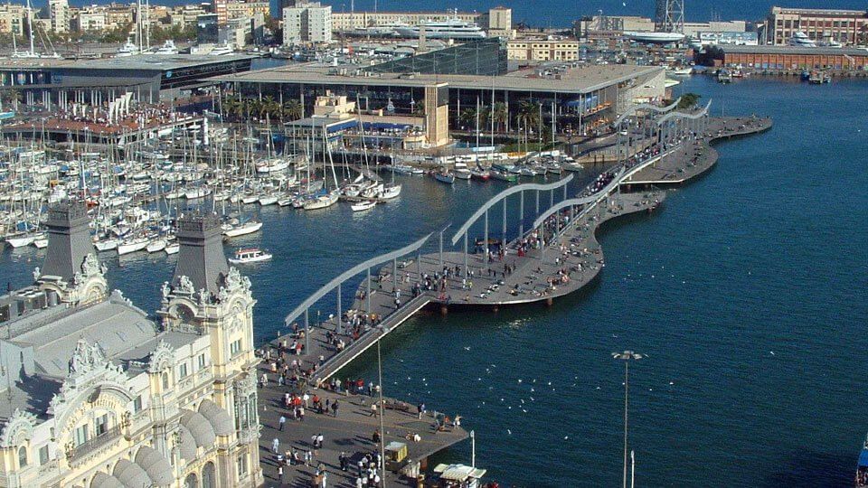
The Rambla de Mar is one of Barcelona’s most striking modern promenades — a graceful wooden walkway that stretches across the water, connecting the end of La Rambla with the vibrant Port Vell (Old Port) area. It’s not only a bridge between land and sea, but also a symbol of Barcelona’s transformation from an industrial port into a lively, open city by the sea.
Built in 1994 as part of the urban renewal project for the 1992 Olympic Games, the Rambla de Mar was designed by architects Helio Piñón and Albert Viaplana. Its name, meaning “Seaside Promenade,” reflects its purpose perfectly — a place where locals and visitors alike can stroll above the Mediterranean, enjoy sea breezes, and admire the city’s modern architecture blended with maritime tradition.
What makes the Rambla de Mar unique is its wavy, undulating design. The wooden walkway mimics the motion of the sea, while its sleek metal structure allows it to open and close like a drawbridge, letting yachts and boats pass through. When the bridge swings open, onlookers often stop to watch, turning a practical feature into a small daily spectacle.
At one end of the walkway lies La Rambla, Barcelona’s famous tree-lined boulevard full of street performers, cafes, and history. At the other end, you’ll find Maremagnum, a modern waterfront complex featuring shops, restaurants, a cinema, and L’Aquàrium de Barcelona, one of Europe’s largest aquariums.
The Rambla de Mar offers panoramic views of Port Vell, the Columbus Monument, and the Montjuïc hill in the distance — making it a perfect spot for photography, sunset walks, or simply pausing to enjoy the rhythm of Barcelona’s coastal life.
Few visitors realize that the Rambla de Mar is also one of the few bridges in Barcelona that moves several times a day, timed to allow sailing boats from the marina to enter and exit. Its elegant engineering and maritime setting make it a beloved symbol of Barcelona’s connection to the sea.
The Rambla de Mar is located in Barcelona, in the Catalonia (Catalunya) region of Spain, linking La Rambla and Port Vell at the city’s southern waterfront.
Address: Moll d’Espanya, 08039 Barcelona, Spain
To get there:
The Rambla de Mar perfectly captures Barcelona’s spirit — a city where art, architecture, and the sea coexist in harmony. Its elegant design, maritime setting, and lively surroundings make it much more than just a bridge; it’s a space where people meet, relax, and enjoy the rhythm of coastal life. Whether you’re heading to Maremagnum for dinner, watching the boats glide by, or catching the golden hour over the harbor, Rambla de Mar offers a uniquely peaceful side of this vibrant Mediterranean city.
1. What is Rambla de Mar?
Rambla de Mar is a modern wooden pedestrian bridge that connects La Rambla with Port Vell in Barcelona.
2. When was it built?
It was completed in 1994, as part of the city’s transformation for the 1992 Olympic Games.
3. What is special about its design?
Its wavy wooden structure mimics the movement of the sea, and it opens like a drawbridge to allow boats to pass.
4. Where does Rambla de Mar lead?
It connects the end of La Rambla to the Maremagnum Shopping Center and Barcelona Aquarium in Port Vell.
5. Can I walk across it at night?
Yes, the bridge is open 24 hours and beautifully illuminated at night.
6. Is there an entrance fee?
No — the Rambla de Mar is free to access.
7. How long is the walkway?
It stretches roughly 380 meters, offering scenic views of the sea and marina.
Discover more hidden gems you might love.

Samogitia
## Description Žemaitija National Park, anchored by the scenic Plateliai Lake, is a standout example of Lithuania’s western Samogitian landscape: rolling forests, glacial lakes, and a rich cultural heritage. What makes this park unique is the combination of water-centered recreation and preserved rural traditions. Plateliai Lake is the largest lake in the park and offers a classic Lithuanian landscape of glassy water, wooded shores, and scattered islets. Visitors will find peaceful village life, historic manors, and small museums that present local folklore and ethnography. A little-known fact: the park preserves several sites tied to Samogitian cultural identity, including local craft traditions and seasonal rites which are still observed in nearby villages. Another lesser-known element is the network of underwater archaeological finds in Plateliai Lake—remnants of older settlements and boating artifacts discovered by divers, now sometimes referenced by local guides. The park’s mix of outdoor activity and intangible cultural heritage makes it a destination for nature lovers, photographers, and anyone interested in rural Lithuanian traditions. In addition to swimming and boating on the lake, there are marked hiking and cycling trails, observation points for birdwatching, and a few modest but charming guesthouses that connect visitors with local cuisine and hospitality. ## Location Žemaitija National Park is in northwestern Lithuania, in the historical region of Samogitia (Žemaitija), near the town of Plateliai in Plungė district, Telšiai County. The park sits roughly 100–150 km northwest of Kaunas and about the same southwest of Vilnius, making it accessible as a multi-day stop on a trip across Lithuania. How to get there: by car the most flexible option—use the A1/A11 roads from Kaunas or the route via Šiauliai depending on start point. From Vilnius, trains and buses to Telšiai or Plungė followed by a short local bus or taxi ride to Plateliai are practical. During summer tourist season local tour operators run trips that include lake boat trips and guided hikes. ## Tips - Best time: late spring through early autumn for boating and hiking; autumn colors are vivid and ideal for photography. - Bring insect repellent for forest trails and a lightweight waterproof jacket—weather can change quickly. - Rent a kayak or small boat in Plateliai to explore secluded bays; sunrise on the lake is particularly tranquil. - Respect local customs and private land boundaries—many trails cross pastoral land. - If interested in cultural programming, check Plateliai museum opening times in advance; some craft demonstrations are seasonal. - Book accommodation in advance during weekends and public holidays. ## Conclusion Žemaitija National Park and Plateliai Lake offer a balanced, authentic Lithuanian experience: tranquil lakeside scenery, woodlands, and a living connection to Samogitian cultural life. It suits visitors who enjoy gentle outdoor activities combined with opportunities to learn about regional traditions. ## FAQ Q: Is Plateliai Lake suitable for swimming? A: Yes—there are safe swimming spots and beaches, but always follow local signage and conditions. Q: Can I rent boats or kayaks on the lake? A: Yes, local operators in Plateliai rent boats and kayaks in season. Q: Are there guided tours of the park? A: Local guides and visitor centers can arrange guided hikes, birdwatching, and cultural visits—book ahead in high season. Q: Is the park family-friendly? A: Yes, with easy trails, picnic sites, and gentle water activities suitable for families. Q: Are there marked cycling routes? A: Yes, several mapped cycling routes traverse scenic roads and trails in the park. ## Links - [Žemaitija National Park (Wikipedia)](https://en.wikipedia.org/wiki/%C5%BDemaitija_National_Park)
GemVoyage Team • World
Milan
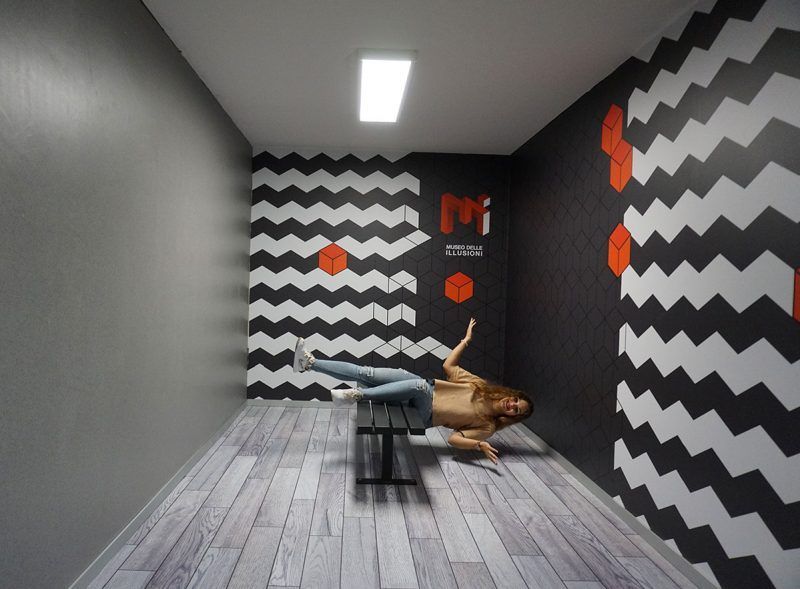
## Description The **Museo delle Illusioni – MDI** in Milan is a contemporary museum designed to challenge the viewer’s understanding of **vision, perception, spatial logic, and cognitive bias**. Unlike traditional museums that focus on historical artifacts or fine arts, MDI operates at the intersection of **science, psychology, and interactive entertainment**, offering an environment where visitors actively participate in the experience rather than observe passively. The space is filled with **optical illusions, perspective rooms, rotating installations, holograms, paradox structures, and sensory challenges** that push visitors to reconsider how the brain interprets visual information. Every room is intentionally constructed to distort scale, depth, orientation, and movement. The museum’s core idea is simple but effective: **what you see is not always what exists**, and the brain can be easily misled when context changes. What differentiates Milan’s MDI from similar illusion museums elsewhere is its emphasis on **sleek design and technical precision**. Installations are engineered with high production quality and clean aesthetics consistent with Milan’s reputation as a design capital. The lighting, angles, and surfaces are calibrated to deliver strong photographic effects, making the museum particularly popular among visitors who enjoy **creative photography and social media content**. Many exhibits demonstrate foundational principles of **Gestalt psychology, neuroscience, and geometry**, though without overwhelming visitors with complex scientific language. The goal is to make scientific concepts **intuitive, experiential, and playful**. By physically stepping into illusions, visitors experience cognitive phenomena that are normally confined to textbooks or laboratory experiments. A little-known fact is that several rooms in the museum use **forced perspective techniques** originally borrowed from early film production and Renaissance stage design. Another interesting detail is that some of the illusions at MDI come from a global research network of visual-perception experts who continually update the installations based on emerging cognitive science findings. Emotionally, the museum operates on a gradient between surprise and curiosity. Children laugh at rooms where gravity seems reversed, adults puzzle over patterns that appear to move, and groups experiment with depth tricks to produce impossible photographs. The museum’s strength lies in its ability to make **intellectual play accessible**, bridging the gap between learning and entertainment. MDI is not a large museum, and it does not intend to be. Its impact comes from **concentration, novelty, and careful choreography**. A visit typically moves quickly, but the density of experiences ensures that visitors remain mentally engaged throughout. In a city known for design excellence, the Museo delle Illusioni offers a refreshing and contemporary counterpoint: an environment where **visual culture becomes an interactive game**, and where perception becomes the main exhibit. ## Location The **Museo delle Illusioni – MDI** is located in the central area of Milan, close to major attractions and easily accessible on foot or by public transport. **City:** Milan **Region:** Lombardy (Lombardia) **Country:** Italy **Address Area:** Near **Porta Venezia** and the **Corso Buenos Aires** district ### How to Get There: * **By metro:** * **M1 (Red Line)** to **Porta Venezia**; the museum is a short 5–7 minute walk. * **By tram:** Various tram lines stop along Corso Venezia and Via Palestro. * **By bus:** Several city buses serve the area around Porta Venezia. * **By car:** Parking is limited and often busy; public transport is strongly recommended. * **On foot:** The museum is easily combined with strolls through **Giardini Indro Montanelli** and nearby galleries. Its central location makes it convenient to pair with shopping, dining, or museum visits in the same outing. ## Tips * **Pre-book tickets:** The museum is popular and time slots fill quickly, especially on weekends. * **Bring a fully charged phone or camera:** Many installations are designed for interactive photography. * **Visit during off-peak hours:** Early afternoons on weekdays offer the best conditions for photos without crowds. * **Expect a short but dense visit:** Most people spend **45–75 minutes** inside. * **Some illusions require participation:** Be ready to pose, experiment, and move around. * **Families will find the space especially engaging:** The illusions work well for children and adults alike. * **Check for rotating exhibits:** Some temporary installations appear seasonally. ## Conclusion The **Museo delle Illusioni – MDI in Milan** delivers an intelligent, playful, and visually rich exploration of how the mind constructs reality. With its polished installations, scientific underpinnings, and strong interactive component, it stands out as one of the city’s most modern cultural experiences. It offers not only entertainment, but also a clear reminder that **perception is fundamentally subjective**. ## FAQ **1. How long does a typical visit take?** Most visitors spend **about one hour** exploring the installations. **2. Is the museum suitable for children?** Yes. It is highly **family-friendly**, with exhibits designed for all ages. **3. Do I need to book in advance?** Yes. **Online reservation** is recommended to secure preferred time slots. **4. Can I take photos inside?** Absolutely. Photography is encouraged, and many rooms are designed for it. **5. Is the museum accessible?** Most areas are accessible for visitors with reduced mobility, though some illusions may be difficult to experience physically. **6. Is it crowded?** It depends on the time and day. **Weekends and holidays** are the busiest. ## Links * [Museo delle Illusioni – Milan Official Website](https://moimilano.it/en/)
GemVoyage Team • World
Lahore
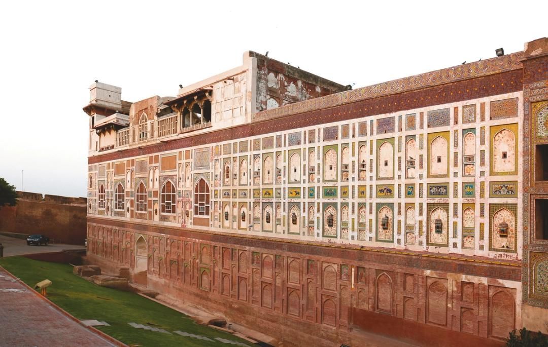
## Description The Walled City of Lahore is one of the most important historic urban districts in South Asia, and it remains one of the best places to understand Lahore beyond its modern boulevards and commercial districts. This is not a museum in the usual sense. It is a living city, layered with Mughal, Sikh, colonial, and contemporary life, where narrow streets, bazaars, mosques, havelis, gates, and food stalls all sit inside a dense and animated urban fabric. Walking here gives travelers a direct sense of how history can still function as everyday geography. What makes the Walled City especially memorable is the density of stories inside a relatively small area. Famous landmarks such as Lahore Fort and the Wazir Khan Mosque are only part of the experience. The streets between them are full of craftsmanship, household life, spices, textile traders, and small businesses that have carried local traditions forward for generations. A little-known fact is that the old city once had multiple gates that structured movement in and out of the historic center, and traces of that gate-based identity still shape how people talk about the district today. Another detail many visitors miss is that the area has been the focus of major restoration work in recent years, which means the old streets are not simply surviving on neglect; they are being actively revived, studied, and reinterpreted. For many travelers, the Walled City is the strongest argument for spending time in Lahore at all. The district makes it easy to move from monumental architecture to street-level life in a matter of minutes. You can stand in front of a grand Mughal monument, turn into a lane with a bakery or metalworker, and then step into a food stall or market that feels intensely contemporary. That overlap is what gives the old city its power. It is historic, but never frozen. It is crowded, but never empty of meaning. ## Location The Walled City of Lahore is in old Lahore, Punjab, Pakistan, centered around the historic core near landmarks such as Lahore Fort, the Badshahi Mosque, Delhi Gate, and the Shahi Guzargah route. It sits in the older part of the city, west of the modern commercial districts and north of several major roads that connect the old center to the rest of Lahore. If you are staying elsewhere in the city, the easiest way to reach it is by taxi, rideshare, or rickshaw. Public transport can help for some parts of the city, but the old city itself is best approached with a direct vehicle drop-off followed by walking. Because the streets are narrow and active, walking is the best way to experience the district once you arrive. It is worth planning the visit carefully rather than trying to see everything at once. Many travelers prefer to enter through a major gate area and then move toward one or two anchor sites rather than forcing a linear route. If possible, use a local guide or an itinerary that combines architecture, street food, and history, since that helps reveal details that are easy to miss on your own. ## Tips - Wear comfortable shoes, because the best way to experience the Walled City is on foot. - Go early or later in the afternoon to avoid the most intense heat and traffic. - Consider hiring a guide if you want the historical layers explained in context. - Dress respectfully, especially if your route includes religious sites. - Keep your schedule flexible, because the district is best enjoyed slowly. - Bring small cash for snacks, tea, and local purchases. ## Conclusion The Walled City of Lahore is a rare historic district that still feels fully alive. It rewards slow exploration, local curiosity, and patience, and it offers one of the richest urban experiences in Pakistan. ## FAQ ### Why is the Walled City of Lahore important? It is one of the oldest and most culturally significant parts of Lahore, with historic gates, monuments, bazaars, and living traditions. ### How much time should I spend there? Half a day is a practical minimum, but a full day is better if you want to include food and major monuments. ### Is it safe to visit with a guide? Yes. Visiting with a knowledgeable local guide can make the experience easier, richer, and more efficient. ### What should I see first? Lahore Fort, Wazir Khan Mosque, Delhi Gate, and the surrounding bazaars are among the most rewarding starting points. ## Links - [Walled City of Lahore Authority](https://walledcitylahore.gop.pk/) - [Wikipedia](https://en.wikipedia.org/wiki/Walled_City_of_Lahore) - [UNESCO Lahore Fort](https://whc.unesco.org/en/list/171/)
GemVoyage Team • World
Prague
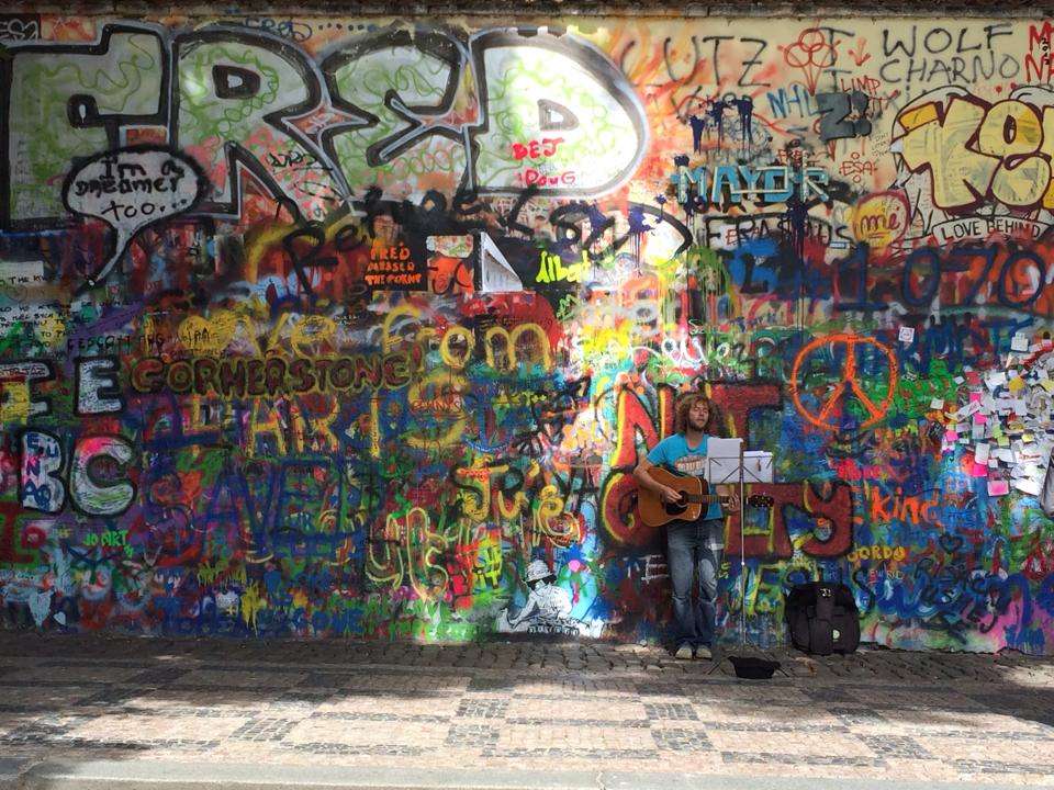
## Description The Lennon Wall in Prague is more than just a colorful stretch of graffiti—it’s a living canvas of freedom, peace, and artistic expression. Located in the historic Malá Strana district, this wall has been a symbol of resistance and hope since the 1980s. After the assassination of John Lennon in 1980, an anonymous artist painted his portrait and lyrics from Beatles songs on the wall. What followed was a spontaneous outpouring of messages, poems, and protest art, especially from Czech youth who saw Lennon as a symbol of Western ideals and freedom during the oppressive communist regime. Over the years, the wall has evolved into a dynamic, ever-changing mural. Layers of paint have buried the original artwork, but the spirit remains. Today, it features vibrant messages of love, peace, and solidarity, often reflecting global movements and local causes. Though the wall is now semi-regulated—with spray painting banned and only designated areas open to public contributions—it continues to attract artists and visitors from around the world. A little-known fact: the wall is owned by the Sovereign Military Order of Malta, whose nearby buildings include a church and embassy. Until 2019, anyone could freely paint on the wall, but due to misuse, it’s now monitored by CCTV and curated by selected artists. ## Location The Lennon Wall is located in **Czechia (Czech Republic)**, in the **Prague Region**, within the city of **Prague**. Specifically, it sits in **Velkopřevorské náměstí (Grand Priory Square)** in the **Malá Strana** neighborhood, just a short walk from the iconic Charles Bridge. ### How to Get There: - **By Foot**: From Charles Bridge, it’s a 5-minute walk through the charming streets of Malá Strana. - **By Tram**: Take tram lines 12, 15, 20, or 22 to Malostranské náměstí, then walk toward the French Embassy. - **By Metro**: The nearest metro station is Malostranská (Line A), followed by a short walk. - **By Bus**: Bus line 194 stops at Malostranské náměstí, close to the wall. Its central location makes it an easy and worthwhile stop on any Prague itinerary. ## Tips for Visitors To make the most of your visit to the Lennon Wall, keep these tips in mind: - **Visit Early or Late**: The wall gets crowded during midday, especially with tour groups. Early morning or evening offers a quieter experience. - **Bring a Marker**: While spray painting is banned, you can still leave a message with a marker in designated areas. - **Respect the Art**: Avoid defacing existing artwork. The wall is a shared space for expression, not vandalism. - **Pair with Nearby Attractions**: Combine your visit with a stroll through Kampa Island or a walk across Charles Bridge. - **Photography**: The wall changes frequently, so it’s a great spot for unique photos. Look for Beatles lyrics or peace symbols hidden among the layers. - **Learn the History**: Guided walking tours often include the Lennon Wall and provide deeper insight into its role during the communist era. ## Conclusion The Lennon Wall in Prague is a vibrant testament to the power of art and free expression. Born from grief and rebellion, it has grown into a global symbol of peace, creativity, and resilience. Whether you're a Beatles fan, a history buff, or simply a curious traveler, the wall offers a colorful and meaningful experience in the heart of Prague. ## FAQ **1. Is there an entrance fee to visit the Lennon Wall?** No, the wall is in a public square and free to visit. **2. Can I paint on the Lennon Wall?** Spray painting is banned, but you can leave messages with markers in designated areas. **3. What is the significance of the Lennon Wall?** It began as a tribute to John Lennon and became a symbol of protest against the communist regime in Czechoslovakia. **4. How often does the wall change?** Constantly. New artwork and messages appear regularly, making each visit unique. **5. Is the wall monitored?** Yes, it’s under CCTV surveillance to prevent vandalism and ensure respectful contributions. **6. What else is nearby?** Charles Bridge, Kampa Island, and the French Embassy are all within walking distance. ## Links - [Lennon Wall – Wikipedia Overview](https://en.wikipedia.org/wiki/Lennon_Wall) - [Prague Tourist Information – Lennon Wall Guide](https://praguetouristinformation.com/en/sightseeing/lesser-town/john-lennon-wall)
GemVoyage Team • World
Stockholm
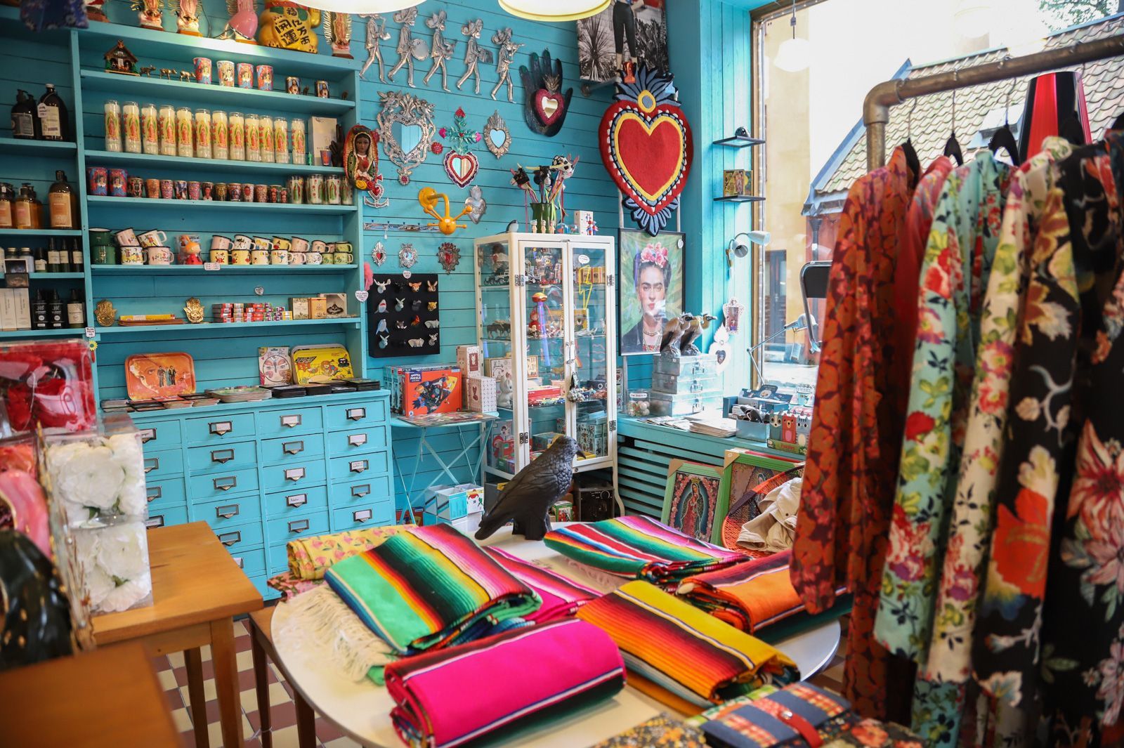
## Description Södermalm has a reputation as one of Stockholm’s most creative and self-assured districts, and its vintage shops are a big part of that identity. The area draws people who like fashion with history, pieces with character, and browsing that feels more like discovery than consumption. Unlike retail zones built around uniform shopping streets, Södermalm’s vintage scene is scattered through a district that already feels interesting to walk through. That means the shopping experience is inseparable from the neighborhood itself. The appeal of Södermalm vintage shops is not only the clothes. It is the curation, the neighborhood energy, and the sense that the area has a long memory. Stockholm’s relationship with design, sustainability, and thoughtful consumption makes secondhand shopping feel especially natural here. You can find everything from well-preserved Scandinavian basics to statement pieces, accessories, workwear, and occasional design objects. Some shops specialize tightly; others feel like treasure hunts where the best finds appear when you least expect them. One little-known fact is that Södermalm’s secondhand culture is closely tied to the district’s broader reputation for indie creativity and alternative style. Another is that many visitors underestimate how pleasant the neighborhood is for walking between shops. Even when one store is busy, the next street might feel calm, which keeps the experience relaxed and exploratory rather than transactional. For travelers who enjoy fashion but dislike generic mall shopping, this is an especially good environment. There is also a practical advantage. Vintage shopping in Södermalm can be combined with cafés, viewpoints, galleries, and neighborhood walks, so the district never feels like a single-purpose retail stop. It becomes part shopping outing, part urban exploration, and part cultural snapshot of Stockholm itself. The result is a richer visit than simply buying clothes. You are also seeing how locals shape style, reuse, and everyday city life. ## Location The vintage shops are located across Södermalm, an island district in central Stockholm, Sweden. Södermalm sits south of Gamla Stan and is one of the easiest central areas of Stockholm to explore on foot. The shopping spots are spread through several streets and pockets of the district, so the experience works best when you treat it as a neighborhood walk rather than a fixed single destination. The easiest way to reach Södermalm is by Stockholm’s metro system, bus network, or on foot from the city center. Medborgarplatsen, Slussen, and other nearby stations are practical starting points depending on which part of the district you want to explore. Because the best finds are often spread out, a comfortable pair of shoes helps more than a tightly scheduled plan. If you are visiting in winter, plan for shorter daylight hours and use indoor stops such as cafés to break up the walk. In warmer months, the district is especially pleasant because moving between shops feels almost like a mini city tour in itself. ## Tips - Start with a broad walk through the district before committing to specific shops. That helps you understand the neighborhood layout. - Look for quality as much as price. The best vintage pieces in Stockholm often stand out because of condition, cut, and timeless design. - Bring a reusable bag or extra room in your luggage if you plan to buy clothing or small home items. - Pair shopping with coffee or lunch so you can pace yourself and avoid rushed decisions. - Visit more than one shop style. A good vintage outing in Södermalm usually mixes curated boutiques, thrift stores, and neighborhood secondhand spots. ## Conclusion Södermalm’s vintage shops offer more than shopping. They give you a stylish way to experience one of Stockholm’s most characterful districts while discovering clothing and objects that feel personal, sustainable, and distinctly local. ## FAQ ### Is Södermalm good for vintage shopping even if I am not a fashion expert? Yes. The neighborhood is easy to browse casually, and many stores are approachable even if you are not hunting for something specific. The pleasure is as much in the atmosphere as in the purchase. ### Are the shops expensive? Prices vary a lot. Some stores are highly curated and price pieces accordingly, while others are more affordable. Stockholm generally has a reputation for quality over bargain-bin pricing. ### How much time should I set aside? At least a few hours if you want to enjoy the area properly. The best experience comes from mixing browsing with time for walking, coffee, and neighborhood exploration. ### Can I combine vintage shopping with other sightseeing? Definitely. Södermalm is close to scenic viewpoints, restaurants, and central Stockholm landmarks, so it fits easily into a larger city day. ## Links - [Södermalm on Wikipedia](https://en.wikipedia.org/wiki/S%C3%B6dermalm) - [Visit Stockholm](https://www.visitstockholm.com/)
GemVoyage Team • World
Taiwan
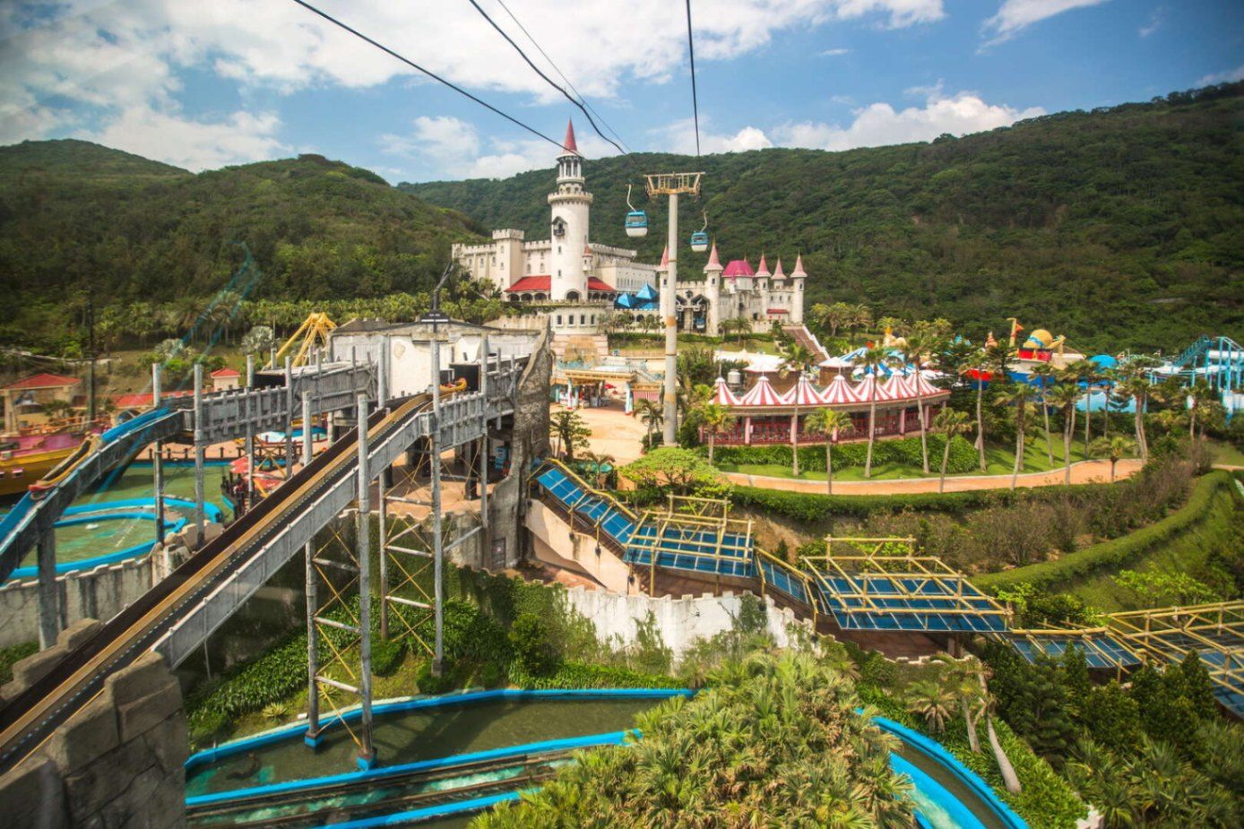
## Description **Farglory Ocean Park (遠雄海洋公園)** is Taiwan’s most prominent **marine-themed amusement park**, uniquely positioned on a **cliff overlooking the Pacific Ocean** near the city of Hualien. Unlike typical flatland theme parks, Farglory combines **high-altitude sea views, performance-based attractions, and family-oriented thrill rides** into a single destination where entertainment and ocean scenery merge into one continuous visual experience. Opened in **2007**, the park was designed to blend the excitement of a modern amusement park with the educational storytelling of marine life and ocean ecology. Rather than focusing solely on rides, Farglory emphasizes **live animal shows, interactive exhibits, aquarium tunnels, and water-based performances**, which give it a hybrid identity somewhere between a theme park and a marine discovery center. One of the defining features of Farglory Ocean Park is its **elevated position on coastal cliffs**, providing uninterrupted panoramic views of the Pacific. On clear days, visitors can watch waves crash far below while riding attractions located hundreds of meters above sea level. This geographical advantage gives the park an atmosphere unlike any other marine park in East Asia, where the ocean is not just a theme but a constant natural presence. The park is divided into several themed zones, including areas focused on **marine exploration, fantasy, adventure rides, and live entertainment**. Dolphin and sea lion performances are among its most popular attractions, carefully choreographed to combine education, humor, and athletic spectacle. The aquarium zones feature massive tanks with sharks, rays, and tropical fish, while tunnel walkways place visitors directly below swimming marine life. Beyond animals, Farglory also invests heavily in **aerial rides, roller coasters, river rapids, and rotating observation attractions**. Many of these rides take full advantage of the park’s cliffside location, creating the illusion that visitors are floating above the open ocean. This vertical relationship with the sea adds a psychological thrill even to moderate rides. A little-known fact is that Farglory Ocean Park was originally conceived as part of a larger coastal tourism transformation project for eastern Taiwan, intended to balance the heavy development of the west coast. Another lesser-known detail is that due to its seaside exposure, the park’s rides and structures are built with **enhanced corrosion-resistant materials** to withstand salt air and typhoon conditions, making maintenance far more complex than at inland parks. Emotionally, the park offers a dual experience. For children and families, it is colorful, loud, and filled with motion and music. For adults, it can feel unexpectedly cinematic, particularly at sunset, when the park’s observation decks and outdoor rides become framed by deep orange skies and dark blue ocean horizons. The contrast between artificial entertainment and raw nature is one of Farglory’s strongest unspoken features. ## Location **Farglory Ocean Park** is located near **Hualien City** on Taiwan’s **eastern coast**, facing the Pacific Ocean. **City:** Hualien **Region:** Eastern Taiwan **Country:** Taiwan **Area:** Shoufong Township (near Hualien City) ### How to Get There: * **By train:** Take a train from **Taipei, Taichung, or Kaohsiung to Hualien Station**. From Hualien Station, transfer to a shuttle bus, taxi, or local tour service to reach the park. * **By car:** Drive along Provincial Highway 11, which follows Taiwan’s eastern coastline. The route is scenic but winding. * **By tour bus:** Many visitors choose organized day tours from Hualien that include park admission and transport. * **By taxi or ride-hailing:** A convenient option from Hualien City, typically 20–30 minutes depending on traffic. Its coastal position makes the park a natural addition to a **Taroko Gorge and East Coast scenic road trip**. ## Tips * **Arrive early:** The park is large, and early arrival helps avoid long queues for top rides. * **Check weather forecasts:** The park is highly exposed to sun and wind. Poor weather can limit ride operations. * **Wear light, breathable clothing:** The coastal humidity can be intense in warmer months. * **Use park lockers:** Useful if you plan to go on water rides or attend splash shows. * **Follow show schedules:** Dolphin and sea lion performances have fixed times and fill up quickly. * **Hydration is essential:** Walking between zones involves long outdoor paths with limited shade. * **Ideal for families:** Thrill-seekers may find the ride selection moderate compared to major international theme parks. * **Stay in Hualien overnight:** One full day is enough for the park, but the surrounding natural attractions justify a longer stay. ## Conclusion **Farglory Ocean Park** stands at the intersection of **entertainment, marine education, and dramatic Pacific coast scenery**. Its elevated cliffside location transforms a conventional theme park into a panoramic ocean viewpoint layered with rides, shows, and aquarium experiences. While it may not compete with the world’s largest amusement parks in scale, it delivers something far rarer: **a theme park where the real ocean is always the main attraction**. ## FAQ **1. What type of park is Farglory Ocean Park?** It is a **marine-themed amusement park** that combines rides, animal shows, and aquarium exhibits. **2. Is Farglory Ocean Park suitable for young children?** Yes. It is **highly family-friendly**, with many attractions designed for children. **3. How long does a full visit usually take?** Most visitors spend **5 to 7 hours** to experience the park properly. **4. Does the park operate year-round?** Yes, but **ride availability may be limited** during typhoon season or severe weather. **5. Is the park accessible for non-Chinese speakers?** Yes. Basic signage and staff support are available in **English**, though detailed explanations may be in Chinese. **6. Is it better to visit independently or with a tour?** Independent visits offer flexibility, while **tours are easier for transport logistics**, especially for short stays in Hualien. ## Links * [Farglory Ocean Park Official Website](https://www.farglory-oceanpark.com.tw)
GemVoyage Team • World

Comments